|
HERMANS L.
Résultats des observations magnétiques effectuées de 1934 à 1938 pour l'établissement de la carte magnétique du Congo Belge [5 fascicules]
5 fascicules: 88 + 105 + 138 + 71 + 67pp.avec figures dans le texte + 12 + 21 + 15 + [10] planches hors-texte, 31cm., dans la série "Institut Royal Colonial Belge, section des sciences techniques, mémoires, collection in-4o" tome 3 [=FASC.préliminair-Fasc.II] & tome 5 fascicule 3 [=Fasc.IV] & "Univeristé de Liège. Institut d'astronomie et de géodésie. Physique du globe" vol.7.II [=Fasc.I] & vol.7.IV [=Fasc.III], br.orig., bon état [contenu: Fascicule préliminaire: aperçu des méthodes et nomenclature des stations. Fasc.I: Elisabethville et le Katanga (15 avril 1934 -17 janvier 1935 et 1er octobre 1937 - 15 janvier 1938). Fasc.II: Kivu, Ruanda, région des parcs nationaux (20 janvier 1935 - 26 avril 1936). Fasc. III: Région des mines d'or de Kilo-Moto, Ituri, Haut-Uele (27 avril - 16 octobre 1936). Fasc.IV: Haut-Uele, Bas-Uele, Aruwimi, le fleuve de Ponthierville à Bumba (27 novembre 1936 - 20 juin 1937)]
|
|
|
Hervé Beaumont
Népal
Editions Marcus 1993 70 pages 20x12x1cm. 1993. broché. 70 pages. Le guide Marcus sur le Népal écrit par Hervé Beaumont est un guide de voyage pratique et culturel. Il met l'accent sur la découverte des paysages et du riche héritage culturel du pays à travers sept itinéraires et quatre randonnées chacun accompagné d'une carte détaillée
Riferimento per il libraio : 9572

|
|
|
Hessler, James A Wayne E Motts & Steven Stanley (Cartography by)
Pickett's Charge At Gettysburg: A Guide to the Most Famous Attack in American History
El Dorado Hills CA: Savas Beatie. Fine in Near Fine dust jacket. 2015. 1st Edition; 1st Printing. Hardcover. 1611212006 . Hardcover with dustjacket first printing as stated on copyright page signed by both authors book has a mild lean to the spine the binding remains tight the contents are fine and there are no other remarkable flaws the jacket is in excellent condition with no remarkable flaws the original price is present and a professional removable mylar cover is included nice gift copy of this "first battlefield guide for this celebrated assault"; ; 310 pages; Signed by Author . Savas Beatie hardcover
Riferimento per il libraio : 054404 ISBN : 1611212006 9781611212006

|
|
|
Hessler, James A , and Wayne E Motts, Cartography by Steven A Stanley
Picketts Charge At Gettysburg: A Guide to the Most Famous Attack in American History
El Dorado Hills CA: Savas Beatie. Fine in Fine dust jacket. 2015. Second Edition. Hardcover. 1611212006 . Illus. color maps jacket now in a clear protector ; 310 pages . Savas Beatie hardcover
Riferimento per il libraio : 37931 ISBN : 1611212006 9781611212006
|
|
|
Heusser, Albert H
The Forgotten General Robert Erskine F. R. S. 1735-1780 Geographer and Surveyor General to the Army of the United States of America
Paterson New Jersey:: The Benjamin Franklin Press 1928. 8" wide by 11" tall. A square reasonably tight copy. Inner hinges are perfect. Bound in the original blue cloth -- moderately rubbed. The front cover is stamped in black with a surveyor's tripod. Gilt lettering on the spine and front cover is still quite bright and shiny. Pages are clean and free of markings except for previous owner's ink name and a thin stain 1/4 inch by 3 inch at the edge of 7 leaves in the margin only NO text is affected. Illustrated with 28 plates -- maps portraits photographs and document facsimiles. Attractive decorative endpapers. For his inventions in the hydraulic engineering field Erskine was elected a fellow of the Royal Society. He left Britain for New Jersey in 1771 where he worked for the American Iron Company whose extensive mines were located in what is now upper Passaic County. In 1775 he organized the men in his employ and was commissioned a captain in the Bergen County militia. Soon afterward General Washington offered him the position of geographer and surveyor-general to the Continental Army. According to the DICTIONARY OF AMERICAN BIOGRAPHY "Erskine worked zealously for the colonial cause and his maps. were important factors in the ultimate victory." Reprinted here are the letters between Erskine and Washington. There is also an appendix that lists 129 of his maps. The DAB cites this book as a primary source for its article on Erskine. Contains chapters on: Erskine the Inventor; Romance of the Ringwood Mines; The Iron Master in the Making; The Hudson River Obstructions and Campaigns against the Indians; and others treating the history of the American Iron Co. New York City Bergen County militia; surveying for Washington Washington at Pompton N.J.; Washington at Morristown for the winter of 1779-1780 etc. From the intro: "Robert Erskine F.R.S. the Surveyor-General of the Continental Army and the trusted friend of the Commander-in-chief was the silent man behind the scenes who mapped out the by-ways and back-roads over the mountains and -- by his familiarity with the great 'middle-ground' between the Hudson Highlands and the Delaware -- provided Washington with that thorough knowledge of the topography of the country which enabled him repeatedly to out-maneuver the enemy.". First Edition. Hard Cover. Very Good condition./No jacket. xii 216pp. 28 plates. . The Benjamin Franklin Press Hardcover
Riferimento per il libraio : 008291
|
|
|
HEWITT Rachel
Map of a Nation. A Biography of the Ordnance Survey. [Second Impression.] NEAR FINE COPY IN UNCLIPPED DUSTWRAPPER
8vo., Second mpression, with coloured plates, monochrome photographs in the text and endpaper maps; black cloth, gilt back, a near fine copy in unclipped dustwrapper.
|
|
|
Heyerdahl Thor
Kon-Tiki. 4000 miglia su una zattera attraverso il Pacifico
illustrazioni in nero

|
|
|
Hickman G. M; W. H. G. Dickins
The lands ane peoples of East Africa. A school certificate geography
8°, 21 cm, pp. XV, 231, numerose tavole fuori testo. Rilegatura editoriale in tela, titolo in oro al piatto e dorso, esemplare ottimo. Timbri editoriali al frontespizio e ai risguardi

|
|
|
HILLAIRET, Jacques
Evocation du vieux Paris - Vieux quartiers, vieilles rues, vieilles demeures historique, vestiges, annales et anecdotes (Tome 1, deuxième édition)
1957 Ed. de Minuit - 1957 - Fort In-8 cartonné - 677 p. - Illustrations et cartes en N&B
Riferimento per il libraio : 101774
|
|
|
Hillary Edmund
Appuntamento al Polo Sud
illustrazioni in bianco e nero

|
|
|
Hirst Bamboo
Il mondo oltre il fiume dei peschi in fiore. Viaggio attraverso la Cina
fotografie di Giorgio Lotti

|
|
|
Historisch-geographische Karten. -
Sammlung von 14 Blättern mit geographischen Karten, teilweise koloriert, 19. Jahrhundert, alle in Passepartout von gleichem Format, in Halbleinen-Mappe.
Riferimento per il libraio : 2129aaf
|
|
|
HODSON D.
Portsmouth Record Series. Maps of Portsmouth before 1801. A Catalogue. NEAR FINE COPY IN DUSTWRAPPER
Folio, First Edition, with frontispiece, maps and endpaper maps; black cloth, gilt back, a near fine copy in dustwrapper.

|
|
|
HODSON Y.
Popular Maps. The Ordnance Survey Popular Edition One-Inch Map of England and Wales 1919-1926.
8vo., First Edition, with 13 coloured plates and 46 illustrations in the text; laminated boards, a near fine copy in unclipped dustwrapper. Includes a full catalogue of all known printings of the 146 sheets of the map
|
|
|
Hoffmann, Detlef und Margot Dietrich:
Gemalte Spielkarten. Deutsches Spielkarten-Museum Leinfelden-Echterdingen,
, _Deutsches Spielkarten-Museum, 1985, softcover 50 pag Illustrated.
Riferimento per il libraio : 62433
|
|
|
Hoffmann, F
Fortschritte d. Kartographie 1969-1982. (Sammelbd. ausgew. Referate v. Veröffentlichungen u. Buchrezensionen). Studienhilfsmittel.
Dresden, 1982. 159 S. St. a. Tit. (TU Dresden, Sekt. Geodäsie u. Kartogr.).
Riferimento per il libraio : 621954
|
|
|
HOFMANN Catherine - LECOQ Danielle -
Lo globe et son image.
Paris, Bibliotheque Nationale de France, 1995, 8vo album brossura con copertina illustrata, pp. 75 con numerose illustrazioni in nero e a colori nel testo.

|
|
|
HOGE E.
Nouvelle contribution à la carte magnétique de la Belgique
Bruxelles, Palais des Académies 1934 50pp.avec figures dans le texte + grande carte dépliante en couleur, 29cm., dans la série "Académie royale de Belgique, classe des sciences, mémoires, collection in-4o, deuxième série" tome 11 fascicule 1, br.orig., non coupé, bon état
Riferimento per il libraio : B66753
|
|
|
HOGE E.
Nouvelle contribution à la carte magnétique de la Belgique
50pp.avec figures dans le texte + grande carte dépliante en couleur, 29cm., dans la série "Académie royale de Belgique, classe des sciences, mémoires, collection in-4o, deuxième série" tome 11 fascicule 1, br.orig., non coupé, bon état
|
|
|
Hogenberg Franz; Braun George
Pianta prospettica di Venezia a volo d'uccello: VENETIA
Incisione in rame (337 x 482) mm, a pieni margini. Foglio (42 x 54) cm. Stato unico. Prima edizione. Esemplare in ottime condizioni, salvo poche segni di ossidazione. In alto al centro della veduta "VENETIA". Molti nomi di località ed isole nell'inciso. In basso elenco, disposto in sette colonne, delle località segnalate nella carta con numeri progressivi da I a XXXV e da 1 a 153. Al centro, dopo la quarta colonna, dentro un cartiglio vignetta rappresentante il corteo ducale durante la festa del Corpus Domini, con sotto breve descrizione dell'evento e sopra ad ogni personaggio della carica ricoperta. Proveniente da "Civitates orbis terrarum", stampato per la prima volta nel 1572, poi ristampato numerose volte in latino, tedesco e francese fino al 1623. L'edizione del 1572 è l'unica che non ha le tavole numerate. Cassini N° 18; Moretto N° 26. Schultz N° 42; Romanelli Biadene N° 13.

|
|
|
Holmden, H.R.
Catalogue des cartes, plans et cartes marines conservés au dépôt des cartes des Archives canadiennes
Imprimerie nationale Fort in-8 Couverture souple Ottawa 1912
Riferimento per il libraio : 3126
|
|
|
HOMANN
La Suisse divisée en ses tréze cantons, ses alliez et ses sujets. Helvetia tredecim statibus liberis quos cantones vocant composita.
Norimbergae, Homannianis heredibus, 1751. (mm. 450 x 560). Carta geografica della Svizzera con lieve coloritura dei confini, che illustra anche parte della Lombardia, Piemonte e Veneto.

|
|
|
HOMANN (EREDI).
Charte von America nach Astronomischen Bestimmungen, den neuesten Nachrichten und Charten entworfen von F. L. Güssefeld. Nürnberg bey Homann Erben.
Norimberga, 1796. Incisione in rame all’acquaforte, colore d’epoca, cm 45 x 58 (la parte incisa), in basso a sn., in lastra, “I. Rausch Sc.”, titolo in basso a sn. entro tondo. Si tratta di una rara mappa dell'America, di grande formato, con dettagli interessanti specie nel tratto del Passaggio a Nord Ovest, basati sulle informazioni derivate da Vancouver, La Perouse, Cook, Mac Kenzie e dagli altri esploratori contemporanei; Quivira e Neu Albion compaiono a ovest; si notano le isole Sandwich (isole hawaiane). La presenza del fiume Oregon che scorre dall'area a ovest del Mississippi fino all'Oceano Pacifico è una delle ultime comparse di questo fiume su una mappa. Rifilati il margine superiore e l’inferiore grossomodo in prossimità della battuta della lastra, alcuni leggeri aloni di umido sulla parte sinistra, bella coloritura, buono stato di conservazione di tutto l’inciso. .

|
|
|
Homann Erben ? Penther, Johann Friedrich
Comitatus Stolbergici ad Hercyniam ceterarumq[ue] ad Illustriss. Comites pertinentium Ditionum & terrarum ipsis adjacentium Georgraphica Descriptio. Gezeichnet 22. Oct. 1736 von J. F. Penther. [Altkolorierter Kupferstich, gerahmt / handcolored copper engraving, framed].
o.J. [3 Warenabbildungen] Johann Baptist Homann, geboren 1664, gestorben 1724, gründete sein Geschäft 1702 in Nürnberg. Sein Kartenverlag wurde zu
Riferimento per il libraio : 13825DB

|
|
|
HOMANN JEAN BAPTISTE
PLAN DE LA PLACE DE CORFOU AVEC SES ENVIRONS ASSIEGEE
HOMANN JEAN BAPTISTE PLAN DE LA PLACE DE CORFOU AVEC SES ENVIRONS ASSIEGEE. , 1716, Tracce di acquerellatura. Mediocre (Poor) Discreto es. - presenta buchi, gore e bruniture sparse. acquaforte <br> cm. 57 x 49 <br> <br> <br>

|
|
|
HOMANN JEAN BAPTISTE
PLAN DU SIEGE DE CORFOU
HOMANN JEAN BAPTISTE PLAN DU SIEGE DE CORFOU. , 1716, Acquerellata in epoca. Mediocre (Poor) Es. problematico. acquaforte <br> cm. 57 x 49 <br> <br> <br>

|
|
|
HOMANN Jean-Baptiste
Generalis Totius IMPERII RUSSORUM
Belle carte de la Russie en 1716. Coloris d'époque. Au dos de la carte texte manuscrit en français à propos de la Russie. En feuille Bon Nuremberg Homann 1716 38 x 25 cm
Riferimento per il libraio : 14590

|
|
|
HOMANN Y. B. (1664 - 1724)
TABULA DUCATUS CARNIOLIAE VINDORUM MARCHIAE ET HISTRIAE
HOMANN Y. B. (1664 - 1724) TABULA DUCATUS CARNIOLIAE VINDORUM MARCHIAE ET HISTRIAE. , 1720, Buono (Good) Buon es., tracce leggere di foxing e piccolo restauro d'epoca al margine basso. acquaforte acquerellata a mano <br> inciso cm. 58 x 49 <br> <br> <br>
|
|
|
HOMANN, IO. BAPTISTA.
Imperium Turcicum in Europa, Asia et Africa Regiones.
Norimberga, 1737. Incisione in rame all'acquaforte, coeva coloritura a mano, cm 51 x 61 circa (il foglio) più margini. Ricco cartiglio in basso a sinistra, con figure di schiavi, mendicanti, santi, studiosi e guerrieri. Esemplare rifilato ai margini superiore e inferiore, sciupature agli estremi della brachetta (visibile al superiore), bella e vivace coloritura, nell'insieme buono stato di conservazione. .

|
|
|
HOMANN, IOH. BAPT.
Regnorum Siciliae et Sardinae nec non Melitae seu Maltae Insula cum adjectis. Italiae et Africae Litoribus Nova Tabula.
Norimberga, 1760 circa. Incisione in rame all'acquaforte, colore d'epoca, cm 51 x 58 (il foglio). In alto al centro, importante cartiglio; in basso a sinistra, in riquadro, “Catanae urbis eiuque vicini Montis Aetnae in Sicilia Prospectus”; in basso a destra, in piccolo riquadro “Valletta civitas Maltae celeberrima...”. Tranne il superiore, margini rifilati in prossimità del perimetro graduato, brachetta centrale leggermente ingiallita dalla metà inferiore del foglio, peraltro buon esemplare in bella coloritura. .

|
|
|
HOMANN, IOH. BAPT.
Regnorum Siciliae et Sardinae nec non Melitae seu Maltae Insula cum adjectis. Italiae et Africae Litoribus Nova Tabula.
Norimberga, 1760 circa. Incisione in rame all'acquaforte, colore d'epoca, cm 51 x 58 (il foglio). In alto al centro, importante cartiglio; in basso a sinistra, in riquadro, “Catanae urbis eiuque vicini Montis Aetnae in Sicilia Prospectus”; in basso a destra, in piccolo riquadro “Valletta civitas Maltae celeberrima...”. Margini con qualche difetto, un lieve foxing, bella coloritura, buono stato. .

|
|
|
Homann, Johann Baptist (1664?1724)
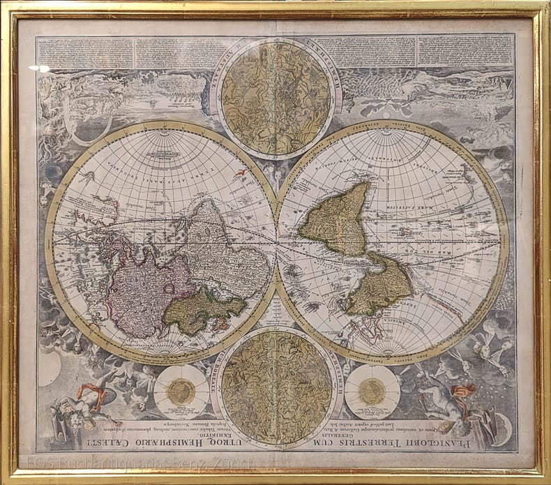
Planiglobii Terrestris cum utroq Hemisphaerio Caelesti generalis exhibito.
Nürnberg, J.B. Homann, ca. 1720. Altkolorierter Kupferstich. Bildformat: 56 x 65 cm. Blattformat: 51 x 60 cm. + Wichtig: Für unsere Kunden in der EU erfolgt der Versand alle 14 Tage verzollt ab Deutschland / Postbank-Konto in Deutschland vorhanden +, 973DG
Riferimento per il libraio : 973DG

|
|
|
Homann, Johann Baptist (1664–1724).
Planiglobii Terrestris cum utroq Hemisphaerio Caelesti generalis exhibito.
Nürnberg, J.B. Homann, ca. 1720. Altkolorierter Kupferstich. Bildformat: 56 x 65 cm. Blattformat: 51 x 60 cm.
Riferimento per il libraio : 973DG
|
|
|
HOMANN, Johann Baptist.
Status Parmensis sive Dvcatvs Parmensis et Placentinvs...
Carta geografica incisa in rame (cm. 49,5x 59) abilmente colorata da mano coeva.Grande carta con grande cartiglio alla base e con scena di caccia e le piante delle città di Parma e di Piacenza. Stampata dagli eredi di Homann e datata 1731. Nel 1702 J.B. Homann a Norimberga inizia l'attività di cartografo. Dopo la pubblicazione del primo atlante (1707) divenne membro dell'Accademia delle Scienze di Berlino, nel 1715 venne nominato Geografo dell'Imperatore. Nel 1724 data della sua morte, l'attività passa al figlio e successivamente trasmessa ai suoi eredi con il nome, appunto di Eredi Homann.. .

|
|
|
HOMANN, Johann Baptist.
Status Parmensis sive Dvcatvs Parmensis et Placentinvs...
Carta geografica incisa in rame (cm. 49,5x 59) abilmente colorata da mano coeva.Grande carta con grande cartiglio alla base e con scena di caccia e le piante delle città di Parma e di Piacenza. Stampata dagli eredi di Homann e datata 1731. Nel 1702 J.B. Homann a Norimberga inizia l'attività di cartografo. Dopo la pubblicazione del primo atlante (1707) divenne membro dell'Accademia delle Scienze di Berlino, nel 1715 venne nominato Geografo dell'Imperatore. Nel 1724 data della sua morte, l'attività passa al figlio e successivamente trasmessa ai suoi eredi con il nome, appunto di Eredi Homann.. .
|
|
|
Homann, Johannes Baptist
Provincia Indigenis dicta La Provence; divisa in omnes suos Vicariatus seu Praefecturas et Terras adiacentes eidem subiectas excudente Io. Baptista Homanno. [Altkolorierter Original-Kupferstich, gerahmt / original colored copper engraving, framed].
o.J. Johann Baptist Homann, geboren 20. März 1664 in Oberkammlach, gestorben 1. Juli 1724 in Nürnberg, Kartograph, Verleger und Kupferstecher. [3 Warenabbildungen]
Riferimento per il libraio : 60148BB

|
|
|
Homann, Johannes Baptist
Recentitissima Asiae Delinatio qua Imperia ejus regna et Status, unacum novissimis Russorum detectionib circa Mare Caspium Terram Yedso... [Altkolorierter Kupferstich um 1720 / colored copper engraving].
o.J. Johann Baptist Homann, geboren 20. März 1664 in Oberkammlach, gestorben 1. Juli 1724 in Nürnberg, Kartograph, Verleger und Kupferstecher.
Riferimento per il libraio : 49972BB

|
|
|
HOMANN, JOHANNES BAPTISTAE (HEREDI D'HOMANN).
Carta geographica, la quale rappresenta lo Stato della Republica di Genova partita nella Riviera di Levante et di Ponente.
Norimberga (o Augusta), 1743 circa. Incisione in rame, colore d’epoca, cm 50 x 59 (alla lastra). Esemplare leggermente rifilato nella parte destra del margine inferiore, in corrispondenza della battuta della lastra, ingiallimento della brachetta centrale al verso, impressione un po’ stanca, nell’insieme buono stato.

|
|
|
Homman Johann Baptist
Status ecclesiastici magnique Ducatus Fiorentini. Nova Exibitio repraesentatio a Io. Bapt. Hommano. Norimbergae, Cum privilegio Sac. Caes. Majestatis.
In folio grande (56,5x48 cm); un rinforzo moderno in adesivo (assolutamente non visibile al verso con l'immagine della Toscana, in corrispondenza della piega del foglio. Un piccolo strappetto, di 6 cm circa, senza perdita di carta e ora chiuso, al margine basso, in corrispondenza della piega del foglio, ininfluente e per il resto, in buone condizioni di conservazione. Fine coloritura coeva a mano. Magnifica e dettagliata carta del centro Italia, dai possedimenti del Ducato Estense fino alla periferia romana, con i possedimenti dello Stato Pontificio nel territorio toscano. La tavola è opera di Johann Baptist Homann celeberrimo cartografo ed incisore tedesco, nato a Norimberga nel 1663. Homman iniziò l'attività di cartografo, come apprendista, nella bottega di David Funk prima e per Giacomo Sandrart, dove apprese l'arte. Nel 1702, decise di aprire una nuova attività in proprio di produzione di carte geografiche. L'estrema cura geografica e l'innovativa veste grafica gli fece ottenere, velocemente, un enorme successo ed una notevole fama, tanto da divenire, ben presto, uno dei cartografi più di successo del XVIII° secolo. Nel 1707 pubblica la propria opera più importante, il “Grosser Atlas” che nella sua massima estensione, fu composto di 126 carte. Esemplare in buone condizioni di conservazione.

|
|
|
HONDIUS, JODOCUS.
Nova Italiae Delineatio.
Amsterdam, 1620 circa. Incisione in rame all'acquaforte, colore, cm 39 x 50, 8 (alla lastra) più margini bianchi. Titolo in alto a destra, entro cartiglio costituito da tavola sorretta da figure allegoriche con sottostante la “Lupa Italia” che allatta Romolo e Remo; in basso a destra, entro altro cartiglio con i busti di Romolo e Remo, due scale grafiche di miglia italiane e germaniche; nel mare ci sono navi e vascelli e la testa emergente di un mostro marino. Carta con reticolato e con margine graduato su tutto il perimetro. Testo francese al verso. Tutti gli elementi della carta derivano dalla “Italia Nuova” del Magini del 1608. La carta conobbe molte ristampe, tra cui quelle realizzate da J. Jansonium e inserite nei più diffusi atlanti olandesi della prima metà del 1600, tra cui quello dei Blaew; tra queste se ne segnala una datata 1641, con scale grafiche in basso a sinistra e con l'inserimento, in basso a destra, di otto stemmi degli stati più importanti. La carta è peraltro identica a quella fiancheggiata complessivamente da dodici vedute di città, da otto riquadri con costumi italiani e da otto stemmi che la rendono ricca di sfarzo e molto decorativa. Esemplare in bella coloritura e in margini, molto buono lo stato di conservazione.

|
|
|
Horrabin, J F [African Nationalism] [European Colonization] [Cartography]
AN ATLAS OF AFRICA
Praeger 1960. First Edition. Hardcover with Dust Jacket. NEAR FINE/NEAR FINE. 10 11-126pp. 12mo sewn binding in black cloth gilt spine lettering. Illustrated throughout with Horrabin's hand-drawn maps and pithy political and historical commentary on facing pages. Owner's name to FFEP and some very faint toning to the endpapers exceedingly clean and sharp otherwise; DJ with a short tear and creasing to rear head clean and bright otherwise and now wrapped in mylar. A lovely book by the famed Socialist Cartographer and illustrator showing aspects of ancient and colonial eras with a particular interest in the African Nationalist movement then hotly active; final publication before his death in 1962. Praeger hardcover
Riferimento per il libraio : 508064
|
|
|
Hosam Elkhadem, J.P. Heerbrandt, L. Wellens-de Donder
Kaarten van Amerika in de verzamelingen van de Koninklijke Bibliotheek Albert I
Paperback, 168 pagina's, Nederlands, 255 x 185 mm, boek in prima staat, . ISBN 9789066370753. Beschrijving van 59 kaarten van Amerika

|
|
|
Hoskins, Samuel A. (Publisher)
Map of Sioux City, Iowa, 1881
Samuel A. Hoskins, Bookseller & Stationoer, Sioux City - Stranahan & Taylor, Cleveland, 1881.
Riferimento per il libraio : 116847

|
|
|
HOURTOULLE
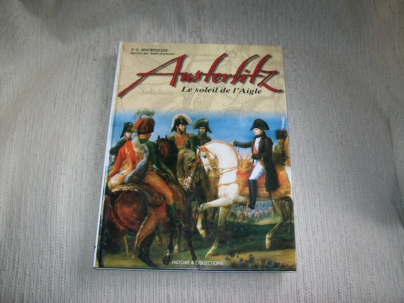
AUSTERLITZ le soleil de l'Aigle.
Paris Histoire et Collections 2003. In-4 128pp imprimées sur 2 colonnes. Cartonnage éditeur papier glacé bradel illustré en couleurs. Abondante et belle illustration d'après des documents anciens, en noir et en couleurs, planches d'uniformologie par André Jouineau, cartographie de Jean-Marie Mongin. Bel exemplaire frais et complet. Excellente documentation, très bien illustrée.
Riferimento per il libraio : GITj305
|
|
|
HOURTOULLE
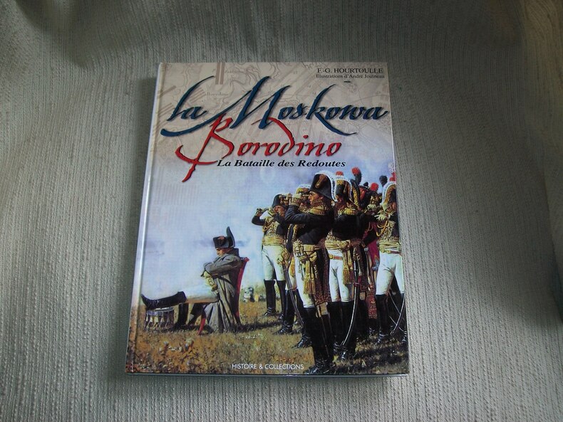
BORODINO LA MOSKOWA. La bataille des redoutes.
Paris Histoire et Collections 2000. In-4 120pp imprimées sur 2 colonnes. Cartonnage éditeur papier glacé bradel illustré en couleurs. Abondante et belle illustration d'après des documents anciens, en noir et en couleurs, planches d'uniformologie par André Jouineau, cartographie de Morgan Gillard. Bel exemplaire frais et complet. Excellente documentation, très bien illustrée.
Riferimento per il libraio : GITj301
|
|
|
HOURTOULLE
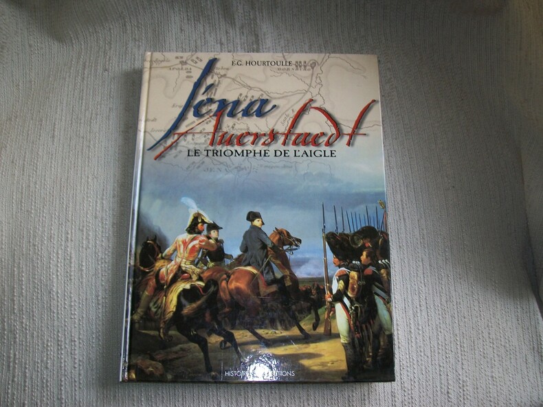
IENA AUERSTAEDT le triomphe de l'Aigle.
Paris Histoire et Collections 1998. In-4 120pp imprimées sur 2 colonnes. cartonnage éditeur papier glacé bradel illustré en couleurs. Abondante et belle illustration d'après des documents anciens, en noir et en couleurs, planches d'uniformologie par André Jouineau, cartographie de Morgan Gillard. Bel exemplaire frais et complet. Excellente documentation, très bien illustrée.
Riferimento per il libraio : GITj303
|
|
|
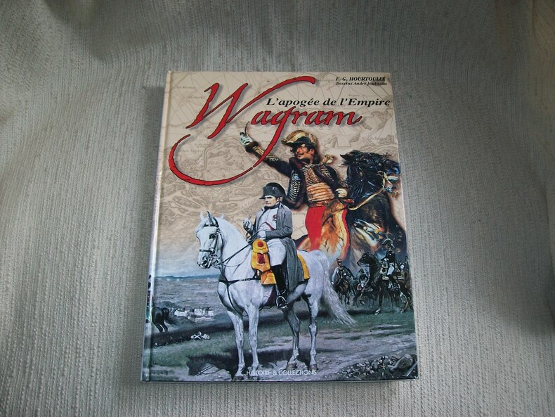
HOURTOULLE
WAGRAM. L'apogée de l'Empire.
Paris Histoire et Collections 2002 In-4 120pp imprimées sur 2 colonnes. Cartonnage éditeur papier glacé bradel illustré en couleurs. Abondante et belle illustration d'après des documents anciens, en noir et en couleurs, planches d'uniformologie par André Jouineau, cartographie de Jean-Marie Mongin. Bel exemplaire frais et complet. Excellente documentation, très bien illustrée.
Riferimento per il libraio : GITj304
|
|
|
HOUTMAN Erik
Een kaartboek van de sint-Bernardsabdij Hemiksem 1666-1671
Brussel, ARA 2005 322pp.rijkelijk geïllustreerd met kaarten en plannen in kleur, linnen uitgeversband, geïllustreerde stofwikkel, 34cm., mooie staat, in de reeks "Cartografische en iconografische bronnen voor de geschiedenis van het landschap in België" volume IX, BIJGEVOEGD: CD-ROM "Landboeken van de Sint-Bernarsabdij te Hemiksem 1744-1752", B89621
Riferimento per il libraio : B89621
|
|
|
HOUTMAN Erik
Een kaartboek van de sint-Bernardsabdij Hemiksem 1666-1671
Brussel, ARA 2005 322pp. rijkelijk geïllustreerd met kaarten en plannen in kleur, linnen uitgeversband, geïllustreerde stofwikkel, 34cm., goede staat, in de reeks "Cartografische en iconografische bronnen voor de geschiedenis van het landschap in België" volume IX, gewicht: 2.8kg., B108483
Riferimento per il libraio : B108483
|
|
|
HOUTMAN Erik
Een kaartboek van de sint-Bernardsabdij Hemiksem 1666-1671
322pp.rijkelijk geïllustreerd met kaarten en plannen in kleur, linnen uitgeversband, geïllustreerde stofwikkel, 34cm., mooie staat, in de reeks "Cartografische en iconografische bronnen voor de geschiedenis van het landschap in België" volume IX, BIJGEVOEGD: CD-ROM "Landboeken van de Sint-Bernarsabdij te Hemiksem 1744-1752", B89621
|
|

 Ricevere i risultati per e-mail
 Scaricare i risultati in PDF
 RSS feed
 Link
Link


