|
|
|
HARITA UMUM MÜDÜRLÜGÜ].
[MAP of CIRCASSIA - CAUCASIA - KRASNODAR KRAI - YEYSK] Yeysk. Bedlapaglia, Yekaterinodar, Anapa, Maykob.
Very Good Turkish, Ottoman (1500-1928) Original color map. Atlas folio. (55 x 46 cm). In Ottoman script. Scale: 1/400.000. [OTTOMAN MAP of CAUCASIA] Yekaterinodar - Yeysk - Maykob - Anapa. Shows Krasnodar, Maikop, Yeysk, Anapa and shores of Black Sea. At northeast, map shows Kuban river (Kuban nehri) and its basin in Circassia (Republic of Adygea). Maykop is the capital city of the Republic of Adygea in Russia, located on the right bank of the Belaya River (a tributary of the Kuban River). Yekaterinodar (Krasnodar) at north of map, near to Maykop. From northwest to south east, map shows Black Sea shores of the extensive area with interesting details in Ottoman Turkish script. Also shown Belaya, Chokhrak and Dakh Rivers in addition all south land of Krasnodar Krai of the Northwestern Caucasus until southern Georgian borders and Georgia. Almost all toponyms are in Ottoman Turkish.
|
|
|
HARITA UMUM MÜDÜRLÜGÜ].
[MAP of GEORGIA - SHORES of BLACK SEA] Batum, Keskim, Kutayisi. [Batoum, Kutaisi, Keskim].
Very Good Turkish, Ottoman (1500-1928) Original color map. Atlas folio. (66 x 46 cm). In Ottoman script. Scale: 1/400.000. [MAP of GEORGIA - SHORES of BLACK SEA] Batum, Keskim, Kutayisi. [Batoum, Kutaisi, Keskim]. Shows all toponym of shores of Black Sea of Georgia including Ottoman fortresses, villages etc. Not in TBMM Library Map Collection. Extremely rare.
|
|
|
HARITA UMUM MÜDÜRLÜGÜ].
[MAP of IRAQ - SHEET of SAMAWAH] Semave (First of 4 feuilles).
Very Good Turkish, Ottoman (1500-1928) Original chromolithograph folded map. Oblong atlas folio. (49 x 65 cm). In Ottoman script. Repaired with a band in the contemporary period from its backside. Set including 4 sheets. Other sheets are Basrah, Bagdad, and Qut al-Amare. This is the first sheet including 'Samawah'. Rare. Scale is 1/500.000. Samawah city was settled by the Arab tribe of Banu Quda'a around the 3rd century AD. It is built on both sides of the Euphrates river; there are four bridges in the center of town for crossing between the two sides. The west bank of the city contains the commercial heart of the city and includes the old town and the Jewish quarter, Agd al Yahood. The west bank is the site of the covered market Suq Al Masgoof, which dates to the Ottoman period. The area surrounding the market is the old city with its Byzantine maze of crowded markets and streets. The eastern side of the city including 'Qushla' has a more modern feel and contains a number of estates of apartment blocks built during the 1970s and 1980s, As Samawah Stadium, which is home to the local Muthanna football team Samawa FC, as well as technical colleges and the polytechnic. There too is Al Qushla, the historic "Ottoman Barracks". The most famous attraction of Samawah in the ruins of the ancient Sumerian city of Uruk which dates to 4000 BC. This was the largest city in Sumer, extending over 2 km2. Uruk was not only the largest conurbation of the first urban civilization on earth, but it is also the place where the first written script was discovered, the oldest dating back to 3300 BC. The palm groves of Samawah: Samawah is built on both sides of the Euphrates and is surrounded by hundreds of palm groves that give it a tropical feel, especially in the southern and northern suburbs. These groves provide cool respite from the scorching heat of Mesopotamia and were the inspiration for the famous Iraqi folk song "The Palm of Samawah".
|
|
|
HARITA UMUM MÜDÜRLÜGÜ].
[MAP of KRASNODAR KRAI - YEYSK] Yeysk. Bedlapaglia, Yekaterinodar, Anapa.
Very Good Turkish, Ottoman (1500-1928) Original color map. Elephant folio. (60 x 50 cm). In Ottoman script. Scale: 1/300.000. [MAP of KRASNODAR - YEYSK] Yeysk. Bedlapaglia, Yekaterinodar, Anapa. Shows Yeysk, a port and a resort town in Krasnodar Krai, Russia, situated on the shore of the Taganrog Gulf of the Sea of Azov in north, Yekaterinodar (Krasnodar) in south, Anapa (Bigurkal) etc.
|
|
|
HARITA UMUM MÜDÜRLÜGÜ].
[MAP of KRASNODAR KRAI - YEYSK] Yeysk. Bedlapaglia, Yekaterinodar, Anapa.
Very Good Turkish, Ottoman (1500-1928) Original color map. Elephant folio. (60 x 50 cm). In Ottoman script. Scale: 1/300.000. [MAP of KRASNODAR - YEYSK] Yeysk. Bedlapaglia, Yekaterinodar, Anapa. Shows Yeysk, a port and a resort town in Krasnodar Krai, Russia, situated on the shore of the Taganrog Gulf of the Sea of Azov in north, Yekaterinodar (Krasnodar) in south, Anapa (Bigurkal) etc.
|
|
|
HARITA UMUM MÜDÜRLÜGÜ].
[MAP] Mufassal Büyük Sark Vilâyeti, Dogu Karadeniz kiyilari, Van Gölü, Gürcistan, Ermenistan [General map of East Province of Ottoman Empire, Eastern Black Sea coasts, Georgia, Armenia, Eastern borders, Van Lake].
Very Good Turkish, Ottoman (1500-1928) Original color map. Atlas folio. (77 x 100 cm). In Ottoman script. Scale: 1/840.000. [MAP] Mufassal Büyük Sark Vilâyeti, Dogu Karadeniz kiyilari, Van Gölü, Gürcistan, Ermenistan [General map of East Province of Ottoman Empire, Eastern Black Sea coasts, Georgia, Armenia, Eastern borders, Van Lake]. Detailed place names. Extremely rare.
|
|
|
HARITA UMUM MÜDÜRLÜGÜ].
MAP] Kars, Kutayisi ve Erivan. [Kars, Kutaisi and Yerevan].
Very Good Turkish, Ottoman (1500-1928) Original color map. Atlas folio. (75 x 54 cm). In Ottoman script. Sacel: 1/400.000. [MAP] Kars, Kutayisi ve Erivan. [Kars, Kutaisi and Yerevan]. Includes east and northeast borders of Turkey with Georgian Kutaisi, Armenian Erevan and Turkish Kars. Showing also five lakes including Çildir Lake. Detailed place names. Extremely rare. Not in TBMM Library Map Collection.
|
|
|
HARLEY J.B.
Ordnance Survey Maps. A Descriptive Manual. BRIGHT, CLEAN COPY
Roy. 8vo., First Edition, with numerous coloured and monochrome plates, and decorative endpapers; original pictorial boards, a very good, clean copy. Invaluable standard OS reference.
|
|
|
Harley J.B. - Woodward David
The History of Cartography. Volume One. Cartography in Prehistoric, Ancient, and Medieval Europe and the Mediterranean
Ril. in tela con sovr., cm 28,5x22, pp 599, molte ill. a col. e b/n.. - ISBN: 0226316335

|
|
|
Harlow, Neal; Alfred Newman
The Maps of San Francisco Bay from the Spanish Discovery in 1769 to the American Occupation 1997 supplemented edition new
Staten Island New York: Maurizio Martino 1997. BRAND NEW in perfect condition. NO rubbing. NO fading. Bright clean square and tight. Sharp corners. NO owner's name or bookplate. NOT a remainder. Fresh and crisp -- obviously never read. No date but 1997 First Martino printing "strictly limited to 300 copies". This is a facsimile edition with significant additions of Neal Harlow's work that was first published by the Book Club of California in 1950. To this edition Harlow has added a new preamble as well as expert descriptions historical notes and full page reproductions of two new maps that came to light after the 1950 edition was published. Also added here is a new introduction with useful historical and biographical details by Alfred Newman President of California Maps Society. Illustrated with 41 full page maps several that spread over two pages or foldout. Reproduced are 31 maps of the Bay and 10 maps of the Town of San Francisco from 1769-1847. Bound in the original gilt-stamped red cloth. Oversize Hardcover. 9" wide by 12.25" tall. This large heavy book will require extra postage for Priority and International shipments but only the standard charge for media mail. Reprint with additions; Limited 300 . Oversize Hardcover. New/No jacket as issued. xviii 144pp. 41 maps 203 total pages. Great Packaging Fast Shipping. Maurizio Martino Hardcover
Riferimento per il libraio : 018214 ISBN : 1888262958 9781888262957
|
|
|
Harris, Joseph
THE DESCRIPTION AND USE OF THE GLOBES AND THE ORRERY
London: Printed for Thomas Wright Mathematical Instrument-Maker. And E. Cushee Globe-Make 1740. fifth Edition . Hardback. Vg. 8vo. THE DESCRIPTION AND USE OF THE GLOBES AND THE ORRERY To which is prefixed by way of introduction a brief Account of the Solar System.viii 190pp. 6 folding plates. Pub. advert to the reverse of the title-page. Index of the astronomical terms. Original full calf polished calf binding with gilt dbl. ruled border to the boards. Five raised band and neat owners to the top edge of the title-page. A tight clean and fresh copy with a plain but period binding Near fine Nicholson Calvert 1816 an English Whig politicain who fought at the Battle of Waterloo. <br/> <br/> Printed for Thomas Wright, Mathematical Instrument-Maker. And E. Cushee, Globe-Make hardcover
Riferimento per il libraio : TH228
|
|
|
Harris, Joseph
THE DESCRIPTION AND USE OF THE GLOBES AND THE ORRERY
London: Printed for Thomas Wright Mathematical Instrument-Maker. And E. Cushee Globe-Make 1745. sixth edition . Hardback. Vg. 8vo. To which is prefixed by way of introduction a brief Account of the Solar System.viii 190pp. 6 folding plates. Pub. advert to the reverse of the title-page. Index of the astronomical terms. Original full calf calf binding. Five raised bands. A tight clean and fresh copy with a plain but period bindng/ Original binding intact but worn to the extremities and joints cracked but the boards attached. A tight and clean text with beautiful crisp plates. <br/> <br/> Printed for Thomas Wright, Mathematical Instrument-Maker. And E. Cushee, Globe-Make hardcover
Riferimento per il libraio : TH352
|
|
|
HARRISSE, Henry:
Notes pour servir à l'histoire, à la bibliographie et à la cartographie de la Nouvelle-France et les pays adjacents 1545-1700. (Réimpression).
Amsterdam, Meridian, 1976, gr. in-8°, XXXVI + 367 p., reliure de l'éditeur en toile verte, dos avec titre doré, très bel exemplaire à l'état de neuf. (Barbier III/430c).
Riferimento per il libraio : 13006aaf
|
|
|
Harrisson,Tom.
History, Science, the Arts and Nature in Sarawak ( 1961 - 62 ) . Reprinted from Sarawak's Annua
<br/> TITOLO: History, Science, the Arts and Nature in Sarawak (1961-62). Reprinted from Sarawak's Annual Report (chapters contributed from the Sarawak Museum by the Curator, Tom Harrisson).<br/> AUTORE: Harrisson,Tom.<br/> EDITORE: The Government Printing Office, F.W.Goodwin Government Printer<br/> DATA ED.: 1962,<br/>
|
|
|
HARTA [sic. HARITA] GENEL MÜDÜRLÜGÜ.
Ankara city plan.
Very Good Turkish Original huge color city plan of Ankara city. 83x67 cm. In Turkish. Scale: 1:8.000. Very detailed and huge city plan of Ankara prepared and printed at the early period of the Republican Turkey. There's one copy in the VEKAM collection of 'Ankara on the maps: Ankara maps and plans, a selection from collections' (p. 64).
|
|
|
HARTA [sic. Harita] UMUM MÜDÜRLÜGÜ.
[TURKISH MAP of BEYROUTH, DAMASCUS, JORDAN] Sam, Beyrouth, Lebanon, Jordan.
Very Good Turkish Original color map. 52x65 cm. In Turkish. Scale: 1: 800,000. Showing shores from Latakia to Haifa; Lebanon , Beyrouth, North Palestine, Syria, Saudi Arabia and borders, Orontes river, deserts. [TURKISH MAP of BEYROUTH, DAMASCUS, JORDAN] Sam, Beyrouth, Lebanon, Jordan.
|
|
|
HARTL, Heinrich (1840-1903):
Praktische Anleitung zum trigonometrischen Höhenmessen. Die Höhenmessungen des Mappeurs. Erster Theil: Anleitung zum trigonometrischen und barometrischen Höhenmessen / Zweiter Teil: Praktische Anleitung zum Höhenmessen mit Quecksilber-Barometern und mit Aneroiden. 2 Tle in 1 Bd.. 2. umgearb. Aufl.
Wien, k.k. Militärgeographisches Institut, 1884, gr. in-8°, 5 Bl. + 171 S. l; 4 Bl. + 146 S. + 1 gef. Tabelle + 15 gef. lith. Tafeln. Halbleinenband mit Ecken, vergold. Titelatur u. Goldfileten auf Rücken. Orig. Umschlag miteingebunden. Schönes Exemplar
Riferimento per il libraio : 94175aaf
|
|
|
Hartnack, W
Die "Milliaria Germanica communia". Ein Beitrag zur Geschichte d. dt. Kartographie d. 16. bis 18. Jh.
Berlin, 1939. (S.-A.). 30 S. OBr.
Riferimento per il libraio : 805029
|
|
|
Hartnack, W
Probleme d. deutschen Kartographie d. 16.-17. Jahrhunderts, dargest. am Bsp. d. Großen Lubinischen Karte v. Pommern aus d. Jahre 1618.
Bremen, 1939. (S.-A.). M. mehr. Tab. u. 7 Abb. 16 S.
Riferimento per il libraio : 805030
|
|
|
HARVEY (P. D. A.) & THORPE (Harry)
The Printed Maps of Warwickshire 1576-1900.
First edition, 4to, xii, 279pp., orig. cloth, d.w.
|
|
|
Harvey Miles
L'isola delle mappe perdute
trad. di Alex Ruggero in 16°, cartone edit. con sovrac. ill., sguardie illustrate

|
|
|
Hass Hans
Fra squali e coralli. Avventure nel Mar Caraibico [Curaçao, ANTILLE OLANDESI]
illustrazioni

|
|
|
Hayes, Derek
British Columbia - A New Historical Atlas
368 pages. Index. Bibliography. "Award-winning map historian Derek Hayes continues his renowned Historical Atlas series by bringing together an unprecedented collection of these contemporary maps, most previously unpublished, in a single handsome volume. You'll find surveys, treaty maps, military maps, mining maps, promotional maps, real estate maps - even maps of murder. Alongside the lively and authoritative text and an additional three hundred photos and historical documents, these maps, many of them works of art in their own right, offer a geographical visual history - a unique and fascinating view of the province's past." - dust jacket. Clean, bright and unmarked with negligible wear. Dust jacket preserved in archival-grade Brodart. An excellent copy of this large and magnificent work. 35 x 26cm. Book

|
|
|
Hayes, Derek
Historical Atlas of British Columbia and the Pacific Northwest : Maps of Exploration - British Columbia, Washington, Oregon, Alaska and Yukon
208 pages. Index. Footnotes. "A unique collection of over 320 original maps of explorers and navigators from four centuries of voyages and overland treks of exploration and discovery to the northwest coast, plus native maps, and a host of others selected for their interest and historical significance." - dust jacket. Clean, bright and unmarked with very light wear. An excellent example of this wonderful work. Book

|
|
|
HAYES-McCOY (G. A.) Editor.
Ulster and other Irish Maps c. 1600.
First edition, folio, xv, [1], 36pp., 21 plates (some coloured, some folding), orig. green cloth, gilt. 23 Early Irish manuscript maps are illustrated and fully described in scholarly essays.
|
|
|
HEBERT MONIQUE & LE MOEL MICHEL
CATALOGUE GENERAL DES CARTES , PLANS ET DESSINS D'ARCHITECTURE , TOME II , SERIE N , DEPARTEMENTS DE AIN A NORD
PARIS S.E.V.P.E.N. 1964 Un volume grand in-8 broché de 466 pages sur papier glacé , illustrations hors-texte en noir et blanc et en couleurs , la couverture est légèrement salie avec pliures aux angles , autrement bon exemplaire . Bon Couverture souple
Riferimento per il libraio : 013746
|
|
|
Hedin,Anders.
Sveriges sjökartor: 1539 - 1836. Seacharts of Sweden.
<br/> STATO: NUOVO.<br/> TITOLO: Sveriges sjökartor:1539-1836. Seacharts of Sweden. <br/> AUTORE: Hedin,Anders.<br/> CURATORE: Translation by Kim Loughran.<br/> EDITORE: Bokforlaget Max Strom<br/> DATA ED.: 2008,<br/> COLLANA: text in English and Swedish.<br/> EAN: 9789171260550

|
|
|
HEDINGER Barbel
Karten in Bildern. Zur Ikonographie der Wandkarte in holländischen Interieurgemälden des 17. Jahrhunderts
Hildesheim, Olms 1986 349pp.with 147 bl/w ills., 21cm., softcover, very good, S85370
Riferimento per il libraio : S85370
|
|
|
HEDINGER Barbel
Karten in Bildern. Zur Ikonographie der Wandkarte in holländischen Interieurgemälden des 17. Jahrhunderts
349pp.with 147 bl/w ills., 21cm., softcover, very good, S85370
|
|
|
Heer Jacob Christoph
Lucerne et les environs du lac des quatre-cantons. Avec une description special des Monts Righi, Pilate and St. Gotthardt. Avec vues, plan de Lucerne et une carte avec panoramas du Righi.
24°, mm 150x100, pp. 186, (6), con antiporta incisa raffigurante Lucerna, una pianta di Lucerna e 4 vedute incise fuori testo, al fondo un panorama del monte Righi ripiegato. Bel cartonato editoriale verdino con veduta al piatto posteriore e vignetta decorata con titolo e un leone dormiente al piatto anteriore; eccellente conservazione. Edizione originale estremamente rara e ancor più in veste editoriale, di questo volume: "la più antica guida di viaggio della città di Lucerna e della regione del lago dei Quattro Cantoni". Un esemplare nella biblioteca nazionale Svizzera. ID 6465

|
|
|
Hegel Georg W. F.
Diario di viaggio sulle alpi bernesi

|
|
|
HEIKELL, Rod et Lucinda -
Guide Imray - Italie - De San Remo à Brindisi, Sicile et Malte
2016 Edition Vagnon-Fleurus - 2016 - 4e édition - In-4 broché, couverture illustrée - 407 pages - Nombreuses illustrations en couleurs dans le texte
Riferimento per il libraio : 125217

|
|
|
Heim, A
Die Alpen und ihr Vorland.
St Gallen 1871. Hardback. Fine. SAENTIS-PANORAMA HERAUSGEGEBEN VON DER SECTION ST GALLEN DES S.A.C.Folding lithographic panorama of the Alps. RUNDISCHT VOM GIPFEL DES SENTIS The View Round the Summit Sentis. 4.45m in length. One extra flap on lower edge present. A lithographic printing of a drawing of the mountains of the Alps drawn between October 1870 and July 1871 showiing a beautiful vista with each peak indentified at the top of the sheet with a faint dotted line down to each location. Santis is the highest mountain in Apline area of North-East Switzerland. A lovely copy in fine condition. No splits foxing marks or wear. Original covers trifle sunned to the red spineand fold creases a trifle toned. Attractive lithographic illustrations of Alpine wildlife to the boards. PLEASE EMAIL FOR PHOTOS. <br/> <br/> hardcover
Riferimento per il libraio : Pa586
|
|
|
Heinrich Zeller
Panorama van Rigi Berg
20 x 192 cm. Stampa raffigurante le alpi Svizzere colorata a mano con alette applicate.
|
|
|
HELLYER Roger
A Guide to the Ordnance Survey One-Inch Third Edition Maps in Colour. England and Wales, Scotland, Ireland.
8vo., First Edition, with 8 coloured plates and 12 plates in monochrome; laminated boards, a near fine copy. Includes a bibliography of all of third edition coloured maps
|
|
|
HELLYER Roger
Military Maps. The One-Inch Series of Great Britain and Ireland.
8vo., First Edition, with 16 coloured plates, 8 plates in monochrome and 7 diagrams in the text; laminated boards, a near fine copy. The standard reference. Appendices include previously unpublished tables showing editions of GSGS 3907 and 3908, sales copies, civilian printers and military printing units, concordance of military map numbers, chronology and bibliography.
|
|
|
HELLYER Roger
The 'Ten Mile' Maps of the Ordnance Surveys.
8vo., First Edition, with illustrations in the text; printed wrappers, a near fine copy.
|
|
|
HENDRICKX, M., JANSSEN, L., RUTTEN, H., SANGERS, H.
STEVENSWEERT. MUNTEN EN KAARTEN.
, Leeuwarden, Hugo Suringar, 1983., softcover, originele geillustreerde uitgeversomslag, 21x15cm, 264pp, geillustreerd.
Riferimento per il libraio : 6054
|
|
|
HENDRICKX, M., JANSSEN, L., RUTTEN, H., SANGERS, H.
STEVENSWEERT. MUNTEN EN KAARTEN.
, Leeuwarden, Hugo Suringar, 1983. ( dub.), GEBONDEN, kunstleder, 21x15cm, 264pp, geillustreerd z/w.
Riferimento per il libraio : 13125
|
|
|
Hendrik de Leth / Topografisch-historische Atlas
Nieuwe geographische en historische atlas van de zeven Vereenigde Nederlandsche provinti n : bestaande inde vijftig nieuwe accurate kaarten, waar onder veele particuliere gemeeten heemraadschappen, plans van de voornaamste steden, met eene korte beschrijving van de provintien, de steden en het merkwaardigste in dezelve; nevens de staat der regeering zoo politicq als kerkelijk &., [1740-1766]
Amsterdam, H. de Leth, 1766 Gebonden in originele lederen band destijds, 156 pagina's. Tekst en 53 uitvouwbare kaarten en plattegronden met zorgvuldig handgekleurde grenzen. 21x13cm. **Een mooi en compleet/intact exemplaar; *Zie; Koeman, Le H 2.
Riferimento per il libraio : 63038
|
|
|
HENDRIK WILLEM VAN LOON
LA GEOGRAFIA DI VAN LOON. VERSIONE DALL'AMERICANO DI CARLO COARDI
OTTIME CONDIZIONI, MAI SFOGLIATO. LIEVISSIMI SEGNI DEL TEMPO. Informazioni bibliografiche Titolo: La geografia scritta ed illustrata da Hendrick Willem Van Loon; versione dall'americano di Carlo Coardi Titolo originale: Van Loon's Geography: The Story of the World We Live In, Autore principale: Van Loon, Hendrik Willem Autori: Hendrik Willem Van Loon, Carlo Coardi Editore: Milano: Valentino Bompiani, 1934 Edizione: II, 2, Seconda Lunghezza: XVIII, 449 pagine, [15] c. di tav. : ill. ; 26 cm. Soggetti: Carte geografiche, Mappe, Mercatore, Illustrazioni, Terra, Globo, Storia dell'Umanità, Paesi, Confini, Oceani, Mari, Europa, Asia, Africa, Imperi, Anni trenta, Culture, Civiltà, Usi, Costumi, Prima guerra mondiale, dopoguerra, Versailles, Geografia umana, Storicista, Civiltà, Politica, Orografia, Mappe, Cartografia, Divulgazione scientifica, Geography, Storia dell'Umanità, History of Discovery, Dutch-American historian, The Story of Mankind, Libri vintage, Illustrati, Universale

|
|
|
Henneberger, Caspar
Prussia Nova Tabula. [Altkolorierter Kupferstich / handcolored copper engraving].
o.J. [5 Warenabbildungen] (Kaspar oder Caspar Henne(n)berg(er), geboren am 1529, gestorben am 29. Februar 1600 in Königsberg. Deutscher Kartograf
Riferimento per il libraio : 61878BB

|
|
|
HENNEQUIN (Frédéric)
La Topographie mise à la portée de tous. Syllabaire ou méthode pratique pour apprendre à lire rapidement la carte de l'Etat Major
P., Dumaine, 1873, in-8, 33pp. illustrées d'une grande carte dépliante broché
Riferimento per il libraio : VLE-365
|
|
|
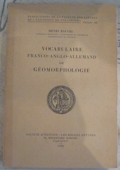
Henri Baulig
Vocabulaire Franco-Anglo-Allemand de Géomorphologie
1956. Paris Société d'Edition Les Belles Lettres 1956 - Broché 16 5 cm x 24 cm XIV+ 230 pages - Texte de Henri Baulig - Bon état
Riferimento per il libraio : 14629
|
|
|
HENRY (J.F.)
Mémoire sur la projection des cartes géographiques adoptée au dépôt général de la guerre par M. Henry, Colonel au Corps impérial des Ingénieurs-géographes publié par ordre de S.E. Mr Le Duc De Feltre pour faire suite au mémorial topographique et militaire -- EDITION ORIGINALE -- ENVOI DE L'AUTEUR -- BEL EXEMPLAIRE
P., Imprimerie Impériale, 1810, un volume in 4 relié en demi-basane, dos orné de filets dorés (reliure de l'époque), 4pp., 220pp., (1), 4 planches dépliantes
Riferimento per il libraio : 2641
|
|
|
Henry [J. F.].
Mémoire sur la projection des cartes géographiques, adoptée au dépot général de la guerre; [..] publié par ordre de S. E. M.r le Duc De Feltre, Ministre de la Guerre, pour faire suite au Mémorial topographique et militaire. Topographie.
In-4º (cm. 26,5), cartoncino coevo con rinforzo al dorso (tracce d'usura); pp. IV, 220, [4] in buono stato e 4 tavole ripiegate f.t. in fine. Edizione originale. (SE3)
|
|
|
HERDER, B.
Meran.
Litographie von B. Herder, Freiburg, fine XIX secolo. Litografia, b/n, confini stampati a colori, cm 42,2 x 47,8 (il foglio). Dettagliata cartina della zona compresa fra Füssen, Brixen, Trient, Wallenstadt. Buono stato..

|
|
|
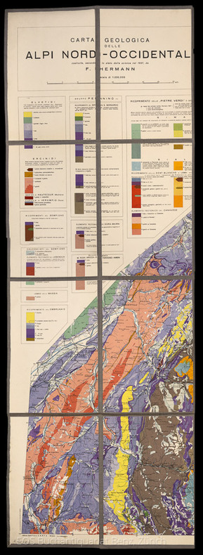
Herman, F
Carta Geologica delle Alpi Nord-Occidentali.
Milano, 1937. 90 x 125 cm. Farbige Karte, auf Leinen aufgezogen und gefaltet. + Wichtig: Für unsere Kunden in der EU erfolgt der Versand alle 14 Tage verzollt ab Deutschland / Postbank-Konto in Deutschland vorhanden +, A
Riferimento per il libraio : 1807AG

|
|
|
Herman, F.
Carta Geologica delle Alpi Nord-Occidentali.
Milano, 1937. 90 x 125 cm. Farbige Karte, auf Leinen aufgezogen und gefaltet.
Riferimento per il libraio : 1807AG
|
|
|
HERMANS L.
Résultats des observations magnétiques effectuées de 1934 à 1938 pour l'établissement de la carte magnétique du Congo Belge [5 fascicules]
Bruxelles, Librairie Falk fils / Hayez / Institut Royal Colonial Belge 1939-1951 5 fascicules: 88 + 105 + 138 + 71 + 67pp.avec figures dans le texte + 12 + 21 + 15 + [10] planches hors-texte, 31cm., dans la série "Institut Royal Colonial Belge, section des sciences techniques, mémoires, collection in-4o" tome 3 [=FASC.préliminair-Fasc.II] & tome 5 fascicule 3 [=Fasc.IV] & "Univeristé de Liège. Institut d'astronomie et de géodésie. Physique du globe" vol.7.II [=Fasc.I] & vol.7.IV [=Fasc.III], br.orig., bon état [contenu: Fascicule préliminaire: aperçu des méthodes et nomenclature des stations. Fasc.I: Elisabethville et le Katanga (15 avril 1934 -17 janvier 1935 et 1er octobre 1937 - 15 janvier 1938). Fasc.II: Kivu, Ruanda, région des parcs nationaux (20 janvier 1935 - 26 avril 1936). Fasc. III: Région des mines d'or de Kilo-Moto, Ituri, Haut-Uele (27 avril - 16 octobre 1936). Fasc.IV: Haut-Uele, Bas-Uele, Aruwimi, le fleuve de Ponthierville à Bumba (27 novembre 1936 - 20 juin 1937)]
Riferimento per il libraio : C66751
|
|
|

 Ricevere i risultati per e-mail
 Scaricare i risultati in PDF
 RSS feed
 Link
Link


