|
Almagià Roberto a cura di
Il planisfero di Arnoldo De Arnoldi (1600)
In folio piccolo, pp. 13 e grande carta geografica ripiegata che riproduce il planisfero. Non comune.
|
|
|
Almagià, R. - Migliorini, E. - Nangeroni, G. - Sestini, A. - Toniolo, A. R. (a Cura di)
Introduzione Allo Studio Della Geografia
Mm 175x255 Collana "Orientamenti e problemi geografici". Brossura editoriale di 283 pagine. Esemplare parzialmente intonso (= a fogli chiusi), firma d'appartenenza alla prima carta, lievi segni del tempo alla copertina, peraltro buona copia. SPEDIZIONE IN 24 ORE DALLA CONFERMA DELL'ORDINE.
|
|
|
Almagià, Roberto
Scritti Geografici 1905-1957 (con Elenco Cronologico Completo delle pubblicazioni)
Mm 180x270 Brossura editoriale, xi-692 pagine con illustrazioni in nero nel testo ed una carta a colori ripiegata f. t. Cinque pagine di un capitolo recano sottolineature a penna blu, peraltro ci tratta di una ottima copia nelle sue legature ben salde. SPEDIZIONE IN 24 ORE DALLA CONFERMA DELL'ORDINE.
|
|
|
Almagià,Roberto.
Il mondo attuale. Descrizione geografica degli Stati mondiali nel loro quadro naturale ed umano.
3 voll.in 6 tomi. <br/> TITOLO: Il mondo attuale. Descrizione geografica degli Stati mondiali nel loro quadro naturale ed umano. <br/> AUTORE: Almagià,Roberto.<br/> EDITORE: UTET<br/> DATA ED.: 1953-1960,<br/>
|
|
|
ALONSO BAQUER (Miguel).
Aportación militar a la cartografía española en la historia contemporánea. Siglo XIX.
M., Patronato "Alonso de Herrera", 1972, 26'5 x 20 cm., 365 págs. - 16 mapas en negro y color.
|
|
|
ALPES-MARITIMES.-
Carte dressée par PELLEGRIN.-
Nice. Grasse. Imbert. 1906. Carte topographique couleur au 250000° de 390 x 475mm. (24).
書籍販売業者の参照番号
: ORD-240
|
|
|
Alpers, Svetlana
Arte del Descrivere. Scienza e Pittura nel Seicento Olandese
Mm 145x220 Collana "Saggi" - Presentazione di Enrico Castelnuovo. Volume rilegato in tela nera, sovraccoperta originale, XVIII-416 pagine, numerose le illustrazioni in nero e a colori.. Esemplare in condizioni pari al nuovo. SPEDIZIONE IN 24 ORE DALLA CONFERMA DELL'ORDINE.
|
|
|
Altafini S, Biancardi D, Calanca A, Vincenzi A (a cura)
Il territorio di Bondeno dalla preistoria al medioevo
<p>30 cm, cartoncino editoriale illustrato . Cartografia storica del territorio del Comune di Bondeno</p>

|
|
|
AMADIO Gianfranco -
Il database DB25 e la corrispondente nuova cartografia alla scala 1:25000 serie 25 DB.
Firenze, 1999, 8vo stralcio con copertina posticcia muta, pp. 407/414 con un grafico e due carte a colori. - !! ATTENZIONE !!: Con il termine estratto (o stralcio) intendiamo riferirci ad un fascicolo contenente un articolo, completo in se, sia che esso sia stato stampato a parte utilizzando la stessa composizione sia che provenga direttamente da una rivista. Le pagine sono indicate come "da/a", ad esempio: 229/231 significa che il testo è composto da tre pagine. Quando la rivista di provenienza non viene indicata é perché ci è sconosciuta. - !! ATTENTION !!: : NOT A BOOK : “extract” or “excerpt” means simply a few pages, original nonetheless, printed in a magazine. Pages are indicated as in "from” “to", for example: 229/231 means the text comprises three pages (229, 230 and 231). If the magazine that contained the pages is not mentioned, it is because it is unknown to us.

|
|
|
Amado Jorge
Bahia. Le strade e le piazze, la gente e le feste, gli incanti e i misteri [BRASILE]
tavole a colori fuori testo

|
|
|
AMANTE Giuseppe - ROSSI ALEXANDER Rossella -
Una carta incompiuta del Granducato di Toscana 1850-1859.
Firenze, 1996, 8vo stralcio con copertina posticcia muta, pp. 241/272 con numerose carte a colori. - !! ATTENZIONE !!: Con il termine estratto (o stralcio) intendiamo riferirci ad un fascicolo contenente un articolo, completo in se, sia che esso sia stato stampato a parte utilizzando la stessa composizione sia che provenga direttamente da una rivista. Le pagine sono indicate come "da/a", ad esempio: 229/231 significa che il testo è composto da tre pagine. Quando la rivista di provenienza non viene indicata é perché ci è sconosciuta. - !! ATTENTION !!: : NOT A BOOK : “extract” or “excerpt” means simply a few pages, original nonetheless, printed in a magazine. Pages are indicated as in "from” “to", for example: 229/231 means the text comprises three pages (229, 230 and 231). If the magazine that contained the pages is not mentioned, it is because it is unknown to us.

|
|
|
AMAT di SAN FILIPPO Pietro -
Planisferio disegnato nel 1436 dal veneziano Bianco che si conserva nella Marciana di Venezia.
(Roma, Barbera, 1879), stralcio con copertina posticcia muta, pp. 367/380 con bella tavola litografica a colori, quadrupla, ripiegata - !! ATTENZIONE !!: Con il termine estratto (o stralcio) intendiamo riferirci ad un fascicolo contenente un articolo di rivista, sia che esso sia stato stampato a parte utilizzando la stessa composizione sia che provenga direttamente da una rivista. Le pagine sono indicate come "da/a", ad esempio: 229/231 significa che il testo è composto da tre pagine. Quando la rivista di provenienza non viene indicata é perchè ci è sconosciuta. - !! ATTENTION !!: : NOT A BOOK : “estratto” or “stralcio” means simply a few pages, original nonetheless, printed in a magazine. Pages are indicated as in "from” “to", for example: 229/231 means the text comprises three pages (229, 230 and 231). If the magazine that contained the pages is not mentioned, it is because it is unknown to us.

|
|
|
Amati A.
Peregrinazione al Gran San Bernardo, Losanna, Friburgo, Ginevra con una corsa a Lione, Parigi e Londra
8°, pp. 479, completo delle 12 tavole incise fuori testo che illustrano alcuni monumenti e le carte geografiche di alcuni percorsi intrapresi. Rilegatura novecentesca in mezza tela, ex libris privato applicato al contropiatto, esemplare molto buono e con barbe. L'opera descrive un viaggio intorno al San Bernardo, da Torino ad Aosta, da Aosta a Chamounix, e intorno al San Bernardo, dal Gran San Bernardo a Losanna; inoltre il viaggio da Losanna a Friburgo e Ginevra, da Ginevra a Lione, da Lione a Parigi e da Parigi a Londra, infine da Ginevra a Milano, passando per il Sempione e con sosta sul Lago Maggiore

|
|
|
Ambrosi, Francesco
MARSEILLE Town View Map
Bassano Del Grappa: Giovanni Remondini 1780. 1st ediiton . No Binding. Fine. Folio. ND c1780. 36 x 50cms. Original hand-colour. Dusty condition. Very rare town view of Marseille engraved by the Venitian Francesco Ambrosi 1713-173. A numbered key in French to the lower margin of places of interest in the city 1-19. A dark impression printed on heavy paper with a strong plate mark and clear chain lines but no watermarks. <br/> <br/> Giovanni Remondini unknown
書籍販売業者の参照番号
: Map724
|
|
|
AMERICA SETTENTRIONALE disegnata dopo i viaggi di Leuvis, Clarke, Parry e Franklin.
Carta incisa in rame e acquarellata a mano.
Carta di cm 36 x 50 alla battuta, più i margini, su tav. piegata a metà. Tratta da 'Atlante storico, geografico, genealogico, cronologico e letterario di M. A. Le Sage in ogni sua parte corretto, ampliato e proseguito sino all'anno corrente. Prima Veneta Edizione'.

|
|
|
Americana 19th Century Cartography Maps Long Island New York
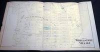
Original Map of Part of Whitestone Village Southern Part Long Island New York.
New York NY: Beers Comstock & Cline 1873. Original Hand-colored Map of Part of Whitestone Village Southern Part from the Beers Comstock & Cline Atlas of Long Island New York. Three sections folded 15 1/2" x 27 1/2" approx. overall size; somewhat age-toned; top edge with a little scraping; old creasing; in very good condition. . First Edition. Not Bound. Very Good. Beers, Comstock & Cline Paperback books
書籍販売業者の参照番号
: 8953
|
|
|
Americana 19th Century Cartography Maps Long Island New York
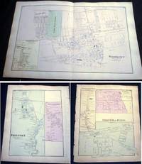
Original Map of Woodhaven with Inset Map of South Woodhaven & Maps of Springfield Store Willow Tree Station Inglewood Freeport Greenwich Point Long Island New York.
New York NY: Beers Comstock & Cline 1873. Original Hand-colored Map of Woodhaven with Inset Map of South Woodhaven from he Beers Comstock & Cline Atlas of Long Island New York. 15 1/2" x 24 1/4" approx. overall size; somewhat age-toned; on reverse are maps of Springfield Store Willow Tree Station Inglewood Freeport Greenwich Point; left margin edge-chipped right margin with a few nicks; in very good condition. PLEASE NOTE: Shipped rolled for safety. First Edition. Not Bound. Very Good. Beers, Comstock & Cline Paperback books
書籍販売業者の参照番号
: 8957
|
|
|
Americana 20th Century Cartography Maps Nassau County New York
Map of the Town of Hempstead Nassau County Long Island New York
New York New York: U.S. Geographical Survey 1929. Department of the Interior U.S. Geological Survey Hempstead Quadrangle; 1929 version of a map edition of 1903 depicting a partially revised shoreline of 1923. Showing contours topography waterways train lines roads and locations of homes; printed in three colors. The back of the map with information on map standard symbols. 20" x 16 1/2" approximate size; some edge tips wear closed edge tear at bottom edge little wrinkling; & back with a darkened panel. In good condition decorative and interesting perspective on Long Island real estate development patterns in the area. PLEASE NOTE: Shipped rolled for safety. . Map. Not Bound. Good. U.S. Geographical Survey Paperback books
書籍販売業者の参照番号
: 13924
|
|
|
Americana 20th Century Cartography Southold Long Island New York
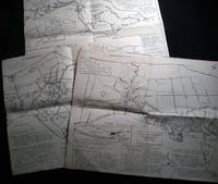
Three Maps of the Town of Southold Long Island N.Y. 1640 -1965
Southold Long Island N.Y.: No Publisher Noted 1965. Three folded sectional maps of the Town of Southold Long Island NY. Approx. 14 1/2" x 18" size; printed black on cream paper stock. Section I depicting western portion Laurel Mattituck Cutchogue Nassau Point Robin's Island; Section II Peconic Southold village Bay View Hashamomack Greenport; Section III East Marion Oysterponds - Orient & a Fisher's Island map inset. Each map with its own numbered key-list of locations and short historical notes on them. Some edge tips-wear and soiling little spotting; old fold lines; in good condition. First Edition. Not Bound. Good. No Publisher Noted paperback books
書籍販売業者の参照番号
: 26508
|
|
|
Americana Cartography Richard Edes Harrison
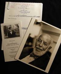
1984 Inscribed and Signed Photograph of Cartographer and Artist Richard Edes Harrison with Related Ephemera
New York New York: Photo By Bill Ray 1984. Black and white photograph 8" x 10" on heavy photographic paper; on back is handwritten "For my old and valued friend Bob Greene" and with Harrison's name and the date of April 1984 at the lower border; with the studio stamp of Photo by Bill Ray 350 Central Park West New York. with A group of copy-pages of drawings from the New Yorker by Harrison and presented "for Bob Greene Richard Edes Harrison on his 66th Birthday" with the black and white illustrated memorial service pamphlet for R. E. Harrison 1901 - 1994 Cartographer-Artisan-Birder-Raconteur on the 93rd Anniversary of his Birth March 11 1994. in good condition. Robert S. Greene 1922 - 2013 American writer jazz musician documentarian and historian friend of the artist who innovated U.S. cartography in the 20th century. see Timothy Barney "Richard Edes Harrision and the Cartographic Perspective of Modern Internationalism" U. of Richmond 2012 for his more on his contributions to cartography. Photograph. Soft Cover. Very Good. Photo By Bill Ray Paperback books
書籍販売業者の参照番号
: 24561
|
|
|
AMIS DU MUSÉE DES SALORGES, GAUTHIER Joseph-Stany, jean Bruneau, Charles Viaud
CAHIERS DES SALORGES - NUMÉRO 18
Nantes Imprimerie Marthe Chantreau et Compagnie 1978 -in-4 broché revue (magazine) in-quarto, première de couverture illustrée (front cover illustrated), illustrations : bien documenté (well-documented), sans pagination (unpaginated), sans date (1978) à Nantes Imprimerie Marthe Chantreau et Compagnie,
書籍販売業者の参照番号
: 25656
|
|
|
Amiran, David H. K.; Elster, Joseph; Gilead, Mordehai; Rosenan, Naftali; Kadmon, Naftali; Paran, Uzi [Eds.] / Zohary, Michael; et al.
Atlas of Israel - Cartography, Physical Geography, Human and Economic Geography, History.
RARE comprehensive atlas of Israel covering all fields from physical, human and economic geography, to history, geology and geomorphology, botany and zoology, with numerous detailed large size maps. [SECTION EDITORS]: Cartography - Joseph Elster, Geomorphology - David H.K.Amiran, Geology - Leo Picard, Hydrology - Martin Julius Goldschmidt, Botany - Michael Zohary, Zoology - Jacob Wahrman, Land Utilization - Isaac Schattner, History - Michael Avi-Yonah, Population - Mordehai Gilead, Settlements - Joseph Elster, Agriculture - Emil Louis Levie & Samuel Pohoryles, Industry and Trade - Yitzhak Guelfat & Shaul Zarhi, Communications - Yehuda Karmon, Services - Helmut Muhsam & Amiram Gonen, Statistical Adviser - Roberto Bachi, Reproduction - Barukh Osri. The first edition in Hebrew was published in 1956-1964, this is the second English edition which was revised and published in 1970. 500x355mm. Unpaginated. Blue cloth Hardcover with plain dust-jacket laid cardboard slipcase. Gilt front cover and spine. Slipcase stained, worn and bumped (partly punctured). Jacket stained and slightly wrinkled. Jacket edges tattered. Jacket spine edges partly missing. Spine edges slightly bumped/wrinkled. Ex-libris sticker on front inner cover upper corner. Front whitepage and title page bottom corner creased. Title and first pages bottom corner slightly worn - NO damage to text. [SUMMARY]: This extremely rare, large and comprehensive atlas of Israel, especially revised and published in English as part of a collaborative project by the leading authorities in each field, is in good condition. PLEASE NOTE: This item is overweight. We may ask for extra shipping costs.
|
|
|
AMMANNATI Francesco -
“Chorographia Tusciae” note sulla geometria della carta di Girolamo Bellarmato.
Firenze, 1987, 8vo stralcio con copertina posticcia muta, pp. 276/289 con 2 illustrazioni e 2 carte a colori a pagina doppia. - !! ATTENZIONE !!: Con il termine estratto (o stralcio) intendiamo riferirci ad un fascicolo contenente un articolo, completo in se, sia che esso sia stato stampato a parte utilizzando la stessa composizione sia che provenga direttamente da una rivista. Le pagine sono indicate come "da/a", ad esempio: 229/231 significa che il testo è composto da tre pagine. Quando la rivista di provenienza non viene indicata é perché ci è sconosciuta. - !! ATTENTION !!: : NOT A BOOK : “extract” or “excerpt” means simply a few pages, original nonetheless, printed in a magazine. Pages are indicated as in "from” “to", for example: 229/231 means the text comprises three pages (229, 230 and 231). If the magazine that contained the pages is not mentioned, it is because it is unknown to us.

|
|
|
Amundsen Roald
Il mio volo polare fino a 88° Lat. Nord [ARTIDE]
9 cartine 132 illustrazioni fuori testo

|
|
|
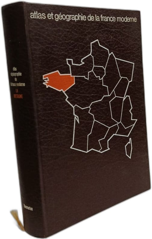
ANDRE MEYNIER
Atlas et géographie de la Bretagne / portrait de la France moderne
FLAMMARION 1976 in4. 1976. Cartonné. Atlas et géographie de la Bretagne est un ouvrage scientifique d'André Meynier géographe spécialiste de la région publié chez Flammarion. L'auteur y met à profit sa profonde connaissance de la Bretagne acquise durant trente-cinq ans d'enseignement à Rennes. Le livre s'inscrit dans la collection 'Atlas et géographie de la France moderne' et présente une approche synthétique de la géographie bretonne
書籍販売業者の参照番号
: 100149952
|
|
|
ANDRIVEAU-GOUJON E.-
Plan de Paris à l'échelle de 2 Millim. pour 25 Mètres indiquant les Nouveaux percements et les changements de noms de Voies publiques. Avec plans supplémentaires pour les Bois de Boulogne et de Vincennes.-
Paris. Andriveau-Goujon. 1869. Très grand plan couleurs (102 x 83 cm) entoilé et remplié in-8 (146 x 208mm). Toile muette, brunie, excellent état de ce magnifique plan de Paris.
書籍販売業者の参照番号
: ORD-11698
|
|
|
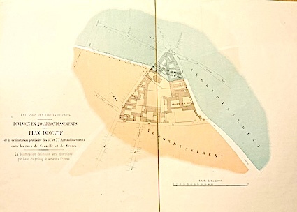
ANDRIVEAU-GOUJON (E.);
PLAN Géométral de PARIS et de ses agrandissements à l'échelle de 1/10.000).
Louis Antoine Paris 1859 1 vol. Feuille entoilée de 216 x 102 cm; repliée au format in-8 sous étui papier avec pièce de titre en veau cerise.
書籍販売業者の参照番号
: 15814
|
|
|
Andrae Carl Christopher Georg (1812-1893)
PROBLEMES DE HAUTE GEODESIE. EXTRAITS DE L'OUVRAGE DANOIS "DEN DANSKE GRANDMAALING". 3° Cahier: Determination du sphéroide terrestre par la combinaison des mesures géodésiques avec les observations astronomiques. Avec une planche.
(Codice OS/0207) In 4° (29,5x23 cm) 56 pp. Edition originale. Une planche en couleurs hors texte. Broché, très bon état. Rare. ~~~ SPEDIZIONE IN ITALIA SEMPRE TRACCIATA

|
|
|
Andrae Carl Christopher.
PROBLEMES DE HAUTE GEODESIE. Extraits de l'ouvrage Danois: "Den Danske Gradmaaling". 1er Cahier: Formation et calcul des triangles géodésiques.
(Codice SM/1900) In 4° (29,5 cm) 52 pp. Edition originale. Couverture souple légérement jaunie, intérieur en parfait état. ~~~ SPEDIZIONE IN ITALIA SEMPRE TRACCIATA

|
|
|
Andrea Marcello
Alcune Carte Manoscritte Presentate All’Esposizione Internazionale Geografica Di Venezia
Venezia, Naratovich 1881. 8°:pp.60n. bross.origin.
|
|
|
Andreas, Alfred T
A. T. Andreas' Illustrated Historical Atlas of the State of Iowa
The Lakeside Press, Chicago, 1875. 45,5 x 37,5 cm ; Halbleder
書籍販売業者の参照番号
: 115929

|
|
|
Andree, R
Andrees Allgemeiner Handatlas. Hrsg. v. A. Scobel. 4. Aufl. 4. Abdr.
Bielefeld, Velhagen & Klasing, 1903. Fol. 126 farb. Haupt- 139 farb. Nebenktn. 2 Bl. Nachgeb. Hlwdbd. m. mont. Deckeltitel. Leicht angeschmutzt. Priv. St. A. Tit. Einige Karten m. schwacher Nässespur. Ohne das Register.
書籍販売業者の参照番号
: 621841
|
|
|
Andree, Richard
Allgemeiner Handatlas in 86 Karten. Mit erläuterndem Text. Herausgegeben von der Geographischen Anstalt von Velhagen & Klasing in Leipzig.
Bielefeld und Leipzig, Verlag von Velhagen & Klasing, 1881. 2°. 43 x 30 cm. 96, 98 Seiten. Halbleinenband, Rücken erneuert. [3 Warenabbildungen]
書籍販売業者の参照番号
: 8072EB

|
|
|
Andree, Richard
Andrees allgemeiner Handatlas in 91 Haupt- und 86 Nebenkarten. Nebst vollständigem alphabetischem Namenverzeichnis. Herausgegeben von der Geographischen Anstalt von Velhagen & Klasing in Leipzig.
Bielefeld und Leipzig, Verlag von Velhagen & Klasing, 1893. 2°. 43 x 30 cm. 140 Blatt Karten, 168 Seiten Verzeichnis. Halbleinenband, Rücken erneuert. [3 Warenabbildungen]
書籍販売業者の参照番号
: 52669BB

|
|
|
ANDRIVEAU-COUJON J.
CARTE des CHEMINS de FER exécutés et en Construction dans la GRANDE BRETAGNE. Janvier 1840.
Grande foglio di cm. 59,3x45,6. Scala: "Kilomètres de 111 au degré ( Milles Légaux Anglais de 69½ au degré". Le ferrovie in funzione con macchine a vapore (locomotive o stazionarie) colorate in rossobruno, quelle in costruz. in verdeblu; ferrovie a traino di cavalli a tracciato non colorato; il confine scozzese è evidenziato in giallo e verde. La carta comprende la parte nord-est dell'Irlanda; le distanze tra città segnate in miglia ingl., per l'Irlanda in miglia irl. Le altitudini d. montagne in metri s.l.m. In larga cornice ornata. 2 strappi senza perdite mal risarciti (di ca. 10 cm.), se no ottima perspicua e pulita.

|
|
|
Andrzej Klimaj; Stanislaw Rutkowicz;
Atlas rybacki Morza Polnocnego. Fishing atlas of the North Sea.
Ex-library copy with the usual stamps and markings. Text in Polish, English, and Russian. Very large format: 11 1/2" x 16". Beautiful colored maps of divisions of the sea, currents, areas, and many for fishing stats.

|
|
|
Anesi, Jose
Nuevo Atlas Geografico de la Argentina
360x275 mm. 27 pages. Softcover. Cover slightly stained. Cover corners tattered. Spine wrinkled and worn. Cover, spine and inner cover yellowing. Binding visible between inner cover and pages, and between few pages. Some page corners wrinkled. Pages yellowing. Else in good condition.
|
|
|
Angela Codazzi
Storia delle carte geografiche da Anassimandro alla rinascita di Tolomeo nel sce. XV
Un volume ciclostilato di 100 pagine, brossura editoriale. Dimensioni: 17,5x24,5 cm. Minime tracce del tempo alla brossura, titolo in rilievo applicato al dorso su nastro adesivo plastificato. VIII tavole in b/n fuori testo.
|
|
|
Angelini, Werther - Piccinini, Gilberto (a cura di)
La cultura nelle Marche in età moderna.
Mm 245x310 Edizione a cura dell'Editore per conto della Mediovenezie - Banca SpA. Volume in copertina rigida, sopracoperta originale, 360 pagine con figure perlopiù a colori. Copia in ottime condizioni, spedizione in 24 ore dalla conferma dell'ordine.
|
|
|
Anghiera Pietro Martire D'
Mondo nuovo (De Orbe Novo) [AMERICA]
11 tavole in bianco e nero fuori testo

|
|
|
ANICH PETER - HUEBER BLASIUS.
Tyrolis sub felici regime Mariae Theresiae... chorographice delineata... curante Ignat. Weinhart.
In 4 custodie ottocentesche in cart. rigido con titoli manoscritti su tasselli contenenti tutte le parti applicate su tela di cui si compone la grande carta corografica del Tirolo incisa in rame. L’intera carta è composta da 20 parti suddivise in 180 segmenti di cm. 19 x 15, così che la misura complessiva è di cm. 230 x 220. Con grandi cartigli decorativi. Esemplare in ottimo stato di conservazione e con un’inchiostratura assai fresca. Alcune sezioni con una patina appena più chiara. L’insieme viene completato da una carta supplementare di cm 58 x 44 che riassume in dimensioni ridotte l’esemplare maggiore. Celebre impresa cartografica; la più affascinante raffigurazione del Tirolo conosciuta come ”Atlas Tyrolensis”. La carta disegnata da Peter Anich e Blasius Hueber costituisce per la sua innovatività un salto evolutivo nella scienza cartografica. In essa sono riunite le caratteristiche di bellezza e decoratività delle vecchie carte assieme alla precisione del rilevamento. E’ considerata come la prima carta topografica unitariamente concepita in Europa. Per ottenere tale qualità e precisione i due “agrimensori” lavorarono a lungo sul campo. Dal momento in cui Maria Teresa d’Austria decise di commissionarne ad Anich la stesura al momento in cui l’incisore viennese J.E. Mannsfeld si ritrovò il materiale definitivo da sistemare, disegnare e trasferire sulle carte, passarono oltre dieci anni. Nel frattempo la vita di Anich si era spenta a causa degli sforzi estremi e delle condizioni climatiche in cui il misuratore aveva dovuto passare forse troppo tempo. L’ottimo risultato raggiunto è dato soprattutto dal felice connubio di attitudini che così si riassume: Anich eccelleva per precisione e per novità dei mezzi usati nella misurazione, Hueber per la capacità plastica di rendere e collezionare per sé e per altri i racconti di viaggio. Alcune delle lettere scritte da Hueber durante il periodo di rilevamento sono esemplari per comprendere questo suo atteggiamento e di grande interesse per la conoscenza delle comunità contadine dell’epoca.

|
|
|
ANICH PETER - HUEBER BLASIUS.
Tyrolis sub felici regime Mariae Theresiae... chorographice delineata... curante Ignat. Weinhart.
Grande carta corografica del Tirolo incisa in rame. L’intera carta è applicata su tela e composta da 20 parti suddivise in 180 segmenti di cm. 19 x 15, così che la misura complessiva è di cm. 230 x 220. Con grandi cartigli decorativi. Esemplare con alcune sezioni leggermente brunite, ma complessivamente ben conservata. L’insieme viene completato da una carta supplementare di cm 58 x 44 che riassume in dimensioni ridotte l’esemplare maggiore. Celebre impresa cartografica; la più affascinante raffigurazione del Tirolo conosciuta come ”Atlas Tyrolensis”. La carta disegnata da Peter Anich e Blasius Hueber costituisce per la sua innovatività un salto evolutivo nella scienza cartografica. In essa sono riunite le caratteristiche di bellezza e decoratività delle vecchie carte assieme alla precisione del rilevamento. E’ considerata come la prima carta topografica unitariamente concepita in Europa. Per ottenere tale qualità e precisione i due “agrimensori” lavorarono a lungo sul campo. Dal momento in cui Maria Teresa d’Austria decise di commissionarne ad Anich la stesura al momento in cui l’incisore viennese J.E. Mannsfeld si ritrovò il materiale definitivo da sistemare, disegnare e trasferire sulle carte, passarono oltre dieci anni. Nel frattempo la vita di Anich si era spenta a causa degli sforzi estremi e delle condizioni climatiche in cui il misuratore aveva dovuto passare forse troppo tempo. L’ottimo risultato raggiunto è dato soprattutto dal felice connubio di attitudini che così si riassume: Anich eccelleva per precisione e per novità dei mezzi usati nella misurazione, Hueber per la capacità plastica di rendere e collezionare per sé e per altri i racconti di viaggio. Alcune delle lettere scritte da Hueber durante il periodo di rilevamento sono esemplari per comprendere questo suo atteggiamento e di grande interesse per la conoscenza delle comunità contadine dell’epoca.
|
|
|
Annales d'histoire sociale
Annales d'histoire sociale / Problèmes fonciers dans l'Empire ottoman ( Omer Lüftü ) - Aspects économiques à la veille de la révolution ( Léon Cahen ) - Les transformations du système bancaire ( J. Houdaille ) - Crise nobilaire en Bordelais (fin ) (R. Boutruche ) - Cosmologie, occultisme et poésie ( L. Febvre ) - Du goût de Voltaire ( Lucien Febvre ) - Une révolution, le romantisme ( L. Febvre ) - Economie nationale-socialiste ( H. Brunschwig )- Un essai d'histoire uropéenne ( L. Febvre ) Etat et ententes d'entreprises ( Paul Leuilliot ) - Histoire et mathématiques ( A.-V Jacquet ) - Au Congrès de Zurich ( Ch.-Ed Perrin ) - Bibliographie : Clio en Orient ( J. Février ) - Cartographie : Les causes de mort ( M. Halbwachs )
N°3 de juin 1939 - 1ère année
書籍販売業者の参照番号
: 10808
|
|
|
Annalina Levi, Mario Levi
La tabula peutingeriana
Annalina Levi, Mario Levi La tabula peutingeriana. Bologna, Edizioni Edison 1978 italian, 163 SL Volume in ottime condizioni. Studio dedicato alla famosa pergamena conservata presso la Biblioteca Nazionale di Vienna. Copertina rigida. Illustrato. Edizioni Edison. Bologna. 1978. Pagg. 163

|
|
|
Anonyme
250 views: Isle of Wight and neighbourhood
sd rigide Published by Rock Bros., Ltd., London - sans date - In-4 cartonné - Sans pagination
書籍販売業者の参照番号
: 124811
|
|
|
ANONYME [PIQUET, Charles ; BOUTIN, Vincent-Yves Capitaine].
Aperçu historique, statistique et topographique sur l’État d’Alger, à l’usage de l’Armée Expéditionnaire d’Afrique.
Paris, Ch. Piquet, 1830. Texte + Atlas, complet. In-12, 10,5 x 17,5 cm (texte) ; In-folio oblong, 36 x 28 cm. Reliure postérieure pastiche en demi-veau fauve et coins crème en vélin, dos lisse orné de filets à froid et roulettes dorées, pièce de titre en maroquin noir, tranches du volume de texte marbrées. viii, 238 pp. ; 21 pl. (atlas). Deuxième édition, publiée la même année que l’originale. « La première édition de cet Aperçu a été envoyée à l’armée expéditionnaire d’Afrique. On trouvera, à la fin de celle-ci, quelques plans nouveaux, et, dans le texte ou en appendice, quelques additions que de nouvelles recherches nous ont mis à même de présenter au lecteur ». L’atlas contient 7 cartes ou plans gravés, dont 6 dépliants (2 établis d’après les relevés du Capitaine Boutin) et 14 planches lithographiées, dont plusieurs issues de la collection du Colonel Rottiers représentant des vues et des costumes, le tout monté sur onglets.« Ouvrage publié par le Dépôt Général de la Guerre à l'usage de l'armée expéditionnaire d'Afrique, qui quitta le port de Toulon le 25 mai 1830, en direction d'Alger. Il fut rédigé par le géographe Charles Piquet, en grande partie d'après le rapport du capitaine Boutin, envoyé en mission d'espionnage, en 1808, dans la régence d'Alger ». Gay, 852 et 873 ; Tailliart, 1455. Ex-dono JJL de Querelles sur la première carte.
書籍販売業者の参照番号
: 2192

|
|
|
ANONYME
Géographie Nationale illustrée de la France et de ses Colonies, illustrée de nombreuses cartes et gravures et suivie d'une géographie générale du globe, Paris, Librairie Géographique et Scientifique, sans date (1877).
1 volume grand in-8° relié demi-basane marron, dos lisse, faux nerfs et titre doré, basane un peu usagée, deux minuscules trous de vers, petites traces de restauration sur le papier en table des matières, quelques rares rousseurs , 644 p. + gravures et cartes dont une en couleurs. BEL ÉTAT.
書籍販売業者の参照番号
: 1926

|
|
|
ANONYME - Plan De Paris
Nouveau Plan de la ville de Paris, chez le Roi libraire -1827
1 carte sur papier chiffon de 305 cm de haut sur 452 cm de large. Petite déchirure sur 7cm en partie supérieure, carte polychrome.
書籍販売業者の参照番号
: 4000

|
|
|
Anonimo
Baja Romansov
Incisione in rame di mm 170 x 120 alla battuta su carta spessa. Esemplare privo di difetti. L'immagine, in mancanza di informazioni più precise, doveva far parte dell'opera di Jean Baptiste Benoit "Viaggio pittoresco in Asia ed in Africa : riassunto generale dei viaggi antichi e moderni secondo Arman ... / di G.B. Eyries ; prima traduzione italiana di Silvestro Bandarini"
|
|
|
ANONIMO
BERTELSMANN HAUSATLAS - 1960
In 4o, pp. 318, t.tela con sovrac. (minimi strappetti ai bordi), 42 carte f.t. Ottimo atlante tedesco diviso in 2 parti: TEXT (Astronomie, Entdeckungsgeschichte der erde, Natur der erde, Geographisches worterbuch, Die welt in zahlen, Namen und sprachen, Landerkunde) e KARTEN (1305/ ATLANTE - ATLAS - CARTOGRAFIA)
|
|

 検索結果のメールを受信する
 PDFファイルの検索結果をダウンロード
 RSSフィード
 パーマネントリンク


