|
|
|
Anonimo
Rodi
Anonima veduta prospettica di Rodi, priva di data ed indicazioni editoriali. In alto al centro, in un nastro, il titolo: RODI. Opera priva di orientazione e scala grafica. Acquaforte e bulino, magnifica prova, impressa su carta vergata coeva, rifilata al rame, tracce di antica coloritura, in perfetto sato di conservazione.L’opera sembra essere una riduzione del modello introdotto da Bernhard von Breydenbach nel Peregrinatio in Terram Sanctam (Mainz 1486). Come giustamente nota la Borroni, questa incisione appare particolarmente più accurata, oltre che di formato maggiore, rispetto alle analoghe vedute della città pubblicate da Bertelli, Camocio e Pinargenti. L’incisione è di estrema rarità; oltre all’esemplare descritto da Borroni (Nazionale di Firenze) e quello dell’atlante di Alessandro d’Este (Estense di Modena), ne abbiamo censito solamente uno alla Bibliothèque Nationale ed un altro in una collezione privata romana. Non sono note ristampe.Magnifico esemplare di questa rarissima veduta prospettica di Rodi. Anonymous perspective view of Rhodes, with no date and editorial indications. A Lafreri school engraving, known in 3 examples.At the top center, the title: RODI. Without orientation and graphic scale.Etching and engraving, magnificent proof, printed on contemporary laid paper, trimmed to copperplate, traces of ancient coloring, very good condition.The work appears to be a reduction of the model introduced by Bernhard von Breydenbach in the Peregrinatio in Terram Sanctam (Mainz 1486). As Borroni rightly notes, this work appears to be particularly more accurate, as well as of a larger format, than the analogous views of the city published by Bertelli, Camocio and Pinargenti.The view is extremely rare; in addition to the example described by Borroni (Biblioteca Nazionale of Florence) and that of the atlas of Alessandro d'Este (Biblioteca Estense of Modena), we have only recorded one at the Bibliothèque Nationale de France. There are no known reprints.Magnificent example of this very rare perspective view of Rhodes. Borroni Salvadori (1980): n. 243; Tavernari (2014): n. 114.

|
|
|
Anonimo
Scorcio della Basilica dei Frari
Stampa calcografica di mm 167 x 232 , alla battuta; foglio a larghi margini (239 x 351 mm.). Carta di cotone della prima parte del XX secolo. Bella incisione, databile ai primi vent'anni del secolo, raffigurante la Basilica dei Frari, colta dalla Salizada San Rocco. L'artista, purtroppo ignoto, ha realizzato l'opera con un larghissimo uso del bulino, chiaramente adoperato da mano esperta, lasciando l'uso dell'acquaforte alle parti meno rilevanti.
|
|
|
Anonimo
Veduta di Ceilan-Point-de-Galle
Incisione in rame di mm 170 x 120 alla battuta su carta spessa. Esemplare privo di difetti. L'immagine, in mancanza di informazioni più precise, doveva far parte dell'opera di Jean Baptiste Benoit "Viaggio pittoresco in Asia ed in Africa : riassunto generale dei viaggi antichi e moderni secondo Arman ... / di G.B. Eyries ; prima traduzione italiana di Silvestro Bandarini"
|
|
|
Anonimo
Veduta di Ceilan-Point-de-Galle
Incisione in rame di mm 170 x 120 alla battuta su carta spessa. Esemplare privo di difetti. L'immagine, in mancanza di informazioni più precise, doveva far parte dell'opera di Jean Baptiste Benoit "Viaggio pittoresco in Asia ed in Africa : riassunto generale dei viaggi antichi e moderni secondo Arman ... / di G.B. Eyries ; prima traduzione italiana di Silvestro Bandarini"
|
|
|
ANONIMO.
ATLAS EL MUNDO Y MI PATRIA. FISICO - POLITICO. EL SALVADOR.
27x19. 18p. + XVII mapas. Mapas. Enc. Cart.ed.

|
|
|
ANONIMO.
ATLAS EL MUNDO Y MI PATRIA. FISICO - POLITICO. NICARAGUA.
27x19. 18p. + XVII mapas. Mapas. Enc. Cart.ed.

|
|
|
ANONIMO.
Carta comprendente i territori a nord del Ducato di Modena, del Po e dello Stato Pontificio (Lombardia, Veneto).
Italia, 1850 circa. Carta telata incisa in acciaio, b/n, cm 43 x 67. Divisa in otto quadri e chiusa ai margini, quindi completa. Usuali difetti del tempo e un lieve ingiallimento ma buono stato.

|
|
|
Anonimo.
Carta Del Teatro Della Guerra Nostra.
Novara, Istituto Geografico De Agostini, 1918. Carta originale mis. mm. (580x920) più margini, ripiegata in segmenti in 8°, a colori in scala 1/500.000. Bross.edit.sciupata.
|
|
|
ANONIMO.
Carta Generale del Regno d'Italia. Schweitz, Tirolo, Udine / Milano, Verona, Venezia / Genova, Firenze, Bologna.
Italia, 1800 circa. Carta telata incisa in rame, b/n, cm 20,5 x 28. Divisa in due quadri e non chiusa, quindi non completa (comprende la sola parte del centro – nord, manca la parte centro – meridionale). Buono stato.

|
|
|
ANONIMO.
Charte von Asien.
Augsburg, 1808. Incisione in rame, colore d’epoca, cm 52 x 62 (alla lastra). La mappa comprende anche una dettagliata descrizione del sud est asiatico e dell’estremo oriente. Carta un po’ brunita, due pieghe trasversali e alcuni strappetti marginali ma in buono stato.

|
|
|
ANONIMO.
Pianta dei Bagni di Lucca e suoi dintorni.
Firenze, 1855. Incisione su acciaio in colore d'epoca, cm 52 x 69 (il foglio). Non tratta da volume e assente qualsiasi indicazione editoriale. Ampissimi margini con patina di sporco e alcuni strappi, piacevole e vivace coloritura, discreto stato.

|
|
|
ANONIMO.
Suite de l’Italie Ancienne comprenant l’Ombrie, le Picenum, la Sabinie, le Latium, la Campanie et le Samnium.
1830 circa Incisione in rame all’acquaforte, colore d’epoca, cm 38,5 x 55 (alla lastra) più margini, ricca cornice incisa e testi descrittivi ai lati della carta. Molto chiaramente si vede lo sviluppo delle città nel Lazio e nelle regioni interne centro meridionali, mentre invece la Toscana e una parte della Emilia Romagna risultano ancora connotate dal solo tratteggio dei monti. Un filo di ingiallimento marginale, ottimo stato di conservazione.

|
|
|
ANONIMO.
Toscana, Mare Tirreno e Isole dell'Arcipelago Toscano.
Austria, 1850 circa. Carta telata incisa in acciaio, b/n, cm 50 x 56,5, divisa in sei quadri, chiusa ai margini e quindi completa. La carta comprende gran parte della Toscana e la costa tirrenica da Spezia a Civitavecchia con tutte le isole dell'Arcipelago Toscano (Gorgona, Capraia, Elba, Pianosa, Montecristo, Giglio, Giannutri) nonché gran parte della Corsica fino all'altezza del Golfo di Valinco, sotto Ajaccio. Contornata da un'alta bordura decorata, inciso ben delineato, ben leggibili nel dettaglio tutte le località. Fioriture sull'inciso ma buono stato di conservazione.

|
|
|
ANONIMO.
Toscana, Mare Tirreno, Isole dell'Arcipelago Toscano.
Austria, 1850 circa. Carta telata incisa in acciaio, b/n, cm 50 x 56,5, divisa in sei quadri, chiusa ai margini e quindi completa. La carta comprende gran parte della Toscana e la costa tirrenica da Spezia a Civitavecchia con tutte le isole dell'Arcipelago Toscano (Gorgona, Capraia, Elba, Pianosa, Montecristo, Giglio, Giannutri) nonché gran parte della Corsica fino all'altezza del Golfo di Valinco, sotto Ajaccio. Contornata da un'alta bordura decorata, inciso ben delineato, ben leggibili nel dettaglio tutte le località. Alcune zone di fioritura sull'inciso ma buono stato di conservazione. .

|
|
|
ANONYM.
[MAP of CONSTANTINOPEL] [German map of the Bosphorus - Constantinople - Princess Islands].
Very Good German Original color map on cloth of Constantinople, the Bosphorus, the Golden Horn, Princess' Islands, Pera, Galata, Scutari and environment. Map on cloth. 50x60 cm. Toponyms are in German entirely. Folded. Scale: 1:100000. A detailed toponyms list titled "Verzeichnis der mit Ziffern bezeichneten öffentlichen Gebaude" under the sections A: Pera und Galata, B: Stambul, C: Skutari; and "Erlauterung der Abkürzungen". Some toponyms are transcripted Turkish into western characters like Karadenis - Bahr-i Siach, Burgas Adassi, Kisil Adalar, Jeni Djami, etc. A rare Istanbul map printed in 19th century.
|
|
|
ANONYM].
[INFLUENCES BY SIR FRANCIS BAILY IN AN OTTOMAN MAP OF THE SKY] Harita-yi semâ: Kevâkib, Tasnîf-i Kürre-i Cenûbî, Tasnîf-i Kürre-i Simâlî, Mintika-yi hareye mahsûs burûc. [i.e. Map of the sky: Stars, planets, South Pole, North Pole, and Zodiacs].
Very Good Turkish, Ottoman (1500-1928) A very attractive chromo-lithograph map on paper. Oblong: 26,5x37,5 cm. In Ottoman script (Old Turkish with Arabic letters). Light foxing and fading on margins and printed area. A very detailed and fine double hemisphere map of the northern and southern skies, showing the various constellations, together with a third map showing the zodiacs on one paper. On the bottom margin, it's written 'Printed in the 549 Numbered Press', and 'Dersaadet...'. This map seems to be influenced (or, a direct translation) from the map of the sky of Sir Francis Baily, (1774-1844), who was one of the leading English Astronomers of the first part of the 19th Century. He is most famous for his observations of "Baily's beads" during a total eclipse of the Sun. Baily was also a major figure in the early history of the Royal Astronomical Society, as one of the founders and as the president four times. After a tour in the unsettled parts of North America in 1796-1797, his journal of which was edited by Augustus de Morgan in 1856, he entered the London Stock Exchange in 1799. The successive publication of Tables for the Purchasing and Renewing of Leases (1802), of The Doctrine of Interest and Annuities (1808), and The Doctrine of Life-Annuities and Assurances (1810), earned him a high reputation as a writer on life-contingencies; he amassed a fortune through diligence and integrity and retired from business in 1825, to devote himself wholly to astronomy. He had already, in 1820, taking a leading part in the foundation of the Royal Astronomical Society. In 1827, the Society awarded him its Gold Medal for preparation of the Astronomical Society's Catalogue of 2881 stars. He was instrumental in the reform of the Nautical Almanac in 1829. In 1837, he recommended to the British Association and later worked extensively on the reduction of Joseph de Lalande's and Nicolas de Lacaille's catalogues containing about 57,000 stars. He also supervised the compilation of the British Association's Catalogue of 8377 stars (published 1845) and revised the catalogues of Tobias Mayer, Ptolemy, Ulugh Beg, Tycho Brahe, Edmund Halley and Hevelius. His notice of Baily's Beads, during an annular eclipse of the sun on May 15 1836, at Inch Bonney in Roxburghshire, started the modern series of eclipse-expeditions. Very rare.
|
|
|
ANONYMOUS].
[MOUSOUL, QIRKUK, SANJAK OF DEIR AL-ZOR, BAGHDAD] Manuscript map on a tissue paper of Vilâyat of Baghdad, Zor [Deir Al-Zor], Mousul and Soleimaniyya.
Very Good Arabic Original hand-colored map on tissue paper. 23x19 cm. In Ottoman script and Arabic. No scale. Manuscript notes of toponyms. It shows Baghdad, Deir Al-Zor, Kirkuk, Mosul, Syria, borders of Ajamistan (Iran), etc. Manuscript notes show that the map was used in military purposes in the last Ottoman Imperial period.
|
|
|
Ansermot, Jean
Plan densemble Commune de Villars sur Glâne 1938. Mensuration cadastrale Suisse. 1:5000 1cm=50m. Levé par Jean Ansermot, géomètre. Image 73.5x103 cm.
1938 73.5x103 cm
書籍販売業者の参照番号
: 937.1aaf
|
|
|
Anselmi Arduino
MILANO STORICA nelle sue vie, nei suoi monumenti trentadue tavole fuori testo, una a colori
Prefazione - Archivi - Biblioteche - Chiese - Cimiteri - Fontane - Giardini -Monumenti -Musei - Ordini religiosi -Ospedali - Palazzi ed Edifici diversi - Palazzi, Chiese ed Edifici diversi ora scomparsi - Stazioni -Teatri e ritrovi per pubblici spettacoli - 1 19x12,5 cm., in brossura, copertina illustrata con 2 persone in costume, pp. 701 (1), non refilate, 32 tavole fuori testo, di cui 1 a colori- in antiporta (La Galleria De Cristoforis) - su carta patinata, prima edizione, in italiano, segno di stacco sul volume, s.d. buon esemplare, solo leggeri segni d'uso e tempo, ben conservato. Allegata scheda editoriale Questo libro scritto da un milanese per i milanesi, scritto senza pretese letterarie ma con una cura che attesta il lungo studio di un ricercatore appassionato e diligente...fa ricordare un altro volume, rarissimo, Milano e le sue vie di Felice Venosta edito nel 1867, in 200 pp., illustrava i nomi delle vie di allora, circa 130; questo volume dell'Anselmi consta di 700 pp. e le vie illustrate sono circa 3000!...la mia lode sincera va all'A. di quasta pregevolissima opera e al venerando editore Hoepli che con questa iniziativa ha voluto dimostrare ancora una volta il grande amore che porta alla nostra diletta Milano.. firmato Marcello Visconti di Modrone, autografa, Milano, 7 ottobre 1932-X
|
|
|
ANSON, GEORGE.
A Chart of the Channel in the Philippine Islands through which the Manila Galeon Passes togheter with the adjacent Islands.
Dal “Voyage round the word, in the years MDCCXL” (in quattro tomi). London, John e Paul Knapton, 1749. Incisa da R. W. Seale, incisione in rame all'acquaforte, b/n, cm 56 x 73 (il foglio), piccolo cartiglio in alto a destra, margine graduato sul laterale sinistro. Fra le principali isole dell'arcipelago delle Filippine, che comprende nel suo insieme oltre settemila isole, sono segnalate la Terra di Luzon o Luconia, la Laguna de Bay, Manila, Myndoro, Panay, Masbate, la Ysl De Negros, Zebu, Leyte e Samal. L'insieme della Luconia, il Shoals Luconia, la cui giurisdizione ricade sotto la Malaysia, rappresenta uno dei complessi più grandi e meno conosciuti della barriera corallina del Mar Cinese Meridionale, situato a sud-ovest dalle Isole Spratly e a cento chilometri al largo della costa del Borneo; non c'è terra emergente al Shoals Luconia, e le scogliere sono completamente sommerse. Anson George (1697 – 1762). Esemplare rinforzato al verso con carta di Cina, margini stretti e poco regolari, una piega marcata accanto al cartiglio, nell'insieme discreto lo stato di conservazione. .

|
|
|
ANSON, GEORGE.
A Chart of the Southern Part of South America.
Tratta dal “A Voyage round the word. In the Years MDCCXL, I, II, III, IV. By George Anson, Esq; Now Lord Anson...” (London, printed for the Author, 1749). Incisione in rame all'acquaforte (incisa da R. W. Seale), b/n, cm 52 x 50 circa (alla lastra), cartiglio in basso a destra, margine graduato su tutti i lati. Sono segnalate tutte le località che dal Brasile scendono fino alla Patagonia e alla Terra del Fuoco con Cape Horn e le Isole Falkland. Anson George (1697 – 1762). Usuali pieghe editoriali, strettissimi margini, molto buono lo stato di conservazione. .

|
|
|
ANSON, GEORGE.
Carte de la mer du Sud ou Mer Pacifique.
Tratta dal “A Voyage round the word. In the Years MDCCXL, I, II, III, IV. By George Anson, Esq; Now Lord Anson...” (London, printed for the Author, 1749). Incisione in rame all'acquaforte (incisa dal Lattre), b/n, cm 29,5 x 55,8 circa (alla lastra), piccolo cartiglio in alto a destra, margine graduato sul laterale sinistro e sull'inferiore. Oltre a tutte le isole e agli scandagli di mare sono raffigurate le coste della California (“Partie de Californie”) e le Coste del Messico (“Partie du Mexique”). Anson George (1697 – 1762). Usuali pieghe editoriali, strettissimi margini, molto buono lo stato di conservazione. .

|
|
|
ANTIN Chevalier d'
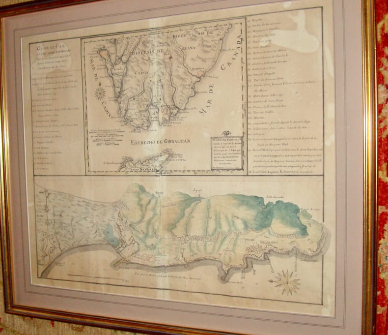
Plan de Gibraltar
Très beau plan levé par le chevalier d'Antin (Bertrand d'Antin ?) en 1796. En feuille Très bon Gibraltar 1796 53 x 66 cm
書籍販売業者の参照番号
: 13938
|
|
|
Antei, Giorgio.
L'orizzonte in fuga. Viaggi e vicende di Agostino Codazzi da Lugo.
n dieci saggi viene composto il ritratto di un personaggio straordinario e poco noto, Agostino Codazzi (1793-1859), uno dei massimi geografi dell’Ottocento. Avventuriero, viaggiatore, esploratore, ingegnere, visse in un periodo in sospeso fra rivoluzione e restaurazione, patriottismo ed espatrio, illusione e delusione: il libro approfondisce i momenti più significativi della sua parabola umana e s <br/> TITOLO: L'orizzonte in fuga. Viaggi e vicende di Agostino Codazzi da Lugo. <br/> AUTORE: Antei, Giorgio.<br/> EDITORE: Olschki Ed.<br/> DATA ED.: 2012,<br/> EAN: 9788822262196

|
|
|
ANTHONISZOON,CORNELIS. Gouw,J.Ter.
groote kaart van Amsterdam in 1544 van Kornelis Antoniszoon in twaalf bladen / ingekaderd. Behoorende bij het vijfde deel der Geschiedenis van Amsterdam
Amsterdam, Tj. van Holkema,, 1885, ingelijst in frame. 12 losse gekleurde lithografische platen in fraaie lijst ingekaderd, In 14 kleuren op Hollandsch papier gedrukt door Tresling & Co. te Amsterdam. Boek in linnen is erbij. afmeting lijst; 1460x1160mm

|
|
|
Antonio e Luigi Bolifoni
Carte de' Regni di Napoli e Sicilia loro Provincie ed Isole adiacenti
Antonio e Luigi Bolifoni Carte de' Regni di Napoli e Sicilia loro Provincie ed Isole adiacenti. , Casa del Libro 1982, Esemplare numerato 1194 di 1500. Copertina in piena tela con titolo in oro al piatto e al dorso, integra con piccole macchie sul fronte e sul retro. Interno in ottime condizioni, cerniera lenta in prima pagina, una mappa con angolo piegato Molto buono (Very Good) . <br> <br> Copertina rigida <br> 8 pp., 19 mappe piegate<br>

|
|
|
Antonioli Fabrizio, Lattavo Fabio
GRAN SASSO 105 itinerari scelti, dai classici ai pi? recenti
Le Guide di ALP alpinismo, collana a cura di Flavio Bessone - Progetto grafico e copertina, Eliana Barbera - Cartografia Eros Deel'Ozio - Introduzione - Esempi difficolt? - Simbologia - Note tecniche 1 20x12,5 cm., in brossura, risvolti con carta all'interno, pp. 159 (1), illustrazioni, figure, schizzi, prima edizione, in italiano, buone condizioni. Copia saggio. Timbro ex libris ...105 vie di arrampicata, dalle classiche alle pi? recenti, con tutti i livelli di difficolt? presenti nello splendido massiccio calcareo...un invito alla scoperta del gioiello dell'Appennino, facilitata dagli schizzi tracciati direttamente sulle fotografie delle pareti e da dettagliate note tecniche relative a esposizione solare, sviluppo, impegno, qualit? della roccia...
|
|
|
ANVILLE (Jean-Baptiste Bourguignon d')
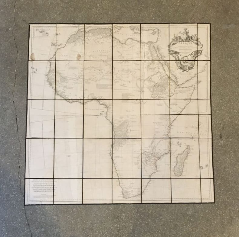
Afrique
Paris, chez l'auteur, 1749, 103,5 x 104 cm (taches, déchirures de la toile).
書籍販売業者の参照番号
: 18655
|
|
|
ANVILLE (Jean-Baptiste Bourguignon d')
Égypte nommée dans le pays Missir
S.l., s.n. 1765. 74 x 47 cm. (un coin détaché, déchirures, rousseurs).
書籍販売業者の参照番号
: 18656

|
|
|
Anville, J.-B. Bourguignon d'
Erster Theil der Karte von Asien welche die Türkei, Arabien, Persien, Indien diesseits des Ganges und einen Theil der Tatarei enthält. Verfasst von Herrn D'Anville. Nach den neuesten Karten verbessert herausgegeben von Herrn F.A. Schraembl. DAZU: Dritter Theil der Karte von Asien, welcher Sibirien u. einige andere Theile der Tatarei enthält.
Wien, Schraembl, 1786-1787. 2 Kupferstichkarten nach Jean-Baptiste Bourguignon d'Anville. Jeweils mit allegorischer Titelkartusche u. zartem Grenzkolorit. 73,5 x 79,5 bzw. 52 x 108 cm. In Segmenten auf Leinen aufgezogen u. mehrfach gefaltet.
書籍販売業者の参照番号
: 190168

|
|
|
Anzilotti, Giulia
Saggio bibliografico di cartografia tridentina.
cm. 17 x 24, 36 pp. con 3 tavv. f.t. Atlante Toponomastico della Venezia Tridentina 79 gr. 36 p.
|
|
|
Apa, Mariano
Tracce Di Memoria Arte e cultura a Genzano Di Roma
Mm 170x240 Volume nella sua brossura originale, dorso muto, 226 pagine con numerose illustrazioni in nero fuori testo. Opera in condizioni molto buone. Spedizione in 24 ore dalla conferma dell'ordine.
|
|
|
Appelius Mario
Nel paese degli uomini nudi
1 carta ripiegata e tavole in bianco e nero fuori testo

|
|
|
ARAGO Jacques
Promenade autour du monde (pendant les années de 1817, 1818, 1819 et 1820, sur les corvettes du Roi l'Uranie et la Physicienne, commandées par M. Freycinet).ATLAS seul
1822 Paris, Béthune & Plon for Leblanc, (1822). atlas vol. in folio. Sans page de titre ni reliure,broche,mouillures en marge,carte abimée,25 lithographies en noir,dans l’etat
書籍販売業者の参照番号
: 17629
|
|
|
ARABIAN GULF CARTOGRAPHY
Bandar Abbas GSGS NG40.
London: Geographical Section General Staff 1963. Scarce charts of Bahrain and the Straits of Hormuz A rare and historically interesting pair of adjacent maps of the Arabian Gulf covering six degrees of longitude each the geographical area encompassing the whole of Qatar Bahrain and part of what was to become the United Arab Emirates Al-Hofuf being the major city in the Al-Ahsa Oasis Eastern Province Saudi Arabia; sixth and fifth editions respectively. Maps of the period issued by the GSGS Geographical Section General Staff use a 7-colour tint scale to distinguish altitude and a glossary that highlights towns of significance and other standout features which provided steady references for army personnel to aid navigation in the challenging conditions of the region. The Bander Abbas map was compiled by the US Army Map Service Corps of Engineers from a number of sources including USAF Aeronautical Approach Charts of 1951-55 and the US Geological Survey of the Arabian Peninsula 1958. The Hofuf chart is based inter alia on 512 Field Survey Royal Engineers charts 1942-4. WorldCat lists just three individual copies for Hofuf NG39 SUNY at Buffalo University of Notre Dame and Eastern Illinois University alongside four copies of Bandar Abbas NG40 University of Exeter University of Notre Dame Eastern Illinois University and University of South Florida. It should be noted that major national institutions - BL for example - will have holdings of these maps within the complete GSGS series. Most copies would be discarded on supersession making these an important record of cartographic progress in the region. Two two-colour printed maps 1:1000000 scale 690 x 610 & 750 x 610 mm respectively. Ex- libris stamp of Arizona State Library both stamped "superseded" in blank margin and "withdrawn" on verso some pencilled marginalia; both in excellent condition. unknown
書籍販売業者の参照番号
: 153757

|
|
|
ARABIAN GULF CARTOGRAPHY
Fabric map: Bandar Abbas and Hofuf GSGS No. Misc. 350.
London: War Office; Printed for D. Survey WO and AM by Balding and Mansell Ltd 1957. A bright example of this detailed Gulf map Classified "restricted" and issued for military use at the time of the Jebel Akhdar War this double-sided sheet shows much of the modern-day UAE extending northwards from the latitude of Abu Dhabi and the Buraimi Oasis as well as the eastern Arabian Peninsula from the Trucial Coast to Jubail. As with other contemporary GSGS maps the sheet covers six degrees of longitude and highlights towns of significance and other standout features for example oil pipelines and wells water systems and roads and railways. Rayon sheet 630 x 710 mm printed both sides in colour folded as issued. A fine example. unknown
書籍販売業者の参照番号
: 182684
|
|
|
ARABIAN GULF CARTOGRAPHY; OMAN
Muscat - Masira North F40 GSGS NG40.
London: Geographical Section General Staff 1956 & 1957. Scarce maps of Oman and south-east Arabia dating to the Jebel Akhdar War A pair of decidedly uncommon and impressively sized regional maps both second editions Muscat-Musira following the first of 1945 S. E. Arabia first published in 1956. The Muscat-Masira map drawn up by D Survey of the Ministry of Defence reaches as far north as Khaburah Oman on the coast south beyond Masirah Island and westward reaching beyond Lahus and Hadhi. It is based on several mappings including Bertram Thomas's map of Rub' al Khali the "Empty Quarter" 1931 the sand desert covering most of the southern third of the Arabian Peninsula Samuel Barrett Miles 1910 map of Oman and Captain F. F. Hunter's map of Arabia 1935 revision. The aeronautical chart goes into greater detail reaching beyond Sur in the North South to Masirah Island and Manadhif and West to Uruq ash Shaybah UAE; this was drawn up by No. 1 SPC.RE i.e. Survey Production Centre Royal Engineers and is based largely on the USAF Aeronautical Approach Charts 1956 and World Aeronautical Chart 563 1951. During the mid to late-1950s Britain was involved in a number of disputes in Oman perhaps the most serious involving the Imam Ghalib al-Hinai and his brother Talib bin Ali who led the Imamate's revolt against Sultan Said bin Taimur which resulted in the Jebel Akhdar or Oman War 1954-1959. In this the RAF played a leading role not least because aircraft could at the same time expedite oil exploration operations in the interior of Oman. Pembrokes light transport aircraft and heavier Avro Ansons from 1417 Communication Flight RAF carried out reconnaissance "and other tasks during this operation against the Imamate and were the first aircraft ever to land at Nizwa marked "Nazwa" on the chart on a roughly cleared strip which proved extremely hazardous for the pilots but which was later transformed into a passable airfield" Lee p. 22. The present chart has two pencilled lines radiating from Masira airfield one of which passes through Nizwa near which is marked the "approx. position" of an airstrip. The chart bear the proviso that they should "not be taken as an authority on names" and that "the alignment of all tracks is approximate". Users were also directed to update information and highlight errors which were to be directly sent to the Director of the Military Survey in the War Office. There are noticeable graphical variations between the chart and map as fitting their usage. Before the Second World War pilots flew using landmarks - such as train tracks or roads - as pointers which meant that they relied on perfect weather conditions. However technological advances in aviation alongside the use of radio for more accurate navigation meant that to a degree pilots could work in more challenging conditions. This meant that maps with their focus on terrain and details relevant from the perspective of ground troops would become irrelevant when observed from a plane's altitude. Therefore a number of countries started to produce charts highlighting key information by reducing the contour structure and focusing on key landmarks necessary for aviators. The Muscat-Masira map uses a five-colour tint scale to distinguish altitude includes a glossary and key the latter identifying towns given four categories of importance significant ruins geographical features such as mountains hills marshes saddles and passes rivers water holes and man-made features such as railways roads tracks telegraph lines pipelines and pumping stations mosques and temples; tribal and regional names are also given. However reflecting the simplification required by pilots the S. E. Arabia chart only uses fives tones to highlight land mountains paths and the sea. These maps intended for use in the field would have had a high rate of attrition; WorldCat locates just a handful of copies of the Muscat-Masira map whilst S.E. Arabia 4802 is well represented institutionally but decidedly uncommon on the market. Two colour printed maps the first 1: 1000000 scale 860 x 640 mm the second 1:500000 scale 1100 x 825 mm. Both with creases from old folds and some minor marginal splits and spots the second with pencil lines marking a flight route from Masira Island and a notation in the margin; both remain very good. Sir David Lee The RAF in the Mediterranean and Middle East 1945-71 1978. unknown
書籍販売業者の参照番号
: 153759

|
|
|
ARCHAMBAULT (M.), LHENAFF (R.), VANNEY (J.-R.)
DOCUMENTS ET MÉTHODE POUR LE COMMENTAIRE DE CARTES (géographie et géologie) 1er fasc. Principes généraux - 2ème fasc. Les reliefs structuraux.
Paris, Masson , 1967. 2 vol. in-4, chemise à double rabats, contenant les planches à gauche et le texte à droite: fasc. I. 7 planches, 12 cartes géologiques en couleurs sur double page avec les notices, 79pp, 27 fig. in-texte - fasc. 2: 6 cartes, 15 cartes géologiques en couleurs sur double page avec les notices,165pp , 44 fig. in-texte. Table des matières et des cartes.
書籍販売業者の参照番号
: 580504
|
|
|
Archivio di Stato di Bari
La cartografia storica nelle fonti documentarie. Terra di Bari nel XVIII e XIX secolo,catalogo a cura di Gregorio Angelini e Giuseppe Carlone
In 4° piccolo , pp. 92. Brossura.
|
|
|
ARCIPELAGO COLOMBIANO cioè LE ISOLE LUCAJE, LE GRANDI E PICCOLE ANTILLE ..
Carta incisa in rame e acquarellata a mano.
Carta di cm 36 x 50 alla battuta, più i margini, su tav. piegata a metà. Ampio testo incorniciato a destra e a sinistra, a descrivere ciascuna isola dell'arcipelago. Tratta da 'Atlante storico, geografico, genealogico, cronologico e letterario di M. A. Le Sage in ogni sua parte corretto, ampliato e proseguito sino all'anno corrente. Prima Veneta Edizione'. Strappetto senza mancanze al margine bianco, in alto a destra.

|
|
|
ARDIZZONE G.D. -
Cartografìa bentonica con sistemi video controllati a distanza.
Taranto, 1992, 8vo stralcio con copertina posticcia muta, pp. 441/452 con un'illustrazione, 3 carte e 2 tabelle. - !! ATTENZIONE !!: Con il termine estratto (o stralcio) intendiamo riferirci ad un fascicolo contenente un articolo, completo in se, sia che esso sia stato stampato a parte utilizzando la stessa composizione sia che provenga direttamente da una rivista. Le pagine sono indicate come "da/a", ad esempio: 229/231 significa che il testo è composto da tre pagine. Quando la rivista di provenienza non viene indicata é perché ci è sconosciuta. - !! ATTENTION !!: : NOT A BOOK : “extract” or “excerpt” means simply a few pages, original nonetheless, printed in a magazine. Pages are indicated as in "from” “to", for example: 229/231 means the text comprises three pages (229, 230 and 231). If the magazine that contained the pages is not mentioned, it is because it is unknown to us.

|
|
|
ARDIZZONE G.D. - BELLUSCIO A. -
Cartografìa delle praterie dì Posidonia oceanica lungo le coste laziali.
Taranto, 1992, 8vo stralcio con copertina posticcia muta, pp. 539/542 con una cartina. - !! ATTENZIONE !!: Con il termine estratto (o stralcio) intendiamo riferirci ad un fascicolo contenente un articolo, completo in se, sia che esso sia stato stampato a parte utilizzando la stessa composizione sia che provenga direttamente da una rivista. Le pagine sono indicate come "da/a", ad esempio: 229/231 significa che il testo è composto da tre pagine. Quando la rivista di provenienza non viene indicata é perché ci è sconosciuta. - !! ATTENTION !!: : NOT A BOOK : “extract” or “excerpt” means simply a few pages, original nonetheless, printed in a magazine. Pages are indicated as in "from” “to", for example: 229/231 means the text comprises three pages (229, 230 and 231). If the magazine that contained the pages is not mentioned, it is because it is unknown to us.

|
|
|
Arena,Gabriella. Palagiano,Cosimo.
L'Europa Occidentale.
2 voll. <br/> TITOLO: L'Europa Occidentale. <br/> AUTORE: Arena,Gabriella. Palagiano,Cosimo.<br/> EDITORE: UTET<br/> DATA ED.: 1990,<br/> COLLANA: Coll.Il Mondo Attuale.<br/>
|
|
|
Armao, Ermanno.
In giro per il Mar Egeo con Vincenzo Coronelli. Note di topologia, toponomastica e storia medievali. Dinasti e famiglie italiane in Levante.
<br/> TITOLO: In giro per il Mar Egeo con Vincenzo Coronelli. Note di topologia, toponomastica e storia medievali. Dinasti e famiglie italiane in Levante. <br/> AUTORE: Armao, Ermanno.<br/> EDITORE: Olschki Ed.<br/> DATA ED.: 1951,<br/> EAN: 9788822214584
|
|
|
Armao, Ermanno.
In giro per il Mar Egeo con Vincenzo Coronelli. Note di topologia, toponomasti
<br/> STATO: NUOVO.<br/> TITOLO: In giro per il Mar Egeo con Vincenzo Coronelli. Note di topologia, toponomastica e storia medievali. Dinasti e famiglie italiane in Levante.<br/> AUTORE: Armao, Ermanno.<br/> EDITORE: Olschki Ed.<br/> DATA ED.: 1951,<br/> EAN: 9788822214577
|
|
|
Armao,Ermanno.
Vincenzo Coronelli. Cenni sull'uomo e la sua vita. Catalogo ragionato delle sue opere. Lettere, fonti bibliografiche. Indici.
<br/> TITOLO: Vincenzo Coronelli. Cenni sull'uomo e la sua vita. Catalogo ragionato delle sue opere. Lettere, fonti bibliografiche. Indici. <br/> AUTORE: Armao,Ermanno.<br/> CURATORE: Con disegni nel testo e tavole fuori testo.<br/> EDITORE: Olschki Ed.<br/> DATA ED.: 1944,<br/> COLLANA: Coll. Biblioteca di bibliografia italiana, 17.<br/> EAN: 9788822214591 Ristampa laser 2005.
|
|
|
Arnberger, E
Handbuch d. thematischen Kartographie.
Wien, Deuticke, 1966. M. 24 Taf. u. 153 Abb. XII, 554 S. OLwd. in Schutzfolie. St. a. Tit. Seiten lichtrandig.
書籍販売業者の参照番号
: 147077
|
|
|
Arnberger, Erik und Kretschmer, Ingrid
Wesen und Aufgaben der Kartographie. Topographische Karten. (Aufnahme; Entwurf Topographischer und Geographischer Karten; Kartenwerke). Teil 1: Textband. Teil 2: Abbildungen und Index. 2 Bände (komplett).
Wien, Franz Deuticke, 1975. Groß-8°. 24,5 cm. XX, 536, 293 Seiten. Original-Leinenbände mit Original-Schutzumschlägen. (= Die Kartographie und ihre Randgebiete. Herausgegeben von Erik Arnberger. Band I. Teil 1 und Teil 2).
書籍販売業者の参照番号
: 5441DB

|
|
|
ARRIGONI Pier Virgilio -
Flora e vegetazione della Macchia lucchese di Viareggio (Toscana) .
Firenze, Webbia, 1990, 8vo punto metallico, pp. 62 con 10 grafici, 15 tabelle ed una carta sciolta a colori, di grande formato, più volte ripiegata. Copia omaggio firmata dall'Autore.

|
|
|
ARRIGONI Pier Virgilio - FOGGI Bruno -
Il paesaggio vegetale delle colline di Lucignano (Prov. di Firenze) .
Firenze, Webbia, 1988, 8vo punto metallico (sciolto in parte) pp. 285/304 con 4 grafici, 4 tabelle ed una carta sciolta a colori, di grande formato, più volte ripiegata. Copia omaggio firmata dall'Autore.

|
|
|

 検索結果のメールを受信する
 PDFファイルの検索結果をダウンロード
 RSSフィード
 パーマネントリンク


