|
JANSSON JEAN (1588-1664).
GASTINOIS ET SENONOIS.
AMSTERDAM. JANSSON. SANS DATE (VERS 1660). JOLIE CARTE GRAVEE (50 X 39 CENTIMETRES ENVIRON, 60 X 49 AVEC MARGES) SUR DOUBLE PAGE, COLORIEE A L'EPOQUE. TEXTE DESCRIPTIF AU DOS. PETITE DECHIRURE AVEC PETIT MANQUE DE PAPIER SUR LE COURS DE LA LOIRE, SINON BEL ETAT, COULEURS FRAICHES.
书商的参考编号 : 437
|
|
|
Jansson, Johann
Bayern auf alten Landkarten aus dem Novus Atlas absolutissimus. Faksimile mit einer Einleitung von T. Seifert und Textfaksimile.
München, Battenberg [ca. 1978]. 2° (Ca. 61 x 51 cm). 22 Bll. Text. Mit 14 (1 gef.) farb. Landkarten-Faksimiles u. Textbeilage. Original-Halbleinenband -Flügelmappe mit marmor. Deckeln.
书商的参考编号 : 193840-1

|
|
|
Jansson, Johann
Niedersachsen, Hamburg und Bremen auf alten Landkarten aus dem Novus Atlas Absolutissimus. (REPRINT der Ausgabe von ca. 1638).
(München, Battenberg, 1979). 17 farbige Kartenreproduktionen u. 48 S. Kommentar. Elefanten-Folio. Lose Karten u. OBroschur zus. in OPp.-Mappe.
书商的参考编号 : 57835

|
|
|
JAPAN REAL ESTATE ATLAS.
In Japanese. Maps of Yamada Village in Keta District Tajima Province present day northern Hyogo Prefecture.
Yamada Village Japan: n.p. ca. 1890. 4to. 7.5 x 11 in. 354 pp index maps & sections separately paginated. entirely in original manuscript with over 250 plat and section maps many double-page some folding many w/ additions tipped-in or laid-in as supplemental overlays and many w/ additional manuscript annotations most hand-coloured throughout. Original beige limp boards punch-sewn at gutter margin title in manuscript on front cover some scuffing wear occasional internal worming mildly affecting some maps still a VG- exemplar. An extraordinary Meiji-era manuscript real estate plat map atlas for the Yamada Village and environs of the Keta District in present-day northern Hyogo Prefecture. Traditionally ruled over by descendants of the Miwabe-no-Atai clan this real estate atlas volume encompasses hundreds of plat maps tied to outline maps with the plats all numbered and many colour-coded with colour coding to the opening index. The creator of this map atlas appears to have been commissioned by local land agents following the economic expansion after the opening of the Hyogo Harbor in 1867 for foreign trade while quickly became one of the largest trading ports in Japan. The Tajima province is perhaps best known as the birthplace of Kobe Beef or Tajima Wagyu traditionally compact working cattle with a calm nature but which quickly came into high demand as Kobe Beef in the late 1880s as the large foreign trading and tourist community desired beef and the Tajima cattle were especially desired. This also contributed to a rising demand for land in which to raise the Tajima Wagyu cattle and land prices. At the same time the nearby coast also began slowly developing a small tourist trade and coastal resorts. The map sections include No. 5 -- Kitakami no machi; No. 11 -- Sampo no matsu; No. 12 - Shita takimiya; No. 13 - Okawahara; No. 14 - Takimiya; No. 30 - Kita shitaya as well as No. 36 - Kawahara. In April 1896 the Keta District was dissolved and merged into the Kinosaki District along with the Mikumi District and became the Hyogo Prefecture anchored by the city of Kobe. The additional supplemental pieces tipped-in others laid-in and the many add-ons to the folding map with many bearing annotations indicate that this was a meticulously maintained working document for Meiji land agents. We have been unable to locate any similar manuscript or printed real estate atlases for this era and geographical location. See: Mochizuki Kotaro Japan To-Day: A Souvenir of the Anglo-Japanese Exhibition Held in London 1910 Special Number of the “Japan Financial and Economic Monthly;†Mike Buchanan Hyogo Prefecture Tajima Wagyu History Australian Wagyu Forum 2018; Masanobu Suzuki Development and Dispersal Process of Ancient Japanese Clans 2003. [n.p.], hardcover
书商的参考编号 : 56329

|
|
|
JAPAN ATLAS / WORLD MAP / CALIFORNIA AS AN ISLAND Yamazaki Yoshimoto.
Dai Nihon Yochi Benran. 大日本輿地便覽
Tenpo 5. 1834. TWO VOLUMES 76 double page color woodblock maps 4135 10 1/8 x 7 inches 26 x 18 cm Japanese accordion style binding with decorative embossed paper covers. There is worming to many but not all of the pages occasional light soiling to margins covers quite worn. This beautiful woodblock atlas begins with a map of Japan which is followed by maps of the individual provinces and finally a map of the world. This map makes clear the effects on geographic knowledge of Japan's long closure to outside influence: California is mapped as an island and Australia marked "megaranika" presumably relating to the color of the inhabitants is joined to New Guinea to the north and to Antarctica at the south examples of outdated geographical knowledge. New Zealand does not appear on the map . unknown
书商的参考编号 : 45262

|
|
|
Japan Atlas
ATLAS. Appendix to "Administrative Subdivisions of Japan".; Department of State Publication 2749 Far Eastern Series 19
1946. Stiff pictorial wrappers spiral bound. VG showing but minor wear to maps. Ex-lib with discrete call letters to front board & occasional stamp to map lower margin. Over 40 folding maps of the region. Folio. 20-1/2" x 14-1/8" <br/><br/> unknown
书商的参考编号 : 27123
|
|
|
Japan Atlas
ATLAS. Appendix to "Administrative Subdivisions of Japan".; Department of State Publication 2749 Far Eastern Series 19
1946. Stiff pictorial wrappers spiral bound. VG showing but minor wear to maps. Ex-lib with discrete call letters to front board & occasional stamp to map lower margin. Over 40 folding maps of the region. Folio. 20-1/2" x 14-1/8" <br/><br/> unknown books
书商的参考编号 : 27123
|
|
|
JAPANESE ATLAS Ichikawa Tokei
KOKUGUN ZENZU 2 volumes
1837. JAPANESE ATLAS Ichikawa T�kei. KOKUGUN ZENZU 2 volumes. Nagoya Edo �saka Ky�to. Eirakuya T�shir� et al. Preface dated 1837. String-bound Japanese-style fukuro-toji printed paper title labels. Original yellow covers. Covers are a bit soiled with ownership labels. Internal occasional marginal worming. Printed in color woodblock throughout an interesting atlas of the traditional governing divisions of Edo-era Japan. unknown
书商的参考编号 : 89193

|
|
|
JAPANESE ATLAS Ichikawa Tokei
KOKUGUN ZENZU 2 volumes
1837. JAPANESE ATLAS Ichikawa Tôkei. KOKUGUN ZENZU 2 volumes. Nagoya Edo Ôsaka Kyôto. Eirakuya Tôshirô et al. Preface dated 1837. String-bound Japanese-style fukuro-toji printed paper title labels. Original yellow covers. Covers are a bit soiled with ownership labels. Internal occasional marginal worming. Printed in color woodblock throughout an interesting atlas of the traditional governing divisions of Edo-era Japan. unknown books
书商的参考编号 : 89193
|
|
|
Jaschke, Dieter. Herausgeber
Regionalatlas Kreis Herzogtum Lauenburg.
Mölln., 1989. Herausgegben von der Lauenburgischen Akademie für Wissenschaft und Kultur - Stiftung Herzogtum Lauenburg. Sechs Lieferungen 1989 - 1998. Enthalten sind 89 farbige Kartenseiten, teilweise mit Unterkarten , und Texterläuterungen. Eine zusätzliche Karte im Anhang ( Gemeinderegister). Enthält Karten zu: Lage des Herzogtums, topographische Übersicht, Oberflächengstaltung, Niederschlag, Gewässer, Siedlungsentwicklung und Siedlungen, Bevölkerung - Verteilung und- Entwicklung, Landwirtschaft - Bodengüte - Flächennutzung, Gesundheitswesen, Verkehr, Eisenbahnnetz, Fortstwirtschaft, Industrie und Handel, Frmedenverkehr, Erwerbstätigkeit, Verwaltung und öffentliche Finanzen, Historie, Ver- und Entsorgung, usw..Zustand: Ausgeschiedenes Bibliotheksexemplar, grüner Leinenband, dreifach verschraubt, mit zahlreichen Institusstempeln, teilweise rückseitg auf den Karten. Querfolio - 50 x 40 cm. OLeinen.
书商的参考编号 : 041618
|
|
|
Jay David Atlas
Logic Meaning and Conversation: Semantical Underdeterminacy Implicature and Their Interface
2005-05-01. New. Ships with Tracking Number! INTERNATIONAL WORLDWIDE Shipping available. May be re-issue. Buy with confidence excellent customer service! unknown
书商的参考编号 : 0195133005n ???????? : 0195133005 9780195133004

|
|
|
Jay David Atlas
Logic Meaning and Conversation: Semantical Underdeterminacy Implicature and Their Interface
2005-05-01. Good. Ships with Tracking Number! INTERNATIONAL WORLDWIDE Shipping available. May not contain Access Codes or Supplements. May be re-issue. May be ex-library. Shipping & Handling by region. Buy with confidence excellent customer service! unknown
书商的参考编号 : 0195133005 ???????? : 0195133005 9780195133004

|
|
|
Jay David Atlas
Logic Meaning and Conversation: Semantical Underdeterminacy Implicature and Their Interface
Oxford University Press USA 2005-02-17. Hardcover. Used:Good. Oxford University Press, USA hardcover
书商的参考编号 : DADAX0195133005 ???????? : 0195133005 9780195133004

|
|
|
Jay David Atlas
Philosophy Without Ambiguity : A Logico-Linguistic Essay
Oxford University Press Incorporated 1989. Hardcover. Very Good. Disclaimer:A copy that has been read but remains in excellent condition. Pages are intact and are not marred by notes or highlighting but may contain a neat previous owner name. The spine remains undamaged. At ThriftBooks our motto is: Read More Spend Less.Dust jacket quality is not guaranteed. Oxford University Press, Incorporated hardcover
书商的参考编号 : G0198244541I4N00 ???????? : 0198244541 9780198244547

|
|
|
Jay David Atlas
Philosophy without Ambiguity: A Logico-Linguistic Essay Clarendon Library of Logic & Philosophy
Oxford University Press USA 1989-10-05. Hardcover. Used:Good. Oxford University Press, USA hardcover
书商的参考编号 : DADAX0198244541 ???????? : 0198244541 9780198244547

|
|
|
Jay David Atlas
Philosophy without Ambiguity: A Logico-Linguistic Essay Clarendon Library of Logic & Philosophy
Oxford University Press USA 1989-10-05. Hardcover. Good. Excellent customer service. Prompt Customer Service. Oxford University Press, USA hardcover
书商的参考编号 : SONG0198244541 ???????? : 0198244541 9780198244547
|
|
|
JAZDZEWSKI (Konrad)
Atlas to the prehistory of the Slavs. Acta praehistorica Universitatis Lodziensis.
1949 br. in-4, 20 cartes en coul., Lodz 1949,
书商的参考编号 : 12355
|
|
|
Jean BLAEU
Le GRAND ATLAS ou COSMOGRAPHIE BLAVIANE, en laquelle est exactement descitte la Terre, la Mer et le Ciel
Un ouvrage de 287 pages, format 215 x 300 mm, illustré de cartes, relié cartonnage couleurs, réimpression (1987) de l'édition de 1664, René Malherbe Editeur, bon état
书商的参考编号 : LFA-126714254
|
|
|
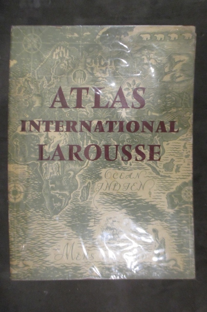
Jean Chardonnet & Yvan du Jonchay
ATLAS INTERNATIONAL LAROUSSE. Politique et Economique / LAROUSSE INTERNATIONAL ATLAS. Political and Economical / ATLAS INTERNACIONAL LAROUSSE. Politico y Economico.
Langue : Français / Espagnol / Anglais. Editions Larousse. 1957. Relié avec jaquette In Folio : 37 x 50 cm.
书商的参考编号 : GEO600M
|
|
|
JEAN ET ANDRE SELLIER
ATLAS DES PEUPLES D'EUROPE OCCIDENTALE
LA DECOUVERTE. FEVRIER 1996. In-8. Broché. Bon état, Couv. convenable, Dos satisfaisant, Intérieur frais. 199 pages. Nombreuses cartes en couleurs dans le texte et hors texte.. . . . Classification Dewey : 912-Atlas, cartes et plans
书商的参考编号 : RO30105570
|
|
|
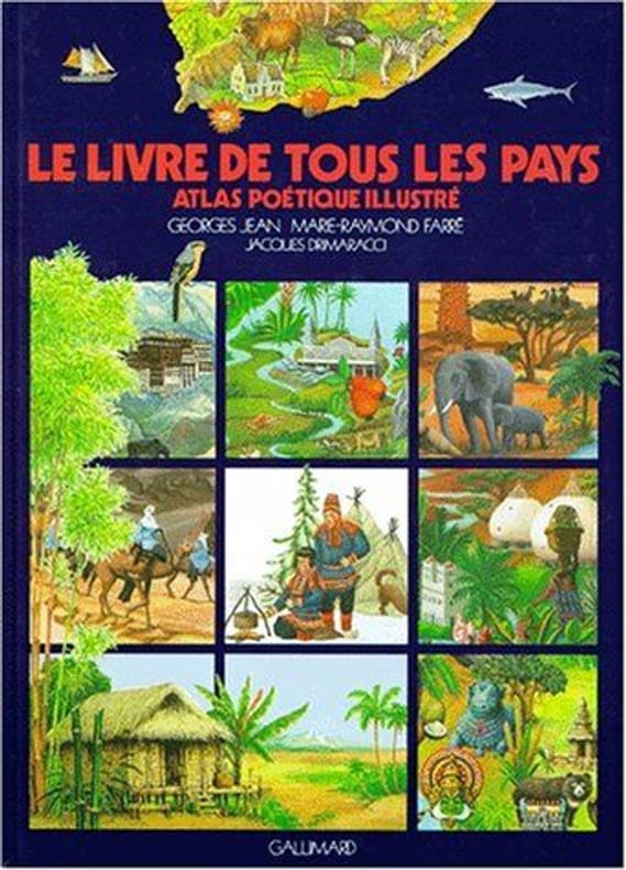
Jean Georges Farré Marie Farré Raymond
Le Livre de tous les pays atlas poétique illustré: ATLAS POETIQUE ILLUSTRE
GALLIMARD JEUNE 1989 192 pages 19 8x1 8x26cm. 1989. Relié. 192 pages.
书商的参考编号 : 500068200
|
|
|
JEAN Georges et FARRE Marie-Raymond
Le livre de tous les pays. Atlas Poétique illustré.
GALLIMARD. Mai 1987. In-12. Cartonné. Bon état, Couv. convenable, Dos satisfaisant, Intérieur frais. 323 pages. Nombreuses illustrations et cartes en couleurs, dans le texte et hors-texte.. . . . Classification Dewey : 912-Atlas, cartes et plans
书商的参考编号 : RO80095574 ???????? : 2070394980
|
|
|
JEAN LE CLERC/SALOMON ROGER
"Carte originale de ""CARTE DU BOURDELOIS, DU PAYS DE MEDOC ET DE LA PREVOSTE DE BORN"""
"JEAN LE CLERC/SALOMON ROGER. 17ème-18ème s.. In-Plano. Broché. Bon état, Couv. convenable, Dos satisfaisant, Intérieur frais. Carte originale noir et blanc,sur papier à la forme ( XVIII ème siècle environ). Echelle ""Lieves de Gascongne"".Tres légères traces de mouillures sur les bords de la carte.. . . . Classification Dewey : 912-Atlas, cartes et plans"
书商的参考编号 : RO20020315
|
|
|
Jean-Christophe VICTOR
LE DESSOUS DES CARTES
Un ouvrage de 224 pages, format 240 x 180 mm, illustré, broché couverture couleurs rempliée, publié en 2012, Editions Tallandier / Arte Editions, bon état
书商的参考编号 : LFA-126742423
|
|
|
Jean-Christophe VICTOR, Virginie RAISSON et Frank TETART
LE DESSOUS DES CARTES
Un ouvrage de 252 pages, format 245 x 175 mm, illustré, broché couverture couleurs, publié en 2006, Editions Tallandier / Arte Editions, bon état
书商的参考编号 : LFA-126736794
|
|
|
Jean-Christophe VICTOR, Virginie RAISSON et Frank TETART
LE DESSOUS DES CARTES - 2
Un ouvrage de 207 pages, format 290 x 210 mm, illustré, broché couverture couleurs, publié en 2007, Editions Tallandier / Arte Editions, bon état
书商的参考编号 : LFA-126741447
|
|
|
Jean-Jacques Barthélémy
ATLAS DU VOYAGE DU JEUNE ANACHARSIS EN GRECE, dessiné par Charles Monin, et gravé par les frères Malo.
A Paris, au Bureau des Editeurs, 1830, 1 demi veau, dos à nerfs, orné, coiffes usagées, coins émoussés, 1 mors fendu sur 2 cm. in-8 oblong, f.t., portrait de Jean-Jacques Barthélémy gravé sur chine par Meuvillon et contrecollé en frontispice, titre, 5 pages de texte, 45 planches gravées de vues, plans et cartes, dont 3 dépliantes et certaines en couleurs, rousseurs sur 2 feuillets ;
书商的参考编号 : 15439
|
|
|
Jean-Jacques Barthélémy, Ambroise Tardieu
Voyage du jeune anacharsis en Grèce vers le milieu du quatrième siècle avant l'ère vulgaire. Atlas, rédigé et gravé par Ambroise Tardieu
E. A. Lequien, Paris, 1824. Cet ouvrage est l'Atlas réalisé en annexe du récit de voyage imaginé par Jean-Jacques Barthélémy pour son héros. Rédigé, réalisé et gravé par Ambroise Tardieu, il comprend 38 planches dont 1 bis. COMPLET. In-8 à l'italienne, relié, demi-dos cuir lisse, caisson titre brun, filets dorés. Superbe ouvrage. Quelques rousseurs sur les premières pages qui ne gênent ni ne ternissent la qualité des travaux. Dos abîmé aux coiffes et couverture émoussée aux coins. Très bel ouvrage en bel état général.
书商的参考编号 : LITT5585M
|
|
|
Jedin, Hubert (Herausgeber)
Atlas zur Kirchengeschichte : die christlichen Kirchen in Geschichte und Gegenwart ; Kommentare, ausführliches Register. Unter Mitwirkung zahlreicher Fachgelehrter bearbeitet von Jochen Martin. Sonderausgabe.
Freiburg im Breisgau ; Basel ; Wien : Herder, 2004. 152, XXXVIII Seiten. Mit zahlreichen farbigen Abbildungen. Karten ; 35 cm Originalpappband.
书商的参考编号 : 299560

|
|
|
JEHEBER
ATLAS DE POCHE UNIVERSEL - CARTES GEOGRAPHIQUES DES PRINCIPAUX PAYS DU MONDE TIREES EN PLUSIEURS COULEURS ET TABLEAUX STATISTIQUES MIS A JOUR
JEHEBER. 1924. In-16. Cartonnage d'éditeurs. Bon état, Couv. convenable, Dos satisfaisant, Intérieur frais. 20 Pages + 20 cartes en couleurs . annotation sur le 1er contreplat.. . . . Classification Dewey : 912-Atlas, cartes et plans
书商的参考编号 : RO80202379
|
|
|
JEHEBER W. H.
ATLAS DE POCHE UNIVERSEL -
JEHEBER. 1924. In-18. Cartonné. Bon état, Couv. convenable, Dos abîmé, Intérieur frais. environ 10 pages + 20 Cartes couleur cartonnées semi rigides. 1 accroc au dos.. . . . Classification Dewey : 912-Atlas, cartes et plans
书商的参考编号 : R320078549
|
|
|
JENOTTE
Carte de la Palestine, de la Terre Sainte, du Royaume de David et Salomon, Terre de Chanaan.
BELIN Eugène.. Non daté. In-Folio. En feuillets. Etat d'usage, Couv. convenable, Dos satisfaisant, Déchirures. Carte dépliante en couleurs, de 34/47cm. Pas de plat de couverture.. . . . Classification Dewey : 912-Atlas, cartes et plans
书商的参考编号 : RO20054715
|
|
|
Jeuge-Maynart Isabelle & Collectif
"Prague et la Bohême (Collection ""Guides bleu évasion"")"
Hachette. 2000. In-8. Broché. Bon état, Couv. convenable, Dos satisfaisant, Intérieur frais. 261 pages. Nombreuses photos en couleurs dans le texte. Etiquette de prix au dos.. . . . Classification Dewey : 912-Atlas, cartes et plans
书商的参考编号 : RO80239626 ???????? : 2012431666

|
|
|
Jill et David WRIGHT
ATLAS de POCHE
Un ouvrage de 189 pages, format 130 x 200 mm, illustré, relié cartonnage couleurs, publié en 1984, Pélican, bon état
书商的参考编号 : LFA-126726137
|
|
|
JIRASEK Vaclav Illustrations de Karel Svolinsky.
Plantes. Atlas illustré.
Couverture rigide. Cartonné. 223 pages.
书商的参考编号 : 206573

|
|
|
Jirasek, V, K. Svolinsky / Jan Hanzak Vratislav Mazak / Jaroslav Spirhanzl-Duris u. a
Taschenatlas der Pflanzen / Taschenatlas der Säugetiere / Taschenatlas der Vögel / Taschenatlas der Tagfalter (4 Bände).
Hanau, Dausien, 1968. 233; 235; 256; 258 S. (17,5 cm) Leinen mit Umschlag / gebundene Ausgabe
书商的参考编号 : 37057
|
|
|
Joan Blaeu, Einführung und Texte von Peter van der Krogt
Atlas Maior of 1665. "Der grösste und prachtvollste Atlas, der jemals veröffentlicht wurde". Einführung und Texte von Peter van der Krogt. Nach dem Original aus der Österreichischen Nationalbibliothek Wien. Mit einer Auswahl d. Originaltexte v. Joan Blaeu
Taschen, Köln, Los Angeles, London, Madrid, Paris, Tokyo 2005. Unverletzter S.U Hardcover Neuwertig
书商的参考编号 : 027800

|
|
|
JOAN COLL I MORELL
Pirineo catalan - Cerdanya - alto valle del segre del conflent al barida - puis pedros, carlit, eina, puigmal, carreteras, caminos, pistas de montana - guia cartografica - Turismo, montanismo, deportes invernales, notas geograficas, espeleologia
EDITORIAL ALPINA. NON DATE. In-8. Broché. Etat d'usage, Couv. convenable, Dos satisfaisant, Intérieur frais. 36 Pages + une carte couleur dépliante d'environ 95 x 65cm (recto uniquement). . . . Classification Dewey : 912-Atlas, cartes et plans
书商的参考编号 : RO20258912

|
|
|
JOANNE
GUIDES JOANNE - PYRENEES
HACHETTE ET CIE. 1909. In-18. Cartonnage d'éditeurs. Bon état, Couv. convenable, Dos satisfaisant, Intérieur frais. 132 + 40 + 156 pages. Quelques cartes en couleurs dépliantes. Nombreuses publicités en noir et blanc dans le texte. Carte dépliante de la fin manquante.. . . . Classification Dewey : 912-Atlas, cartes et plans
书商的参考编号 : RO30095836

|
|
|
Joanne (Adolphe)
Géographie du département de l'Aude.
français In-12 de 64 pp. + carte dépliante in fine ; dos toilé bleu, plats cartonnés imprimés. Deuxième édition. Avec une carte coloriée et 9 gravures.
|
|
|
Joanne (Adolphe)
Géographie du département de l'Aude.
français In-12 de 64 pp. + carte dépliante in fine ; dos toilé bleu, plats cartonnés imprimés. Deuxième édition. Avec une carte coloriée et 9 gravures. Rousseurs.
|
|
|
Joanne (Adolphe)
Géographie du département de la Charente-inférieure.
français In-12 de 61 pp. + carte dépliante in fine ; dos toilé bleu, plats cartonnés imprimés. Septième édition. Avec une carte coloriée et 12 gravures. Bel exemplaire.
|
|
|
Joanne (Adolphe)
Géographie du département de La Manche.
français In-12 de 76 pp. + carte dépliante in fine ; dos toilé bleu, plats cartonnés imprimés. Sixième édition. Avec une carte coloriée et 12 gravures. Bel exemplaire.
|
|
|
Joanne (Adolphe)
Géographie du département de VAucluse.
français In-12 de 62 pp. + carte dépliante in fine ; dos toilé bleu, plats cartonnés imprimés. Deuxième édition. Avec une carte coloriée et 16 gravures. Rousseurs.
|
|
|
Joanne (Adolphe)
Géographie du département du Doubs.
français In-12 de 69 pp. + carte dépliante in fine ; dos toilé bleu, plats cartonnés imprimés. Sixième édition. Avec une carte coloriée et 14 gravures. Bel exemplaire.
|
|
|
Joanne (Adolphe)
Géographie du département du Pas-de-Calais.
français In-12 de 77 pp. + carte dépliante in fine ; dos toilé bleu, plats cartonnés imprimés. Septième édition. Avec une carte coloriée et 9 gravures. Légères rousseurs.
|
|
|
Joanne (Paul)
Géographie du département du Puy-de-Dôme.
français In-12 de 78 pp. + carte dépliante in fine ; dos toilé bleu, plats cartonnés imprimés. Douzième édition. Avec une carte coloriée et 21 gravures. Bel exemplaire.
|
|
|
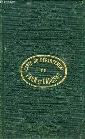
JOANNE ADOLPHE
CARTE DU DEPARTEMENT DE TARN-ET-GARONNE
Hachette et Cie. Non daté. In-16. En feuillets. Etat d'usage, Tâchée, Dos frotté, Intérieur acceptable. Carte dépliable en couleur d'env. 33/27 cm avec couverture rigide d'origine.. . . . Classification Dewey : 912-Atlas, cartes et plans
书商的参考编号 : RO40127030
|
|
|
JOANNE ADOLPHE
CARTE DU DEPARTEMENT DE TARN-ET-GARONNE
Hachette et Cie. Non daté. In-16 Carré. En feuillets. Etat d'usage. Tâchée. Dos frotté. Intérieur acceptable. Carte dépliable en couleur d'env. 33/27 cm avec couverture rigide d'origine. Moissac. Castelsarrasin. Montauban. Villebrumier...

|
|
|
JOANNE ADOLPHE
ITINERAIRE GENERAL DE LA FRANCE - LE NORD / + PUBLICITE DES GUIDES JOANNE APPENDICE 1874-1875
HACHETTE ET CIE. 1869. In-12. Broché. Bon état, Couv. convenable, Dos satisfaisant, Intérieur frais. 420+ 96 pages- avec 7 cartes et plans gravés en noir et blanc, dépliants dans le texte. . . . Classification Dewey : 912-Atlas, cartes et plans
书商的参考编号 : R200055814
|
|
 ?????????
 ?????PDF???
 RSS feed


