|
Mérienne Patrick
Plan de Bordeaux et de son agglomération avec lignes et stations de tramway
Sud Ouest. Non daté. In-12. Broché. Bon état, Couv. convenable, Dos satisfaisant, Intérieur frais. 80 pages de cartes en couleurs et index. Relié par deux agrafes.. . . . Classification Dewey : 912-Atlas, cartes et plans
書籍販売業者の参照番号
: RO20230437
|
|
|
Möller, Christa und Götz Schmitt
Siedlungen Palästinas nach Flavius Josephus. Von Christa Möller und Götz Schmitt. (= Tübinger Atlas des Vorderen Orients, Nr. 14).
Wiesbaden: Ludwig Reichert 1976. XIV, 202 Seiten. Als Typoskript gedruckt. Gr. 8° (22,5-25 cm) Orig.-Broschur. [Softcover / Paperback].
書籍販売業者の参照番号
: 2139158

|
|
|
Möller, J.H. (Text)
Orbis terrarum antiquus. Schul-Atlas der Alten Welt nach Mannert, Ukert, Reichard, Kruse, Wilhelm u.A. bearbeitet. 13. vermehrte Auflage.
Gotha, bei Justus Perthes, 1839.
書籍販売業者の参照番号
: 192604

|
|
|
MÖRZER BRUIJNS, M. F. und R. J. Benthem
Spectrum Atlas van de Nederlandse landschappen. Het ontstaan van het landschap / Waddeneilanden en Waddenzee / De zeekleigebieden van Groningen en Friesland / De Friese Wouden en Meren en het zuiden van het Groningse Westerkwartiert / De Gronings-Drentse veenkoloniën en Westerwolde / De Drentse zangronden / De Kop van Overijssel en Zuidwest- Drente / Twente en Salland / De Achterhoek, de Lihmers en het Montferland / De Gelderse Peel / Zuid-Lumbzrg / De Brabantse zandgronden / Zeeland en Goeree-Overflakkee / Het mondingsgebied van de grote rivieren en de Biesbosch / Het Groene Midden / Utrechtse Heuvelrug, Kromme-Rijngebied, Eemvallei en Gelderse Vallei / Het Gooi en de Vechtstreek / De duinen / West-Friesland en de voormalige zeeboezem Zijpe / Het polderland van Noord-Holland / Het voormalige Zuiderzeegebiet / De toekomst van het landschap / Bibliografie. Waddeneilanden en Waddenzee / De zeekleigebieden van Groningen en Friesland / De Friese Wouden en Meren en het zuiden van het Groningse Westerkwartiert / De Gronings-Drentse veenkoloniën en Westerwolde / De Drentse zangronden / De Kop van Overijssel en Zuidwest- Drente / Twente en Salland / De Achterhoek / De Gelderse Ijssel u.v.m.
Utrecht: Uitgeverij Spectrum, 1979. 272 S. mit zahlreichen Abbildungen; 4°; gebunden, illustrierter Orig.-Pappband;
書籍販売業者の参照番号
: 146145

|
|
|
Mück, Ida
Preussen-Atlas. Kartenbild. Darstellung v. Preussens Wachstum mit Erläuterungen und Beilagen. Jubiläumsausgabe zur 500 jährigen Hohenzollernherrschaft in Brandenburg-Preußen.
Bielefeld/Leipzig, Velhagen & Klasing, 1915. Jub. Ausg. quer - 4°. 6 nn. Bll. Mit 12 Ktn. HLwd. Illustr. Deckel. Ber. u. fl. L. gebr.
書籍販売業者の参照番号
: 35850AB
|
|
|
Mück, J
Preußen-Atlas. Kartenbildliche Darstellung von Preußens Wachstum mit Erläuterungen und Beilagen. Jubiläumsausgabe zur 500jährigen Hohenzollernherrschaft in Brandenburg-Preußen.
Braunschweig ., Archiv Verlag. Reprint der Jubiläums-Auflage 1915 im Verlag Velhagen & Klasing, Bielefeld, Leipzig. (4), XII Kartenseiten mit ausstanzungen, (4) Seiten (territoriale Entwicklung, Stammbaum des Hauses der Hohenzollern, Wappen, Wahlsprüchen und Namensunterschriften der Fürsten). Erschien in einer limitierten Vorzugsaugabe, hier Nummer 962 /2500. Guter Zustand. Quer - 2°. OKunstleder.
書籍販売業者の参照番号
: 062155
|
|
|
Mühlenberg, J
Stadtplan von Coblenz / bearbeitet von J. Mühlenberg - Maßstab: 1:10.000
Coblenz : Verlag Fritz Gutmann, [1910]. 1 Karte : farbig ; 69 x 47,7 cm, Exemplar in gutem Erhaltungszustand
書籍販売業者の参照番号
: 58576

|
|
|
MÜLLER-BADEN (Emanuel)(dir.).
Bibliothek des allgemeinen und praktischen Wissens. Zum Studium und Selbstunterricht in den hauptsächlichen Wissenszweigen und Sprachen. Tome V. – [Bibliothèque de connaissances générales et pratiques. Pour l'étude et l'auto-éducation dans les principales branches des sciences et des langues].
Berlin, Deutsches Verlaghaus Bong & Co., 1912, fort pt in-4° (19 x 26 cm), 897 pp, (paginées 28-76-161-128-108-152-192-52), 561 gravures et cartes dans le texte, 8 planches doubles en couleurs hors texte, 6 cartes dépliantes + un atlas de 42 cartes en couleurs hors texte (la plupart dépliantes), index, reliure pleine toile gris-bleu de l'éditeur, bon état. Texte en allemand (gothique)
書籍販売業者の参照番号
: 31198
|
|
|
Müller, Adriaan von
Römische Kaiserzeit II. Römische Münzen. Römischer Import. Brandgruben und Drehscheibenkeramik.
Berlin, New York, Walter de Gruyter, 1980. Gr.-8vo. Mit 3 mehrf. gef., farbigen Karten. 8 S. OBrosch. m. Deckeltitel.
書籍販売業者の参照番号
: 24016

|
|
|
Müller, Georg. Bearbeiter
Westdeutschlands Wirtschaftsraum. Regionalstatistischer Atlas zur Bevölkerungs-, Sozial- und Wirtschaftsstruktur der Bundesrepublik Deutschland mit Erläuterungen.
Stuttgart., Mairs Geographischer Verlag. Herausgegeben vom Institut für Raumforschung Bonn. Mit einer Einleitung von Erich Dittrich. Ohne Jahr , vermutlich 1953 / 54. Nicht paginiert, 5 farbige Karten , 8 Seiten Text. Inhalt der Karten: eine geographische Karte, Bevölkerungsentwicklung, Wanderungsbilanz, Beschäftigte in der Industrie, Krafträder auf 1000 Einwohner. Vermutlich handelt sich um ein Art Werbematerial für das später erscheinende Kartenwerk in größerem Umfang (Strukturkarten für das Bundesgebiet). Zustand: Ausgeschiedenes Bibliotheksexemplar, unterer Rücken mit kleinem Aufkleber, Titelblatt mit dem Stempel einer Institutsbibliothek. 2°. S OKarton / Leinenrückenstreifen
書籍販売業者の参照番号
: 041811
|
|
|
Müller, J. C
Handbuch zu dem Atlas von Preußen in 27 Karten (Blaettern) ; oder geographisch-statistisch-topographische Beschreibung der preußischen Monarchie und Verzeichniß sämmtlicher Ortschaften derselben.
Erfurt., J. E. Müller'sche Buchhandlung., 1835. Zweite Hälfte: Vollständiges Verzeichniß sämmtlicher Städte, Flecken, Dörfer, Weiler, Kolonien, Pustkowien, Vorwerke, Höfe, Mühlen, einzelnen Häuser, mit Angabe der Feuerstellen und Einwohnerzahl, des Regierungs-Bezirks, Kreises, Gerichtssprengels, des Amts und der Herrschaft, Militair-Bezirks, des Kirchspiels, der nächsten Post-Anstalt, so wie alles dessen, was der Ort irgend Merkwürdiges von allgemeinem Interesse darbietet. Erster - Vierter Band A - Z, 1835 - 1836. Vier Bände: VI, 878, 1082(2), 1035(1), 956 Seiten. Zustand: Aus einer Institutsbibliothke ausgeschieden, schwarze Pappbände mit rotem Titel-Rückenschild, Einband und Einbandkante berieben und bestossen, Titelblätter mit Bibliotheksstempel und Inventarnummer. 8°. S Pappband. der Zeit.
書籍販売業者の参照番号
: 043913
|
|
|
Müller, Johann Ulrich
Kurtz-bündige Abbild- und Vorstellung der gantzen Welt. REPRINT der Ausgabe Ulm, Kühnen, 1692 (mit Nachwort von Egon Klemp).
(Würzburg, Edition Popp, 1979). 95 Bl. in getr. Zählung, 103, VIII S. 95 zweifarb. Karten. 17 cm. OPp. m. bedrucktem OKart, Schuber.
書籍販売業者の参照番号
: 94146

|
|
|
Müller, Theodor und Christian Eisenhuth
Neuer Atlas für Mittelschulen und verwandte Lehranstalten. Herausgegeben unter Mitwirkung der Erdkundefachgruppe Groß-Berlin. Dritte, verbesserte Auflage.
Bielefeld/Leipzig, Velhagen & Klasing Verlag, 1934.
書籍販売業者の参照番号
: 120903

|
|
|
Müllner, Johann (Hg.)
Richters Schulatlas für Gymnasien, Realschulen, Mädchenlyzeen, Lehrerbildungs-Anstalten und sonstige höhere Lehranstalten im Anschlusse an seine Erdkunde für Mittelschulen. Dritte, verbess. Auflage.
Wien, Verlag von F. Tempsky, 1910. Gr 4°. Mit 117 Haupt- und 112 Nebenkarten (114 Kartenseiten) in Farbendruck.Orig.-Ganzleinenband. Einband mit schwachen Gebrauchsspuren, insgesamt schön und wohlerhalten.
書籍販売業者の参照番号
: 31568

|
|
|
Münster, Sebastian
Mappa Europae Mit einem Nachwort herausgegeben von Klaus Stopp Faksimile der Ausgabe Frankfurt, Egenolff, 1536.
Wiesbaden, Guido Pressler 1965. 24 Bl., 21 S. Mit 2 Faltkarten und zahlreichen Abbildungen. Kl.-4° (22 x 17 cm). (Holzfurnierimitation), gebundene Ausgabe, untere Kante beschädigt, sonst Exemplar in gutem Erhaltungszustand
書籍販売業者の参照番号
: 46138

|
|
|
Münzer, Lutz / Karl Arne Richter u.a. (Red.)
Eisenbahn-Taschenatlas: Deutschland - Österreich - Schweiz.
München, GeraMond, 2006. (Maßstab 1:750.000 ; alle Strecken, alle Bahnhöfe, mit Register) 95 S. (24x17 cm) Broschierte Ausgabe
書籍販売業者の参照番号
: 74638
|
|
|
MÜZIK ATLASI. [= MUSICAL ATLAS].
Müzik atlasi. Edited by Bülent Özükan, Murat Önes.
New English Original bdg. HC. In special box. 4to. (33 x 33 cm). In Turkish. 420 p., color and b/w ills. Müzik atlasi. Edited by Bülent Özükan, Murat Önes. A very heavy volume.
|
|
|
N
Atlas et notices géographiques complémentaires
PARIS, imp. Lemercier - Sans date, Avant 1871 - Cartres gravées par Maurice PERRIN - Reliure pleine toile - 24 Pages de texte sur 3 colonnes - L'atlas se compose de cartes montées sur onglets : 1 Planisphère (double page : DP), Afrique (DP), Algérie, Tunisie, Allemagne, Amérique (DP), Asie (DP)Autiche-Hongrie, Presqu'ile des Balkans, Belgique & Luxembourg, Iles britanniques, Colonies Françaises, Danemark, Espagne,Europe (DP), France (2 en DP), Grèce, Italie, Océanie (DP), Pays-Bas, Russie, Suède, Norvège, Suisse, Suivi des 89 départements Français - quelques cartes détachées, rousseurs éparses - bon exemplaire - 106 cartes + 8 sur double-page
書籍販売業者の参照番号
: 10307
|
|
|
N
Atlas du Cameroun
Edité par les soins du Haut Commissaire de la République Française au Cameroun / PARIS, Ed. SELPA - sans date - In-4 - Broché - 7 cartes dépliantes en couleurs HT, 1 croquis NB HT - 2 planches de photographies NB HT - Non paginé (environ 14 pages de texte) - Bon exemplaire
|
|
|
N
Atlas et notices géographiques complémentaires
PARIS, imp. Lemercier - Sans date, Avant 1871 - Cartres gravées par Maurice PERRIN - Reliure pleine toile - 24 Pages de texte sur 3 colonnes - L'atlas se compose de cartes montées sur onglets : 1 Planisphère (double page : DP), Afrique (DP), Algérie, Tunisie, Allemagne, Amérique (DP), Asie (DP)Autiche-Hongrie, Presqu'ile des Balkans, Belgique & Luxembourg, Iles britanniques, Colonies Françaises, Danemark, Espagne,Europe (DP), France (2 en DP), Grèce, Italie, Océanie (DP), Pays-Bas, Russie, Suède, Norvège, Suisse, Suivi des 89 départements Français - quelques cartes détachées, rousseurs éparses - bon exemplaire - 106 cartes + 8 sur double-page
|
|
|
n
Guerres de la Révolution et de l'Empire ( Révolution française (1792-1802) - Guerres napoléoniennes (1803-1815)
Sans lieu, ni date (XIX è) - 2 Volumes Atlas ( Plans et cartes) sur histoires de la Révolution et de l'Empire, contenant 77 & 80 cartes et plans, certains dépliants - In-8 - Reliure 1/2 chagrin - Bon exemplaire
書籍販売業者の参照番号
: 46874

|
|
|
n
Guerres de la Révolution et de l'Empire ( Révolution française (1792-1802) - Guerres napoléoniennes (1803-1815)
Sans lieu, ni date (XIX è) - 2 Volumes Atlas ( Plans et cartes) sur histoires de la Révolution et de l'Empire, contenant 77 & 80 cartes et plans, certains dépliants - In-8 - Reliure 1/2 chagrin - Bon exemplaire
|
|
|
N. A.].
[MAP OF EAST & SOUTHEAST ANATOLIA AND CAUCASIA BORDERS] Erzurum, Van, Bitlis vilâyetleri ile bunlara civar olan Trabzon, Sivas, Harput ve Diyarbekir vilâyetlerinin bâzi kisâmi.
Very Good Turkish, Ottoman (1500-1928) Extremely rare huge chromo-lithograph map in 24 sheets mounted on canvas, showing a large zone including Midyat (Mardin), Mosul, Mt. Cilo (Resko-Buzul) on the southeast; Kahta (Adiyaman), Munzur Mt., Divrigi (Sivas) on the west; the Black Sea on north and Turkish borders to Armenia, Azerbaijan on the east, and to Russia on the northeast. In addition shows in separate little portions, roads, mountains and hills, lakes, and telegraph and post ways and borders in that zone. Not in any libraries and any collection. An attractive map with its huge size and decorative surface. Several toponyms are underlined in red ink. Otherwise a very good example. Original folded map mounted on canvas. 118x112 cm. In Ottoman script (Turkish with Arabic letters). Scale: 1/630.000.
|
|
|
N. A.].
[OTTOMAN MAP OF RHODES] Rodos.
Very Good Turkish, Ottoman (1500-1928) Original color map. Folded. Oblong atlas folio. (50 x 60 cm). In Ottoman script. Shows Rhodes and Tilos Islands. Scale: 1/200.000. Hegira: 1332 = Gregorian: 1916. Not description on map-maker. This is one of the series of the Bonn projection maps which are the first map series in modern techniques in Turkey and the Ottoman Empire. This is one of the series of the Bonn projection maps which are the first map series in modern techniques in Turkey and the Ottoman Empire. In order to produce these maps covering Turkish territory, Reconnaissance Branch was incorporated into The Mapping Commission. The maps were produced in the datum based on the latitude and longitude of Ayasofya Mosque in an equal area Bonn Projection. The field works for the 123 sheets covering the country were conducted by 76 staff. The production was completed in 18 years starting from east-west. Fieldworks continued without stopping except in the years 1914 and 1920. This map series called also reconnaissance maps contributed a lot to producing 1:25.000 scale maps. A very detailed and attractive map of Rhodes Island showing its harbors and Ottoman place names.
|
|
|
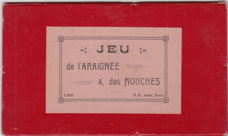
N.K. ATLAS
Jeu de l'araignée et des mouches
N.K. ATLAS sd
書籍販売業者の参照番号
: 25700
|
|
|
N/A,
HAN NEFKENS 10 JAAR MECENAS,
Rotterdam, Museum Boymans - van Beuningen/Atlas, 2011 Gebonden onder fotokartonomslag in kleur, oblongformaat : 245 x 225mm., pagina's niet genummerd, overvloedig geillustreerd in kleur. ISBN 9789045019505.
書籍販売業者の参照番号
: 32827
|
|
|
Nadir Atlas
How They See Us : Writers from Around the Globe Reflect on America
Atlas & Co. 2009. Paperback. Very Good. Disclaimer:A copy that has been read but remains in excellent condition. Pages are intact and are not marred by notes or highlighting but may contain a neat previous owner name. The spine remains undamaged. An ex-library book and may have standard library stamps and/or stickers. At ThriftBooks our motto is: Read More Spend Less.Dust jacket quality is not guaranteed. Atlas & Co. paperback
書籍販売業者の参照番号
: G1934633100I4N10 ISBN : 1934633100 9781934633106

|
|
|
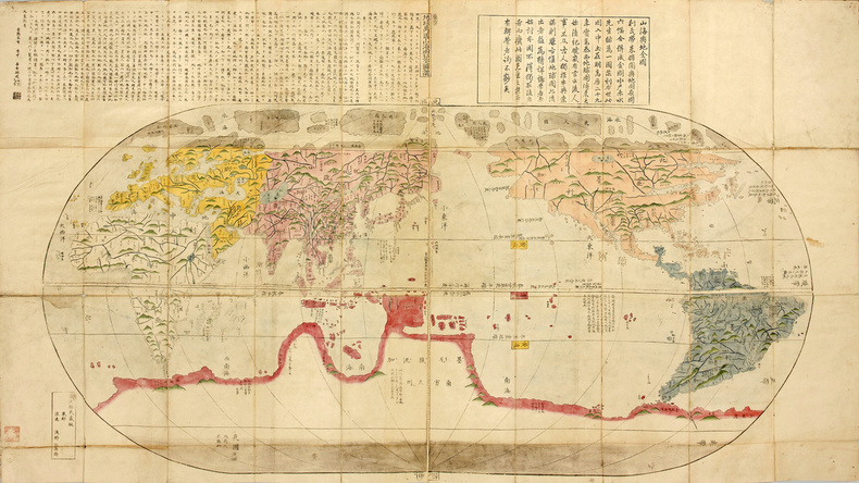
NAGAKUBO SEKISUI
Kaisei Chikyu Bankoku Zenzu 改正地球万国全図 (= Carte géographique complète et améliorée de tous les pays du monde). La carte du monde « vue du Japon » en 1785, entièrement coloriée à la main à l’époque.
Première édition de cette superbe et rare carte du Monde publiée au Japon en 1785, qui montre l’état d’avancement des connaissances géographiques et cartographiques japonaises à la fin du XVIIIe siècle. Yamazaki Kinbe, Edo et Asana Yahei, Osaka, 5e année de la période Tenmei (1785).Grande carte de 165 x 91 cm gravée sur bois, entièrement coloriée à la main à l’époque. Tampon à l’encre rouge dans le bas. Repliée et préservée dans un étui de protection de toile bleu moderne. Très bon état de conservation.
書籍販売業者の参照番号
: LCS-17476
|
|
|
NAHUM-VALENSI Maya / ATLAS Corinne.
Les Ados, peuple extraordinaire.
MAZARINE. 1987. In-12. Broché. Bon état, Couv. convenable, Dos satisfaisant, Intérieur frais. 155 pages.. . . . Classification Dewey : 155.5-Psychologie des adolescents
書籍販売業者の参照番号
: RO20058676 ISBN : 286374271
|
|
|
NAIPAUL, V.S..
SCHRIJVERSMENSEN,
Amsterdam/ Antwerpen, Atlas, 2008 Paperback, foto-kartonomslag in kleur, 130 x 210mm., 206pp. . ISBN 9789045004204.
書籍販売業者の参照番号
: 28561
|
|
|
NAPOLEON ATLAS. GRIESS Thomas E. ed.
Atlas for wars of Napoleon.
Wayne NJ: Avery Publishing 1986. Oblong folio. 4 leaves 67 colour maps. Spiral-bound colour-illust. covers as issued slght shlfwr NF. First edition of this excellent reference. Avery Publishing, unknown
書籍販売業者の参照番号
: 33202 ISBN : 0895293013 9780895293015

|
|
|
Nash, Ernest
Bildlexikon zur Topographie des antiken Rom. 2 Bde.
Tübingen: Wasmuth Vlg. 1961. 544, 531 S., zahlr. s/w Abb. im Text und auf Taf., Lagepläne, Karten, Reg., Lit.verz. 4° Ln.
書籍販売業者の参照番号
: 229903
|
|
|
National Géographic
Clair de terre - 1 Carte du monde - Supplément du National Geographic Novembre 2004.
National Géographic. 2004. In-Plano. Broché. Bon état, Couv. convenable, Dos satisfaisant, Intérieur frais. 1 carte en couleurs du monde . Supplément du National Geographic Novembre 2004.. . . . Classification Dewey : 912-Atlas, cartes et plans
書籍販売業者の参照番号
: R160209989
|
|
|
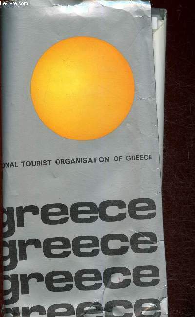
National Tourist Organisation
Greece (cartes) : Greece Patre - Greece Kerkira - Greece Ionian islands - etc
Chez l'auteur. 1971. In-8. Broché. Etat d'usage, Plats abîmés, Dos satisfaisant, Papier jauni. 17 cartes en couleur. Texte en anglais.. . . . Classification Dewey : 912-Atlas, cartes et plans
書籍販売業者の参照番号
: RO30342235
|
|
|
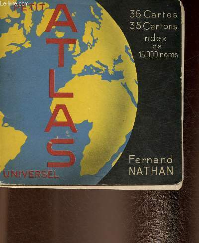
Nathan
Petit Atlas universel. 36 cartes, 35 cartons. Index de 16.000 noms
Fernand Nathan. 1957. In-12. Broché. Bon état, Plats abîmés, Dos satisfaisant, Papier jauni. 36 pages. Nombreuses cartes en couleur, hors texte. Coiffes en tête et en pied abîmées.. . . . Classification Dewey : 912-Atlas, cartes et plans
書籍販売業者の参照番号
: RO30342701
|
|
|
National Atlas Co
Wright County Atlas 1970
Minnesota: National Atlas Co. 1970. Spiral Bound. good. Quarto. 13" x 10" Spiral bound. Previous owner's name. Consists of Code maps advertising as well as a listing of names and address of previous occupants in the Wright County area in 1970. There is a small piece chipped off corner of back cover. <br/><br/> National Atlas Co. unknown
書籍販売業者の参照番号
: 48521

|
|
|
National Geographic Picture Atlas Of Our World Ross S. Bennett Bennett
National Geographic Picture Atlas Of Our World Ross S
6. cover page torn out otherwise excellent shape/hardcover hardcover
書籍販売業者の参照番号
: 9-10bq ISBN : 0870443119 9780870443114
|
|
|
National Guide & Atlas Of The Kingdom Of Saudi Arabia
National Guide & Atlas of the Kingdom of Saudi Arabia
Saudi Arabia: Eng'r. Zaki M. A. Farsi. Good in Very Good dust jacket. 1989. Paperback. To . Eng'r. Zaki M. A. Farsi paperback
書籍販売業者の参照番号
: 213107
|
|
|
National Geographic Atlas of Archaeology
Wonders of the Ancient World
Washington D.C.: National Geographic Society 1994. Hardcover very good. Hardcover. Very Good/Very Good. National Geographic Society
書籍販売業者の参照番号
: 131218-J52
|
|
|
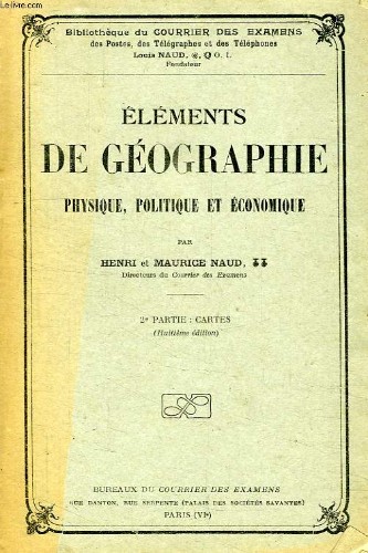
NAUD HENRI ET MAURICE
ELEMENTS DE GEOGRAPHIE PHYSIQUE, POLITIQUE ET ECONOMIQUE, 2e PARTIE: CARTES
Le Courrier des Examens. Non daté. In-8. Broché. Bon état, Couv. convenable, Agraffes rouillées, Intérieur frais. Plaquette de 32 pages illustrée de nombreuses cartes en couleur sur planches dépliables.. . . . Classification Dewey : 912-Atlas, cartes et plans
書籍販売業者の参照番号
: RO40151812
|
|
|
NAUD Louis
Précis de Géographie physique, politique & économique. 2ème partie : Cartes.
BUREAUX DU COURRIER DES EXAMENS. 44ème édition. Nov. 1919. In-8. Broché. Etat d'usage, Couv. défraîchie, Dos satisfaisant, Intérieur acceptable. 40 pages de cartes en couleurs, hors-texte. Ouvrage légèrement déformé.. . . . Classification Dewey : 912-Atlas, cartes et plans
書籍販売業者の参照番号
: RO80149166
|
|
|
NAUD HENRI ET MAURICE
ELEMENTS DE GEOGRAPHIE PHYSIQUE, POLITIQUE ET ECONOMIQUE, 2e PARTIE: CARTES
Le Courrier des Examens. Non daté. In-8 Carré. Broché. Bon état. Couv. convenable. Agraffes rouillées. Intérieur frais. Plaquette de 32 pages illustrée de nombreuses cartes en couleur sur planches dépliables. 8e édition. 'Bibliothèque du Courrier des Examens, des Postes, des Télégraphes et des Téléphones', Louis Naud.

|
|
|
Naudiet, Rainer. Arlt, Karl-Heinz. Jansen, Uwe. Maiwald, Detlef
Atlas des Kreises Steinburg. Innenansichten einer Region.
Münsterdorf., Verlag Hansen & Hansen., 1994. 160 Seiten mit zahlreichen Karten und Ansichten. Guter Zustand. 4°. OPappband.
書籍販売業者の参照番号
: 064238 ISBN : 387980950
|
|
|
Nauhaus Karl-Eberhard
Das Emsland im Ablauf der Geschichte
Sögel (Emsländische Landschaft für die Landkreise Emsland und Grafschaft Bentheim) 1984 (= Erste Ausgabe). Quer-4°, Originalbroschur (Paperback) ohne Pagination, 76 farbige Karten, ISBN 3925034005 1
書籍販売業者の参照番号
: V43113
|
|
|
NAVARRO CORREA Manuel
En torno a un atlas linguistico venezolano. VI congreso de asociaciones de las academias de la lengua espanola.
Couverture souple. Broché. 192 pages. A l'italienne. Couverture légèrement défraîchie. 21 x 30 cm.
書籍販売業者の参照番号
: 88734
|
|
|
Nava Atlas
5-Ingredient Vegan: 175 Simple Plant-based Recipes for Delicious Healthy Meals in Minutes
Paperback / softback. New. This cookbook offers 175 easy plant-based recipes that anyone can put together in as little as 15 minutes. paperback
書籍販売業者の参照番号
: A9781454933557 ISBN : 1454933550 9781454933557

|
|
|
Nava Atlas
5-Ingredient Vegan
Paperback. New. Make fast fun and delicious vegan meals at home--using just five ingredients per dish! Solve the daily dilemma of planning meals that are healthy tasty and ready to eat in half an hour or less. Vegan expert Nava Atlas has created super-simple plant-based recipes that incorporate fresh produce paperback
書籍販売業者の参照番号
: ria9781454933557_new ISBN : 1454933550 9781454933557

|
|
|
Nava Atlas
5-Ingredient Vegan: 175 Simple Plant-Based Recipes for Delicious Healthy Meals in Minutes
2019-10-01. New. Ships with Tracking Number! INTERNATIONAL WORLDWIDE Shipping available. May be re-issue. Buy with confidence excellent customer service! unknown
書籍販売業者の参照番号
: 1454933550n ISBN : 1454933550 9781454933557

|
|
|
Nava Atlas
5-Ingredient Vegan: 175 Simple Plant-Based Recipes for Delicious Healthy Meals in Minutes
2019-10-01. Good. Ships with Tracking Number! INTERNATIONAL WORLDWIDE Shipping available. May not contain Access Codes or Supplements. May be re-issue. May be ex-library. Shipping & Handling by region. Buy with confidence excellent customer service! unknown
書籍販売業者の参照番号
: 1454933550q ISBN : 1454933550 9781454933557

|
|
|
Nava Atlas
5-Ingredient Vegan
Paperback. As New. Make fast fun and delicious vegan meals at home--using just five ingredients per dish! Solve the daily dilemma of planning meals that are healthy tasty and ready to eat in half an hour or less. Vegan expert Nava Atlas has created super-simple plant-based recipes that incorporate fresh produce paperback
書籍販売業者の参照番号
: ria9781454933557_rkm ISBN : 1454933550 9781454933557
|
|
 検索結果のメールを受信する
 PDFファイルの検索結果をダウンロード
 RSSフィード


