|
PRELCEC- GRADISER
1 CARTE DEPLIANTE EN COULEURS- YOUGOSLAVIE- CARTE TOURISTIQUE- DE DIMENSION 78x53 cm environ
CENTRE YOUGOSLAVE POUR LA PROMOTION DU TOURISME. 1973. In-Plano. Relié. Bon état, Couv. convenable, Dos satisfaisant, Intérieur frais. 1 CARTE DEPLIANTE EN COULEURS- DE DIMENSION 78x53 cm environ- avec légendes + notices explicatives et renseignements au verso de la carte. . . . Classification Dewey : 912-Atlas, cartes et plans
Référence libraire : R200052029
|
|
|
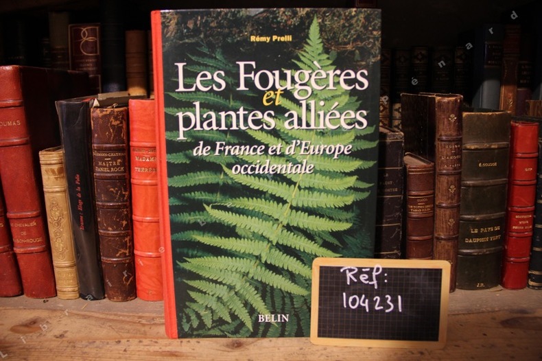
PRELLI, Rémy - Michel Boudrie (avec la collaboration de)
Les Fougères et plantes alliées de France et d'Europe occidentale
2001 Editions Belin - 2001 - 1 volume In-4 - Cartonnage souple éditeur illustré, dos toilé rouge - 430 pages - Illustrations en couleurs dans le texte
Référence libraire : 104231
|
|
|
Prep. by E. NARDIN.
[MAP] A IV. Sinob. Black Sea shores, Pontus Euxinus.
Very Good French Original color map on cloth. Folded. Oblong atlas folio. (48 x 63 cm). Toponyms in German. It shows Sinop and Samsun city with their shores to 'Schwarzes Meer' and their hinterlands. [MAP] A IV. Sinob. Black Sea shores, Pontus Euxinus.
|
|
|
Prep. by IRFAN DAGDELEN.
Istanbul Büyüksehir Belediyesi Atatürk Kitapligi harita-haritalar katalogu. 4 volumes set.
Fine Turkish Paperback. 4to. (29 x 21 cm). In turkish. 4 volumes set: ([xiv], 333 p.; [4], [iv], 212 p.; [8], 200 p.; [8], 197 p.; 12 color plates, b/w ills.). Istanbul Büyüksehir Belediyesi Atatürk Kitapligi harita-haritalar katalogu. 4 volumes set. A very comprehensive map catalogue from Istanbul Municipality Ataturk Library Collection.
|
|
|
Prep. by MARTIN STERN, PASCAL LEBOUTEILLER, JEAN-FRANÇOIS Perouse.
Deux siecles de cartographie d'Istanbul et de son environment.= Istanbul ve çevresi üzerine iki yüzyil boyunca haritacilik. 07/03/2013 - 08/04/2013, Lycee Notre Dame de Sion, Istanbul. [Catalogue de l'exposition].
New English Paperback. Pbo. Oblong small 4to. In French and Turkish. 79 p. Color and b/w ills. "En relation avec le projet international , cette exposition a pour but d'interroger la representation cartographique de la ville et de son environnement a partir de l'exemple d'Istanbul. E s'appuyant sur une selection de cartes originales de l'Institut Français d'Etudes Anatoliennes (IFEA), il s'agira de saisir quelques aspects de cet entre-deux invisible qui relie le passe au present, et donne son identite a l'ancienne capitale Ottomane devenue megapole Europenne". Contents (Sommaire): Presentation generale de la cartographie. La carte comme convention. / La naissance d'une cartographie scientifique d'Istanbul, autour de Kauffer (1776-1844). / Autour des Kiepert (1844-1910). / Autour de la Grande Guerre (1910-1923). / 1923- 1960: Specialisation, municipalisation et vulgarisation.
|
|
|
Prep. by MURAT P. ERKEN.
Savaslarda haritacilar.
New Turkish Paperback. Demy 8vo. (21 x 14 cm). In Turkish. 158 p., b/w ills. Savaslarda haritacilar. A list and biographies of military cartographers of the Ottoman Empire and Turkish Republic from Mehmed Sevki to Mehmet Neset. It includes 150 short biographies with battles their participated. A fine reference for Turkish cartography.
|
|
|
Prep. by SÜKRÜ AKALIN et all.
Chart and map catalogue of Turkish Naval Museum.= Türk Deniz Müzesi harita katalogu.
Fine Fine English Original bdg. Dust wrapper. Oblong 4to. (28 x 28 cm). In English and Turkish. 437 p. Color ills. 1000 copies were printed. Chart and map catalogue of Turkish Naval Museum.= Türk Deniz Müzesi harita katalogu.
|
|
|
PRESIDENCE DU CONSEIL
CARTE N°44 - AMERIQUE DU SUD - INDUSTRIES ET TRANSPORTS
LAFOSSE. Non daté. In-Plano. En feuillets. Bon état, Couv. convenable, Dos satisfaisant, Intérieur frais. CARTE N°44 En couleurs Echelle 1/ 10 000 000.. . . . Classification Dewey : 912-Atlas, cartes et plans
Référence libraire : R160205284
|
|
|
PRESSOUYRE Sylvia
ROME AU FIL DU TEMPS. Atlas historique d'urbanisme et d'architecture.
1973 Boulogne (Hauts-de-Seine), éditions Joël Cuénot, collection des Atlas historiques d'urbanisme et d'architecture des grandes villes mondiales, 1973. Préface de Georges Vallet, directeur de l'École française de Rome. Comprenant une succession de plans à échelle constante, du site des origines à nos jours, avec en regard un texte explicatif et les photographies des principaux monuments. Grand in-8 de format à l'italienne, 25 x 22 cm., environ 180 pp. non numérotées, avec index in fine. Reliure de l'éditeur, pleine toile noisette imprimée en blanc, jaquette illustrée. Très bon état extérieur et intérieur.
Référence libraire : 18664

|
|
|
PREVOTEAU Raoul, DESIRY
CANTON DE BEAUVOIR
1899 carte entoilée en couleurs (map in colours cloth-lined map), dimensions de la carte dépliée (Dimensions of the unfolded map - size in Inches) : 43.5 centimètres de largeur (width : 17.12) sur 55.5 de hauteur (height : 21.85), sans date imprimée (undated printed) - circa 1886 - à Paris Erhard Graveur et Imprimeur - 35 bis Denfert-Rochereau et 8 rue Nicole,
Référence libraire : 15738
|
|
|
PREVOTEAU Raoul, DESIRY
CANTON DE ROCHESERVIERE
1899 carte entoilée en couleurs (map in colours cloth-lined map), dimensions de la carte dépliée (Dimensions of the unfolded map - size in Inches) : 43.5 centimètres de largeur (width : 17.12) sur 55.5 de hauteur (height : 21.85), sans date imprimée (undated printed) - circa 1886 - à Paris Erhard Graveur et Imprimeur - 35 bis Denfert-Rochereau et 8 rue Nicole,
Référence libraire : 15739
|
|
|
PREVOTEAU Raoul, DESIRY
CANTON DE TALMONT
1899 carte entoilée en couleurs (map in colours cloth-lined map), dimensions de la carte dépliée (Dimensions of the unfolded map - size in Inches) : 73 centimètres de largeur (width : 28.74) sur 55.5 de hauteur (height : 21.85), sans date imprimée (undated printed) - circa 1886 - à Paris Erhard Graveur et Imprimeur - 35 bis Denfert-Rochereau et 8 rue Nicole,
Référence libraire : 15736
|
|
|
PREVOTEAU Raoul, DESIRY
carte du CANTON DE LA ROCHE-SUR-YON
1899 carte entoilée en couleurs (map in colours cloth-lined map), dimensions de la carte dépliée (Dimensions of the unfolded map - size in Inches) : 73 centimètres de largeur (width : 28.74) sur 55.5 de hauteur (height : 21.85), sans date imprimée (undated printed) - circa 1886 - à Paris Erhard Graveur et Imprimeur - 35 bis Denfert-Rochereau et 8 rue Nicole,
Référence libraire : 15737
|
|
|
Preyssinger, Ludwig
Astronomischer Bilder-Atlas (Atlas-Mappe + Textheft).
Stuttgart, Wilhelm Nitzschke, o. J. (ca. 1850). Braune verschließbare Original-Ganzleinenmappe im Format 32 x 26 cm mit goldgeprägtem Deckeltitel sowie ornamentalen Blindprägungen. Außerdem zugehöriges Textheft (2. Aufl., 84 S., 1 Bl.). Sehr seltenes Atlaswerk des Augsburger Mathematikers und Kosmographen Ludwig Preyssinger, enthaltend 12 ganzseitige, überwiegend kolorierte lithographische Tafeln auf Karton, welche folgende Himmelskonstellationen abbilden: Taf. I: Die Central-Sonne und die Ansicht von der Fixsternenwelt. Taf. II: Himmels Karte mit den Sternen welche während des ganzen Jahres sichtbar sind. Taf. III: Darstellung des Sonnensystems, die Planeten mit ihren Bahnen, wie sie bis heute bekannt sind. Taf. IV: Vergleichende Darstellung der Grösse der Planeten. Taf. V: Die Sonne und verschiedene Erscheinungen derselben. Taf. VI: Der Mond durch das Fernrohr gesehen. Taf. VII: Transparente Darstellung der Mondphasen. Taf. VIII: Finsternisse (Mondfinsterniss - Sonnenfinsterniss; niedrige Fluth - Springfluth) Taf. IX: Ansicht von den Jahreszeiten nebst den Zeichen des Thierkreises. Taf X: Die Erde und ihre Atmosphäre. Taf. XI: Kometen und Aerolithen. Taf. XII: Mathemat. Geographische Begriffsversinnlichungen. Das Besondere an den kunstvoll gestalteten Tafeln sind unter anderem zahlreiche kleine oder größere, mit transparentem Buntpapier hinterlegte Ausstanzungen, so daß die betreffenden Areale, sobald die Tafeln ins Licht gehalten werden, aufleuchten und zum Beispiel die Himmels-Karte als leuchtender Sternenhimmel erscheint. Alle Tafeln mit erklärenden Texten. Mit enthalten ist ferner das zugehörige Textheft (Ergänzungs-Text zum Astronomischen Bilder-Atlas) mit den jeweiligen Tafeln zugeordneten astronomischen und kosmographischen Erläuterungen. Ludwig Preyssinger lehrte als Professor für Mathematik, Chemie, Physik, Kosmographie und Naturgeschichte am Königlichen Lyceum Augsburg und fungierte zugleich als Leiter des Augsburger Observatoriums.
Référence libraire : SB-17775

|
|
|
Price, Roberto Salinas (compiled by)
ATLAS OF HOMERIC GEOGRAPHY
Very minor shelfwear and rubbing to boards. ; 60 pages
|
|
|
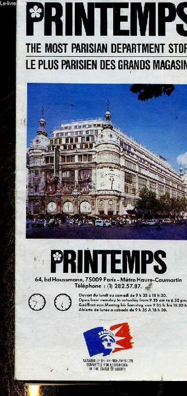
Printemps
Printemps, le plus Parisien des grands magasins + 1 carte de Paris
Printemps. Non daté. In-Folio. Broché. Bon état, Couv. convenable, Dos satisfaisant, Papier jauni. Une carte dépliante de Paris d'environ 55cm x 40cm. Nombreuses illustrations en couleur hors texte.. . . . Classification Dewey : 912-Atlas, cartes et plans
Référence libraire : RO30346545
|
|
|
Prior (Robin) - Wilson (Trevor)
La Première Guerre mondiale. 1914-1918
Autrement, coll. « Atlas des guerres » 2001 In-4 cartonné 27 cm sur 21. Jaquette en assez bon état. 224 pages. Assez bon état d’occasion. Poids sans emballage : 1100 grammes.
Référence libraire : 43665
|
|
|
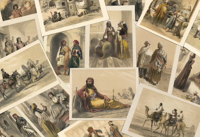
PRISSE D’AVENNES, Achille Constant Théodore Emile.
Oriental Album, characters, costumes, and modes of life in the valley of Nile. “The above is one of the most attractive books of Eastern Costume”.
“The influence of such a book on the mind is analogous to that of travelling: it extends our knowledge of different modes of existence”. London, James Madden, [1848].30 planches en couleurs en tirage à part plus 1 frontispice.
Référence libraire : LCS-18008
|
|
|
Pritchard, James Bennett (Herausgeber) und Othmar (Mitwirkender) Keel
Herders grosser Bibel-Atlas.
Freiburg im Breisgau, Herder, 2002. 2. Aufl. der Sonderausg. 255 S. überw. Ill. 37 x 28 cm, Pappband ohne Schutzumschlag
Référence libraire : 23109

|
|
|
Prof. Dr. H. Haack (Leitung)
Stielers Handatlas.
Gotha, Justus Perthes Verlag, 1928. Privater Halblederband mit Lederecken, Folio, 107 Karten und Inhaltsverzeichnis. 254 haupt und Nebenkarten in Kupferstich (maschinell gedruckt). 10 auflage 100 Jahrausgabe, von Grund auf neu bearbeitet.
Référence libraire : 45967
|
|
|
Professor S. P. Chatterjee National Atlas Organisation
IRRIGATION ATLAS OF INDIA. REPORT OF THE IRRIGATION COMMISSION VOLUME IV
Calcutta: Ministry of Education & Youth Services Government of India 1972. Hard Cover. Very Good binding. This folio atlas is 22 x 16.5" and is comprised of 35 double page plates some of which are folded. Housed in a blue binder which has the beginnings of separation at the front joint but which is holding well. The boards are lightly soiled but the maps are fine with no ownership or other marks.~~The atlas covers inter alia rainfall soils land use crops groundwater river basins and irrigation. Very Good binding. Ministry of Education & Youth Services | Government of India unknown books
Référence libraire : 293032

|
|
|
PROP G. / ATLAS
Atlas van Nederland en de Indi�n voor de lagere school. 27e druk
Zutphen : Thieme 1937. HARDCOVER . orig. half linnen licht los in band voorplat gevlekt gebruikssporen de kaart van Indie mist 1/3 deel verder ZEER GOED. Very rare Dutch primary school atlas covering The Netherlands and the East-Indian colony probably the last for WW II. In university librarries of Amsterdam and Utrecht is only 26 th edition. Zutphen : Thieme hardcover
Référence libraire : 9534
|
|
|
PROUVIER / HACQ / PIERE / ROUILLARD
Carte de Beaune. N°125
DEPOT DE GUERRE. Années 1880 - 1890. In-Plano. En feuillets. Bon état, Couv. convenable, Dos satisfaisant, Intérieur frais. Carte dépliante en noir et blanc, de 92/62 cm. Pas de plats de couverture.. . . A l'italienne. Classification Dewey : 912-Atlas, cartes et plans
Référence libraire : RO80006229
|
|
|
PROUVIER, COUSTEIX, FLAHAUT et BARRIERE
Carte de Bordeaux Sud-Est (n°180)
SERVICE GEOGRAPHIQUE DE L'ARMEE. Septembre 1927. In-Plano. En feuillets. Etat d'usage, Livré sans Couverture, Dos satisfaisant, Intérieur acceptable. Carte dépliante en noir et blanc, de 53 / 75 cm.. . . A l'italienne. Classification Dewey : 912-Atlas, cartes et plans
Référence libraire : RO80076198
|
|
|
PROUVIER, COUSTEIX, FLAHAUT et BARRIERE
Carte de Bordeaux Sud-Ouest et Sud-Est.
DEPOT DE GUERRE. 1899. In-Plano. En feuillets. Etat d'usage, Livré sans Couverture, Dos satisfaisant, Intérieur frais. Carte dépliante en noir et blanc, de 138/51 cm. Traits au cryon rouge. Bords de la carte usés. Quelques petits accrocs et déchirures.. . . A l'italienne. Classification Dewey : 912-Atlas, cartes et plans
Référence libraire : RO80022273
|
|
|
PROVOST Michel
Atlas de répartition des plantes vasculaires de Basse-Normandie.
Presses Universitaires de Caen Presses Universitaires de Caen, 1993, cartonnage éditeur sous jaquette, environ 30x21cm, de légères griffures sur le second plat de la jaquette, bon état néanmoins et intérieur très propre.
Référence libraire : 102437
|
|
|
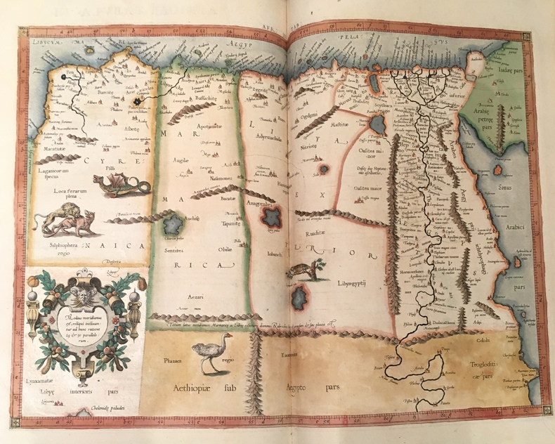
PTOLEMAEUS (Claudius) /MERCATOR (Gerard).
I. Geographiae libri octo, recognitiam diligenter... [II. Galliae Tabule Geographicae. Belgii Inferiores Geographicae Tabule].
Cologne, Gottfried von Kempen, 1584 / Duisburg, [1585-1602]. 1584 3 parties en 1 vol in-folio (410 x 280 mm) de: [2] ff. (titre gravé et enluminé et feuillet préliminaire) ; 106 pp. (nombreux schémas dans le texte) ; [16] ff. (index, 1 tableau sur pleine page) ; [5] ff. (f. blanc, titre, privilège et schéma gravé sur pleine page) ; 27 cartes sur double page en beaux coloris d'époque avec description de chacune au dos ; 1 carte dépliante avec description ; [15] ff. (index) ; [10] ff. (titre gravé, privilège, avis au lecteur et index) ; 23 cartes sur double page avec description de chacune au dos ; 1 carte à pleine page avec description. (Rares traces de mouillures, corps d'ouvrage frais). Plein veau XVIIe, dos à nerfs orné, titre de maroquin rouge, roulette dorée sur les coupes, tranches jaspées rouges. (Discrètes restaurations aux coiffes et aux coins)
Référence libraire : 4144
|
|
|
Ptolemaeus, Claudius
La Geografia. Nuouamente tradotta di Greco in Italiano, da Girolamo Ruscelli, con Espositioni des medesimo, particolari di luogo in luogo, & uniuersali sopra tutto il libro, et sopra tutta la Geographia, o modo di far la descrittione di tutto il mondo.
Venedig, Valgrisi, 1561. 3 Teile in 1 Bd. 4 nn. Bll., 358 S., 1 Bl.; 28 Bll., 47 S., 24 Bll. mit einigen Textholzschnitten. 64 doppelblattgroßen Kupferkarten (mit Rückentext). Gr.-8°. Pgmt. der Zeit mit hs. Rückentitel (Gebrssprn.). [5 Warenabbildungen]
Référence libraire : 18808

|
|
|
PTOMELEE
Cosmographie. Tables de la Géographie de Ptolémée.
Paris, Bookking International, 1990, gd. in-folio, cartonnage couv. ill. coul. éd., XVI pp. de texte par Lelio PAGANI et XXVII pp. de reproductions des 27 doubles planches en coul. du Manuscrit latin VF.32 du XVe siècle de la Bibliothèque Nationale de Naples, bibliographie ainsi que le sommaire des planches, Superbe album qui reprend les planches de la "Cosmographie" de Ptomélée détenu par la bibliothèque nationale de Naples. RARE Très bon état
Référence libraire : 60385
|
|
|
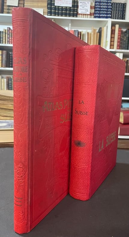
Publications du Dictionnaire Géographique de la Suisse
La Suisse + Atlas pittoresque de La Suisse. Recueil
Neuchâtel Paris, Publications du Dictionnaire Géographique de la Suisse, Attinger Frères, éditeurs 1920 2 volumes : Premier tome : Atlas In-4 cartonnage éditeur Pleine percaline rouge, Premier plat taché. 31,5 cm sur 25. 476 pages. Editions sans planches couleurs Ex-libris manuscrit. Date d’édition estimé 1910. Bon état d’occasion. second Tome : La Suisse : In-4, 29 sur 21 cm, cartonnage éditeur Pleine percaline rouge. Orné d’un fer à froid avec le drapeau Suisse, titre doré. VIII-708 pages+ tableau dépliant. Date d’édition estimé 1920.
Référence libraire : 119495
|
|
|
Published by Editions Atlas
Tsahal l'Armée d'Israël
<p>128 p. Collection Les seigneurs de la guerre sous la direction de Jean Mabire TSAHAL L'ARMEE D'ISRAËL Book in french language. contenu du livre : La guerre de survie-la campagne du Sinaï-la guerre des six jours-la guerre d'usure-la guerre du Kippour-opération paix en Galilée-Israël veille Etat. Nombreuses illustrations in et hors texte photographies d'époque et dessins.</p> Editions Atlas hardcover
Référence libraire : biblio828

|
|
|
Pulsfort, Ernst
Herders neuer Atlas der Religionen.
Darmstadt, Wissenschaftliche Buchgesellschaft, 2010. Durchgehend bebildert. 160 S. 28,5 x 21,5 cm, Pp. Leichte Gebrauchsspuren, sonst gut erhalten.
Référence libraire : 59245

|
|
|
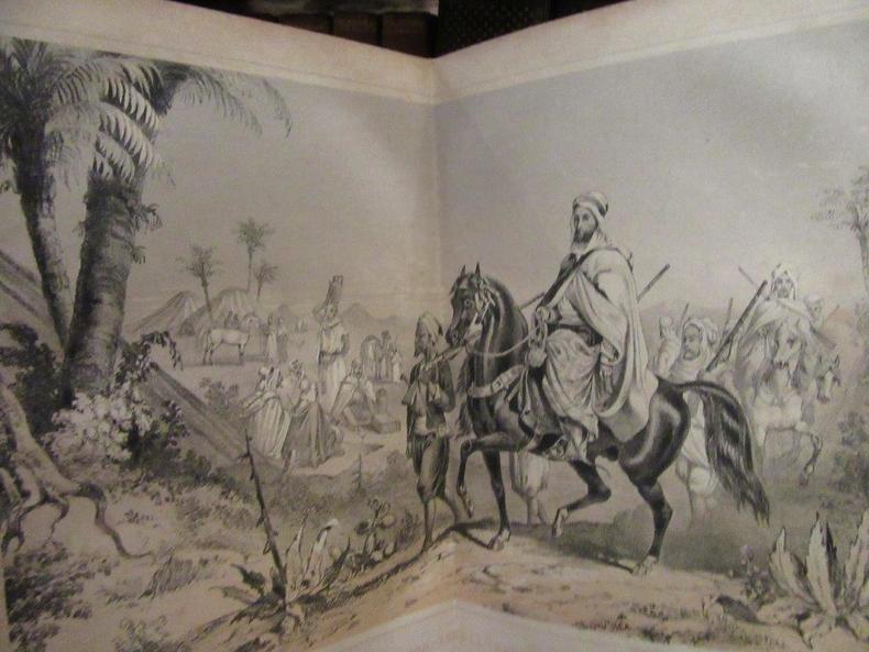
PULSZKY Francis
The Tricolor on The Atlas or, Algeria and the French Conquest
Londres.Nelson and Sons.1854.In-12 relié.402 p.4 double-pages de planches.E.O.En langue anglaise.Belle reliure en veau glacé vert souligné de filets dorés avec au centre du 1er plat,le blason de "Coopers Company School Founded A.D.1538".Tranches peigne.Dos à 5 nerfs orné avec pièce de titre.Ex-libris.Quelques rousseurs.
Référence libraire : 40688
|
|
|
Puppe Georg Hofmann Eduard ritter von . Atlas der gerichtlichen medizin
Atlas und grundriss der gerichtlichen medizin unter benutzung von E. v. Hofmann's Atlas der gerichtlichen medizin 1908 Leather Bound
2019. Leather Bound. New. Leather Binding on Spine and Corners with Golden Leaf Printing on round Spine. Reprinted in 2019 with the help of original edition published long back 1908. This book is printed in black & white sewing binding for longer life Printed on high quality Paper re-sized as per Current standards professionally processed without changing its contents. As these are old books we processed each page manually and make them readable but in some cases some pages which are blur or missing or black spots. If it is multi volume set then it is only single volume if you wish to order a specific or all the volumes you may contact us. We expect that you will understand our compulsion in these books. We found this book important for the readers who want to know more about our old treasure so we brought it back to the shelves. Hope you will like it and give your comments and suggestions. Lang: - ger Pages 437. EXTRA 10 DAYS APART FROM THE NORMAL SHIPPING PERIOD WILL BE REQUIRED FOR LEATHER BOUND BOOKS. FOLIO EDITION IS ALSO AVAILABLE. hardcover
Référence libraire : LB1111006712697
|
|
|
Puppe Georg Hofmann Eduard ritter von. Atlas der gerichtlichen medizin
Atlas und grundriss der gerichtlichen medizin unter benutzung von E. v. Hofmann's Atlas der gerichtlichen medizin Volume 1 1908 Leather Bound
2019. Leather Bound. New. Leather Binding on Spine and Corners with Golden Leaf Printing on round Spine. Reprinted in 2019 with the help of original edition published long back 1908. This book is printed in black & white sewing binding for longer life Printed on high quality Paper re-sized as per Current standards professionally processed without changing its contents. As these are old books we processed each page manually and make them readable but in some cases some pages which are blur or missing or black spots. We expect that you will understand our compulsion in these books. We found this book important for the readers who want to know more about our old treasure so we brought it back to the shelves. Hope you will like it and give your comments and suggestions. Lang: - ger Vol: - Volume 1 Pages 531. EXTRA 10 DAYS APART FROM THE NORMAL SHIPPING PERIOD WILL BE REQUIRED FOR LEATHER BOUND BOOKS. FOLIO EDITION IS ALSO AVAILABLE. Volume 1 hardcover
Référence libraire : LB1111005383821
|
|
|
Puppe Georg Hofmann Eduard ritter von . Atlas der gerichtlichen medizin
Atlas und grundriss der gerichtlichen medizin unter benutzung von E. v. Hofmann's Atlas der gerichtlichen medizin 1908
2020. Paperback. New. Lang: - ger Pages 437. Reprinted in 2020 with the help of original edition published long back 1908. This book is Printed in black & white sewing binding for longer life with Matt laminated multi-Colour Soft Cover HARDCOVER EDITION IS ALSO AVAILABLE Printed on high quality Paper re-sized as per Current standards professionally processed without changing its contents. As these are old books we processed each page manually and make them readable but in some cases some pages which are blur or missing or black spots. If it is multi volume set then it is only single volume if you wish to order a specific or all the volumes you may contact us. We expect that you will understand our compulsion in these books. We found this book important for the readers who want to know more about our old treasure so we brought it back to the shelves. Any type of Customisation is possible with extra charges. Hope you will like it and give your comments and suggestions. paperback
Référence libraire : PB1111006712697
|
|
|
Puppe Georg Hofmann Eduard ritter von . Atlas der gerichtlichen medizin
Atlas und grundriss der gerichtlichen medizin unter benutzung von E. v. Hofmann's Atlas der gerichtlichen medizin 1908 Hardcover
2020. Hardcover. New. Lang: - ger Pages 437. Reprinted in 2020 with the help of original edition published long back 1908. This book is Printed in black & white Hardcover sewing binding for longer life with Matt laminated multi-Colour Dust Cover Printed on high quality Paper re-sized as per Current standards professionally processed without changing its contents. As these are old books we processed each page manually and make them readable but in some cases some pages which are blur or missing or black spots. If it is multi volume set then it is only single volume if you wish to order a specific or all the volumes you may contact us. We expect that you will understand our compulsion in these books. We found this book important for the readers who want to know more about our old treasure so we brought it back to the shelves. Any type of Customisation is possible with extra charges. Hope you will like it and give your comments and suggestions. hardcover
Référence libraire : 1111006712697
|
|
|
Puppe Georg Hofmann Eduard ritter von. Atlas der gerichtlichen medizin
Atlas und grundriss der gerichtlichen medizin unter benutzung von E. v. Hofmann's Atlas der gerichtlichen medizin Volume 1 1908
2020. Paperback. New. Lang: - ger Vol: - Volume 1 Pages 531. Reprinted in 2020 with the help of original edition published long back 1908. This book is Printed in black & white sewing binding for longer life with Matt laminated multi-Colour Soft Cover HARDCOVER EDITION IS ALSO AVAILABLE Printed on high quality Paper re-sized as per Current standards professionally processed without changing its contents. As these are old books we processed each page manually and make them readable but in some cases some pages which are blur or missing or black spots. We expect that you will understand our compulsion in these books. We found this book important for the readers who want to know more about our old treasure so we brought it back to the shelves. Any type of Customisation is possible with extra charges. Hope you will like it and give your comments and suggestions. Volume 1 paperback
Référence libraire : PB1111005383821
|
|
|
Puppe Georg Hofmann Eduard ritter von. Atlas der gerichtlichen medizin
Atlas und grundriss der gerichtlichen medizin unter benutzung von E. v. Hofmann's Atlas der gerichtlichen medizin Volume 1 1908 Hardcover
2020. Hardcover. New. Lang: - ger Vol: - Volume 1 Pages 531. Reprinted in 2020 with the help of original edition published long back 1908. This book is printed in black & white Hardcover sewing binding for longer life with Matt laminated multi-Colour Dust Cover Printed on high quality Paper re-sized as per Current standards professionally processed without changing its contents. As these are old books we processed each page manually and make them readable but in some cases some pages which are blur or missing or black spots. We expect that you will understand our compulsion in these books. We found this book important for the readers who want to know more about our old treasure so we brought it back to the shelves. Any type of Customisation is possible with extra charges. Hope you will like it and give your comments and suggestions. Volume 1 hardcover
Référence libraire : 1111005383821
|
|
|
PUTFIN M S, BELZACQ R, MIOTTO F.
NOUVEL ATLAS GISSEROT.
ISBN : 2877476510. GISSEROT.. 2006. In-8 Carré. Broché. Très bon état. Couv. fraîche. Dos satisfaisant. Intérieur frais. 55 pages. Nombreuses cartes en couleurs dans le texte et hors texte.

|
|
|
PUTFIN M S, BELZACQ R, MIOTTO F.
NOUVEL ATLAS GISSEROT.
GISSEROT.. 2006. In-8. Broché. Très bon état, Couv. fraîche, Dos satisfaisant, Intérieur frais. 55 pages. Nombreuses cartes en couleurs dans le texte et hors texte.. . . . Classification Dewey : 912-Atlas, cartes et plans
Référence libraire : R150183303
|
|
|
Putzger, F. W
F. W. Putzgers Historischer Schul-Atlas zur alten, mittleren und neuen Geschichte in 67 Haupt- und 71 Nebenkarten. Dreiundzwanzigste Auflage
Bielefeld, Verlag von Velhagen & Klasing, 1899. XII + 37 S. 4° Quart, Leinen
Référence libraire : 97865

|
|
|
Putzger, F. W
Historischer Weltatlas. 81. A. (Jubiläumsausgabe). Hauptband.
Bielefeld, Velhagen & Klasing (ca. 1961). 4°. 146 Kartenseiten. Original-Leinenband
Référence libraire : 184648-1 ISBN : 9
|
|
|
Putzger, F. W
Putzgers historischer Schul-Atlas Schulatlas zur alten, mittleren und neuen Geschichte
Bielefeld, Velhagen+Klasing, 1899. PP, Besitzvermerk, 37 Karten, gutes Exemplar
Référence libraire : 11453

|
|
|
Putzger, Friedrich Wilhelm / Bruckmüller, Ernst (Hrsg.)
Putzger - Historischer Weltatlas. Hrsg. von Ernst Bruckmüller und Peter Claus Hartmann. (103. Aufl.). [Lizenzausgabe für Archiv Verlag, Braunschweig].
(Berlin), Cornelsen, (2001). 260 S. Mit mehr als 350 farb. Ktn. 34 cm. Goldgeprägt. schwarzes Halbleder auf 5 imit. Bünden mit Lesebändchen. Im stabilen. leinenbezog. Schuber.
Référence libraire : 91979

|
|
|
Putzger, W
Historischer Weltatlas. 88. Auflage
Bielefeld, Velhagen & Klasing, 1965. 146 S. 4° Quart, Leinen
Référence libraire : 84553

|
|
|
PUTZGERS (F. W).
Historischer Schul Atlas zur alten mittleren und neuen Geschichte.
Bielefeld und Leipzig, Velhagen & Klasing,, 1906, grand in-8, xxvi pp. et 40 cartes en couleurs montées sur onglets, reliure toile moutarde, imprimée, de l’éditeur. (B3)
Référence libraire : 100281
|
|
|
PUTZGERS F.W. et BALDAMUS Alfred (revue par)
HISTORISCHER SCHUL-ATLAS zur Alten,- GroBe Ausgae.
Hardcover in-8°, 165 pages entierement illustrees en couleurs, cartonnage pleine percale de l'editeur - Ouvrage orné de planches in plano montées sur onglets Tres bel exemplaire. [GD8-3] Textes en allemand.
|
|
|
PUTZGERS F.W. et BALDAMUS Alfred (revue par)
HISTORISCHER SCHUL-ATLAS zur Alten,- GroBe Ausgae.
Bielfeld-Leipzig, Editions Velhagen & Klasing, 1928. Hardcover in-8°, 165 pages entierement illustrees en couleurs, cartonnage pleine percale de l'editeur - Ouvrage orné de planches in plano montées sur onglets
Référence libraire : 40633
|
|
|
Putzgers, F. W
Konvolut Historischer Schulatlanten: Historischer Schul-Atlas - Große Ausgabe; Historischer Schulatlas - Von der Altsteinzeit bis zur Gegenwart (v. 1962).
Bielefeld/Leipzig, Verlag von Velhagen & Klasing, 1962 & 1939 & 1926. 4°, 167 S., Bearb. und hg. von Alfred Baldamus, Ernst Schwabe und Ernst Ambrosius (v. 1926, 47. Auflabge); Bearb. und hg. von Max Phlet, Hans Silberborth, M. Iskraut u. R. Ströbel (v. 1939, 57. Auflage);mit zahlreichen farb. Grafiken, Schaubildern, Karten, Bezahlung per PayPal möglich, we accept PayPal, mit zahlreichen s/w Abb., Zeichnungen, Grafiken, Schaubildern, Karten, Leinen
Référence libraire : 31282
|
|
 Recevoir par e-mail
 Télécharger en PDF
 Flux RSS


