|
Van Houten, Cacao [Hrsg.]
Van Houten's kleiner Atlas in losen Blättern Seltene Ausgabe
Amsterdam: Van Houten ca. 1900. 20 farb. ill. Kt., 9cm x 10cm Karten
书商的参考编号 : 6200167
|
|
|
Vannini, Vanio and Pogliani, Giuliano (Editors).
THE COLOR ATLAS OF HUMAN ANATOMY. Translated by Dr. Richard T. Jolly.
107p. Numerous color illustrations. 4to. Original full cloth binding. Original dust jacket. MED 2
|
|
|
VAPEREAU (G.) & RUCHE
Atlas Géographique et Statistique des Départements de la France.
Contenant 90 cartes avec 200 vignettes, et d'après les documents les plus récents, 90 notices ou tableaux de statistique géographique, topographique, administrative, morale, judiciaire, agricole, commerciale, industrielle, etc. Publié par la Ruche Parisienne. Paris, Bureaux et Administration, 1865. In-8 (17x24cm) oblong relié demi chagrin brun passé, plats de papiers marbré. Très peu de rousseurs.
书商的参考编号 : WOC-1375

|
|
|
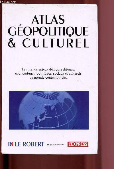
Varrod Pierre
Atlas géopolitique & culturel
Le robert. 2004. In-8. Broché. Bon état, Couv. convenable, Dos satisfaisant, Intérieur frais. 167 pages augmentées de nombreuses cartes et quelques illustrations en couleurs,dans le texte.. . . . Classification Dewey : 912-Atlas, cartes et plans
书商的参考编号 : R200099399
|
|
|
VARROD, Pierre
L'atlas géopolitique et culturel du Petit Robert des noms propres. 80 cartes.
Paris, éd. Dictionnaire Le Robert, 1999, in-8, cartonnage souple, couv. ill. coul. éditeur, 136 pp., papier glacé, très nb. cartes en coul., table des cartes, Tout savoir sur la culture et la géopolitique à travers 80 cartes en couleurs. Pas courant Très bon état
书商的参考编号 : 74740
|
|
|
Various Contributors
The Illustrated London News - February 24, 1962
Features/Photos: John Glenn - Successful Atlas E launching; Gale-Struck Northern England; The Hamburg Floods; East and West Germany; The Queen tours British Railways installations; Theory of Relativity - Rotation; Centrefold - half a million march in tribute to eight people killed after the anti-o.a.s. demonstration February 8; The art of the Situlas; The Loch Ness Monster; Prince Philip's South American Tour; The Icelert - warns drivers of ice danger; and more. Moderate wear. Clean and unmarked. Quality copy. Magazine

|
|
|
Various Phillips William Editor; Atlas James; Dickstein Morris; Glazer Nathan; Kurzweil Edith; Kramer Hilton; Milosz Cze
Partisan Review Vol. LVIII No. 2 1991
Boston MA: Partisan Review Inc. 1991. First Printing. Softcover. Very Fine. This Special Issue number of the venerable American literary journal is sub-titled "The Changing Culture of the University." As explained in the Introduction by Executive Editor & contributor Edith Kurzweil: "It is unusual for Partisan Review to publish an entire issue on one subject but then our conference on "The Changing Culture of the University" was an unusual event.As you will note from the names of our participants and from the topics we tried to include experts from most of the humanist disciplines and attempted to cover many of the issues that preoccupy not only humanities scholars within the university but their students and the general public as well." pg. 185 Many of the most esteemed well-known authors & academicians including James Atlas Morris Dickstein Nathan Glazer Edith Kurzweil Hilton Kramer Czeslaw Milosz William Phillips also Editor of PR Roger Shattuck & others wrestle intellectually with such topics as "The Crisis in Our Culture" "The Impact of the Media" "The Remaking of the Canon" & so forth. With brief notes on contributors contemporary ads etc. Not to be sarcastic but this must be among the high-water marks of American over-intellectual bloviation and the ever-further changes to the "culture of the university" in the nearly three decades since this compendium was first published probably make its contents seem quaint. Nevertheless this is a landmark number in the venerable collectible PR series very desirable for our collectors in the proverbial Ivory Tower. In very fine condition with only very light rubbing to front back covers & spine; very light wear & a few tiny bumps & creases at thin edges & corners of same; several very small areas of surface loss along spine & esp. upper spine-edge. Interior very fine with only tiny bumps at upper corners of a few page leaves; subscription card sheet neatly removed from between pages 306-307 & not present; otherwise substantially mint. <br/><br/> Partisan Review, Inc. paperback
书商的参考编号 : 3271

|
|
|
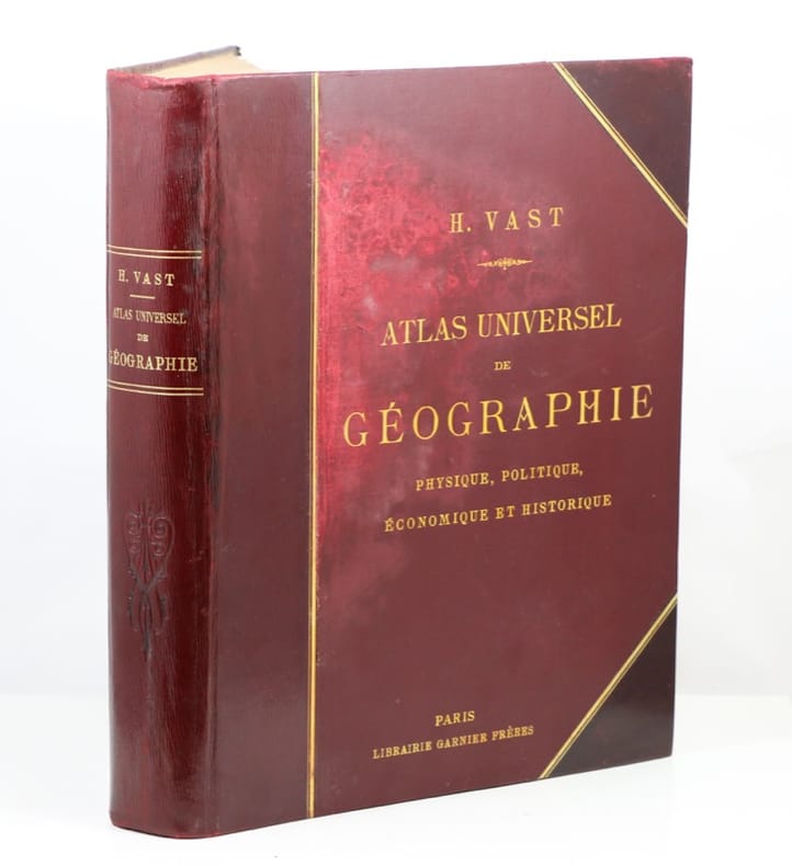
VAST (Henri)
Atlas Universel de Géographie Physique, Politique et Economique.
P., Librairie Garnier Frères, s.d. [1913]. Un fort vol. In-plano, rel. de l'époque demi-cuir à coins bordeaux imitant le maroquin à long grain, filet doré, dos lisse orné d'un fleurons à froids, titre doré, plats de percaline bordeaux, titre doré, [3]ff.-163 cartes en couleurs certaines en doubles pages, le tout monté sur onglet.
书商的参考编号 : 553219
|
|
|
Vat (L.)
Nouvel ATLAS CLASSIQUE physique, politique, historique et commercial divisé en trois parties.
français Sans date (circa 1850). In-4 ; demi-toile verte, titre estampé au centre du premier plat (reliure de l'époque). Troisième partie renfermant 40 cartes coloriées, écrites et muettes, et en regard de chacune d'elles un précis historique et géographique pour servir de mémento aux candidats et une chronologie universelle ou l'on voit d'un seul coup d'oeil les dates et les faits les plus importants de l'histoire.
|
|
|
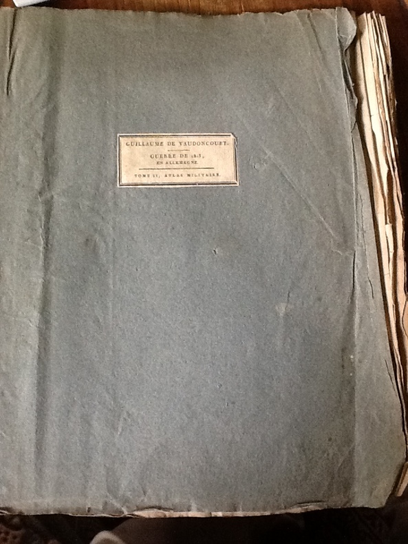
VAUDONCOURT (Frédéric Guillaume de).
Histoire de la Guerre soutenue par les Français en Allemagne en 1813
mb. VAUDONCOURT (Frédéric Guillaume de). Tome 2 uniquement Histoire de la Guerre soutenue par les Français en Allemagne en 1813; avec un atlas militaire. Tome second contenant l'atlas militaire. Paris Barrois l'ainé 1819. in-4 en brochure d'attente (étiquette de titre sur le premier plat). Bien complet des 12 cartes dépl.annoncées. (taches jaunies).
书商的参考编号 : CCC-474
|
|
|
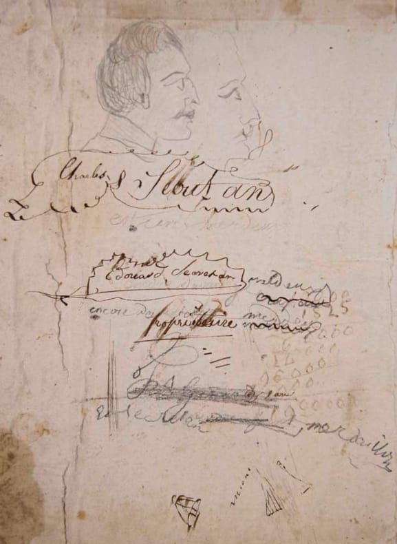
VAUGONDY, Robert de (Géographe):
Nouvel Atlas portatif, Destiné principalement pour l’instruction de la Jeunesse d’après la Géographie Moderne de feu l’Abbé Delacroix. Revue et corrigé et augmenté avec la division de la France en Départemens par le Cit. Lamarche géogr. succ. du cit. Fortin ing. mécanicien pour les Globes et Sphères.
Paris, Chez Lamarche, l’An II. de la République Française, (1794), 47x57 cm, Titre gravé dans un encadrement typogr. avec les puttis tenant la carte du monde + 4 ff. (discours sur l’étude de la géogr. - table des cartes - table alphabétique + double cartes num. de 1 à 52 + une carte 47- 2ème, ens. 53 cartes numérotées au pochoir au recto, cartes montées sur onglets, plusieurs notices et noms ms. à l’int. du premier plat e.a. Charles (et Edouard) Secretan, reliure en d.-veau brun d’époque, fortes traces d’usure. (Atlas à restaurer).
书商的参考编号 : 134562aaf
|
|
|
VAUGONDY Robert de.
Nouvel atlas portatif destiné principalement pour l'instruction de la jeunesse. D'après la géographie moderne de feu l'abbé DELACROIX. Revu, corrigé et augmenté avec la division de la France en départemens.
A Paris, chez le Cen Lamarche, l'an III de la République française 1795. - In-4 plats cartonnés,dos abscent, 10 pages dont le titre gravé et 53 cartes aux limites coloriées, gravées à double page et montées sur onglet. (Quelques salissures, et mouillures claires en marges des premieres cartes.) titre gravé un peu taché,cartes numerotées a la main,en grande marge non rognée;
书商的参考编号 : 19070
|
|
|
Vaughan Williams Composer; Dalia Atlas Conductor; Israel Philharmonic Orchestra Orchestra; Zina Schiff Performer;
Lark Ascending / Charterhouse Suite / Violin Concerto / Tallis Fantasia
Stradivari 1992-11-04. Audio CD. Good. Scratch free disc. Front insert had old price sticker attached. Satisfaction guaranteed! dnr1 Stradivari unknown
书商的参考编号 : 050620004
|
|
|
VAUGONDY, Robert de
[Toscana] ÉTAT DE L'ÉGLISE ET DUCHÉ DE TOSCANE - Par le Sr. Robert Geog.' ord.' du Roi. Engraved map with coloured borders from 'Petit Atlas Vaugondy; T.1, P. 392'.
(Paris), 1748. 1 sheet, formerly folded; ca. 24 x 38 cm (sheet), ca. 17 x 21 cm (engraved map).
书商的参考编号 : 3100614810xbvk
|
|
|
VAUGONDY, Robert de
Dansk - ROYAUME DE DANEMARCK [1748; Kingdom of Denmark / Königreich Dänemark] - Par le Sr. Robert Geog.' ord.' du Roi.
(Paris), Avec Privilège, 1748. Gravure en taille-douce avec des frontières coloriées (copperplate-engraving with coloured borders); ca. 24 x 38 cm (feuille / sheet), ca. 16 x 19 cm (carte géographique / map).
书商的参考编号 : 453058298xbvk
|
|
|
VAUGONDY, Robert de
Great Britain - CARTE DES ISLES BRITANNIQUE [1748; Map of the British Isles / Great Britain - Karte von Grossbritannien] - Par le Sr. Robert Geog.' ord.' du Roi.
(Paris), Avec Privilège, 1748. Gravure en taille-douce avec des frontières coloriées (copperplate-engraving with coloured borders); ca. 24 x 38 cm (feuille / sheet), ca. 16 x 19 cm (carte géographique / map).
书商的参考编号 : 453058296xbvk
|
|
|
VAUGONDY, Robert de
Holland / Nederland - CARTE DES PAYS BAS CATHOLIQUES [1748; Map of the Netherlands / Karte der Niederlande] - Par le Sr. Robert Geog.' ord.' du Roi.
(Paris), Avec Privilège, 1748. Gravure en taille-douce avec des frontières coloriées (copperplate-engraving with coloured borders); ca. 24 x 38 cm (feuille / sheet), ca. 17 x 21 cm (carte géographique / map).
书商的参考编号 : 453058303xbvk
|
|
|
VAUGONDY, Robert de
Nederland / Belgie - CARTE DES PROVINCES-UNIES LES PAYS-BAS [1748, unis; Map of the United Netherlands / Karte der Vereinigten Niederlande] - Par le Sr. Robert Geog.' ord.' du Roi.
(Paris), Avec Privilège, 1748. Gravure en taille-douce avec des frontières coloriées (copperplate-engraving with coloured borders); ca. 24 x 38 cm (feuille / sheet), ca. 17 x 20 cm (carte géographique / map).
书商的参考编号 : 453058302xbvk
|
|
|
VAUGONDY, Robert de
RUSSIE BLANCHE OU MOSCOVIE [1748; White-Russia and Moscow / Weissrussland und Moskau] - Par le Sr. Robert Geog.' ord.' du Roi.
(Paris), Avec Privilège, 1748. Gravure en taille-douce avec des frontières coloriées (copperplate-engraving with coloured borders); ca. 24 x 38 cm (feuille / sheet), ca. 17 x 16 cm (carte géographique / map).
书商的参考编号 : 453058300xbvk
|
|
|
VAUGONDY, Robert de
Schwyz / La Suisse - LES SUISSES / LES ALLIÉS DES SUISSES ET LEURS SUJETS [1748; Switzerland / Schweiz] - Par le Sr. Robert Geog.' ord.' du Roi.
(Paris), Avec Privilège, 1748. Gravure en taille-douce avec des frontières coloriées (copperplate-engraving with coloured borders); ca. 24 x 38 cm (feuille / sheet), ca. 17 x 21 cm (carte géographique / map).
书商的参考编号 : 453058304xbvk
|
|
|
VAUGONDY, Robert de
Sverige / Norge - ROYAUMES DE SUEDES ET DE NORWÈGE [1748; Kingdoms of Sweden and Norway / Königreiche Schweden und Norwegen] - Par le Sr. Robert Geog.' ord.' du Roi.
(Paris), Avec Privilège, 1748. Gravure en taille-douce avec des frontières coloriées (copperplate-engraving with coloured borders); ca. 24 x 38 cm (feuille / sheet), ca. 17 x 21 cm (carte géographique / map).
书商的参考编号 : 453058299xbvk
|
|
|
VAVASSEUR F.
CARTE ROUTIERE DE FRANCE DE DION BOUTON, SPECIALE POUR AUTOMOBILES, 1900
J. Barreau, Paris. 1900. In-4. En feuillets. Etat d'usage, Livré sans Couverture, Dos satisfaisant, Déchirures. Très grande carte en couleur entoilée et dépliable, d'env. 160/130 cm. Illustrée de nombreuses gravures en noir et blanc sur les bords. Déchirures aux pliures, avec partie supérieure détachée.. . . . Classification Dewey : 912-Atlas, cartes et plans
书商的参考编号 : RO40185832
|
|
|
VAVASSEUR / BISCAY
Carte Maritime de la Pointe de la Coubre à la pointe de la Négade
SERVICE HYDROGRAPHIQUE DE LA MARINE. 1915. In-Plano. En feuillets. Etat d'usage, Couv. convenable, Dos satisfaisant, Quelques rousseurs. Carte, noir et blanc, en double-planches de 92/74 cm. Quelques mouillures en marge de la carte.. . . . Classification Dewey : 912-Atlas, cartes et plans
书商的参考编号 : RO20039485
|
|
|
VAVASSEUR F.
CARTE ROUTIERE DE FRANCE DE DION BOUTON, SPECIALE POUR AUTOMOBILES, 1900
J. Barreau, Paris. 1900. In-4 Carré. En feuillets. Etat d'usage. Livré sans Couverture. Dos satisfaisant. Déchirures. Très grande carte en couleur entoilée et dépliable, d'env. 160/130 cm. Illustrée de nombreuses gravures en noir et blanc sur les bords. Déchirures aux pliures, avec partie supérieure détachée. Très rare. Echelle: 800.000e. Cartes de France, de Paris, de l'Algérie et de Corse. En bordures: L'automobile de 1882 à 1900, 13 figures.

|
|
|
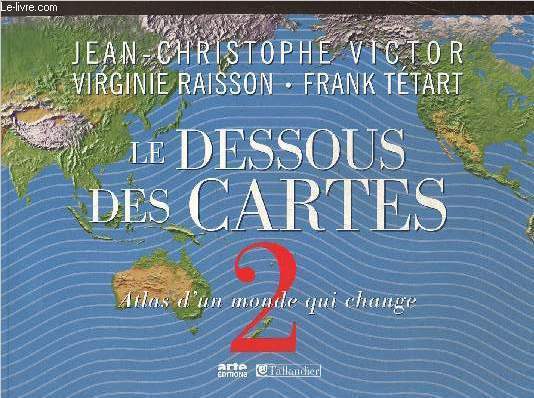
Vctor Jean-Christophe, Raisson V., Tétart F.
Le Dessous des cartes, tome II : Atlas d'un monde qui change
Arte - Tallandier. 2009. In-4. Broché. Bon état, Couv. convenable, Dos satisfaisant, Intérieur frais. 207 pages. Nombreuses cartes en couleurs dans et hors texte.. . . A l'italienne. Classification Dewey : 912-Atlas, cartes et plans
书商的参考编号 : RO80241521
|
|
|
VEB Bibliographisches Institut und dem Verlag Neues Deutschland (Hrsg.)
Auto-Atlas "Neues Deutschland". Maßstab 1 : 500 000.
Leipzig, Bibliographisches Institut/ Verlag Neues Deutschland, 1950. 27 x 16,5 cm. 8 Bl., 27 sechsfarbige Karten und 84 Stadtdurchfahrtsplänen, einer Tafel der Verkehrszeichen und einer Übersichtskarte., 47 (1) Seiten (alphabetisches Namensverzeichnis), 32 Bl. (Werbeanhang: Simson-Motorrad, Wartburg, MZ ES 250, Globo Auto-Pflegemittel, Chemoloid-Lacke, Hunger-Kipper, etc.). Orig.-Halbleinenband., 11143ab|11143ab 2|11143ab 3 [3 Warenabbildungen] Einband etw. angestaubt, Kanten berieben, Vorderdeckel fleckig.
书商的参考编号 : 11146AB

|
|
|
VEDEL, BAUER & DE SAINT-ETIENNE
Livre-Atlas de Géographie. Cours élémentaire
LAROUSSE. Non daté. In-4. Cartonnage d'éditeurs. Etat passable, 1er plat abîmé, Dos satisfaisant, Intérieur acceptable. 32 pages. Nombreuses cartes en couleurs dans le texte et quelques gravures en noir et blanc, dans le texte. Manque un coin sur le 1er plat de couverture.. . . . Classification Dewey : 912-Atlas, cartes et plans
书商的参考编号 : RO80125171
|
|
|
VEDEL- BAUER- DE SAINT ETIENNE
LIVRE ATLAS DE GEOGRAPHIE- COURS MOYEN
LAROUSSE. vers 1915?. In-4. Cartonné. Etat d'usage, Coins frottés, Dos satisfaisant, Intérieur frais. 56 pages- nombreuses illustrations en noir et blanc et en couleurs dans et hors texte- texte sur 2 colonnes. . . . Classification Dewey : 912-Atlas, cartes et plans
书商的参考编号 : R200057281
|
|
|
VEDEL, BAUER & DE SAINT-ETIENNE
LIVRE-ATLAS DE GEOGRAPHIE - COURS MOYEN (PREPARANombreuses illustrations en couleurs et en noir et blanc dans et hors texte.TION AU CERTIFICAT D'ETUDES) / TABLEAUX GRAPHIQUES, 33 GRAVURES ET 41 CARTES.
LIBRARIE LAROUSSE. NON DATE. In-4. Cartonné. Etat d'usage, Plats abîmés, Dos abîmé, Rousseurs. 56 pages. Nombreuses illustrations en couleurs et en noir et blanc dans et hors texte. Texte sur 2 colonnes.. . . . Classification Dewey : 912-Atlas, cartes et plans
书商的参考编号 : ROD0112869
|
|
|
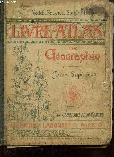
Vedeli, Bauer
Livre-Atlas de Géographie - Cours Supérieur
Librairie Larousse. Non daté. In-4. Cartonné. Etat passable, Plats abîmés, Dos abîmé, Papier jauni. 112 pages. 100 cartes en couleurs dans et hors texte.. . . . Classification Dewey : 912-Atlas, cartes et plans
书商的参考编号 : RO80251159
|
|
|
Vehrenberg, Hans; Blank, Dieter
Handbuch der Sternbilder.
Düsseldorf, Treugesell-Verlag, 1973. 4° quer, 197 S., mit zahlreichen Karten, mit Griffregister, Bezahlung per PayPal möglich, we accept PayPal, Name a. Titel, Griffregister mit Gebr.sp., sonst gutes Ex., Kunststoff
书商的参考编号 : 26416
|
|
|
Velhagen & Klasings - Grosser Volksatlas
Das Jubiläumswerk des Verlages zu seinem hundertjährigen Bestehen .
Bielefeld und Leipzig, Velhagen & Klasing, 1936.
书商的参考编号 : 191737

|
|
|
VENNETIER PIERRE
EAU ET AMENAGEMENT DANS LES REGIONS INTER-TROPICALES - TOME I
CENTRES D ETUDES GEOGRAPHIQUE TROPICAL. 1990. In-8. Broché. Bon état, Couv. convenable, Dos satisfaisant, Intérieur frais. 365 pages augmentées de nombreuses illustrations en noir et blanc hors texte.. . . . Classification Dewey : 912-Atlas, cartes et plans
书商的参考编号 : R260183118 ???????? : 290662117
|
|
|
VENETA KOTSEVA.
Studies on history of geodesy and cartography in Bulgaria. Translated into English Meglena Bazhdarova.
Fine English Paperback. Roy. 8vo (24 x 17 cm). In English. 304 p., ills. Studies on history of geodesy and cartography in Bulgaria. Translated into English Meglena Bazhdarova.
|
|
|
VERMAST A.
Album-manuel d'histoire de Belgique à l'usage de l'Enseignement Moyen.
Gand (Belgique), Maison d'Editions Vandepoorten, 1924 19 x 25, 110 pp., 29 planches, cartes en couleurs, cartonnage d'édition, bon état (couverture légèrement défaîchie).
书商的参考编号 : 17683
|
|
|
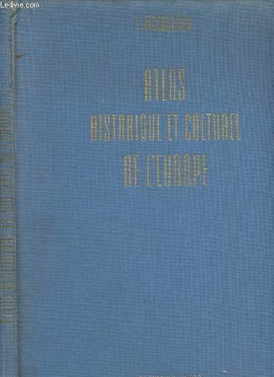
Vercauteren F.
Atlas historique et culturel de l'Europe
Elsevier/Meddens. 1962. In-Folio. Relié toilé. Etat d'usage, Couv. légèrement passée, Coiffe en tête abîmée, Intérieur frais. 245 pages - nombreuses photos en noir et blanc et cartes en couleurs hors texte. Cartes en noir et blanc sur les contreplats. Coins frottés. 2e plat légèrement taché. Mors fendus en coiffe de tête. Ex dono à l'encre au verso de la page de garde.. . . . Classification Dewey : 912-Atlas, cartes et plans
书商的参考编号 : R300287614
|
|
|
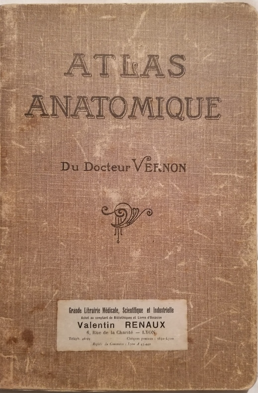
VERNON (Docteur)
Atlas Anatomique, du Docteur Vernon.
Ouvrage orné de 5 planches anatomiques en couleurs de volets mobiles révélant l'intérieur des différentes parties du corps, avec légendes en regard:Homme–Femme–Tête–Coeur–Larynx, Pharynx, Langue et Voile du Palais–Oreille–Nez et Bouche. Lyon, Grande Librairie Médicale, Scientifique et Industrielle–Valentin Renaux, sans date (vers 1890). Grand in-8 (25x17cm) de cartonnage souple beige imprimée et avec quelques usures de temps. Bon état intérieur et complet de toutes les planches.
书商的参考编号 : WOC-808
|
|
|
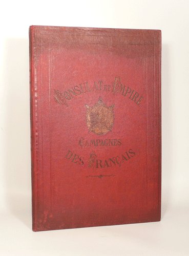
VERNET (Carle).
CAMPAGNES DES FRANCAIS SOUS LE CONSULAT ET L'EMPIRE. Album de 52 batailles et 100 portraits des maréchaux, généraux et personnages les plus illustres de l'époque et le portrait de napoléon accompagné d'un fac-similé de sa signature.
1850 Paris, Administration des Journaux Réunis, sans date [vers 1850]. In-folio (324 X 484) toile chagrinée vieux rouge, sur les plats encadrement de filets à froid avec armes impériales et titre dorés, dos lisse orné de caissons avec titre doré, tranches dorées (Ch. MAGNIER REL.) ; (2) ff. blancs, frontispice, titre imprimé en rouge et noir, table des planches, 57 planches sous serpente, (1) f. blanc. Cartonnage en partie ombré avec les ors ternis, léger cerne de mouillure claire dans la marge inférieure de l'ensemble des planches, plus marqué aux premiers et derniers feuillets, à peine visible dans le reste de l'ouvrage.
书商的参考编号 : 003312
|
|
|
VERNET CATHERINE- LONTCHO FREDERIC
CARTES ANCIENNES DE FRANCE & DU MONDE- REPRODUCTIONS DE CARTES CONTENUES DANS L ATLAS GENERAL METHODIQUE ET ELEMENTAIRE POUR L ETUDE DE LA GEOGRAPHIE ET DE L HISTOIRE MODERNE EDITE CHEZ DESNOS EN 1778
ERRANCE. 1980. In-4. Broché. Bon état, Couv. convenable, Dos satisfaisant, Intérieur frais. 60 pages environ augmentées de quelques illustrations en noir et blanc dans le texte+ de nombreuses cartes en noir et blanc hors texte. . . A l'italienne. Classification Dewey : 912-Atlas, cartes et plans
书商的参考编号 : RO30124078
|
|
|
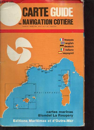
Vergnot Claude
Cartes guides Navigatin cotière n°545-546 et 547- échelle de 1/50000e
Cartographiques maritimes. Non daté. In-Plano. Broché. Bon état, Couv. convenable, Dos satisfaisant, Intérieur frais. 3 cartes dépliantes. en couleurs, avec légende. Texte en Français, Anglais, Allemand, Italien et Espagnol.. . . . Classification Dewey : 912-Atlas, cartes et plans
书商的参考编号 : RO30320251
|
|
|
Vergnot Claude
Carte guide de navigation côtière n°543.
Editions Maritimes et d'Outre-Mer. 1969. In-Plano. En feuillets. Etat d'usage, Coins frottés, Dos satisfaisant, Intérieur acceptable. Une grande carte en couleurs dépliante.. . . . Classification Dewey : 912-Atlas, cartes et plans
书商的参考编号 : R320145662
|
|
|
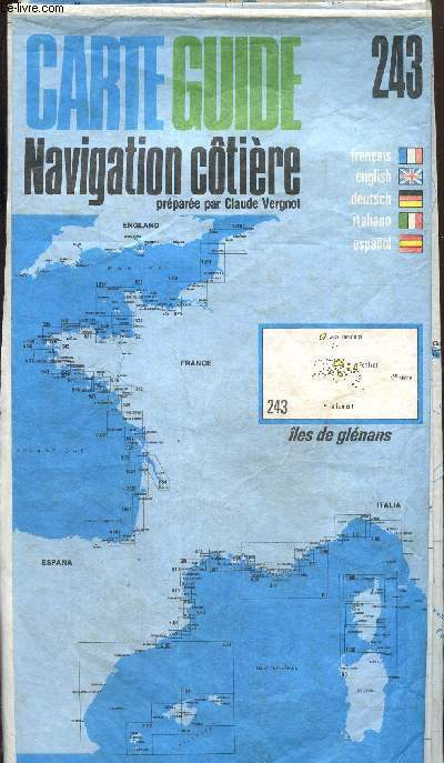
Vergnot Claude
Carte Guide Navigation Côtière, n°243 : Îles de Glénans
Editions Cartographiques Maritimes. 1976. In-Plano. Broché. Etat d'usage, Couv. légèrement pliée, Dos satisfaisant, Intérieur acceptable. Carte dépliante en couleurs, environ 60x100 cm. Echelle 1/50000e. Carte résistante à l'eau.. . . . Classification Dewey : 912-Atlas, cartes et plans
书商的参考编号 : RO80241096
|
|
|
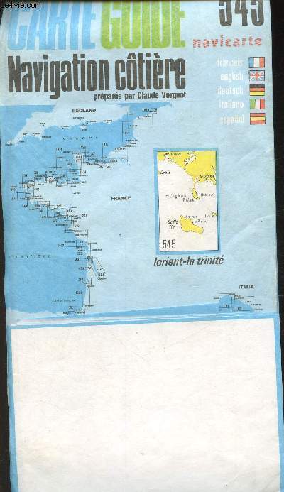
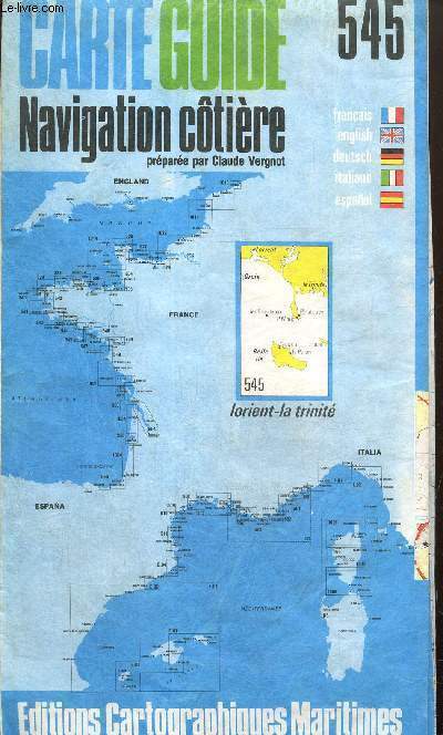
Vergnot Claude
Carte Guide Navigation Côtière, n°545 : Lorient - La Trinité
Editions Cartographiques Maritimes. 1976. In-Plano. Broché. Etat d'usage, Couv. légèrement passée, Dos satisfaisant, Intérieur acceptable. Carte dépliante en couleurs, environ 102x70 cm. Echelle 1/50000e. Carte résistante à l'eau.. . . . Classification Dewey : 912-Atlas, cartes et plans
书商的参考编号 : RO80241091
|
|
|
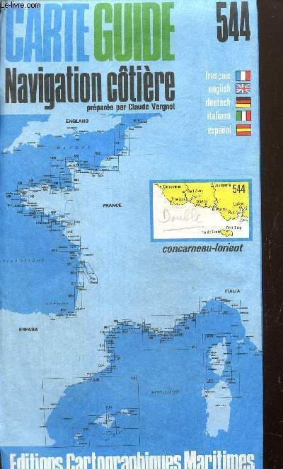
Vergnot Claude
Carte Guide Navigation Côtière, n°544 : Concarneau - Lorient
Editions Cartographiques Maritimes. 1976. In-8. Broché. Etat d'usage, Couv. défraîchie, Dos satisfaisant, Intérieur acceptable. Carte dépliante en couleurs, environ 102x70 cm. Echelle 1/50000e. Carte résistante à l'eau. Annotation au crayon sur la couverture.. . . . Classification Dewey : 912-Atlas, cartes et plans
书商的参考编号 : RO80241092
|
|
|
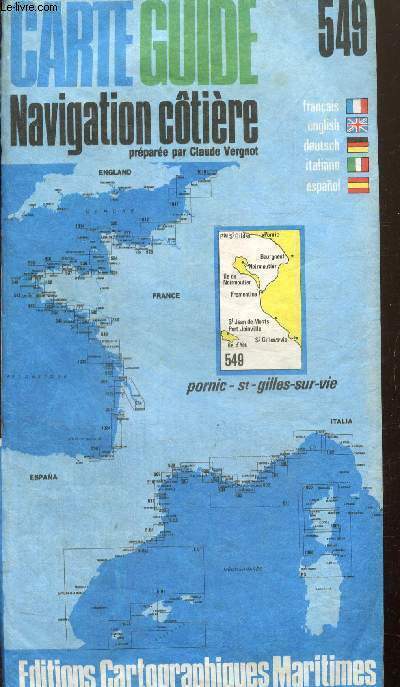
Vergnot Claude
Carte Guide Navigation Côtière, n°549 : Pornic - St-Gilles-sur-Vie
Editions Cartographiques Maritimes. 1976. In-8. Broché. Etat d'usage, Couv. convenable, Dos satisfaisant, Intérieur frais. Carte dépliante en couleurs, environ 102x70 cm. Echelle 1/50000e. Carte résistante à l'eau.. . . . Classification Dewey : 912-Atlas, cartes et plans
书商的参考编号 : RO80241093
|
|
|
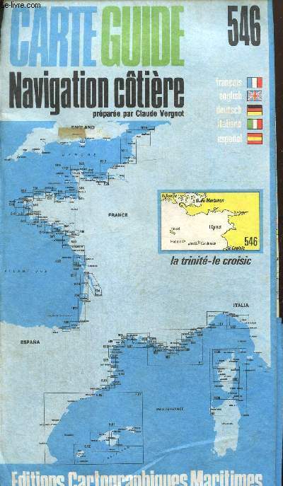
Vergnot Claude
Carte Guide Navigation Côtière, n°546 : La Trinité - Le Croisic
Editions Cartographiques Maritimes. 1976. In-Plano. Broché. Etat d'usage, Couv. défraîchie, Dos satisfaisant, Intérieur acceptable. Carte dépliante en couleurs, environ 102x70 cm. Echelle 1/50000e. Carte résistante à l'eau.. . . . Classification Dewey : 912-Atlas, cartes et plans
书商的参考编号 : RO80241095
|
|
|
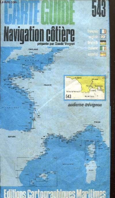
Vergnot Claude
Carte Guide Navigation Côtière, n°543 : Audierne - Trévignon
Editions Cartographiques Maritimes. 1976. In-Plano. Broché. Etat d'usage, Couv. défraîchie, Dos satisfaisant, Intérieur acceptable. Carte dépliante en couleurs, environ 102x70 cm. Echelle 1/50000e. Carte résistante à l'eau.. . . . Classification Dewey : 912-Atlas, cartes et plans
书商的参考编号 : RO80241097
|
|
|
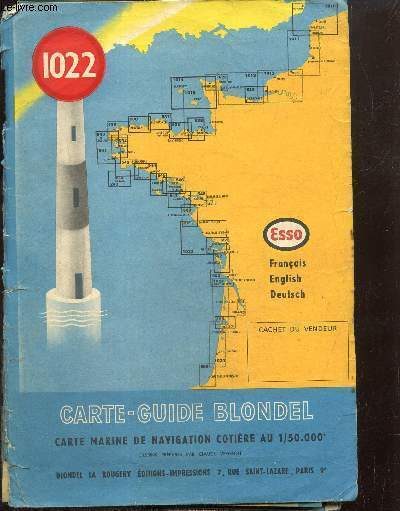
Vergnot Claude
Carte-Guide Blondel, n°1022 : Ile d'Yeu, La Rochelle, Les Sables d'Olonnes
Blondel - La Rougerie. 1965. In-Plano. Broché. Etat passable, Couv. convenable, Dos abîmé, Papier jauni. Carte dépliante en couleurs. Echelle 1/50000. Environ 75x102 cm.. . . . Classification Dewey : 912-Atlas, cartes et plans
书商的参考编号 : RO80241224
|
|
|
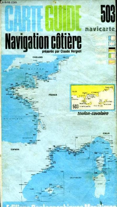
Vergnot Claude (préparée par)
Carte guide Navigation côtière N°503 Toulon-Cavalaire
Editions cartographiques maritimes. non daté. In-Plano. Broché. Bon état, Couv. convenable, Dos satisfaisant, Intérieur frais. 1 carte de navigation maritime en couleurs, dépliante, 65x120 cm environ.. . . . Classification Dewey : 912-Atlas, cartes et plans
书商的参考编号 : RO40052571
|
|
|
VERCAUTEREN F.,
Cultuurhistorische atlas van Europa
, Brussel, Meddens 1962, 246pp.met 474 zw/w.ills. & 5 kleurenills. & 28 kaarten (waarvan 13 buitentekst in kleur), linnen band
书商的参考编号 : G22013
|
|
 ?????????
 ?????PDF???
 RSS feed


