|
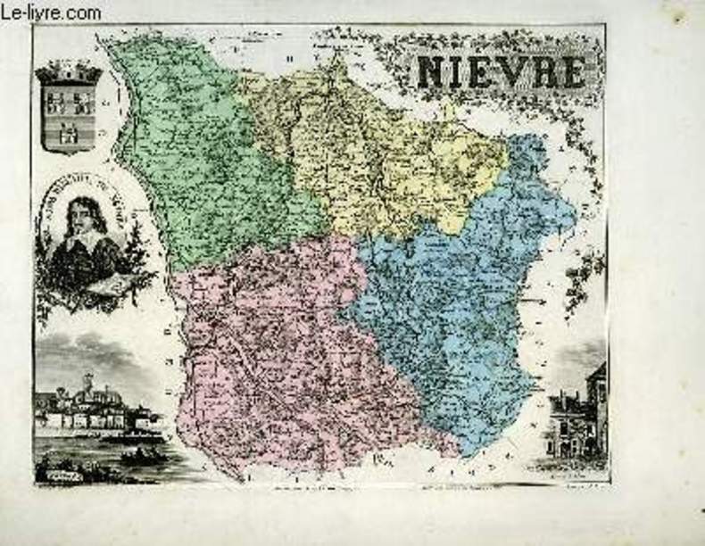
VUILLEMIN A., gravé par VILLEREY - ISIDORE
1 carte gravée en couleurs de la Nièvre - N°57
IMP. MIGEON. XIXe siècle. In-4. En feuillets. Bon état, Livré sans Couverture, Dos satisfaisant, Intérieur acceptable. Une planche ( de 34.5 x 26.5 cm) illustrée d'une carte en couleurs et de quelques gravures en noir et blanc.. . . A l'italienne. Classification Dewey : 912-Atlas, cartes et plans
书商的参考编号 : RO80091089
|
|
|
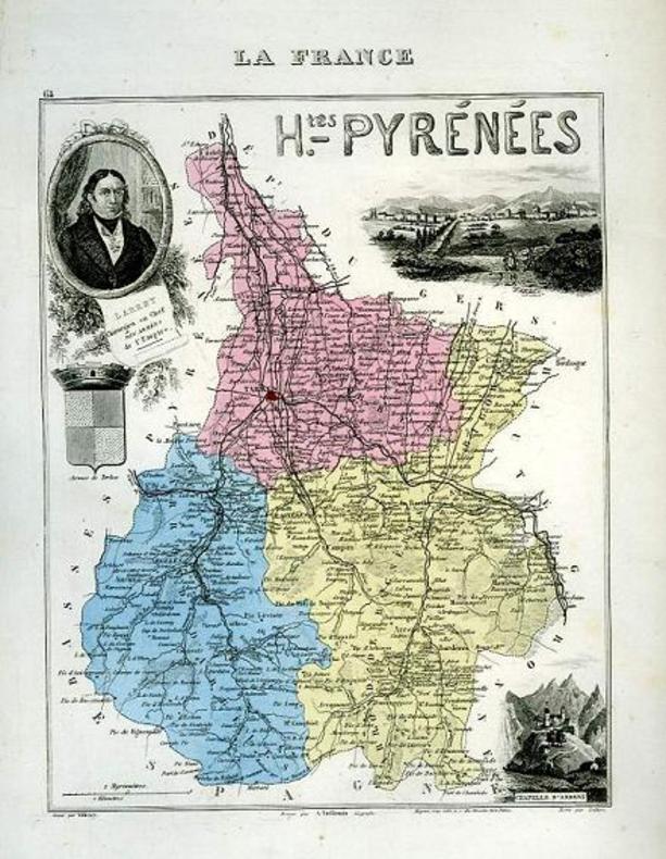
VUILLEMIN A., gravé par VILLEREY - ISIDORE
1 carte gravée en couleurs des Hautes-Pyrénées - N°64
IMP. MIGEON. XIXe siècle. In-4. En feuillets. Bon état, Livré sans Couverture, Dos satisfaisant, Intérieur acceptable. Une planche ( de 34.5 x 26.5 cm) illustrée d'une carte en couleurs et de quelques gravures en noir et blanc.. . . . Classification Dewey : 912-Atlas, cartes et plans
书商的参考编号 : RO80091092
|
|
|
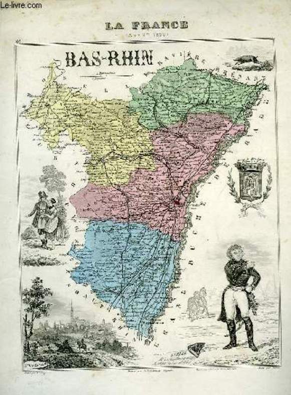
VUILLEMIN A., gravé par VILLEREY - ISIDORE
1 carte gravée en couleurs du Bas-Rhin - N°66. (La France avant 1870)
IMP. MIGEON. XIXe siècle. In-4. En feuillets. Etat d'usage, Livré sans Couverture, Dos satisfaisant, Intérieur acceptable. Une planche ( 34.5x 26.5 cm) illustrée d'une carte en couleurs et de quelques gravures en noir et blanc. Quelques accrocs et petites déchirures en marges, n'atteignant pas les gravures.. . . . Classification Dewey : 912-Atlas, cartes et plans
书商的参考编号 : RO80091040
|
|
|
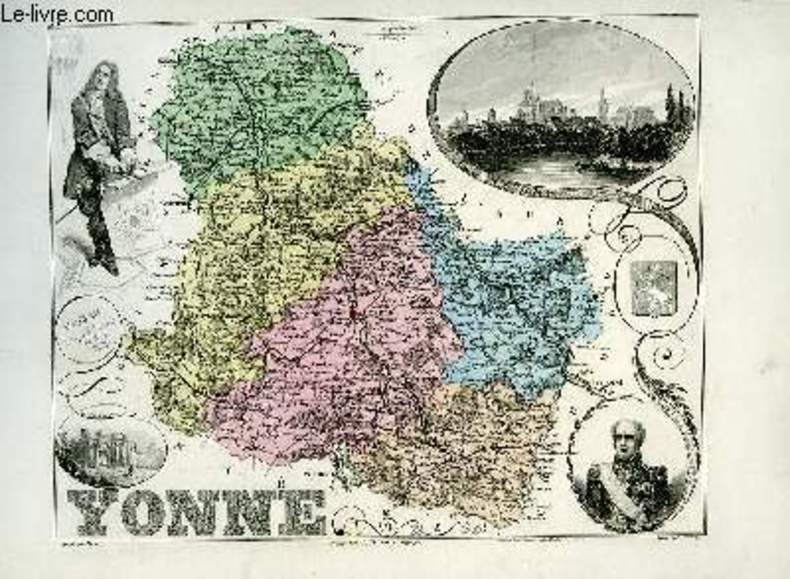
VUILLEMIN A., gravé parALES - ISIDORE
1 carte gravée en couleurs de l'Yonne - N°86.
IMP. MIGEON. XIXe siècle. In-4. En feuillets. Bon état, Livré sans Couverture, Dos satisfaisant, Intérieur acceptable. Une planche (34.5 x 26.5 cm) illustrée d'une carte en couleurs et de quelques gravures en noir et blanc.. . . A l'italienne. Classification Dewey : 912-Atlas, cartes et plans
书商的参考编号 : RO80091043
|
|
|
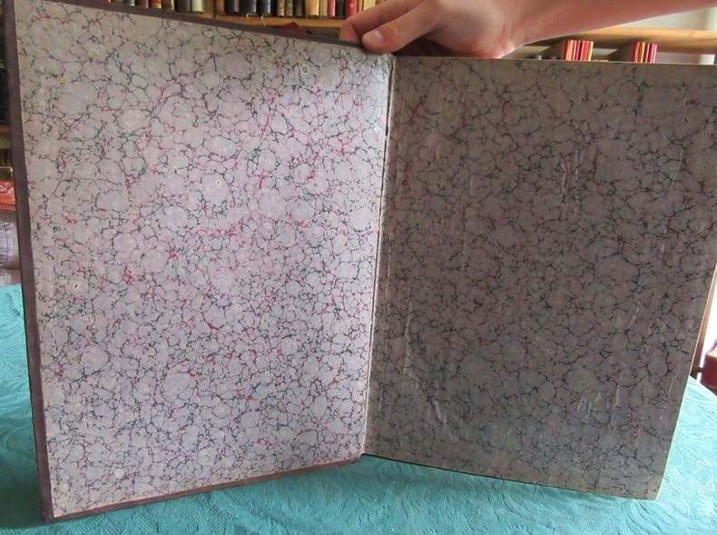
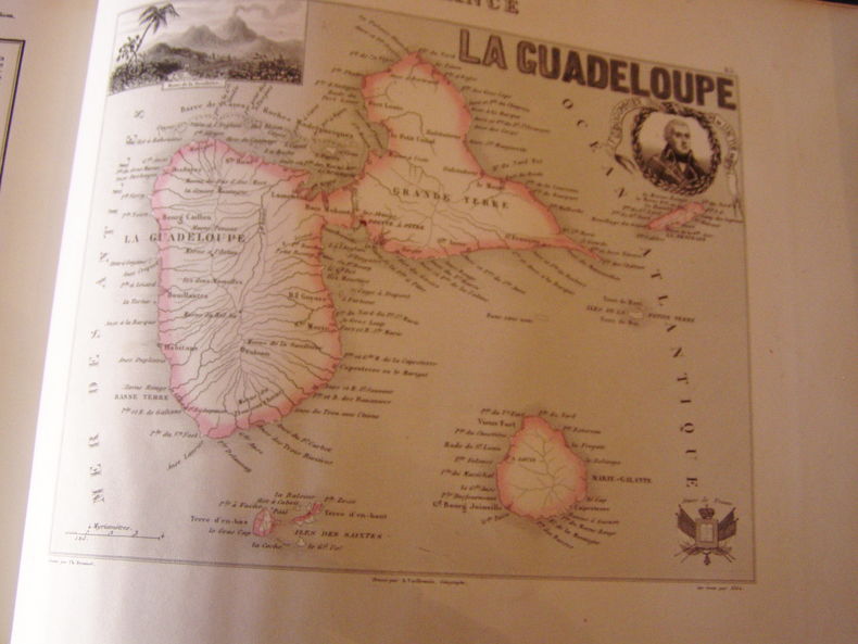
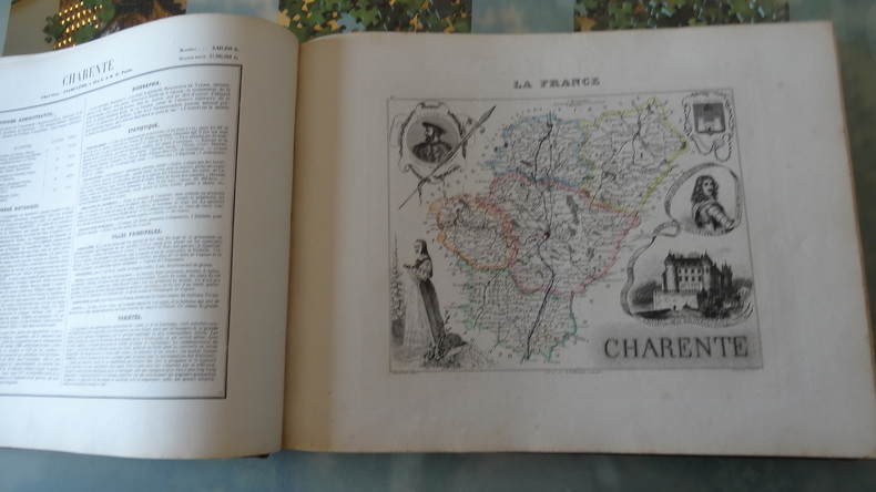
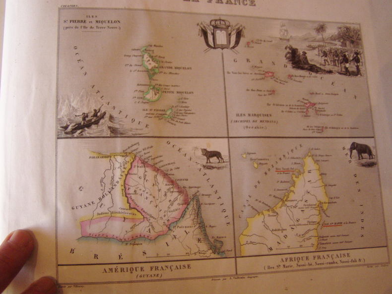
VUILLEMIN et POIREE Ernest
La France et ses Colonies. Atlas de 107 cartes.
Atlas illustré de cent-cinq cartes en couleurs dressées d'après les cartes de Cassini, du dépôt de la guerre, des ponts et chaussées et de la marine par M. Vuillemin.Texte rédigé d'après les documents officiels et sur un plan entièrement nouveau réunissant en forme de tableaux :1/ la division administrative, politique, judiciaire, religieuse, militaire.2/ les vicissitudes historiques.3/la biographie.4/ la statistique.5/ les ressources agricoles, industrielles, commerciales.6/les établissements d'instruction ou d'utilité publique.7/ la description détaillée de tous les chefs-lieux d'arrondissement et des lieux remarquables.8/ enfin les curiosités et la physionomie morale,de chaque département et de chaque colonie française par Ernest Poirée.Paris, J. Migeon - Edition de 1872. ( 96 cartes des départements dont 2 sur Paris, 10 cartes des colonies et 1 carte de la France), soit 107 cartes au total.Reliure demi-chagrin brun de l’époque. Dos à nerfs avec titre et auteur. Pas de rousseur. Très bon état. Format in-4° (36x27).
书商的参考编号 : 19681
|
|
|
VUILLEMIN M .
LA FRANCE ET SES COLONIES .ATLAS MIGEON . ATLAS ILLUSTRE de 100 CARTES , dressées d ' après les cartes de Cassini , du Dépot de la guerre , des Ponts-et-chaussées et de la Marine , par M . Vuillemin. TEXTE rédigé d ' après les documents officiels et sur un plan entièrement nouveau , réunissant en forme de tableaux : 1/ la division administrative , politique , judiciaire , religieuse , militaire , etc.. 2/ les vicisitudes historiques . 3/ la Biographie. 4/ la Statistique . 5/ les Ressources agricoles , industrielles , commerciales . 6/ les Etablissements d ' instruction ou d ' utilité publique . 7/ la Description détaillée de tous les chefs-lieux d ' arrondissement et des lieux remarquables . 8/ enfin les curiosités et la Physonomie morale. de chaque département et de chaque colonie française . par E . POIREE.
1850 édité à Paris , chez Migeon . 1850 . 1 VOLUME in 4 oblong . à l ' italienne ( 270 x 340 mm ) basane verte époque . dos à faux nerfs ornés . Titres dorés. BIEN COMPLET DE LA GRANDE CARTE DEPLIANTE DE LA FRANCE .
书商的参考编号 : 19981
|
|
|
VUILLEMIN M.
LA FRANCE ET SES COLONIES - ATLAS ILLUSTRÉ - 100 CARTES
La France et ses colonies, Atlas Illustré, cent cartes dressées d'après les cartes de Cassini, du dépôt de la guerre, des Ponts-et-Chaussées et de la Marine par M. Vuillemin. Texte rédigé d'après les documents officiels et sur un plan entièrement nouveau par Ernest Poirée. Migeon, éditeur à Vanves et Bertin, éditeur à Paris, sans date. 1 volume de format 28 x 37 cm, à l'italienne, reliure éditeur demi chagrin, plats percaline, reliure bien solide, cartes en bel état, sans rousseurs, 2 cartes dépliantes in fine. Frais de port en supplément.
书商的参考编号 : 230573
|
|
|
VUILLEMIN, ALEXANDRE et Ernest Poirée.
La France et ses colonies. Atlas illustré de cent cartes dressées d'après les cartes de Cassini, du Dépot de la guerre, des Ponts-et-chaussées et de la Marine Texte redigé d'après les documents officiels et sur un plan entièrement nouveau réunissant en forme de tableaux 1°, la division administrative, politique, judiciaire, religieuse, militaire, etc. ; 2°, les vicissitudes historiques ; 3°, la biographie ; 4°, la statistique ; 5°, les ressources agricoles, industrielles, commerciales ; 6°, les établissements d'instruction ou d'utilité publique ; 7°, la description détaillée de tous les chefs-lieux d'arrondissement et des lieux remarquables ; 8° Enfin les curiosités et la physionomie morale de chaque département et de chaque colonie française,par Ernest Poirée,edition originale.
1850 Migeon, Paris 1850,2e titre gravé daté 1848 :"La France, nouvel atlas illustré des départements et des colonies" - In-4 oblong, demi-basane verte, plats percaline verte usée , dos lisse, filets et dentelles dorés, 96 ff. n. ch. & 100 cartes dont 97 ht, en couleurs en regard,gravées sur papier fin, une grande repliée in-fine. Dos et coupes lég. frottés,2 coins accidentés.. Intérieur bon exemplaire quelques rousseurs. Division administrative, politique, judiciaire, religieuse, militaire, etc. ; les vicissitudes historiques ; biographie ; statistique ; ressources agricoles, industrielles, commerciales ; établissements d'instruction ou d'utilité publique ; description détaillée de tous les chefs-lieux d'arrondissement et des lieux remarquables ; enfin les curiosités et la physionomie morale de chaque département et de chaque colonie française.Le decor des planches sera modifié dans les innombrables editions posterieures.Oblong folio, pp. [4], engraved title-p., plus 97 hand-colored maps (including 1 large folding one of France), each with a descriptive leaf of text.
书商的参考编号 : 21788
|
|
|
VUILLEMIN, et DYONNET
Carte de France. Aveyron. N°11
IMP. MIGEON. XIXe siècle. In-4. En feuillets. Bon état, Couv. convenable, Dos satisfaisant, Intérieur frais. Une planche de 35 x 26.5 cm, illustrée d'une carte gravée en couleurs.. . . . Classification Dewey : 912-Atlas, cartes et plans
书商的参考编号 : RO80087895
|
|
|
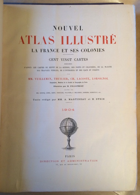
VUILLEMIN, THUILIER Ch LACOSTE LORSIGNOL
Nouvel atlas illustré.
La France et ses colonies.Cent vingt et une cartes montées sur onglets,dressées d’après les cartes du dépôt de la guerre,des Ponts et Chaussées,de la Marine, des travaux publics, de l’Intérieur et des eaux et forêts par VUILLEMIN etc.illustrées par M.FILATREAU gravées par MM Lecocq, Lebel, Bizet,Fontaine, Waltner,Delannoy Barbier etc.texte rédigé par MM A.Martineau et H.Stein in folio reliure éditeur demi-chagrin rouge à nerfs,titre,fers,caissons dorés.titre doré sur le premier plat encadré de filets dorés et de filets à froid.Charnière intérieure toile rouge, texte sur 2 colonnes.Premier plat légèrement insolé. Bon état d’ensemble coloris frais.Cartes très décoratives
书商的参考编号 : 6147
|
|
|
Vuillemin, Thuilier, Ch. Lacoste, Lorsignol
Nouvel Atlas illustré : La France et ses colonies
Direction et administration Relié 1896 In-4 (31 x 40,5 cm), reliure demi chagrin, dos à cinq nerfs, non paginé, complet des cent huit cartes dressées d'après les cartes du dépot de la guerre, des ponts et chaussées, de la marine des travaux publics, de l'intérieur et des eaux et forêts ; épidermures et manques de toile aux plats et coupes, rousseurs aux tranches, par ailleurs intérieur bien conservé, état moyen. Livraison a domicile (La Poste) ou en Mondial Relay sur simple demande.
书商的参考编号 : wx453
|
|
|
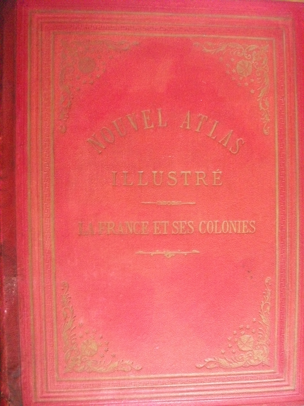
VUILLEMIN, THUILLIER, CH. LACOSTE, LORSIGNOL.
NOUVEL ATLAS ILLUSTRE. LA FRANCE ET SES COLONIES. CENT VINGT CARTES DRESSEES D'APRES LES CARTES DU DEPOT DE LA GUERRE, DES PONTS ET CHAUSSEES, DE LA MARINE, DES TRAVAUX PUBLICS, DE L'INTERIEUR ET DES EAUX ET FORETS, PAR MM. VUILLEMIN, THUILLIER, CH. LACOSTE, LORSIGNOL, GEOGRAPHES, MEMBRES DE LA SOCIETE DE GEOGRAPHIE DE PARIS. ILLUSTREES PAR M. FILLATREAU, GRAVEES PAR MM. LECOCQ, LEBEL, BIZET, FONTAINE, WALTER, F. DELANNOY, BARBIER, RABOUILLE, ETC. TEXTE REDIGE PAR MM. A. MARTINEAU ET H. STEIN.
PARIS. DIRECTION ET ADMINISTRATION. 1904. GRAND IN-4 (30 X 40, 5 CENTIMETRES ENVIRON), RELIURE DE L'EDITEUR 1/2 CHAGRIN ROUGE, DOS ORNE D'UN DECOR DORE, TITRE DORE. LES CARTES HISTORIEES ET COLORIEES, SONT ACCOMPAGNEES CHACUNE D'UN FEUILLET DE TEXTE EXPLICATIF. AVEC 2 GRANDES CARTES REPLIEES EN FIN DE VOLUME. INTERESSANTES CARTES DE L'ENSEMBLE DE NOS COLONIES DE L'EPOQUE, DONT CARTES DOUBLES DES PROVINCES D'ALGER, DE CONSTANTINE ET D'ORAN, AINSI QUE DE TUNISIE. DEFAUTS DE RELIURE, DEBOITE, UN FEUILLET DE TEXTE CONSOLIDE AU PAPIER AUTOCOLLANT TRANSPARENT, PETITES DECHIRURES SANS MANQUE SUR LES 2 GRANDES CARTES REPLIEES, SINON ENSEMBLE DE CARTES TRES FRAIS.
书商的参考编号 : 188
|
|
|
VUILLEMIN.
Atlas universel de géographie ancienne et moderne à l'usage des pensionnats.
Paris, J. langlumé, 1852. In-4 format à l'italienne (25 x 32 cm) demi basane havane, titre à l'or au dos, plats de papier marbré avec étiquette de titre sur le premier. (Reliure postérieure).
书商的参考编号 : 23368
|
|
|
Vuillemin:
Atlas universel de géographie ancienne et moderne à l'usage des pensionnats par Vuillemin, élève de Dufour. Nouvelle édition, revue et corrigée avec soin.
Paris, J. Langlumé, ca. 1850-60, in-4to oblong, 2 ff. (titre + table avec rousseurs, usées, faux plies) + 50 cartes num. de 1 à 50, gravées en couleurs, (cartes en bon état), ex libris manuscrit ‘ Pauline Fliemann, Osterberg 1870, cartonnage orig., dos toilé, plats marbrés, la reliure est très usé, plats détachés (à relier)
书商的参考编号 : 68781aaf
|
|
|
Vuitton Louis; Jacobs Marc; Atlas Mert; Piggott Marcus
Visionaire 52: Private 2007 LIMITED EDITION IN GOLD CASE - FINE COPY
Visionaire 2007. First Edition First Printing. Hardcover. Fine. Visionaire 2007. Golden plastic Louis Vuiton case with leather title vignet designed by Marc Jacobs. Black cloth book with gilt lettering. First Edition First Printing. Limited Edition of 2500 individually hand-numbered copies this being #186. Featuring color and black & white photographic plates throughout by photographers Mert Alas & Marcus Piggott capturing fleeting intimate moments with celebrities and supermodels like Lindsay Lohan Gisele B�ndchen Marc Jacobs Drew Barrymore Naomi Campbell and Chlo� Sevigny. Guest editor was Marc Jabobs and this edition was sponsored by Louis Vuitton. CONDITION: Book is Fine/As new; Gold case is Near Fine showing light rubbing and wear to case edges and a few small scratches to leather vignetTe title and offsetting from black ribbon to inside panel of case. Nice copy of a scarce and collectible item. Guest Art Director Marc Jacobs teamed up with photographers Mert Alas and Marcus Piggott on the newest installment of the coveted fashion quarterly Visionaire which comes housed this time in a limited-edition Louis Vuitton case designed by Jacobs. Altas and Piggott photographed a series of intimate portraits of today's most inspiring contemporary icons traveling to New York London and Paris in search of their personal muses. Subjects include actors Drew Barrymore Scarlett Johansson and Selma Blair; singers Jennifer Lopez and Lil' Kim; models Gisele B ndchen Stephanie Seymour and Christy Turlington; New York City Ballet principle dancer and choreographer Benjamin Millepied; and fashion designers Marc Jacobs Vivienne Westwood and Stella McCartney to name a few. Visionaire hardcover
书商的参考编号 : 2933
|
|
|
Vögel - Voous, Karel Hendrik
Die Vogelwelt Europas und ihre Verbreitung. Ein tiergeographischer Atlas über die Lebensweise aller in Europa brütenden Vögel.
Hamburg (u.a.) : Parey, 1962. 284 S. zahlr. Ill.+Ktn. 4°. OLwd
书商的参考编号 : 360
|
|
|
Völkerkunde.- Weule, Karl:
Leitfaden der Völkerkunde.
Leipzig, Bibliographisches Institut, 1912. 4°. 152 Seiten, 120 Tafeln mit zahrleichen s/w Abbildungen, 1 farbige Karte. Orig.-Leinen.
书商的参考编号 : 19102AB
|
|
|
W. & A.K. Johnston Limited
Sixpenny Atlas - Johnston's Simplex Series of School Atlases
41 pages. Undated. Circa late 1800s? Above-average external wear and soiling. Binding intact. Few place names discretely underlined in ink. Water staining to illustrated boards and periphery of some maps. Book

|
|
|
W. Devos et R. Geivers
Atlas historique
Erasme / Le grand livre du mois, 1984. Format 24x33 cm, broche, 102 pages. Tres bon etat .
书商的参考编号 : 15333
|
|
|
W.Devos & R.Geivers
Atlas historique.
Erasme / Le grand livre du mois. 1987. In-4. Relié. Bon état, Couv. convenable, Dos satisfaisant, Intérieur frais. 98 pages - nombreuses cartes en couleurs hors texte - tampons sur la page de titre et sur la page de garde.. . . . Classification Dewey : 912-Atlas, cartes et plans
书商的参考编号 : R320149848
|
|
|
W[ILHELM?] DÖRFLEIN.
[UNPUBLISHED PHOTOGRAPHS with SOME AUTOGRAPH NOTES from a TRAVEL into TURKEY and GREECE] [Collection of nine photographs of a German traveller into Turkey, Greece and Middle East]: Reisebilder aus den Türkei.
Very Good German 9 original silver photographs; 6 with original cardboards, 3 on paper with their descriptive texts. Cardboards: 26x18 cm, photos: 13x9 cm. Title on cardboard and descriptions are in German. Cannot find any information about W. Dörflein. Photographs: Photo on titled cardboard (written "Reisebilder aus den Türkei" is a view from Aegean shores through the trees.; A view from Milet ruined city, can be seen mosque, village.; "Abstieg nach Tomatje" (i.e. Descent to tomatoes), can be seen a garden of tomatoes and butler of German traveler with his pony.; Ioran, Apollotempel von limps vorne (i.e. Ioran, Apollo temple of limps in front): Can be seen Apollon Temple.; Villa gegenüber der Insel Samos (Villa opposite the island of Samos).; Apollotempel zu Ioran (Apollon Temple in Ioran).; Last three photos glued on paper have descriptive autograph texts in German by Dörflein: "Kruppsches Feldgeschütz auf Pischan V. Abschnitt. Im Hintergründe das schneebedeckte Olitschka-Gebirge.; Drisko-Berg - Betonwerk Pischan - Das Zeltlager umfalste Im Festungsstab - Nazarett - V. Abschmitt: Pischan (Bisani oder Bezani).; Die schneebedeckten Berge stellen die griechische Grenze östl. des Arta-Flusses dar.; Beton werk der 15 cm. Haubitzen. Offiziers wohnung.; Mein Bursche Mustafa mit meinem Maulesel.". Small but a unique collection.
|
|
|
WAGNER (E) -
Atlas du touriste de Wagner à l'usage des étrangers en Suisse, description des routes principales et secondaires aboutissant à l'Allemagne, l'Autriche, la France et la Haute Italie -
Lucerne, Wagner, fin XIX° siècle. In-12, percaline rouge, 83p. Avec 12 cartes géographiques. Publicités d'tablissements en fin d'ouvrage.Légères rousseurs, t.b.e.
书商的参考编号 : 1948
|
|
|
Wagner, E
Wagners Touristen-Atlas für den Fremdenverkehr der Schweiz. Darstellung der Hauptrouten mit Anschluss an Deutschland, Oesterreich, Frankreich und Oberitalien.
Luzern, Verlag E.Wagner, 1890. 12 Karten (Leporello), 1 Übersichtskarte, VI, 80 S. + Werbung (25 S.) Kl.-8°, OLn. mit goldgeprägemt Titel
书商的参考编号 : 35302

|
|
|
Wagner, Hermann (Hrsg.)
Sydow-Wagners Methodischer Schul-Atlas. Entworfen, bearbeitet und herausgegeben von Hermann Wagner. 61 Haupt- und 50 Nebenkarten auf 45 Tafeln.
Gotha, Justus Perthes, 1897. 4° (32 x 20 cm). 4 Bl., 45 doppelblattgroße farbige Karten. Original-Halblederband. 7., berichtigte und erweiterte Auflage.
书商的参考编号 : 25421AB
|
|
|
Wagner, Karlheinz (Bearb) / Oestergaard, Paul (Hrsg)
Grosser Columbus Weltatlas : E. Debes Handatlas : Jubiläumsausgabe.
Berlin; Stuttgart, Columbus Verlag : Paul Oestergaard : Kartographische Anstalt Dr. Wagner, (1959). 2° Folio (42x39), 330 S., mit 66 meist doppelseitige Karten, roter wattierter Oln imprägniert mit goldPrägung auf Deckel und Rücken, nahezu ungenutzt, schönes gepflegtes Exemplar,
书商的参考编号 : 57182AB

|
|
|
Wagner, Reinhold
Fortificatorischer Atlas zum Gebrauch an Militär-Bildungsanstalten und zum Selbst-Unterricht : eine Ergänzung der genetischen Skizze des Lehrstoffs für den Unterricht in der Fortification auf den Königichen. Kriegsschulen und des Grundriss der Fortification.
Berlin, In Commision der Vossischen Buchhandlung, 1874. gr2° grFolio (60x35) mittig gefaltet, Umschlag + 25 doppelseitige Tafeln, Umschlag + 25 Tafeln, dazu Supplement-Tafel, [3 Warenabbildungen] 2., verbesserte Aufl. der Umschlag mit unterlegten Läsuren, die 25 Tafeln gut und sauber, die Supplement-Tafel stärker gebrauchsspurig (angerändert, fleckig), handschriftl Besitzvermerk 8. Württ. Inf.-Reg. Kriegsschule Kassel 1875,
书商的参考编号 : 53609AB

|
|
|
WAGNERS TASCHENATLAS.-
Taschenatlas der Schweiz. Politisch-Statistisch.
Bern, Geographischer Karten-Verlag, Kümmerly & Frey, ca. 1900, in-8vo, 24 S. + 26 Farbigen Karten, Original-Pappband, Leinen Rückenstreifen.
书商的参考编号 : 50731aaf
|
|
|
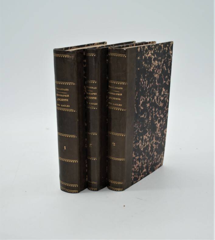
WALCKENAER, Charles Athanase, (Baron).
Géographie ancienne historique et comparée des Gaules Cisalpine et Transalpine, suivie de l'Analyse Géographique des itinéraires anciens et accompagnée d'un Atlas de neuf cartes .
A Paris, Librairie de P. Dufart et A Saint-Pétersbourg, chez J.-F. Hauer et Cie, 1839, 3 volumes in-8 de (210x135 mm) , 3ff. -566 pp, 520 pp, lxiv-204 pp., relié demi cuir époque , dos lisse avec auteur , titre et tomaison , bel exemplaire sans l’atlas.
书商的参考编号 : PHO-936
|
|
|
WALKEr J. & C
Carte maritime de l'Île d'Oléron.
ADMIRALTY. Début 19ème siècle. In-Plano. En feuillets. Bon état, Couv. convenable, Dos satisfaisant, Intérieur acceptable. Carte, noir et blanc, en planche de 50/65 cm.. . . . Classification Dewey : 912-Atlas, cartes et plans
书商的参考编号 : RO20039469
|
|
|
WALKER J. & C
Carte maritime de La Côte Ouest Française.
ADMIRALTY. 1919. In-Plano. En feuillets. Bon état, Couv. convenable, Dos satisfaisant, Intérieur frais. Carte, noir et blanc, en double-planches de 102 /69 cm. Légendes en anglais.. . . . Classification Dewey : 912-Atlas, cartes et plans
书商的参考编号 : RO20039478
|
|
|
WALKER J. & C
Carte maritime de la France Ouest. Pointe de La Coubre des Sables d'Olonnes.
ADMIRALTY. 1918. In-Plano. En feuillets. Bon état, Couv. convenable, Dos satisfaisant, Intérieur frais. Carte, noir et blanc, en double-planches de 102 /69 cm. Légendes en anglais. Plié en 4.. . . . Classification Dewey : 912-Atlas, cartes et plans
书商的参考编号 : RO20039466
|
|
|
WALKER J. & C
Carte Maritime du Golfe de Naples.
ADMIRALTY. 1911. In-Plano. En feuillets. Bon état, Couv. convenable, Dos satisfaisant, Intérieur frais. Carte, noir et blanc, en double-planches de 102 /69 cm. Légendes en anglais. Quelques points orange au feutre.. . . A l'italienne. Classification Dewey : 912-Atlas, cartes et plans
书商的参考编号 : RO20039512
|
|
|
Wallet Atlas
The Autcar Sectional Road Map England & Wales 24 sectional cards
Iliffe & son 1935. Book. Good. Soft cover. a well preserved 24 sectional road map of England Wales in colours and on a scale of 8 miles to an inch housed in original wallet which is worn & scuffed press-stud button at rear flap worn . Iliffe & son Paperback
书商的参考编号 : 190166

|
|
|
Walser, Gabriel
Atlas der alten Eidgenossenschaft in 20 Karten aus dem Jahre 1769.
Gattikon, Verlag Dorfpresse, 1968. Folio. 2 Bl. Mit 20 kol. faks. Karten. Lose in Pappmappe. + Wichtig: Für unsere Kunden in der EU erfolgt der Versand alle 14 Tage verzollt ab Deutschland / Postbank-Konto in Deutschland vorhanden +, A|B [2 Warenabbildungen]
书商的参考编号 : 31223AB

|
|
|
WALSER, Gabriel / HOMANN Erben:
Atlas novus Reipublicae Helveticae XX. Mappis compositus.(Gabriel Walsers, Schweitzer-Geographie: Atlas). (OHNE die 95 Textseiten: ‘Samt den Merkwürdigkeiten in den Alpen und hohen Bergen’, aber mit der Karte v. Neuchâtel).
Sumtibus Homannianis Heredibus Norimbergae, 1769, gr. in-Folio, (ca. 60:36 cm), Gest. Titel mit lateinisch-deutschem Index u. 20 altkolorierten Kupferkarten + 1 zusätzl. doppelblattgr. Karte v. Neuchâtel (1778) - Teilw. gebräunt, Ränder stellenweise etwas angestaubt u. fingerfleckig. Kupfertitel mit Randeinriss. Sammlung loser Tafeln / collection de cartes sans reliure.
书商的参考编号 : 129020aaf
|
|
|
Walt Disney
Atlas illustré.
français In-4 de 61 pp.; album cartonné illustré de l'éditeur. Adaptation française de Andrée Lenglet et R.-G. Le Bars. Riche illustration en couleur.
|
|
|
Wanru, Cao and Zheng Xihuang
An Atlas of Ancient Maps in China The Qing Dynasty (1644-1911). Wanru Cao, Xihuang Zheng, Shengzhang Huang, Zhongxun Niu, Jincheng Ren, Deyuan Ju Zweisprachig: english - chinesisch
Beijing : Cultural Relics Publishing House, 1997. 35.6 x 26.7 x 2.8 cm, Foreward: 34 pages / 212 farbige Abbildungen auf Tafeln // 188 pages Text gebundene Ausgabe, Leinen, Exemplar in gutem Erhaltungszustand
书商的参考编号 : 34584

|
|
|
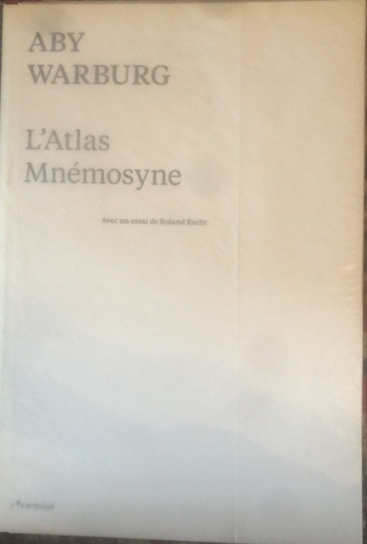
Warburg Aby
L'atlas Mnémosyne
in-4 brochè en très bon état de 198 pages édité par l'écarquillé
书商的参考编号 : yam0418
|
|
|
Warkentin, John; Ruggles, Richard I.
Historical Atlas of Manitoba - A Selection of Facsimile Maps, Plans and Sketches from 1612 to 1969
585 pages. Bibliography. Intended to "Give readers an understanding of the historical and geographical development of the area which is Manitoba today through facsimile maps, selected to show the main events and cultural proesses that were important in the growth of the whole or of any part of the area from the time of the earliest map, made in 1612, to the present." - from page 1. Somewhat above-average wear. Binding intact. Usual library markings. A worthy working copy of this sensational Manitoba historical reference. Book

|
|
|
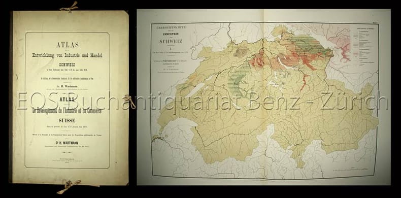
Wartmann, Hermann
Atlas über die Entwicklung von Industrie und Handel der Schweiz in dem Zeitraume vom Jahr 1770 bis zum Jahr 1870. Im Auftrage der schweizerischen Commission für die additionellen Ausstellungen in Wien.
Winterthur, Topograpisches Institut Wurster Randegger, 1873. Gr.-folio. (2) Bl. Mit 8 farb. doppelblattgr. Tafeln. Orig.-Halbleinenmappe. + Wichtig: Für unsere Kunden in der EU erfolgt der Versand alle 14 Tage verzollt ab Deutschland / Postbank-Konto in Deutschland vorhanden +, 2865D
书商的参考编号 : 2865DB

|
|
|
Wartmann, Hermann:
Atlas über die Entwicklung von Industrie und Handel der Schweiz in dem Zeitraume vom Jahr 1770 bis zum Jahr 1870. Im Auftrage der schweizerischen Commission für die additionellen Ausstellungen in Wien.
Winterthur, Topograpisches Institut Wurster Randegger, 1873. Gr.-folio. (2) Bl. Mit 8 farb. doppelblattgr. Tafeln. Orig.-Halbleinenmappe.
书商的参考编号 : 2865DB
|
|
|
Washington George; Atlas; Martin Lawrence Editor
GEORGE WASHINGTON ATLAS. A Collection of Eighty-Five Maps Including Twenty-eight made by George Washington Seven Used and Annotated by Him Eight made at his Direction or for his use or otherwise associated with him and Forty-two new maps Concerning his Activities in Peace and War and His Place in History
Washington D.C.: United States George Washington Bicentennial Commission 1932. First Edition. Illustrated throughout with 50 elephant folio sized plates printed in sepia black and red on beige paper cartographic endleaves and illustrated title-page. Elephant Folio publisher's original navy blue cloth the upper cover with all over design incorporating a compass and drawing after George Washington's own work and titling and publication information in gilt. iv 49 iv pp. A very fine copy as pristine and without fault the blue is vibrant the giltwork unblemished. FIRST EDITION OF THIS VERY SCARCE ATLAS DEPICTING THE MAPS MADE BY DIRECTED BY OR USED BY GEORGE WASHINGTON THROUGHOUT HIS LONG CAREER. The maps show the history of Washington's professional and work life as well as his military and political life. Copies of the atlas are rare in the marketplace and seldom show for sale. This copy is especially well preserved and remains essentially as pristine. A very fine copy for a condition based collection. United States George Washington Bicentennial Commission hardcover
书商的参考编号 : 70020
|
|
|
WATELET, MARCEL.
GERARDI MERCATORIS ATLAS EUROPAE.
, Antwerpen, Bibliotheek van de Vrienden van het Mercatorfonds, 1994., Suite, niet gebonden, met foudraal, vergulde bandstempel op de voorplaat, rug versierd met vergulde titel, zonder omslagwikkel, 27,5x40cm, 92pp + 17 uitvouwbare kaarten in kleur. ISBN 9789061533177.
书商的参考编号 : 12046
|
|
|
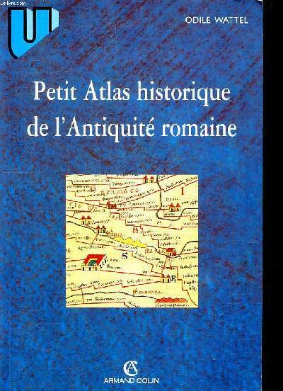
Wattel Odile
Petit atlas historique de l'Antiquité romaine
Armand Colin. 1998. In-8. Broché. Bon état, Coins frottés, Dos satisfaisant, Intérieur frais. 175 pages.. . . . Classification Dewey : 912-Atlas, cartes et plans
书商的参考编号 : R260273008
|
|
|
Wawrik, Franz
Berühmte Atlanten. Kartographische Kunst aus 5 Jahrhunderten.
Dortmund, Harenberg Verlag. 1982. 8° 331 S., zahlr. Ill. (z.T. farb.). kart. Illustr. Deckel, Kanten leicht bestossen, schön und sauber erhalten. Die bibliophilen Taschenbücher ; 299.
书商的参考编号 : 33705BB
|
|
|
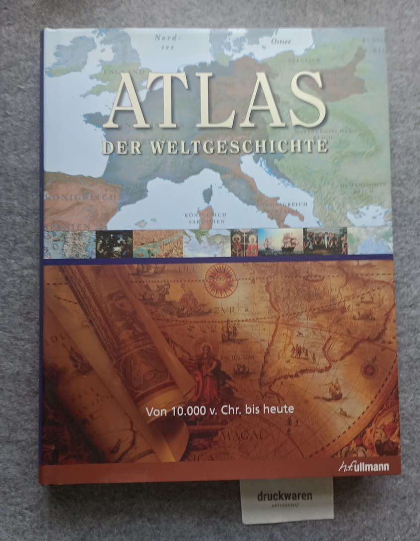
Wawro, Geoffrey (Hrsg.)
Atlas der Weltgeschichte : von 10.000 v. Chr. bis heute.
Königswinter : Ullmann, 2009. 512 S. : zahlr. Ill., Kt. 34 cm. Pp., gebundene Ausgabe, SU.
书商的参考编号 : 229490
|
|
|
Weber Moritz Ignaz Weber Moritz Ignaz . Anatomischer Atlas des menschlichen Ko?rpers in natu?rlicher Gro?sse Lage und Ve
Explanation of the Anatomical atlas of the human body in natural size 92 plates of M.J. Weber 1844 Leather Bound
2019. Leather Bound. New. Leather Binding on Spine and Corners with Golden Leaf Printing on round Spine extra customization on request like complete leather Golden Screen printing in Front Color Leather Colored book etc. Reprinted in 2019 with the help of original edition published long back 1844. This book is printed in black & white sewing binding for longer life Printed on high quality Paper re-sized as per Current standards professionally processed without changing its contents. As these are old books we processed each page manually and make them readable but in some cases some pages which are blur or missing or black spots. If it is multi volume set then it is only single volume if you wish to order a specific or all the volumes you may contact us. We expect that you will understand our compulsion in these books. We found this book important for the readers who want to know more about our old treasure so we brought it back to the shelves. Hope you will like it and give your comments and suggestions. Lang: - eng. EXTRA 10 DAYS APART FROM THE NORMAL SHIPPING PERIOD WILL BE REQUIRED FOR LEATHER BOUND BOOKS. COMPLETE LEATHER WILL COST YOU EXTRA US$ 25 APART FROM THE LEATHER BOUND BOOKS. hardcover
书商的参考编号 : LB1111006909845
|
|
|
Weber Moritz Ignaz Weber Moritz Ignaz . Anatomischer Atlas des menschlichen Ko?rpers in natu?rlicher Gro?sse Lage und Ve
Explanation of the Anatomical atlas of the human body in natural size 92 plates of M.J. Weber 1844 FULL LEATHER BOUND
2019. SUPER DELUXE EDITION. New. Antique look with Golden Leaf Printing and embossing with round Spine completely handmade bindingextra customization on request like Color Leather Colored book special gold leaf printing etc. Reprinted in 2019 with the help of original edition published long back 1844. This book is printed in black & white sewing binding for longer life Printed on high quality Paper re-sized as per Current standards professionally processed without changing its contents. As these are old books we processed each page manually and make them readable but in some cases some pages which are blur or missing or black spots. If it is multi volume set then it is only single volume if you wish to order a specific or all the volumes you may contact us. We expect that you will understand our compulsion in these books. We found this book important for the readers who want to know more about our old treasure in old look so we brought it back to the shelves. Hope you will like it and give your comments and suggestions. Lang: - eng. EXTRA 10 DAYS APART FROM THE NORMAL SHIPPING PERIOD WILL BE REQUIRED. Normal Hardbound Edition is also available on request. unknown
书商的参考编号 : SD1111006909845
|
|
|
Weber Moritz Ignaz Weber Moritz Ignaz . Anatomischer Atlas des menschlichen Ko?rpers in natu?rlicher Gro?sse Lage und Ve
Explanation of the Anatomical atlas of the human body in natural size 92 plates of M.J. Weber 1844
2019. Paperback. New. Lang: - eng. Reprinted in 2019 with the help of original edition published long back 1844. This book is Printed in black & white sewing binding for longer life with Matt laminated multi-Colour Soft Cover HARDCOVER EDITION IS ALSO AVAILABLE Printed on high quality Paper re-sized as per Current standards professionally processed without changing its contents. As these are old books we processed each page manually and make them readable but in some cases some pages which are blur or missing or black spots. If it is multi volume set then it is only single volume if you wish to order a specific or all the volumes you may contact us. We expect that you will understand our compulsion in these books. We found this book important for the readers who want to know more about our old treasure so we brought it back to the shelves. Any type of Customisation is possible with extra charges. Hope you will like it and give your comments and suggestions. paperback
书商的参考编号 : PB1111006909845
|
|
|
Weber Moritz Ignaz Weber Moritz Ignaz . Anatomischer Atlas des menschlichen Ko?rpers in natu?rlicher Gro?sse Lage und Ve
Explanation of the Anatomical atlas of the human body in natural size 92 plates of M.J. Weber 1844 Hardcover
2019. Hardcover. New. Lang: - eng. Reprinted in 2019 with the help of original edition published long back 1844. This book is Printed in black & white Hardcover sewing binding for longer life with Matt laminated multi-Colour Dust Cover Printed on high quality Paper re-sized as per Current standards professionally processed without changing its contents. As these are old books we processed each page manually and make them readable but in some cases some pages which are blur or missing or black spots. If it is multi volume set then it is only single volume if you wish to order a specific or all the volumes you may contact us. We expect that you will understand our compulsion in these books. We found this book important for the readers who want to know more about our old treasure so we brought it back to the shelves. Any type of Customisation is possible with extra charges. Hope you will like it and give your comments and suggestions. hardcover
书商的参考编号 : 1111006909845
|
|
 ?????????
 ?????PDF???
 RSS feed


