|
Weber Moritz Ignaz Weber Moritz Ignaz . Anatomischer Atlas des menschlichen Ko?rpers in natu?rlicher Gro?sse Lage und Ve
Explanation of the Anatomical atlas of the human body in natural size 92 plates of M.J. Weber 1844 Hardcover
2019. Hardcover. New. Lang: - eng. Reprinted in 2019 with the help of original edition published long back 1844. This book is Printed in black & white Hardcover sewing binding for longer life with Matt laminated multi-Colour Dust Cover Printed on high quality Paper re-sized as per Current standards professionally processed without changing its contents. As these are old books we processed each page manually and make them readable but in some cases some pages which are blur or missing or black spots. If it is multi volume set then it is only single volume if you wish to order a specific or all the volumes you may contact us. We expect that you will understand our compulsion in these books. We found this book important for the readers who want to know more about our old treasure so we brought it back to the shelves. Any type of Customisation is possible with extra charges. Hope you will like it and give your comments and suggestions. hardcover
书商的参考编号 : 1111006909845
|
|
|
Websters Concise World Atlas & Almanac Edition: reprint
Websters Concise World Atlas and Almanac
Outlet. Hardcover. Used; Good. Simply Brit Shipped with Premium postal service within 24 hours from the UK with impressive delivery time. We have dispatched from our book depository; items of good condition to over ten million satisfied customers worldwide. We are committed to providing you with reliable and efficient service at all times. 05/01/1988 Outlet hardcover
书商的参考编号 : 3006120 ???????? : 0517474131 9780517474136

|
|
|
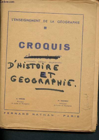
Weiler A., Rouable M.
Croquis d'histoire et géographie
Fernand Nathan. Non daté. In-8. Broché. Etat d'usage, Couv. convenable, Dos satisfaisant, Papier jauni. Environ 30 croquis et cartes en feuillet mobile, monochromme. Annotations à l'encre sur la pochette de rangement.. . . . Classification Dewey : 912-Atlas, cartes et plans
书商的参考编号 : R200104758
|
|
|
WEISS, Johann Heinrich (1758-1826):
La feuille 7 de l’Atlas général de la Suisse (Atlas Meier-Weiss). La partie du Canton de Lucerne d’Unterwalden d’Uri et Zurich le Canton Glarus SChweiz et Zug. Glaciers coloriées à la main.
Au frais de Mr. J.R. Meyer à Aarau, 1796, imperial in-folio, Levée et dessinée par J. H. Weiss et gravée par MG. Eichler, feuille enroulé, quelques petites déchirures sur le bord (ne touchent pas la carte), bon état.
书商的参考编号 : 92486aaf
|
|
|
WEISS, Johann Heinrich (1758-1826):
La feuille 7 de l’Atlas général de la Suisse (Atlas Meier-Weiss). La partie du Canton de Lucerne d’Unterwalden d’Uri et Zurich le Canton Glarus Schweiz et Zug. Glaciers coloriées à la main.
Au frais de Mr. J.R. Meyer à Aarau, 1796, imperial in-folio, Levée et dessinée par J. H. Weiss et gravée par MG. Eichler, feuille pliée, bon état.
书商的参考编号 : 92487aaf
|
|
|
Weiduschat, Willy
Griechenland : ill. Touristenhandbuch für Reisen u. Ferien. Mit e. Regionen-Übersichtskt., 33 Regionen-, Stadt- u. Lageplänen u. 16 ganzseit. photograph. Ill. / bearb. von Willy Weiduschat.
Zürich [u.a.] : Stauffacher, 1956. 416 S. : 8 Bl. Abb. + Kt. in d. Spiegeln. Kl. 8°. 1. Aufl. - [EA]. OLwd mit Goldpräg. (Stauffacher-Reiseführer)
书商的参考编号 : 8036
|
|
|
Weiland, C.F. und C. Ackermann
Bibel-Atlas nach den neuesten und besten Hülfsmitteln gezeichnet. Weimar, Geographisches Institut, 1832. Titelvignette (Ansicht Jerusalems), V, 75 SS. Hier nur der Textband vorliegend!
o.J.
书商的参考编号 : 20037
|
|
|
Weiland, Karl Ferdinand
Bibel-Atlas, nach den neuesten und besten Hülfsmitteln gezeichnet von C. F. Weiland und erläutert von C. Ackermann.
Weimar, Verlag des Geographischen Instituts, 1832. V, 75 S. Mit gestoch. Titelvign. (Ansicht Jerusalems) u. 12 gestoch. Karten, davon 6 grenzkoloriert. 23 cm. Schlichtes Ln d. Zeit.
书商的参考编号 : 94143

|
|
|
Weitz, Barbara
Atlas der Anatomie : Organsysteme und Strukturen in 439 Bildern.
[Augsburg] : Weltbild-Verl., 1998. 312 S. überw. Ill. 4°. Geb. in ill. OPpbd.
书商的参考编号 : 35348
|
|
|
WELLER Edward.
Carte maritime de Calais, du Havre et de la Côte Est Anglaise.
ADMIRALTY. 1920. In-Plano. En feuillets. Bon état, Couv. convenable, Dos satisfaisant, Intérieur frais. Carte, noir et blanc, en double-planches de 102 /69 cm. Légendes en anglais.. . . A l'italienne. Classification Dewey : 912-Atlas, cartes et plans
书商的参考编号 : RO20039467
|
|
|
WELLER Edward.
Carte maritime de Marseille sur la route d'Agay
ADMIRALTY. 1913. In-Plano. En feuillets. Bon état, Couv. convenable, Dos satisfaisant, Intérieur frais. Carte, noir et blanc, en double-planches de 102 /69 cm. Légendes en anglais.. . . . Classification Dewey : 912-Atlas, cartes et plans
书商的参考编号 : RO20039471
|
|
|
WELLER Edward. / ADDISON
Carte maritime Marseille
ADMIRALTY. 1913. In-Plano. En feuillets. Bon état, Couv. convenable, Dos satisfaisant, Intérieur bon état. Carte, noir et blanc, en double-planches de 102 /69 cm. Légendes en anglais.. . . A l'italienne. Classification Dewey : 912-Atlas, cartes et plans
书商的参考编号 : RO20039472
|
|
|
WELLER Edward.
Carte maritime de l'Entrée de la Garonne.
ADMIRALTY. 1918. In-Plano. En feuillets. Bon état, Couv. convenable, Dos satisfaisant, Pliures. Carte, noir et blanc, en double-planches de 102 /69 cm. Légendes en anglais.. . . . Classification Dewey : 912-Atlas, cartes et plans
书商的参考编号 : RO20039477
|
|
|
WELLER Edward.
Carte Maritime de Cette à Marseille. Côte Sud Française.
ADMIRALTY. 1914. In-Plano. En feuillets. Bon état, Couv. convenable, Dos satisfaisant, Intérieur bon état. Carte, noir et blanc, en double-planches de 102 /69 cm. Légendes en anglais.. . . . Classification Dewey : 912-Atlas, cartes et plans
书商的参考编号 : RO20039479
|
|
|
WELLER Edward. / ADDISON
Carte Maritime de Cabo Toriñana à la Pointe Carrero. Côte Ouest Espagnole.
ADMINISTRATION. 1911. In-Plano. En feuillets. Bon état, Couv. convenable, Dos satisfaisant, Intérieur frais. Carte, noir et blanc, en double-planches de 102 /69 cm. Légendes en anglais.. . . A l'italienne. Classification Dewey : 912-Atlas, cartes et plans
书商的参考编号 : RO20039486
|
|
|
WELLER Edward. / ADDISON
Carte Maritime des Îles de Scilly. Côte Ouest Anglaise.
ADMIRALTY. 1911. In-Plano. En feuillets. Bon état, Couv. convenable, Dos satisfaisant, Intérieur frais. Carte, noir et blanc, en double-planches de 102 /69 cm. Légendes en anglais.. . . . Classification Dewey : 912-Atlas, cartes et plans
书商的参考编号 : RO20039487
|
|
|
WELLER Edward.
Carte Maritime de la Sicile. Côte 4. De Catania à Cefalù.
ADMIRALTY. 1876. In-Plano. En feuillets. Bon état, Couv. convenable, Dos satisfaisant, Intérieur bon état. Carte, noir et blanc, en double-planches de 102 /69 cm. Légendes en anglais.. . . . Classification Dewey : 912-Atlas, cartes et plans
书商的参考编号 : RO20039490
|
|
|
WELLER Edward.
Carte Maritime de l'Espagne et du Portugal. Cap Finisterre au Cap St-Vincent.
ADMIRALTY. 1910. In-Plano. En feuillets. Etat d'usage, Couv. convenable, Dos satisfaisant, Intérieur bon état. Carte, noir et blanc, en double-planches de 102 /69 cm. Légendes en anglais.. . . . Classification Dewey : 912-Atlas, cartes et plans
书商的参考编号 : RO20039496
|
|
|
WELLER Edward.
Carte Maritime d'Espagne. De la Baie de Saint Ciprien au Cap Finisterre
ADMIRALTY. 1917. In-Plano. En feuillets. Bon état, Couv. convenable, Dos satisfaisant, Intérieur bon état. Carte, noir et blanc, en double-planches de 102 /69 cm. Légendes en anglais. Quelques marques au feutre orange.. . . A l'italienne. Classification Dewey : 912-Atlas, cartes et plans
书商的参考编号 : RO20039499
|
|
|
WELLER Edward.
Carte Maritime de la tête de Trevose et de la Pointe de Dodman.
ADMIRALTY. 1920. In-Plano. En feuillets. Bon état, Couv. convenable, Dos satisfaisant, Intérieur bon état. Carte, noir et blanc, en double-planches de 102 /69 cm. Légendes en anglais. Quelques marque au feutre rouge. . . A l'italienne. Classification Dewey : 912-Atlas, cartes et plans
书商的参考编号 : RO20039502
|
|
|
WELLER Edward.
Carte Maritime de la Manche.
ADMIRALTY. 1920. In-Plano. En feuillets. Bon état, Couv. convenable, Dos satisfaisant, Intérieur bon état. Carte, noir et blanc, en double-planches de 127/71 cm. Légendes en anglais. Nombreux repères au feutre orange sur la carte.. . . A l'italienne. Classification Dewey : 912-Atlas, cartes et plans
书商的参考编号 : RO20039505
|
|
|
WELLER Edward.
Carte Maritime de la Partie Est de la Méditérranée. De Candia à Alexandrie
ADMIRALTY. 1917. In-Plano. En feuillets. Bon état, Couv. convenable, Dos satisfaisant, Intérieur bon état. Carte, noir et blanc, en double-planches de 102 /69 cm. Légendes en anglais. Quelques points au feutre orange .. . . A l'italienne. Classification Dewey : 912-Atlas, cartes et plans
书商的参考编号 : RO20039511
|
|
|
Wellman William A. director; Leopold Atlas Guy Endore Philip Stevenson screenwriters; Burgess Meredith Robert Mitchum Fredd
Story of G.I. Joe Original pressbook for the 1945 film
Beverly Hills CA: United Artists 1945. Vintage pressbook for the 1945 film. Ernie Pyle Meredith is a journalist who enlists in the US Army during WWII. During his tour of duty in Africa and Italy he documents the effects of war on the human condition illuminating catastrophe the consequences of combat and new partnerships in times of crisis all from a first-person narrative. The real Pyle won a Pulitzer Prize in 1944 for his war correspondence. Nominated for four Academy Awards. 14x 21 inches. 22 pages and a laid-in ad sheet saddle stitched in monochrome wrappers folded horizontally as issued. Very Good plus with spine rubbing a few spine chips and light foxing overall. United Artists unknown
书商的参考编号 : 139955
|
|
|
Wenng, Gustav (Herausgeber)
Topographischer Atlas von München in seinem ganzen Burgfrieden : dargestellt und bearbeitet in 88 Sectionen im 2,500 theiligen Maass-Stabe. Herausgegeben und dem Hohen Magistrate der königlichen Haupt- und Residenzstadt München in tiefster Hochachtung gewidmet von Gustav Wenng.
München : Bezirksausschuss Maxvorstadt, 2002. Nachdr. der Orig.-Ausg. München, Wenng, 1849/51 / Hrsg.: Bezirksausschuss Maxvorstadt, lokales Organ der Landeshauptstadt München. Red.: Franz Schiermeier ; Klaus Bäumler. zahlr. Karten, o.Pag. [97 Bl.] qu.-4°, OLn. + Begleitbroschüre "Ein Bild der Stadt"(zahlr. Abb., 106 S.) + Übersichtsplan (Kartenbeilage zur Begleitbroschüre - diese mittig gefaltet) in Pappschuber
书商的参考编号 : 34155

|
|
|
Wenschow, Karl
Weltatlas. Hergestellt nach dem Wenschow-Verfahren.
Wenschow, München 1947. 33 S. mit zahlreichen farbigen Karten. 4°. Illustr.-Kart. Gebrsp. Berieben, Rücken etwas beschädigt. Papierbedingt gebräunt. "This atlas has been approved for school by Office of Military Government (US)." Veränderter Neudruck, teils andere Karten.
书商的参考编号 : 12630

|
|
|
Werner HILGEMANN et Hermann KINDER
ATLAS HISTORIQUE
Un ouvrage de 653 pages, format 130 x 195 mm, illustré, relié cartonnage couleurs, publié en 1993, bon état
书商的参考编号 : LFA-126737560
|
|
|
Werner SJ, [Oscar]
Katholischer Missions-Atlas : Neunzehn Karten in Farbendruck mit begleitendem Text.
Freiburg, Herder'sche Verlagshandlung, 1885. 4° (30x23), 36 S., + 3 teils mehrfach gefaltete Tabellen/Schaubilder und 19 (davon 16 ganz- und 3 doppelseitige) Karten, grüner OHln mit LeinenEcken, reiche goldRückenPrägung, goldFiletten, 2., verbesserte Aufl. nahezu ungelesen, schönes gepflegtes und frisches Exemplar,
书商的参考编号 : 54829AB

|
|
|
Werner, Oscar
Katholischer Kirchen-Atlas - 14 colorirte Karten mit begleitendem Text
Freiburg im Breisgau : Herder 1888. 96 S. : + 14 farbige Karten ; cm gebundene Ausgabe, Halbleinen, ausgemustertes Bibliotheksexemplar mit Bibliotheks-Signatur, sonst Exemplar in gutem Erhaltungszustand
书商的参考编号 : 34353

|
|
|
Werner, Oscar
Katholischer Missions-Atlas O. Werner S. J. 2. Auflage
Freiburg im Breisgau ; München [u.a.] ; Herder Verlag 1885. 36 S., + 19 farbige Karten, 23,5 x 31 cm, gebundene Ausgabe,, Halbleinen, Leinenrücken fleckig, sonst Exemplar in gutem Erhaltungszustand
书商的参考编号 : 34352

|
|
|
Werner, Reinhold von (Mitwirkender)
Atlas des Seewesens. [Von Reinhold Werner]. Nachdruck der Separat-Ausgabe aus der 2. Auflage des Bilder-Atlas Leipzig 1871 bei Brockhaus.
Hannover: Edition "Libri Rari" Schäfer 1981. 20 Seiten, 25 Blatt. Frakturdruck. 25 teils farbige Tafeln in Stahlstich nebst erläuterndem Text. Quer 4° (28,5 x 34,5 cm). Farbig illustrierter Orig.-Pappband. [Hardcover / fest gebunden].
书商的参考编号 : 2122017

|
|
|
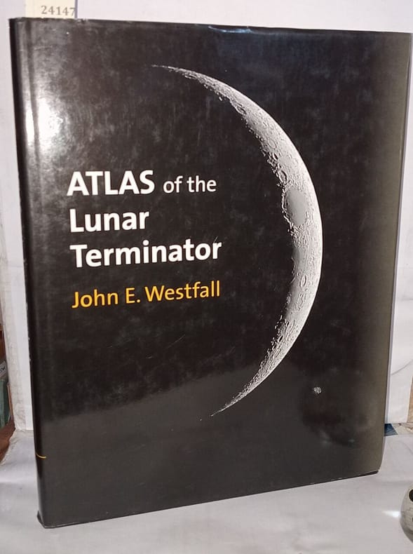
Westfall John
Atlas of the Lunar Terminator
Cambridge university press 2000 292 pages 21 74x2 41x28 55cm. 2000. Relié avec jacquette. 292 pages.
书商的参考编号 : 524020 ???????? : 521590027
|
|
|
Wessinghage, Dieter
Rheuma - welche Diagnose stellen Sie ? / D. Wessinghage.
Bad Abbach / Regensburg : Ciba, [19]79. [120] Bl. Mit Farbabb. 8°. Ill. OBroschur.
书商的参考编号 : 37095
|
|
|
Westermann George
Deutschland - Nordstliches Deutschland -Sudwestliches Deutschland - Preussen 1 Physikalische - 3 Politische karte
4 28,5x31,5 cm., margini, a colori, rinforzo posteriore a met?, in tedesco, ben conservate.
|
|
|
Westermann, Georg (Red.)
Diercke Schulatlas für höhere Lehranstalten. Grosze Ausgabe.
Braunschweig, Westermann, 1936. Beiliegend Carte Taride No. 17 - Provence, Basses-Alpes VI, 159 S. (36 cm) Halbleinen / gebundene Ausgabe
书商的参考编号 : 34890
|
|
|
WESTERMANNS Grosser Atlas zur
Weltgeschichte. Hg.: H.-E.Stier u.a.
Braunschweig: Westermann 1969. 170 Kartenseiten + 80 S. Reg. 4° Kst. Ln. *Name auf Titel*.
书商的参考编号 : 2127
|
|
|
Western Atlas International Inc
Introduction to Wireline Log Analysis
Western Atlas International Inc 1992. SPIRAL_BOUND. Very Good. 312pp. Front lower left corner bumped else Near Fine spiral bound hardcover. No dust jacket as issued. OB1. Quantity Available: 1. Pictures of this item not already displayed here available upon request. Inventory No: SKU1000430. . Western Atlas International Inc unknown
书商的参考编号 : SKU1000430

|
|
|
WETTSTEIN, H.:
Schul-Atlas. Anhang: Geographisches Bilder und Ansichten nach Zeichnungen von Rob. Wettstein und Photographien. Obligatorisches Lehrmittel der Sekundarschulen des Kantons Zürich.
Zürich, Erziehungsdirektion des Kantons, 1887, in-4to, Titelbl. + 20 xylograph. doppel Tafeln, Stempel auf Titelbl., einf. Hlwd.
书商的参考编号 : 63477aaf
|
|
|
WETTSTEIN, H.:
Schul-Atlas. In zweiunddreissig Blättern bearbeitet von J. Randegger. IV. Auflage. Obligatorisches Lehrmittel der Sekundarschulen des Kantons Zürich.
Zürich, Verlag der Erziehungsdirektion, 1890, in-4to, 32 Karten + 20 Doppelt-Tafeln mit hist. Gebäude, Landschaften u. Sehenswurdigkeiten, halb-Leinenband, schönes Exemplar.
书商的参考编号 : 69666aaf
|
|
|
WETTSTEIN, H. / RANDEGGER, J.:
Schul-Atlas in zweiunddreissig Blättern. V Auflage. Obligatorisches Lehrmittel der Sekundarschulen des Kantons Zürich. Bezug beim kantonalen Lehrmittelverlag im Obmannamt.
Zürich, Verlag der Erziehungsdirektion, 1895, in-4to, gef. Titelblatt + 64 S., ill. mit 32 doppelt Farb-Tafeln, Hlwd. (Bibl.).
书商的参考编号 : 109529aaf
|
|
|
WETTSTEIN, H(einrich) (1831-1895):
Schul-Atlas. in zweiunddreissig Blättern. Bearb. von J. Randegger III Auflage. + Anhang: Geographische Bilder und Ansichten. Nach Zeichnungen von Rob. Wettstein und Photographien. Obligatorisches Lehrmittel der Sekundarschulen des Kantons Zürich.
Zürich, Verlag der Erziehungdirektion, 1887, gr. in-4°, gef. Titelblatt + 32 Doppeltbl. Karten (Bl. XXV nur zur hälfte da) + Titelbl. Anhang (1887): 20 Doppelt-Tafeln mit Abbildungen in Xylographie, etwas fleckig am Rand, Original-Halbleinenband. Einband stark gebraucht.
书商的参考编号 : 115952aaf
|
|
|
WETTSTEIN H.
Schul-Atlas. Obligatorisches Lehrmittel der Sekundarschulen des Kantons Zürich.
Zürich, 1890. 210 X 300 mm. relié demi-toile (de l'époque). 32 planches doubles chromolithographiées, montées sur onglets. Quelques traces d'usage, le dos manque.
书商的参考编号 : 10922
|
|
|
WETTSTEIN, H. - RANDEGGER, J. (bearbeitet von).
Schul-Atlas. V. Auflage. Obligatorisches Lehrmiteel der Sekundarschulen des Kantons Zürich.
Zürich, Verlag der Erziehungsdirektion 1895, 300x215mm, Halbperkalin. Beibehalten oberer Abdeckung und Rücken. In gutem Zustand.
书商的参考编号 : 77384
|
|
|
Wettstein H.
Nord un Sud Amerika - Sud Amerika
2 40x27 cm., la prima con tre tasselli: Mundungen des Amazonen Str., Die Cordillieren, Isthmus von Panama, , l'altra con tre tasselli: Kleine Antillen. Schweiz, Bay von Riode Janeiro, in tedesco, buone condizioni.
|
|
|
Weule, Karl
Leitfaden der Völkerkunde.
Leipzig, Bibliographisches Institut, 1912. 4°. 152 Seiten, 120 Tafeln mit zahrleichen s/w Abbildungen, 1 farbige Karte. Orig.-Leinen. + Wichtig: Für unsere Kunden in der EU erfolgt der Versand alle 14 Tage verzollt ab Deutschland / Postbank-Konto in Deutschland vorhanden +
书商的参考编号 : 19102AB
|
|
|
WEYGAND Jacques
GOUMIER DE L'ATLAS
1954 br. in-octavo avec jaq. ill., n.c., clichés h-txt., 251 p., 1954 flammarion éd.,
书商的参考编号 : 2741
|
|
|
WEYGAND Jacques
Goumier de l'Atlas. Collection L'aventure vécue.
Paris, Flammarion, 1954. 15 x 21, 251 pp., 16 planches, broché, bon état.
书商的参考编号 : 21436
|
|
|
Weyhausen KG (Hrsg.)
Ersatzteilliste Atlas Hydraulik-Lader Typ 500. Ausgabe 1/71.
Delmenhorst, Selbstverlag um, 1971. Broschiert
书商的参考编号 : 204496

|
|
|
WHITEHOUSE (David and Ruth).
Archaeological Atlas of the World.
Thames and Huston, 1975, gr. in-8°, 272 pp, avec 103 cartes en 2 couleurs dessinées par John Woodcock and Shalom Schotten, index, broché, bon état. Texte en anglais
书商的参考编号 : 52433
|
|
|
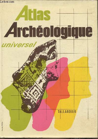
WHITEHOUSE David et Ruth
Atlas Archéologique Universel.
TALLANDIER Jules. 1978. In-8. Relié toilé. Bon état, Couv. convenable, Dos satisfaisant, Intérieur frais. 290 pages. Nombreuses cartes bicolores, hors-texte.. Avec Jaquette. . . Classification Dewey : 912-Atlas, cartes et plans
书商的参考编号 : RO80121415
|
|
|
Whitehouse David et Ruth
Atlas Archéologique universel
Tallandier. 1978. In-8. Relié toilé. Etat passable, Couv. convenable, Dos satisfaisant, Intérieur acceptable. 290 pages. 107 cartes hors texte. Quelques salissures en tranches. Jaquette passable. Texte sur deux colonnes. Papier légèrement jauni. Signet conservé.. Avec Jaquette. . . Classification Dewey : 912-Atlas, cartes et plans
书商的参考编号 : RO30335426
|
|
 ?????????
 ?????PDF???
 RSS feed


