|
|
|
[Kartographie - Mercator]. - Wolff, Hans (Hg.)
Vierhundert Jahre Mercator. Vierhundert Jahre Atlas. ?Die ganze Welt zwischen zwei Buchdeckeln?. Eine Geschichte der Atlanten.
Weißenhorn, Anton H. Konrad Verlag, 1995. Qu.-4°. Mit zahlr. tlw. ganzs. bzw. farb. Abbildungen. 382 S., 1 Bl., Illustr.-OPpbd.
Riferimento per il libraio : 54502
|
|
|
[La FRANCE PITTORESQUE].-
La France Pittoresque ou description par département de la France et de ses colonies.
P., Librairie Illustrée, sans date, 2 forts volumes in 4° reliés demi-veau bleu nuit, dos à nerfs ornés, XLVIII-721 et 817 pages ; quelques rousseurs ; petits frottis.
Riferimento per il libraio : 69584
|
|
|
[Le Monde]
BILAN du MONDE 2006
Une publication de 176 pages, format 235 x 300 mm, illustrée + cartes, brochée couverture couleurs, publiée en 2006, bon état
Riferimento per il libraio : LFA-126719902
|
|
|
[Lebail-Weissert].
Livres de Voyages, Atlas, Estampes, cartes, plans, Vues... Ensemble de 6 catalogues de vente de la Librairie Lebail-Weissert de Paris.
Paris, Lebail-Weissert, 2003-2007. Ensemble de 6 catalogues de format in 4°; environ 1000 pp.; nombreuses illustrations en couleurs. Bel état. Luxueux catalogues; exactement 1700 numéros soigneusement décrits.
|
|
|
[LINGUISTIQUE, ATLAS]
Le grand atlas des littératures.
Paris, Universalis, 1990 ; in-folio, 435 pp., cartonnage de l'éditeur. Avec jaquette.
Riferimento per il libraio : 201710331
|
|
|
[LUINE ou LUYNE (Guillaume de)]
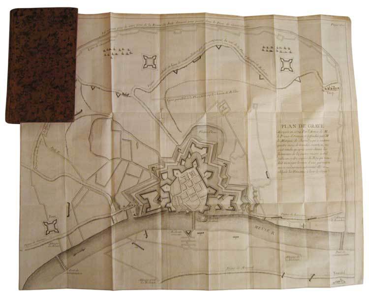
Relation du siège de Grave, en 1674, et de celui de Mayence, en 1689; avec le plan de ces deux villes.
In-12, plein veau marbré de l'époque, dos lisse orné de compartiments cloisonnés et fleuronnés, pièce de titre de maroquin bordeaux, tranches rouges, xii, 356 p. et (4) p. d'approbation et privilège, 2 très grands plans dépliants hors texte. Première édition collective illustrée de 2 très grands plans dépliants des villes de Grave et Mayence. En juillet 1674, les Hollandais mirent le siège pendant 93 jours devant Grave dans le Brabant-Septentrional, ville occupée par les français depuis 1672. Les pertes furent considérables des deux côtés. Fin octobre, le gouverneur de la place, le marquis de Chamilly, reçut l’ordre du roi de se rendre. Ce qui restait de la garnison défila devant l’armée hollandaise qui lui rendit les honneurs et le Prince Guillaume III d'Orange récupéra la ville le 28 octobre 1674. Le siège de Mayence se déroula du 1er juin au 8 septembre 1689, pendant la guerre de la Ligue d’Augsbourg. "Récit méthodique, composé par un témoin oculaire. Exposé par ordre chronologique. Correct, froid, très détaillé et très utile" (Sources de l’Histoire de France, n° 3973). Petite étiquette imprimée à l’époque de la librairie Cellot et Jombert, "Rue Dauphine, la seconde porte cochère à droite par le Pont-Neuf, au fond de la cour". Bel exemplaire, frais, très bien relié à l’époque.
|
|
|
[LUINE ou LUYNE (Guillaume de)]
Relation du siège de Grave, en 1674, et de celui de Mayence, en 1689; avec le plan de ces deux villes.
In-12, plein veau marbré de l'époque, dos lisse orné de compartiments cloisonnés et fleuronnés, pièce de titre de maroquin bordeaux, tranches rouges, xii, 356 p. et (4) p. d'approbation et privilège, 2 très grands plans dépliants hors texte. Paris, C.A. Jombert, 1756.
Riferimento per il libraio : 34837
|
|
|
[M. SAIT MALATYALI (Turkish mapmaker and soldier)].
[MAP of DIYARBAKIR and SYRIA] Diyarbekir, Siverek, Sard, Ras al-Ayn.
Very Good Turkish, Ottoman (1500-1928) Original color map. Folded. Oblong atlas folio. (50 x 60 cm). In Ottoman script. Shows Southeastern parts of Asia Minor and Syria; Siverek, Sard (Iraq) and Ras Al-Ayn (Rasulayn - Resualyn) in Syria. Hegira: 1333 = Gregorian: 1917. Not description on map-maker. Scale: 1: 200.000. This is one the serie of the Bonn projection maps which are the first map series in modern techniques in Turkey and the Ottoman Empire. In order to produce these maps covering Turkish territory, Reconnaissance Branch was incorporated into The Mapping Commission. The maps were produced in the datum based on the latitude and longitude of Ayasofya Mosque in equal area Bonn Projection. The field works for the 123 sheets covering the country were conducted by 76 staff. The production was completed in 18 years starting from east west. Field works continued without stopping except in years 1914 and 1920. This map series called also reconnaissance maps contributed a lot to producing 1:25.000 scale maps. According to Türkezer & Çobanoglu: History of Mapping in Turkey-1:200.000 Scale Maps, last cartographer of Diyarbakir regio is M. Sait Malatyali. No his biographic material and info in 'Savaslarda Haritacilar'. Rare.
|
|
|
[MACARTNEY]
Atlas de Macartney - Voyage dans l'intérieur de la Chine et en Tartarie, fait dans les années 1792,1793 et 1794, par Lord Macartney, Ambassadeur du Roi d'Angleterre auprès de l'Empereur de Chine; Rédigé sur les papiers de Lord Macartney, sur ceux du Commodore Erasme Gower, et des autres Personnes attachées à l'Ambassade; Par Sir Georges Staunton, de la Société Royale de Londres, Secrétaire de l'Ambassade d'Angleterre, et Ministre plénipotentiaire auprès de l'Empereur de Chine; Traduit de l'anglais, avec des notes, par J. Castera.
A Paris, Chez F. Buisson, Imprimeur-Libraire, An XII (1804). 1 volume in-4, reliure ancienne demi-basane, plats cartonnés fortement frottés, intérieur propre, comportant une collection de 37 Planches et 4 Cartes dessinées à Londres, et gravées en taille-douce par Tardieu l'aîné, bon état.
Riferimento per il libraio : 11328
|
|
|
[MACARTNEY] [ATLAS]
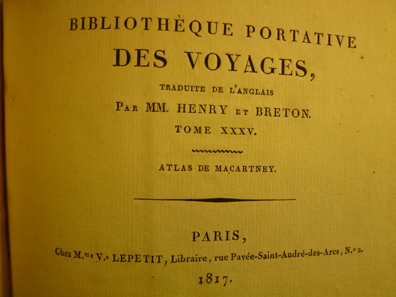
Atlas de Macartney
Paris, Chez M.me V.e Lepetit, Libraire, 1817. 1 volume in-12 oblong, couverture cartonnée d'éditeur salie (soiled covers), enrichi d'une carte dépliante de la Chine et de 22 petites gravures en noir et blanc (1 map of China and 22 small prints), quelques rousseurs (some foxing), état correct.
Riferimento per il libraio : 3602
|
|
|
[MACARTNEY] [ATLAS]
Voyage dans l'intérieur de la Chine et en Tartarie, fait dans les années 1792,1793 et 1794, par Lord Macartney, Ambassadeur du Roi d'Angleterre auprès de l'Empereur de Chine; Rédigé sur les papiers de Lord Macartney, sur ceux du Commodore Erasme Gower, et des autres Personnes attachées à l'Ambassade; Par Sir Georges Staunton, de la Société Royale de Londres, Secrétaire de l'Ambassade d'Angleterre, et Ministre plénipotentiaire auprès de l'Empereur de Chine; Traduit de l'anglais, avec des notes, par J. Castera. 5 volumes de texte et 1 Atlas in quarto
A Paris, Chez F. Buisson, Imprimeur-Libraire, An XII (1804). 5 volumes de texte, reliure plein veau, plats ornés de liserés, dos ornés, très beaux exemplaires et 1 volume d'atlas in quarto, reliure ancienne plein veau, comportant une collection de 37 Planches et 4 Cartes dessinées à Londres, et gravées en taille-douce par Tardieu l'aîné, excellent état. REMISE POSSIBLE POUR ACHAT DIRECT - DISCOUNT OFFERED FOR DIRECT SALE - PLEASE CONTACT THE BOOKSELLER FOR MORE INFORMATION
Riferimento per il libraio : 5582
|
|
|
[MAJOR] HALIT ZIYA [TÜRKKAN] (?), (Turkish cartographer, scientist, specialist of cadaster), (1886-1966).
[MANUSCRIPT HAND-COLOURED MAP OF SYRIA - PALESTINE - TRANSJORDAN] Suriye - Filistin - Transjordan.
Very Good Turkish Original manuscript color map of Middle East including Syria, Palestine and Transjordan. Signed by cartographer. 28x20 cm. In Turkish (with Latin letters). The Mapping Department, which moved to Ankara from Istanbul after the Independence War, settled in the Attar Basi Khan in Koyunpazari and the press section also started its studies in the building which is the Art School in Ulus today. In 1924, the department, which is still inside the General Directorate Garrison, moved to the hut-shaped buildings with single floor between the Military Sewinghouse and the General Directorate. On the other hand, the production of maps and plans, which were to be used in development services carried out in parallel to the revolutions starting with the declaration of the Republic and following each other, was considered to be based on a legal arrangement. Because of the necessity of an urgent legal arrangement, the bill of law concerning to the General Directorate of Mapping, whose preparations were initiated by Lieut. Gen. M. Sevki (Ölçer) who knew the importance of the subject, was sent to the Ministry of Defense at the beginning of 1925. After the approval of Ministry of Defense, the bill, which was sent to the Prime Ministry, was discussed in the Council of Ministers and presented to the Grand National Assembly of Turkey. As a result; the Mapping Department was re-organized as the General Directorate of Mapping affiliated with the Ministry of Defense with the law bearing the number 657 on May 2, 1925 in order to do all mapping works and meet the needs of maps and plans of all ministries, institutions and organizations. [.] The first application of photogrammetry was made in Kayas, Ankara with the Wild Autograph plotting apparatus which was purchased in that year. Captain Ömer Kadri and Captain Niyazi came back from their photogrammetry education in Germany. Major Halit and Major Nüzhet were sent to France for photogrammetry education and Captain Ishak and Captain Bahri were sent to Germany. Captain Ahmet (Denkmen) and Captain Ömer Kadri attended the Congress of Photogrammetry assembled in Berlin. (Source: The Illustrated History Of Turkish Cartography). Halid Ziya was born in Izmir, Tire. He went to Istanbul and continued to Hendese-i Mülkiye and Engineer Mekteb-i Âlîsi for seven years. After starting with "Aydin Province Umur-i Nafia Third Class Engineering", Halid Ziya Bey, who continued to work as a deputy chief engineer on 14 March 1910, left Aydin and returned to Istanbul after continuing this duty for about six and a half months. As a teacher, he taught Accounting, Algebra, Geometry, and Topography at Halkali Ziraat Mekteb-i Âlîsi and Darussafaka. Halid Ziya Bey, who was appointed as a teacher of Hendese and Cosmography in Kabatas High School, started to practice the profession of engineering and cadastral, which was his main specialty in 1327. After the First World War, the Istanbul Government started its activities in order to capture and neutralize Halid Ziya Bey and his friends. Upon the harsh measures taken, Halid Ziya Bey had to live as a fugitive in the Hasirci Mountains of Eskisehir for a while with the armed force attached to him. Halid Ziya Bey, who was involved in the movement in Anatolia until the end of the National Liberation Struggle, returned to his engineering duty after the proclamation of the Republic and was included in the cadastral works again. In 1925, Halid Ziya Bey was appointed as the Head of the Science Committee of the new cadastre organization. He wrote 5 books on cadastre, photogrammetry, trigonometry, and cadastral tools in 1928 and 1929. In addition, as a result of personal work in 1928, the road between the provincial division of the Republic of Turkey with cities has prepared a comprehensive map to show up in the forest and mining. (Source: Kadastro ne idi, nedir, ne olacaktir, Kadioglu - Yildirir. From Preface.). No scale.
|
|
|
[MALTE-BRUN (Conrad)]
[Abrégé de géographie].
1842 Sans lieu, sans nom, sans date [circa 1842]
Riferimento per il libraio : 119

|
|
|
[MAP ATLAS -- INDIANA].
Atlas of Bartholomew Co. Indiana: to which are added various general maps history statistics illustrations &c. &c. &c. . . .
Chicago: J.H. Beers & Co. Publishers Lakeside Building Cr. of Clarks & Adams 1879. Atlas folio. 15 x 17.5 in. 82 pp fairly continuous pagination including maps & lithographs. With 39 hand-coloured lithographed maps several double-page Indiana United States World Columbus Township Columbus Plat Sand Creek & Wayne numerous lithographed plates some large double-page tables charts. Quarter-sheep over black embossed publisher’s cloth gilt lettering stamped on front cover borders embossed in blind wear & bumping to corners some chipping head & foot of spine some wear to fore-edges somewhat shaken still a G copy. First edition of this uncommon original 19th-Century plat map atlas for Bartholomew County Indiana during the Gilded Age. J.H. Beers specialized in County Plat Map atlases and histories from 1878-1900 and also focused on producing municipal history and biographical history titles primarily in and around the Midwest. Their well-executed lithograph birds-eye views of businesses towns family farms and more were quite popular were generally pre-sold through subscription and prosperous towns businesses and farms who paid extra were able to secure a biographical section or view within the volumes. Bartholomew County located about 40 miles south of Indianapolis was originally established in 1821 and named for Lt. Col. Joseph Bartholomew a militia officer wounded at the battle of Tippecanoe. The County featured such companies as the Reeves Pulley Co. Ceraline Manufacturing Orinoco Furniture and others in the 19th Century and as of this publication the population was about 30000 inhabitants and today the County features approximately 82000 inhabitants. The atlas was later reprinted in 1969 1979 and 1986 in very poor smaller reproductions. J.H. Beers & Co., Publishers, Lakeside Building Cr. of Clarks & Adams, hardcover
Riferimento per il libraio : 61342
|
|
|
[MAP of OTTOMAN BALKANS].
[MAP of OTTOMAN PROVINCE of BALKANS-ALBANIA] 52 Ipek (Peja). 53 Yakoh. 59 Akola. 60 Iskodra (Shkodra).
Very Good Turkish, Ottoman (1500-1928) Original color map on cloth. Oblong: 67x75 cm. In Ottoman script. Folded originally. A very detailed map. Scale: 1:210.000. Shows Shkodra Lake, its shores, Bog Mountains, Karadag (Montenegro), Iakoh, Has etc. [MAP of OTTOMAN PROVINCE of BALKANS-ALBANIA] 52 Ipek (Peja). 53 Yakoh. 59 Akola. 60 Iskodra (Shkodra).
|
|
|
[MAP of OTTOMAN PROVINCE of DIYAR-I BEKR].
[MAP of OTTOMAN PROVINCE of DIYAR-I BEKR] Diyarbakir Vilâyeti.
Very Good Turkish, Ottoman (1500-1928) Original color map. Folded. Very good. Large oblong 8vo. (21 x 26 cm). In Ottoman script. [MAP of OTTOMAN PROVINCE of DIYAR-I BEKR] Diyarbakir Vilâyeti. Province of Diyarbekir in Southeast Anatolia and its around. Many sandjaks and provinces with their detailed place names. Scale: 1/500.000.
|
|
|
[MAP of OTTOMAN PROVINCE of DIYAR-I BEKR].
[MAP of OTTOMAN PROVINCE of DIYAR-I BEKR] Diyarbakir Vilâyeti.
Very Good Turkish, Ottoman (1500-1928) Original color map. Folded. Very good. Large oblong 8vo. (21 x 26 cm). In Ottoman script. [MAP of OTTOMAN PROVINCE of DIYAR-I BEKR] Diyarbakir Vilâyeti. Province of Diyarbekir in Southeast Anatolia and its around. Many sandjaks and provinces with their detailed place names. Scale: 1/1.500.000.
|
|
|
[MAP of OTTOMAN PROVINCE of EASTERN ROUMELI].
[MAP of OTTOMAN PROVINCE of EASTERN ROUMELI] Rumeli-yi Sarkî Vilâyeti, Bulgaristan Eyâleti, Edirne Vilâyeti, [Trakya], Selânik Vilâyeti. [East Roumeli, Salonica, Adrianople provinces; Old Zagra Sandjak, Bulgarian State].
Very Good Turkish, Ottoman (1500-1928) Original color map. Folded. Very good. Large oblong 8vo. (21 x 26 cm). In Ottoman script. [MAP of OTTOMAN PROVINCE of EASTERN ROUMELI] Rumeli-yi Sarkî Vilâyeti, Bulgaristan Eyâleti, Edirne Vilâyeti, [Trakya], Selânik Vilâyeti. [East Roumeli, Salonica, Adrianople provinces; Old Zagra Sandjak, Bulgarian State]. Scale: 1/1.500.000. Ottoman Provinces in the Balkan Peninsula.
|
|
|
[MAP of OTTOMAN PROVINCE of ERZURUM].
[MAP of OTTOMAN PROVINCE of ERZURUM] Erzurum Vilâyeti.
Very Good Turkish, Ottoman (1500-1928) Original color map. Folded. Very good. Large oblong 4to. (19 x 37 cm). In Ottoman script. [MAP of OTTOMAN PROVINCE of ERZURUM] Erzurum Vilâyeti. Province of Erzurum of east Anatolia and its around. Many sandjaks and provinces with their detailed place names. Scale: 1/1.500.000.
|
|
|
[MAP of OTTOMAN PROVINCE of KONIA].
[MAP of OTTOMAN PROVINCE of KONIA] Konya Vlâyeti and around; Burdur, Isparta, Teke sandjaks, Hüdavendigâr Province Tozlu Ova, Tuz Gölü etc.
Very Good Turkish, Ottoman (1500-1928) Original color map. Folded. Very good. Oblong 4to. (21 x 42 cm). In Ottoman script. [MAP of OTTOMAN PROVINCE of KONIA] Konya Vlâyeti and around; Burdur, Isparta, Teke sandjaks, Hüdavendigâr Province Tozlu Ova, Tuz Gölü etc. Scale: 1/500.000.
|
|
|
[MAP of OTTOMAN PROVINCE of SIVAS].
[MAP of OTTOMAN PROVINCE of SIVAS] Sivas Vilâyeti, Trabzon Vilâyeti, Tokat Sancagi. [Sivas and Trabzon Provinces, Tokat Sandjak].
Very Good Turkish, Ottoman (1500-1928) Original color map. Folded. Very good. Large oblong 8vo. (26 x 26 cm). In Ottoman script. [MAP of OTTOMAN PROVINCE of SIVAS] Sivas Vilâyeti, Trabzon Vilâyeti, Tokat Sancagi. [Sivas and Trabzon Provinces, Tokat Sandjak]. Scale: 1/1.500.000.
|
|
|
[MAP of OTTOMAN PROVINCE of SIVAS].
[MAP of OTTOMAN PROVINCE of SIVAS] Sivas Vilâyeti, Trabzon Vilâyeti, Tokat Sancagi. [Sivas and Trabzon Provinces, Tokat Sandjak].
Very Good Turkish, Ottoman (1500-1928) Original color map. Folded. Very good. Large oblong 8vo. (26 x 26 cm). In Ottoman script. [MAP of OTTOMAN PROVINCE of SIVAS] Sivas Vilâyeti, Trabzon Vilâyeti, Tokat Sancagi. [Sivas and Trabzon Provinces, Tokat Sandjak]. Scale: 1/1.500.000.
|
|
|
[MAP of OTTOMAN PROVINCE of TREBIZOND].
[MAP of OTTOMAN PROVINCE of TREBIZOND] Trabzon Vilâyeti, Trabzon Sancagi, Canik Sancagi, Sivas Vilâyeti. [Provinces of Trabzon and Sivas; Canik and Trebizond Sandjak].
Very Good Turkish, Ottoman (1500-1928) Original color map. Folded. Very good. Obblong 4to. (21 x 38 cm). In Ottoman script. Scale:: 1/500.000. [MAP of OTTOMAN PROVINCE of TREBIZOND] Trabzon Vilâyeti, Trabzon Sancagi, Canik Sancagi, Sivas Vilâyeti. [Provinces of Trabzon and Sivas; Canik and Trebizond Sandjak]. Black Sea at north.
|
|
|
[MAP of OTTOMAN SALONIQUE].
[MAP of OTTOMAN SALONICA -THESSALONIKI-] Selânik Vilâyeti.
Very Good Turkish, Ottoman (1500-1928) Original color map. Folded. Very good. Large oblong 8vo. (21 x 26 cm). In Ottoman script. [MAP of OTTOMANT SALONICA -THESSALONIKI-] Selânik Vilâyeti. Ottoman Greece. Scale: 1/1.500.000. It shows Thessaloniki and its around. Manastir Vilayat, At north Kosovo, Siroz Sandjak etc.
|
|
|
[Maroc] – Collectif.
Maroc. Atlas historique, géographique et économique.
Horizons de France, 1935, in-4°, 96 pp, introduction du Résident général Henri Ponsot, préface par J. Gotteland, nombreuses illustrations dont certaines en couleurs de Théophile-Jean Delaye et Stéphane Lamarche, 15 cartes en noir et en couleurs, plans et graphiques, cartonnage papier simili-maroquin bleu vif de l'éditeur, vignette représentant un méhariste, titre et frise d'encadrement dorés au 1er plat, dos toilé noir avec titre doré, bon état
Riferimento per il libraio : 114270
|
|
|
[MEDECINE] - MCMINN - HUTCHINGS - LOGAN (R.M.H. - R.T. - B.M.)
Anatomie de la tête et du cou, atlas photographique en couleurs d'anatomie humaine.
Lausanne, Éditions André Delcourt, 1990; in-4, 224 pp., broché. Ouvrage d'anatomie à destination des neurologues, illustré par des photos très réalistes. Très bon état.
|
|
|
[MILITARY PRINTINGHOUSE].
[MAP of HELLESPONT & GALLIPOLI] [Map of Hellespont, Gallipoli Peninsula, Suvla Bay, Seddülbahir and Tenedos].
Very Good Turkish, Ottoman (1500-1928) Original color map. 65,5x63 cm. In Ottoman script. This rare and decorative Gallipoli map including Hellespont, Gallipoli Peninsula, Suvla Bay, Seddülbahir, and Tenedos, the places of Gallipoli Aar in 1915 (Dardanelles Campaign) during World War 1, separated two map views. Seddulbahir and Suvla Bay at north and Straight, Peninsula, and its shores with Tenedos (now Bozcaada) at the southwest of the map. It's a very detailed and rare map printed with the series of "History of the Dardanelles Campaign" after the seven years of war. The Gallipoli campaign, also known as the Dardanelles campaign, the Battle of Gallipoli or the Battle of Çanakkale (Turkish: Çanakkale Savasi, or, Muharebâti), was a military campaign in the First World War that took place on the Gallipoli peninsula (Gelibolu in modern Turkey), from 17 February 1915 to 9 January 1916. The Entente powers, Britain (with Anzacs), France, and Russia, sought to weaken the Ottoman Empire, one of the Central Powers, by taking control of the Turkish straits.
|
|
|
[Miller, Franz Xaver; Kindermann; Atlas von Innerösterreich; Privileg; Nachdruck; Raubdruck]. - [Franz II. (I.), Kaiser]
?Kaiserl. königl. Privilegium. Wir Franz der Zweyte [...] Bekennen öffentlich mit diesem Briefe [...]; daß Uns der Buchhändler und Buchbinder zu Grätz in Unserm Herzogthume Steyermark, Franz Xav. Miller [... ], wienach er mit vielen Kosten und grosser Genauigkeit einen sogenannten Innerösterreichischen Atlas verfertigen ließe, und mit der [...] Bitte, womit wir zur Verhütung des zu befürchtenden Nachdruckes [...] Unser [...] Privilegium [...] zu verleihen [...]?.
Wien, 26. November 1799. Fol. Beidseitig bedrucktes Privileg.
Riferimento per il libraio : 66610

|
|
|
[MORNAS Buy de]:
[Introduction à la géographie].
Sans lieu, sans nom, sans date. 1 vol. in-folio non-paginé de 26 planches en double-page, demi-veau brun moucheté, dos à nerfs orné de fleurons dorés, tranches dorées. Accrocs aux coiffes, dos, coins et coupes frottés, plats griffés.
Riferimento per il libraio : 2222
|
|
|
[OREGON -- MULTNOMAH COUNTY ATLAS]. SMITH, Wiley W (Assessor).
Cover title. Multnomah County maps. 1000 to 1 inch. . . .
Portland OR: Multnomah County Assessor’s Office ca. 1950. Oblong folio. 21 x 13.5 in. 1 1-71 74 leaves as issued. Including Multnomah County key map w/ 73 whiteprint diazo process maps all w/ borders key map w/ small closed tear at lower fore-edge w/ ghosting from old removed scotch tape now neatly repaired on verso. Original black cloth post-binder gilt lettering stamped on front cover 3 nickel-plates screwposts at gutter margin minor rubbing still VG copy. First edition thus of this exceedingly scarce plat map atlas for Multnomah County Oregon surveyed and issued after the famed May 30 1948 Memorial Day flood destroyed Vanport the Wartime Housing Authority of Portland project still existing following V-J Day 3 years earlier. The Vanport community housed the majority of African-American residents in Oregon who were prevented through racist real estate covenants and local ordinances from moving elsewhere prior to the flood and afterwards 1000’s were confined to the Albina area of North Portland. In addition the ongoing highway project for Highway 99 or the Pacific Highway is still demarcated without reference to I-5 which after the 1956 Highway Act would eventually serve to sever North Portland and eliminate entire neighborhoods when later completed. These maps offer an essential snapshot of development in Post-War Portland and guide to neighborhoods and land developments radically changed by expansion of the Portland Airport Interstate Construction and more. Worldcat locates 1 copy OR Hist. Soc. Lib. incorrect collation. Multnomah County Assessor’s Office, hardcover
Riferimento per il libraio : 59129
|
|
|
[OREGON -- ATLAS]. METSKER, Charles Frederick
Metsker’s atlas of Marion County State of Oregon.
Portland OR & Tacoma WA: Metsker the Map Man 1929. Oblong atlas folio. 18 x 14.5 in. 45 leaves cyanotype blueprints. Including 44 detailed blueprint plat maps consistently dated 1929 1 large folding key map sized 24.5 x 14.25 in. Publisher’s flexible simulated calf post-binder gilt lettering title stamped on front cover burgundy-coloured silk more pastedowns neat typed label affixed to upper fore-edge of spine minor rubbing shelfwear NF copy. First edition thus of this exceedingly scarce Marion County Metsker plat map atlas providing invaluable historical and genealogical data for 1920s Salem Turner Silverton Stayton and as far north as the area around Aurora Oregon. The index provides specific names and locations for Donation Land Claims Fruit Farms and Tracts including logging and sawmill tracts as well as cities towns and suburban additions. Metsker 1881-1966 civil engineer and mapmaker began working as a teenager with his father in a Winlock WA sawmill by 1900 and later by 1910 ahd become a draftsman in an engineering office in Tacoma WA followed during the next 15 years by stints at engineering firms in Seattle Tacoma and Portland before striking out on his own as a mapmaker surveyor and mapmaker during the Roaring 20s. Metsker’s maps were sold by subscription and updated on an ongoing basis so the subscribers were supposed to throw out the earlier versions of the maps and replace them in the succeeding decades. They all received heavy use and the earliest versions created in the 1920s and 1930s are by far the scarcest of the atlases produced by the firm. Worldcat locates 3 copies of the 1929 Multnomah County Library OHS State Library of Oregon. Metsker the Map Man, unknown
Riferimento per il libraio : 55692
|
|
|
[OSMAN] SAFVET [GEYLANGIL], (1887-1944).
[BEAUTIFUL CHROMOLITHOGRAPHED MAPS / OTTOMAN ATLAS] Yeni resimli ve haritali cografya-yi Osmanî. Mekâtîb-i Ibtidâiyye Devre-i Aliye birinci sinifa mahsus.
Very Good Turkish, Ottoman (1500-1928) Contemporary red cloth. Roy. 8vo. (24 x 16 cm). In Ottoman script (Old Turkish with Arabic letters). [1], 229, [1] p., many b/w and color ills., 30 chromo-lithographed maps. Wear and fading on spine, some ex-library stamps on the colophon and several blank pages, ownership ink inscription and signature on the first page-overall a good copy. First edition of this rare Ottoman atlas for the primary schools in the late Ottoman Empire, including beautiful 30 chromo-lithographed maps of the Ottoman land according to administrative regions (provinces) and richly illustrated with b/w plates of the cities and provinces in the Middle East. Map list: 1. World map 2. Complete Imperial Ottoman 3. Arabian Peninsula 4. Anatolia 5. Asia Minor 6. Marmara and Black Sea 7. Aegean (The Archipelago) 8. Demography of Anatolia and Syria, Libya, etc 9. Administrative map of Anatolia 10. Map of mines of Anatolia 11. Agricultural map of the Imperial Ottoman 12. Arabian Peninsula 13. Map of the Edirne Vilayat [Adrianople Province of the Ottoman Empire] 14. Map of the Bosphorus 15. Map of the Hüdavendigâr Vilayat [Brusa Province] 16. Maps of Izmit and Biga Sanjaks 17. Map of Aydin Vilayat and Mentese Sanjak 18. Map of the Konya Vilayat 19. Maps of the Adana Vilayat and the Mediterranean Sea 20. Maps of the Erzurum and Ankara Vilayats 21. MAps of Kastamonu Vilayat and Bolu Sanjak 22. Map of the Trebizond Vilayat 23. Maps of the Van and Bitlis Vilayats 24. Maps of the Sivas and Harput Vilayats 25. Maps of the Bagdad and Basrah Vilayats 26. Map of the Mosul Vilayat and Day al-Zor Sanjak 27. Map of the Aleppo Vilayat and Urfa Sanjak 28. Map of the Syria and Beirut Vilayats 29. Map of the Arabia 30. Maps of the Yemen vilayat and Asir Sanjak. This atlas was printed four times for the different classes of the early Turkish / Ottoman schools, during World War 1 (two times in 1916) and the National Struggle (two times in 1921). Geylangil was born in Istanbul in 1887 and studied in Aleppo and Baghdad. Geylangil, who also studied economic geography, taught geography at many schools, including Galatasaray High School. Until his death, he wrote 14 books on geography, most of which were geographical atlases. In 1941, he was among the founding members of the Turkish Geographical Society. Özege 23216.; TBTK 11481.; We couldn't find any copy of this edition worldwide.
|
|
|
[OTTOMAN ATLAS - MANUSCRIPT].
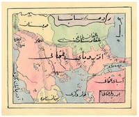
Atlas of the western Ottoman Empire.
Ottoman Empire 1910. Gold-stamped cloth with the tughra of Mehmed V ruled 1908-18 on the front board when reading right to left and "Album" on the back board the front when reading left to right with an inscription below the tughra and the European numerals 16 and 2 flanking an ornament below the inscription the whole framed by 4 large floral cornerpieces. Oblong 4to 26.5 x 19.5 cm. 14 leaves with 10 pen-and-ink maps hand coloured with watercolours. Tissue guards. An album of hand-drawn maps forming an atlas of the western mostly European parts of the Ottoman Empire with legends in Ottoman Turkish written in the Arabic script. The overview map shows Albania Kosovo Macedonia and the Ottoman controlled northern parts of Greece coloured together with Thrace and the northwest parts of Anatolia shown treating them as a single unit while Serbia and Bulgaria like the small parts of territories outside Ottoman control are coloured separately. Most of the other maps give more detailed views of some of these regions including the Bosporus the Dardanelles Halkidiki Chalcidice Albania etc. but there is also a map of Crete not in the overview map.In fine condition. hardcover
Riferimento per il libraio : ABC_47241
|
|
|
[OZANAM (Jacques)]
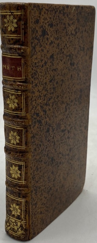
Méthode de lever les plans et les cartes de terre et de mer. avec toutes sortes d'instruments et sans instruments
Paris, Jombert, 1716 in-12, (12)- 215 pp., 14 planches repl., veau brun moucheté, dos à nerfs orné, tranches rouges (rel. de l'époque). Premier feuillets brunis.
Riferimento per il libraio : 230174
|
|
|
[PACIFIC NORTHWEST -- ATLAS]. DAVIS, Ellis A
Davis’ new commercial Encyclopedia. Washington Oregon and Idaho. The Pacific Northwest.
Seattle & Berkeley CA: Ellis A. Davis 1909. Folio. 190 pp. Illust. & decorated title 100s of photo illusts. over 100 colour maps many double page 1 very large folding colour map tipped-in on rear pastedown a couple minor closed tears at creases. Red cloth silver lettering & decoration embossed on front cover minor bumping to corners bumping & minor fraying head & foot of spine very faint tidemark to fore-edges still a VG- copy very clean and bright textblock. First edition of this well-illustrated commercial atlas intended to promote the Pacific Northwest during the Alaska-Yukon Exposition carefully listing most of the major and minor cities their counties industries local products and 100s of photos of buildings logging railroads shipping and more. The atlas includes detailed economic statistical maps of Oregon Washington and Idaho; street maps of Spokane WA Portland OR Seattle WA Boise ID and more. The large folding colour map at rear is of Oregon State -- these atlases were also issued with Idaho Washington and Oregon & Washington colour maps separately. Ellis A. Davis, hardcover
Riferimento per il libraio : 53081
|
|
|
[RAYNAL].-
Atlas de toutes les parties connues du globe terrestre dressé pour l'Histoire Philosophique et Politique des Établissemens et du Commerce des Européens dans les deux Indes.-
Sans indication de lieu ni de date [Genève. Pellet. 1780]. In-4 (183 x 261mm) dos lisse maroquin rouge orné de filets et d'un semis d'étoiles or, plats veau raciné à double encadrement de filets or, gardes marbrées, bien complet des 23 tableaux et des 50 cartes dressées par Bonne, la plupart dépliants. Menus défauts mais bon exemplaire.
Riferimento per il libraio : ORD-16352
|
|
|
[REAL ESTATE ATLAS -- LAKE OSWEGO, OREGON].[HINES (Surveyor); UNDERWOOD, Walter A & Doris (Owners).]
Oswego later Lake Oswego: realty atlas.
Portland OR: Oregon Blue Print Co. 1947-1959. Oblong atlas folio. 21 x 17.5 in. 52 leaves not contiguously numbered. all dyazo-print whjteprint maps w/ first consisting of a large folding “Oswego Oregon Street Map†many leaves w/ creasing corners worn some with closed tears secured at gutter margin w/ 4 brass split-pins over thick brown paper stock still a VG- exemplar. First edition thus of this exceedingly rare realty atlas for Oswego Oregon chronicling its’ explosive growth following World War II prior to the consolidation with surrounding suburbs and renaming as the City of Lake Oswego in 1960. These real estate atlases were sold in installments to Lake Oswego & Portland area real estate agents land use boards and public institutions with installments appearing from 1947-1959 but the Oswego atlas sheets are far scarcer than even the very rare Portland issues. Oswego and surrounding suburbs such as Alto Park Acres Forest Hills Lake Grove Rainbow Terrace Uplands Crest and Woodmont were all developed initially by the Ladd Estate Company which first platted the area with Paul C. Murphy overseeing the design with the aid of of Frederick & John Olmsted to create a park like setting around the Lake. This atlas with key map opening details the evolution from 1947-1959 the street-by-street and plat-by-plat of the surrounding area providing essential information on the emergence of these suburbs from the original donation land claims as the city grew from about 1500 to over 10000 by 1959. The more than 100 new residential plats created from the original donation land claims throughout the Lake Oswego area including the plats on the south side of South Shore Drive which created the Palisades Neighborhood and just prior to the July 2 1959 annexation which brought all of Oswego Lake parts of Lake Grove Palisades and others in the Lake Grove Sanitary District all evolve through these maps. Researchers can trace the evolution of the Portland-Salem Expressway later called the Baldock Freeway and further developed into the I-5 corridor alongside Lake Oswego along with the rapid growth of the area. Original Donation Land Claims are clearly demarcated including those of Charles Brown Bryant Waters Carman Albert Durham and many others. Oregon Blue Print Co. was established on SE Hawthorne in Portland OR by the early 1940’s and were the printers for the Pittmon maps which were extensively used and continually updated in the Portland area. Under Walter & Min Underwood the company focused on blueprinting and engineering plans as well as land promotion brochures and street maps. Company still remains family owned. It appears that later versions of the Oswego Oregon Street Map were used as land promotion brochures and some early versions do survive in holdings of Lake Oswego City Government and 1 in OHS but no other examples are located in Worldcat. No similar versions of this atlas have survived in institutional holdings that this cataloguer could identify accurately. See: Mid-Century Lake Oswego: A Look at Lake Oswego’s Modern Developments 1935-1965 August 2010. Oregon Blue Print Co., hardcover
Riferimento per il libraio : 64270
|
|
|
[Revue de Géographie Alpine]
REVUE de GEOGRAPHIE ALPINE - Tome 84 - 1996 - N° 4
Revue de 172 pages, format 160 x 240 mm, illustrée, brochée, Institut de Géographie Alpine, bon état
Riferimento per il libraio : LFA-126722826
|
|
|
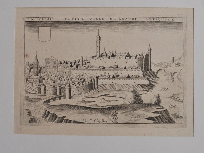
[RHÔNE L’ARBESLE] - CHASTILLON (Claude).
La Besle petite ville de grande antiquité. Estampe originale
[Paris, Boisseau, vers 1640], 11,5 X 17,5 cm. sur une feuille de 20 x 27 cm., monté dans un passe-partout. Vue de la ville tirée de Topographie françoise parue chez Boisseau.
Riferimento per il libraio : 46405254
|
|
|
[Robert de Vaugondy] Delamarche (C. F.)
Europe divisée en ses Empires, Royaumes et Républiques, par C.F. Delamarche, géographe, et successeur de Robert de Vaugondy.
français An XII (1803). Carte entoilée dépliante (55x73 cm) de 18 panneaux, aux contours finement aquarellés de l'époque. Etui en plein papier bleu de l'époque orné de dentelle dorée, titre frappé or sur le plat supérieur. Revue et corrigée suivant les nouvelles divisions. Bel exemplaire.
|
|
|
[ROLLIN] - LETRONNE (M.).-
Atlas de géographie ancienne pour servir à l'intelligence des oeuvres de Rollin.
1827 Paris, Firmin-Didot, 1827, petit in folio relié demi-veau vert olive, dos lisse orné de filets dorés, titre en long.
Riferimento per il libraio : 79455
|
|
|
[SCHOOL ATLAS] DITTENBERGER, FRIEDRICH; SOMMERLATT, FRIEDRICH
Hand und Schulatlas
Karlsruhe: Verlag Von Gottlieb Braun 1831. Neue Ausgabe. Hardcover. Good. Two volumes bound in one. Oblong with cloth spine and corners marbled paper boards printed label to upper board. 45 21 & 24 hand-colored lithographed maps some folding. Rubbing and wear to boards spotting throughout but hardly untypical. A rather scarce student atlas. <br/><br/> Verlag Von Gottlieb Braun hardcover
Riferimento per il libraio : D19539
|
|
|
[SCIENCE - ATLAS] GALLON Jean-Gaffin
MACHINES ET INVENTIONS APPROUVEES PAR L'ACADEMIE ROYALE DES SCIENCES, depuis son établissement jusqu'à présent, avec leur description, ATLAS TOME 2 SEUL (1776) - 165 PLANCHES IN-FOLIO
Paris Antoine BOUDET 1776 -in-folio plein-veau 1 volume, reliure d'époque plein veau brun in-folio (binding full calfskin in-folio) (30 x 45 cm), Reliure d'Epoque, dos à nerfs (spine with raised bands), décoration "or" et à froid (gilt and blind-stamping line decoration), la pièce de titre manque, tomaison frappée "or", pièce de tomaison sur fond marron foncé avec deux filets "or" en encadrement, filets à froid de part et d'autre des nerfs, coiffes arasées, entre nerfs à fleuron "or" dans un encadrement à double filets "or" avec fleurons fleurettes "or" aux angles, filet et roulette large "or" en tête et en pied, mors du 1er plat fendu sur 20 cm, manques de cuir aux plats, coins écornés (à restaure, double filets "or" sur les coupes (blind stamping fillets on the cuts) avec manques de dorure, toutes tranches lisses rouges, ATLAS DE PLANCHES N°II, de la planche N° 147 à la Planche N° 312, soit 165 gravures hors-texte gravées sur bois en noir majoritairement gravées par Dheulland et Hérisset, représentent les inventions techniques concernées, utiles aux arts les plus divers : militaire, hydraulique, horlogerie, astronomie, machines de calcul, arpentage et topographie, etc des Années 1714 à 1728, sans paginations (165 feuillets), légères mouillures claires en marge de quelques gravures, mais l'ensemble est en bon état, 1776 Paris Antoine BOUDET Editeur,
Riferimento per il libraio : 22987
|
|
|
[Société des Amateurs de Jardins Alpins]
PLANTES de MONTAGNE - N° 149 - 1989
Une revue de 24 pages, format 150 x 240 mm, illustrée, brochée, publiée en 1989, Société des Amateurs de Jardins Alpins, bon état
Riferimento per il libraio : LFA-126748726
|
|
|
[Spanien, Portugal, Madrid]
?Spanien und Portugal [...] von C. Glaser?. Grenzkolor. lithogr. Karte. (Aus: Glaser, C. Vollständiger Atlas).
(Mainz, um 1840). 39,5 x 48 cm. Mittig gefaltet (wie erschienen).
Riferimento per il libraio : 40835

|
|
|
[SUISSE] Bureau de Statistique du Département fédéral de l'intérieur:
Atlas graphique et statistique de la Suisse. 1914.
Berne, Bureau de Statistique du Département fédéral de l'intérieur, 1914. In-folio oblong de [2]-6 pages et 64 tableaux imprimés en couleurs. Coupes et coins légèrement frottés, plats un peu sali.
Riferimento per il libraio : 13240
|
|
|
[SYRIA - MAP].
[MAP OF SYRIA] Harita al-Suriyah. Calligraphed by Kamel Al-Baba, (1905-1991).
Very Good Arabic Original chromo-lithograph map in brown tones. On a special paper with an ongoing blindstamped "Regestre Robur" during the borders. Folded. 70x100 cm. In Arabic. Scale: 1 /1.000.000. Chipped on margins, split on folded traces. Slight discoloration and one stain on lower margin. Otherwise a good copy. An attractive and detailed map of Syria shows the capital (as Aleppo n that map), other cities like Damascus, Raqqa, Homs, Latakia, Ayn al-Arab, Idlib, Hama, Deir Ez-Zor, Jarabulus, et alli. And it shows Turkey on the north (as Turkey containing Hatay and Alexandrette), The Mediterranean shores of the land as well as Lebanon and Palestine (and Jerusalem) on the west, Sharq al-Urdun (Jordan) and Iraq on the south and east. It's very detailed on showing the roads spread throughout the land like railways and ancient roads from the Roman period. Additionally this roads can be followed to the other Arabic countries and regions on the map. This map was calligraphed by Kamel Al-Baba, (1905-1991), who was a Lebanese contemporary / modern calligrapher. He is the son of famous calligrapher Mokhtar Al-Baba. Cannot be found in WorldCat.; Not in Library of Congress Map Collection. Very scarce.
|
|
|
[Ungarn]
?A nemet Bánati Hatarörzö Regement Videkenek Tablaya?.
[Wien, um 1810]. Grenzkolor. Kupferstich-Karte von B. Biller aus D. v. Görög, Magyar Atlas (Blattgröße 36,6 x 28,9 cm, Darstellung 27,5 x 22 cm).
Riferimento per il libraio : 55228

|
|
|
[Ungarn]
?Györ Varmegye (Comitatus Jaurinensis)?.
[Wien, um 1810]. Grenzkolor. Kupferstich-Karte von J. Berken aus D. v. Görög, Magyar Atlas (Blattgröße 27,5 x 35 cm, Darstellung 22,5 x 28,2 cm).
Riferimento per il libraio : 55226

|
|
|
[Ungarn]
?Pest, Pilis, es Solt törvenyesen egyesült Varmegyek?.
[Wien], 1811. Grenzkolor. Kupferstich-Karte aus D. v. Görög, Magyar Atlas (Blattgröße 37 x 28,5 cm, Darstellung 29,2 x 22,2 cm).
Riferimento per il libraio : 55229

|
|
|

 Ricevere i risultati per e-mail
 Scaricare i risultati in PDF
 RSS feed
 Link
Link


