|
|
|
HARITA UMUM MÜDÜRLÜGÜ = MAP GENERAL DIRECTORY].
[MAP of TURKISH BALKANS] 26. Otluk Köyü. 27. Samako. 32. Sofiye. 33. Cumabâla. Mübde-i Tûl Paris'den itibâr olunmusdur.
Very Good Turkish, Ottoman (1500-1928) Original color map on cloth. A little foxing on cloth. Very good. Folded. Oblong atlas folio. (66 x 72 cm). In Ottoman script. Scale: 1/210.000. Ottoman sanjaks in Balkans. A rare Ottoman map of Balkans with Turkish place names for the period of pre-Balkan Wars, (1912-1913). Very important for onomastics and historical geography. Written 'Paris -French meridian- was accepted as the 0 meridian'. The Paris meridian is a meridian line running through the Paris Observatory in Paris, France-now longitude 2°20'14.03" east. It was a long-standing rival to the Greenwich meridian as the prime meridian of the world. Personal stamp of Muhiddin Pasha on cloth, under the printed descriptive texts. It's from the collection of him. Hasan Muhiddin Pasha [Çanga], (1866-1944), who was a lieutenant in Hedjaz Army of the Ottoman Empire in 1887. After he suppressed the rebellion in Yemen, 1891, his rank was promoted to the 'major'. After the Imam Yahya rebellion in Yemen, 1904, he prepared a report for the Ottoman government. He also took part in Ethiopia, Sudan, Yemen, Arabian Peninsula for various military duties. After promotion to division command, he was provincial president of CHP (Republican People's Party). He was a very important politic and diplomatic figure for the last period of Ottoman and early Republican Turkey. Not in Tooley. Extremely rare.
|
|
|
HARITA UMUM MÜDÜRLÜGÜ = MAP GENERAL DIRECTORY].
[MAP of TURKISH BALKANS] 54. Debre-bala (Makedonya). 55. Ilbasan (Elbasan Sandjak -Arnavutluk-). 61. Nis Sandjak (Sirbistan). 62. Draç Sandjak (Arnavutluk). Mübde-i Tûl Paris'den itibâr olunmusdur. [Debar (Macedonia), Elbasan Sandjak (Albania), Nish (Serbia), Durras (Albania)].
Very Good Turkish, Ottoman (1500-1928) Original color map on cloth. A little foxing on cloth. Very good. Folded. Oblong atlas folio. (66 x 72 cm). In Ottoman script. Scale: 1/210.000. Ottoman sanjaks in Albania, Macedonia, Greece and Serbia. A rare Ottoman map of Balkans with Turkish place names for the period of pre-Balkan Wars, (1912-1913). Very important for onomastics and historical geography. Written 'Paris -French meridian- was accepted as the 0 meridian'. The Paris meridian is a meridian line running through the Paris Observatory in Paris, France-now longitude 2°20'14.03" east. It was a long-standing rival to the Greenwich meridian as the prime meridian of the world. Personal stamp of Muhiddin Pasha on cloth, under the printed descriptive texts. It's from the collection of him. Hasan Muhiddin Pasha [Çanga], (1866-1944), who was a lieutenant in Hedjaz Army of the Ottoman Empire in 1887. After he suppressed the rebellion in Yemen, 1891, his rank was promoted to the 'major'. After the Imam Yahya rebellion in Yemen, 1904, he prepared a report for the Ottoman government. He also took part in Ethiopia, Sudan, Yemen, Arabian Peninsula for various military duties. After promotion to division command, he was provincial president of CHP (Republican People's Party). He was a very important politic and diplomatic figure for the last period of Ottoman and early Republican Turkey. Not in Tooley. Extremely rare.
|
|
|
HARITA UMUM MÜDÜRLÜGÜ = MAP GENERAL DIRECTORY].
[MAP of TURKISH BALKANS] 58. Parga, 71. Liyapidis, 72-73. Yunan Denizi. Mübde-i Tûl Paris'den itibâr olunmusdur. [Parga, Liapidis, Greek Sea].
Very Good Turkish, Ottoman (1500-1928) Original color map on cloth. A little foxing on cloth. Very good. Folded. Oblong atlas folio. (66 x 72 cm). In Ottoman script. Scale: 1/210.000. A rare Ottoman map of Balkans with Turkish place names for the period of pre-Balkan Wars, (1912-1913). Very important for onomastics and historical geography. Ottoman Greece. Written 'Paris -French meridian- was accepted as the 0 meridian'. The Paris meridian is a meridian line running through the Paris Observatory in Paris, France-now longitude 2°20'14.03" east. It was a long-standing rival to the Greenwich meridian as the prime meridian of the world. Personal stamp of Muhiddin Pasha on cloth, under the printed descriptive texts. It's from the collection of him. Hasan Muhiddin Pasha [Çanga], (1866-1944), who was a lieutenant in Hedjaz Army of the Ottoman Empire in 1887. After he suppressed the rebellion in Yemen, 1891, his rank was promoted to the 'major'. After the Imam Yahya rebellion in Yemen, 1904, he prepared a report for the Ottoman government. He also took part in Ethiopia, Sudan, Yemen, Arabian Peninsula for various military duties. After promotion to division command, he was provincial president of CHP (Republican People's Party). He was a very important politic and diplomatic figure for the last period of Ottoman and early Republican Turkey. Not in Tooley. Extremely rare.
|
|
|
HARITA UMUM MÜDÜRLÜGÜ].
[MAP of BALKANS] Bati Arnavutluk, Venedik Körfezi kiyilari. [Venice Bay, Albania].
Very Good Turkish, Ottoman (1500-1928) Original color map on cloth. Folded. A good copy. Oblong atlas folio. (65 x 75 cm). In Ottoman Turkish. Showing Adriatic shores of Western Albania and Albanian land. [MAP of BALKANS] Bati Arnavutluk, Venedik Körfezi kiyilari. [Venice Bay, Albania]. Extremely rare.
|
|
|
HARITA UMUM MÜDÜRLÜGÜ].
[MAP of IRAQ - SHEET of SAMAWAH] Semave (First of 4 feuilles).
Very Good Turkish, Ottoman (1500-1928) Original chromolithograph folded map. Oblong atlas folio. (49 x 65 cm). In Ottoman script. Repaired with a band in the contemporary period from its backside. Set including 4 sheets. Other sheets are Basrah, Bagdad, and Qut al-Amare. This is the first sheet including 'Samawah'. Rare. Scale is 1/500.000. Samawah city was settled by the Arab tribe of Banu Quda'a around the 3rd century AD. It is built on both sides of the Euphrates river; there are four bridges in the center of town for crossing between the two sides. The west bank of the city contains the commercial heart of the city and includes the old town and the Jewish quarter, Agd al Yahood. The west bank is the site of the covered market Suq Al Masgoof, which dates to the Ottoman period. The area surrounding the market is the old city with its Byzantine maze of crowded markets and streets. The eastern side of the city including 'Qushla' has a more modern feel and contains a number of estates of apartment blocks built during the 1970s and 1980s, As Samawah Stadium, which is home to the local Muthanna football team Samawa FC, as well as technical colleges and the polytechnic. There too is Al Qushla, the historic "Ottoman Barracks". The most famous attraction of Samawah in the ruins of the ancient Sumerian city of Uruk which dates to 4000 BC. This was the largest city in Sumer, extending over 2 km2. Uruk was not only the largest conurbation of the first urban civilization on earth, but it is also the place where the first written script was discovered, the oldest dating back to 3300 BC. The palm groves of Samawah: Samawah is built on both sides of the Euphrates and is surrounded by hundreds of palm groves that give it a tropical feel, especially in the southern and northern suburbs. These groves provide cool respite from the scorching heat of Mesopotamia and were the inspiration for the famous Iraqi folk song "The Palm of Samawah".
|
|
|
Harms
A-Z Atlas - Gesamtband
Leipzig, List und Bressendorf, ca1927. Hln, 62S, Gebrauchsspuren, noch gutes Arbeitsexemplar
Referentie van de boekhandelaar : 01424

|
|
|
Harms
Harms Schulatlas. Ausgabe C.
Leipzig, List & von Bressensdorf, um 1930. 4°, 41 S., mit 40 Kartenseiten; Bezahlung per PayPal möglich, we accept PayPal, Regalspuren am Fußschnitt, Einband stark beschabt und stark bestoßen und eingeschmutzt, Kanten mit Paketband verstärkt, altersbedingte Bräunungen, starke Gebr.sp., Pappband, gebunden
Referentie van de boekhandelaar : 29890
|
|
|
Harrington, Sheila; Stevenson, Judi (Editors); Dunster, Kathy; Bateman, Robert (Preface); Penn, Briony (Foreword)
Islands in the Salish Sea : A Community Atlas
157 pages. Endnotes. Colour photos and illustrations. "The spectacular and surprising maps in this atlas were created by communities on 17 of the largest islands in the Strait of Georgia and are presented with stories of their remarkable places and people." - from back cover. Unmarked with moderate wear. A sound copy. Book

|
|
|
Hart, Atlas
The House on Coven Cove
paperback. Good. Access codes and supplements are not guaranteed with used items. May be an ex-library book. paperback
Referentie van de boekhandelaar : 1718966687.G ISBN : 1718966687 9781718966680

|
|
|
Hart, Franz / Henn, Walter / Sontag, Hansjürgen
Stahlbau Atlas, Geschoßbauten. 2, neu bearb. Aufl.
München: Institut für internationale Architektur Dokumentation 1982. 400 S., zahlr. s/w Abb., Grafiken und Tab., Reg., Lit.verz. 4° Kart.mS.
Referentie van de boekhandelaar : 259052
|
|
|
HARTA [sic. Harita] UMUM MÜDÜRLÜGÜ.
[TURKISH MAP of BEYROUTH, DAMASCUS, JORDAN] Sam, Beyrouth, Lebanon, Jordan.
Very Good Turkish Original color map. 52x65 cm. In Turkish. Scale: 1: 800,000. Showing shores from Latakia to Haifa; Lebanon , Beyrouth, North Palestine, Syria, Saudi Arabia and borders, Orontes river, deserts. [TURKISH MAP of BEYROUTH, DAMASCUS, JORDAN] Sam, Beyrouth, Lebanon, Jordan.
|
|
|
Hassan Jouad et Bernard Lortat-Jacob
La saison des fêtes dans une vallée du Haut-Atlas
1978, Seuil. In-4 broché, 109p. Illustrations en couleur ainsi qu’en noir et blanc. Exemplaire en bon état malgrès des traces de viellissement.
Referentie van de boekhandelaar : VOY958M

|
|
|
HASAN TAHSIN.
Rehber-i cografya. [i.e. Guide to geography].
Very Good Turkish, Ottoman (1500-1928) Paperback. Demy 8vo. (22 x 14 cm). In Ottoman script. 44 p. Hasan Tahsin's book called Rehber-i Cografya [i.e. Guide to geography] was prepared for use in primary schools. The author, who started the work with the benefits of learning geography, explained the geographical concepts briefly and clearly after giving brief information about the geographic terminology and its branches of geography. Physical and human geography information is predominant throughout the work. After telling about the coasts, mountains, lakes, rivers, cultural parts, important cities, and towns of the geographical regions he has dealt with, he conveyed the peoples according to their population, race, and religion. He explained the geographical concepts in detail with their names in Arabic, Persian and Ottoman languages, such as Muhit-i Daire [i.e. Horizon], directions, winds, Mihver-i Âlem [i.e. Axis of celestial sphere], Merkez-i arz, Kutblar [i.e. Polars], Hatt-i Istivâ [i.e. Equator], Devair-i Mütevâziye, Nisfünnehar ve Tûl Daireleri [i.e. Parallels and Meridians], Husuf ve Kusuf [i.e. Lunar and Solar Eclipses], etc. Description chapters after that including Ottoman land, Ottoman lands in Europe and shores, the Archipelago, Ottoman administration system, vilayats of Istanbul (Constantinople), Edirne (Adrianople), Selânik (Thessaloniki - Salonica), Yanya (Ioannina), Iskodra, Manastir, Kosovo, Girid - Kandiye (Crete), Bosnia and Herzegovina, East Rumelia, Bulgaria, Asya-yi Osmânî (Ottoman in Asia), Trablusgarp [Libya], Benghazi, Egypt, Bahr-i Sefid [i.e. the Mediterranean Sea], Afrika-yi Osmânî [i.e. Ottoman lands in Africa], Aleppo, Syria, Beirut, Basrah, Bagdad, Mosul, etc. Hasan Tahsin was an Ottoman / Turkish teacher in the Dar'u l-Hayr-i Ali and the director of the Amcazâde [ori Amucazâde] Hüseyin Pasha School. Özege 16576. First Edition.
|
|
|
Hasselaar, J.M
Wegen en Kruispunten op een oude Atlas. [Von Johannes Martinus Hasselaar]. (een diactische commentaar op de Reformierte Dogmatiek van H Heppe).
ohne Ort, im Selbstverlag des Verfassers 1974. 225 Seiten. Als Typoskript gedruckt. 4° (25-35 cm) Priv.-Rückenbroschur. [Softcover / Paperback].
Referentie van de boekhandelaar : 2141408

|
|
|
Hassinger, Hugo
Kunsthistorischer Atlas der k. k. Reichshaupt- und Residenzstadt Wien und Verzeichnis der erhaltenswerten historischen, Kunst- und Naturdenkmale des Wiener Stadtbildes.
Wien, Schroll, 1916. VI, 1 Bl., 304 S. mit zahlr. Textabb. (Ohne die 19 Stadtpläne). 4°. Lwd. der Zeit mit montiertem OU (kl. Gebrssprn., etw. gebräunt).
Referentie van de boekhandelaar : 21997
|
|
|
Hassler, R., F. Mundinger and T. Riechert
Stereotaxis in Parkinson Syndrome. With an Atlas of the Basal Ganglia in Parkinsonism by R. Hassler. [By R. Hassler, F. Mundinger & T. Riechert]. Foreword by E. A. Spiegel.
Berlin, Heidelberger & New York: Springer-Verlag 1979. 315, (1) pages. With 163 Figures in 235 separate Illustrations. 4° (27,6 x 20 cm). Illustrierter Orig.-Pappband mit schlichtem Pappschuber. [Hardcover / fest gebunden].
Referentie van de boekhandelaar : 3143214

|
|
|
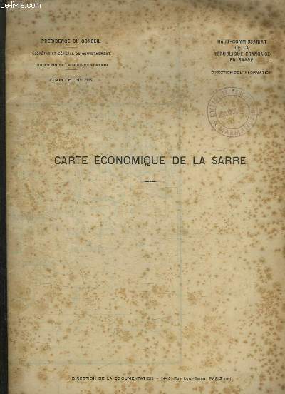
HAUT COMMISSARIAT DE LA REPUBLIQUE FRANCAISE.
CARTE N° 36. CARTE ECONOMIQUE DE LA SARRE.
DIRECTION DE LA DOCUMENTATION.. Non daté. In-Plano. Broché. Bon état, Couv. convenable, Dos satisfaisant, Quelques rousseurs. Carte en couleurs dépliante de 99 cm / 74 cm.. . . . Classification Dewey : 912-Atlas, cartes et plans
Referentie van de boekhandelaar : R150175843
|
|
|
Hauck, Arthur und Peter Quick
Strukturen des Lebens. Ein Bildatlas zur Biologie und Mikroskopie der Zelle.
Stuttgart, Metzler, 1986. 312 S. mit zahlr. Ill. (z.T. farb.) 26 x 19 cm, Leinen mit OSchU
Referentie van de boekhandelaar : 14409
|
|
|
Haupka und Co. (Hrg.)
Autoatlas und Reiseführer Deutschland
Hamburg, Falk-Verlag, ohne Angaben. 1. Auflage 541 Seiten , 30 cm , Hardcover/Pappeinband
Referentie van de boekhandelaar : 49280
|
|
|
HAUT COMMISSARIAT DE LA REPUBLIQUE FRANCAISE.
CARTE N° 36. CARTE ECONOMIQUE DE LA SARRE.
DIRECTION DE LA DOCUMENTATION.. Non daté. In-Plano Carré. Broché. Bon état. Couv. convenable. Dos satisfaisant. Quelques rousseurs. Carte en couleurs dépliante de 99 cm / 74 cm.

|
|
|
HAWKES Jacquetta et alii
"Atlas culturel de la préhistoire et de l'antiquité; encyclopédie chronologique des civilisations du monde entier, de 35000 av. JC à 500 ap. JC. Collection : Encyclopédie visuelle."
Paris/Bruxelles, Elsevier/Séquoia, 1978. 21 x 29, 255 pp., très nombreuses illustrations en couleurs, reliure d'édition pleine toile + jaquette, très bon état.
Referentie van de boekhandelaar : 36940
|
|
|
HAWKES JACQUETTA
ATLAS CULTUREL DE LA PREHISTOIRE ET DE L'ANTIQUITE.
1978 Elsevier Sequoia 1978. In-4 relié pleien toile éditeur sous jaquette illustrée rempliée de 255 pages. Reproductions dans et hors texte, en noir et en couleurs.
Referentie van de boekhandelaar : 1310
|
|
|
Hawkes, Jacquetta Hopkins
Atlas of Ancient Archaeology
Traces the patterns of cultures and civilizations down to the beginning of the classical world. Many pages are devoted to the rich and diverse remains of Anatolia and Persia, of the river valley civilizations of Nile, Tigris-Euphrates and Indus, of Mycenaean Greece and Minoan Crete. Pre-Columbian Meso- and South America receive equally full coverage. 272op. maps diagrams bibliography. index Book
|
|
|
HAYT FRANZ
ATLAS D'HISTOIRE UNIVERSELLE / COLLECTION ROLAND
WESMAEL-CHARLIER. 1968. In-8. Relié. Etat d'usage, Couv. convenable, Dos satisfaisant, Intérieur frais. 134 pages - cartes en couleurs - petit tampon et annotation en debut d'ouvrage.. . . . Classification Dewey : 912-Atlas, cartes et plans
Referentie van de boekhandelaar : RO20160556
|
|
|
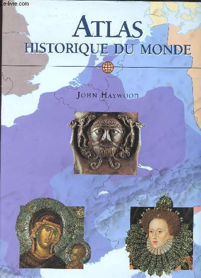
HAYWOOD JEAN
ATLAS HISTORIQUE DU MONDE
KONEMANN. NON DATE. In-4. Broché. Bon état, Couv. convenable, Dos satisfaisant, Intérieur frais. 240 pages augmentées de nombreuses photos, illustrations et cartes en couleurs, dans et hors texte. Jaquette en bon état.. . . . Classification Dewey : 912-Atlas, cartes et plans
Referentie van de boekhandelaar : RO30301381
|
|
|
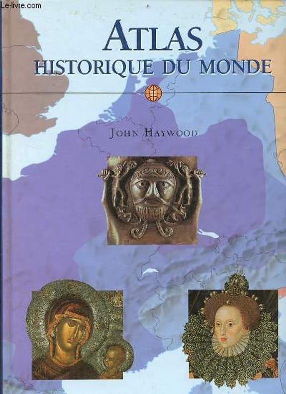
Haywood John
Atlas historique du monde.
Könemann. 1999. In-4. Relié. Bon état, Couv. convenable, Dos satisfaisant, Intérieur frais. 240 pages - nombreuses cartes et illustrations en couleurs dans et hors texte.. . . . Classification Dewey : 912-Atlas, cartes et plans
Referentie van de boekhandelaar : R160224829
|
|
|
HAYWOOD (John).-
Atlas historique du monde.
1999 Cologne, Ed. Könemann, 1999, in 4°, cartonnage illustré de l'éditeur, jaquette illustrée, 240 pages ; très nombreuses cartes et illustrations.
Referentie van de boekhandelaar : 80492
|
|
|
Hayes, Derek
Historical Atlas of British Columbia and the Pacific Northwest : Maps of Exploration - British Columbia, Washington, Oregon, Alaska and Yukon
208 pages. Index. Footnotes. "A unique collection of over 320 original maps of explorers and navigators from four centuries of voyages and overland treks of exploration and discovery to the northwest coast, plus native maps, and a host of others selected for their interest and historical significance." - dust jacket. Clean, bright and unmarked with very light wear. An excellent example of this wonderful work. Book

|
|
|
Hayes, Derek
Historical Atlas of the North American Railroad
224 pages. Index. List of Map Sources. Recommended reading list. Map endpapers. "A sumptuous and captivating look at the pivotal role the railroad played in the development and growth of the continent it linked from sea to sea... Gathers 400 maps, from meticulous route surveys and engineering diagrams to gorgeous promotional posters and schematic passenger timetables complemented by informative text and an impressive array of railroadiana." - from dust jacket. Clean, bright and unmarked with negligible wear. Dust jacket now preserved in glossy new archival-grade Brodart cover. A superb copy of this marvelous title. Book

|
|
|
Hayward, Charles B.; Dayton, Thaddeus S.; Harwhite, John S.; Slauson, HArold Whiting; White, T.L.; Bangs, John Kendrick; La Rue, Lawrence; Scheffauer, Herman; Witherup, Anne Warrington; Nathan, George Jean; Bacon, Leonard; Whiting, H.S.; Harrison, Henry
Harper's Weekly (Magazine), January (Jan.) 7, 1911, Vol. LV, No. 2820 - Motor Car Issue
This issue devoted to motoring. Features: Title page photo of the sport of winter motoring; One-page cartoon by E.W. Kemple represents the G.O.P. as a car tilting in the 'stand pat' direction; Improvement to be offered auto purchasers in 1911; Photo comparison of Fifth Ave. traffic between 1901 and today (many more cars in use and no horses to be seen now); How to Sell a Car; The Anatomy of the Motor; Joy-Riding of the Real Kind - new car models are brutally tested; Motoring in Winter; Boggs Sees Naples and its Environs; Two photos of new fire truck for the Bradford, England fire brigade; First Aid to Broken Cars - article with great vintage photos; Laocoon (snake fiction by Herman Scheffauer); Article on Superstitions; Witherup's Cyclopaedia of the Months; Romances of the Recruiting Offices (for the United States Army); Home Song for Montana (poem by Leonard Bacon); Blanche Bates (article with photo); The Well-Kept Car "At Home" - article with photo of home grease pit in use, small home machine shop, and large storage building with several cars parked in front; The Horse and the Motor Car - article by Henry Harrison; One-page Goodyear tire ad; Automobile Horns - article by Steven D. Thatton; Sensational one-page illustrated ad for the Phipps-Grinnell Electric Car, featuring the Model "C" 1911! (yes, electric cars were in production well over 100 years ago!); Bond Markets Renewal - article by Franklin Escher; Nice one-page ad for the Carhartt Thirty-Five automobile; Nice half-page photo ad for the Speedwell Motor Car Co. of Dayton, OH features the 4-passenger Torpedo; Quarter page ads for the Premier Motor Mfg. Company and the Atlas Motor car Company; Motoring on European Highways; Nice illustrated ad for the Hupp-Yeats Electric Car Co. of Detroit; Full-page ad for the White Company of Cleveland features illustration of a Western canada Flour Mills Co. truck. Middle leaf loose but present. Please note: front cover is numbered page 3. Presumably this issue originally included an illustrated outer wrap which is no longer present. Otherwise, it appears complete and unmarked with average wear. A worthy vintage copy, notable for its wonderful coverage of a formative time in the history of motoring - both gas and electric. Book

|
|
|
Haywood, John
Atlas der alten Kulturen : (Vorderer Orient und Mittelmeer) Aus dem Englischen (Ancient civilizations of the Near East and Mediterranean; London, 1997) von Helmut Schareika.
Stuttgart, Konrad Theiss Verlag, 2005. 4° (31x24), 304 S., mit zahlr. Karten, Illustrationen, Zeittafeln und fotograf Aufnahmen, OPbd mit fotoill OU, nahezu ungelesen, schönes gepflegtes Exemplar,
Referentie van de boekhandelaar : 58463AB ISBN : 380621963

|
|
|
Haywood, John
Die Zeit der Kelten : ein Atlas. 2. Aufl.
Frankfurt am Main : Zweitausendeins, 2003. 144 S. : zahlr. Ill., Kt. 29 cm. OPp., gebundene Ausgabe, SU.
Referentie van de boekhandelaar : 227203

|
|
|
Haywood, John
Die Zeit der Kelten : ein Atlas. Geleitw. von Barry Cuncliffe. Aus dem Engl. von Manfred Mothes ...] Dt. Erstausg., 1. Aufl.
Frankfurt am Main : Zweitausendeins 2002. 144 S. : 57 Ktn, 162 Abb. ; 29 cm, mit Schutzumschlag Pp., gebundene Ausgabe, Hardcover/Pappeinband, Exemplar in gutem Erhaltungszustand
Referentie van de boekhandelaar : 49437

|
|
|
Haywood, John
Historischer Weltatlas.
München: Bassermann, 2012. 240 S., zahlr. Ill. und Kt., 31 cm. Opp., gebundene Ausgabe.
Referentie van de boekhandelaar : 218511

|
|
|
Haywood, John
Völker, Staaten und Kulturen. Ein universalhistorischer Atlas. Mit Brian Catchpole u.a. Aus dem Engl. von Jobst-Christian Rojahn und Jochen Grube. [Lizenzausgabe für Archiv Verlag, Braunschweig].
Braunschweig, Westermann, (1998). [384] S. Mit 200 farb. Karten, 168 Zeittaf., 140 Illustr sowie Farbfotos. 30 cm. Goldgeprägt. schwarzes Halbleder auf 5 imit. Bünden. Im stabilen, leinenbezog. Schuber.
Referentie van de boekhandelaar : 91976

|
|
|
HECK, Johann Georg:
Der Alpenführer : neuer Reise-Atlas der Schweiz.
Leipzig, Weber, 1852, (hs. in 1882 abgeändert), kl. in-8vo, (17x11 cm), Eisenbahnkarte Mitteleuropa auf Vorsatz vorne. Übersichts-Karte der Schweiz auf Vorsatz hinten. + Kolor. Titelbl. mit Kantonswappen u. Inhaltsverz. + 1 Bl. Zeichen- und Schrifterkl. + 10 gest. kol. Karten (13.5x8.5 cm), Exlibris Peter E. Obergfell, Original-Leinenband. (Goldgesprägt: HECK’S Reise-Atlas der Schweiz).
Referentie van de boekhandelaar : 139353aaf
|
|
|
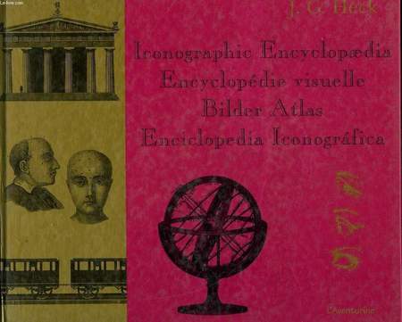
HECK J. G.
ICONOGRAPHIC ENCYCLOPAEDIA ENCYCLOPEDIE VISUELLE BILDER ATLAS ENCICLOPEDIA ICONOGRAFICA
L'AVENTURINE. 2001. In-8. Cartonnage d'éditeurs. Bon état, Couv. convenable, Dos satisfaisant, Intérieur frais. 572 pages illustrées de planches en noir et blanc.. Avec Jaquette. . . Classification Dewey : 912-Atlas, cartes et plans
Referentie van de boekhandelaar : RO30068928 ISBN : 291419918
|
|
|
Heckenroth, Hartmut/Volker Laske
Atlas der Brutvögel Niedersachsens 1981 - 1995 und des Landes Bremen.
Hannover, Niedersächisches Landesamt für Ökologie-Abt. Naturschutz, 1997. 30 cm. 332 S. Mit zahlr. Strichzeichnungen, Verbreitungskarten und Tab. Beilagen: 9 Klarsichtfolien mit Kartenaufdruck. Illustrierter Originalkarton (Softcover), Klebebindung. 1.Aufl. 1-4.000. Tadelloses gepflegtes Exemplar. Naturschutz und Landschaftspflege in Niedersachsen ; 25/2.
Referentie van de boekhandelaar : 18577AB

|
|
|
HEIN ALB. / SCHMIDT C. (Drs)
1 CARTE TOILEE DEPLIANTE DE : EVOLENA - MISCHABEL - BLATT 533 / Section4? BI, XXII / Echelle : 1: 50000.
KOMMISSIONSVERLAG VON SCHMID, FRANCKE & Co. NON DATE. In-Plano. En feuillets. Bon état, Couv. convenable, Dos satisfaisant, Intérieur frais. 1 CARTE DEPLIANTE TOILEE EN COULEUR DE DIMENSION DE 58 X 76 Cm environ.. . . . Classification Dewey : 912-Atlas, cartes et plans
Referentie van de boekhandelaar : R320093590
|
|
|
HEINRICH DIETER - HERGT MANFRED
ATLAS DE L'ECOLOGIE - ENCYCLOPEDIES D'AUJOURD'HUI
LA POCHOTEQUE. 1993. In-12. Broché. Etat d'usage, Couv. convenable, Dos satisfaisant, Intérieur frais. 284 Pages. Nombreuses figures en couleur dans et hors texte. Texte sur 2 colonnes.. . . . Classification Dewey : 912-Atlas, cartes et plans
Referentie van de boekhandelaar : RO80181389
|
|
|
Heide, Paul
Praktisches Geographie-Lern- und Wiederholungsbuch und Taschenatlas mit besonderer Berücksichtigung der Anforderungen zur Vorprüfung als Post-, Telegraphen- und Eisenbahn-Assistent für Militär-Anwärter. I. Teil: Deutschland.
Berlin, Selbstverlag, ohne Jahr (ca. 1905). Ca. 13,3 x 9,2 cm. 65 Seiten, mit farbigen Karten. Original-Karton mit Leinenrücken 40. Auflage.
Referentie van de boekhandelaar : 30944A

|
|
|
Heilpflanzen - Bianchini, Francesco und Francesco Corbetta
Der große BLV Heilpflanzenatlas 1. Auflage
1983. 243 Seiten, zahlreiche Abbildungen gebundene Ausgabe
Referentie van de boekhandelaar : 202892

|
|
|
HEIN ALB. / SCHMIDT C. (DRS)
1 CARTE TOILEE DEPLIANTE DE : EVOLENA - MISCHABEL - BLATT 533 / Section4? BI, XXII / Echelle : 1: 50000.
KOMMISSIONSVERLAG VON SCHMID, FRANCKE & Co. NON DATE. In-Plano Carré. En feuillets. Bon état. Couv. convenable. Dos satisfaisant. Intérieur frais. 1 CARTE DEPLIANTE TOILEE EN COULEUR DE DIMENSION DE 58 X 76 Cm environ. Texte et legende en Suisse Allemande. / NACHTRAGE 1890.
|
|
|
HEIN ALB. / SCHMIDT C. (DRS)
1 CARTE TOILEE DEPLIANTE DE : TOPOGRAPHISCHE KARTE DER SCHWEIZ - CARTE TOPOGRAPHIQUE DE LA SUISSE (CARTE DUFOUR) / 1 : 100.000 - BLATT - FEUILLE VIII.
BUREAU TOPOGRAPHIQUE FEDERAL. 1897. In-Plano Carré. En feuillets. Bon état. Couv. convenable. Dos satisfaisant. Intérieur frais. 1 CARTE DEPLIANTE TOILEE EN noir et blanc DE DIMENSION DE 56 X 76 Cm environ. Texte et legende en Suisse Allemande en francais.
|
|
|
Heinrich, Gerd
Berlin am 18. und 19. März 1848. Märzrevolution, Militäraufgebot und Barrikadenkämpfe.
Berlin, New York, Walter de Gruyter, 1980. Gr.-8vo. Mit 1 mehrf. gef., farbigen Karte. 7 S. OBrosch. m. Deckeltitel.
Referentie van de boekhandelaar : 24019

|
|
|
Heinrich, Gerd (Bearb.)
Kulturatlas Berlin : ein Stadtschicksal in Karten und Texten. Bearb. und hrsg. von Gerd Heinrich und Joachim Robert Moeschl ;
Berlin-Lichterfelde : Scantinental, 2007. 1. Aufl. ; 80 S. : zahlr. Abb. u. Karten ; 22 x 30 cm ; roter Org.-Pappb. mit farb. Deckelillustr.
Referentie van de boekhandelaar : 16217

|
|
|
Heinritz, Günter und Peter Heigl
Der München-Atlas : die Metropole im Spiegel faszinierender Karten. Hrsg. von Günter Heinritz u.a. Mit Fotos von Peter Heigl und Luftbildern von Klaus Leidorf ERSTAUSGABE.
Köln : Emons, 2003. 239 Seiten. Mit zahlreichen farbigen Abbildungen und graphischen Darstellungen, Karten ; 25 x 33 cm Originalleinen mit Originalumschlag im blauen Originalschuber
Referentie van de boekhandelaar : 287151

|
|
|
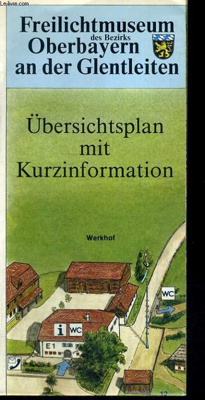
HELMUT KEIM, FRANZISKA LOBENHOFER
FREILICHTMUSEUM OBERBAYERN AN DER GLENTLEITEN. ÜBERSICHTPLAN MIT KURZINFORMATION
BEZIRK OBERBAYERN/GROSSVEIL. 1985. In-12. Broché. Etat d'usage, Couv. légèrement passée, Dos satisfaisant, Intérieur frais. Carte dépliante en 24 pages. Carte illustrée en couleurs. Texte et illustrations en noir et blanc au dos.. . . . Classification Dewey : 912-Atlas, cartes et plans
Referentie van de boekhandelaar : RO60080841
|
|
|
HELL - CORSE - ATLAS
Pilote de l'île de CORSE levé dans les années 1820, 1821, 1822 et 1824.
Au Dépôt Général De La Marine S.L. 1831 Grand in-folio ( 675 X 525 mm ), demi-toile bleue à coins, plats de percaline maroquinée. Exemplaire complet de son feuillet d'index gravé et de ses 32 cartes gravées -majoritairement marines- dont 8 sur double page ( dont carte générale de la Corse ) et montées sur onglet. EDITION ORIGINALE. Rousseurs passim et petite mouillure claire en marge intérieure. Bon exemplaire. TRES RARE. Cervoni, Image de la Corse, 138.
Referentie van de boekhandelaar : 354239
|
|
|
Hellmann, G.. Elsner, G. von. Henze, H.. Knoch, K.. Bearbeiter
Klima-Atlas von Deutschland.
Berlin., Verlag Dietrich Reimer (Ernst Vohsen)., 1921. Bearbeitet im Preusisschen Meterologischen Insitut. Mit 87 Karten in farbigen Steindruck (auf 63 Kartenseiten, 13 davon ausfaltbar), Erläuterungen und 16 Klimatabellen (auf 40 Textseiten). Zustand: Ausgeschiedenes Bibliotheksexremplar, Rückem oben mit weißem Klebestreifen, unten mit Kleberesten eines entfernten aufklbers, Einbandkanten bestoßen, Einband gebräunt. Bindung deutlich gelockert. Einbanddeckel und Vortitelblatt mit Bibliotheksstempel und Inventarnummer, Quer-4°. Halbleinen.
Referentie van de boekhandelaar : 041206
|
|
|

 De zoekresultaten per email ontvangen
 Zoekresultaten downloaden als PDF
 RSS feed
 Permanente link


