|
Hänsgen, Dirk (Hrsg.)
Deutschlandatlas: unser Land in 200 thematischen Karten. Dirk Hänsgen ... (Hrsg.). [Kart.: Leibniz-Institut für Länderkunde, Leipzig]
Darmstadt: WBG, (Wiss. Buchges.), [Abt. Verl.] 2010. 240 S.: Ill., graph. Darst., Kt.; 30 cm Pappe 0
Referentie van de boekhandelaar : 57236

|
|
|
Hänsgen, Dirk, Sebastian Lentz und Sabine Tzschaschel (Hg.)
Deutschlandatlas. Unser Land in 200 thematischen Karten.
Darmstadt : WBG Wissenschaftliche Buchgesellschaft, 2010. 240 S. mit zahlreichen Abbildungen; 30 cm; gebunden, Orig.-Pappband mit Original-Schutzumschlag;
Referentie van de boekhandelaar : 146020

|
|
|
Häntzschel, Walther
Die Praxis des modernen Maschinenbaues. Modell=Atlas.
Berlin, Weller. 12 zerlegbare Maschinenmodelle auf 8Tafeln. Halbln., etwas berieb. + bestoss. insges. guter Zustand.
Referentie van de boekhandelaar : 51360AB
|
|
|
HÉRINCQ (F.), GÉRARD (F.) et RÉVEIL (O).
Traité de botanique générale. Texte & Atlas
Paris, Abel Pilon et Cie, s.d.,2 volumes grand in-8 (28x18,5cm), viii-458pp.-79pp., cartonnage époque, dos lisse avec pièces auteurs, titre et tomaison, page de titre du texte détachée, frottements, charnière fendue (texte),
Referentie van de boekhandelaar : PHO-2112

|
|
|
HÉRINCQ (F.), GÉRARD (F.) et RÉVEIL (O).
Traité de botanique générale. Atlas iconographique du tome deuxième seul
Paris, Théodore Morgand, s.d., grand in-8 (28x18,5cm), cartonnage époque, dos lisse avec pièce de titre, frottements, accroc au plat, quelques rousseurs et brunissures.
Referentie van de boekhandelaar : PHO-2192

|
|
|
I. [PAEZ, Gaspar / MENDEZ, le Père Alphonse] II. [KIRWITZER, Wencelas Pantaléon] III. [ANDRADE, Antonio de]
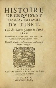
I. Histoire de ce qui s’est passé au royaume d’Ethiopie Es années 1624, 1625 & 1626. Tirées des lettres écrites & adressées au R.P. Mutio Viteleschi, General de la Compagnie de Jésus. Traduite de l’Italien en François par un Père de la mesme Compagnie. II. Histoire de ce qui s’est passé au Royaume de la Chine en l’Année 1624. III. Histoire de ce qui s’est passé au Royaume du Tibet. Tirée des Lettres écrites en l’année 1626. Relations écrites par les Jésuites en Ethiopie, Chine et Tibet
Rare réunion de trois lettres jésuites écrites d’Ethiopie, de Chine et du Tibet. Exemplaire d’une grande pureté conservé dans son vélin de l’époque. Paris, Sébastien Cramoisy, 1629.Soit 3 ouvrages reliés en 1 volume in-8 de : I/ (4) ff., 262 pp. mal chiffrées 252, (1) f.bl. ; II/ (2) ff., 102 pp., (1) f.bl. ; III/ (4) ff., 104 pp. Plein vélin souple de l’époque, dos lisse avec le titre manuscrit. Reliure de l’époque. 168 x 108 mm.
Referentie van de boekhandelaar : LCS-8124
|
|
|
I. A. (IBRAHIM ALAETTIN GÖVSA), (1889-1949).
[PROPAGANDA MAP SPREADING THE WORD THAT TURKEY IS WINNING THE WAR] Map of West Anatolia and the Archipelago showing the fronts of Turkish War of Independence in 1921-22. Tercümân-i Hakîkât'in kârilerine hediyesi. [i.e. Extra suppl. to 'Tercümân-i Hakîkat' Newspaper].
Very Good Turkish, Ottoman (1500-1928) An extremely rare litho propaganda map published as an extra supplement to the Tercümân-i Hakîkat [i.e. The Translator of Truth] newspaper just before the proclamation of Republic in Turkey in 1923 by Mustafa Kemal Atatürk (1881-1938), showing the front in West Anatolia during the War of Independence (or National Struggle) between 1919-1922 against Greek forces. The upside of the map between the note as title 'Gift to the readers of 'Tercümân-i Hakîkat', Mustafa Kemal Atatürk's portrait among decorated heroic lithographed drawings. In the lower right corner, can be seen legends of the map, scale, and mapmaker's signature. Tercümân-i Hakîkat was a daily newspaper published in Istanbul between 1878-1921 during the Ottoman Empire. Tercüman-i Hakîkat, the most important newspaper published during the reign of Sultan Abdülhamid II, was founded by novelist Ahmed Midhat Efendi, (1844-1912). In the beginning, most of the articles were written by Ahmed Midhat Efendi. It was an encyclopedic newspaper with the aim of inculcating and educating reading habits among the Turks and it played an important role in the training of many famous Ottoman journalists. Its first issue was published on June 26, 1878. After Ahmed Midhat's death in 1913, the newspaper changed owners, and the last issue was published on February 11, 1921. Ibrahim Alaettin Gövsa, (1889-1949), was an Ottoman / Turkish journalist, educator, and intellectual who supported the War of Independence the most. This propaganda map published in Tercümân-i Hakîkat, during the war in 1920 or 1921, is a propaganda tool that calls on the literate people belonging to a certain class, especially those living in Istanbul, to support the war, and aims to spread the word that Turkey is winning the war. Original lithograph map. 50x35,5 cm. In Ottoman script (Turkish with Arabic letters). Scale: 1: 250.000. Occasionally foxing and slight stains on paper, folded traces. Otherwise a very good copy.
|
|
|
IABLOKOFF (A. Kh.)
Un mois de recherches écologiques dans le Moyen-Atlas.
Saint-Amand (Cher), Pinardon, 1954 ; plaquette in-8, brochée, couverture muette. paginé 97-128Rare tiré à part du Bulletin de la Société des sciences Naturelles et Physiques du Maroc. Cette communication concerne les insectes découverts dans les forêts de l’Atlas.
Referentie van de boekhandelaar : 35503886
|
|
|
IBNU'N-NEDÎM (EBU'L-FEREC MUHAMMED BIN EBÎ YA'KÛB ISHÂK BIN MUHAMMED BIN ISHÂK EN-NEDÎM), (935-990).
El-Fihrist [Islâm tarihinin ilk dört asrindaki ilmî, edebî ve fikrî faaliyetlerin sistematik bir biçimde sunuldugu bibliyografik bir eserdir].Prep. by Abdülkadir Coskun. Translated by Ramazan Sesen.
New Turkish Original bdg. HC. Roy. 8vo. (24 x 17 cm). In Turkish. El-Fihrist. [Islâm tarihinin ilk dört asrindaki ilmî, edebî ve fikrî faaliyetlerin sistematik bir biçimde sunuldugu bibliyografik bir eserdir].Prep. by Abdülkadir Coskun. Translated by Ramazan Sesen. Translation of manuscript copy of Süleymaniye Yazma Eser Library, Sehid Ali Pasha Nr. 1934.
|
|
|
IBRAHIM OF MURSIYE.
The chart of Ibrahim of Mursiye 1461.= Mürsiyeli Ibrahim haritasi 1461.
Fine English Paperback. Pbo. Cr. 8vo. (20 x 14 cm). In English and Turkish. 31 p., b/w ills. The chart of Ibrahim of Mursiye 1461.= Mürsiyeli Ibrahim haritasi.
|
|
|
IGN.
CARTE TOURISTIQUE. NEW YORK MANHATTAN. 1 / 15000.
CHEZ L AUTEUR.. Non daté. In-Plano. Broché. Bon état, Couv. convenable, Dos satisfaisant, Intérieur frais. Carte dépliante en couleurs de 96 cm / 130.5 cm.. . . . Classification Dewey : 912-Atlas, cartes et plans
Referentie van de boekhandelaar : R150181385
|
|
|
IGN France
Carte topographique 1636 Est - 1;25000 / Castillon la bataille Saint Emilion -
IGN France. 1982. In-Plano. Broché. Bon état, Couv. convenable, Dos satisfaisant, Intérieur frais. Carte topographique 1636 Est - 1;25000 / Castillon la bataille Saint Emilion - Partie Est de la feuille au 1:50 000 de libourne.. . . . Classification Dewey : 912-Atlas, cartes et plans
Referentie van de boekhandelaar : RO80208027

|
|
|
IGN.
CARTE TOURISTIQUE. NEW YORK MANHATTAN. 1 / 15000.
CHEZ L AUTEUR.. Non daté. In-Plano Carré. Broché. Bon état. Couv. convenable. Dos satisfaisant. Intérieur frais. Carte dépliante en couleurs de 96 cm / 130.5 cm.

|
|
|
IGOL.
ROUTES DE FRANCE.
CHEZ L AUTEUR.. Non daté. In-8. Broché. Etat d'usage, Couv. légèrement passée, Agraffes rouillées, Intérieur acceptable. 54 pages de texte + 1 carte dépliante en couleurs en fin d'ouvrage.. . . . Classification Dewey : 912-Atlas, cartes et plans
Referentie van de boekhandelaar : R150169921

|
|
|
IGOL.
ROUTES DE FRANCE.
CHEZ L AUTEUR.. Non daté. In-8 Carré. Broché. Etat d'usage. Couv. légèrement passée. Agraffes rouillées. Intérieur acceptable. 54 pages de texte + 1 carte dépliante en couleurs en fin d'ouvrage.

|
|
|
Ike et Tina Turner
Les Génies du Blues nº 1
EDITIONS ATLAS collection JAZZ. Sans date.
Referentie van de boekhandelaar : 500381464

|
|
|
Illustrated Atlas of the City of Richmond
MAP PART OF MANCHESTER. CHESTERFIELD
F. W. Beers C. E. 1876. Plan showing Part of the 3rd and 4th Wards in Manchester. Interesting to see how much of Manchester was not developed at this time. Taken from The Illustrated Atlas of the City of Richmond published in 1876. F. W. Beers, C. E. unknown books
Referentie van de boekhandelaar : 271208
|
|
|
Imaging anatomy of the head and spine : a photogr color atlas of MRI, CT, gross, and microscop anatomy in axial, coronal, and sa
Imaging anatomy of the head and spine : a photogr. color atlas of MRI CT gross and microscop. anatomy in axial coronal and sagittal planes. Unknown Binding Imaging anatomy of the head and spine : a photogr. color atlas of MRI CT gross and microscop. anatomy in axial coronal and sagittal planes. Unknown Binding
Urban and Schwarzenberg. Imaging anatomy of the head and spine : a photogr. color atlas of MRI CT gross and microscop. anatomy in axial coronal and sagittal planes. Unknown Binding <br/><br/>Imaging anatomy of the head and spine : a photogr. color atlas of MRI CT gross and microscop. anatomy in axial coronal and sagittal planes. Unknown Binding Imaging anatomy of the head and spine : a photogr. color atlas of MRI CT gross and microscop. anatomy in axial coronal and sagittal planes. Unknown Binding Urban and Schwarzenberg unknown
Referentie van de boekhandelaar : BN91501 ISBN : 3541718811 9783541718818
|
|
|
IMBERT DES MOTTELETTES Charles
Atlas synchronistique, geographiques et genealogiques pour servir a l etude de l histoire moderne de l Europe, depuis l avenement de Francois Ier, jusqu a la restauration, 1515-1815
Paris 1834 Chez l'auteur Hardcover 1st Edition
Referentie van de boekhandelaar : 027115

|
|
|
Imhof Edouard
Atlas scolaire suisse pour l'enseignement secondaire - 12éme édition- conférence des chefs des départements cantonaux de l'instruction publique
Payot lausanne. 1962. In-4. Relié. Bon état, Couv. convenable, Dos satisfaisant, Intérieur frais. 144 pages. Nombreuses cartes en couleur, hors texte. Inclus une carte du monde, pliée et ndépendante, de médecins sans frontière de 80 x 60cm environ, datant de 2016.. . . . Classification Dewey : 912-Atlas, cartes et plans
Referentie van de boekhandelaar : R200118000
|
|
|
IMHOF, Ed.:
Atlas scolaire Suisse pour l'enseignement secondaire. Publié par la Conférence des Chefs des Départments cantonaux de l'Instruction publique, subventionné par la Confédération et les Cantons. 5me édition. complètement refondue.
Lausanne, Payot (Lithographie de l'Institut artistique Orell Füssli, Zurich), 1932, in-4to, XII + 136 cartes en couleurs, reliure en demi-toile originale, bon exemplaire propre..
Referentie van de boekhandelaar : 19931aaf
|
|
|
IMHOF, Ed.:
Atlas scolaire Suisse pour l'enseignement secondaire. Publié par la Conférence des Chefs des Départments cantonaux de l'Instruction publique, subventionné par la Confédération et les Cantons. 12e édition.
Lausanne, Payot (Lithographie de l'Institut artistique Orell Füssli, Zurich), 1962, in-folio, VIII + 144 cartes en couleurs, reliure en toile originale. Bel état.
Referentie van de boekhandelaar : 42167aaf
|
|
|
IMHOF, Ed.:
Atlas scolaire Suisse pour l'enseignement secondaire. Publié par la Conférence des Chefs des Départments cantonaux de l'Instruction publique, subventionné par la Confédération et les Cantons. 14e édition.
Lausanne, Payot (Lithographie de l'Institut artistique Orell Füssli, Zurich), 1972, in-folio, VIII + 147 cartes en couleurs, + 1 cahier Supplément p. 148 à 188, reliure en toile originale.
Referentie van de boekhandelaar : 42166aaf
|
|
|
IMHOF, Ed.:
Atlas scolaire Suisse pour l'enseignement secondaire. Publié par la Conférence des Chefs des Départments cantonaux de l'Instruction publique, subventionné par la Confédération et les Cantons. 3e édition.
Lausanne, Payot (Exécuté par l'institut Kartographia Winterthur S.A.) , 1925, in-4to, X + 136 cartes en couleurs, reliure en demi-toile originale, bon exemplaire.
Referentie van de boekhandelaar : 58767aaf
|
|
|
IMHOF, Ed.:
Atlas scolaire Suisse pour l'enseignement secondaire. Publié par la Conférence des Chefs des Départments cantonaux de l'Instruction publique, subventionné par la Confédération et les Cantons. 2e édition.
Lausanne, Payot (Exécuté par l'institut Kartographia Winterthur S.A.), 1921, in-4to, X + 136 cartes en couleurs, reliure en demi-toile originale, bon exemplaire.
Referentie van de boekhandelaar : 58766aaf
|
|
|
IMHOF, Ed.:
Atlas. - Schweizerischer Mittelschulatlas. 10. Auflage, bearbeitet ... von Ed. Imhof.
Zürich, Orell Füssli, 1951, gr. in-4°, VIII + 144 farb. Karten, Original-Halbleinenband.
Referentie van de boekhandelaar : 59017aaf
|
|
|
IMHOF, Ed.:
Atlas scolaire Suisse pour l'enseignement secondaire. Neuvième (9me) édition.
Lausanne, Payot (Lithographie et impr. Orell Füssli, Zurich), 1951, in-4to, VIII + 144 cartes en couleurs, reliure en demi-toile originale, bon exemplaire.
Referentie van de boekhandelaar : 87598aaf
|
|
|
IMPRIMERIE INDUSTRIELLE
Carte de l'Europe - Afrique - Moyen Orient eu du Bassin Méditerranéen.
EDE. Non daté. In-Plano. En feuillets. Bon état, Livré sans Couverture, Dos satisfaisant, Intérieur acceptable. Carte dépliante (à la verticale) en couleurs, de 98 / 49 cm.. . . . Classification Dewey : 912-Atlas, cartes et plans
Referentie van de boekhandelaar : RO80070154
|
|
|
In Four Parts and Atlas; Part 1
Annual Report of the Secretary of War for the Year 1892 Vol. 2 of 4
paperback. Good. Access codes and supplements are not guaranteed with used items. May be an ex-library book. paperback
Referentie van de boekhandelaar : 0331954060.G ISBN : 0331954060 9780331954067

|
|
|
INCONNU
LONDON HALLWAG - PLAN DE LONDRE
INCONNU. 1969. In-Plano. Broché. Etat d'usage, Couv. convenable, Dos satisfaisant, Intérieur frais. 1 carte de dimension 90X21 et 1 petit livret de 32 pages collé à l'intérieur.. . . . Classification Dewey : 912-Atlas, cartes et plans
Referentie van de boekhandelaar : RO20155188
|
|
|
INGLEFIELD ERIC
LES DRAPEAUX - LE MONDE EN COULEURS
SOLAR. 1979. In-12. Relié. Bon état, Couv. convenable, Dos satisfaisant, Intérieur frais. 123 pages augmentées de nombreuses illustrations en couleurs dans et hors texte - annotations au crayon sur la page de garde.. . . . Classification Dewey : 912-Atlas, cartes et plans
Referentie van de boekhandelaar : ROD0138846
|
|
|
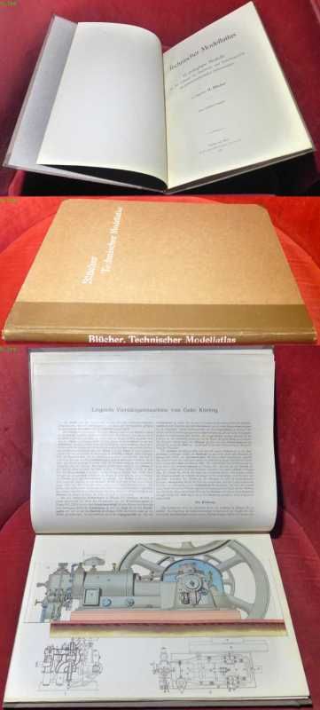
Ingenieur H. Blücher
Technischer Modellatlas. 15 zerlegbare Modelle aus den Gebieten der Machinen- und Verkehrstechnik mit gemeinverständlichen Erläuterungen
Bibliographisches Institut, Leipzig und Wien 1915. Hardcover Sehr gut
Referentie van de boekhandelaar : 031823
|
|
|
Institut Géographique National
ATLAS DES FORMES DU RELIEF.
Paris : IGN, 1956. Ouvrage toilé vert 32x26 cm, reliure spirale, 179 pages avec photographies aériennes, cartes géographiques et cartes anaglyphes en 3D (paire de lunettes en fin d'ouvrage). [Dos insolé]
Referentie van de boekhandelaar : SPN-579

|
|
|
INSTITUT GEOGRAPHIQUE NATIONAL
Carte administrative de la France.
CHEZ L'AUTEUR. Avril 1946. In-Plano. En feuillets. Bon état, Livré sans Couverture, Dos satisfaisant, Intérieur frais. Carte dépliante en couleurs, hors-texte, de 91 / 74 cm. Une déchirure de 4 / 5 cm, au niveau d'une pliure.. . . . Classification Dewey : 912-Atlas, cartes et plans
Referentie van de boekhandelaar : RO80040679
|
|
|
INSTITUT GEOGRAPHIQUE NATIONAL
Carte de l'Archipel de la Société
Non Renseigné. s.d. In-Plano. Broché. Bon état, Couv. convenable, Dos satisfaisant, Intérieur frais. Carte couleurs N°513, echelle 1:100.000.. . . . Classification Dewey : 912-Atlas, cartes et plans
Referentie van de boekhandelaar : RO20019165
|
|
|
INSTITUT GEOGRAPHIQUE NATIONAL
CARTE DE RANDONNEES : BIGORRE, PARC NATIONAL DES PYRENEES / PYRENEES, MONTAGNES SUD. ECHELLE 1 : 50 000. DIMENSION : 88 x 121 cm environ.
RANDONNEES PYRENEENNES. NON DATE. In-Plano. Broché. Etat d'usage, Coins frottés, Dos satisfaisant, Intérieur acceptable. Carte en couleurs (recto uniquement) dépliante de DIMENSION : 88 x 121 cm environ.. . . . Classification Dewey : 912-Atlas, cartes et plans
Referentie van de boekhandelaar : ROD0108013
|
|
|
INSTITUT GEOGRAPHIQUE NATIONAL
CARTE DE FRANCE 1/50000 - TYPE 1922 / GAVARNIE (ARGELES-GAZOST) - FLLE XVI-48. Carte en couleurs (recto uniquement) de DIMENSION : 72 x 56 cm environ.
INSTITUT GEOGRAPHIQUE NATIONAL. 1962. In-Plano. Broché. Bon état, Couv. convenable, Dos satisfaisant, Intérieur frais. Carte en couleurs (recto uniquement) de DIMENSION : 72 x 56 cm environ.. . . . Classification Dewey : 912-Atlas, cartes et plans
Referentie van de boekhandelaar : ROD0108059
|
|
|
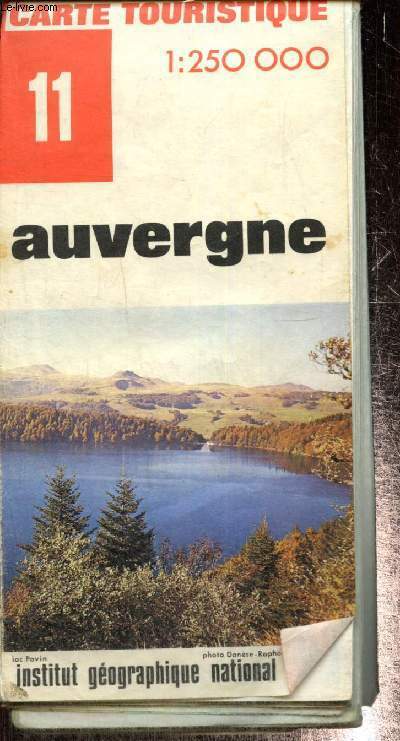
Institut Géographique National
Carte touristique n°11 : Auvergne
Institut Géographique National. 1972. In-Plano. En feuillets. Etat d'usage, Couv. convenable, Dos satisfaisant, Déchirures. 1 carte dépliante en couleurs. Echelle 1/250000. Environ 92x121 cm.. . . . Classification Dewey : 912-Atlas, cartes et plans
Referentie van de boekhandelaar : RO80244206
|
|
|
Institut géographique national
Les spéciales de l'Ign - Outre-mer - Guyane Carte touristique au 1 :500 000
Institut géographique national. 1995. In-Plano. Broché. Bon état, Couv. convenable, Dos satisfaisant, Intérieur frais. Carte touristique au 1 :500 000 en couleurs.. . . . Classification Dewey : 912-Atlas, cartes et plans
Referentie van de boekhandelaar : RO80216015
|
|
|
INSTITUT DE FRANCE, Académie des sciences
Recueil de Mémoires, Rapports et Documents relatifs a l'Observation du Passage de Venus Sur Le Soleil
Paris, Gauthier-Villars, 1885, 2 volumes grands in-4, couverture éditeur, Introduction et Zoologie 576pp., Botanique 23pp., Géologie 180pp., Planches 32pp.-2ff. et son Atlas de 2ff. et 68 planches en lithographie, d'études géologiques et zoologiques (55 planches de zoologie sur fond crème et 13 planches de géologie dont 10 d'observations microscopiques de roches, en couleurs), dos cassé à l’atlas.
Referentie van de boekhandelaar : PHO-1499

|
|
|
INSTITUT DE FRANCE, Académie des Sciences.
Recueil de mémoires, rapports et documents relatifs à l'observation du passage de Vénus sur le Soleil.
Firmin-Didot puis Gauthier-Villard, Paris, 1878-85, 5 volumes grands et forts in-4 (sur 8), tome 2, 1ere et 2eme partie relié cartonnage éditeur, tome 3, 1ere, 2eme partie et atlas, brochage éditeur, non coupé.
Referentie van de boekhandelaar : PHO-1677

|
|
|
INSTITUT NATIONAL D'ETUDES DEMOGRAPHIQUES
SUPERFICIE ET POPULATION DES PRINCIPALES CONTREES DU MONDE
NON PRECISE. non daté. In-8. En feuillets. Bon état, Couv. convenable, Dos satisfaisant, Intérieur frais. 1 carte bi-couleur de 59 x 92 cm.. . . . Classification Dewey : 912-Atlas, cartes et plans
Referentie van de boekhandelaar : RO30025925
|
|
|
INSTITUTO GEOGRAFICO DE AGOSTINI.
TOSCANA - CARTE REGIONALI DE AGOSTINI - CON INDICE DEI NOMI - 1:250 000 CARTA - STRADALE CON SIMBOLOGIA TURISTICA.
INSTITUTO GEOGRAFICO DE AGOSTINI. 1999. In-8. Broché. Bon état, Couv. convenable, Dos satisfaisant, Intérieur frais. fascicule de 31 pages + 1 carte grande carte géographique en couleur.. . . . Classification Dewey : 912-Atlas, cartes et plans
Referentie van de boekhandelaar : R320004921
|
|
|
Institut National de la Recherche agronomique.
Carte pédologique de la France à l'échelle du millionième dressée par Jacques Dupuis.
français Ensemble de 2 cartes, chacune mesurant 60x116 cm.
|
|
|
Institute of Electrical and Electronics Engineering; ATLAS 771 committee, AM Greenspan, Chairman A M
IEEE Guide to the Use of ATLAS
New York: The Institute of Electrical and Electronics Engineering Inc 1984. Fine condition in a bright and shiny Fine dust jacket. NO chips tears creases or fading. Sharp corners. Square and tight. NO owner's name or bookplate. NOT a remainder. NOT a library discard. Pages are crisp clean and unmarked. NO underlining. NO highlighting. NO margin notes. Illustrated with many figures and flow diagrams. IEEE Std 771-1984. Bound in the original gilt-stamped green cloth. Complete with dust jacket. 1984 edition. Hardcover. Fine condition/Fine dust jacket. Illus. by NOT a library discard. 207 pages 112 pages of appendixes. Great Packaging Fast Shipping. The Institute of Electrical and Electronics Engineering, Inc Hardcover
Referentie van de boekhandelaar : 029989 ISBN : 0471827460 9780471827467
|
|
|
Instituto Geografico Agustin Codazzi ; Archivo Historico Nacional
Atlas de cartografia historica de Colombia [ Edition originale ]
500 ejemplares numerados y con encuadernacion especial (ejemplar n° AB22), 1 vol. in-folio reliure éditeur sous jaquette illustrée, Instituto Geografico Agustin Codazzi, Instituto Colombiano de Cultura, Archivo Historico Nacional, 1985, 85 laminas Scarce and interesting copy (tear on dustjacket, otherwise a good copy). This atlas offer a large collection (85 plates) of quality reproductions of historic map of Colombia. Espagnol

|
|
|
Intemann, Gabriele / Snoussi-Zehnter, Annette / Venhoff, Michael / Wiktorin, Dorothea
Diercke-Länderlexikon. Sonderausgabe für den Archiv Verlag, Braunschweig.
(Braunschweig), Westermann, (1999). 936 S. Mit 1500 Abb. u. 300 Ktn. 31 cm. Goldgeprägtes, schwarzes HALBLEDER auf 5 Scheinbünden mit 2 Lesebändchen. Im blauen, leinenbezog. Schuber.
Referentie van de boekhandelaar : 91933

|
|
|
IOANNIS IANSSONIUS EXC
"Carte originale ""DESCRIPTION DU GUIENNE"""
"IOANNIS IANSSONIUS EXC. 17ème-18ème s.. In-Plano. Broché. Bon état, Couv. convenable, Dos satisfaisant, Intérieur frais. Carte originale, sur papier à la forme, 56/42 cm, délimitation des provinces en couleurs, deux échelles ""Milliaria Germanica"" et Milliaria Gallica"".XVIII ème siècle environ.. . . . Classification Dewey : 912-Atlas, cartes et plans"
Referentie van de boekhandelaar : RO20020300
|
|
|
Irlinger, Bernhard
Radtouren in Irland : 60 Radtouren durch alle Landesteile der Republik Irland mit Schwerpunkt im Westen
München : Bruckmann, 1993. 192 S. Mit 97 Farbfotos, 54 Kt.-Skizzen u. 1 Übersichtskt. Gr. 8°. Ill. orig. engl. Broschur.
Referentie van de boekhandelaar : 32035
|
|
|
IRO Autoführer
Italien - Französische Riviera - Westösterreich. Hier: Band Norditalien. Mit 21 6farbigen Kartenseiten im Massstab 1:250 000 / zwei 6farbigen Kartenseiten im Massstab 1:400000 / einer zehnfarbigen strassenkarte im Masstab 1:1 000 000. In Hinterdeckeltasche eine 10farbige, gefaltete IRO-Strassen- und Reisekarte im Massstab 1:1 000 000 (124 : 86,5 cm), bearbeitet von Ernst Kremling. Mit reich illustrierter Werbung im Textteil.
München, IRO., (um 1955). Gr.8°. [14,5 : 24,5 cm]. XVI/48/192 Seiten für Karten und Textteil. Roter Originalleinenband mit goldgeprägtem Deckeltitel und Lesebändchen. (1 Eck und oberes Rückenende gering bestossen). - Ansonsten ein sehr gut erhaltenes, sauberes Exemplar in fester Bindung, ohne Eintragungen und seltener Vollständigkeit.
Referentie van de boekhandelaar : 48746AB

|
|

 De zoekresultaten per email ontvangen
 Zoekresultaten downloaden als PDF
 RSS feed
 Permanente link


