|
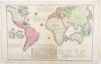
[ANTIQUE WORLD MAP] (SMITH, ROSWELL CHAMBERLAIN), O PELTON (ENGRAVER).
A Chart Exhibiting the Actual and Comparative Size of Each Country Nation or Kingdom; its Population as a Whole and to a Square Mile: Also the Different States of Society Forms of Government Religion &c.
Philadelphia.: W. Marshall. Circa1835. Handcoloured engraved map 26.5 x 41.3 cms; 29.6 x 48.3 cms sheet central fold insets of "Oceanica" and "New Holland" central table some light staining in the image and margins in good condition. Eurocentrism laid bare. This 19th Century map includes a "State of Society" for each part of the world declared with a symbol to represent "Barbarous Half Civilized Civilized and Enlightened Societies" as well as noting religion and ethnicity. It includes a table of distances between chief towns or capitals and between these towns and Washington DC. Australia "New Holland" is styled principally as pagan barbarous unexplored and African a thin sliver of what is now New South Wales and Victoria is labelled civilized European and Protestant. Scarce. . (W. Marshall). unknown
Referentie van de boekhandelaar : 203763
|
|
|
[Archéologia]
ARCHEOLOGIA
N° 291 (Juin 1993) : revue de 80 pages, format 215 x 285 mm, illustrée, brochée couverture couleurs, bon état
Referentie van de boekhandelaar : LFA-126746906
|
|
|
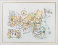
[ASIA - 1960S AVIATION PICTORIAL MAP]. LIOZU, JACQUES
Asie. The President Special Pan American Menu.
Pan American World Airways. 1964. Colour pictographic/pictorial map of Asia 23.2 x 30.1 cms gilt double-rule border printed on a folding decorative menu card 32 x 50 cms open highlighted in gilt text in English French and Japanese central fold and later central vertical crease in very good condition. Pan Am menu card for First Class passengers dubbed "The President Special" the deluxe cuisine by fabled Maxim's of Paris "Good food is the basis for true happiness". Passengers were feted with gourmet meals on bone china with silver cutlery. The witty pictorial cover-map of Asia was by French artist and commercial illustrator Jacques Liozu 1910-1974 also known for his larger scale maps. . Pan American World Airways. unknown
Referentie van de boekhandelaar : 195995
|
|
|
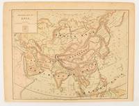
[ASIA - MAP]
Physical map of Asia
New York.: Harper & Brothers. 1875. Map printed in colour polar projection 21 x 27.1 cm marginal spotting and toning small edge tears to the inner margin but in god condition. Prepared for "Harper's School Geography" first published by Harper & Brothers in 1875. The map shows physical features mountains steppes plains rivers and deserts etc. together with sources of primary production: whale fisheries furs coffe tea minerals etc.The verso of the map with references and attractive line engravings part of the entry for Netherlands and Belgium. . Harper & Brothers. unknown
Referentie van de boekhandelaar : 174830
|
|
|
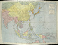
[ASIA - WORLD WAR II MAP].
The Daily Telegraph War Map of the Far East. Daily Telegraph War Map No. 11.
London.: Hutchinson & Co. Circa1940. Full colour folding map 70.7 x 93 cms; 76 x 101.2 cms sheet original folds short fold splits previous owner's neat title markings on the verso but the map in very good condition. A "Geographia" map of the war theatre in Asia and the Pacific including the northernmost coast of Australia. Showing railways and canals roads and steamer routes oilfields and pipe lines and a key to the unfederated states of Malaya. The Spratley Islands are marked as French and Thai territorial claims within French Indo China are marked. . Hutchinson & Co. unknown
Referentie van de boekhandelaar : 205763
|
|
|
[ASIA-PACIFIC - MAP].
Robinson's Pacific Ocean Mercator's Projection. Map no. 1804 : New Map of the Pacific Ocean with Insets showing Island Groups in Detail.
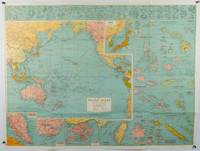
Sydney.: H.E.C. Robinson. Circa1945. Full colour inset maps principal cities and towns marked shipping routes international boundaries and railways. 99 x 73cm. Some small insect damage has been repaired on the verso visible on map as a few small lighter areas in the western Pacific. Pinpoint holes at folds paper repair along cover but a very good clean copy. From the Sydney publisher H.E.C. Robinson the firm founded in 1895 by Herbert Robinson 1857-1933 a founder of the Royal Geographical Society of Australasia. <br> <br>Although the map is undated North and South Korea are shown as divided which occurred in late 1945 and Manchuria is marked as still under Soviet occupation which only lasted until 1946 at which point it was handed over to Communist China. <br> <br>As well as what now would be considered Southeast Asia the main map shows the eastern half of India Tibet and parts of Mongolia the USSR and East Asia. Inset maps include: Caroline Islands Marshall Islands Federation of Malaya Singapore Hong Kong Taiwan Japan Hawaiian Islands Philippine Islands Midway Gaum and Wake Islands Fiji Islands Eastern & Western Samoa Santa Cruz and Solomon Islands New Caledonia Rabaul Tahiti Lord Howe etc. . H.E.C. Robinson. unknown
Referentie van de boekhandelaar : 180206
|
|
|
[Association des Amis de l'Université & Société des Ecrivains Dauphinois]
CAHIERS de l'ALPE - N° 66 - 1976
Revue culturelle, économique et sociale des activités dauphinoises, savoyardes, provençales et vivaroises : 36 pages, format 210 x 270 mm, illustrée, brochée, bon état
Referentie van de boekhandelaar : LFA-126738205
|
|
|
[AUSTRALIA - ANTIQUE MAP].
Johnson's Australia.
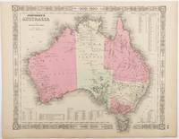
Johnson and Ward. Circa1865. Hand coloured map 32.3 x 39.7 x cms including the decorative border; 35.6 x 45.8 cms sheet key to major centres unrelated text on verso sheet age toned in very good condition. Detailed map from the leading mid 19th Century American firm of Johnson and Ward. Although Tasmania was known as such from 1856 the map refers to "Van Diemen Land". . Johnson and Ward. unknown
Referentie van de boekhandelaar : 214355
|
|
|
[AUTOMOBILES]-[DELAUNAY BELLEVILLE].
L'Auto, la route et l'homme.
T.I. P., Draeger, [1920], cart. gris, couv. imp. en rel.Dix huit personnalités des Lettres, des Arts et du Spectacle s'unissent pour proclamer qu'il n'existe rien de plus prestigieux que de rouler en "Delaunay Belleville". S'unissent ainsi d'une même voix, avec leur style propre : Curnonsky, Anatole France, Franck Nohain, Paul Reboux, Réjane, Jean Richepin, Rip, Edmond Rostand, Sem (qui avec un dessin lui prête des ailes), Pierre Veber, Willy... Et même une photo de la famille impériale de Russie. Tome I. qui n'a pas connu de suite. manq. au dos, pet. acc. à la couv. tache sur couverture; interieur en parfait etat
Referentie van de boekhandelaar : 2006
|
|
|
[BARONI (Lorenzo)].
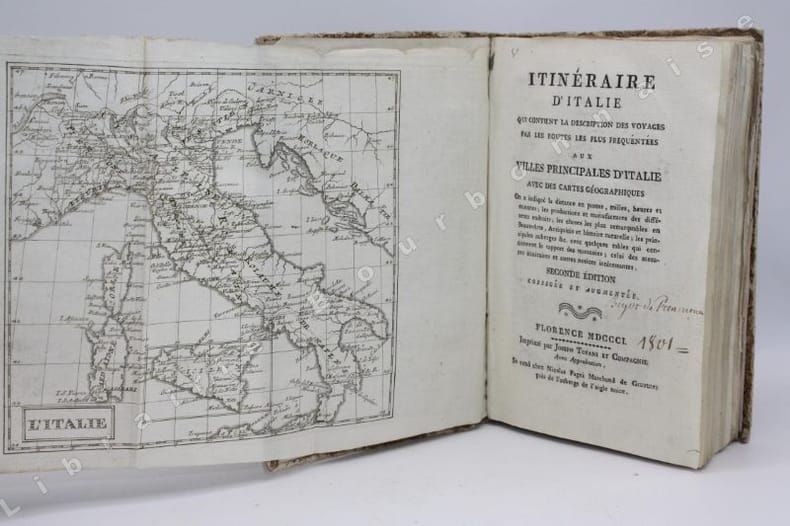
Itinéraire d'Italie, qui contient la description des voyages par les routes les plus fréquentées aux villes principales d'Italie avec des cartes géographiques [...]. Deuxième édition augmentée et corrigée.
Florence, Joseph Tofani et Compagnie, Se vend chez Nicolas Pagni, 1801 ; in-8. 208 pp. - 26 cartes dépliantes. Couverture d'attente de l'époque en papier marbré. Frottements sur le dos et les plats. Inscriptions anciennes au crayon sur la première et la dernière garde. Ex-libris manuscrit sur le titre "Bigot de Préameneu" (il s'agit peut-être de Félixe Julien jean Bigot..., juriste et homme politique, un des quatre rédacteurs du Code civil de 1804).
Referentie van de boekhandelaar : 14446
|
|
|
[BELLIN , JACQUES-NICOLAS]. (CARTOGRAPHER).
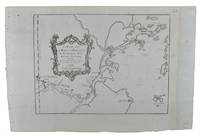
Carte de La Baye d'Hocsieu et des Entrées de La Rivière de Chang.
Paris. Circa1749. Engraved map on watermarked laid paper 20 x 27.3 cm of Fuzhou and coastline of Fujian Province original folds designed by the great French cartographer Jacques-Nicolas Bellin. This map is from the impressive 15-volume "Histoire Génèrale des Voyages" compiled by Antoine François Prévost map no. 2 Vol. 6. This map shows the estuary of Yangtze River Rivière de Chang. Very light browning on sheet edges but in very good condition. . unknown
Referentie van de boekhandelaar : 136827
|
|
|
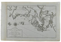
[BELLIN, JACQUES NICHOLAS] (CARTOGRAPHER).
Carte de L'isle de Cheu-Chan ou Isle de Chusan de la Province de Che-Kiang Avec les Costes et Isles voisines.
Paris. circa1749. Black and white engraved map on watermarked laid paper 20.9 x 32.7cm showing coastal area of Zhejiang Province Province de Che-kiang including Zhoushan Archipelago Isle de Chusan Zhoushan Bay Bay de Chusan and Xiangshan County Siang-chan-luen a walled city outside of upper border Ningbo Ning-po prefecture under Qing administration title cartouche lower left original folds. This map is No. 3 Vol. 6 from the impressive 15-volume "Histoire Generale des Voyages" compiled by Antoine François Prévost. Even browning mainly to the sheet edges in very good condition. . unknown
Referentie van de boekhandelaar : 136826
|
|
|
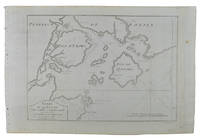
[BELLIN, JACQUES-NICOLAS]. (CARTOGRAPHER).
Carte De La Baye De Chin-Chew ou Chang-Chew.
Paris. circa1749. Black and white engraved map of Quanzhou and Zhangzhou 21.1 x 30 cm here spelled Chin-chew and Chang-chew and both final words with added superscript "ou" on watermarked laid paper 25.6 x 38 cm original folds a few marginal spots simplified compass rose and a decorative fleur de lis bottom right in very good condition. Attractive map including the estuary of Quanzhou River Xiamen Emowi and Kinmen or Quemoy Quemowi island. The map was designed by the eminent French cartographer Jacques-Nicolas Bellin and here published as plate No. 22 in the impressive 15 volume compilation of voyages "Histoire Generale des Voyages" by Antoine François Prévost. . unknown
Referentie van de boekhandelaar : 136795
|
|
|
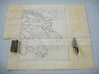
[BELLIN, JACQUES NICOLAS] (CARTOGRAPHER).
Carte de L'entree de la Riviere de Canton. Dressee sur les Observations les plus recentes.
Paris. circa1749. Black and white engraved map on laid paper showing entrance to Pearl/Canton river Macao and the area which would become Hong Kong Sinn-gan-hien folded designed by the prominent French cartographer Jacques-Nicolas Bellin. This map is No. 16 Vol. 5 from the impressive 15-volume "Histoire Generale des Voyages" compiled by French novelist Antoine François Prévost. The walled city of Canton upper section is divided into areas of Tartar and Chinese. <br> <br>Some light even browning on paper added at margins good copy. Map measures 25.7 x 20.5. . unknown
Referentie van de boekhandelaar : 136781
|
|
|
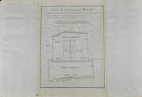
[BELLIN, JACQUES-NICOLAS]. (CARTOGRAPHER).
Plan De la Ville De Peking.
Paris. circa1749. Black and white engraved plan map of Peking on laid paper folded designed by the prominent French cartographer Jacques-Nicolas Bellin. This map is No. 18 Vol. 5 from the impressive 15-volume "Histoire Generale des Voyages" compiled by French novelist Antoine François Prévost. This city map shows two areas of walled cities: Ville Tartare Imperial city and the Forbidden City and Ville Chinoise ethnic Han residential area. <br> <br>Notes A and B represents buildings within the Forbidden City. A: Lieu de Plaisance ou l'on voit une Montagne faite a la main B: Grandes Cours du Palais de l'Empereur. Two missionary buildings French and Portuguese as well as the Tower of Mathematics illustrated within Ville Tartare. Two temples illustrated side by side near the south gate of the Ville Chinoise. <br> <br>Overall in good condition very light browning on edges and darker toning along the borders of the map. Text in French. Map measures 21 x 16.4cm. . unknown
Referentie van de boekhandelaar : 136794
|
|
|
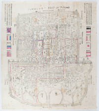
[BOXER REBELLION MAP OF BEIJING].
Map of Peking. 京城內外全圖 .Jing cheng nei wai quan tu.
Circa1900. Large illustrated map of Beijing showing the city in the period following the invasion of the military forces of the Eight National Alliance old folds scale not given. Some scattered light foxing particularly at edges short closed tear at fold lower edge neat non acidic tape repair short section upper edge wear along folds and a couple of small unobtrusive holes with minor image loss. Blocks of text in traditional Chinese right and left upper sections stating each nation's occupied zone Japanese text title accompanies the English title along the upper section of the map. 63.7 x 56.9cm. Very good overall. A rare and significant large Japanese woodblock map of Peking Beijing issued just after the suppression of the Boxer Rebellion. Centred on the Forbidden City the map depicts Peking following the multinational suppression of the Boxer Rebellion or Yihetuan Movement of 1900. The map was issued to illustrate the areas of occupation associated with each of the powers in the Eight Nation Alliance. <br> <br>The map gives measurements of the city walls detailed names of streets and buildings and the boundaries of the inner and outer city including the forbidden city are shown with demarcation lines in pink yellow and blue. The hand coloured eight national flags of the occupation powers are featured at the right and left. <br> <br>This map is essentially a later edition of 京城内外首善全圖 a map of Beijing issued by the Qing for administrative purposes in the mid-19th century. The Japanese seized the wood blocks during the suppression of the Rebellion and subsequently pulled new impressions overprinting them additional details including flags and demarcations of areas of the city held by members of the Alliance. Versions are known in French German Japanese and as with the present example English. An attractive map of great historical interest. . unknown
Referentie van de boekhandelaar : 169765
|
|
|
[BREST - ROCHEFORT] CHARLES-LOUIS THIRAT, Contre-Amiral, Commandant d'Armes au Port de BREST
LETTRE ADRESSEE AU CITOYEN HERAUD, ENSEIGNE DE VAISSEAU, COMMANDANT LA CORVETTE "L'EUGENIE", LUI PERMETTANT DE RECEVOIR A SON BORD EN QUALITE DE PASSAGER POUR ROCHEFORT, LE CITOYEN BERGEVIN CHEF DU BUREAU CIVIL DE LA MARINE A ROCHEFORT
Brest 1795 1 feuillet avec en-tête préimprimé : Liberté Egalité AU NOM DE LA REPUBLIQUE FRANCAISE et orné d'une vignette en noir (avec symboles révolutionnaires : faisceaux d'Armes et bonnet Phrygien), manuscrit à l'encre brune sur papier vergé ligné filigrané, format 19,4 centimètres de large par 30,5 centimètres de haut, Lettre écrite à BREST, le 23 Germinal 3ème année républiquaine, signature manuscrite de THIRAT,
Referentie van de boekhandelaar : 21088
|
|
|
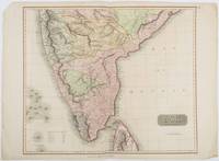
[BRITISH INDIA AND CEYLON - MAP] NEELE, SAMUEL JOHN (ENGRAVER)
British India Southern Part.
London.: Thomson. 1816. Engraved map with full handcolour 50.5 x 59.7 cms ; 53.9 x 73.8 cms sheet central fold a few minor edge tears one intruding into the top border the map unscathed marginal edgewear two corners with some loss but the map in very good crisp condition. An elegant map with great detail prepared for John Thomson's influential "New General Atlas" 1814-1821. Showing India from 20 degrees to 7 degrees north of the equator and includes the northern half of Ceylon with territorial interests attractively coloured. . Thomson. unknown
Referentie van de boekhandelaar : 185242
|
|
|
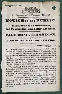
[British Postal History - California and Oregon - Gold Rush Period - Panama Route] Royal Mail
Instructions No. 10 1850. By Command of the Postmaster General. Notice to the Public and Instructions to all Postmasters Sub-Postmasters and Letter Receivers. California and Oregon Option of Transmitting Correspondence for Through United States
Great Britain 1850. Broadside measuring 9 ⅞ x 15 ⅜ inches. Some chipping and wear to edge ink number written in corner two small section of loss due to improper mounting very good overall. Coat of arms of the United Kingdom above printed text. Very Good. A scarce broadside relating to British postal rates across the Panama Route through the Chagres River which supplied mail to California and Oregon beginning in 1848 before eventually being replaced by the Overland route in 1860. The service was characterized by long delay times as steamships on either side of the isthmus were often not coordinated causing major delays in the delivery. Several different steamship companies operated privately some carrying express mail. The letters were transported by canoe or pack animal across the isthmus. Postmaster General Cave Johnson began establishing post offices in California in 1848. Johnson also oversaw the transition to the prepaid delivery system. The broadside here of which we find no other records does state that postage must be prepaid and that the route can be accessed by writing “via New York†on the letters. A scarce postal history item relating to the expansion of mail services to California. We find no other records of this institutionally or in the trade. unknown
Referentie van de boekhandelaar : List2416
|
|
|
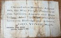
[Broadside] [Georgia Rail Road] [Transportation] {George Younge, Superintendent]
On and After Monday August 9th The Way Freight Trains will run between Augusta and Rutledge. Also p Night Freightd between Rutledge and Atlanta. Geo. Yonge Sup't. Georgia Rail Road Augusta August 5 1858
Augusta: Georgia Rail Road 1858. Broadside. Fair. Broadside. Approximately 5" x 7.5". Paper is folded creased toned with two small holes. Tears at the splits. Tape repair on the blank reverse side. Fair condition only. Obscure. No other copies of this advertisement were found during a recent search. Georgia Rail Road unknown
Referentie van de boekhandelaar : 36085
|
|
|
[Burlington Route] [Railroad Map] Rand McNally & Company
Indiana
Chicago: Rand Mcnally & Co 1900. Two color map 28x21" folding to 6x3.5." Few small marginal tears at folds some toning else very good. Attached to original Burlington Route folder lacking front cover. <br /> <br /> Uncommon Indiana pocket map from the Burlington Route showing roads counties cities etc. with an emphasis on railways which are listed in red at the bottom right corner. List of chief cities with populations along left margin. <br /> <br /> <br /> . Rand, Mcnally & Co unknown
Referentie van de boekhandelaar : 5708
|
|
|
[BURLINGTON ROUTE]
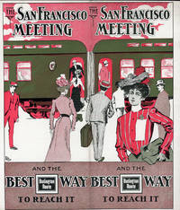
THE SAN FRANCISCO MEETING AND THE BEST WAY TO REACH IT
N.P.: Privately printed 1901. 1901. 9 1/4" x 8" in clorful pictorial wrapper folded at center. 12 pp. Illustrations. Schedule. Overview of San Francisco along with information on its climate Chinatown The Cliff House Golden Gate Park Sutro Baths and Museum Nob Hill and side trips from San Francisco to include brief information on Monterey San Jose Paciic Grove Lake Tahoe Los Angeles etc. Information on the Burlington Route train and its railroad cars. Finally a schedule for the trip from Omaha .by way of Denver and Salt Lake City and onto San Francisco. Light soiling and light wear to the extremities. Very good. Privately printed, 1901. unknown
Referentie van de boekhandelaar : 51617
|
|
|
[BURMA - MAP]
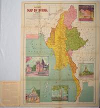
Latest Map of Burma. Political showing relief of land.
Delhi.: S.B. Makhija & Brothers. circa1951. Printed colour map 98.6 x 69 cms folding into pictorial wrappers 25.3 x 19.5 cms five pictorial colour inserts of pagodas and the Shwethalyaung reclining Buddha wrappers a little chipped marginal wear and three small fold splits in the map but overall in very good condition. Attractive large map of Burma with the provinces coloured steamship routes shown in red and printed in the booklet a range of information printed based on the 1951 census including climate agriculture and form of government "Burma became an independent nation completely outside the British Empire on January 4 1948 and is now a sovereign independent republic known as the Union of Burma". . S.B. Makhija & Brothers. unknown
Referentie van de boekhandelaar : 214601
|
|
|
[BURROUGHS (William)]. LEE (William). -- HELBRANT (Maurice)
JUNKIE. Contessions of an Unredeemed drug addict. -- NARCOTIC AGENT. Signed by Burroughs
New York Ace Books, Inc. - Collection « Ace double books » D-15 1953 In-12 broché, couverture illutrée Signé par l'auteur
Referentie van de boekhandelaar : 013812
|
|
|
[BYZANTINE EMPIRE - MAP]. SPRUNER, KARL AND MENKE, THEODOR
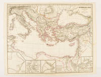
Oströmisches Reich zu Justinians Zeit.
Gotha.: Justus Perthes. Map with original colour and outline hand-colour 32.2 x 40 cm text in German five inset maps central fold slight marginal toning and spotting on the verso but in very good condition. A most handsome and highly detailed map detailing the Eastern provinces of the Byzantine/Roman Empire in the time of the Roman Emperor Justinian 527-565. The inset maps depict Carthage Rome Constantinople Naples and a Western continuation of the main map originally issued for the "Hand-Atlas für die Geschichte des Mittelatters und die Neueren Zeit" . Justus Perthes. unknown
Referentie van de boekhandelaar : 174950
|
|
|
[BYZANTINE EMPIRE - MAP]. SPRUNER, KARL AND MENKE,THEODOR
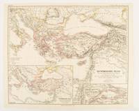
Oströmisches Reich von der Einwanderung der Ungarn in Ponnonien um 895 bis zur Unterwerfung des Bulgarenreichs durch Kaiser Basilius im J. 1019.
Gotha: Justus Perthes. 1874. Map with original colour and outline hand-colour 32.2 x 40 cm three inset maps text in German central fold slight marginal toning in very good condition. A most handsome map detailing the Eastern Roman Empire from the immigration of Hungarians in Ponnonia around 895 to the subjugation of the Bulgarian Empire by Emperor Basilius in 1019. The inset maps depict Divisions of the Empire Palestine and the Themata around Propontis present day Sea of Marmara issued for the "Hand-Atlas für die Geschichte des Mittelatters und die Neueren Zeit". . Justus Perthes unknown
Referentie van de boekhandelaar : 174914
|
|
|
[BYZANTINE EMPIRE - MAP]. SPRUNER, KARL AND MENKE, THEODOR
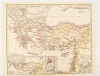
Oströmisches Reich 1096-1204
Gotha: Justus Perthes. 1876. Map with original colour and outline hand-colour 32.2 x 40 cm text in German four inset maps central fold slight marginal toning and spotting on the verso but in very good condition. A most handsome and highly detailed map detailing the Eastern provinces of the Byzantine/Roman Empire before the Fourth Crusade. The inset maps depict Constantinople Divisions of the Empire and Antioch issued for the "Hand-Atlas für die Geschichte des Mittelatters und die Neueren Zeit" . Justus Perthes unknown
Referentie van de boekhandelaar : 174911
|
|
|
[CALIFORNIA -- ROAD BUILDING].
Asphalt cover title.
San Francisco CA: Standard Asphalt Company of California Printed by Bosqui Printing & Engraving Co. 1894. 8vo. 8 pp unpaginated. printed in red & black. Black printed softcovers white lettering front cover company logo illust. on back cover minor shelfwear slight rubbing very slight chip to upper right corner still VG copy. First edition of this scarce promotional brochure by this pioneering California oil and mining company initially drawing upon petroleum and asphalt mines near Bakersfield California by the late 1880’s. They had originally drawn upon deposits in Asphalto and Hazleton but later these were played out due to high production costs to refine out the clay but later the company made a large discovery in 1893 just prior to the publication of this promotional piece touting 79% level of bitumen and production of asphalt vital for use in lacquers paints and road construction. Worldcat locates 1 copy UC Berkeley; See: Asphaltum Mineral Resources of the United States 1893-1894 1895 pp. 633-634; Asphaltum Standard Asphalt Company of California Los Angeles Herald April 5 1891 p. 6. Standard Asphalt Company of California, Printed by Bosqui Printing & Engraving Co., paperback
Referentie van de boekhandelaar : 57598
|
|
|
[CASPIAN SEA - ANTIQUE MAP].
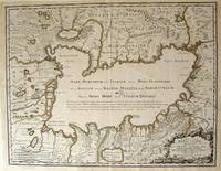
Nouissima et accurata Maris Caspij. Fere nobis incogniti Regionumque adiacentium Delineatio Iussu Petri Alexij Fil. Magni Russorum Principis.
Rainer Ottens. 1723. A most attractive map with early outline hand colour vertical fold barely visible diagonal crease upper half of map few very pale small brown spots otherwise a clean and bright image. Numbering in red pencil few annotations in pencil and light number stamp on reverse however not at all visible from front of map or affecting image. Sheet measures 46.6 x 60.2cm. . Rainer Ottens. unknown
Referentie van de boekhandelaar : 54819
|
|
|
[CATALOGUE -- ROAD CONSTRUCTION EQUIPMENT]. GILLETTE, Halbert P (Ed)
Road and street catalog. A consolidation of manufacturers catalogs of highway road and street materials construction plant and maintenance equipment. Together with a data section of engineering information and economic methods on the design construction and maintenance of highways roads and streets. . . .
Chicago IL: Engineering and Contracting Publishing Co. 1925. 4to. 320 pp. 100s of photo illusts. diagrams text illusts. Embossed & decorated gray cloth lettering & decorated border red & black lettering on spine minor shelfwear light rubbing to corners VG copy w/ former ownership markings on ffep. First edition numbered on verso of title of this fascinating work illustrating the equipment and materials needed to build the roads and highways in the early automobile era. Included are asphalt companies oil burning equipment for road building and repairs expansion joint steel fencing companies steam rollers graders cranes excavators and much more. Engineering and Contracting Publishing Co., hardcover
Referentie van de boekhandelaar : 44354
|
|
|
[CELEBES AND MOLUCCA - 1943 JAPANESE MAP].
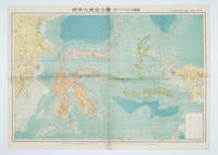
標準大東亜分図: 13 セレベス・モルッカ諸島扁. Hyōjun Dai tōa bunzu: 13 Serebesu・Morukka shotou-hen. Standard Maps of Greater East Asia: 13 - Celebes and the Moluccas.
Tokyo 東京: 統制社Tosei-sha. 昭和 Showa 18. 1943. Colour folding map 54 x 75.5cm with original envelope. Envelope a little torn some occasional browning very good. The 13th map in this Standard Maps of Greater East Asia series of 20 maps. All text in Japanese. Shows railways shipping routes administrative boundaries airfields ports lighthouses mines oil wells etc. . 統制社(Tosei-sha) unknown
Referentie van de boekhandelaar : 160554
|
|
|
[CHAR]
Spectacle René Char. Le Fer et le blé - Claire.
Paris Agnès Capri 1957 60 x 40 cm Affiche Edition originale
Referentie van de boekhandelaar : 005704
|
|
|
[CHICAGO WORLD'S FAIR -- BURLINGTON ROUTE RAILROAD]. [COTSWORTH, Jr, A (Passenger Traffic Manager)].
A Century of Progress Exposition Chicago 1933. Travel by train. Make Chicago the hub of your 1933 travels. . . photographs by Kaufmann & Faubry.
Chicago: Chicago Burlington & Quincy Railroad Printed by Poole Bros. Inc. 1933. Tall 8vo. 4 x 9 in. which folds out into 8 x 9 in. 4to. 20 pp unpaginated illustrated & printed in red & black throughout numerous photo illustrations text illustrations 1 double-page maps 1 double-page. Colour-illustrated softcovers cover art on front of the Hall of Sciences back cover w/ pictorial map of Burlington Routes slight shelfwear NF copy. First edition of this very scarce promotional brochure advertising the low round trip rates being offered by the Burlington Route for tourists to the 1933 Chicago World’s Fair. Detailed descriptions are included of the Exposition exhibits a birds-eye view of the Century of Progress grounds amenities in Chicago and the Travel & Transport Building which held a special Burlington Route exhibit. Kaufmann & Fabry was an active commercial photographic firm specializing in architectural photography in Chicago from before 1910 and are still in existence. No copies located in Worldcat. Chicago, Burlington & Quincy Railroad, [Printed by Poole Bros., Inc.,] paperback
Referentie van de boekhandelaar : 58148
|
|
|
[CHINA - 18TH CENTURY MAP] PARISH, HENRY WILLIAM (MAPMAKER). BAKER, BENJAMIN (ENGRAVER).
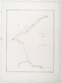
A Sketch of the Pay-ho or White River and of the Road from Pekin to Geho taken 1793.
London.: George Nicol. 1796. Engraved copperplate map on Whatman paper 43.8 x 33.6 cm; 57 x 42 cm sheet including plate markscale in nautical and English miles; light undulation to sheet marginal toning and edgewear but in very good condition. Finely engraved and detailed map of two routes to Pekin Beijing along the White River Baihe from the Gulf of Petcheli and along the Imperial Highway from Jehol and includes commentary locating palaces and gardens type of cultivation "many barges" and "the road shaded by willow trees". The map elegantly drawn by Henry William Parish was published in George Staunton's account of Earl Macartney's embassy to China 1792-1794. . George Nicol. unknown
Referentie van de boekhandelaar : 209283
|
|
|
[CHINA - MAP].
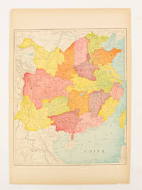
China.
circa1900. Map printed in colour text in English provinces shaded in colour 28.3 x 23.2 cm central fold paper toned a small edge tear confined to the outer margin but in good condition. . unknown
Referentie van de boekhandelaar : 174904
|
|
|
[CHINA - MAP - WORLD WAR II].
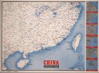
Newsmap for the Armed Forces. 291st Week of the War - 173rd Week of U.S. Participation. Monday 9 April 1945.
New York.: Army Information Branch. Volume III No. 51F. 9 April1945. Folding colour map and six inset maps in a vertical panel 88 x 119 cms sheet and on the recto circular map of Europe smaller inset map of Asia and of the Ryukyu Islands descriptive text original folds in very good bright condition. Scarce Newsmap of "China Southeast Coast" from Shanghai to French Indochina with the islands of Formosa and Hainan. At the right edge are inset maps of the vicinities of Shanghai Wenchow Foochow Swatow Canton and Hong Kong. On the verso is a large map of the European theatre of operations centred on Berlin a map of the Pacific area noting the American occupation of Okinawa with a detailed map of this island. In unusually fine bright condition. . Army Information Branch. unknown
Referentie van de boekhandelaar : 194660
|
|
|
[CHINA - RUSSIA - JAPAN - WORLD WAR II MAP] BURKE, HOWARD
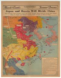
Japan and Russia Will Divide China. Signs Increase That Northern Area and Lower Yangtze Basin Will be Carved Into Puppet States by Stalin and Mikado Leaving South Largely at Mercy of Both.
Los Angeles.: Los Angeles Examiner. 1940. Printed colour pictorial map on a single newspaper leaf 42.3 x 39.9 cms; 54.3 x 42.5 cms sheet archivally laid down on linen slight discoloration to lower centrefold and sheet slightly age-toned but in very good condition. A striking geopolitical map by Los Angeles Examiner artist Howard Burke covering China Japan Southern Russia and the northern part of French Indochina and Siam showing how the "Aggressors Divide China." Areas under Japanese occupation are shown in red and their naval blockade shown by an arc of naval vessels with vivid arrows indicating lines of supply. Text labels including sources of agricultural and raw materials provide a dynamic overview of the geopolitical situation and show the influence of American scientific illustrator and cartographer Richard Edes Harrison who argued for examining geographic issues from multiple perspectives and Los Angeles Times artist Charles Owens. . Los Angeles Examiner. unknown
Referentie van de boekhandelaar : 209821
|
|
|
[CHITTAGONG AND SURROUNDING REGION - MAP].
Chittagong.
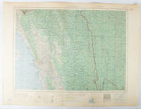
Washington D.C.: Army Map Service U.S. Army. 1955. Large colour map. 1:250000 scale. Transverse mercator projection. 23°00'N 91°30'E-22°00'N 93°00'E. Series U502 Sheet NF 46-6 Edition 1-AMS. Map measures 57.3 x 75.8cm. Slight wear creasing even light browning small closed tears on edges upper-right corner little foxed. Shows signs of use but map is clean and complete. Corps of Engineers Army Map Service map of Chittagong and surrounds compiled in 1955. Based on the British Indian one-inch and half-inch map series from 1938-43 and 1936-43 respectively. . Army Map Service, U.S. Army. unknown
Referentie van de boekhandelaar : 173072
|
|
|
[CODE DE LA ROUTE, PESCH] - VOELTZEL (Louis), PESCH (J.L.) -
CODE DE LA ROUTE le piéton e tle cycliste.
Strasbourg, Automobile-club d'alsce, 1965 ; in-8, 36 pp., br. Bon état mais un tampons sur la page de titre, un peu écorné plat et coins un peu frotté texte bon rare -Illustrations de Pesch petites rousseurs.
Referentie van de boekhandelaar : 201324229
|
|
|
[CODE DE LA ROUTE] - NOULENS (Joseph) -
Le nouveau code de la route.
Paris, Cartes taride , 1923 ; in-12, 229 pp., br. Texte et commentaire du déécret du 31 decembre 1922 et des reglementations annexes sur la police de la circulation et du roulage.
Referentie van de boekhandelaar : 202200873
|
|
|
[CODE DE LA ROUTE] - VOELTZEL (Louis), PESCH (J.L.) -
CODE DE LA ROUTE le piéton e tle cycliste.
Roubaix, Automobile-club du nord de la france, 1960 ; in-8, 32 pp., br. Très bon état mais un tampons sur le 1er plat rare -Illustrations de Pesch petites rousseurs.
Referentie van de boekhandelaar : 201213518
|
|
|
[Corbin, Austin; John A Bowman; Long Island Rail Road Company]
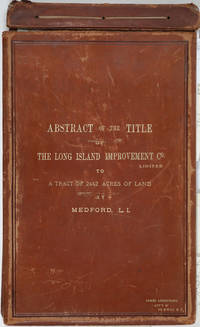
Abstract of the Title of the Long Island Improvement Co. Limited to a Tract of 2442 Acres of Land at Medford L. I. With a Manuscript folding hand colored map
Riverhead New York 1885. Hardcover. Very good condition. The original manuscript title to a very large tract of land near Brookhaven Long Island acquired by John A. Bowman from the individual proprietors and conveyed here by Bowman in its entirety to the Long Island Improvement Company Ltd. <br /> <br /> The Long Island Improvement Company was formed by Austin Corbin then president of the L. I. Rail Road and others in 1881. Corbin sought the land in order to develop expensive summer residences on Long Island; Bowman was acting as Corbin's agent in the acquisition of this valuable property. Austin Corbin 1827 – 1896 was an American railroad executive plantation owner resort operator banker and robber baron. In Iowa as a bank president he engaged in mortgage scams. Later through theft and corruption he consolidated the individual rail lines into the profitable Long Island Rail Road. He was widely despised in his day: Puck Sept 1882 printed a caricature in which Corbin appears at a Louis XIV styled party where he carouses with Jay Gould and other robber barons. <br /> <br /> The Abstract a bound sml. folio volume records that Bowman paid $5 per acre for most of the parcels in 1882 then conveyed January of 1883 the incalculably valuable entire tract to the LI Improvement Co for $1. The Abstract volume concludes with the Suffolk County embossed seal and is signed by the Clerk at Riverhead 1st June 1885. It includes the ownership history of each parcel as well as a history of the town of Brookhaven from its founding.<br /> <br /> The Abstract volume is accompanied by the original hand colored manuscript map on architectural vellum of the entire tract with silk ribbon binding showing the 25 property owner names and parcel sizes. Surveys were conducted by Justus Roe. The map is titled "Map of Property of the Long Island Improvement Company Limited at Medford LI". The scale is 300 feet to the inch. The northern boundary of the tract shows the Brewster Terry Property and Horse Block Road; the western edge defined by Tunnel and Progues Road and the Austin Roe and Daniel Gerard property; the southern boundary with Georgianna Rider property and Canaan and Medford Roads; the eastern boundary with the Robinson property and Lime Road. The Long Island RR can be seen running from east to west at approximately one third of the way through the tract at the north side. The map signed in ink at the lower right corner E. H. H. Forder.<br /> <br /> The Abstract bound in full gilt tan leather 9 x 14 3/4" attorney's name stamped in gilt at lower corner James Armstrong Attny 115 B'Way N. Y. Boards slightly rubbed; front board detached but present. Pages very bright and clean. The map 67 x 44" a few short splits at folds but very bright and clean in very good condition.<br /> <br /> A remarkable record of Long Island land speculation in the late 1880s. hardcover
Referentie van de boekhandelaar : 25162
|
|
|
[CRIMEA - MAP]. TARDIEU, AMBROISE
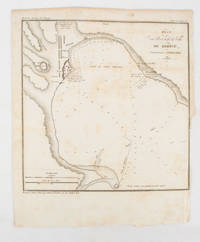
Plan du Port at de la Ville de Kertch Anciennement Panticapée
Paris.: Librairie de Gide. 1839. Engraved map 21.1 x 20.8 cm 27 x 22 cm sheet original folds trimmed to the inner margin with slight loss to the border only map spotted but otherwise in sound condition. Map of the Port of Kerch in Crimea prepared for the 1839 edition of the French Journal "Nouvelles Annales des Voyages." the editors for this edition amongst others the translator and geographer Jean-Baptiste Benoît Eyriès and Alexander von Humboldt founding members of the world's first geographical society the Société de Géographie. . (Librairie de Gide). unknown
Referentie van de boekhandelaar : 175248
|
|
|
[Cumberland Road]
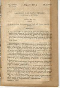
CUMBERLAND ROAD EAST OF THE OHIO
Washington 1837. 24th Cong. 2d Sess. H. Rep. 135. 38pp disbound folding sketch of wire suspension bridge across the Ohio River at Wheeling. Some leaves browned else Very Good. unknown
Referentie van de boekhandelaar : 28840
|
|
|
[Dumas, Louis]
Vues générales sur l'entretien des routes, par un Auteur.
Le Mans, Imprimerie Monnoyer, 1839 ; in-8, broché ; 48 pp., couverture beige décorée d'ornements typographiques de style romantique.
Referentie van de boekhandelaar : 10927
|
|
|
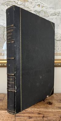
[East African slave trade; Mont Cenis; Overland Route to India; Railway Tunnel of the Alps; Easter Island; Egypt, bicycles; &c,
Illustrated London News. Vol LIV: January to June 1869. Volume LIV 54
<p>London: Illustrated London News 1869. Book. Near Fine. Hardcover. Folio - over 12 - 15" tall. Half-year run bound in early half-leather over pebbled cloth boards. Some edge-wear and bumping to covers; small paper label painted over to upper spine. Edges toned and old library bookplate and marks to front and rear endpapers. Front hinge nearly exposed internally at endpaper but still firm. Otherwise clean tight and unmarked. Very neat -- a sound and handsome volume and internally unusually bright and clean. Superb illustrations.</p> Illustrated London News hardcover
Referentie van de boekhandelaar : 85507h
|
|
|
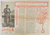
[EDITORIAL UNIT OF WAR DISPATCHES OF MAP, WORKERS' REPRESENTATIVE ASSEMBLY OF CHINA CARTOGRAPHIC PUBLISHING HOUSE REVOLUTIONARY
地图戰報: 第6期. Di tu zhan bao: di liu qi. Chinese Cultural Revolution Maps - War Dispatches of Maps. Issue no. 6.
Beijing.: 地图戰報.Di tu zhan bao. September1967. Maps printed in red and black single sheet printed on both sides folded scale not given photographic image of Mao Zedong. Some light browning at edges with tears and losses on left edge still good. Text in Chinese. Sheet measures 26.5 x 38.4cm. Includes a map of Autumn Harvest Uprising and also shows the routes of the military advancing towards Jinggangshan between September and October 1927. On reverse left section a map shows the route along which Chairman Mao led the Fourth Army of the Chinese Red Army marching towards south of Anhui and Jiangxi Provinces in 1929. On reverse right section a map titled "The Long March of The Chinese Workers' and Peasants' Red Army October 1934-October 1935". Quotations of Chairman Mao about the Long March insert on corners of the map. <br> <br>Issue no. 6 of a series of maps with text issued by the Red Guards organisations in the form of Cultural Revolution tabloid-sized newspaper. This issue is designed to celebrate the 40th anniversary of the Autumn Harvest Uprising which was one of the earliest armed uprisings organised by the Chinese Communist Party. . 地图戰報.[Di tu zhan bao]. unknown
Referentie van de boekhandelaar : 169746
|
|
|
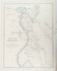
[EGYPT - ANTIQUE MAP] JOHNSTON, KEITH, FRSE; JOHNSTON, W & A K (ENGRAVERS). F R S E
Egypt Arabia Petræa and Lower Nubia.
Edinburgh & London.: William Blackwood & Sons. 1861. Engraved map with original outline hand-colour 57 x 43.8 cm 61.1 x 49 cm sheet central fold very slight edge toning but the map in very good bright condition. First edition. Fine large folding map: the Nile delta and river with attractive original outline colour railways and canals marked and name references to biblical and classical geography. Published for inclusion as map 39 in "Keith Johnston's royal atlas of modern geography" . William Blackwood & Sons. unknown
Referentie van de boekhandelaar : 177021
|
|
|
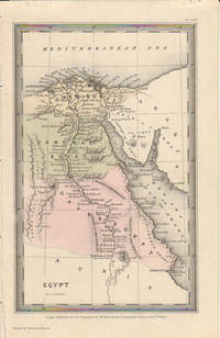
[EGYPT - MAP]. STARLING, THOMAS
Egypt.
London.: Published for the Proprietors by Mr. Bull. 1833. Engraved map 14.1 x 8.8 cm original hand colour in very good condition. Fine miniature map with appealing hand colour denoting Lower Central and Upper Egypt. . Published for the Proprietors by Mr. Bull. unknown
Referentie van de boekhandelaar : 174939
|
|
|
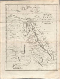
[EGYPT - MAP] NEELE, SAMUEL JOHN-ENGRAVER
Map of Egypt and Abyssinia from the best Authorities.
London. circa1803. Engraved map 23 x 18.5 cm original folds small split to one fold affecting the margin only paper age- toned lower corner darkened and on the verso inked circles to the lower half in an early hand but in good condition. Finely engraved early 19th Century map also showing to the north Syria Palestine and Cyprus and Darfur and Mountains of the Moon Sources of the Nile to the South. . unknown
Referentie van de boekhandelaar : 174955
|
|

 De zoekresultaten per email ontvangen
 Zoekresultaten downloaden als PDF
 RSS feed
 Permanente link


