|
[EGYPT - MAP].
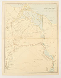
Suez Canal.
London Edinburgh & Glasgow.: William Mackenzie. 1880. Map printed in colour with original outline hand colour 29.8 x 22.7 cm central fold edge toning but in very good condition. Published for inclusion in "The National Encyclopaedia: A Dictionary of Useful Knowledge". . William Mackenzie. unknown
Referentie van de boekhandelaar : 174937
|
|
|
[EGYPT AND SINAI - WWII MAP].
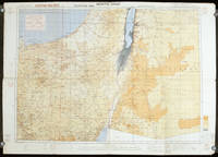
Egypt. North Sinai. Sheet 3.
London.: Royal Engineers. July1942. Printed colour topographical map mounted on linen 56.7 x 79.2 cms; 64.6 x 89. 5 cms sheet original folds edgewear small marginal chips a little dusty but in good condition. Detailed World War II operational map of Egypt and the Middle East issued by 512 Army Field Survey Company of the Royal Engineers. The map is marked "Not to be Published" in the upper right margin. Railways roads camel tracks telegraph lines boundaries altitudes towns and villages are marked. . Royal Engineers. unknown
Referentie van de boekhandelaar : 207841
|
|
|
[ENGLISH COUNTY MAPS]
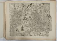
English County Maps in the Collection of the Royal Geographical Society. Reproductions of Early Engraved Maps II.
London.: Royal Geographical Society. 1932. Twenty one loose maps with tissue guards printed on sheets 49.5 x 63.5 cm in the original folio title-wrappers the maps with some edge wear and toning but on the whole in very good condition the wrappers browned and stained torn with minor loss at the foot of the title wrapper small closed edge tears now re-enforced with archival material and sound. Lacking the introductory notes by Edward Heawood. The complete suite of maps: an impressive production. The first map is a general map of England and Ireland by an unknown author 1594; nineteen county maps; and a final sheet of miniature county maps printed as a deck of playing-cards. The county maps proper vary in date from Saxton's “Southamtonia” of 1575 to John Speed's version of Norden's map of Sussex dated 1610. A contemporary reviewer dubbed it " a rich cartographical feast" allowing easy access to rare and valuable maps and comparison of maps by different cartographers for the same county. <br>The county maps reproduced include five by Christopher Saxton three by John Norden Philip Symonson's map of Eastern Kent published in 1596 a series of seven maps dating from the early years of the seventeenth century two maps prepared for Camden and two published by John Speed. . Royal Geographical Society unknown
Referentie van de boekhandelaar : 176499
|
|
|
[EQUIPMENT] Acme Road Machinery Co
Road Rollers and Roller Equipment Catalog No. 14-a
NY: Acme Road Machinery Company 1927. Quarto. 48 pp; illustrated throughout in b/w. Stapled wraps. Very good with some rusting to staples and a small split to top of spine. Internally clean and bright. Early examples of heavy road working equipment. Soft Cover. Near Fine. Acme Road Machinery Company Paperback
Referentie van de boekhandelaar : 014098
|
|
|
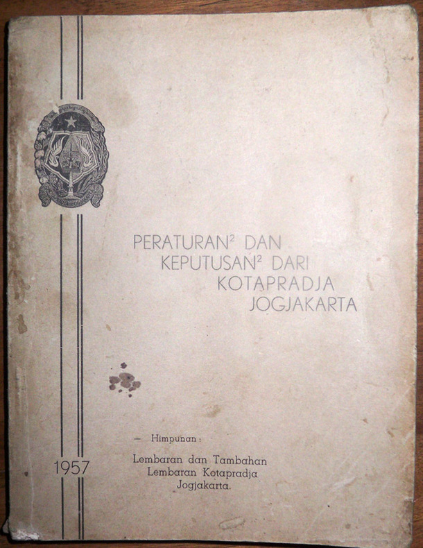
[Errinnophily : Indonesian road tax disc labels] - [DPRD and DPD Kotapradja Jogjakarta]
Peraturan-peraturan dan keputusan-keputusan dari kotapradja Jogjakarta. Himpunan lembaran dan tambahan lembaran kotapradja Jogjakarta. 1957
1957 Jogjakarta (Yogyakarta), [Yogyakarta municipality], 1957. 16 - 28 - 246 pp., 6 colored samples of road tax disc labels for non-motorised vehicles (carts - andong, handcarts - kletek, horse or buffle carts - cikar, becak, bicycles) pasted-down, softcover.
Referentie van de boekhandelaar : 1976
|
|
|
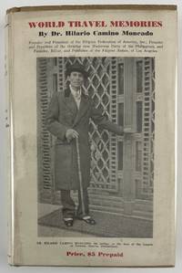
[Filipino Americana]: Moncado, Hilario Camino
World Travel Memories. Being the First Series of Illustrated Travel Stories To Be Published As Such in a Single Volume By Any Filipino
Washington DC: Claude T. Clements Press 1932. 14362pp. Profusely illustrated. Publisher's tan cloth with titles stamped in brown on spine and front board. In original unclipped pictorial dust jacket. Minor edge wear light insect damage to boards. Dust jacket either trimmed a bit short or originally produced a half-inch shorter than boards. Minor dust-soiling to jacket with minor insect damage to rear flap. Internally clean. Overall very good. The rare autobiographical travel narrative by one of the most important Filipino-American political leaders in history especially notable for retaining the original pictorial dust jacket. Hilario Camino Moncado established the Filipino Federation of America in 1925 in Los Angeles California. It was also known at various times as the Filipino World Federation and the Filipino Crusaders World Army. As one of the fraternal organizations appealing to the small but growing Filipino immigrant community the FFA distinguished itself from competitors by accentuating "clean living" and rules of moral conduct. Moncado earned a law degree and also edited and published Filipino Nation. Through his work Moncado sought to portray the immigrant community as responsible and healthy in contrast to the then-prevalent depictions of them as uneducated gamblers. Much less publicly the FFA developed a set of religious teachings that held Moncado to be the reincarnation of Jesus Christ by way of José Rizal the Filipino patriot executed in the waning days of Spanish rule. Moncado's birthday was changed to make him appear to have been born after Rizal's death so that his identity as Rizal's reincarnation would be more plausible.<br /> <br /> In the present travel memoir Moncado focuses on political and social issues encountered on a trip around the world conveying an impression of worldliness which burnished his reputation within the Filipino-American community. He visits England Holland Germany France Italy Egypt India China Japan and "Home Sweet Home Philippines." A sampling of chapters focus on London his visit to Oxford University the refusal of Germany to pay reparations from the First World War mentioning the German people's and particularly Hitler's stance against paying them any further his visit to the League of Nations "Mussolini - Benevolent Despot or Tyrant" Gandhi and "India's Revolution" China "The Awakening Giant" "Americanized Japan" and the betrayal of the Filipino independence movement by the American Congress.<br /> <br /> OCLC records just eight institutional copies including one in the Philippines one in Singapore and six in the United States at NYPL UC-Davis the University of Hawaii Michigan Washington and Wisconsin. Claude T. Clements Press unknown
Referentie van de boekhandelaar : 12800
|
|
|
[Frederick Gorringe (1831-1909), draper; Frederick Gorringe's Department Store, 75 Buckingham Palace Road, London; the Daily Tel
Frederick Gorringe's Department Store. Manuscript subscription list of donations by staff to the Daily Telegraph fund for 'the Sufferers' by the Edgware Road Fire giving more than 200 names and sums. With two press cuttings.
London. May and June 1888. 4pp. foolscap 8vo. Bifolium. In fair condition on aged paper. First page headed: 'The Edgware Road Fire The proprietor of "The Daily Telegraph" have as hitherto on similar occasions opened a Subscription list for the Sufferers and it is estimated that £3000 will be required to meeet the urgent claims for relief which are already too well known I shall be glad to receive any donations you may be pleased to give on their behalf JNER.'. Arranged in eight columns two to a page with running totals and a grand total of £16 1s 0d. The first donation is for 10s 6d from 'Mr. Kynock' and the last for 1s from Mr Catliffe'. Accompanying the list are two newspaper cuttings laid down on one side of a piece of 12mo paper with manuscript heading The Edgware Rd. Fire Fund'. The first cutting records the donation of £20 by 'Fredk. Gorring Buckingham Palace-road' and of £16 1s 0d by 'Employés of Fredk. Gorringe'; the second cutting reproduces a letter from Gorringe reading: 'TO THE EDITOR OF "THE DAILY TELEGRAPH." SIR - I have pleasure in sending a cheque for £20 towards the fund being raised for the assistants who are sufferers by the Edgware-road fire; also one for £16 1s from my employés. - Yours faithfully FREDK. GORRINGE. Buckingham Palace-road June 5.' The fire had occurred on 30 May 1888 with The Times devoting the following day's editorial to it beginning: 'London has been visited by many greater and more destructive fires but by few more tragic and pathetic in their circumstances than that which occurred in the Edgware-road shortly after six o'clock yesterday morning. The large drapery establishment of Messrs. GARROULD occupying the angle formed by the Edgware-road and Queen-street was suddenly attacked by fire and five of the young assistants who slept in the upper floors were burnt to death or suffocated while five more were seriously scorched or injured by jumping from the windows.' The Times drew parallels with another fire eight months before at the Exeter Theatre and concluded that it had 'once more taught Londoners the lesson that they cannot have efficient protection from fire without paying for it'. [London. May and June 1888.] unknown
Referentie van de boekhandelaar : 13915
|
|
|
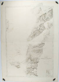
[GALLIPOLI - ANTIQUE MAP] DUMAS-VORZET, E; GERIN, A (ENGRAVER); GERMAIN, A (HYDROGRAPHER)
Abords et Entrée des Dardanelles. Mer Mediterranée.
Paris.: Service hydrographique et océanographique de la marine. 1883 but1894. Engraved hydrographical chart on watermarked double sheet 99 x 63 cm soundings in metres lighthouses picked out in yellow and red inset map of the port and town of Tenedos central fold a few very slight edge tears to the generous margins light spotting and surface soiling but in very good condition. Fine and impressive large naval chart of this strategically important strait then still under the control of the Ottoman Empire. <br> <br>From a private collection; "Lord John Fitzroy Royal Yacht Squadron" in manuscript on the verso. . Service hydrographique et océanographique de la marine unknown
Referentie van de boekhandelaar : 178272
|
|
|
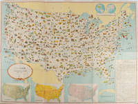
[GENERAL DRAFTING COMPANY]. ネラル・ドラーフティング株式会社.
アメリカ合衆國.主要地方資源産物及び風景絵入り地図. Amerika Gasshūkoku. Shuyō chihō shigen sanbutsu oyobi fūkei eiri chizu. Pictorial Map of the United States of America Showing Principal Regional Resources Products and Natural Features.
Washington D.C.: 国務省. Kokumishō. No date. circa1955. Large folding Japanese coloured map of the United States with 3 inset maps at foot of map showing main railways air and highway routes and hemispheres at the top right. Some browning mainly visible on reverse still a good copy. 66 x 81cm. An intricate and detailed pictorial map of the United States published in Japanese by the US State Department. The same type of map had been published since 1945 in English and subsequently in other languages. The Japanese language map is hard to find. The map is undated but was probably produced in the 1950's. The images include depictions of women board riders in two piece swimsuits of the sort popular in the 1950s but the inset text lists Alaska and Hawaii as external territories of the US indicating that the map was produced before they attained statehood in 1959. <br> <br>An inset panel provides information on the area and population of the US the population of major American cities mineral and other resources climate and topography. A note at the bottom right hand corner of the map states that copies of the map can be obtained free of charge from your nearest US Information Office. <br> <br>Every region of the country is decorated with an illustration of the natural resources industries or cultural or historical resources associated with that particular place. These include images of early colonial settlers the birthplaces of Mark Twain and Woodrow Wilson Booker T. Washington's house and Abraham Lincoln's grave; images of major dams oil fields coal mines cotton plantations etc. various animals and crops and images of ships cars and public buildings including the Statue of Liberty located rather oddly far out at sea. . 国務省. [Kokumishō]. unknown
Referentie van de boekhandelaar : 172003
|
|
|
[GREECE].
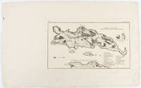
Delos.
Amsterdam. circa1703. Engraved map on watermarked laid paper 16.5 x 26.5 cm plate-mark 26 x 42 cm sheet key in German inset detail of grave sites on the island of "Rhenee" Rineia and Apollonian relics lower corner creased and with a sealed tear to the verso no loss in very good condition. Fine engraving with large margins of the Greek island of Delos of great significance to classical antiquity and the mythological birthplace of the Greek deities Artemis and Apollo. . unknown
Referentie van de boekhandelaar : 176390
|
|
|
[HANGZHOU - MAP].
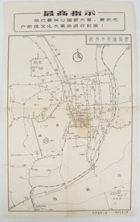
杭州市交通简图. Hangzhou shi jiao tong jian tu. City Transportation Map of Hangzhou.
1967. Vintage transportation black and white map of Hangzhou folded no scale a legend lower right corner shows bus/trolleybus routes and terminals. The map covers the old city of Hangzhou from the north side of the city 杭三中"Hangzhou No.3 High School" to the south side 钱江大桥 "Qiantang River Bridge". The West Lake is featured in the centre with its famous tourist spot 三潭映月 "Three Pools Mirroring the Moon" indicated. Bus/trolleybus routes connects schools hospitals municipal government departments cinemas department stores tourist spots around the West Lake etc are all shown on this map. <br> <br>Stained in the central section light wear along folds and edges otherwise good. Text in Chinese. Sheet measures 39.1 x 24.8cm The headline Chinese text in the box along the top of the map reproduces one of the highest directives from Mao's Quotations: "You must pay attention to state affairs and carry the great proletarian cultural revolution through to the end!" . unknown
Referentie van de boekhandelaar : 163238
|
|
|
[HISTORY EDITORIAL OFFICE OF PEOPLE'S EDUCATION PRESS]. 人民教育出版社曆史編輯室.
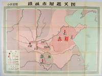
绿林赤眉起义图. Lulin Chimei qi yi tu. Chinese Educational Map - Map of Lulin and Chimei Rebellion.
Beijing.: 地图出版社. Di tu chu ban she. 1st Edition 2nd Printing. 1958. Large Chinese coloured educational map folded. Scale 1:2000000 legend lower left corner showing the military advance of two peasant insurgent groups Lulin and Chimei's march towards the capital city Chang'an now Xi'an in 17 AD. In original worn paper wrapper map in very good condition. Text in traditional Chinese. Map measures 77 x 105.2cm. 王匡 Wang Kuang and 王凤 Wang Feng founded the Lulin Army in the region of modern Hubei Province. 樊崇 Fan Chong lead the Chimei also known as Red Eyebrows Army in the northern parts of modern Shandong Province. . 地图出版社. [Di tu chu ban she]. unknown
Referentie van de boekhandelaar : 171563
|
|
|
[ILE D'YEU] JEAN-PIERRE PILLET, Capitaine de Vaisseau, commandant les Forces stationnées sur les Côtes, depuis Brest jusqu'au Pertuis d'Antioche
LETTRE : ORDRE DE ROUTE ADRESSEE AU CITOYEN HERO (HERAUD) COMMANDANT LA CORVETTE DE LA REPUBLIQUE "L' EUGENIE" afin que celui-ci fasse tout le nécessaire pour Escorter le convoi de Rochefort et Bordeaux contre d'éventuels Batimens ennemis, Lettre écrite à bord de la Frégate "LA NEREÏDE", le 13 Floréal An 3
1795 1 feuillet avec en-tête préimprimé : MARINE LIBERTE, EGALITE, FRATERNITE et orné d'une vignette en noir, manuscrit à l'encre brune sur papier vergé ligné filigrané, format 20 centimètres de large par 30,8 centimètres de haut, Lettre écrite à bord de la Frégate "LA NEREÏDE", le 13 Floréal An 3, signature manuscrite de Jean-Pierre PILLET
Referentie van de boekhandelaar : 21085
|
|
|
[INAGAKI, RIKICHI]. 稲垣利吉.
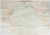
日・米・英・勢力圖太平洋上: 比較對照. Nichi bei ei seiryokuzu Taiheiyojo : Hikaku taisho. Military Strength of Japan the United States and the United Kingdom on the Pacific: A Comparison Map.
東京. Tokyo.: 九段書房.Kudan shobo. 大正十四 1925. Coloured folding Japanese map showing the military strength of Japan the United States and the United Kingdom in the Pacific original pictorial envelope scale not given. Some small holes at folds occasional light foxing a prior owner's signature on reverse minor wear envelope. Very good copy in like envelope. Map measures 54.4 x 78.8cm. The explanatory text in Japanese printed on the reverse in blue summarises the colonial possessions of the US and the UK as well as providing a comparison between the land size naval presence natural resources immigration issues and maritime transport capacities of Japan the United States and the United Kingdom. Legend indicates national regional provincial territorial boundaries canals undersea cables airline routes metropolitans capital cities mining fields hot springs ancient battle fields major trade ports Japanese embassies and consular offices. A large area marked 日本委任统治 "South Pacific Mandate" highlighted in a box is adjacent to Australian occupied Papua New Guinea. . 九段書房.[Kudan shobo]. unknown
Referentie van de boekhandelaar : 169329
|
|
|
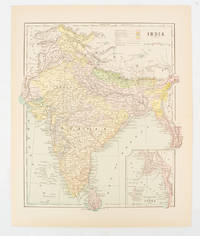
[INDIA - MAP] FISK & CO (ENGRAVERS)
India
New York. circa1910. Printed colour map 29 x 25 cm with inset map of the Eastern Part of India colour key reference key to the ruling divisions current and projected railways and telegraphs also shown central fold slight toning; in very good condition. Interesting map shaded by Divisions: the Presidencies of Bengal Madras Bombay Ceylon "Native States under British Protection" and "Independent States" Nepal and Bhutan. . unknown
Referentie van de boekhandelaar : 174839
|
|
|
[INDIA - MAP]
Southern India
London. circa1910. Printed colour map on conjoined pages 22.3 x 33.7 railways submarine cables and heights above sea level marked faded but in very good condition. Map showing the ruling divisions by shading borders with Burma and the Andaman and Nicobar Islands also shown. . unknown
Referentie van de boekhandelaar : 174841
|
|
|
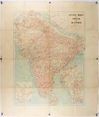
[INDIA - PRE PARTITION & BURMA - MAP]
Road Map of India and Burma.
Bombay.: Joshi & Co. circa1940. Colour lithographic map 66 x 50 cms; 81.x 68.5 cms sheet two inset maps and on the verso a full sheet "Relief Map of India" original folds with fold splits archivally strengthened several city names have been neatly underlined “Agartala” inked in the margin overall in good condition. Scarce Bombay-published map of the pre-Partition Indian sub-continent with two small inset maps one showing roads around Karachi and the other Burma. Through Routes Other Main Roads and Motorable Roads Subject to Weather are marked. The "Relief Map of India" on the verso includes Railway Lines Canals Steamer Routes Rivers Air Routes Navigable Canals and Broadcasting Stations. . Joshi & Co. unknown
Referentie van de boekhandelaar : 211089
|
|
|
[INDIA - RAJASTHAN ANTIQUE MAP] SMITH, HM (LITHOGRAPHER). H M
Rajpootana and Adjoining States Sheet No. 4.
Calcutta.: Surveyor Generals Office. 1870. Reissue of 1859 edition. Lithographed map 57.2 x 93 cms; 61.1 x 96 cms sheet original folds old paper repairs to the verso and a sealed marginal tear central folds archivally strengthened some toning to the folds and creasing but the map in remarkably good clean condition. Impressive large Calcutta printing from the Survey of India showing Rajasthan Uttar Pradesh and surrounding states with extremely detailed delineation of settlements roads railways rivers and major points of interest the Taj Mahal is highlighted. . Surveyor Generals Office. unknown
Referentie van de boekhandelaar : 189711
|
|
|
[INDIA - TOURIST MAP].
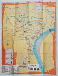
Tourist Map of Varanasi.
Circa1960. Folding colour tourist map of Varanasi in Uttar Pradesh province two inset maps of India and a gude map of Sarnath legend and key select Ghats shown railways "western style" and "Indian style" hotels marked in very good condition. 42.9 x 33.1 cm. . unknown
Referentie van de boekhandelaar : 178269
|
|
|
[INDOCHINE] [EPHEMERA] [OFFICE INDOCHINOIS DU TOURISME] [ROUTE MANDARINE]
La Route Mandarine - Une Route de 2567 km
Paris, Office Indochinois du Tourisme, sans date (1930?). 1 plaquette in-8 carrée, reliée par un cordon de soie, couvertures souples illustrées, 12 pp., illustrée de nombreuses photos en noir et blanc in texte et d'une double carte en couleurs du tracé de la Route Mandarine ou Route Coloniale No1. Bon état général.
Referentie van de boekhandelaar : 13277
|
|
|
[INDONESIA - MAP OF SULAWESI & MALUKU ISLANDS] WELLER, EDWARD
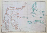
Celebes and the Molucca Islands.
London.: Weekly Dispatch Atlas. circa1860. Map with outline handcolour 31.3 x 43.3; 33.3 x 48.7 cms sheet 12 x 17 inches small marginal bloom not affecting the map in very good condition. Detailed mapping of these two island groups by Edward Weller 1819–1884 from the ‘Weekly Dispatch Atlas’ an atlas published in monthly instalments from 1855 for subscribers to the long running newspaper. Weller was a pioneer in lithography and was sought after for his skill in producing detailed and accurate maps. . Weekly Dispatch Atlas. unknown
Referentie van de boekhandelaar : 184035
|
|
|
[INDONESIA - WWII MAP].
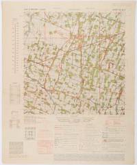
Java & Madura. 1:50000. Djombang. Sheet 53/XLIC. HIND 1090.
Washington D.C.: Army Map Service. First edition - revised AMS4. 1945. Army survey map printed in colour 36.7 x 36.7 cm; 58 x 48 cm sheet conversion graph glossary and administrative index to the inner margin; scale three column legend index to adjoining sheets and notes re grid references and mean declination to the foot; sheet toned a very few edge tears the map in very good condition. Wartime map produced by the US Army Map Service AMS who formed in 1942 and were at the forefront of military mapping campaigns during WWII and the post-war years. The very detailed map shows residency and administrative boundaries transportation ground and water features vegetation cultivation ruins religious sites "Graves; Chinese native" and "Cemetery; heathen Christian" walls hedges populated places built-up areas and buildings with those of iron stone wood and bamboo differentiated by colour; fishponds plantations and much more. . Army Map Service. unknown
Referentie van de boekhandelaar : 200411
|
|
|
[INDONESIA - ANTIQUE PRINT] VAN DER SCHLEY, JAKOB
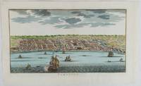
Samboupo.
circa1750. Hand-coloured engraving 19.5 x 35.6 cm 25.5 x 41.6 cm sheet original folds two old paper repairs not affecting the image a trifle toned but in very good condition Attractive bird's-eye view town plan of Makassar in Sulawesi prepared for Abbé Prevost's monumental 'Histoire Générale des Voyages.' . unknown
Referentie van de boekhandelaar : 177186
|
|
|
[Inglis, Harry R. G.]
The Contour Road Book of England.
[Edinburgh & London: Gall & Inglis ca. 1900]. 848, 23, (5) Seiten. Dünndruckpapier / Bible paper. Mit zahlreichen Karten im Text sowie einer großen Faltkarte im Anhang. Kl. 8° (16 x 9 cm) Orig.-Lederband mit goldgeprägtem Rückentitel und goldgeprägter Deckelvignette (KFZ / automobile). [Hardcover / fest gebunden].
Referentie van de boekhandelaar : 2097933

|
|
|
[ISERE] PHOTOGRAPHE JOSEPH ALLARD NANTES
2 PHOTOGRAPHIES ORIGINALES DE "PONTS SUR LA ROUTE DES (GRANDS) GOULETS (ISÈRE)" 1890
isere 1890 2 photographies originales albuminées en noir, insérées par les angles sur une feuille de papier beige, format : 32 x 23,5 cm, format de chaque photographie : 12 x 17 cm, 2 photos prises à 2 endroits différents sur la "ROUTE DES GOULETS", sans date (1890), noté à l'encre brune sous les 2 photos : Route des goulets et noté aussi à l'encre brune en haut à gauche Photo Joseph Allard ,
Referentie van de boekhandelaar : 28246
|
|
|
[ISHIBASHI GORO, GENERAL EDITOR]. 石橋五郎監修.
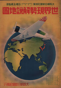
世界現勢解説地圖. Sekai Gensei Kaisetsu Chizu. Explanatory Maps of the Present State of the World.
大阪朝日新聞社. Osaka Asahi Shinbunsha. Showa 12 1937. 10 colour maps not including insets or sketch maps in text on 12 pages. Handsome world map features as the centre fold colour pictorial paper wrappers. A little light soiling and horizontal crease wrappers. An attractive atlas. 38 x 26.7cm. A large format atlas with six pages of coloured maps showing the nations of the world and five pages of Japanese text. The publication seems to have been produced to celebrate the 1937 world record flight from Tokyo to London by Iinuma Masaaki and Tsugayoshi Kenji in their plane 'Kamikaze' which was sponsored by the Asahi Newspaper. The front cover depicts the plane soaring over a map of the world while the back cover also had a colour image of the 'Kamikaze' with an advertisement for the Oji Paper Company which we are told donated a hundred million yen to support the flight. The name 'Kamikaze" had at that stage not yet taken on the connotations which it acquired during the Pacific War. <br> <br>The maps inside the volume show political boundaries major cities and transport routes. The opening pages show the Japanese Empire including Japan proper Korea Karufuto and Manchukuo with small insets covering Taiwan the Chishima Archipelago and Japan's South Sea mandate. The accompanying text focuses on Japan's newly acquired client state of Manchukuo detailing its area population principle products etc while the map includes graphs illustrating Japan's trade with the world and with Manchukuo. China receives an entry of its own with a map of the Chinese Republic and information on the political situation population trade and infrastructure. The central pages of the volume are taken up with a double-spread map of the world including depictions of the flags of a selection of the world's nations. Other sections of the work cover Asia Europe America Africa and Oceania grouped together. The discussion of Oceania includes a section on Hawaii and some small and improbable depictions of Maori and Indigenous Australians. . 大阪朝日新聞社. [Osaka Asahi Shinbunsha]. unknown
Referentie van de boekhandelaar : 208633
|
|
|
[ISTANBUL - POST-TREATY OF LAUSANNE].
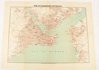
Plan of Constantinople and Environs.
Constantinople.: The Anglo-American Book & Newsagency. 1925. Printed folding colour map 36 x 49.2 cm street grids for Stambul Pera Galata and Skutari railways and landing places marked small fold splits affecting the margins only now repaired with archival material two small holes at central folds pin-holes to the four corner some age-toning but in very good condition. A scarce map of the historic peninsula soon after the Republic of Turkey was founded and the capital moved to Ankara. Printed for the tourist market this map is a rare survival. . The Anglo-American Book & Newsagency. unknown
Referentie van de boekhandelaar : 174961
|
|
|
[Isthmian Route]
CANAL- ATLANTIC TO PACIFIC. MARCH 2 1839. MR. MERCER FROM THE COMMITTEE ON ROADS AND CANALS SUBMITTED THE FOLLOWING REPORT:.
Washington 1839. 25th Cong. 3d Sess. H.Rep.322. 167pp disbound. Six folding maps and chart. Several text leaves browned Very Good plus. <br /> <br /> Reviewing proposals and data for a canal route including a memorial from Matthew Carey. <br /> Morrison 5 noting only 3 maps. unknown
Referentie van de boekhandelaar : 28837
|
|
|
[JAMAICA AND JAVA AND BALI - MAP].
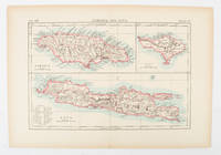
Jamaica and Java and Bali.
London and New York.: Encyclopedia Britannica. circa1900. Map in three insets after W & AK Johnston engravers with printed outline colour 18.9 x 28.9 cm central fold paper age-toned but in very good condition. Interesting map which first appeared in the ninth edition of Encyclopedia Britannica. . [Encyclopedia Britannica] unknown
Referentie van de boekhandelaar : 174875
|
|
|
[JAPAN & TAIWAN - MAP] OKISHIO, TAKACHIKA
Map of Japan.
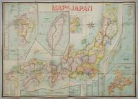
Kobe Japan.: Fuku-In-Kwan. 1906. Printed colour folding map on two conjoined sheets laid down 73.8 x 10⁵ cms foxing on verso not affecting map single pinhole in each corner scant spotting small fold splits no loss a few soft fold creases but in good condition. Very rare striking map of Japan published for the Western market. <br> <br>Created under the direction of Takachika Okishio featuring 10 inset maps: Chishima Kurile Islands Hokushu Hokkaido Ogasawara-Jima Bonin Islands Hachijo-Shima Ioshima Okinawa Saki-Shima Kyushu Saikaido Taiwan Formosa and Eastern Asia. The insets of Taiwan and Kyushu are the largest and centrally positioned. A Glossary and Explanation of Signs is printed at the foot of the map which list Towns Railway Stations Boundaries of Prefectures Notable Places Hot Springs Water-falls rapids Volcanoes Light-Houses Gold Silver and Coal-Oil fields. The Japanese Government Railway series of Travellers' Maps of Japan appear to have been modelled after this design. . Fuku-In-Kwan. unknown
Referentie van de boekhandelaar : 197908
|
|
|
[JAPAN - 1850S MAP]
Japan.
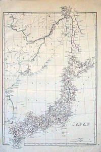
London.: Cassell Petter & Galpin. circa1852. Map with outline handcolour 42.5 x 30.1 cms; 49.2 x 34.3 cms sheet margins a little toned small corner crase but in very good condition. Very detailed map of the Japanese islands with Sakhalin above and the coast of Manchuria and Korea. . Cassell, Petter & Galpin. unknown
Referentie van de boekhandelaar : 185246
|
|
|
[JAPAN - MEIJI ERA MAP] BATHOLOMEW, JG J G
Japanese Empire - Political.
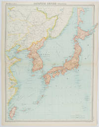
Edinburgh.: John Bartholomew & Son Ltd. 1922. Large double page map 54.2 x 43 cms map original fold some edge toning and to the fold but in very good condition. Large map prepared as plate 65 for “The Times Survey Atlas of the World” in 1922 and was prepared at the Edinburgh Geographical Institute under the direction of J G Bartholomew. The map shows Japan's territory inclusive of Korea southern Sakhalin and Taiwan. . John Bartholomew & Son Ltd. unknown
Referentie van de boekhandelaar : 215880
|
|
|
[JAPAN - TOKYO - WORLD WAR II MAP] GFROERER, CURT (ARTIST).
Tokyo Bay Area - Heart of Japan's Empire.
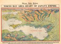
Chicago.: Chicago Daily Tribune. 28 July1945. Colour bird's eye view map 22.4 x 39.3 cms on a newspaper leaf trimmed to a half sheet 29.8 x 41.6 cms including caption slight toning at an old central fold the map in very good condition. <br>Unrelated black and white photographic illustrations on the verso "Pre-flight Trainers used in Chicago to give ground instruction to would-be pilots" and "New rekindled Montauk Light Long Island N.Y." Map published in the Chicago Daily Tribune days before the bombing of Hiroshima on August 61945. <br>"Perspective map of Tokyo bay and contiguous land and sea areas showing Tokyo Yokohama the Yokosuka naval base industrial sections and other features .In this map north is at the right instead of at the top - an expedient adopted to show all of the bay as large as possible in half page space." caption . Chicago Daily Tribune. unknown
Referentie van de boekhandelaar : 209335
|
|
|
[JAPAN - WWII MAP] GFROERER, CURT (MAPMAKER).
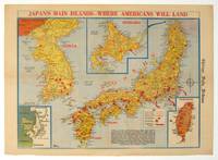
Japan's Main Islands - Where Americans Will Land.
Chicago.: Chicago Daily Tribune. August1945. Printed colour pictorial map on a single newspaper leaf 37 x 52 cms; 43 x 59.5 cms sheet three inset maps archivally laid down on linen very good condition. Full page map published in the "Chicago Daily Tribune" after the bombing of Hiroshima and Nagasaki prior to occupation by US and Allied forces in September 1945. "This is a new map of the main islands of Japan where American occupational troops will land and establish their military rule." map text The legend notes "Places bombed by U.S. Air Forces with a red circle" and "Cities bombed by Atomic Bomb" with a red star. The main map shows the Japanese islands of Honshu Shikoku and Kyushu with the Korean peninsula. Inset maps show Hokkaido Formosa and a general map of the area. . Chicago Daily Tribune. unknown
Referentie van de boekhandelaar : 208877
|
|
|
[JAPAN - YAMANASHI - MAP]
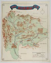
Yamanashi Prefecture Sight-Seeing Guide Map.
Kofu.: Onkodo Printing Co. circa1930s. Colour pictorial map 70.2 x 56 cms; 75.5 x 59.5 cms sheet light wear along the inner margin some soft creases from folding short split at center fold; in very good clean condition. An appealing and decorative map of Yamanashi Prefecture which while a process print has the attractive soft look of a lithograph adorned with vignettes of key attractions landmarks such as Mt. Fuji and industry such as silk and wine. The legend lists Railways 'Footing' Roads Hot Springs Hotels and National Parks. A scarce and attractive English language map for the tourist market. . Onkodo Printing Co., unknown
Referentie van de boekhandelaar : 206841
|
|
|
[JAPAN AND KOREA - MAP]. MEYERS, JOSEPH
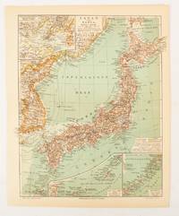
Japan und Korea.
Leipzig.: Bibliographisches Institut. 1902-1908. Map printed in colour 27.2 x 21.4 cm inset colour key to territorial administration by country inset "western continuation of the main chart" including the Gulf of Tschili and Tsientsin and two insets at the foot of the map to the Kuril and the Ryuku Islands text in Geman central fold slight edge toning but in very good condition. Attractive map text in German prepared for Meyers Großes Konversations-Lexikon. . Bibliographisches Institut unknown
Referentie van de boekhandelaar : 174898
|
|
|
[JAPANESE WORLD WAR II MAP OF NEW ZEALAND].
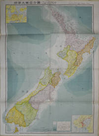
標準大東亜分図: 17 ニュージーランド編. Hyōjun Dai tōa bunzu: 17 Nyuujiirandohen. Standard Maps of Greater East Asia: 17 New Zealand.
Tokyo: 統制社Tosei-sha. 昭和18 Showa1943. Folding colour map of New Zealand with inset of Auckland and Wellington top and bottom corners1:2000000 scale little light browning. Original envelope worn with closed tears. 54 x 76.5cm. Good copy. Scale plan of New Zealand printed by Tosei in 1943. The map legend shows infrastructure deemed important to the Land Survey Bureau of the General Staff Headquaters of the Imperial Japanese army such as boundaries powerlines quarries and mines; railroads sea-routes etc. . 統制社(Tosei-sha) unknown
Referentie van de boekhandelaar : 154080
|
|
|
[KIKUCHI, KIYOSHI, EDITED BY]. 菊池清編輯.
満洲鉄道図. Manshu tetsudo zu. Railway Map of Manchuria.
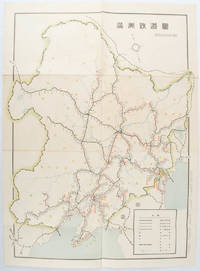
奉天. Mukuden.: 満鉄鉄道総局. Mantetsu Tetsudo Sokyoku. 昭和 15 1940. Colour folded map seven small very holes not affecting the printed image otherwise good. 53 x 38.5cm Map showing the comprehensive railway network in Manchuria with names of all the stations. It includes the lines run by the South Manchurian Railway Company their temporary industrial lines light rail as well as the lines run by other Russian and Chinese companies. By 1940 the network had expanded so much that it included almost the whole of Manchuria. . 満鉄鉄道総局. [Mantetsu Tetsudo Sokyoku]. unknown
Referentie van de boekhandelaar : 172590
|
|
|
[King Road Mennonite Brethren Church]
Die King Road Mennoniten Bruedergemeinde; Ein Uberlick Der Esten Fünfundzwanzig Jahre: 1966-1991
Abbotsford B.C.: King Road Mennonite Brethren Church 1991. First printing. Hardcover. Fine. pp. 116 38 unpaginated pages of portraits. 4to. Bound in light blue cloth board silver lettering and illusration to the spine and front board. Replete with many photographs portraits of members clergy and parishioners. No detectable flaws contents bright clean and unmarked with tight sound binding; fine. English Title: King Road Mennonite Brethren Church: A Review of the First Twenty-Five Years. <br/><br/> King Road Mennonite Brethren Church hardcover
Referentie van de boekhandelaar : 1004
|
|
|
[KINGU HENSHū-KYOKU / KINGU EDITORIAL OFFICE] キング編輯局.
最新支那明細大地圖/滿・蒙・ソ聯國境大地圖. Saishin Shina meisai daichizu / Man Mō Soren kokkyō daichizu. Latest Large Detailed Map of China/Large Map of Manchuria Mongolia and the Soviet Union Borders.
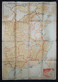
Tokyo: 大日本雄辯會講談社 Dainihon Yūbenkai Kōdansha. Shōwa 13. 1938. Two large detailed maps of China and on the reverse of the Soviet Union in Asia Manchuria and Mongolia printed double sided on a single large sheet. Issued as a supplement to Volume 14 Number 1 of the magazine Kingu on New Year's Day in 1938. <br> <br>Holes at a number of holes causing a small amount of loss some occasional browning some chipping on margins. The map has clearly been used but is still largely complete. The colourful map of China on a scale of 1:2600000 includes part of Manchukuo and Inner and Outer Mongolia on the north and part of French Indochina to the south-west. It shows East Hebei Autonomous Anti- Communist Council Jidong Fanggong Zizhi Zhengfu 冀東防共自治政府 south of Manchukuo which existed from late 1935 until February the 1st1938. The legend includes national and provincial borders cities roads railways sea and air routes and undersea cables. There is an inset map of East Asia titled "Present Situation of Far East" on the lower right corner which shows the areas under influence of Communism and those under influence of/controlled or colonised by the United Kingdom France Japan and China. <br> <br>The map on the reverse printed in blue and black shows the Asian section of the Soviet Union Manchuria and Mongolia on a scale of 1:3000000. There is an inset map of Asia titled "Asian Continent" at the upper left corner the area enclosed by a rectangle which indicates the area covered in this map. The legend includes cities railways roads national borders district borders province borders and air routes. . 大日本雄辯會講談社 [Dainihon Yūbenkai Kōdansha]. unknown
Referentie van de boekhandelaar : 159295
|
|
|
[KIZAKI, JUNICHI]. 木崎純一.
最新詳密蘇連極東地方大地図. Saishin shomitsu Soren Kyokuto chiho dai chizu Most Recent and Detailed Large Map of the Soviet Union and Far East Region.
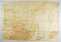
東京. Tokyo.: 伊林書店. Ibayashi Shoten. 昭和14 1939. Colour printed folding map 78 X 109cm minor damage original envelope 27.5 x 20cm. Very good copy. This map offers comprehensive information on northern China Manchuria the Soviet Union and Hokkaido including Kuril Islands under the Japanese control. It also includes the Jewish Autonomous State which existed in the late 1930s. The inset map provides detailed information on the border area of Japan Manchuria and the Soviet Union. Legends include national borders railways major cities iron mines and oil wells. <br> <br>Published in 1939 this map is an expression of the tension Japan felt in its relationship with the Soviet Union. At the time the Soviet Union was seen as the mighty threat to the lying just north of Manchuria and Japan . . 伊林書店. [Ibayashi Shoten]. unknown
Referentie van de boekhandelaar : 171112
|
|
|
[KOYAMA, KICHIZO]. 小山吉三.
蘭領東印度諸島詳圖 附泰國・佛印・マレー半島. Ranryo Higashi-Indo Shotoo shozu : Fu Taikoku Futsu-In Mare Hanto. Malay Archipelago.
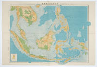
東京.Tokyo.: 日本名所圖繪社.Nihon Meisho Zuesha. 昭和16 1941. Folding colour Japanese map of the Malay Archipelago and Thailand scale 1: 8500000 with attractive original pictorial paper envelope. This map also shows the Dutch French and American colonies. Hainan Province and the South China Sea are shown in the north. Agricultural and mineral resources indicated across the map. Few small holes at holes and other light signs of wear. Slipcase lttle torn. Text in Japanese and English. 53.3 × 78.2cm. . 日本名所圖繪社.[Nihon Meisho Zuesha]. unknown
Referentie van de boekhandelaar : 160538
|
|
|
[La Fontaine de Pétrarque]
La FONTAINE de PETRARQUE n° 10
Journal de la Société Littéraire de La Poste et de France Telecom, Délégation de Vaucluse : 20 pages, format 210 x 297 mm, illustré, broché
Referentie van de boekhandelaar : LFA01856
|
|
|
[LAND SURVEY DEPARTMENT, EMPIRE OF JAPAN]. 大日本帝国陸地測量部.
上海 支那江蘇省・浙江省. Japanese Map - Shanghai Jiangsu Province and Zhejiang Province.
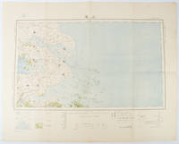
Tokyo.: 大日本帝國陸地測量部. Dainihon Teikoku Rikuchi Sokuryōbu. Taisho 15. 1926. Folding colour Japanese map of Shanghai and coastal areas of Jiangsu and Zhejiang Provinces. Scale 1:100000 embossed stamp lower right corner. Legend lower edge showing different landforms on the left section forests deserts wildlands plateaus rivers and lakes middle section showing various facilities such as post offices telecommunication offices temples ancestral halls ancient battle ground mines military fortifications submarine communications cables city walls and gates etc. right section showing different sizes of cities towns and villages and administrative boundaries. <br> <br>Occasional foxing along edges and folds ink annotation in Kanji on reverse good copy. Text in Japanese. Sheet measures 45.2 x 57.7cm. This very detailed map was originally surveyed by the Land Survey Department Empire of Japan in Taisho 7 1918. This revised edition features the railway line connecting Hangzhou - Jiashan - Shanghai - Suzhou - Wuxi. . 大日本帝國陸地測量部. [Dainihon Teikoku Rikuchi Sokuryōbu]. unknown
Referentie van de boekhandelaar : 173266
|
|
|
[LAND SURVEY DEPARTMENT]. 陸地測量部.
東部亜細亜圖. 五百万分一. Tobu Ajiazu. Gohyakumanbunnoichi. East Asia. 1:5000000.
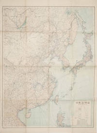
Tokyo.: 大日本帝國陸地測量部. 昭和14 1939. Large colour folding Japanese WWII map. Scale 1:5000000 featuring Japan Korea Taiwan Karafuto Eastern China parts of French Indochina and the Northern Philippines US colony in detail. Legend includes territorial boundaries national and regional and shows some borders as unclear i.e. Taiwan and bordering region along Northeast China the Soviet Union and Mongolia air routes submarine communication cables linking major costal cities i.e. Hong Kong Xiamen Shanghai Nagasaki etc. airports radio stations mining fields and more. A small chart shows the names of mountains rivers and lakes also included adjacent to legend. Some small holes at folds creases and some minor loss edges generally very good. Text in Japanese. 109 x 77.8cm. . 大日本帝國陸地測量部. unknown
Referentie van de boekhandelaar : 160524
|
|
|
[Le MONDE de la ROUTE et du RAIL]-
Le MONDE de la ROUTE et du RAIL.
1965 Zurich, Editions Metz (Collection FORUM de la TECHNIQUE), 1965, in 4° relié pleine toile grise de l'éditeur, jaquette illustrée, 477 pages.
Referentie van de boekhandelaar : 78245
|
|
|
[LES DANNÉS DE LA ROUTE ] - ACHDÉ, RICHEZ - RODRIGUE - LUNVEN -
VOL AU DESSUS D'UN NID DE 2 CHEVAUX T4.
PANTIN, Bamboo, 2005 ; in-4, 46 pp., cartonnage de l'éditeur. Deuxième édition.
Referentie van de boekhandelaar : 201118315
|
|
|
[LI CHENGSAN]. 李承三 (EDITOR).
臺灣地圖. Taiwan ditu. Taiwan Map.
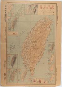
Taiwan.: 禹甸圖書局. Yudian tushuju. 1945. 1945 Ministry of Interior map of Taiwan published in the 34th year of the Republic of China with inset title and key top right. Romanised Japanese names for some areas and cities written in capital letters on main map which is surrounded by 15 small inset maps at edges each with its own scale. Paper browned wear at folds and edges repaired with archival washi on reverse some light stains and a few marks. 1 x 3cm chip bottom right corner. 77.4 x 54 cm. Text in traditional Chinese characters. Inset maps show clockwise from right edge; 1. Distribution of inhabitants according to ethnic background or minority group 2. Qing Dynasty prefectures and counties 3. Japanese administrative regions during the occupation 4. Strategic industrial and military places three city maps - 5.Chilung or Keelung port 6. Taipei city and 7. Tainan city 8. Geological formations 9. agricultural metallurgical and mineral products 10. Soil types 11. Topography of the island including sea currents and altitude diagram 12. Taiwan's position in relation to the mainland coast provinces of Fujian and Zhejiang as well as the Liuqiu Ryukyu Islands including Okinawa 13. Okinawa detail 14. Climate and rainfall in January 15. Climate and rainfall in July. . 禹甸圖書局. [Yudian tushuju]. unknown
Referentie van de boekhandelaar : 215871
|
|
|
[LINEN BACKED MAP OF CHINA]
China. Philips' Travelling Maps Cover Title.
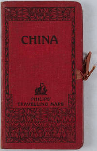
no date. circa1920. Linen backed colour folding map of China insets of Peking and Environs and Hongkong and Canton in lower left corner. 54 x 63.8cm. Table of place names at upper left gives the cities that "By a recent ordinance of the Republic all 'Fu' 'Chow'' and 'Ting' cities have been nominally reduced to the rank of 'Hsien'. The following parallel list gives the 'Fu' cities the names of which have been officially changed together with the new form adapted." Map folds into a red cloth covered case with ribbon ties 19 x 10.3cm. Title and decoration printed in black on upper cover. Trifle foxed on linen backing a little insect damage case in a few small places otherwise a very good clean map. . hardcover
Referentie van de boekhandelaar : 161936
|
|
|
[Long Island Rail Road]
The Long Island Rail Road: Main Line to the Mainland
n.p.: n.p. 1959. 16 pp. 8vo. Illustrated wrappers staple bound sepia-toned photographs and line drawings throughout. 16 pp. 8vo. A small booklet celebrating the 125th anniversary of the Long Island Rail Road. <br/><br/> n.p. unknown
Referentie van de boekhandelaar : 370788
|
|

 De zoekresultaten per email ontvangen
 Zoekresultaten downloaden als PDF
 RSS feed
 Permanente link


