|
|
|
[ANONYME].
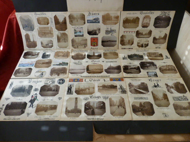
Souvenirs de Belgique. Ensemble de 50 Photographies originales de Bruxelles, Anvers, Ostende et Bruges, avec décors et illustrations manuscrits Belle Epoque (circa 1900).
s.l., ca 1900. 35 X 26 cm (planches), environ 6 x 8 cm, 7,5 x 8,5 cm, 8 x 11 cm, (photos). 9 planches. Ensemble de 50 photographies originales sur papier, réparties sur 9 planches, titrées et illustrées à la main, à l'encre et à la gouache. Les photographies retracent un parcours touristique en Belgique, de la Grand Place et des rues de Bruxelles au bois de La Cambre, en passant par le célèbre Manneken Pis, de la gare du Midi à la Bourse et à Laeken, puis dans plusieurs quartiers de Bruges (quais, Grand' Place, églises, beffroi et cathédrale...), avec un cliché du tramway à vapeur de Han à Rochefort, les alentours du port et de la gare d'Ostende, et enfin Anvers, ses gares, son port, sa cathédrale, son jardin zoologique... De nombreuses illustrations ornent également les planches : les armoiries de chaque ville sont représentées, des paysages (à l'encre ou à l'aquarelle et à la gouache) complètent les photographies, des personnages animent les marges, sans oublier frises, décors, vignettes et ornementations diverses. Tous les titres bénéficient d'un travail particulier de la typographie. Très intéressant ensemble, qui reflète une certaine diffusion sociale de la pratique photographique - au sein de l'élite bourgeoise - à la fin du XIXe siècle, en lien avec l'évolution des techniques, à la fois en ce qui concerne la prise de vue et les procédés de tirage. Equipés d'appareils d'utilisation de plus en plus aisée, de nombreux amateurs immortalisent alors les petits et grands moments de la vie de tous les jours, constituant albums de souvenirs et collections privées qui consacrent le rôle désormais essentiel de l'image dans la culture de la Belle Epoque. L'auteur de ces clichés, qui ne manquait ni d'humour ni de talent, a par ailleurs enrichi son travail artisanal d'autres éléments esthétiques : décors et ornements graphiques issus de l'univers du livre (imitant fleurons,bandeaux, culs-de-lampe, séparations de chapitres...), dessins "classiques" (paysages, portraits), inspirés du mouvement Art Nouveau ou influencés par la presse et l'affiche (typographie fantaisiste, caricatures,...).
书商的参考编号 : 1869
|
|
|
[ANONYME].
Souvenir de CREVECOEUR LE GRAND. Ensemble de 10 photographies originales, avec décors et illustrations manuscrits Belle Epoque (circa 1900).
Sans lieu, circa 1900. 35 X 26 cm (planches), environ 8 x 11 cm (photos). 2 planches. Ensemble de 10 photographies originales sur papier, réparties sur 2 planches, illustrées à la main, à l'encre et à la gouache. Les photographies retracent un parcours touristique dans la ville de Crèvecoeur-le-Grand (la Mairie, le Château, l'ancien Hôtel de l'Ecu où Dumas logea d'Artagnan et les trois Mousquetaires, sur le cadran solaire se trouve cette maxime : "Time horam ne sivas", Haute Epine près Crèvecoeur, le baptême de Mlle Yvette). Très beaux titres, à l'encre, planches illustrées de dessin à l'encre et d'un à la gouache, photographies en partie légendées. Très intéressant ensemble, qui reflète une certaine diffusion sociale de la pratique photographique - au sein de l'élite bourgeoise - à la fin du XIXe siècle, en lien avec l'évolution des techniques, à la fois en ce qui concerne la prise de vue et les procédés de tirage. Equipés d'appareils d'utilisation de plus en plus aisée, de nombreux amateurs immortalisent alors les petits et grands moments de la vie de tous les jours, constituant albums de souvenirs et collections privées qui consacrent le rôle désormais essentiel de l'image dans la culture de la Belle Epoque. L'auteur de ces clichés, qui ne manquait ni d'humour ni de talent, a par ailleurs enrichi son travail artisanal d'autres éléments esthétiques : décors et ornements graphiques issus de l'univers du livre (imitant fleurons,bandeaux, culs-de-lampe, séparations de chapitres...), dessins "classiques" (paysages, portraits), inspirés du mouvement Art Nouveau ou influencés par la presse et l'affiche (typographie fantaisiste, caricatures,...).
书商的参考编号 : 1922

|
|
|
[ANONYME].
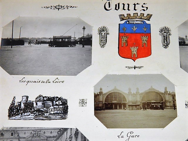
TOURS. Ensemble de 5 photographies originales, avec décors et illustrations manuscrits Belle Epoque (circa 1900).
Sans lieu, circa 1900. 35 X 26 cm (planche), environ 8 x 11 cm et 9 X 6,5 cm (photos). 1 planche. Ensemble de 5 photographies originales sur papier, réparties sur 1 planche, illustrées à la main, à l'encre et à la gouache. Les photographies retracent un parcours touristique à Tours (les quais de la Loire, le Théâtre municipal, de vieilles maisons, la gare). Les armoiries de Tours à l'encre et à la gouache et 3 dessins ainsi que divers motifs à l'encre ornent également la planche. Les portraits à l'encre de Jacques SARRAZIN et Jean CALVIN se trouvent au dos de la planche. Très intéressant ensemble, qui reflète une certaine diffusion sociale de la pratique photographique - au sein de l'élite bourgeoise - à la fin du XIXe siècle, en lien avec l'évolution des techniques, à la fois en ce qui concerne la prise de vue et les procédés de tirage. Equipés d'appareils d'utilisation de plus en plus aisée, de nombreux amateurs immortalisent alors les petits et grands moments de la vie de tous les jours, constituant albums de souvenirs et collections privées qui consacrent le rôle désormais essentiel de l'image dans la culture de la Belle Epoque. L'auteur de ces clichés, qui ne manquait ni d'humour ni de talent, a par ailleurs enrichi son travail artisanal d'autres éléments esthétiques : décors et ornements graphiques issus de l'univers du livre (imitant fleurons,bandeaux, culs-de-lampe, séparations de chapitres...), dessins "classiques" (paysages, portraits), inspirés du mouvement Art Nouveau ou influencés par la presse et l'affiche (typographie fantaisiste, caricatures,...).
书商的参考编号 : 1914
|
|
|
[ANONYME].
Ville de SENS. Dessin original en couleurs, titre illustré et manuscrit façon enluminure. Belle Epoque (circa 1900). [ENLUMINURE TYPOGRAPHIE]
Sans lieu, circa 1900. 35 X 26 cm. 1 planche. Pièce unique. Dessin original à l'encre et à la gouache. L'auteur, photographe amateur, aimait illustrer les pages des albums qu'il créait. Chaque destination bénéficiait d'un travail artistique particulier.
书商的参考编号 : 1942

|
|
|
[ANONYME].
Ville de SENS. Dessin original en noir et blanc, titre illustré et manuscrit façon enluminure. Belle Epoque (circa 1900). [REGIONALISME TYPOGRAPHIE]
Sans lieu, circa 1900. 35 X 26 cm. 1 planche. Pièce unique. Dessin original à l'encre et à la gouache. L'auteur, photographe amateur, aimait illustrer les pages des albums qu'il créait. Chaque destination bénéficiait d'un travail artistique particulier.
书商的参考编号 : 1943

|
|
|
[ANCIENT WORLD - ANTIQUE MAP] (MALTE-BRUN, CONRAD), POIRSON, JEAN BAPTISTE; TARDIEU (AMBROISE).
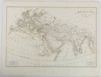
Monde comm des Anciens.
Paris. circa1820. Engraved map with original outline hand-colour 21.1 x 31.5cm original folds a few spots and a little creased but in very good condition. Latin map of the Ancient world encompassing Europe India Arabia the Middle East and North Africa by the French cartographer Jean Baptiste Poirson 1761-1831 finely engraved. . unknown
书商的参考编号 : 177230
|
|
|
[ANSON'S VOYAGE]. THOMAS, Pascoe
A true and impartial Journal of a Voyage to the South-Seas and round the Globe in His Majesty's Ship the Centurion under the Command of Commodore Anson.
London Birt 1745. . First edition; 8vo xvi 347 i 39 ipp. a couple of gatherings in the appendix slightly proud contemporary sprinkled calf lightly rubbed short splits to joints corners bumped a very good copy.<br /> 'Pascoe Thomas kept a full and faithful daily journal of the incidents of this important four-year voyage. Included is an appendix giving an account of the treasure taken from the Nuestra Signora del Buono Carmella. This account. preceded the publication of the official account of Lord Anson's voyage by three years' Hill. At the bottom of page 36 of the appendix the exact latitude and remarkably the longitude of the fabled Strait of Anian are provided. This precise location of the Pacific entrance to the elusive Northwest Passage came from a Spanish document captured by Anson and gave rise to the suspicion that the Spanish had discovered the passage but kept it secret. <br /><br />Anson's voyage was a landmark of 18th-century English circumnavigation laying the groundwork for the British exploration of the Pacific in the later half of the 18th century. The expedition set out to cut off Spanish supplies of gold and silver from South America after the outbreak of war in 1739. Whilst successful taking a number of prize ships off the Philippines the cost was high: six ships were wrecked off the coast of South America or in rounding Cape Horn. <br /> Hill 1693; Sabin 95437. London, Birt, 1745. unknown
书商的参考编号 : 98434

|
|
|
[Antebellum South – Travel Narratives] Barnard, Calvin
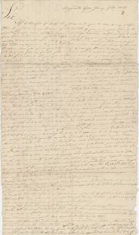
A Letter Written from Augusta Georgia Describing the Author’s Voyage from Boston to Augusta Georgia in 1818
Augusta Georgia 1818. Single letter three 9 x 16 inch pages letters with some tape repairs and stray holes at folds still quite legible. Very good. A letter written by Calvin Barnard to his friend Asa Holman of Bolton Massachusetts describing the former’s trip from Boston to Augusta South Carolina from November 25 to January 1. Barnard first traveled from Boston to Charleston South Carolina by boat from which he notes “almost a continual gagging and vomiting†from the passengers. In Charleston Barnard observes that the city is inelegant the unpaved streets “filled with mud†and views “the breastworks which were thrown up during the last warâ€. This would have been the War of 1812 of which Barnard was likely a veteran. South Carolina had engaged upwards of 5000 soldiers and had put up defenses along the coastline in anticipation of the war but it did not come to the mainland – although South Carolina was under naval blockade and the Sea Islands were targeted by the British.<br /> <br /> Barnard reaches Savannah Georgia on the 25th of December; similarly he finds it “although a place of considerable business†“about as dissatisfactory a place I ever was in.†Augusta which he reaches by foot “is much handsomer built and situated than Savannah but not less dissipated†– he remarks that “Being the first day of the year is in this part of the country another great day for getting drunk.†After spending some time in Augusta he finishes the letter with some pointed observations about its residents:<br /> <br /> “I have had a better opportunity of becoming acquainted with the manners customs and dispositions of the citizens of Augusta . I shall not do them injustice by dividing them into three classes in which the Negroes are excepted. The first class of which are the gentry as they would expect to be called made up of men from all parts who have become rich here mostly by avaricious and unjust means . And this class we cannot expect to see drink more than once a week. The second is mostly the natives of this state and South Carolina who are men of a little property of a little education and very little of an honorable principle of any kind and these are not often seen drunk in the forenoon. The third class appears to me to be made up of the off-scouring of every bad place on earth for I never saw their equal for drunkenness lying stealing fighting swearing from morning till morning again. It is not possible that the continent of America has in any other place their equal. If it had I think the whole world soon be sunk.â€<br /> <br /> He finds Augusta’s African-American residents the only trustworthy ones despite local opinions:<br /> <br /> “If any stealing is done here it is laid to the Negroes but I had my surtout a shirt and handkerchief stolen on Friday night last but have too good an opinion of the blacks to think they have them.â€<br /> <br /> Of interest as an outsider’s views on the early Antebellum South and on drinking – another pressing social issue of the day. unknown
书商的参考编号 : List2715
|
|
|
[ANTIQUE WORLD MAP] (SMITH, ROSWELL CHAMBERLAIN), O PELTON (ENGRAVER).
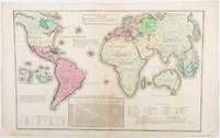
A Chart Exhibiting the Actual and Comparative Size of Each Country Nation or Kingdom; its Population as a Whole and to a Square Mile: Also the Different States of Society Forms of Government Religion &c.
Philadelphia.: W. Marshall. Circa1835. Handcoloured engraved map 26.5 x 41.3 cms; 29.6 x 48.3 cms sheet central fold insets of "Oceanica" and "New Holland" central table some light staining in the image and margins in good condition. Eurocentrism laid bare. This 19th Century map includes a "State of Society" for each part of the world declared with a symbol to represent "Barbarous Half Civilized Civilized and Enlightened Societies" as well as noting religion and ethnicity. It includes a table of distances between chief towns or capitals and between these towns and Washington DC. Australia "New Holland" is styled principally as pagan barbarous unexplored and African a thin sliver of what is now New South Wales and Victoria is labelled civilized European and Protestant. Scarce. . (W. Marshall). unknown
书商的参考编号 : 203763
|
|
|
[ARCTIQUE] - MIRSKY (Jeannette) -
Arctique enfer de glace.
Paris, France empire, 1967 ; in-8, 347 pp., broché, couverture illustr (ptes usures). Traduit de l'anglais par R. Jouan.
书商的参考编号 : 200711437
|
|
|
[ARCHEOLOGIE] - MATTHIESSEN (Peter) -
DAS VERBROGENE TAL.
Munchen-zch., Droemer - Knaur, 1964 ; in-8, 336 pp., cartonnage de l'éditeur. Très bon état avec sa jaquette - chronik einer reise in dies stgeinzeit mit 85 abbildungen.
书商的参考编号 : 201206427
|
|
|
[ART] - STROHM (Stefan) -
Die Kupferbibel Matthaus Merians von 1630.
Stuttgart, Verlag Muller und Schindler, 2001 ; in-8, 84 pp., cartonnage de l'éditeur.
书商的参考编号 : 200705506
|
|
|
[ART] - DAUX (Georges ) -
Les merveilles de l art antique.
Paris, Frenand nathan, 1946 ; in-8, 187 pp., broché, couverture illustr.
书商的参考编号 : 200502756
|
|
|
[ARCHEOLOGIE, VOYAGE]
Msitra a cité médiévale et la forteresse.
Grece, Ekdotike athenon sa, 1985 ; in-8, 127 pp., br.
书商的参考编号 : 201407087
|
|
|
[ARCTIQUE] - HOWARTH (David) -
Patrouille arctique.
Paris, Flammarion - aventure vécu, 1959 ; in-8, 218 pp., cartonnage de l'éditeur.
书商的参考编号 : 200604092
|
|
|
[ARCTIQUE] - FRISON-ROCHE (Roger) -
Peuples chasseurs de l'arctique.
Paris, Arthaud, 1967 ; in-8, 285 pp., br. 47 photogaphies de Pierre TAIRRAZ 2 carte.
书商的参考编号 : 201708679
|
|
|
[ARCTIQUE] - [Capitaine ROSS].-
Quatre ans dans les glaces. Deuxième expédition du capitaine Ross dans les mers arctiques 1820-1833.
P., Librairie Nationale d'Education et de Récréation, sans date, grand in 8° cartonnage rouge décoté de l'éditeur, 160 pages ; frontispice ; coiffes usées.
书商的参考编号 : 64622
|
|
|
[ART] - COLLECTIF
Revue «Traverses» N° 19 – Juin.
Paris, Éditions de Minuit, 1980 ; in-8 (201 x 241 mm), 152 pp., broché. Revue du Centre national d’art et de culture Georges Pompidou / CCI. Nombreuses illustrations en noir et blanc.
书商的参考编号 : _202404619
|
|
|
[ASIA - MAP]
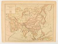
Physical map of Asia
New York.: Harper & Brothers. 1875. Map printed in colour polar projection 21 x 27.1 cm marginal spotting and toning small edge tears to the inner margin but in god condition. Prepared for "Harper's School Geography" first published by Harper & Brothers in 1875. The map shows physical features mountains steppes plains rivers and deserts etc. together with sources of primary production: whale fisheries furs coffe tea minerals etc.The verso of the map with references and attractive line engravings part of the entry for Netherlands and Belgium. . Harper & Brothers. unknown
书商的参考编号 : 174830
|
|
|
[ASIA - WORLD WAR II MAP].
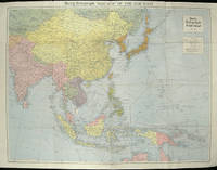
The Daily Telegraph War Map of the Far East. Daily Telegraph War Map No. 11.
London.: Hutchinson & Co. Circa1940. Full colour folding map 70.7 x 93 cms; 76 x 101.2 cms sheet original folds short fold splits previous owner's neat title markings on the verso but the map in very good condition. A "Geographia" map of the war theatre in Asia and the Pacific including the northernmost coast of Australia. Showing railways and canals roads and steamer routes oilfields and pipe lines and a key to the unfederated states of Malaya. The Spratley Islands are marked as French and Thai territorial claims within French Indo China are marked. . Hutchinson & Co. unknown
书商的参考编号 : 205763
|
|
|
[ASIA-PACIFIC - MAP].
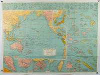
Robinson's Pacific Ocean Mercator's Projection. Map no. 1804 : New Map of the Pacific Ocean with Insets showing Island Groups in Detail.
Sydney.: H.E.C. Robinson. Circa1945. Full colour inset maps principal cities and towns marked shipping routes international boundaries and railways. 99 x 73cm. Some small insect damage has been repaired on the verso visible on map as a few small lighter areas in the western Pacific. Pinpoint holes at folds paper repair along cover but a very good clean copy. From the Sydney publisher H.E.C. Robinson the firm founded in 1895 by Herbert Robinson 1857-1933 a founder of the Royal Geographical Society of Australasia. <br> <br>Although the map is undated North and South Korea are shown as divided which occurred in late 1945 and Manchuria is marked as still under Soviet occupation which only lasted until 1946 at which point it was handed over to Communist China. <br> <br>As well as what now would be considered Southeast Asia the main map shows the eastern half of India Tibet and parts of Mongolia the USSR and East Asia. Inset maps include: Caroline Islands Marshall Islands Federation of Malaya Singapore Hong Kong Taiwan Japan Hawaiian Islands Philippine Islands Midway Gaum and Wake Islands Fiji Islands Eastern & Western Samoa Santa Cruz and Solomon Islands New Caledonia Rabaul Tahiti Lord Howe etc. . H.E.C. Robinson. unknown
书商的参考编号 : 180206
|
|
|
[Atlas] Lesage (conte de Las Cases)
Atlas historique, généalogique, chronologique et géographique.
Leclère 1829 In-folio, demi-basane rouge, dos lisse, fleurons et dentelles dorés, 2 ff. & 37 tableaux à double page rehaussés en couleurs, 20 illustrés de cartes, le tout sur onglet. Dos passé, coiffes arrachées, plats et coins usés. Quelques rousseurs et brunissures éparses.
书商的参考编号 : 31873
|
|
|
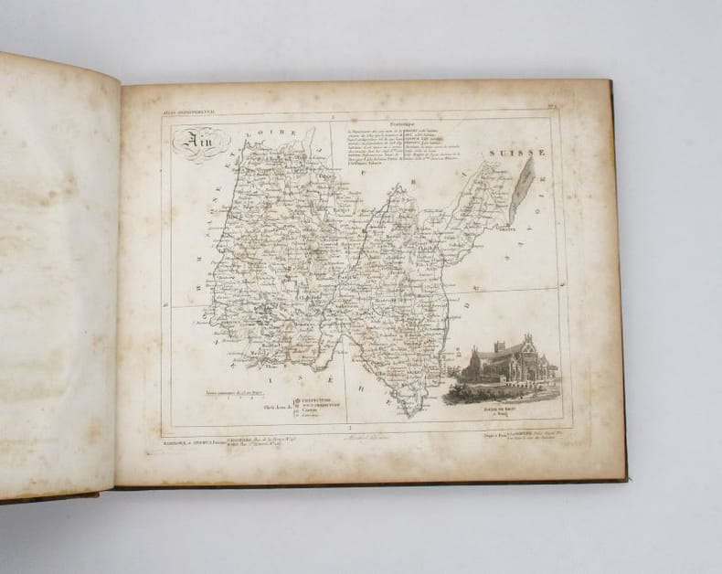
[ATLAS]
La France et ses colonies. Atlas départemental
Versailles, Andrieux et Barreswil, s.d. In-4 oblong, 1 titre, 95 cartes, demi-basane havane, dos lisse orné de filets dorés (épidermures, rousseurs).
书商的参考编号 : 19217
|
|
|
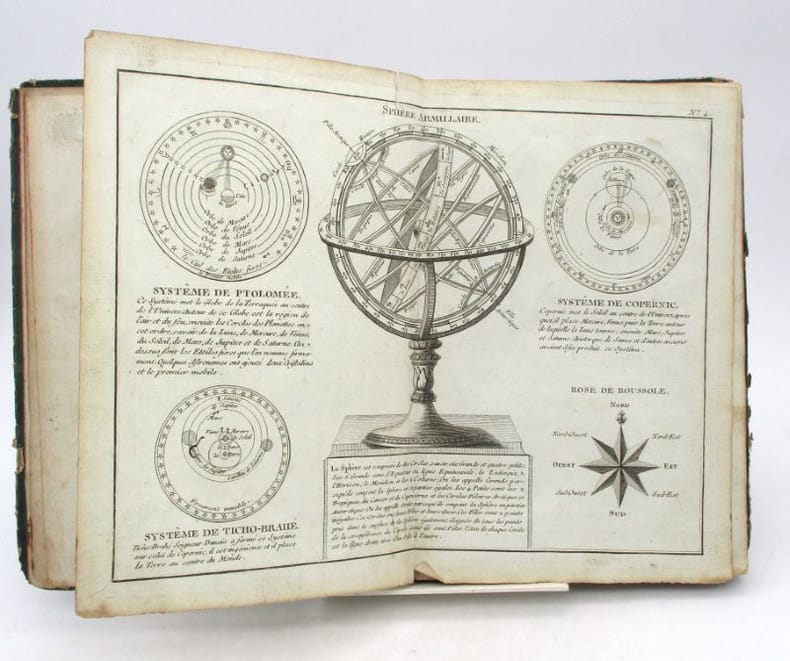
[ATLAS]
Petit Atlas moderne ou Collection de arts élémentaires dédié la Jeunesse
Paris, chez Lattré, 1788. In-8, [1]-20-[4] pp., 28 cartes ou planches doubles, cartonnage vert muet, tranches mouchetées de rouge (cartonnage défraîchi mais solide, quelques petites déchirures et taches, parfois relié dans le désordre).
书商的参考编号 : 21111
|
|
|
[AUTREMENT] - COLLECTIF -
Aventure australie.
S.l., Autrement, 1984 ; in-8, 294 pp., br.
书商的参考编号 : 201316954
|
|
|
[Aulnoy, Marie Catherine Le Jumel de Barneville d']
Relation du voyage d'Espagne. Tome Premier-Tome Troisieme. 3 Tomes (complet)
Paris, Chez Claude Barbin, 1691. Klein-8°. 16,5 x 9,5 cm. [8] Blatt, 336, 343 und 419 Seiten. Original-Ganzlederbände der Zeit, mit goldgeprägten Rückentiteln und floralem Buchschmuck. [4 Warenabbildungen] Marie-Catherine, Baronne d?Aulnoy (Madame d?Aulnoy), geboren 1650 oder 1651 als Le Jumel de Barneville in Barneville-la-
书商的参考编号 : 13748DB

|
|
|
[Austrian Foreign Trade].
Hongkong. - Burma. - Laos. - Kambodscha. - Australien. Vienna, Bundeskammer der Gewerblichen Wirtschaft, 1960.
8vo. 5 vols. 58 pp. (Hong Kong). 28 pp. (Burma). 20 pp. (Laos). 24 pp. (Cambodia). 76 pp. (Australia). Original illustrated stiff wrappers, each volume with a map on the inside front cover. Collection of five curious foreign trade monographs issued by the Austrian Chamber of Commerce, directed at Austrian concerns aiming to do business with Southeast Asia and Australia. Contains general geographical data and statistics, details on units of measurements, economic structure, and customs of trade.
|
|
|
[Automobiles] [Travel] [Maine]
1920's New England Manuscript Automobile Record of Travel
Maine: n.p. 1920. Leather bound. Good. Oblong soft red leather ledger. Approximately 6.5" x 4.5." 64 leaves. Printed title page and explanation page. 60 pages used for writing down records. Several blank pages. Front cover shows light scratches a small stain and light creases. Small ink stain on a couple of blank pages towards the back else contents are clean. <br /> <br /> Records are written in columns for the first 56 pages. Column heading include date start time cyclo arrival time cyclo distance delays net running time average miles per hour roads party and remarks. Several empty pages until 4 pages of manuscript written in the memoranda section. The last note in this section is dated 1927. Alphabetical thumb index for expense records towards the back was not used. Title page does not have the name of the driver. However written at the bottom of the page is "1917 Ford #1750755 1921 Reg # 49290 Maine."Early trips recorded to Plymouth New Bedford Concord Boston Harvard Boothbay Harbor etc. Last driving record recorded August 1926. Although a date of 1927 recorded in the Memoranda section. A presentation card to "Uncle Charlie" enclosed with the inscription "may the roads be good the pleasure great and the blowouts few. n.p. unknown
书商的参考编号 : 36670
|
|
|
[AVENTURE VÉCUE] - MANCIET (Yves) -
Amazonie terre inachevée.
Paris, Flammarion, 1967 ; in-8, 266 pp., cartonnage de l'éditeur.
书商的参考编号 : 201305364
|
|
|
[AVENTURE VECUE ] - PFEFFER (Pierre) -
Bivouacs a Bornéo.
Paris, Flammarion, 1963 ; in-8, 249 pp., cartonnage de l'éditeur.
书商的参考编号 : 201803601
|
|
|
[AVENTURE] - LANGHOLF (Paul) -
Bounty le rescapé.
Paris, Editions vie et santé , 1983 ; in-8, 198 pp., br.
书商的参考编号 : 201707503
|
|
|
[AVENTURE] - LANGHOLF (Paul) -
Bounty le rescapé.
Paris, Editions vie et santé , 1983 ; in-8, 198 pp., br.
书商的参考编号 : 201707502
|
|
|
[AVENTURE] - LANGHOLF (Paul) -
Bounty le rescapé.
Paris, Editions vie et santé , 1983 ; in-8, 198 pp., br.
书商的参考编号 : 201707481
|
|
|
[AVENTURE, VOYAGE]
Decouverte de l'aventure.
Paris, Gallimard, 1990 ; in-8, 384 pp., br.
书商的参考编号 : 201318362
|
|
|
[AVENTURE, VOYAGE ] - LAPIERRE (Alexandra), MOUCHARD (Christel) -
Elles ont conquis le monde les grandes aventurieres 1850-1950.
Paris, ARTHAUD , 2007 ; in-4, 232 pp., cartonnage de l'éditeur. Avec jaquette.
书商的参考编号 : 202302937
|
|
|
[AVENTURE VECUE ] - BOLLER (Freddy) -
L'enfer des crocodiles.
Paris, Flammarion, 1976 ; in-8, 231 pp., br.
书商的参考编号 : 201907505
|
|
|
[AVENTURE, VOYAGE] - DURRELL (Gerald) -
Trois aller simples pour l'aventure.
Paris, Librairie Stock, 1956 ; in-8, 191 pp., br. Broché très bon état avec sa jaquette.
书商的参考编号 : 201407451
|
|
|
[BARRAULT Jean-Louis et Madeleine RENAUD] BERTIN Pierre.
1) CARNET DE VOYAGE. Brésil, Uruguay, Argentine, Chili.- 2) AUX EMPIRES DU SOLEIL. Relation de la tournée Renaud-Barrault, accomplie d'avril à juillet 1956 : Mexique, Pérou, Equateur, Colombie, Venezuela, la Guadeloupe, la Martinique, Haïti. Deuxième carnet de voyage.
1) CARNET DE VOYAGE. Brésil, Uruguay, Argentine, Chili.- 2) AUX EMPIRES DU SOLEIL. Relation de la tournée Renaud-Barrault, accomplie d'avril à juillet 1956 : Mexique, Pérou, Équateur, Colombie, Venezuela, la Guadeloupe, la Martinique, Haïti. Deuxième carnet de voyage.
书商的参考编号 : 8340
|
|
|
[BASTIDE Jean-François de]:
Le dépit et le voyage, poëme, avec des notes, suivi des lettre vénitiennes.
A Londres et se trouve à Paris, Chez J. P. Costard, 1771. In-8 de [4]-front.-179 pages, plein veau marbré, dos lisse orné de filets et fleurons dorés, filet doré sur les coupes, triple filet doré encadrant les plats, tranches rouges. Coins, coiffes et mors un peu frottés, un coin sup. un peu tapé.
书商的参考编号 : 9397

|
|
|
[BAEDEKERS]
Schweiz.
, 1964 ; in-8, 352+carte , cartonnage d'éditeur avec jaquette.
书商的参考编号 : 201008833
|
|
|
[Bardili, Johann Wendel].
Des Weyland Durchl. Printzens Maximilian Emanuels Hertzogs in Würtemberg etc. [...] Reisen und Campagnen durch Teutschland in Polen, Lithauen, roth und weiß Reußland, Volhynien, Severien und Ukrainie. [...] Nebst der Reys-Beschreibung von Pultawa nach Bender. Stuttgart, auf Kosten des Authoris, 1730.
8vo. (12), (2), 453 [but: 451; omitting 177/178] pp., ff. 454-456, 457-480 [but: 470], 481-653, (1) pp. With engraved portrait frontispiece. Contemporary blindstamped leather over wooden boards on 4 raised bands; giltstamped oval armorial supralibros to both covers. All edges red. 2 clasps. Rare first edition of this eyewitness account of the Great Northern War, in which the "Little Prince" Maximilian Emanuel of Wuerttemberg-Winnental (1689-1709) took part on the Swedish side. Captured by the Russians in the Battle of Poltava, he died at Dubno. On his journeys he was accompanied by the preacher J. W. Bardili (1676-1740, grandson of the physician Carl Bardili), who later published the present report, containing numerous interesting geographico-cultural observations on Belarus, Smolensk, Sivershchyna, Volhynia and the Ukraine: "The country known as Ukrainie is splendidly fertile and produces such amounts of crops that they can impossibly be stored away, for which reason a large proportion of grain is used for brandy, a drink of which the inhabitants are not only great connoisseurs, but of which they are also wont to possess quite significant quantities. The grass is rich [...]. Thus fed, the Cossacks' horses grow very strong and durable, and they are able to remain outside, throughout summer and winter, until they are five or six years old, and only then are they slowly accustomed to the saddle and bridle" (cf. p. 422). From p. 481 onwards, the book contains an anonymous account of the ensuing events informed by the operations of the Ottoman Empire (such as the Turkish captivity of Charles XII at Bender). - Some occasional browning and staining due to paper. The half-title belonging to the appendix ("Reise-Beschreibung von Pultawa nach Bender", pp. 481 ff.) is erroneously bound after the preliminaries. Both covers bear the giltstamped arms of the Benedictine monk and scholar Gottfried (Johann Georg) Bessel (1672-1749), the probably most important abbot of the Austrian Abbey of Göttweig (1714-49), which he had rebuilt in 1718, following a fire, based on plans by Johann Lucas von Hildebrandt. Hailed as "Germany's Mabillon" for his pioneering work in diplomatics and the auxiliary sciences of history, Bessel authored the "Chronicon Gotwicense" and served as rector of the University of Vienna from 1714 to 1716. Estreicher XII, 370. Warmholtz 5546. ADB XXI, 76.
|
|
|
[BENELUX] - OGRIZEK (Doré) -
Le benelux belgique -nederland-luxembourg.
Paris, Edition odé, 1950 ; in-12, 543 pp., cartonnage d'éditeur .
书商的参考编号 : 200905180
|
|
|
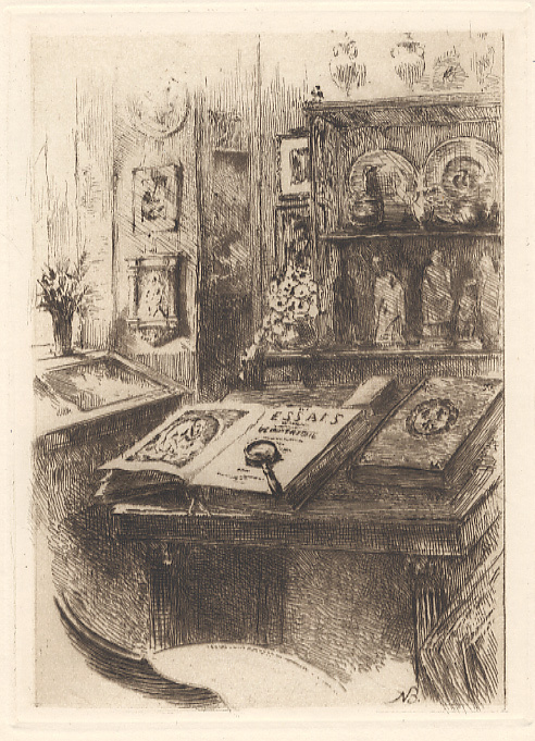
[Berton, Armand]Lemaître, Jules :
Trois contes en marge d'Homère.
Paris, Les Amis des livres, 1921; in-8, broché sous étui muet en papier bleu avec motifs géométriques ; (7) ff., 99 pp., (3) ff. ; 37 eaux-fortes in et hors-texte d'Armand Berton, la plupart en couleurs, protégées par des serpentes ; couverture beige imprimée à rabats.
书商的参考编号 : 2114
|
|
|
[BELLE-ILE-EN-MER] MORICEAU, C.-G. (Dr)
VOYAGE A BELLE-ILE : lu dans la section des sciences naturelles par le Dr Moriceau
Nantes impr. de Vve C. Mellinet 1855 in-8 broché une plaquette, brochée in-octavo (paperback in-8 Editor), dos muet, recouvert d'une fausse couverture d'attente verte d'époque, toutes tranches non-rognées, signature EX-LIBRIS à l'encre brune en haut de la fausse couverture d'attente : Mme L. SAY (femme de l'explorateur Nantais Louis Jean-Baptiste Say, fondateur de PORT-SAY en Algérie).sans illustrations (no illustration), 16 pages, sans date (1855) Nantes : impr. de Vve C. Mellinet Editeur,
书商的参考编号 : 22439
|
|
|
[Beijing].
Strassen-Bilder in Peking. [Beijing, 19th century].
50 watercolours (342 x 240 mm) mounted on album paper, all captioned in Chinese. In brown cloth. Oblong folio. Curious album of 50 watercolours, showing various portraits of people who do business in the streets of Beijing, among them a barber, street vendors, carpenters, jugglers, sculptors, beggars, mouse and rat catchers, newspaper salesmen, pickpockets, etc. The album also shows different types of machines such as slides and looms as well as everyday scenes: a young boy stealing the hat of an elderly man, another man collecting food discarded by the wealthy, a painter drawing the portrait of a deceased. - In very good condition, with ms. German translations of the Chinese captions.

|
|
|
[BELLIN , JACQUES-NICOLAS]. (CARTOGRAPHER).
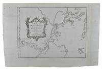
Carte de La Baye d'Hocsieu et des Entrées de La Rivière de Chang.
Paris. Circa1749. Engraved map on watermarked laid paper 20 x 27.3 cm of Fuzhou and coastline of Fujian Province original folds designed by the great French cartographer Jacques-Nicolas Bellin. This map is from the impressive 15-volume "Histoire Génèrale des Voyages" compiled by Antoine François Prévost map no. 2 Vol. 6. This map shows the estuary of Yangtze River Rivière de Chang. Very light browning on sheet edges but in very good condition. . unknown
书商的参考编号 : 136827
|
|
|
[BELLIN, JACQUES NICHOLAS] (CARTOGRAPHER).
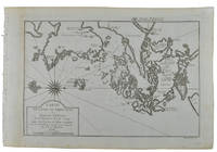
Carte de L'isle de Cheu-Chan ou Isle de Chusan de la Province de Che-Kiang Avec les Costes et Isles voisines.
Paris. circa1749. Black and white engraved map on watermarked laid paper 20.9 x 32.7cm showing coastal area of Zhejiang Province Province de Che-kiang including Zhoushan Archipelago Isle de Chusan Zhoushan Bay Bay de Chusan and Xiangshan County Siang-chan-luen a walled city outside of upper border Ningbo Ning-po prefecture under Qing administration title cartouche lower left original folds. This map is No. 3 Vol. 6 from the impressive 15-volume "Histoire Generale des Voyages" compiled by Antoine François Prévost. Even browning mainly to the sheet edges in very good condition. . unknown
书商的参考编号 : 136826
|
|
|
[BELLIN, JACQUES-NICOLAS]. (CARTOGRAPHER).
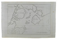
Carte De La Baye De Chin-Chew ou Chang-Chew.
Paris. circa1749. Black and white engraved map of Quanzhou and Zhangzhou 21.1 x 30 cm here spelled Chin-chew and Chang-chew and both final words with added superscript "ou" on watermarked laid paper 25.6 x 38 cm original folds a few marginal spots simplified compass rose and a decorative fleur de lis bottom right in very good condition. Attractive map including the estuary of Quanzhou River Xiamen Emowi and Kinmen or Quemoy Quemowi island. The map was designed by the eminent French cartographer Jacques-Nicolas Bellin and here published as plate No. 22 in the impressive 15 volume compilation of voyages "Histoire Generale des Voyages" by Antoine François Prévost. . unknown
书商的参考编号 : 136795
|
|
|
[BELLIN, JACQUES NICOLAS] (CARTOGRAPHER).
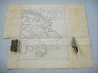
Carte de L'entree de la Riviere de Canton. Dressee sur les Observations les plus recentes.
Paris. circa1749. Black and white engraved map on laid paper showing entrance to Pearl/Canton river Macao and the area which would become Hong Kong Sinn-gan-hien folded designed by the prominent French cartographer Jacques-Nicolas Bellin. This map is No. 16 Vol. 5 from the impressive 15-volume "Histoire Generale des Voyages" compiled by French novelist Antoine François Prévost. The walled city of Canton upper section is divided into areas of Tartar and Chinese. <br> <br>Some light even browning on paper added at margins good copy. Map measures 25.7 x 20.5. . unknown
书商的参考编号 : 136781
|
|
|
[BELLIN, JACQUES-NICOLAS]. (CARTOGRAPHER).
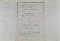
Plan De la Ville De Peking.
Paris. circa1749. Black and white engraved plan map of Peking on laid paper folded designed by the prominent French cartographer Jacques-Nicolas Bellin. This map is No. 18 Vol. 5 from the impressive 15-volume "Histoire Generale des Voyages" compiled by French novelist Antoine François Prévost. This city map shows two areas of walled cities: Ville Tartare Imperial city and the Forbidden City and Ville Chinoise ethnic Han residential area. <br> <br>Notes A and B represents buildings within the Forbidden City. A: Lieu de Plaisance ou l'on voit une Montagne faite a la main B: Grandes Cours du Palais de l'Empereur. Two missionary buildings French and Portuguese as well as the Tower of Mathematics illustrated within Ville Tartare. Two temples illustrated side by side near the south gate of the Ville Chinoise. <br> <br>Overall in good condition very light browning on edges and darker toning along the borders of the map. Text in French. Map measures 21 x 16.4cm. . unknown
书商的参考编号 : 136794
|
|
|

 ?????????
 ?????PDF???
 RSS feed
 ??
??


