|
|
|
Michel Houellebecq
Piattaforma Nel centro del mondo
bross. edit. con sovrac. ill., fioriture ai tagli e alle prime pagine - prima edizione it. - trad. di Sergio Claudio Perroni A.I.T.I.

|
|
|
Michel Lancelot
Campus
Albin Michel 1971 308 pages in8. 1971. broché. 308 pages. Campus est un livre de Michel Lancelot publié en 1971 qui s'inspire de et analyse l'émission de radio mythique du même nom qu'il animait sur Europe 1. L'ouvrage étudie les phénomènes sociaux de l'époque notamment le mouvement hippie et les revendications de la jeunesse en abordant des sujets profonds comme la vie la mort et la recherche spirituelle
书商的参考编号 : 8238

|
|
|
Michel, Duc d'Elchingen, Prince de la Moskowa NEY
L'île de Wight. Les châteaux et les cottages... Le tour de l'île. Extrait de la Revue des Deux Mondes
Extrait de La Revue des deux mondes | s. l. [Paris] s. d. [1851] | 15.50 x 25 cm | agrafé
书商的参考编号 : 14168
|
|
|
MICHEL, Henri.
LOS MOVIMIENTOS CLANDESTINOS EN EUROPA.
17x11. 123p.

|
|
|
Michel, Henry
The Shadow War: Resistance in Europe 1939-45
416 pages including index, bibliography and abbreviations. "The first adequately comprehensive history of the Resistance in Europe during Hitler's war to be published in any language." - The Times Literary Supplement reviewing the original French edition. Translated from the French by Richard Barry. Light wear to attractive price-clipped dust jacket. Prior owner's details upon front endpaper. Pencil markings to contents. Nice copy overall. Book
|
|
|
Michel, Hugo
Europa Katalog 1910 [Faksimile-Ausgabe]
Apolda: Hugo Michel. 108 S. ; 19m x 12 cm ; kart. ;
书商的参考编号 : 127381

|
|
|
Michel, J. A. (Hrsg.)
Das Königreich Böhmen. Ein historisch-statistisch topographisches Handbuch.
Prag, Haase Söhne, 1840. 8°. 2. Band. 575 Seiten. Mit 1 mehrfach gefaltet., gest. Karte und 10 gest. Ansichten. Orig. Halbledereinband mit Rückenvergoldung. Vergoldung verblichen, Einband minimal berieben. Das Österreichische Kaiserthum, 3. Band.
书商的参考编号 : 6451A
|
|
|
MICHEL, Paul-Henri.
La Fresque Romane.
in-12 carre, 254 pp, nombreuses illustrations n&b, broche, couv. illustree. Bel exemplaire. [AR-2]
|
|
|
Michele Battini
L'ordine della gerarchia I contributi reazionari e progressisti alle crisi della democrazia in Francia 1789-1914
bross. edit. ill. con bandelle, tracce d'uso in cop. - prima edizione

|
|
|
Michele Cervantes di Saavedra - illustrazioni di Gustavo Dorè
Don Chisciotte della Mancia Illustrata da Gustavo Dorè
bross. edit. ill., macchie e piccole rotture in cop., macchie al taglio di testa, lievi fioriture, brunitura della carta - numerose illustrazioni in b.n. nel testo

|
|
|
Michele de Cervantes Saavedra
Don Chisciotte della Mancia - completo in 2 voll.
bross. edit. con titoli, bruniture in cop. e lievi fioriture ai tagli, timbri d'appartenenza - trad. di Alfredo Giannini

|
|
|
Michele Genovese Gianni Baget Bozzo
Europa, una speranza oltre la ragione
Brossura editoriale, con buon aspetto interno, copertina segnata da minime tracce di manipolazione, sovraccoperta con imperfezioni da sfregamento e bordo stanco, toni velati da polvere da scaffale, conservazione interna molto buona, denso pulviscolo ai tagli. N. pag. 214. USATO

|
|
|
Michelet Jules
Ecrits de jeunesse Journal (1820-1823) - Memorial - Journal des idees
in francese bross. edit., piccola rottura alla cuffia sup.
|
|
|
Michelet, J
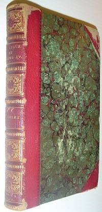
La Ligue et Henri IV: Histoire De France Au Seizieme Siecle
Paris: Chamerot Libraire-Editeur 1856. Book. Good. Hardcover. First Edition. 8vo - over 7¾" - 9¾" tall. 492 pages. Handsomely tooled red leather spine with gilt. Bookplate of Lord James Butler inside front board. Unmarked. Narrow openings along each hinge. Binding sound. Significant but not excessive external wear to corners and edges. A book cover has been removed leaving several tape discolourations to endpapers. Varying degrees of foxing throughout primarily near edges of textblock more near endpapers. A sound copy. Chamerot, Libraire-Editeur Hardcover
书商的参考编号 : 113a2200
|
|
|
Michelet, J
Sur les chemins de l'Europe. Angleterre, Flandre, Hollande, Suisse, Lombardie, Tyrol.
Paris:, Marpon & Flammarion, 1893. Kl.-8°. 5 Bll., 525 S. Halbleder (Einband wenig beschabt, leicht gebräunt)
书商的参考编号 : 6569AB

|
|
|
Michelet, J.
La Ligue et Henri IV: Histoire De France Au Seizieme Siecle
492 pages. Handsomely tooled red leather spine with gilt. Bookplate of Lord James Butler inside front board. Unmarked. Narrow openings along each hinge. Binding sound. Significant but not excessive external wear to corners and edges. A book cover has been removed, leaving several tape discolourations to endpapers. Varying degrees of foxing throughout, primarily near edges of textblock, more near endpapers. A sound copy. Book

|
|
|
Michelet, Jon
Der Gürtel des Orion : Thriller / aus d. Norweg. von Gabriele Haefs.
Hamburg : Kabel, 1988. 296 S. 8°. Bibl.- Einbd.
书商的参考编号 : 32111
|
|
|
MICHELET, Jules:
Histoire de la révolution française. En 7 vols. Complet.
Paris, Jean De Bonnot, 1974, gr. in-8vo, env. 400 p. par vols., richement ill. n./b., reliure en cuir vert, orné or.
书商的参考编号 : 117265aaf
|
|
|
MICHELET, Jules:
Histoire de la révolution française. Êdition bicentenaire. 1789-1989. Complète n 7 vols. Complet.
Paris, Jean De Bonnot, 1974, gr. in-8vo, 380 + 445 + 478 + 418 + 545 + 430 + 396 p., richement ill. n./b., reliure d'édition plein cuir véritable de mouton, tête dorée, or titré 22 carats, état de neuf.
书商的参考编号 : 136191aaf
|
|
|
MICHELET, Pierre:
Les transports au sol et l'organisation de l'Europe. Thèse.
Lausanne, Imprimeries réunies, 1961, in-8°, 270 p., ill. de 15 graphiques, brochure originale.
书商的参考编号 : 52515aaf
|
|
|
MICHELET, Pierre:
Les transports au sol et l’Organisation de l’Europe. Thèse
Lausanne, Imprimeries Réunis S.A., 1961, gr. in-8vo, 270 p., envoi sur 6 lignes à Mr. Casanova signé par l’auteur, ex libris récent, brochure originale.
书商的参考编号 : 113686aaf
|
|
|
Micheletti, Eric; Debay, Yves; Villaume, Jean-Pierre (translator)
War in the Balkans 1991-1993. 600 Days of Conflict in War-Torn Yugoslavia.
Poole: Histoire & Collections 1993. 143pp num col photos maps. Or pictorial boards. Some foxing. Covers two years of the war in former Yugoslavia showing the development and escaltion of hostilities. Includes many previously unpublished photos the book focuses on specific aspects of the conflict and gives a detailed account of the military operations. First Edition. Hard Cover. Very Good. 4to. Histoire & Collections Hardcover
书商的参考编号 : 038152 ???????? : 2908182211 9782908182217

|
|
|
Micheletti, Emma
Galleria degli Uffizi <Firenze> : die Meisterwerke aus den Uffizien in Florenz / Vorw.: Luciano Berti. Übers. aus d. Ital.: Christel Galliani.
Stuttgart [u.a.] : Belser, 1983. Gemälde, Bd 1. 125 S. : zahlr. Ill. (z.T. farb.) 8°. Deutschsprach. Ausg. Ill. OPpbd. (Belser-Kunstbibliothek)
书商的参考编号 : 7728
|
|
|
Michelin
Paris.
1992. Michelin, 2. Auflage. Reihe: Micheln-Reiseführer. Mit Abbildungen. OKart., 287 S..
书商的参考编号 : 18203
|
|
|
Michelin, Der Grüne Reiseführer
Elsass Lothringen Champagne
Michelin Reise Verlag 2000. 496 S. mit Abb. Softcover/Paperback, Exemplar in gutem Erhaltungszustand
书商的参考编号 : 63850

|
|
|
MICHELOT & BREMOND;
[ELBE] Plan de Porto Ferraro en l'isle de l'Elbe.
1730 178 x 255 mm.
书商的参考编号 : LBW002a2
|
|
|
MICHELOT & BREMOND;
[MESSINE] Partie de la ville et port de Messine.
1727 173 x 250 mm.
书商的参考编号 : LBW00265
|
|
|
MICHELOT & BREMOND;
[NAPLES] Plan du golfe de Naples.
1727 174 x 250 mm.
书商的参考编号 : LBW0026c

|
|
|
MICHELOT & BRÉMOND.
[PALERME] Plan de la ville, port et rades de Palerme.
[1730]. 175 x 250 mm.
书商的参考编号 : LBW00268
|
|
|
MICHELOT & Laurent BREMOND Henry
Nouvelle Carte Generalle de la Mer Mediterranée Dediée a Monseigneur Le Grand Prieur General des Galeres de France
Nouvelle Carte Generalle de la Mer Mediterranée Dediée a Monseigneur Le Grand Prieur General des Galeres de France. Par ses tres humbles Servoteurs Michelot Hidrographe et Pilot Real des Galeres du Roy et Bremond Hidrographe du Roy et de la Ville. Avec Privilege du Roy.Acquaforte, stampata su tre fogli, rispettivamente di dimensioni 499x711 mm, 700x490 mm e 468x693 mm. Imprint editoriale nel cartiglio: Ce Vend chez Laurent Bremond sur le Port a Marseille au Coin de Reboul; in basso a destra, la firma dell’incisore: Gravéè par P. Starckman.Bell'esemplare, in ottimo stato di conservazione.Carta del Mediterraneo, che viene suddiviso in tre parti. Nel foglio occidentale, in basso, un riquadro contiene le scale metriche (ripetute nel foglio centrale, in basso a destra, e in quello orientale, in alto a destra): Echelle de Lieues Françoises et Angloises, a 20 pour Degré; Echelle de Lieues d'Hollande, a 15 pour un Degré; Echelle de Lieues d'Espagne, à 17 1/2 pour un Degré; Echelle de Milles, a 75 pour un Degré, Selon l'usage de la Mediterranée. In basso, in un riquadro, troviamo i Noms des Isles et de quelques Ports contenues dans cette Carte, un elenco di 56 toponimi. Nel foglio centrale, il secondo riquadro riporta i Noms des Isles et de quelques Ports contenues dans cette Carte, lista di ulteriori 64 toponimi; in alto a destra, in un cartiglio, è rappresentato il piano nautico di Tripoli. Nel foglio orientale, un riquadro riporta i Noms des Isles et quelques Caps contenues dans cette Carte, lista di 80 toponimi sul Mar Egeo. La carta è dedicata a Jean Philippe d’Orleans (1702 - 1748), bâtard d’Orléans, chiamato le Chevalier d’Orléans o le Grand Prieur d’Orléans, figlio illegittimo di Filippo d’Orléans, nipote e genero di Luigi XIV. La carta era la seconda tavola dell’atlante nautico che Michelot e Bremond realizzarono nel primo ventennio del Settecento. La tecnica adottata per il disegno costiero e la disposizione dei toponimi provano la derivazione di questa carta direttamente da modelli manoscritti. Il foglio centrale mostra insolitamente il nord a sinistra, a differenza degli altri due fogli, pertanto, sviluppandosi in verticale non è sovrapponibile agli altri due.Henry Michelot, dopo il successo riscosso con la pubblicazione della sua guida nautica Le Portulan de Partie de la Mer Méditerranée, ou Le vray Guide des Pilotes Costiers (1703), cercò di capitalizzarlo unendosi a Laurent Bremond. All’inizio del XVIII secolo Henry Michelot e Laurens Bremond pubblicarono due importanti atlanti nautici del Mediterraneo e piani nautici ampiamente utilizzati dai naviganti costieri. Le carte sono interessanti e importanti per l’attendibilità derivata dall’esperienza di Michelot che, a differenza dei successivi “geografi del Dépôt des cartes et plans de la Marine” come Jacques-Nicolas Bellin ha avuto una lunga esperienza in mare. Il primo atlante prodotto contiene 16 carte, su piccola scala, del Mediterraneo e della costa atlantica in prossimità dello stretto di Gibilterra, integrate da una o più profili costieri. Le date delle carte sono comprese tra il 1715 e il 1726; in questo periodo Michelot si firmava come Hydrographe et Pilote Real des Galères du Roy (idrografo e pilota della cambusa reale per il corpo della galea dei re). Poco si sa del co-creatore dell’opera Laurent Bremond. Nella raccolta nautica il suo nome succede sempre a quello di Michelot, e viene qualificato come Hydrographe du Roy et de la Ville (idrografo del re e della città). Bremond sembrerebbe essere stato l’editore e il venditore della raccolta nautica, la forza commerciale della società; titolare di una sorta di negozio vicino al porto. Tutte le carte sono chiaramente contrassegnate: Ce vendent a Marseille chez Laurens Bremond sur le Port au coin de Reboul (venduto a Marsiglia da Laurens Bremond nel porto all’angolo di Reboul).Bibliografia: National Maritime Museum, Catalogue of the Library - Vol. Three,... Nouvelle Carte Generalle de la Mer Mediterranée Dediée a Monseigneur Le Grand Prieur General des Galeres de France. Par ses tres humbles Servoteurs Michelot Hidrographe et Pilot Real des Galeres du Roy et Bremond Hidrographe du Roy et de la Ville. Avec Privilege du Roy.Etching, printed on three sheets, respectively 499x711 mm, 700x490 mm and 468x693 mm. Imprint in the cartouche: Ce Vend chez Laurent Bremond sur le Port in Marseille au Coin de Reboul; bottom right, the engraver's signature: Gravéè par P. Starckman.Beautiful example, in excellent condition.Mediterranean Sea charts, which is divided into three parts. In the western sheet, at the bottom, a box contains the metric scales (repeated in the central sheet, bottom right, and in the eastern one, top right): Echelle de Lieues Françoises et Angloises, a 20 pour Degré; Echelle de Lieues d'Hollande, a 15 pour un Degré; Echelle de Lieues d'Espagne, à 17 1/2 pour un Degré; Echelle de Milles, a 75 pour un Degré, Selon l'usage de la Mediterranée. Below, in a box, we find the "Noms des Isles and those Ports contenues dues cette Carte", a list of 56 toponyms. In the central sheet, the second box shows the "Noms des Isles and those Ports contenues dans cette Carte", list of further 64 toponyms; in the upper right, in a scroll, the nautical plan of Tripoli is represented. In the eastern folio, a box shows the "Noms des Isles et quelques Caps contenues dans Cette Carte", list of 80 place names on the Aegean Sea. The chart is dedicated to Jean Philippe d’Orleans (1702 - 1748), bâtard d’Orléans, called le Chevalier d’Orléans or le Grand Prieur d’Orléans, illegitimate son of Philip d’Orléans, nephew and son-in-law of Louis XIV.The work was the second plate of the nautical atlas that Michelot and Bremond made in the first twenty years of the eighteenth century. The technique adopted for the coastal design and the placement of toponyms prove the derivation of this chart directly from manuscript models. The central sheet shows unusually the north to the left, unlike the other two sheets, therefore, developing vertically, it cannot be joined on the other two.Henry Michelot, after his success with the publication of his nautical guide "Le Portulan de Partie de la Mer Méditerranée, ou Le vray Guide des Pilotes Costiers" (1703), tried to capitalize it by joining Laurent Bremond. At the beginning of the 18th century, Henry Michelot and Laurens Bremond published two important nautical atlases of the Mediterranean and nautical plans widely used by coastal mariners.The charts are interesting and important for the reliability derived from the experience of Michelot who, unlike the subsequent "geographers of the Dépôt des cartes et de la Marine" like Jacques-Nicolas Bellin had a long experience at sea. The first atlas produced contains 16 maps, on a small scale, of the Mediterranean and the Atlantic coast near the Strait of Gibraltar, supplemented by one or more coastal profiles. The dates of the charts are between 1715 and 1726; in this period Michelot signed himself as Hydrographe et Pilote Real des Galères du Roy (hydrographer and pilot of the royal galley). Little is known about the co-creator of the work Laurent Bremond. In the nautical collection his name always happens to that of Michelot, and he is qualified as Hydrographe du Roy and de la Ville. Bremond seems to have been the publisher and seller of the nautical collection, the commercial strength of the company; owner of a sort of shop near the port. All charts are clearly marked: Ce vendent a Marseille chez Laurens Bremond sur le Port au coin de Reboul (sold in Marseille by Laurens Bremond in the port at the corner of Reboul).Bibliografia: National Maritime Museum, Catalogue of the Library - Vol. Three, Atlas & Cartography, Londra, 1971, pp. 262-263, n. 219 (2-4); R. Shirley, Maps in the Atlases of the British Library, Londra, 2004, pp. 1233-1234, M.MICH-1a. S. Bifolco, "Mare Nostrum, Cartografia nautica a stampa del Mar Mediterraneo" (2020), pp. 260-261, tav. 121.

|
|
|
MICHELOT & Laurent BREMOND Henry
Plan de la Baye de Poyance et de celle d'Alcudia
Carta nautica tratta dal raro Recueil de Plusiereurs Plans des Ports et Rades de la Mer Mediterranée Dediée A Monseigneur le Grand Prieur de France, General des Galeres Levé et Dessigné sur les Lieux par les Srs. Michelot Hydrographe et Pilote Real des Galeres du Roy et Bremond Hydrographe du Roy et de la Ville, avec Pri.ge Du Roy (1727), atlante nautico di 37 tavole, stampato a Marsiglia. I piani nautici sono incisi da Pieter Starckman, uno dei più attivi intagliatori dell’epoca, collaboratore di molti cartografi ed editori. Secondo Shirley [cfr. Maps in the Atlases of the British Library, p. 1234] la prima edizione dell’opera contiene 21 tavole, mentre la ristampa, senza data, contiene 37 tavole delle quali alcune datate 1730. La terza, e ultima, contiene 38 tavole e reca la data 1732. Henry Michelot, dopo il successo riscosso con la pubblicazione della sua guida nautica Le Portulan de Partie de la Mer Méditerranée, ou Le vray Guide des Pilotes Costiers (1703), si unì a Laurent Bremond. All’inizio del XVIII secolo Henry Michelot e Laurens Bremond pubblicarono due importanti atlanti nautici del Mediterraneo e piani nautici ampiamente utilizzati dai naviganti costieri. Le carte sono interessanti e importanti per l’attendibilità derivata dall’esperienza di Michelot che, a differenza dei successivi “geografi del Dépôt des cartes et plans de la Marine” come Jacques-Nicolas Bellin, ha avuto una lunga esperienza in mare. Il primo atlante prodotto contiene 16 carte, su piccola scala, del Mediterraneo e della costa atlantica in prossimità dello stretto di Gibilterra, integrate da una o più profili costieri. Le date delle carte sono comprese tra il 1715 e il 1726; in questo periodo Michelot si firmava come Hydrographe et Pilote Real des Galères du Roy (idrografo e pilota della cambusa reale per il corpo della galea dei re). Poco si sa del co-creatore dell’opera Laurent Bremond. Nella raccolta nautica il suo nome succede sempre a quello di Michelot, e viene qualificato come Hydrographe du Roy et de la Ville (idrografo del re e della città). Bremond sembrerebbe essere stato l’editore e il venditore della raccolta nautica, la forza commerciale della società; titolare di una sorta di negozio vicino al porto. Tutte le carte sono chiaramente contrassegnate: Ce vendent a Marseille chez Laurens Bremond sur le Port au coin de Reboul (venduto a Marsiglia da Laurens Bremond nel porto all’angolo di Reboul). Incisione in rame, in ottimo stato di conservazione. Bibliografia S. Bifolco, Mare Nostrum (2019), pp. 270-271, tav. 122; Palau, 168325. Tooley, 438,80. Nautical chart taken from the rare Recueil de Plusiereurs Plans des Ports et Rades de la Mer Mediterranée Dediée A Monseigneur le Grand Prieur de France, General des Galeres Levé et Dessigné sur les Lieux par les Srs. Michelot Hydrographe et Pilote Real des Galeres du Roy et Bremond Hydrographe du Roy et de la Ville, avec Pri.ge Du Roy (1727), nautical atlas of 37 plates, printed in Marseilles. The nautical plans are engraved by Pieter Starckman, one of the most active engravers of the time, collaborator of many cartographers and publishers. According to Shirley [see Maps in the Atlases of the British Library, p. 1234] the first edition of the work contains 21 plates, while the reprint, undated, contains 37 plates, some of which are dated 1730. The third and last edition contains 38 plates and is dated 1732. Henry Michelot, after the success achieved with the publication of his nautical guide Le Portulan de Partie de la Mer Méditerranée, ou Le vray Guide des Pilotes Costiers (1703), joined Laurent Bremond. In the early 18th century Henry Michelot and Laurens Bremond published two important nautical atlases of the Mediterranean and nautical plans widely used by coastal mariners. The charts are interesting and important for the reliability derived from the experience of Michelot who, unlike later "geographers of the Dépôt des cartes et plans de la Marine" such as Jacques-Nicolas Bellin, had long experience at sea. The first atlas produced contains 16 maps, on a small scale, of the Mediterranean and the Atlantic coast near the Strait of Gibraltar, supplemented by one or more coastal profiles. The dates of the charts are between 1715 and 1726; at this time Michelot signed himself as Hydrographe et Pilote Real des Galères du Roy (hydrographer and pilot of the royal galley for the kings' galley corps). Little is known about the co-creator of the work Laurent Bremond. In the nautical collection his name always succeeds that of Michelot, and he is qualified as Hydrographe du Roy et de la Ville (hydrographer of the king and the city). Bremond would seem to have been the publisher and seller of the nautical collection, the commercial force of the company; owner of a sort of store near the port. All charts are clearly marked: Ce vendent a Marseille chez Laurens Bremond sur le Port au coin de Reboul (sold in Marseille by Laurens Bremond in the port at the corner of Reboul). Copper engraving, in excellent condition. Literature S. Bifolco, Mare Nostrum (2019), pp. 270-271, tav. 122; Palau, 168325. Tooley, 438.80.

|
|
|
MICHELOT & Laurent BREMOND Henry
Plan de la Baye et Rades de Marseille
Carta nautica tratta dal raro Recueil de Plusiereurs Plans des Ports et Rades de la Mer Mediterranée Dediée A Monseigneur le Grand Prieur de France, General des Galeres Levé et Dessigné sur les Lieux par les Srs. Michelot Hydrographe et Pilote Real des Galeres du Roy et Bremond Hydrographe du Roy et de la Ville, avec Pri.ge Du Roy (1727), atlante nautico di 37 tavole, stampato a Marsiglia. I piani nautici sono incisi da Pieter Starckman, uno dei più attivi intagliatori dell’epoca, collaboratore di molti cartografi ed editori. Secondo Shirley [cfr. Maps in the Atlases of the British Library, p. 1234] la prima edizione dell’opera contiene 21 tavole, mentre la ristampa, senza data, contiene 37 tavole delle quali alcune datate 1730. La terza, e ultima, contiene 38 tavole e reca la data 1732. Henry Michelot, dopo il successo riscosso con la pubblicazione della sua guida nautica Le Portulan de Partie de la Mer Méditerranée, ou Le vray Guide des Pilotes Costiers (1703), si unì a Laurent Bremond. All’inizio del XVIII secolo Henry Michelot e Laurens Bremond pubblicarono due importanti atlanti nautici del Mediterraneo e piani nautici ampiamente utilizzati dai naviganti costieri. Le carte sono interessanti e importanti per l’attendibilità derivata dall’esperienza di Michelot che, a differenza dei successivi “geografi del Dépôt des cartes et plans de la Marine” come Jacques-Nicolas Bellin, ha avuto una lunga esperienza in mare. Il primo atlante prodotto contiene 16 carte, su piccola scala, del Mediterraneo e della costa atlantica in prossimità dello stretto di Gibilterra, integrate da una o più profili costieri. Le date delle carte sono comprese tra il 1715 e il 1726; in questo periodo Michelot si firmava come Hydrographe et Pilote Real des Galères du Roy (idrografo e pilota della cambusa reale per il corpo della galea dei re). Poco si sa del co-creatore dell’opera Laurent Bremond. Nella raccolta nautica il suo nome succede sempre a quello di Michelot, e viene qualificato come Hydrographe du Roy et de la Ville (idrografo del re e della città). Bremond sembrerebbe essere stato l’editore e il venditore della raccolta nautica, la forza commerciale della società; titolare di una sorta di negozio vicino al porto. Tutte le carte sono chiaramente contrassegnate: Ce vendent a Marseille chez Laurens Bremond sur le Port au coin de Reboul (venduto a Marsiglia da Laurens Bremond nel porto all’angolo di Reboul). Incisione in rame, in ottimo stato di conservazione. Bibliografia S. Bifolco, Mare Nostrum (2019), pp. 270-271, tav. 122; Palau, 168325. Tooley, 438,80. Nautical chart taken from the rare Recueil de Plusiereurs Plans des Ports et Rades de la Mer Mediterranée Dediée A Monseigneur le Grand Prieur de France, General des Galeres Levé et Dessigné sur les Lieux par les Srs. Michelot Hydrographe et Pilote Real des Galeres du Roy et Bremond Hydrographe du Roy et de la Ville, avec Pri.ge Du Roy (1727), nautical atlas of 37 plates, printed in Marseilles. The nautical plans are engraved by Pieter Starckman, one of the most active engravers of the time, collaborator of many cartographers and publishers. According to Shirley [see Maps in the Atlases of the British Library, p. 1234] the first edition of the work contains 21 plates, while the reprint, undated, contains 37 plates, some of which are dated 1730. The third and last edition contains 38 plates and is dated 1732. Henry Michelot, after the success achieved with the publication of his nautical guide Le Portulan de Partie de la Mer Méditerranée, ou Le vray Guide des Pilotes Costiers (1703), joined Laurent Bremond. In the early 18th century Henry Michelot and Laurens Bremond published two important nautical atlases of the Mediterranean and nautical plans widely used by coastal mariners. The charts are interesting and important for the reliability derived from the experience of Michelot who, unlike later "geographers of the Dépôt des cartes et plans de la Marine" such as Jacques-Nicolas Bellin, had long experience at sea. The first atlas produced contains 16 maps, on a small scale, of the Mediterranean and the Atlantic coast near the Strait of Gibraltar, supplemented by one or more coastal profiles. The dates of the charts are between 1715 and 1726; at this time Michelot signed himself as Hydrographe et Pilote Real des Galères du Roy (hydrographer and pilot of the royal galley for the kings' galley corps). Little is known about the co-creator of the work Laurent Bremond. In the nautical collection his name always succeeds that of Michelot, and he is qualified as Hydrographe du Roy et de la Ville (hydrographer of the king and the city). Bremond would seem to have been the publisher and seller of the nautical collection, the commercial force of the company; owner of a sort of store near the port. All charts are clearly marked: Ce vendent a Marseille chez Laurens Bremond sur le Port au coin de Reboul (sold in Marseille by Laurens Bremond in the port at the corner of Reboul). Copper engraving, in excellent condition. Literature S. Bifolco, Mare Nostrum (2019), pp. 270-271, tav. 122; Palau, 168325. Tooley, 438.80.

|
|
|
MICHELOT & Laurent BREMOND Henry
Plan de la Baye et Rades de Toulon
Carta nautica tratta dal raro Recueil de Plusiereurs Plans des Ports et Rades de la Mer Mediterranée Dediée A Monseigneur le Grand Prieur de France, General des Galeres Levé et Dessigné sur les Lieux par les Srs. Michelot Hydrographe et Pilote Real des Galeres du Roy et Bremond Hydrographe du Roy et de la Ville, avec Pri.ge Du Roy (1727), atlante nautico di 37 tavole, stampato a Marsiglia. I piani nautici sono incisi da Pieter Starckman, uno dei più attivi intagliatori dell’epoca, collaboratore di molti cartografi ed editori. Secondo Shirley [cfr. Maps in the Atlases of the British Library, p. 1234] la prima edizione dell’opera contiene 21 tavole, mentre la ristampa, senza data, contiene 37 tavole delle quali alcune datate 1730. La terza, e ultima, contiene 38 tavole e reca la data 1732. Henry Michelot, dopo il successo riscosso con la pubblicazione della sua guida nautica Le Portulan de Partie de la Mer Méditerranée, ou Le vray Guide des Pilotes Costiers (1703), si unì a Laurent Bremond. All’inizio del XVIII secolo Henry Michelot e Laurens Bremond pubblicarono due importanti atlanti nautici del Mediterraneo e piani nautici ampiamente utilizzati dai naviganti costieri. Le carte sono interessanti e importanti per l’attendibilità derivata dall’esperienza di Michelot che, a differenza dei successivi “geografi del Dépôt des cartes et plans de la Marine” come Jacques-Nicolas Bellin, ha avuto una lunga esperienza in mare. Il primo atlante prodotto contiene 16 carte, su piccola scala, del Mediterraneo e della costa atlantica in prossimità dello stretto di Gibilterra, integrate da una o più profili costieri. Le date delle carte sono comprese tra il 1715 e il 1726; in questo periodo Michelot si firmava come Hydrographe et Pilote Real des Galères du Roy (idrografo e pilota della cambusa reale per il corpo della galea dei re). Poco si sa del co-creatore dell’opera Laurent Bremond. Nella raccolta nautica il suo nome succede sempre a quello di Michelot, e viene qualificato come Hydrographe du Roy et de la Ville (idrografo del re e della città). Bremond sembrerebbe essere stato l’editore e il venditore della raccolta nautica, la forza commerciale della società; titolare di una sorta di negozio vicino al porto. Tutte le carte sono chiaramente contrassegnate: Ce vendent a Marseille chez Laurens Bremond sur le Port au coin de Reboul (venduto a Marsiglia da Laurens Bremond nel porto all’angolo di Reboul). Incisione in rame, in ottimo stato di conservazione. Bibliografia S. Bifolco, Mare Nostrum (2019), pp. 270-271, tav. 122; Palau, 168325. Tooley, 438,80. Nautical chart taken from the rare Recueil de Plusiereurs Plans des Ports et Rades de la Mer Mediterranée Dediée A Monseigneur le Grand Prieur de France, General des Galeres Levé et Dessigné sur les Lieux par les Srs. Michelot Hydrographe et Pilote Real des Galeres du Roy et Bremond Hydrographe du Roy et de la Ville, avec Pri.ge Du Roy (1727), nautical atlas of 37 plates, printed in Marseilles. The nautical plans are engraved by Pieter Starckman, one of the most active engravers of the time, collaborator of many cartographers and publishers. According to Shirley [see Maps in the Atlases of the British Library, p. 1234] the first edition of the work contains 21 plates, while the reprint, undated, contains 37 plates, some of which are dated 1730. The third and last edition contains 38 plates and is dated 1732. Henry Michelot, after the success achieved with the publication of his nautical guide Le Portulan de Partie de la Mer Méditerranée, ou Le vray Guide des Pilotes Costiers (1703), joined Laurent Bremond. In the early 18th century Henry Michelot and Laurens Bremond published two important nautical atlases of the Mediterranean and nautical plans widely used by coastal mariners. The charts are interesting and important for the reliability derived from the experience of Michelot who, unlike later "geographers of the Dépôt des cartes et plans de la Marine" such as Jacques-Nicolas Bellin, had long experience at sea. The first atlas produced contains 16 maps, on a small scale, of the Mediterranean and the Atlantic coast near the Strait of Gibraltar, supplemented by one or more coastal profiles. The dates of the charts are between 1715 and 1726; at this time Michelot signed himself as Hydrographe et Pilote Real des Galères du Roy (hydrographer and pilot of the royal galley for the kings' galley corps). Little is known about the co-creator of the work Laurent Bremond. In the nautical collection his name always succeeds that of Michelot, and he is qualified as Hydrographe du Roy et de la Ville (hydrographer of the king and the city). Bremond would seem to have been the publisher and seller of the nautical collection, the commercial force of the company; owner of a sort of store near the port. All charts are clearly marked: Ce vendent a Marseille chez Laurens Bremond sur le Port au coin de Reboul (sold in Marseille by Laurens Bremond in the port at the corner of Reboul). Copper engraving, in excellent condition. Literature S. Bifolco, Mare Nostrum (2019), pp. 270-271, tav. 122; Palau, 168325. Tooley, 438.80.

|
|
|
MICHELOT & Laurent BREMOND Henry
Plan de la Baye et Rades des Isles D'Hieres
Carta nautica tratta dal raro Recueil de Plusiereurs Plans des Ports et Rades de la Mer Mediterranée Dediée A Monseigneur le Grand Prieur de France, General des Galeres Levé et Dessigné sur les Lieux par les Srs. Michelot Hydrographe et Pilote Real des Galeres du Roy et Bremond Hydrographe du Roy et de la Ville, avec Pri.ge Du Roy (1727), atlante nautico di 37 tavole, stampato a Marsiglia. I piani nautici sono incisi da Pieter Starckman, uno dei più attivi intagliatori dell’epoca, collaboratore di molti cartografi ed editori. Secondo Shirley [cfr. Maps in the Atlases of the British Library, p. 1234] la prima edizione dell’opera contiene 21 tavole, mentre la ristampa, senza data, contiene 37 tavole delle quali alcune datate 1730. La terza, e ultima, contiene 38 tavole e reca la data 1732. Henry Michelot, dopo il successo riscosso con la pubblicazione della sua guida nautica Le Portulan de Partie de la Mer Méditerranée, ou Le vray Guide des Pilotes Costiers (1703), si unì a Laurent Bremond. All’inizio del XVIII secolo Henry Michelot e Laurens Bremond pubblicarono due importanti atlanti nautici del Mediterraneo e piani nautici ampiamente utilizzati dai naviganti costieri. Le carte sono interessanti e importanti per l’attendibilità derivata dall’esperienza di Michelot che, a differenza dei successivi “geografi del Dépôt des cartes et plans de la Marine” come Jacques-Nicolas Bellin, ha avuto una lunga esperienza in mare. Il primo atlante prodotto contiene 16 carte, su piccola scala, del Mediterraneo e della costa atlantica in prossimità dello stretto di Gibilterra, integrate da una o più profili costieri. Le date delle carte sono comprese tra il 1715 e il 1726; in questo periodo Michelot si firmava come Hydrographe et Pilote Real des Galères du Roy (idrografo e pilota della cambusa reale per il corpo della galea dei re). Poco si sa del co-creatore dell’opera Laurent Bremond. Nella raccolta nautica il suo nome succede sempre a quello di Michelot, e viene qualificato come Hydrographe du Roy et de la Ville (idrografo del re e della città). Bremond sembrerebbe essere stato l’editore e il venditore della raccolta nautica, la forza commerciale della società; titolare di una sorta di negozio vicino al porto. Tutte le carte sono chiaramente contrassegnate: Ce vendent a Marseille chez Laurens Bremond sur le Port au coin de Reboul (venduto a Marsiglia da Laurens Bremond nel porto all’angolo di Reboul). Incisione in rame, in ottimo stato di conservazione. Bibliografia S. Bifolco, Mare Nostrum (2019), pp. 270-271, tav. 122; Palau, 168325. Tooley, 438,80. Nautical chart taken from the rare Recueil de Plusiereurs Plans des Ports et Rades de la Mer Mediterranée Dediée A Monseigneur le Grand Prieur de France, General des Galeres Levé et Dessigné sur les Lieux par les Srs. Michelot Hydrographe et Pilote Real des Galeres du Roy et Bremond Hydrographe du Roy et de la Ville, avec Pri.ge Du Roy (1727), nautical atlas of 37 plates, printed in Marseilles. The nautical plans are engraved by Pieter Starckman, one of the most active engravers of the time, collaborator of many cartographers and publishers. According to Shirley [see Maps in the Atlases of the British Library, p. 1234] the first edition of the work contains 21 plates, while the reprint, undated, contains 37 plates, some of which are dated 1730. The third and last edition contains 38 plates and is dated 1732. Henry Michelot, after the success achieved with the publication of his nautical guide Le Portulan de Partie de la Mer Méditerranée, ou Le vray Guide des Pilotes Costiers (1703), joined Laurent Bremond. In the early 18th century Henry Michelot and Laurens Bremond published two important nautical atlases of the Mediterranean and nautical plans widely used by coastal mariners. The charts are interesting and important for the reliability derived from the experience of Michelot who, unlike later "geographers of the Dépôt des cartes et plans de la Marine" such as Jacques-Nicolas Bellin, had long experience at sea. The first atlas produced contains 16 maps, on a small scale, of the Mediterranean and the Atlantic coast near the Strait of Gibraltar, supplemented by one or more coastal profiles. The dates of the charts are between 1715 and 1726; at this time Michelot signed himself as Hydrographe et Pilote Real des Galères du Roy (hydrographer and pilot of the royal galley for the kings' galley corps). Little is known about the co-creator of the work Laurent Bremond. In the nautical collection his name always succeeds that of Michelot, and he is qualified as Hydrographe du Roy et de la Ville (hydrographer of the king and the city). Bremond would seem to have been the publisher and seller of the nautical collection, the commercial force of the company; owner of a sort of store near the port. All charts are clearly marked: Ce vendent a Marseille chez Laurens Bremond sur le Port au coin de Reboul (sold in Marseille by Laurens Bremond in the port at the corner of Reboul). Copper engraving, in excellent condition. Literature S. Bifolco, Mare Nostrum (2019), pp. 270-271, tav. 122; Palau, 168325. Tooley, 438.80.

|
|
|
MICHELOT & Laurent BREMOND Henry
Plan de la Rade du Gourjan et des Isles Ste. Marguerite
Carta nautica tratta dal raro Recueil de Plusiereurs Plans des Ports et Rades de la Mer Mediterranée Dediée A Monseigneur le Grand Prieur de France, General des Galeres Levé et Dessigné sur les Lieux par les Srs. Michelot Hydrographe et Pilote Real des Galeres du Roy et Bremond Hydrographe du Roy et de la Ville, avec Pri.ge Du Roy (1727), atlante nautico di 37 tavole, stampato a Marsiglia. I piani nautici sono incisi da Pieter Starckman, uno dei più attivi intagliatori dell’epoca, collaboratore di molti cartografi ed editori. Secondo Shirley [cfr. Maps in the Atlases of the British Library, p. 1234] la prima edizione dell’opera contiene 21 tavole, mentre la ristampa, senza data, contiene 37 tavole delle quali alcune datate 1730. La terza, e ultima, contiene 38 tavole e reca la data 1732. Henry Michelot, dopo il successo riscosso con la pubblicazione della sua guida nautica Le Portulan de Partie de la Mer Méditerranée, ou Le vray Guide des Pilotes Costiers (1703), si unì a Laurent Bremond. All’inizio del XVIII secolo Henry Michelot e Laurens Bremond pubblicarono due importanti atlanti nautici del Mediterraneo e piani nautici ampiamente utilizzati dai naviganti costieri. Le carte sono interessanti e importanti per l’attendibilità derivata dall’esperienza di Michelot che, a differenza dei successivi “geografi del Dépôt des cartes et plans de la Marine” come Jacques-Nicolas Bellin, ha avuto una lunga esperienza in mare. Il primo atlante prodotto contiene 16 carte, su piccola scala, del Mediterraneo e della costa atlantica in prossimità dello stretto di Gibilterra, integrate da una o più profili costieri. Le date delle carte sono comprese tra il 1715 e il 1726; in questo periodo Michelot si firmava come Hydrographe et Pilote Real des Galères du Roy (idrografo e pilota della cambusa reale per il corpo della galea dei re). Poco si sa del co-creatore dell’opera Laurent Bremond. Nella raccolta nautica il suo nome succede sempre a quello di Michelot, e viene qualificato come Hydrographe du Roy et de la Ville (idrografo del re e della città). Bremond sembrerebbe essere stato l’editore e il venditore della raccolta nautica, la forza commerciale della società; titolare di una sorta di negozio vicino al porto. Tutte le carte sono chiaramente contrassegnate: Ce vendent a Marseille chez Laurens Bremond sur le Port au coin de Reboul (venduto a Marsiglia da Laurens Bremond nel porto all’angolo di Reboul). Incisione in rame, in ottimo stato di conservazione. Bibliografia S. Bifolco, Mare Nostrum (2019), pp. 270-271, tav. 122; Palau, 168325. Tooley, 438,80. Nautical chart taken from the rare Recueil de Plusiereurs Plans des Ports et Rades de la Mer Mediterranée Dediée A Monseigneur le Grand Prieur de France, General des Galeres Levé et Dessigné sur les Lieux par les Srs. Michelot Hydrographe et Pilote Real des Galeres du Roy et Bremond Hydrographe du Roy et de la Ville, avec Pri.ge Du Roy (1727), nautical atlas of 37 plates, printed in Marseilles. The nautical plans are engraved by Pieter Starckman, one of the most active engravers of the time, collaborator of many cartographers and publishers. According to Shirley [see Maps in the Atlases of the British Library, p. 1234] the first edition of the work contains 21 plates, while the reprint, undated, contains 37 plates, some of which are dated 1730. The third and last edition contains 38 plates and is dated 1732. Henry Michelot, after the success achieved with the publication of his nautical guide Le Portulan de Partie de la Mer Méditerranée, ou Le vray Guide des Pilotes Costiers (1703), joined Laurent Bremond. In the early 18th century Henry Michelot and Laurens Bremond published two important nautical atlases of the Mediterranean and nautical plans widely used by coastal mariners. The charts are interesting and important for the reliability derived from the experience of Michelot who, unlike later "geographers of the Dépôt des cartes et plans de la Marine" such as Jacques-Nicolas Bellin, had long experience at sea. The first atlas produced contains 16 maps, on a small scale, of the Mediterranean and the Atlantic coast near the Strait of Gibraltar, supplemented by one or more coastal profiles. The dates of the charts are between 1715 and 1726; at this time Michelot signed himself as Hydrographe et Pilote Real des Galères du Roy (hydrographer and pilot of the royal galley for the kings' galley corps). Little is known about the co-creator of the work Laurent Bremond. In the nautical collection his name always succeeds that of Michelot, and he is qualified as Hydrographe du Roy et de la Ville (hydrographer of the king and the city). Bremond would seem to have been the publisher and seller of the nautical collection, the commercial force of the company; owner of a sort of store near the port. All charts are clearly marked: Ce vendent a Marseille chez Laurens Bremond sur le Port au coin de Reboul (sold in Marseille by Laurens Bremond in the port at the corner of Reboul). Copper engraving, in excellent condition. Literature S. Bifolco, Mare Nostrum (2019), pp. 270-271, tav. 122; Palau, 168325. Tooley, 438.80.

|
|
|
MICHELOT & Laurent BREMOND Henry
Plan de la Ville et Port de Colioure
Carta nautica tratta dal raro Recueil de Plusiereurs Plans des Ports et Rades de la Mer Mediterranée Dediée A Monseigneur le Grand Prieur de France, General des Galeres Levé et Dessigné sur les Lieux par les Srs. Michelot Hydrographe et Pilote Real des Galeres du Roy et Bremond Hydrographe du Roy et de la Ville, avec Pri.ge Du Roy (1727), atlante nautico di 37 tavole, stampato a Marsiglia. I piani nautici sono incisi da Pieter Starckman, uno dei più attivi intagliatori dell’epoca, collaboratore di molti cartografi ed editori. Secondo Shirley [cfr. Maps in the Atlases of the British Library, p. 1234] la prima edizione dell’opera contiene 21 tavole, mentre la ristampa, senza data, contiene 37 tavole delle quali alcune datate 1730. La terza, e ultima, contiene 38 tavole e reca la data 1732. Henry Michelot, dopo il successo riscosso con la pubblicazione della sua guida nautica Le Portulan de Partie de la Mer Méditerranée, ou Le vray Guide des Pilotes Costiers (1703), si unì a Laurent Bremond. All’inizio del XVIII secolo Henry Michelot e Laurens Bremond pubblicarono due importanti atlanti nautici del Mediterraneo e piani nautici ampiamente utilizzati dai naviganti costieri. Le carte sono interessanti e importanti per l’attendibilità derivata dall’esperienza di Michelot che, a differenza dei successivi “geografi del Dépôt des cartes et plans de la Marine” come Jacques-Nicolas Bellin, ha avuto una lunga esperienza in mare. Il primo atlante prodotto contiene 16 carte, su piccola scala, del Mediterraneo e della costa atlantica in prossimità dello stretto di Gibilterra, integrate da una o più profili costieri. Le date delle carte sono comprese tra il 1715 e il 1726; in questo periodo Michelot si firmava come Hydrographe et Pilote Real des Galères du Roy (idrografo e pilota della cambusa reale per il corpo della galea dei re). Poco si sa del co-creatore dell’opera Laurent Bremond. Nella raccolta nautica il suo nome succede sempre a quello di Michelot, e viene qualificato come Hydrographe du Roy et de la Ville (idrografo del re e della città). Bremond sembrerebbe essere stato l’editore e il venditore della raccolta nautica, la forza commerciale della società; titolare di una sorta di negozio vicino al porto. Tutte le carte sono chiaramente contrassegnate: Ce vendent a Marseille chez Laurens Bremond sur le Port au coin de Reboul (venduto a Marsiglia da Laurens Bremond nel porto all’angolo di Reboul). Incisione in rame, in ottimo stato di conservazione. Bibliografia S. Bifolco, Mare Nostrum (2019), pp. 270-271, tav. 122; Palau, 168325. Tooley, 438,80. Nautical chart taken from the rare Recueil de Plusiereurs Plans des Ports et Rades de la Mer Mediterranée Dediée A Monseigneur le Grand Prieur de France, General des Galeres Levé et Dessigné sur les Lieux par les Srs. Michelot Hydrographe et Pilote Real des Galeres du Roy et Bremond Hydrographe du Roy et de la Ville, avec Pri.ge Du Roy (1727), nautical atlas of 37 plates, printed in Marseilles. The nautical plans are engraved by Pieter Starckman, one of the most active engravers of the time, collaborator of many cartographers and publishers. According to Shirley [see Maps in the Atlases of the British Library, p. 1234] the first edition of the work contains 21 plates, while the reprint, undated, contains 37 plates, some of which are dated 1730. The third and last edition contains 38 plates and is dated 1732. Henry Michelot, after the success achieved with the publication of his nautical guide Le Portulan de Partie de la Mer Méditerranée, ou Le vray Guide des Pilotes Costiers (1703), joined Laurent Bremond. In the early 18th century Henry Michelot and Laurens Bremond published two important nautical atlases of the Mediterranean and nautical plans widely used by coastal mariners. The charts are interesting and important for the reliability derived from the experience of Michelot who, unlike later "geographers of the Dépôt des cartes et plans de la Marine" such as Jacques-Nicolas Bellin, had long experience at sea. The first atlas produced contains 16 maps, on a small scale, of the Mediterranean and the Atlantic coast near the Strait of Gibraltar, supplemented by one or more coastal profiles. The dates of the charts are between 1715 and 1726; at this time Michelot signed himself as Hydrographe et Pilote Real des Galères du Roy (hydrographer and pilot of the royal galley for the kings' galley corps). Little is known about the co-creator of the work Laurent Bremond. In the nautical collection his name always succeeds that of Michelot, and he is qualified as Hydrographe du Roy et de la Ville (hydrographer of the king and the city). Bremond would seem to have been the publisher and seller of the nautical collection, the commercial force of the company; owner of a sort of store near the port. All charts are clearly marked: Ce vendent a Marseille chez Laurens Bremond sur le Port au coin de Reboul (sold in Marseille by Laurens Bremond in the port at the corner of Reboul). Copper engraving, in excellent condition. Literature S. Bifolco, Mare Nostrum (2019), pp. 270-271, tav. 122; Palau, 168325. Tooley, 438.80.

|
|
|
MICHELOT & Laurent BREMOND Henry
Plan de Porto Vecchio en l'Isle de Corse
Carta nautica tratta dal raro Recueil de Plusiereurs Plans des Ports et Rades de la Mer Mediterranée Dediée A Monseigneur le Grand Prieur de France, General des Galeres Levé et Dessigné sur les Lieux par les Srs. Michelot Hydrographe et Pilote Real des Galeres du Roy et Bremond Hydrographe du Roy et de la Ville, avec Pri.ge Du Roy (1727), atlante nautico di 37 tavole, stampato a Marsiglia. I piani nautici sono incisi da Pieter Starckman, uno dei più attivi intagliatori dell’epoca, collaboratore di molti cartografi ed editori. Secondo Shirley [cfr. Maps in the Atlases of the British Library, p. 1234] la prima edizione dell’opera contiene 21 tavole, mentre la ristampa, senza data, contiene 37 tavole delle quali alcune datate 1730. La terza, e ultima, contiene 38 tavole e reca la data 1732. Henry Michelot, dopo il successo riscosso con la pubblicazione della sua guida nautica Le Portulan de Partie de la Mer Méditerranée, ou Le vray Guide des Pilotes Costiers (1703), si unì a Laurent Bremond. All’inizio del XVIII secolo Henry Michelot e Laurens Bremond pubblicarono due importanti atlanti nautici del Mediterraneo e piani nautici ampiamente utilizzati dai naviganti costieri. Le carte sono interessanti e importanti per l’attendibilità derivata dall’esperienza di Michelot che, a differenza dei successivi “geografi del Dépôt des cartes et plans de la Marine” come Jacques-Nicolas Bellin, ha avuto una lunga esperienza in mare. Il primo atlante prodotto contiene 16 carte, su piccola scala, del Mediterraneo e della costa atlantica in prossimità dello stretto di Gibilterra, integrate da una o più profili costieri. Le date delle carte sono comprese tra il 1715 e il 1726; in questo periodo Michelot si firmava come Hydrographe et Pilote Real des Galères du Roy (idrografo e pilota della cambusa reale per il corpo della galea dei re). Poco si sa del co-creatore dell’opera Laurent Bremond. Nella raccolta nautica il suo nome succede sempre a quello di Michelot, e viene qualificato come Hydrographe du Roy et de la Ville (idrografo del re e della città). Bremond sembrerebbe essere stato l’editore e il venditore della raccolta nautica, la forza commerciale della società; titolare di una sorta di negozio vicino al porto. Tutte le carte sono chiaramente contrassegnate: Ce vendent a Marseille chez Laurens Bremond sur le Port au coin de Reboul (venduto a Marsiglia da Laurens Bremond nel porto all’angolo di Reboul). Incisione in rame, in ottimo stato di conservazione. Bibliografia S. Bifolco, Mare Nostrum (2019), pp. 270-271, tav. 122; Palau, 168325. Tooley, 438,80. Nautical chart taken from the rare Recueil de Plusiereurs Plans des Ports et Rades de la Mer Mediterranée Dediée A Monseigneur le Grand Prieur de France, General des Galeres Levé et Dessigné sur les Lieux par les Srs. Michelot Hydrographe et Pilote Real des Galeres du Roy et Bremond Hydrographe du Roy et de la Ville, avec Pri.ge Du Roy (1727), nautical atlas of 37 plates, printed in Marseilles. The nautical plans are engraved by Pieter Starckman, one of the most active engravers of the time, collaborator of many cartographers and publishers. According to Shirley [see Maps in the Atlases of the British Library, p. 1234] the first edition of the work contains 21 plates, while the reprint, undated, contains 37 plates, some of which are dated 1730. The third and last edition contains 38 plates and is dated 1732. Henry Michelot, after the success achieved with the publication of his nautical guide Le Portulan de Partie de la Mer Méditerranée, ou Le vray Guide des Pilotes Costiers (1703), joined Laurent Bremond. In the early 18th century Henry Michelot and Laurens Bremond published two important nautical atlases of the Mediterranean and nautical plans widely used by coastal mariners. The charts are interesting and important for the reliability derived from the experience of Michelot who, unlike later "geographers of the Dépôt des cartes et plans de la Marine" such as Jacques-Nicolas Bellin, had long experience at sea. The first atlas produced contains 16 maps, on a small scale, of the Mediterranean and the Atlantic coast near the Strait of Gibraltar, supplemented by one or more coastal profiles. The dates of the charts are between 1715 and 1726; at this time Michelot signed himself as Hydrographe et Pilote Real des Galères du Roy (hydrographer and pilot of the royal galley for the kings' galley corps). Little is known about the co-creator of the work Laurent Bremond. In the nautical collection his name always succeeds that of Michelot, and he is qualified as Hydrographe du Roy et de la Ville (hydrographer of the king and the city). Bremond would seem to have been the publisher and seller of the nautical collection, the commercial force of the company; owner of a sort of store near the port. All charts are clearly marked: Ce vendent a Marseille chez Laurens Bremond sur le Port au coin de Reboul (sold in Marseille by Laurens Bremond in the port at the corner of Reboul). Copper engraving, in excellent condition. Literature S. Bifolco, Mare Nostrum (2019), pp. 270-271, tav. 122; Palau, 168325. Tooley, 438.80.

|
|
|
MICHELOT & Laurent BREMOND Henry
Plan de Ville et du Mole D'Agde en Languedoc
Carta nautica tratta dal raro Recueil de Plusiereurs Plans des Ports et Rades de la Mer Mediterranée Dediée A Monseigneur le Grand Prieur de France, General des Galeres Levé et Dessigné sur les Lieux par les Srs. Michelot Hydrographe et Pilote Real des Galeres du Roy et Bremond Hydrographe du Roy et de la Ville, avec Pri.ge Du Roy (1727), atlante nautico di 37 tavole, stampato a Marsiglia. I piani nautici sono incisi da Pieter Starckman, uno dei più attivi intagliatori dell’epoca, collaboratore di molti cartografi ed editori. Secondo Shirley [cfr. Maps in the Atlases of the British Library, p. 1234] la prima edizione dell’opera contiene 21 tavole, mentre la ristampa, senza data, contiene 37 tavole delle quali alcune datate 1730. La terza, e ultima, contiene 38 tavole e reca la data 1732. Henry Michelot, dopo il successo riscosso con la pubblicazione della sua guida nautica Le Portulan de Partie de la Mer Méditerranée, ou Le vray Guide des Pilotes Costiers (1703), si unì a Laurent Bremond. All’inizio del XVIII secolo Henry Michelot e Laurens Bremond pubblicarono due importanti atlanti nautici del Mediterraneo e piani nautici ampiamente utilizzati dai naviganti costieri. Le carte sono interessanti e importanti per l’attendibilità derivata dall’esperienza di Michelot che, a differenza dei successivi “geografi del Dépôt des cartes et plans de la Marine” come Jacques-Nicolas Bellin, ha avuto una lunga esperienza in mare. Il primo atlante prodotto contiene 16 carte, su piccola scala, del Mediterraneo e della costa atlantica in prossimità dello stretto di Gibilterra, integrate da una o più profili costieri. Le date delle carte sono comprese tra il 1715 e il 1726; in questo periodo Michelot si firmava come Hydrographe et Pilote Real des Galères du Roy (idrografo e pilota della cambusa reale per il corpo della galea dei re). Poco si sa del co-creatore dell’opera Laurent Bremond. Nella raccolta nautica il suo nome succede sempre a quello di Michelot, e viene qualificato come Hydrographe du Roy et de la Ville (idrografo del re e della città). Bremond sembrerebbe essere stato l’editore e il venditore della raccolta nautica, la forza commerciale della società; titolare di una sorta di negozio vicino al porto. Tutte le carte sono chiaramente contrassegnate: Ce vendent a Marseille chez Laurens Bremond sur le Port au coin de Reboul (venduto a Marsiglia da Laurens Bremond nel porto all’angolo di Reboul). Incisione in rame, in ottimo stato di conservazione. Bibliografia S. Bifolco, Mare Nostrum (2019), pp. 270-271, tav. 122; Palau, 168325. Tooley, 438,80. Nautical chart taken from the rare Recueil de Plusiereurs Plans des Ports et Rades de la Mer Mediterranée Dediée A Monseigneur le Grand Prieur de France, General des Galeres Levé et Dessigné sur les Lieux par les Srs. Michelot Hydrographe et Pilote Real des Galeres du Roy et Bremond Hydrographe du Roy et de la Ville, avec Pri.ge Du Roy (1727), nautical atlas of 37 plates, printed in Marseilles. The nautical plans are engraved by Pieter Starckman, one of the most active engravers of the time, collaborator of many cartographers and publishers. According to Shirley [see Maps in the Atlases of the British Library, p. 1234] the first edition of the work contains 21 plates, while the reprint, undated, contains 37 plates, some of which are dated 1730. The third and last edition contains 38 plates and is dated 1732. Henry Michelot, after the success achieved with the publication of his nautical guide Le Portulan de Partie de la Mer Méditerranée, ou Le vray Guide des Pilotes Costiers (1703), joined Laurent Bremond. In the early 18th century Henry Michelot and Laurens Bremond published two important nautical atlases of the Mediterranean and nautical plans widely used by coastal mariners. The charts are interesting and important for the reliability derived from the experience of Michelot who, unlike later "geographers of the Dépôt des cartes et plans de la Marine" such as Jacques-Nicolas Bellin, had long experience at sea. The first atlas produced contains 16 maps, on a small scale, of the Mediterranean and the Atlantic coast near the Strait of Gibraltar, supplemented by one or more coastal profiles. The dates of the charts are between 1715 and 1726; at this time Michelot signed himself as Hydrographe et Pilote Real des Galères du Roy (hydrographer and pilot of the royal galley for the kings' galley corps). Little is known about the co-creator of the work Laurent Bremond. In the nautical collection his name always succeeds that of Michelot, and he is qualified as Hydrographe du Roy et de la Ville (hydrographer of the king and the city). Bremond would seem to have been the publisher and seller of the nautical collection, the commercial force of the company; owner of a sort of store near the port. All charts are clearly marked: Ce vendent a Marseille chez Laurens Bremond sur le Port au coin de Reboul (sold in Marseille by Laurens Bremond in the port at the corner of Reboul). Copper engraving, in excellent condition. Literature S. Bifolco, Mare Nostrum (2019), pp. 270-271, tav. 122; Palau, 168325. Tooley, 438.80.

|
|
|
MICHELOT & Laurent BREMOND Henry
Plan du Pontvendre en Rousillon, en l'Etat on il ètoit en l'année 1704
Carta nautica tratta dal raro Recueil de Plusiereurs Plans des Ports et Rades de la Mer Mediterranée Dediée A Monseigneur le Grand Prieur de France, General des Galeres Levé et Dessigné sur les Lieux par les Srs. Michelot Hydrographe et Pilote Real des Galeres du Roy et Bremond Hydrographe du Roy et de la Ville, avec Pri.ge Du Roy (1727), atlante nautico di 37 tavole, stampato a Marsiglia. I piani nautici sono incisi da Pieter Starckman, uno dei più attivi intagliatori dell’epoca, collaboratore di molti cartografi ed editori. Secondo Shirley [cfr. Maps in the Atlases of the British Library, p. 1234] la prima edizione dell’opera contiene 21 tavole, mentre la ristampa, senza data, contiene 37 tavole delle quali alcune datate 1730. La terza, e ultima, contiene 38 tavole e reca la data 1732. Henry Michelot, dopo il successo riscosso con la pubblicazione della sua guida nautica Le Portulan de Partie de la Mer Méditerranée, ou Le vray Guide des Pilotes Costiers (1703), si unì a Laurent Bremond. All’inizio del XVIII secolo Henry Michelot e Laurens Bremond pubblicarono due importanti atlanti nautici del Mediterraneo e piani nautici ampiamente utilizzati dai naviganti costieri. Le carte sono interessanti e importanti per l’attendibilità derivata dall’esperienza di Michelot che, a differenza dei successivi “geografi del Dépôt des cartes et plans de la Marine” come Jacques-Nicolas Bellin, ha avuto una lunga esperienza in mare. Il primo atlante prodotto contiene 16 carte, su piccola scala, del Mediterraneo e della costa atlantica in prossimità dello stretto di Gibilterra, integrate da una o più profili costieri. Le date delle carte sono comprese tra il 1715 e il 1726; in questo periodo Michelot si firmava come Hydrographe et Pilote Real des Galères du Roy (idrografo e pilota della cambusa reale per il corpo della galea dei re). Poco si sa del co-creatore dell’opera Laurent Bremond. Nella raccolta nautica il suo nome succede sempre a quello di Michelot, e viene qualificato come Hydrographe du Roy et de la Ville (idrografo del re e della città). Bremond sembrerebbe essere stato l’editore e il venditore della raccolta nautica, la forza commerciale della società; titolare di una sorta di negozio vicino al porto. Tutte le carte sono chiaramente contrassegnate: Ce vendent a Marseille chez Laurens Bremond sur le Port au coin de Reboul (venduto a Marsiglia da Laurens Bremond nel porto all’angolo di Reboul). Incisione in rame, in ottimo stato di conservazione. Bibliografia S. Bifolco, Mare Nostrum (2019), pp. 270-271, tav. 122; Palau, 168325. Tooley, 438,80. Nautical chart taken from the rare Recueil de Plusiereurs Plans des Ports et Rades de la Mer Mediterranée Dediée A Monseigneur le Grand Prieur de France, General des Galeres Levé et Dessigné sur les Lieux par les Srs. Michelot Hydrographe et Pilote Real des Galeres du Roy et Bremond Hydrographe du Roy et de la Ville, avec Pri.ge Du Roy (1727), nautical atlas of 37 plates, printed in Marseilles. The nautical plans are engraved by Pieter Starckman, one of the most active engravers of the time, collaborator of many cartographers and publishers. According to Shirley [see Maps in the Atlases of the British Library, p. 1234] the first edition of the work contains 21 plates, while the reprint, undated, contains 37 plates, some of which are dated 1730. The third and last edition contains 38 plates and is dated 1732. Henry Michelot, after the success achieved with the publication of his nautical guide Le Portulan de Partie de la Mer Méditerranée, ou Le vray Guide des Pilotes Costiers (1703), joined Laurent Bremond. In the early 18th century Henry Michelot and Laurens Bremond published two important nautical atlases of the Mediterranean and nautical plans widely used by coastal mariners. The charts are interesting and important for the reliability derived from the experience of Michelot who, unlike later "geographers of the Dépôt des cartes et plans de la Marine" such as Jacques-Nicolas Bellin, had long experience at sea. The first atlas produced contains 16 maps, on a small scale, of the Mediterranean and the Atlantic coast near the Strait of Gibraltar, supplemented by one or more coastal profiles. The dates of the charts are between 1715 and 1726; at this time Michelot signed himself as Hydrographe et Pilote Real des Galères du Roy (hydrographer and pilot of the royal galley for the kings' galley corps). Little is known about the co-creator of the work Laurent Bremond. In the nautical collection his name always succeeds that of Michelot, and he is qualified as Hydrographe du Roy et de la Ville (hydrographer of the king and the city). Bremond would seem to have been the publisher and seller of the nautical collection, the commercial force of the company; owner of a sort of store near the port. All charts are clearly marked: Ce vendent a Marseille chez Laurens Bremond sur le Port au coin de Reboul (sold in Marseille by Laurens Bremond in the port at the corner of Reboul). Copper engraving, in excellent condition. Literature S. Bifolco, Mare Nostrum (2019), pp. 270-271, tav. 122; Palau, 168325. Tooley, 438.80.

|
|
|
MICHELOT & Laurent BREMOND Henry
Plan du Port de Bouc, proche Le Martigues
Carta nautica tratta dal raro Recueil de Plusiereurs Plans des Ports et Rades de la Mer Mediterranée Dediée A Monseigneur le Grand Prieur de France, General des Galeres Levé et Dessigné sur les Lieux par les Srs. Michelot Hydrographe et Pilote Real des Galeres du Roy et Bremond Hydrographe du Roy et de la Ville, avec Pri.ge Du Roy (1727), atlante nautico di 37 tavole, stampato a Marsiglia. I piani nautici sono incisi da Pieter Starckman, uno dei più attivi intagliatori dell’epoca, collaboratore di molti cartografi ed editori. Secondo Shirley [cfr. Maps in the Atlases of the British Library, p. 1234] la prima edizione dell’opera contiene 21 tavole, mentre la ristampa, senza data, contiene 37 tavole delle quali alcune datate 1730. La terza, e ultima, contiene 38 tavole e reca la data 1732. Henry Michelot, dopo il successo riscosso con la pubblicazione della sua guida nautica Le Portulan de Partie de la Mer Méditerranée, ou Le vray Guide des Pilotes Costiers (1703), si unì a Laurent Bremond. All’inizio del XVIII secolo Henry Michelot e Laurens Bremond pubblicarono due importanti atlanti nautici del Mediterraneo e piani nautici ampiamente utilizzati dai naviganti costieri. Le carte sono interessanti e importanti per l’attendibilità derivata dall’esperienza di Michelot che, a differenza dei successivi “geografi del Dépôt des cartes et plans de la Marine” come Jacques-Nicolas Bellin, ha avuto una lunga esperienza in mare. Il primo atlante prodotto contiene 16 carte, su piccola scala, del Mediterraneo e della costa atlantica in prossimità dello stretto di Gibilterra, integrate da una o più profili costieri. Le date delle carte sono comprese tra il 1715 e il 1726; in questo periodo Michelot si firmava come Hydrographe et Pilote Real des Galères du Roy (idrografo e pilota della cambusa reale per il corpo della galea dei re). Poco si sa del co-creatore dell’opera Laurent Bremond. Nella raccolta nautica il suo nome succede sempre a quello di Michelot, e viene qualificato come Hydrographe du Roy et de la Ville (idrografo del re e della città). Bremond sembrerebbe essere stato l’editore e il venditore della raccolta nautica, la forza commerciale della società; titolare di una sorta di negozio vicino al porto. Tutte le carte sono chiaramente contrassegnate: Ce vendent a Marseille chez Laurens Bremond sur le Port au coin de Reboul (venduto a Marsiglia da Laurens Bremond nel porto all’angolo di Reboul). Incisione in rame, in ottimo stato di conservazione. Bibliografia S. Bifolco, Mare Nostrum (2019), pp. 270-271, tav. 122; Palau, 168325. Tooley, 438,80. Nautical chart taken from the rare Recueil de Plusiereurs Plans des Ports et Rades de la Mer Mediterranée Dediée A Monseigneur le Grand Prieur de France, General des Galeres Levé et Dessigné sur les Lieux par les Srs. Michelot Hydrographe et Pilote Real des Galeres du Roy et Bremond Hydrographe du Roy et de la Ville, avec Pri.ge Du Roy (1727), nautical atlas of 37 plates, printed in Marseilles. The nautical plans are engraved by Pieter Starckman, one of the most active engravers of the time, collaborator of many cartographers and publishers. According to Shirley [see Maps in the Atlases of the British Library, p. 1234] the first edition of the work contains 21 plates, while the reprint, undated, contains 37 plates, some of which are dated 1730. The third and last edition contains 38 plates and is dated 1732. Henry Michelot, after the success achieved with the publication of his nautical guide Le Portulan de Partie de la Mer Méditerranée, ou Le vray Guide des Pilotes Costiers (1703), joined Laurent Bremond. In the early 18th century Henry Michelot and Laurens Bremond published two important nautical atlases of the Mediterranean and nautical plans widely used by coastal mariners. The charts are interesting and important for the reliability derived from the experience of Michelot who, unlike later "geographers of the Dépôt des cartes et plans de la Marine" such as Jacques-Nicolas Bellin, had long experience at sea. The first atlas produced contains 16 maps, on a small scale, of the Mediterranean and the Atlantic coast near the Strait of Gibraltar, supplemented by one or more coastal profiles. The dates of the charts are between 1715 and 1726; at this time Michelot signed himself as Hydrographe et Pilote Real des Galères du Roy (hydrographer and pilot of the royal galley for the kings' galley corps). Little is known about the co-creator of the work Laurent Bremond. In the nautical collection his name always succeeds that of Michelot, and he is qualified as Hydrographe du Roy et de la Ville (hydrographer of the king and the city). Bremond would seem to have been the publisher and seller of the nautical collection, the commercial force of the company; owner of a sort of store near the port. All charts are clearly marked: Ce vendent a Marseille chez Laurens Bremond sur le Port au coin de Reboul (sold in Marseille by Laurens Bremond in the port at the corner of Reboul). Copper engraving, in excellent condition. Literature S. Bifolco, Mare Nostrum (2019), pp. 270-271, tav. 122; Palau, 168325. Tooley, 438.80.

|
|
|
MICHELOT & Laurent BREMOND Henry
Plan du Port de Cette aux Plages du Languedoc
Carta nautica tratta dal raro Recueil de Plusiereurs Plans des Ports et Rades de la Mer Mediterranée Dediée A Monseigneur le Grand Prieur de France, General des Galeres Levé et Dessigné sur les Lieux par les Srs. Michelot Hydrographe et Pilote Real des Galeres du Roy et Bremond Hydrographe du Roy et de la Ville, avec Pri.ge Du Roy (1727), atlante nautico di 37 tavole, stampato a Marsiglia. I piani nautici sono incisi da Pieter Starckman, uno dei più attivi intagliatori dell’epoca, collaboratore di molti cartografi ed editori. Secondo Shirley [cfr. Maps in the Atlases of the British Library, p. 1234] la prima edizione dell’opera contiene 21 tavole, mentre la ristampa, senza data, contiene 37 tavole delle quali alcune datate 1730. La terza, e ultima, contiene 38 tavole e reca la data 1732. Henry Michelot, dopo il successo riscosso con la pubblicazione della sua guida nautica Le Portulan de Partie de la Mer Méditerranée, ou Le vray Guide des Pilotes Costiers (1703), si unì a Laurent Bremond. All’inizio del XVIII secolo Henry Michelot e Laurens Bremond pubblicarono due importanti atlanti nautici del Mediterraneo e piani nautici ampiamente utilizzati dai naviganti costieri. Le carte sono interessanti e importanti per l’attendibilità derivata dall’esperienza di Michelot che, a differenza dei successivi “geografi del Dépôt des cartes et plans de la Marine” come Jacques-Nicolas Bellin, ha avuto una lunga esperienza in mare. Il primo atlante prodotto contiene 16 carte, su piccola scala, del Mediterraneo e della costa atlantica in prossimità dello stretto di Gibilterra, integrate da una o più profili costieri. Le date delle carte sono comprese tra il 1715 e il 1726; in questo periodo Michelot si firmava come Hydrographe et Pilote Real des Galères du Roy (idrografo e pilota della cambusa reale per il corpo della galea dei re). Poco si sa del co-creatore dell’opera Laurent Bremond. Nella raccolta nautica il suo nome succede sempre a quello di Michelot, e viene qualificato come Hydrographe du Roy et de la Ville (idrografo del re e della città). Bremond sembrerebbe essere stato l’editore e il venditore della raccolta nautica, la forza commerciale della società; titolare di una sorta di negozio vicino al porto. Tutte le carte sono chiaramente contrassegnate: Ce vendent a Marseille chez Laurens Bremond sur le Port au coin de Reboul (venduto a Marsiglia da Laurens Bremond nel porto all’angolo di Reboul). Incisione in rame, in ottimo stato di conservazione. Bibliografia S. Bifolco, Mare Nostrum (2019), pp. 270-271, tav. 122; Palau, 168325. Tooley, 438,80. Nautical chart taken from the rare Recueil de Plusiereurs Plans des Ports et Rades de la Mer Mediterranée Dediée A Monseigneur le Grand Prieur de France, General des Galeres Levé et Dessigné sur les Lieux par les Srs. Michelot Hydrographe et Pilote Real des Galeres du Roy et Bremond Hydrographe du Roy et de la Ville, avec Pri.ge Du Roy (1727), nautical atlas of 37 plates, printed in Marseilles. The nautical plans are engraved by Pieter Starckman, one of the most active engravers of the time, collaborator of many cartographers and publishers. According to Shirley [see Maps in the Atlases of the British Library, p. 1234] the first edition of the work contains 21 plates, while the reprint, undated, contains 37 plates, some of which are dated 1730. The third and last edition contains 38 plates and is dated 1732. Henry Michelot, after the success achieved with the publication of his nautical guide Le Portulan de Partie de la Mer Méditerranée, ou Le vray Guide des Pilotes Costiers (1703), joined Laurent Bremond. In the early 18th century Henry Michelot and Laurens Bremond published two important nautical atlases of the Mediterranean and nautical plans widely used by coastal mariners. The charts are interesting and important for the reliability derived from the experience of Michelot who, unlike later "geographers of the Dépôt des cartes et plans de la Marine" such as Jacques-Nicolas Bellin, had long experience at sea. The first atlas produced contains 16 maps, on a small scale, of the Mediterranean and the Atlantic coast near the Strait of Gibraltar, supplemented by one or more coastal profiles. The dates of the charts are between 1715 and 1726; at this time Michelot signed himself as Hydrographe et Pilote Real des Galères du Roy (hydrographer and pilot of the royal galley for the kings' galley corps). Little is known about the co-creator of the work Laurent Bremond. In the nautical collection his name always succeeds that of Michelot, and he is qualified as Hydrographe du Roy et de la Ville (hydrographer of the king and the city). Bremond would seem to have been the publisher and seller of the nautical collection, the commercial force of the company; owner of a sort of store near the port. All charts are clearly marked: Ce vendent a Marseille chez Laurens Bremond sur le Port au coin de Reboul (sold in Marseille by Laurens Bremond in the port at the corner of Reboul). Copper engraving, in excellent condition. Literature S. Bifolco, Mare Nostrum (2019), pp. 270-271, tav. 122; Palau, 168325. Tooley, 438.80.

|
|
|
MICHELOT & Laurent BREMOND Henry
Plan du Port et du Mole de la Ciotat
Carta nautica tratta dal raro Recueil de Plusiereurs Plans des Ports et Rades de la Mer Mediterranée Dediée A Monseigneur le Grand Prieur de France, General des Galeres Levé et Dessigné sur les Lieux par les Srs. Michelot Hydrographe et Pilote Real des Galeres du Roy et Bremond Hydrographe du Roy et de la Ville, avec Pri.ge Du Roy (1727), atlante nautico di 37 tavole, stampato a Marsiglia. I piani nautici sono incisi da Pieter Starckman, uno dei più attivi intagliatori dell’epoca, collaboratore di molti cartografi ed editori. Secondo Shirley [cfr. Maps in the Atlases of the British Library, p. 1234] la prima edizione dell’opera contiene 21 tavole, mentre la ristampa, senza data, contiene 37 tavole delle quali alcune datate 1730. La terza, e ultima, contiene 38 tavole e reca la data 1732. Henry Michelot, dopo il successo riscosso con la pubblicazione della sua guida nautica Le Portulan de Partie de la Mer Méditerranée, ou Le vray Guide des Pilotes Costiers (1703), si unì a Laurent Bremond. All’inizio del XVIII secolo Henry Michelot e Laurens Bremond pubblicarono due importanti atlanti nautici del Mediterraneo e piani nautici ampiamente utilizzati dai naviganti costieri. Le carte sono interessanti e importanti per l’attendibilità derivata dall’esperienza di Michelot che, a differenza dei successivi “geografi del Dépôt des cartes et plans de la Marine” come Jacques-Nicolas Bellin, ha avuto una lunga esperienza in mare. Il primo atlante prodotto contiene 16 carte, su piccola scala, del Mediterraneo e della costa atlantica in prossimità dello stretto di Gibilterra, integrate da una o più profili costieri. Le date delle carte sono comprese tra il 1715 e il 1726; in questo periodo Michelot si firmava come Hydrographe et Pilote Real des Galères du Roy (idrografo e pilota della cambusa reale per il corpo della galea dei re). Poco si sa del co-creatore dell’opera Laurent Bremond. Nella raccolta nautica il suo nome succede sempre a quello di Michelot, e viene qualificato come Hydrographe du Roy et de la Ville (idrografo del re e della città). Bremond sembrerebbe essere stato l’editore e il venditore della raccolta nautica, la forza commerciale della società; titolare di una sorta di negozio vicino al porto. Tutte le carte sono chiaramente contrassegnate: Ce vendent a Marseille chez Laurens Bremond sur le Port au coin de Reboul (venduto a Marsiglia da Laurens Bremond nel porto all’angolo di Reboul). Incisione in rame, in ottimo stato di conservazione. Bibliografia S. Bifolco, Mare Nostrum (2019), pp. 270-271, tav. 122; Palau, 168325. Tooley, 438,80. Nautical chart taken from the rare Recueil de Plusiereurs Plans des Ports et Rades de la Mer Mediterranée Dediée A Monseigneur le Grand Prieur de France, General des Galeres Levé et Dessigné sur les Lieux par les Srs. Michelot Hydrographe et Pilote Real des Galeres du Roy et Bremond Hydrographe du Roy et de la Ville, avec Pri.ge Du Roy (1727), nautical atlas of 37 plates, printed in Marseilles. The nautical plans are engraved by Pieter Starckman, one of the most active engravers of the time, collaborator of many cartographers and publishers. According to Shirley [see Maps in the Atlases of the British Library, p. 1234] the first edition of the work contains 21 plates, while the reprint, undated, contains 37 plates, some of which are dated 1730. The third and last edition contains 38 plates and is dated 1732. Henry Michelot, after the success achieved with the publication of his nautical guide Le Portulan de Partie de la Mer Méditerranée, ou Le vray Guide des Pilotes Costiers (1703), joined Laurent Bremond. In the early 18th century Henry Michelot and Laurens Bremond published two important nautical atlases of the Mediterranean and nautical plans widely used by coastal mariners. The charts are interesting and important for the reliability derived from the experience of Michelot who, unlike later "geographers of the Dépôt des cartes et plans de la Marine" such as Jacques-Nicolas Bellin, had long experience at sea. The first atlas produced contains 16 maps, on a small scale, of the Mediterranean and the Atlantic coast near the Strait of Gibraltar, supplemented by one or more coastal profiles. The dates of the charts are between 1715 and 1726; at this time Michelot signed himself as Hydrographe et Pilote Real des Galères du Roy (hydrographer and pilot of the royal galley for the kings' galley corps). Little is known about the co-creator of the work Laurent Bremond. In the nautical collection his name always succeeds that of Michelot, and he is qualified as Hydrographe du Roy et de la Ville (hydrographer of the king and the city). Bremond would seem to have been the publisher and seller of the nautical collection, the commercial force of the company; owner of a sort of store near the port. All charts are clearly marked: Ce vendent a Marseille chez Laurens Bremond sur le Port au coin de Reboul (sold in Marseille by Laurens Bremond in the port at the corner of Reboul). Copper engraving, in excellent condition. Literature S. Bifolco, Mare Nostrum (2019), pp. 270-271, tav. 122; Palau, 168325. Tooley, 438.80.

|
|
|
Michels R.
Francia contemporanea – studi – ricerche – problemi – aspetti – 1° ed. coll. “ Cultura contemporanea “
Ottima copia
|
|
|
Michels Robert
Sunto di Storia economica germanica
bross. edit. ill., fogli chiusi, minime rotture al dorso e alle unghiature, lieve piega in quarta di cop.
|
|
|
Michels, Agnes Kirsopp
THE CALENDAR OF THE ROMAN REPUBLIC
Princeton University Press. 1967. Hardcover. Very Good in Good dust jacket. Scholar's bookplate to inner cover G. P. Goold. DJ has been reinforced with tape to extremities. DJ is price-clipped. DJ spine browned.; Book deals exclusively with the calendar of the Roman Republic commonly called the pre-Julian calendar. It discusses Roman Religion Roman history and chronology and Roman institutions only when they can shed light on the nature and history of the calendar.; 227 pages . 0691035113 . Princeton University Press hardcover
书商的参考编号 : 28569 ???????? : 0691035113 9780691035116
|
|
|
Michels, Leo
Ver Verwahrungsvertrag im internationalen Privatrecht.
Berlin, Puttkammer & Mühlbrecht, o. J. (ca. 1918). VIII, 71 S. Schwarze Halbleinenbroschur mit festen Deckeln.
书商的参考编号 : SB-12427

|
|
|
Michels, Rudolf K.
Cartels, Combines and Trusts in Post - War Germany
Bound in blue leather with Columbia University Press device in gilt on top board; gilt title on spine. Very minor wear and damp markings around edges; bumped at bottom right corner. Ex - library: label on spine, bookplate and barcode on FEP. Binding cracked at title, page block still sound; some minor pencil markings in margins, contents otherwise clean and sound throughout. Ex - Library
|
|
|
Michelup, M. L
Schnell zu ersehende Gewichts-Reduction der vorzüglichen Länder und Städte von Europa, Asien, Afrika, Amerika und Australien, nach dem Zollgewicht von 1 bis 10000 Pfund, nebst einem Anhang das Wiener Gewicht auf das Zollgewicht ebenfalls von 1 bis 10000 Pfund. 4. ganz neu umgearb. Auflage.
Prag, Selbstverlag, o. J. (um 1850). 8°. Mehrf. gefalt., in 18 Segmenten auf Lwd. aufgezogene Tabelle (ca. 52 x 71 cm), in Blindgepr. Lwd.-Umschlag d. Zt.
书商的参考编号 : 42168

|
|
|
MICHELUTTI M. (a cura)
Klagenfurt: Karnten - Friaul / Clanfurt: Friul - Carinzie
in 8°; pp. 308 (ill. bn. e col.); leg. con sovracop. 77° Congresso della Società

|
|
|
Michiels, Alfred.
Geheime Geschichte der Oesterreichischen Regierung seit Ferdinand II. bis auf unsere Zeit. Erste Geschichte Oesterreichs nach authent. Actenstücken. Deutsche Ausgabe.
VII, 471 S. Leinwand d. Zt. mit Rückentitel und dreiseitigem marmoriertem Schnitt. Rücken leicht verblasst. *GV 96, 90. Erste Ausgabe. - Stempel der Bibl. Fürstenberg. Bücher de
|
|
|

 ?????????
 ?????PDF???
 RSS feed
 ??
??


