|
|
|
PAZZINI CARLI Vincenzo (Siena ? - 1769)
Le Sette Provincie Unite
Carta tratta dalla rara raccolta di carte geografiche denominata Atlante Geografico, prima stesura delle opera dell’abate Bartolomeo Borghi, pubblicata in Siena dal Pazzini Carli. Molte delle carte, datate tra il 1788 ed il 1800, sono incise da Agostino Costa e poi successivamente inserite nell’opera Atlante generale dell'ab. Bartolommeo Borghi, pubblicato a Firenze nel 1819.Bartolomeo Borghi, che Vermiglioli (Biografia degli scrittori perugini, 1829) definisce "uno dei migliori geografi dell'Europa", nacque nel 1750 a Monte del Lago, piccola frazione del comune di Magione, in provincia di Perugia, sulle rive del Trasimeno. Ordinato sacerdote nel 1774, trascorse i primi anni del suo mandato nel paese natale, poi a Magione e quindi a Sorbello (Cortona).Appassionato studioso di geografia, applicò dapprima le sue conoscenze all'analisi delle terre a lui più familiari: nel 1770 scrisse Descrizione geografica, fisica e naturale del Lago Trasimeno (che sarà tuttavia data alle stampe per la prima volta solo nel 1821), e nel 1791 pubblicò negli atti dell'Accademia etrusca di Cortona una Dissertazione sopra l'antica geografia dell'Etruria, Umbria e Piceno, arricchendo entrambe le opere di una carta delle regioni descritte. Intanto la sua fama di cartografo, oltre che di geografo, cresceva, tanto da fargli ottenere le nomine a membro delle Accademie Cortonese e Reale di Firenze, e procurargli l'incarico, da parte di Pietro Leopoldo, di delineare la carta del catasto pubblico di Cortona e del contado di Castiglione.Nello stesso tempo gli orizzonti geografici della sua attività si allargavano sensibilmente, e se nell'Atlante Novissimo, illustrato ed accresciuto sulle osservazioni, e scoperte fatte dai più celebri e più recenti cartografi di Antonio Zatta (Venezia 1779-1785) il suo contributo fu ancora legato all'area toscana, nell'Atlante geografico che si pubblicò a Siena da Pazzini Carli tra il 1798 ed il 1800 il Borghi tracciò la maggior parte delle carte e spaziò dalle province del Sud-Est dell'Inghilterra, al Regno di Danimarca, alla Romania.Una sorta di prova generale, quest'ultima, della sua opera più importante, quell'Atlante generale dell'ab. Bartolommeo Borghi, pubblicato a Firenze nel 1819. L'Atlante, corredato da brevi descrizioni storiche, politiche, civili e naturali che introducono le carte relative ai territori afferenti a ciascun Impero o Regno illustrato, rispecchia il nuovo assetto geo-politico attuato dal Congresso di Vienna. Incisione in rame, in buone condizioni. Map taken form the very rare Atlante Geografico, the first draft of the abbot Bartolomeo Borghi, published in Siena by Pazzini Carli. Many of the mapss, dated between 1788 and 1800, are engraved by Agostino Costa and then later incorporated in the work of AB Atlante Generale di Bartolomeo Borghi, published in Florence in 1819.Bartolomeo Borghi, who Vermiglioli (Biography of writers Perugini, 1829) calls "one of the best geographers of Europe", was born in 1750 in Monte del Lago, a small fraction of the town of Mansfield, in the province of Perugia, on the shores of Lake Trasimeno. Ordained in 1774, spent the first years of his term in his hometown, then to Mansfield and then Sorbello (Cortona).A passionate student of geography, first applied his knowledge to the analysis of land more familiar to him: he wrote in 1770 Description geographical, physical and natural Lake Trasimeno (which will however be given to the press for the first time only in 1821), and 1791 published in the Proceedings of Etruscan Cortona a dissertation on the geography of ancient Etruria, Umbria and Piceno, enriching both the works of a map of the regions described. Meanwhile, his fame as a cartographer, as well as a geographer, was growing, so that he get the nomination as a member of the Royal Academies of Florence and Cortona, and give him the job, by Pietro Leopoldo, to outline the paper's public land Cortona and the county of Castiglione.At the same time the geographical horizons of its activities widened considerably, and if in the Atlas Novissimo, illustrated and amplified the observations and discoveries made by the most recent and most famous cartographer Antonio Zatta (Venice 1779-1785) his contribution was still related area of Tuscany, in the Atlas geographic monthly published in Siena by Pazzini Carli between 1798 and 1800 the villages drew most of the cards and spaced from the provinces of South-East of England, the Kingdom of Denmark, Romania.A sort of dress rehearsal, the latter, his most important work, quell'Atlante General of AB. Bartolomeo Borghi, published in Florence in 1819. The Atlas, accompanied by brief descriptions of historical, political, civil and natural to introduce the papers relating to the territories belonging to each United Empire or illustrated, reflects the new geo-political structure implemented by the Congress of Vienna.
|
|
|
PAZZINI CARLI Vincenzo (Siena ? - 1769)
Parte Settentrionale della Scozia
Carta tratta dalla rara raccolta di carte geografiche denominata Atlante Geografico, prima stesura delle opera dell’abate Bartolomeo Borghi, pubblicata in Siena dal Pazzini Carli. Molte delle carte, datate tra il 1788 ed il 1800, sono incise da Agostino Costa e poi successivamente inserite nell’opera Atlante generale dell'ab. Bartolommeo Borghi, pubblicato a Firenze nel 1819.Bartolomeo Borghi, che Vermiglioli (Biografia degli scrittori perugini, 1829) definisce "uno dei migliori geografi dell'Europa", nacque nel 1750 a Monte del Lago, piccola frazione del comune di Magione, in provincia di Perugia, sulle rive del Trasimeno. Ordinato sacerdote nel 1774, trascorse i primi anni del suo mandato nel paese natale, poi a Magione e quindi a Sorbello (Cortona).Appassionato studioso di geografia, applicò dapprima le sue conoscenze all'analisi delle terre a lui più familiari: nel 1770 scrisse Descrizione geografica, fisica e naturale del Lago Trasimeno (che sarà tuttavia data alle stampe per la prima volta solo nel 1821), e nel 1791 pubblicò negli atti dell'Accademia etrusca di Cortona una Dissertazione sopra l'antica geografia dell'Etruria, Umbria e Piceno, arricchendo entrambe le opere di una carta delle regioni descritte. Intanto la sua fama di cartografo, oltre che di geografo, cresceva, tanto da fargli ottenere le nomine a membro delle Accademie Cortonese e Reale di Firenze, e procurargli l'incarico, da parte di Pietro Leopoldo, di delineare la carta del catasto pubblico di Cortona e del contado di Castiglione.Nello stesso tempo gli orizzonti geografici della sua attività si allargavano sensibilmente, e se nell'Atlante Novissimo, illustrato ed accresciuto sulle osservazioni, e scoperte fatte dai più celebri e più recenti cartografi di Antonio Zatta (Venezia 1779-1785) il suo contributo fu ancora legato all'area toscana, nell'Atlante geografico che si pubblicò a Siena da Pazzini Carli tra il 1798 ed il 1800 il Borghi tracciò la maggior parte delle carte e spaziò dalle province del Sud-Est dell'Inghilterra, al Regno di Danimarca, alla Romania.Una sorta di prova generale, quest'ultima, della sua opera più importante, quell'Atlante generale dell'ab. Bartolommeo Borghi, pubblicato a Firenze nel 1819. L'Atlante, corredato da brevi descrizioni storiche, politiche, civili e naturali che introducono le carte relative ai territori afferenti a ciascun Impero o Regno illustrato, rispecchia il nuovo assetto geo-politico attuato dal Congresso di Vienna. Map taken form the very rare Atlante Geografico, the first draft of the abbot Bartolomeo Borghi, published in Siena by Pazzini Carli. Many of the mapss, dated between 1788 and 1800, are engraved by Agostino Costa and then later incorporated in the work of AB Atlante Generale di Bartolomeo Borghi, published in Florence in 1819.Bartolomeo Borghi, who Vermiglioli (Biography of writers Perugini, 1829) calls "one of the best geographers of Europe", was born in 1750 in Monte del Lago, a small fraction of the town of Mansfield, in the province of Perugia, on the shores of Lake Trasimeno. Ordained in 1774, spent the first years of his term in his hometown, then to Mansfield and then Sorbello (Cortona).A passionate student of geography, first applied his knowledge to the analysis of land more familiar to him: he wrote in 1770 Description geographical, physical and natural Lake Trasimeno (which will however be given to the press for the first time only in 1821), and 1791 published in the Proceedings of Etruscan Cortona a dissertation on the geography of ancient Etruria, Umbria and Piceno, enriching both the works of a map of the regions described. Meanwhile, his fame as a cartographer, as well as a geographer, was growing, so that he get the nomination as a member of the Royal Academies of Florence and Cortona, and give him the job, by Pietro Leopoldo, to outline the paper's public land Cortona and the county of Castiglione.At the same time the geographical horizons of its activities widened considerably, and if in the Atlas Novissimo, illustrated and amplified the observations and discoveries made by the most recent and most famous cartographer Antonio Zatta (Venice 1779-1785) his contribution was still related area of Tuscany, in the Atlas geographic monthly published in Siena by Pazzini Carli between 1798 and 1800 the villages drew most of the cards and spaced from the provinces of South-East of England, the Kingdom of Denmark, Romania.A sort of dress rehearsal, the latter, his most important work, quell'Atlante General of AB. Bartolomeo Borghi, published in Florence in 1819. The Atlas, accompanied by brief descriptions of historical, political, civil and natural to introduce the papers relating to the territories belonging to each United Empire or illustrated, reflects the new geo-political structure implemented by the Congress of Vienna.
|
|
|
PAZZINI CARLI Vincenzo (Siena ? - 1769)
Supplemento alla Carta Generale della Svezia ossia La Svezia Meridionale Divisa secondo il presente sistema politico del Reg
Carta tratta dalla rara raccolta di carte geografiche denominata Atlante Geografico, prima stesura delle opera dell’abate Bartolomeo Borghi, pubblicata in Siena dal Pazzini Carli. Molte delle carte, datate tra il 1788 ed il 1800, sono incise da Agostino Costa e poi successivamente inserite nell’opera Atlante generale dell'ab. Bartolommeo Borghi, pubblicato a Firenze nel 1819.Bartolomeo Borghi, che Vermiglioli (Biografia degli scrittori perugini, 1829) definisce "uno dei migliori geografi dell'Europa", nacque nel 1750 a Monte del Lago, piccola frazione del comune di Magione, in provincia di Perugia, sulle rive del Trasimeno. Ordinato sacerdote nel 1774, trascorse i primi anni del suo mandato nel paese natale, poi a Magione e quindi a Sorbello (Cortona).Appassionato studioso di geografia, applicò dapprima le sue conoscenze all'analisi delle terre a lui più familiari: nel 1770 scrisse Descrizione geografica, fisica e naturale del Lago Trasimeno (che sarà tuttavia data alle stampe per la prima volta solo nel 1821), e nel 1791 pubblicò negli atti dell'Accademia etrusca di Cortona una Dissertazione sopra l'antica geografia dell'Etruria, Umbria e Piceno, arricchendo entrambe le opere di una carta delle regioni descritte. Intanto la sua fama di cartografo, oltre che di geografo, cresceva, tanto da fargli ottenere le nomine a membro delle Accademie Cortonese e Reale di Firenze, e procurargli l'incarico, da parte di Pietro Leopoldo, di delineare la carta del catasto pubblico di Cortona e del contado di Castiglione.Nello stesso tempo gli orizzonti geografici della sua attività si allargavano sensibilmente, e se nell'Atlante Novissimo, illustrato ed accresciuto sulle osservazioni, e scoperte fatte dai più celebri e più recenti cartografi di Antonio Zatta (Venezia 1779-1785) il suo contributo fu ancora legato all'area toscana, nell'Atlante geografico che si pubblicò a Siena da Pazzini Carli tra il 1798 ed il 1800 il Borghi tracciò la maggior parte delle carte e spaziò dalle province del Sud-Est dell'Inghilterra, al Regno di Danimarca, alla Romania.Una sorta di prova generale, quest'ultima, della sua opera più importante, quell'Atlante generale dell'ab. Bartolommeo Borghi, pubblicato a Firenze nel 1819. L'Atlante, corredato da brevi descrizioni storiche, politiche, civili e naturali che introducono le carte relative ai territori afferenti a ciascun Impero o Regno illustrato, rispecchia il nuovo assetto geo-politico attuato dal Congresso di Vienna. Map taken form the very rare Atlante Geografico, the first draft of the abbot Bartolomeo Borghi, published in Siena by Pazzini Carli. Many of the mapss, dated between 1788 and 1800, are engraved by Agostino Costa and then later incorporated in the work of AB Atlante Generale di Bartolomeo Borghi, published in Florence in 1819.Bartolomeo Borghi, who Vermiglioli (Biography of writers Perugini, 1829) calls "one of the best geographers of Europe", was born in 1750 in Monte del Lago, a small fraction of the town of Mansfield, in the province of Perugia, on the shores of Lake Trasimeno. Ordained in 1774, spent the first years of his term in his hometown, then to Mansfield and then Sorbello (Cortona).A passionate student of geography, first applied his knowledge to the analysis of land more familiar to him: he wrote in 1770 Description geographical, physical and natural Lake Trasimeno (which will however be given to the press for the first time only in 1821), and 1791 published in the Proceedings of Etruscan Cortona a dissertation on the geography of ancient Etruria, Umbria and Piceno, enriching both the works of a map of the regions described. Meanwhile, his fame as a cartographer, as well as a geographer, was growing, so that he get the nomination as a member of the Royal Academies of Florence and Cortona, and give him the job, by Pietro Leopoldo, to outline the paper's public land Cortona and the county of Castiglione.At the same time the geographical horizons of its activities widened considerably, and if in the Atlas Novissimo, illustrated and amplified the observations and discoveries made by the most recent and most famous cartographer Antonio Zatta (Venice 1779-1785) his contribution was still related area of Tuscany, in the Atlas geographic monthly published in Siena by Pazzini Carli between 1798 and 1800 the villages drew most of the cards and spaced from the provinces of South-East of England, the Kingdom of Denmark, Romania.A sort of dress rehearsal, the latter, his most important work, quell'Atlante General of AB. Bartolomeo Borghi, published in Florence in 1819. The Atlas, accompanied by brief descriptions of historical, political, civil and natural to introduce the papers relating to the territories belonging to each United Empire or illustrated, reflects the new geo-political structure implemented by the Congress of Vienna.
|
|
|
PC Treasures
10 Pack Of Sounds Of Europe Audio CDs Model: 18259 SKU: DSD4476 42
New CD. Ships directly from manufacturers. Pls. allow 20 - 25 days of business days delivery time. The Sounds of Berlin Berlin, nic knamed The Grey City, is the capitol and largest city in Germany. As a major cultural center and the home of many symphony orchest ras, opera companies, museums and repertory theaters, Berlin is o ne of the principal centers of symphonic compositions since 1740. Timeless Classics from Berlin features the immortal compositions of Bach, Beethoven, Brahms, Humperdinck, Pachelbel and Handel th at you will want to visit again and again.The Sounds of BrusselsI n the cosmopolitan city of Brussels, capitol of Belgium, the pic turesque streets, impressive structures, beautiful parks, and its music exhibit an essence that is a confluence of French and Flem ish culture which comes alive in the excellent recording. Timeles s Classics from Brussels features works by these famous composers : Berlioz, Bizet, Faure, Franck, Gossec, Mauret, Ravel, Saient - Sa ens, Satie, and Chopin.The Sounds of London London has had a reco gnized influence on the development of classical music and it the home of three of the most respected and prestigious orchestras i n the world, The London Symphony, The London Philharmonic Orchest ra and the Royal Philharmonic Orchestra. timeless Classics from L ondon features the wonderful works by Clark, Elgar, Holst, Purcel l and Handel.The Sounds of Moscow Moscow, known as The Third Rome , is the capitol city of Russia and is the political, scientific, historical, architectural and business focal point of the nation . Along with St Petersburg, Moscow has been a major center of mus ical activity for several hundred years. Timeless Classics from M oscow features the great compositions of: Borodin, Liadov, Prokoo fiev, Rachmaninoff, Rimsky - Karsakov and Tchaikovsky.The Sounds of Paris Many celebrated French composers, as well as many other gr eat composers, have resided in or lived for a time in Paris, the capitol city of France. This beautifully composed collection will open your eyes and ears to the City of Love and Light. Timeless Classics from Paris features works from these fine composers: Biz et, Debussy, Faure , Massenet, Offenbach, Ravel, and Saint - Saens. The Sounds of Prague Prague, the capitol city of the Czech Republ ic Prague, has a long history of musical education. It has been t he origin and destination of excellent performers and fine compos ers for centuries. Timeless Classics From Prague features works b y these famous composers: Bruckner, Beethoven, Chopin, Dvorak, Li szt, Mozart, Gluck and Wagner.The Sounds of Rome Ancient architec ture and quaint outdoor cafes are the delightful images conjured by this collection of classical music from the great Italian mast er composers. Enjoy this much - loved music with a glass of fine re d wine as you entertain friends and family with a traditional Ita lian feast.The Sounds of Tuscany Drench your home with the deligh tful sounds of spectacular Tuscany. From the stunning wishful col ors of the sloping hill to the tantalizing aroma of Italian cooki ng, this wonderful music will bring a delicious touch of Old Worl d authenticity to your next gathering.The Sounds of Vienna Vienna , Austria's capitol and largest city is a melting pot of Germanic , Italian, Slavic, and Hungarian culture. Its musical history is so significant and splendid that Civilization's musical heritage. Weight: 1.00 lb(s) Manufacturer: PC Treasures Shipping Method: UPS
|
|
|
Pearce B. Trotskii L
Balkan Wars 1912-13 (War Correspondence of Leon Trotsky)
Monad Press 1981 530 pages 13 21x2 79x20 83cm. 1981. Broché. 530 pages.
Referentie van de boekhandelaar : 100145511 ISBN : 913460680
|
|
|
Peabody, A E
Control of Pipeline Corrosion
Houston: National Association of Corrision Engineers. VG : in very good condition without dust jacket as issued. 1976. First Edition. White laminated card cover. 280mm x 220mm 11" x 9". 190pp. . National Association of Corrision Engineers unknown
Referentie van de boekhandelaar : e7623 ISBN : 1567920276 9781567920277
|
|
|
Peace David
GB84
trad. di Marco Pensante bross. edit. ill. con bandelle, timbro d'appartenenza
|
|
|
Pearce, J
Under the eagle. U.S. Intervention in Central America and the Caribbean.
(London, 1981). M. einigen Abb. XI, 273 S. OBr. Umschl. teils leicht geknickt. M. Widm. a. Tit.
Referentie van de boekhandelaar : 130357
|
|
|
Pears, Edwin
Forty Years In Constantinople: The Recollections Of Sir Edwin Pears 1873-1915 With 16 Illustrations
London / New York: Herbert Jenkins 1916. 1st Edition 1st Printing. Hardcover. Very Good. 390 Pp. 2 Pp Ads At Rear. Gray Cloth Spine Lettered In Gilt Front Cover Stamped In Blind. First Edition Uk 1916. Light Usage Gilt Bright No Marks. <br/> <br/> Herbert Jenkins hardcover
Referentie van de boekhandelaar : 056640
|
|
|
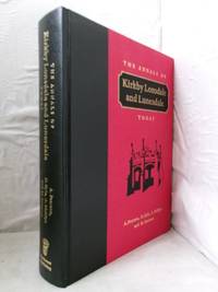
Pearson, A, D Kyle, A Phillips and M Gresson
The Annals of Kirkby Lonsdale and Lunesdale Today
The Parthenon Publishing Group 1996. Hardback. Fine Hardback in as new condition firm binding clean and unmarked. An excellent copy of this impressive volume. Hardback in cloth with gilt titles on spine and decoration and gilt titles on front board. The image on this listing page is of the actual book for sale. The Parthenon Publishing Group hardcover
Referentie van de boekhandelaar : 61529
|
|
|
Pearson, Alfred
A Short History of the Renaissance in Italy: Taken from the Work of John Addington Symonds
No jacket. Hardcover with bumped and worn leading corners, and head and foot of spine. Some staining on front board, and colour loss on rear. Spine sides are slightly worn. Upper and lower edges are slightly worn. Slightly cocked. Name penned on half-title page. Pen mark on reverse of frontispiece. Grubby marks on reverse of title-page. Page corners are slightly curled. BEP is dog-eared on lower corner. Binding visible in places, but remains intact. Page block is a little rough. Text is clear throughout. TH. Used
|
|
|
Pearson, Lionel
Popular Ethics in Ancient Greece
Hardcover. Good condition. In acceptable unclipped dust jacket, with edge wear, shelf wear, nicks and tears. Hardcover spine ends bumped. Previous owners name on the FEP. Pages tanned. Text fine. RB Used
|
|
|
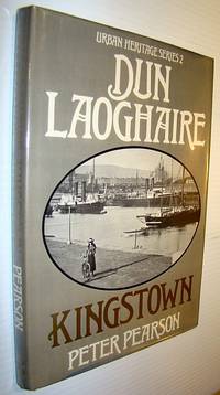
Pearson, Peter
Dun Laoghaire - Kingstown Urban heritage Series 2
Ireland: O'Brien Press 1981. Book. Fine. Hardcover. First Edition. 4to - over 9¾" - 12" tall. 176 pages inc. glossary bibliography and index. "Dun Laoghaire's assumed name The Premier Township was no empty boast. The book describes how the fishing village Dunleary became within seventy years Kingstown - the most important packet station and largest and most popular watering places in Ireland and a vast port an infant city built in the most ornamental style." - dust jacket. Clean and unmarked binding sound. O'Brien Press Hardcover
Referentie van de boekhandelaar : 736G0067 ISBN : 0905140834 9780905140834
|
|
|
Pearson, Peter
Dun Laoghaire - Kingstown (Urban heritage Series 2)
176 pages inc. glossary, bibliography and index. "Dun Laoghaire's assumed name, The Premier Township, was no empty boast. The book describes how the fishing village Dunleary, became within seventy years Kingstown - the most important packet station and largest and most popular watering places in Ireland and a vast port, an infant city, built in the most ornamental style." - dust jacket. Clean and unmarked, binding sound. Book
|
|
|
Pearton, Maurice
The Knowledgeable State: Diplomacy, War and Technology Since 1830
287 pages. Footnotes. Select Bibliography. Index. "The traditional view of peace and war holds that irrespective of how they may be defined and justified, they represent opposit poles of experience. Today, however, preparedness for war is a continuous activity, reaching into all aspects of society and eroding, even nullifying, conventional distinctions about the 'civil' and 'military' spheres of life. The reasons are mainly to be found in men's response to the opportunities offered by technology in the industrial age." - from Preface. Clean, bright and unmarked with very light wear. Price-clipped dust jacket now preserved in glossy new archival-grade Brodart. A handsome copy of this fascinating study. Book
|
|
|
PECHEUX J.
l'âge D'or Du Rail Européen 1850-1900
Paris Berger-Levrault 1975 Petit In-8 carré 253 pp, illustrations N&B in-texte, 1er plat illustré en couleur, pliures au dos. Mors supérieur faibles, exemplaire légèrement gauchi. Ex-libris au tampon
Referentie van de boekhandelaar : 6966
|
|
|
PECHEUX J.
La naissance du rail européen (1800-1850).
Paris, Berger-Levrault, 1970. 15 x 21, 206 pp., nombreuses illustrations, broché, bon état.
Referentie van de boekhandelaar : 93167
|
|
|
Pechmann, Alexander von
Autonomie und Autorität. Studien zur Genese des europäischen Denkens.
Freiburg i. Br., Alber 2008. 753 Seiten. Softcover/Paperback
Referentie van de boekhandelaar : 96210
|
|
|
Pecl, Karel (Mitwirkender), KvÄ?toslav (Mitwirkender) Hísek und Christian (Mitwirkender) Köhler
Süsswasserfische. Text von K. Pecl. Ill. von K. Hísek und J. Maly. [Ins Dt. übertr. von Günter Brehmer. Bearb. des dt. Textes von Christian Köhler]
Hanau : Dausien [1989]. 224 S. : zahlr. Ill. 21,5*15,5 cm. OLeinenband, OSchu.
Referentie van de boekhandelaar : 141698
|
|
|
PEDRAGOSA S
Légendes et Chroniques castillanes. Illustrations de P Decomble P, F Lanore, in8br, 158pp, cachets
Langue: Français
Referentie van de boekhandelaar : ML1990
|
|
|
Pedini Mario.
TEMPO D'EUROPA (come nuovo).
(Codice SW/1486) In 8° (21 cm) 392 pp. Prefazione di Giuseppe Petrilli. Brossura editoriale, fascetta Come nuovo. ~~~ SPEDIZIONE IN ITALIA SEMPRE TRACCIATA
|
|
|
Pedroni, Luigi
CRISI FINANZIARIA E MONETAZIONE DURANTE LA GUERRA SOCIALE
Latomus. 2006. Softcover. Near Fine. Very light bump to bottom corner else fine.; Collection Latomus Volume 297; 224 pages . 2870312385 . Latomus paperback
Referentie van de boekhandelaar : 11040 ISBN : 2870312385 9782870312384
|
|
|
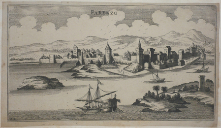
PEETERS (Jan);
[CROATIE] Parenzo.
circa 1690 133 x 238 mm.
Referentie van de boekhandelaar : LBW045ec
|
|
|
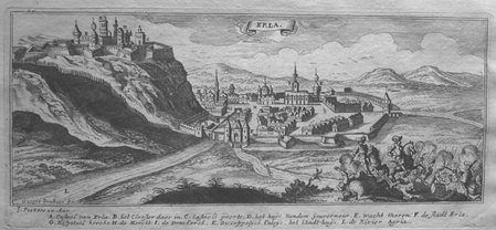
PEETERS (Jan);
[EGER] Erla.
circa 1690 100 x 247 mm.
Referentie van de boekhandelaar : LBW0279c
|
|
|
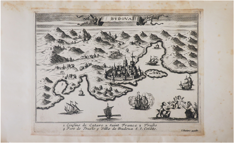
PEETERS (Jan).
[MONTENEGRO] Budova.
[circa 1690]. 150 x 210 mm.
Referentie van de boekhandelaar : LBW045d9
|
|
|
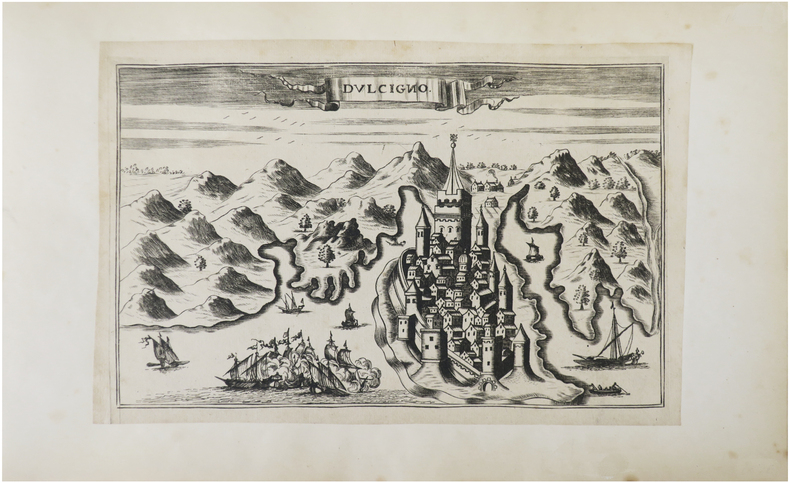
PEETERS (Jan).
[MONTENEGRO] Dulcigno.
[circa 1690]. 132 x 209 mm.
Referentie van de boekhandelaar : LBW045f8
|
|
|
PEETERS (Jan);
[SZARVAS] St. Servaes.
circa 1690 96 x 244 mm.
Referentie van de boekhandelaar : LBW02799
|
|
|
PEETERS (Jan);
[SZIGETVAR] Ziget.
circa 1690 101 x 270 mm.
Referentie van de boekhandelaar : LBW0279e
|
|
|
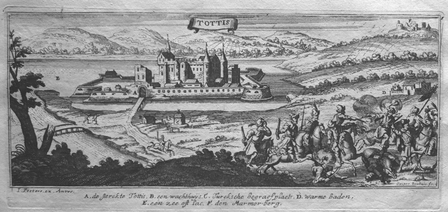
PEETERS (Jan);
[TATA] Tottis.
circa 1690 101 x 248 mm.
Referentie van de boekhandelaar : LBW027a0
|
|
|
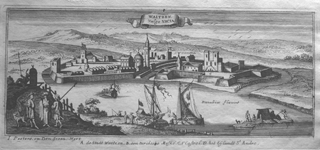
PEETERS (Jan);
[VAC] Waitzen vulgo Vacia.
circa 1690 105 x 256 mm.
Referentie van de boekhandelaar : LBW0279a
|
|
|
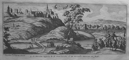
PEETERS (Jan);
[VESZPREM] Vesprin.
circa 1690 101 x 245 mm.
Referentie van de boekhandelaar : LBW0279f
|
|
|
PEETERS (Jan);
[VISEGRAD] Vicegrad.
circa 1690 103 x 265 mm.
Referentie van de boekhandelaar : LBW0279b
|
|
|
PEESCH Reinhard
Art Populaire en Europe.
Sacelp Paris 1981 In-4 ( 275 X 245 mm ) de 220 pages, pleine toile beige illustrée. Illustrations dans et hors-texte. Très bel exemplaire.
Referentie van de boekhandelaar : 455511
|
|
|
PEEK, Cuthbert E. & MORGAN, E. Delmar.
Across Iceland By The Sprengisandre Route. [Plus] Excursion to Askja
Two accounts in one issue, altogether 20 pages. Plus a colour map and a plan on a fold-out sheet, the map measures approximately 7.5 x 10 inches (19 x 25cm) and the plan measures approximately 7.5 x 6 inches (19 x 15cm). Original condition with blue wrappers, titles to front, and containing all the ads. This is a complete issue, seldom found in such good and original condition. Although many persons annually visit Iceland, there are few who travel far into the interior to examine the barren wastes and lava fields which exist in the centre of the island. In July 1881, Mr. Coles, Mr. Delmar Morgan and Cuthbert Peek left Leith by the mail-steamer Valdemar to explore this little-known country. Their chief objectives were to visit and examine the world-famed Geysir, and the hot springs in its immediate vicinity, to traverse the little known Sprengisandre Route, and if possible, to fix the northern termination of the great lava stream which flowed from Askja. Accompanied by a colour route map of Iceland and a plan of the Great Geysir and neighbourhood from a survey by Mr, Cuthbert E. Peek and Mr. John Coles.
|
|
|
Peesch, Reinhard
Ornamentik der Volkskunst in Europa. [Zeichn. Inge Brüx-Gohrisch]
Königstein im Taunus : Langewiesche 1982. 220 S. : zahlr. Ill. (z.T. farb.) ; 28 cm Gewebe 0
Referentie van de boekhandelaar : 78004
|
|
|
Peeters, K. C
Flämisches Volkstum, 1. - 4. Tsd.
Jena : Eugen Diederichs Verlag 1943. 131 Seiten. 13x20, helle illustr. O Broschur.
Referentie van de boekhandelaar : 2882
|
|
|
PEEZ, Alexander v
Die Lage in Rußland.
Mchn.,Bayerische Druckerei und Vlgsanst. 1906. 16 S. Obrosch. etwas nachgedunkelt und geringfügig fleckig, sonst in gutem Zustand. - Sonderabdruck aus Nr.196,197 und 198 der Beilage zur "Allgemeinen Zeitung" vom 25.,26. Und 28.August 1906
Referentie van de boekhandelaar : R1613-01
|
|
|
PEGGIO Eugenio
1992 LA SINISTRA L’EUROPA L’ITALIA.
In-8 (cm. 21), brossura editoriale, con alette, pp. (8), 240. Timbro di biblioteca estinta alla prima carta, peraltro ben conservato. Prima edizione. .
|
|
|
PEILLARD, Léonce
Ce jour là : 22 septembre 1943. Coulez le "Tirpitz" !
1965 Editions Robert Laffont, collection "Ce jour-là" - 1965 - In-8, broché couverture à rabats - 389 pages - Illustrations et reproductions photographiques en N&B hors texte
Referentie van de boekhandelaar : 112544
|
|
|
PEIFFER, Jacques G.:
Emaux d’Istanbul à Longwy. L’Europe de la faïence.
Thionville, Gérard Klopp, 1995, in-folio, 464 p., richement ill., reliure en toile originale, jaquette, avec emboîtage. Très bel exemplaire.
Referentie van de boekhandelaar : 82143aaf
|
|
|
Peixoto, Tanya
Artist's Book Yearbook 1994-95
Articles, interviews, reviews, useful addresses, and diary notes. Occasional pencil lines in margins. Some light indentations and rubbing to cover surfaces.
|
|
|
PELLOT (Joseph)
Mémoire sur la campagne de l'armée française dite des Pyrénées. en 1813 et 1814
À Bayonne, Chez Gosse, 1818 petit in-8, VII-187 pp., demi-basane brune, dos lisse orné de filets à froid (reliure postérieure). Dos passé et frotté. Coupes et coins usés. Galeries de vers en marge supérieure des pages 57 à la fin, affectant par endroits la lecture. Fenêtre découpée au titre et en dernière page. Exemplaire rogné. Cachet Bibliothèque E. Fort.
Referentie van de boekhandelaar : 221888
|
|
|
PELLOT (Joseph)
Mémoire sur la campagne de l'armée française dite des Pyrénées. en 1813 et 1814
À Bayonne, Chez Gosse, 1818 in-8, VII-187 pp., broché, sous couverture d'attente de papier jaune. Manques de papier au dos. Quelques mouillures claires en marge. Petites galeries de vers sur quelques pages. Dernière page déchirée avec petite perte de texte.
Referentie van de boekhandelaar : 221890
|
|
|
Pellegrini, Carlo
Il Sismondi e la storia della letteratura dell'Europa meridionale.
cm. 18 x 25,5, 3 cc. e 168 pp. Biblioteca dell'?Archivum Romanicum? - Serie I: Storia, Letteratura, Paleografia 270 gr. 168 p.
|
|
|
PELLERIN, CHARLES JEAN – GEORGIN.
Portrait des Souverains de L'Europe.
Epinal, Jean Charles Pellerin, 1850 - 1870 circa. Incisione su legno in coloritura d'epoca, cm 43 x 63 circa (il foglio). La veduta è stata incisa dal Georgin e stampata dal Pellerin, il più importante editore di Epinal, cittadina del dipartimento dei Vosgi, nella regione della Lorena. Piega centrale editoriale, lieve ingiallimento del foglio, strappi e mancanze marginali, piacevole coloritura.
|
|
|
Pellow, Thomas
The History of the Long Captivity and Adventures of Thomas Pellow in South Barbary Etc.
Sherborne: Printed for R. Goadby and Sold By W. Owen 1751. 2nd Ed . Full-Leather. Good reading copy/No Jacket as issued. 16mo - over 5¾" - 6¾" tall. Top board detached. spine has small loss; boards rubbed and worn at corners; Text block and contents sound. 388p. <br/> <br/> Printed for R. Goadby and Sold By W. Owen hardcover
Referentie van de boekhandelaar : 84282
|
|
|
PENALOSA (Luis F. de)
La Iglesia de San Juan de los Caballeros.
Segovia, Gabel, 1950 in-8, 33 pp., (dernière page mal chiffrée 121), planches, demi-basane fauve marbrée, dos lisse, couverture conservée (reliure moderne). Etiquette de bibliothèque et ex-libris Amadeo Delaunet. Ex-libris Marquis de Pontecroix. Envoi.
Referentie van de boekhandelaar : 203583
|
|
|
Penot Natasha Rabardeau Sandrine Cavalletti Domitilla Der Andreassian Betty Collectif
Un grand week-end à Rome
Hachette Tourisme 2012 10 6x1 8x18 8cm. 2012. Broché.
Referentie van de boekhandelaar : 500218873
|
|
|
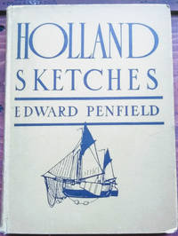
Penfield, Edward
Holland Sketches
NY: Charles Scribner's Sons. Good with no dust jacket; Boards worn splits at backstrip rear hinge . cracked. 1907. First Edition. Hardcover. Yellow illustrated boards. A vintage travelogue of a trip to the Netherlands with 34 tipped-in color plates by the author of landscapes streetscapes and portaits. Illustrated endpapers. ; 8vo 8" - 9" tall; 147 pages . Charles Scribner's Sons hardcover
Referentie van de boekhandelaar : 49039
|
|
|
Penn, Heinrich
Die Geschichte der Stadt Wien und ihrer Vorstädte. Von ihrem Urspurnge bis auf die gegenwärtige Zeit.
Brünn & Wien, Fr. Karafiat, [1880]. Ca. 27 x 19,5 cm. (2) S., 742 Seiten. Mit 300 Holzstichillustrationen. Brauner Orig.-Leinenband mit reicher Goldprägung. [4 Warenabbildungen]
Referentie van de boekhandelaar : 53530AB
|
|
|