|
RUMLER, Günther - HOLZMANN, Otto
Freigemachtes Grenzland. Erlebnisberichte.
Bln.,Nordland Vlg. (1942). 205 S. Mit zahlr. photogr. Abb. Illustr. Ohln., leicht bestoßen und fleckig, papierbedingt ein wenig nachgedunkelt, sonst gut erhalten.
Referentie van de boekhandelaar : R4231-93
|
|
|
RUMPELT, Alexander
Sicilien und die Sicilianer. Neue Folge.
Radeberg,Pfeil 1907. (2),339 S. Obrosch., unbeschnitten, etw. bestoßen, fleckig u. angestaubt, hs. Eintr. a.d. Vorsatz, sonst gut erhalten.
Referentie van de boekhandelaar : R2578-94

|
|
|
Rumpf, F
Meister d. japanischen Farbenholzschnittes. Neues über ihr Leben u. ihre Werke.
Berlin, de Gruyter, 1924. 4°. M. 18 Taf. m. (teils farb.) mont. Abb. u. 70 Textabb. VII, 142 S. OLwd. Einbd. fleckig. Nr. a. Tit.
Referentie van de boekhandelaar : 416811
|
|
|
Rumpf, F
Sharaku. 2. Aufl.
Berlin, Würfel-Vlg. 1932. M. zahlr. Abb. 132 s. OLwd. St. a. Tit. (Nihon Bunka).
Referentie van de boekhandelaar : 212012
|
|
|
Rumph, Stephen
Beethoven After Napoleon: Political Romanticism in the Late Works
Hardcover. Several scores on dust jacket. Binding is intact, contents are clean and clear. AM Used

|
|
|
RUMPLER, Helmut (Hg.)/ BURZ, Ulfried (Mitarbeit)
Kärnten. Von der deutschen Grenzmark zum österreichischen Bundesland. (Schriftenreihe d. Forschungsinst. f. Politisch-Histor. Studien d. Dr. Wilfried-Haslauer-Bibliothek, 6) (Geschichte d. österr. Bundesländer seit 1945).
Köln: Böhlau 1998. XI,843 S., Textabb. Reg. Gr 8° Kart.mS. *im Fußschnitt gestempelt*
Referentie van de boekhandelaar : 49357
|
|
|
Rungaldier, R
Natur- u. Kulturlandschaft zwischen Donau u. Theiss. (Beiträge zu einer Landeskunde).
Wien, Deuticke, 1943. M. 7 Taf. 127 S. Obr. Rücken etwas angerissen u. angeschmutzt. (Abhandlungen d. geogr. Ges. Wien 14/4).
Referentie van de boekhandelaar : 620513
|
|
|
Ruoff-Vaananen, Eeva
STUDIES ON THE ITALIAN FORA
Franz Steiner Verlag. Very Good. 1978. Softcover. Minor shelfwear. Former owner's bookplate on inner cover. ; Insights on the fora-- road-posts on the Roman viae. ; Historia : Einzelschriften ; Heft 32; 81 pages . Franz Steiner Verlag paperback
Referentie van de boekhandelaar : 4680
|
|
|
Ruotsalo, R
Naturlandschaft u. Siedlung in d. Gegend d. Stadt Kuopio auf d. finn. Seenplatte.
Helsinki, 1967. M. 2 Ktn. u. 15 Abb. 118 S. (Ann. Acad. Scient. Fenn. A 3/91).
Referentie van de boekhandelaar : 811880
|
|
|
RUPNIK (Jacques)
L'Autre Europe - Crise et fin du communisme.
Paris, Odile Jacob, 1990 1 volume 14,5 x 22cm Encollé sous couverture au 1er plat orné d'une vignette couleurs. 384p., 1feuillet; cartes in texte. Très bon état.
Referentie van de boekhandelaar : 8689
|
|
|
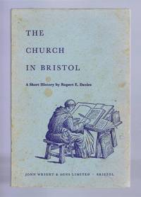
Rupert E Davies
The Church in Bristol A Short History
John Wright & Sons Limited Bristol 1960. First Edition. Softcover. Very Good Condition/No Dust Jacket. Illustrator: Reginald Dymond. Pale blue card covers are foxed sound binding light foxing to first and last pages and edges pages are otherwise clean. No dust jacket as published. Illustrator: Reginald Dymond. Quantity Available: 1. Shipped Weight: under 1 kg. Pictures of this item not already displayed here available upon request. Inventory No: 51716102064. All our books music and maps are sent by a tracked mail service. John Wright & Sons Limited paperback
Referentie van de boekhandelaar : 51716102064
|
|
|
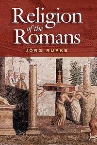
Rupke, Jorg & (translated and edited by Richard Gordon)
THE RELIGION OF THE ROMANS
Polity. Near Fine. 2007. Softcover. 0745630154 . Very light shelfwear. ; 350 pages; The gods were the true heroes of Rome. In this major new contribution to our understanding of ancient history Jörg Rüpke guides the reader through the fascinating world of Roman religion describing its unique characteristics and bringing its peculiarities into stark relief. Rüpke gives a thorough and engaging account of the multiplicity of cults worshipped by peasant and aristocrat alike the many varied rites and rituals daily observed and the sacrifices and offerings regularly brought to these immortals by the population of Ancient Rome and its imperial colonies. . Polity paperback
Referentie van de boekhandelaar : 7896 ISBN : 0745630154 9780745630151
|
|
|
RUPNIK (Jacques)
L'Autre Europe - Crise et fin du communisme.
Version française établie par l'auteur et Jean BONNEFOY, de "The Other Europe", publié en 1988 par l'historien et politologue Jacques RUPNIK, spécialiste de l'Europe centrale et des Balkans: complexité et paradoxes d'une Europe centrale, parfois devenue "ex-de l'Est"...; cartes; notes et références; index; bibliographie. 1ère édition (et non livre de poche). Français
|
|
|
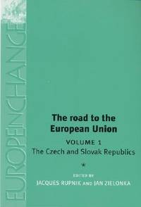
Rupnik, J and Zielonka, J (eds)
The Road to the European Union Volume 1: The Czech and Slovak Republics Europe in Change
Manchester University Press 2003. Volume 1. This is an ex-library book and may have the usual library/used-book markings inside.This book has soft covers. Clean from markings. In fair condition suitable as a study copy. Please note the Image in this listing is a stock photo and may not match the covers of the actual item650grams ISBN:9780719065972 Manchester University Press paperback
Referentie van de boekhandelaar : 7062817 ISBN : 0719065976 9780719065972
|
|
|
Rupnik, J. (ed.)
The Road to the European Union Volume 1
Manchester University Press 2003. Volume 1. This is an ex-library book and may have the usual library/used-book markings inside.This book has soft covers. Clean from markings. In good all round condition. Please note the Image in this listing is a stock photo and may not match the covers of the actual item700grams ISBN:9780719065972 Manchester University Press paperback
Referentie van de boekhandelaar : 9867220 ISBN : 0719065976 9780719065972
|
|
|
RUPPERT, K
Beiträge zur Landeskunde Jugoslawiens. (= Münchner Studien zur Sozial- u. Wirtschaftsgeographie, Bd. 23).
Michael Lassleben, Kallmünz/Regensburg 1983. 230 S. mit zahlreichen Abbildungen und Karten, 4°, Original-Karton (Softcover), Rücken leicht gebräunt, Name auf Vortitel, insgesamt gutes und innen sauberes Exemplar,
Referentie van de boekhandelaar : 54874

|
|
|
Ruppert, K
Sozialgeographische Probleme Südosteuropas. Aspekte raumdifferenzierender Proßezabläufe. (= Münchner Studien zur Sozial- und Wirtschaftsgeographie - Band 7),
Verlag Michael Lassleben, Kallmünz/Regensburg 1973. 130 S. und 28 in Tasche beiliegenden Karten, 4°, Original-Karton (Softcover), Rücken leicht aufgehellt, Stempel des Herausgebers auf Deckel, insgesamt gutes und innen sauberes Exemplar,
Referentie van de boekhandelaar : 52501

|
|
|
Ruppert, K
Sozialgeographische Probleme Südosteuropas. Aspekte raumdifferenzierender Prozeßabläufe.
Kallmünz, Lassleben, 1973. M. 13 beilieg. Ktn. 130 S. Umschl. teils verblichen. (Münchner Stud. z. Sozial- u. Wirtschaftsgeogr. 7).
Referentie van de boekhandelaar : 124409
|
|
|
Rupprecht Kronprinz von Bayern
Reise-Erinnerungen aus dem Süd-Osten Europas und dem Orient. [Erstausgabe].
München, Kösel & Pustet Verlag, 1923. Groß-8°. 24,5 cm. XII, 430 Seiten. Original-Halblederband mit goldgeprägtem Rückentitel und Original-Schutzumschlag.
Referentie van de boekhandelaar : 55792BB

|
|
|
Rupprecht v. Bayern
Reise-Erinnerungen aus dem Süd-Osten Europas und dem Orient.
München, Kösel & Pustet, 1923. M. zahlr. Abb. XII, 430 S. Hlwd. Kanten etwas beschabt. M. Rsign. St. a. Vorsatz.
Referentie van de boekhandelaar : 209872
|
|
|
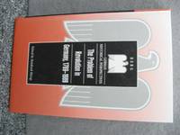
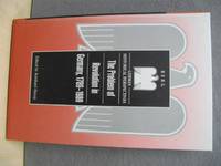
Rurup Reinhard ed.
The Problem of Revolution in Germany 1789-1989 German Historical Perspectives
Oxford/New York: Berg 2000. Hardcover in very good condition; content clean and clear. AE. Hardcover. Very Good/No Dust Jacket. Used. Berg Hardcover
Referentie van de boekhandelaar : 454092 ISBN : 1859732763 9781859732762
|
|
|
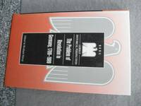
Rurup, Reinhard (ed.)
The Problem of Revolution in Germany 1789-1989
Oxford: Berg 2000. Hardcover without jacket in excellent condition throughout. TS. Hardcover. Very Good/No Dust Jacket. Used. Berg Hardcover
Referentie van de boekhandelaar : 455082 ISBN : 1859732763 9781859732762
|
|
|
Rurup, Reinhard (ed.)
The Problem of Revolution in Germany 1789-1989 German Historical Perspectives
Oxford/New York: Berg 2000. Hardcover in very good condition; content clean and clear. AE. Hardcover. Very Good/No Dust Jacket. Used. Berg Hardcover
Referentie van de boekhandelaar : 454104 ISBN : 1859732763 9781859732762
|
|
|
Rurup, Reinhard (editor)
Topography of Terror: Gestapo SS and Reichssicherheitshauptamt on the "Prinz-Albrecht-Terrain": A Documentation. Translated from the German Edition by Werner T Angress
Berlin: Verlag Wilmuth Arenhovel 2000. 239pp illustrated throughout with b/w photos maps plans appendix. Paperback. The Documentation was assembled as part of the central historical exhibition on the occasion of Berlin's 750 year celebration. It aims to inform about the institutions that were operative in the area the administrtive center of the SS-State betwen 1933 and 1945 about their organization and structure their ways of functioning and the effects of their activities. Tenth Edition. Soft Cover. Very Good. 8vo. Verlag Wilmuth Arenhovel Paperback
Referentie van de boekhandelaar : 022279 ISBN : 3922912257 9783922912255
|
|
|
Rurup, Reinhard (ed.)
The Problem of Revolution in Germany, 1789-1989
Hardcover without jacket in excellent condition throughout. TS Used
|
|
|
Rurup, Reinhard (ed.)
The Problem of Revolution in Germany, 1789-1989 (German Historical Perspectives)
Hardcover in very good condition; content clean and clear. AE Used
|
|
|
Rurup, Reinhard (ed.)
The Problem of Revolution in Germany, 1789-1989 (German Historical Perspectives)
Hardcover in very good condition; content clean and clear. AE Used
|
|
|
RUS, Fernando (Photography) / GUIBERNAU, Julio F. (Text) / Pedro Bonet (Grabado)
BARCELONA Á LA VISTA. - ALBUM DE FOTOGRAFIAS DE LA CAPITAL Y SUS ALREDEDORES: 192 VISTAS.
Barcelona, Antonio Lopéz - Libreria Espanola, no date (ca. 1900). Ca. 180 unnumbered pages, photographically illustrated throughout. - Publisher's gilt and black illustrated titled red-silk blockbook-binding with white moirée-endpapers; oblong-Folio (ca. 28 x 36 cm; ca. 1,35 kg.).
Referentie van de boekhandelaar : 1610191457xbvk
|
|
|
Ruscelli Girolamo (1504-1506)
Europae Tabula VIII
Inserita nell'opera "La Geografia di Claudio Tolomeo alessandrino, già tradotta di greco in italiano da M. Giero. Ruscelli: & hora in questa nuoua editione da M. Gio. Malombra ricorretta, & purgata d'infiniti errori: ... Con l'Espositioni del Ruscelli, ... Con una copiosa tauola de' nomi antichi, dichiarati co' nomi moderni: dal Malombra riueduta, & ampliata. Et con un Discorso di M. Gioseppe Moleto, .. ". Leggero alone al lato sinistro

|
|
|
RUSCELLI Girolamo (Viterbo 1504 – Venezia 1566)
Evropae Tabvla IX
Carta tratta dalla "Geographia di Claudio Tolomeo", a cura del Ruscelli, pubblicata in Venezia in pù edizioni tra il 1561 ed il 1598. La carta è basata sulla "Geografia" di Giacomo Gastaldi, che probabilmente disegnò personalmente anche queste mappe, che vennero incise dai fratelli Sanuto. La peculiarità di queste mappe è che sono incise due per lastra e successivamente tagliate; questo il motivo per cui il segno del rame appare solo in tre lati della mappa. Il testo del Ruscelli e le sue carte sono considerate come il miglior atlante moderno fino alla prima versione del Thatrum di Ortelius, 1570. Solo la loro enorme diffusione ne impedisce una valutazione sostenuta nel mercato antiquario. L'opera infatti ebbe una prima stesura nel 1561, stampata da Vincenzo Valgrisi che ne curò anche la ristampa del 1562. Tre sono le edizioni firmate da Giordano Ziletti (due nel 1564 e una del 1574), mentre nel 1597 viene edita dai fratelli Calignani. Tutte queste edizioni contengono 64 tavole. Nel 1598 e 1599 vengono alla luce le due edizioni curate da Giuseppe Rosaccio e stampate dagli Eredi di Melchior Sessa. Queste ultime due edizioni comprendono 69 tavole; sono infatti aggiunte la carta del planisfero e dei continenti del Rosaccio. Map, taken from Ruscelli edition of Ptolemy's "Geographia", printed in Venice from 1561 to 1598. Ruscelli's Atlas is an expanded edition of Gastaldi's "Geografia" of 1548, which has been called the most comprehensive atlas produced between Martin Waldseemüller's Geographiae of 1513, and the Abraham Ortelius Theatrum of 1570. Ruscelli and Gastaldi's maps were beautifully engraved on copper, marking a turning point in the history of cartography. From that point forward, the majority of cartographic works used this medium. As it was a harder material than wood it gave the engraver the ability to render more detail. Gastaldi sought the most up-to-date geographical information available, making the modern maps in Ruscelli's Geographia among the best modern maps of the period. The maps are engraved by the Sanuto borthers.Only their enormous diffusion prevents a sustained evaluation in the antique market. The work in fact had a first issue in 1561, printed by Vincenzo Valgrisi who also edited the reprint of 1562. There are three editions signed by Giordano Ziletti (two in 1564 and one in 1574), while in 1597 it was edited by the Calignani brothers. All these editions contain 64 engraved maps. In 1598 and 1599 the two editions edited by Giuseppe Rosaccio and printed by the heirs of Melchior Sessa come to light. These last two editions include 69 plates; in fact the map of the planisphere and of the continents of Rosaccio are added.

|
|
|
RUSCELLI Girolamo (Viterbo 1504 – Venezia 1566)
Evropae Tabvla V
Carta tratta dalla "Geographia di Claudio Tolomeo", a cura del Ruscelli, pubblicata in Venezia in pù edizioni tra il 1561 ed il 1598. La carta è basata sulla "Geografia" di Giacomo Gastaldi, che probabilmente disegnò personalmente anche queste mappe, che vennero incise dai fratelli Sanuto. La peculiarità di queste mappe è che sono incise due per lastra e successivamente tagliate; questo il motivo per cui il segno del rame appare solo in tre lati della mappa. Il testo del Ruscelli e le sue carte sono considerate come il miglior atlante moderno fino alla prima versione del Thatrum di Ortelius, 1570. Solo la loro enorme diffusione ne impedisce una valutazione sostenuta nel mercato antiquario. L'opera infatti ebbe una prima stesura nel 1561, stampata da Vincenzo Valgrisi che ne curò anche la ristampa del 1562. Tre sono le edizioni firmate da Giordano Ziletti (due nel 1564 e una del 1574), mentre nel 1597 viene edita dai fratelli Calignani. Tutte queste edizioni contengono 64 tavole. Nel 1598 e 1599 vengono alla luce le due edizioni curate da Giuseppe Rosaccio e stampate dagli Eredi di Melchior Sessa. Queste ultime due edizioni comprendono 69 tavole; sono infatti aggiunte la carta del planisfero e dei continenti del Rosaccio. Map, taken from Ruscelli edition of Ptolemy's "Geographia", printed in Venice from 1561 to 1598. Ruscelli's Atlas is an expanded edition of Gastaldi's "Geografia" of 1548, which has been called the most comprehensive atlas produced between Martin Waldseemüller's Geographiae of 1513, and the Abraham Ortelius Theatrum of 1570. Ruscelli and Gastaldi's maps were beautifully engraved on copper, marking a turning point in the history of cartography. From that point forward, the majority of cartographic works used this medium. As it was a harder material than wood it gave the engraver the ability to render more detail. Gastaldi sought the most up-to-date geographical information available, making the modern maps in Ruscelli's Geographia among the best modern maps of the period. The maps are engraved by the Sanuto borthers.Only their enormous diffusion prevents a sustained evaluation in the antique market. The work in fact had a first issue in 1561, printed by Vincenzo Valgrisi who also edited the reprint of 1562. There are three editions signed by Giordano Ziletti (two in 1564 and one in 1574), while in 1597 it was edited by the Calignani brothers. All these editions contain 64 engraved maps. In 1598 and 1599 the two editions edited by Giuseppe Rosaccio and printed by the heirs of Melchior Sessa come to light. These last two editions include 69 plates; in fact the map of the planisphere and of the continents of Rosaccio are added.

|
|
|
RUSCELLI Girolamo (Viterbo 1504 – Venezia 1566)
Moscovia Nvova Tavola
Carta tratta dalla "Geographia di Claudio Tolomeo", a cura del Ruscelli, pubblicata in Venezia in pù edizioni tra il 1561 ed il 1598. La carta è basata sulla "Geografia" di Giacomo Gastaldi, che probabilmente disegnò personalmente anche queste mappe, che vennero incise dai fratelli Sanuto. La peculiarità di queste mappe è che sono incise due per lastra e successivamente tagliate; questo il motivo per cui il segno del rame appare solo in tre lati della mappa. Il testo del Ruscelli e le sue carte sono considerate come il miglior atlante moderno fino alla prima versione del Thatrum di Ortelius, 1570. Solo la loro enorme diffusione ne impedisce una valutazione sostenuta nel mercato antiquario. L'opera infatti ebbe una prima stesura nel 1561, stampata da Vincenzo Valgrisi che ne curò anche la ristampa del 1562. Tre sono le edizioni firmate da Giordano Ziletti (due nel 1564 e una del 1574), mentre nel 1597 viene edita dai fratelli Calignani. Tutte queste edizioni contengono 64 tavole. Nel 1598 e 1599 vengono alla luce le due edizioni curate da Giuseppe Rosaccio e stampate dagli Eredi di Melchior Sessa. Queste ultime due edizioni comprendono 69 tavole; sono infatti aggiunte la carta del planisfero e dei continenti del Rosaccio. Map, taken from Ruscelli edition of Ptolemy's "Geographia", printed in Venice from 1561 to 1598. Ruscelli's Atlas is an expanded edition of Gastaldi's "Geografia" of 1548, which has been called the most comprehensive atlas produced between Martin Waldseemüller's Geographiae of 1513, and the Abraham Ortelius Theatrum of 1570. Ruscelli and Gastaldi's maps were beautifully engraved on copper, marking a turning point in the history of cartography. From that point forward, the majority of cartographic works used this medium. As it was a harder material than wood it gave the engraver the ability to render more detail. Gastaldi sought the most up-to-date geographical information available, making the modern maps in Ruscelli's Geographia among the best modern maps of the period. The maps are engraved by the Sanuto borthers.Only their enormous diffusion prevents a sustained evaluation in the antique market. The work in fact had a first issue in 1561, printed by Vincenzo Valgrisi who also edited the reprint of 1562. There are three editions signed by Giordano Ziletti (two in 1564 and one in 1574), while in 1597 it was edited by the Calignani brothers. All these editions contain 64 engraved maps. In 1598 and 1599 the two editions edited by Giuseppe Rosaccio and printed by the heirs of Melchior Sessa come to light. These last two editions include 69 plates; in fact the map of the planisphere and of the continents of Rosaccio are added.

|
|
|
RUSCELLI Girolamo (Viterbo 1504 – Venezia 1566)
Polonia et Hungaria Nvova Tavola
Carta tratta dalla "Geographia di Claudio Tolomeo", a cura del Ruscelli, pubblicata in Venezia in pù edizioni tra il 1561 ed il 1598. La carta è basata sulla "Geografia" di Giacomo Gastaldi, che probabilmente disegnò personalmente anche queste mappe, che vennero incise dai fratelli Sanuto. La peculiarità di queste mappe è che sono incise due per lastra e successivamente tagliate; questo il motivo per cui il segno del rame appare solo in tre lati della mappa. Il testo del Ruscelli e le sue carte sono considerate come il miglior atlante moderno fino alla prima versione del Thatrum di Ortelius, 1570. Solo la loro enorme diffusione ne impedisce una valutazione sostenuta nel mercato antiquario. L'opera infatti ebbe una prima stesura nel 1561, stampata da Vincenzo Valgrisi che ne curò anche la ristampa del 1562. Tre sono le edizioni firmate da Giordano Ziletti (due nel 1564 e una del 1574), mentre nel 1597 viene edita dai fratelli Calignani. Tutte queste edizioni contengono 64 tavole. Nel 1598 e 1599 vengono alla luce le due edizioni curate da Giuseppe Rosaccio e stampate dagli Eredi di Melchior Sessa. Queste ultime due edizioni comprendono 69 tavole; sono infatti aggiunte la carta del planisfero e dei continenti del Rosaccio. Map, taken from Ruscelli edition of Ptolemy's "Geographia", printed in Venice from 1561 to 1598. Ruscelli's Atlas is an expanded edition of Gastaldi's "Geografia" of 1548, which has been called the most comprehensive atlas produced between Martin Waldseemüller's Geographiae of 1513, and the Abraham Ortelius Theatrum of 1570. Ruscelli and Gastaldi's maps were beautifully engraved on copper, marking a turning point in the history of cartography. From that point forward, the majority of cartographic works used this medium. As it was a harder material than wood it gave the engraver the ability to render more detail. Gastaldi sought the most up-to-date geographical information available, making the modern maps in Ruscelli's Geographia among the best modern maps of the period. The maps are engraved by the Sanuto borthers.Only their enormous diffusion prevents a sustained evaluation in the antique market. The work in fact had a first issue in 1561, printed by Vincenzo Valgrisi who also edited the reprint of 1562. There are three editions signed by Giordano Ziletti (two in 1564 and one in 1574), while in 1597 it was edited by the Calignani brothers. All these editions contain 64 engraved maps. In 1598 and 1599 the two editions edited by Giuseppe Rosaccio and printed by the heirs of Melchior Sessa come to light. These last two editions include 69 plates; in fact the map of the planisphere and of the continents of Rosaccio are added.

|
|
|
RUSCELLI Girolamo (Viterbo 1504 – Venezia 1566)
Tabvla Evropae I
Carta tratta dalla "Geographia di Claudio Tolomeo", a cura del Ruscelli, pubblicata in Venezia in pù edizioni tra il 1561 ed il 1598. La carta è basata sulla "Geografia" di Giacomo Gastaldi, che probabilmente disegnò personalmente anche queste mappe, che vennero incise dai fratelli Sanuto. La peculiarità di queste mappe è che sono incise due per lastra e successivamente tagliate; questo il motivo per cui il segno del rame appare solo in tre lati della mappa. Il testo del Ruscelli e le sue carte sono considerate come il miglior atlante moderno fino alla prima versione del Thatrum di Ortelius, 1570. Solo la loro enorme diffusione ne impedisce una valutazione sostenuta nel mercato antiquario. L'opera infatti ebbe una prima stesura nel 1561, stampata da Vincenzo Valgrisi che ne curò anche la ristampa del 1562. Tre sono le edizioni firmate da Giordano Ziletti (due nel 1564 e una del 1574), mentre nel 1597 viene edita dai fratelli Calignani. Tutte queste edizioni contengono 64 tavole. Nel 1598 e 1599 vengono alla luce le due edizioni curate da Giuseppe Rosaccio e stampate dagli Eredi di Melchior Sessa. Queste ultime due edizioni comprendono 69 tavole; sono infatti aggiunte la carta del planisfero e dei continenti del Rosaccio. Map, taken from Ruscelli edition of Ptolemy's "Geographia", printed in Venice from 1561 to 1598. Ruscelli's Atlas is an expanded edition of Gastaldi's "Geografia" of 1548, which has been called the most comprehensive atlas produced between Martin Waldseemüller's Geographiae of 1513, and the Abraham Ortelius Theatrum of 1570. Ruscelli and Gastaldi's maps were beautifully engraved on copper, marking a turning point in the history of cartography. From that point forward, the majority of cartographic works used this medium. As it was a harder material than wood it gave the engraver the ability to render more detail. Gastaldi sought the most up-to-date geographical information available, making the modern maps in Ruscelli's Geographia among the best modern maps of the period. The maps are engraved by the Sanuto borthers.Only their enormous diffusion prevents a sustained evaluation in the antique market. The work in fact had a first issue in 1561, printed by Vincenzo Valgrisi who also edited the reprint of 1562. There are three editions signed by Giordano Ziletti (two in 1564 and one in 1574), while in 1597 it was edited by the Calignani brothers. All these editions contain 64 engraved maps. In 1598 and 1599 the two editions edited by Giuseppe Rosaccio and printed by the heirs of Melchior Sessa come to light. These last two editions include 69 plates; in fact the map of the planisphere and of the continents of Rosaccio are added.

|
|
|
Rusconi, Art. Jahn:
La Villa, il Museo e la Galleria Borghese. Con 157 illustrazioni.
28 cm. 196 pp. Contemporary half vellum, leather shield on spine (fine). Bücher it
|
|
|
Rusconi, Jahn
Siena - (Collezione Monografie Illustrate - Serie 1.a - Italia Artistica 9.) Sprache: Italienisch
Bergamo : Istituto Italiono d'Arti Grafiche - Editore 1913. 159 p. mit Abb. Broschur, Softcover/Paperback, leichte Gebrauchsspuren am Einband, sonst guter Zustand
Referentie van de boekhandelaar : 50032

|
|
|
Rush, Christopher
A TWELVEMONTH AND A DAY
Aberdeen University Press 1989. 265pp. Softback back corner tips creased front end page and title page wrinkled a book that inspired the film 'Venus Peter' about a young boy in a Scottish fishing town that wants to join his grandfather on his fishing boat the Venus Peter then suffers a mishap in the sea . Soft Cover. Good. Aberdeen University Press Paperback
Referentie van de boekhandelaar : w150418998 ISBN : 008032469X 9780080324692
|
|
|
Rushforth, Gordon McNeil
LATIN HISTORICAL INSCRIPTIONS Illustrating the History of the Early Empire
Oxford Clarendon Press. Good with no dust jacket. 1893. First Edition. Hardcover. Some pages are uncut. Spine is discolored. Rubbing and minor soiling to boards. Edgewear to spine ends. Small tear to cloth along spine 1cm. Overall a solid copy. ; Looks at latin historical inscriptions and deciphers them along with the lessons they teach for modern readers. ; 144 pages . Oxford Clarendon Press hardcover
Referentie van de boekhandelaar : 2722
|
|
|
Rushforth, Gordon McNeil
LATIN HISTORICAL INSCRIPTIONS Illustrating the History of the Early Empire
Ares Publishers Inc. Very Good- with no dust jacket. 1976. Second Edition. Hardcover. 0890051798 . Underlining in pen on a few pages otherwise NF. Light foxing to textblock. ; Unchanged Reprint of 1930. Deciphers Latin inscriptions. . Ares Publishers Inc. hardcover
Referentie van de boekhandelaar : 893 ISBN : 0890051798 9780890051795
|
|
|
Rusinow, Dennison
The Yugoslav Experiment 1948-1974.
Berkeley CA: University of California Press 1978 Book. Near Fine. Trade Paperback. First Pbk.Ed. Published for the Royal Institute of International Affairs. Analysis of Yugoslavia after WW II and the establishment of communism under Tito. 410p. bibliography.index. University of California Press paperback
Referentie van de boekhandelaar : 041147 ISBN : 0520037308 9780520037304

|
|
|
Rusinski, W
Osady tzw. "Oledrów" w dawnym woj. poznanskim.
Kraków, 1947. M. 1 Kte. u. 4 Taf. X, 160 S. (Prace Komisji atlasu histor. Polski 5).
Referentie van de boekhandelaar : 237997
|
|
|
Ruskin, John
GUIDE TO THE PRINCIPAL PICTURES IN THE ACADEMY OF FINE ARTS AT VENICE
Kent: George Allen. Good; Cover Detached. 1882. Paperback. George Allen paperback
Referentie van de boekhandelaar : 80788
|
|
|
Ruskin, John
GUIDE TO THE PRINCIPAL PICTURES IN THE ACADEMY OF FINE ARTS AT VENICE
Kent: George Allen. Good; Cover Detached. 1882. Paperback. George Allen paperback
Referentie van de boekhandelaar : 80789
|
|
|
Ruskin, John. Francesca Alexander
Story Of Ida:
New York: John Wiley And Sons 1883. First American edition. Hardcover. Good. francesca alexander. 12mo; vii 94 pages printed boards scuffed <br/><br/>Ruskin edited this memoir and contributed the Preface. Ruskin befriended two American girls Francesca and her sister in Tuscan Italy. This is Francesca's memoir of her young Italian friend. The portrait frontispiece engraving was drawn by Francesca who was an illustrator working in pen-and-ink a collector of folk lore and a philanthropist. John Wiley And Sons hardcover
Referentie van de boekhandelaar : 0007468
|
|
|
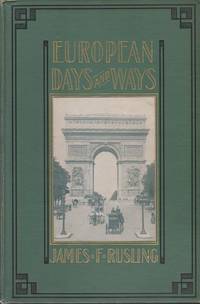
Rusling, James F.
EUROPEAN DAYS AND WAYS
Cincinnati: Jennings and Pye. Very Good-. 1902. Hardcover. Boards with light wear to extremities. One corner lightly bumped. Slight fraying to spine ends. Hinges have a bit of play. Former owner's name on front free endpaper. ; Over sixty illustrations. A nice thorough description of many European cities and towns including: Naples Pompeii Sorrento Vesuvius Capri Amalfi Salerno Rome Tiber Valley Perugia Florence Pisa Genoa Lombardy Verona Padua Venice Milan Como St. Gothard sic St. Gotthard The Alps Lake Lucerne Vierwaldstättersee Lucerne Brienz Interlaken Berne Munich Nuremberg Nürnberg Heidelberg Frankfurt am Main Coblenz Cologne The Rhine Amsterdam Marken The Hague Antwerp Brussels Waterloo Paris York Minster Edinburgh Winterton Warwick Oxford London Canterbury New Foundland. ; B&W Photographs; 8vo 8" - 9" tall; 420 pages . Jennings and Pye hardcover
Referentie van de boekhandelaar : 21128
|
|
|
Rusling, James F.
EUROPEAN DAYS AND WAYS
Cincinnati: Jennings and Pye. Very Good. 1902. Hardcover. Boards with light wear to extremities. ; Over sixty illustrations. A nice thorough description of many European cities and towns ; B&W Photographs; 8vo; 420 pages . Jennings and Pye hardcover
Referentie van de boekhandelaar : 842
|
|
|
Rusling, James F.
EUROPEAN DAYS AND WAYS
Spine frayed at top and bottom and hinges. Corners of boards chipped. Hinges weakening ; Over sixty illustrations; Ex-Lib; 8vo; 420 pages
|
|
|
Rusling, James F.
EUROPEAN DAYS AND WAYS
Boards with light wear to extremities. ; Over sixty illustrations. A nice thorough description of many European cities and towns ; B&W Photographs; 8vo; 420 pages
|
|
|
RUSSEL,HW. H. W.
Gestalt eines christlichen Humanismus.
Amsterdam Pantheon Akademische Verlagsgesellschaft 1940. 194 p. Cloth 20 cm Pencil underlinings on 5 pages hardcover
Referentie van de boekhandelaar : 155246
|
|
|
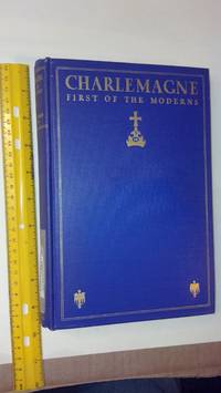
Russell Charles Edward
Charlemagne First of the Moderns
Macmillan 1930. HARDCOVER. VG / NONE. 0x0x0. VERY-GOOD HARDBACK. VIOLET CLOTH BINDING WITH GILT DECORATION AND LETTERING. BRIGHT AND ALMOST NEW LOOKING; PAGES SEEM FAULTLESS Macmillan hardcover
Referentie van de boekhandelaar : 76241
|
|
 De zoekresultaten per email ontvangen
 Zoekresultaten downloaden als PDF
 RSS feed


