|
|
|
DUROSELLE, Jean-Baptiste
L'Europe de 1815 a nos jours vie politique et relations internationales.
Paris, PUF, 1964. VIII, 397 S. OPpbd.
Referentie van de boekhandelaar : 3460864
|
|
|
Durrell Gerald
I segugi di Bafut A cura di Salvatore Marano
trad. di Fiammetta Lang n. 11 bross. edit. ill. con bandelle

|
|
|
Durrell Lawrence
Justine
trad. di Liana M. Johnson n. 30 in 16°, bross. edit. ill., lievi macchie in quarta di cop.
|
|
|
Durrell Lawrence
L'ineffabile Antrobus
trad. di Marina Morpurgo bross. edit. ill. con bandelle

|
|
|
Durrell Lawrence
Monsieur o Il principe delle tenebre
trad. di Luca Fontana bross. edit. ill. con bandelle

|
|
|
Durrell Lawrence (adattamento di)
La papessa Giovanna Dal testo greco di Emmanuel Royidis (stampa 1973)
trad. di Cesare Cristofolini n. 395 in 16°, bross. edit. ill.
|
|
|
Durrell Lawrence (adattamento di)
La papessa Giovanna Dal testo greco di Emmanuel Royidis
trad. di Cesare Cristofolini tela edit. con sovrac. ill., rotture e lievi abrasioni in sovrac.
|
|
|
DURRELL, Lawrence (preface
Lear's Corfu; An Anthology Drawn from the Painter's Letters
4to [28 x 21 cm]; 40 pp, 8 plates and title page vignette from Lear's paintings, from the original lithographs, notes to his letters. orig heavy paper pictorial wraps, title lettering, slightly rubbed at spine, else fine & clean, with the loose leaf from the publisher that includes Lear's limerick on Corfu and a drawing being an ad promoting travel to Corfu, as issued but often lacking. Durrell, who had lived in Corfu, describes Lear's work in the preface and the major influence of Greek scenery and culture on his work. The plates are scenes.
|
|
|
Durrenmatt Friedrich
La morte della Pizia
trad. di Renata Colorni n. 216 in 16°, bross. edit. con bandelle, minime tracce d'uso

|
|
|
Durrich [Durrich], Joachim; Annemarie Benker (fwd, captions); Werner Albsmeier
Münster Munster in Westfalen: Bilder einer Stadt
Münster Germany: Verlag Aschendorff 1965. Book. Fine. Hardcover. First Edition. 4to - over 9¾" - 12" tall. Color pictorial paper covered boards. Text in German English French and Dutch. As issued. Illus. dust jacket as issued now in archival mylar. 149 pp. illus. w/ b&w photographs drawings folding maps at rear. A very scarce photographic history of Münster in Westphalia. Verlag Aschendorff Hardcover
Referentie van de boekhandelaar : 032775
|
|
|
Duru, G., R. Launois und F. Schulenburg J.-M. Graf von ( Hrsg.) Schneider
Ökonomische Probleme der Gesundheitsversorgung in Deutschland und Frankreich
Frankfurt Campus Verlag, 1989. 362 S. 8° Oktav Brosch.
Referentie van de boekhandelaar : 10319

|
|
|
Duruy, George (ed)
Memoirs of Barras: Member of the Directorate Four Volumes Complete
NY: Harper & Brothers Publishers. Very Good with No dust jacket as issued. 1895. First American Edition. First Printing. Hard Cover. Publisher's full cream cloth gilt lettering and vicomte coronet decoration gilt on spine gilt lettering and coat-of-arms medallion gilt and blue on covers t.e.g. fore-edges deckle. cii 424; xxi 610; xlii 591; xxxix 617 pp. Illustrated with seven portraits in photogravure two facsimiles and two Plans. Edited with a general Introduction Prefaces and Appendices by George Duruy. Translated from the French by C. E. Roche. Volume One: The Ancient Regime and The Revolution; Volume Two: The Directorate up to the 18th Fructidor; Volume Three: The Directorate from the 18th Fructidor to the 18th Brumaire; Volume Four: The Consulate The Empire The Restoration and Analytical Index. Paul François Jean Nicolas vicomte de Barras 1755 1829 was a leader of the French Revolution the main executive officer during the Directorate and the man largely responsible for the rise of Napoleon as well as for his marriage to Josephine. . Spines uniformely sunned boards moderately soiled slightly cocked former owner's name neatly stamped on fep of volume one only otherwise unmarked tight and clean. VERY GOOD. . 8vo 8" - 9" tall . Harper & Brothers Publishers hardcover
Referentie van de boekhandelaar : 568
|
|
|
Dushnyck, Walter
IN QUEST OF FREEDOM 1918-1958: IN COMMEMORATION OF THE FORTIETH ANNIVERSARY OF UKRAINIAN INDEPENDENCE
Original Wrappers. 16mo. 26 pages. 18 cm. Contains black and white portraits of notable Ukrainian leaders, as well as photographs of demonstrations and assemblies held during the Ukrainian National Revolution of 1918. Essay commemorating and analyzing the independent Ukrainian government, with an examination of the post-World War II situation in Ukraine. Subjects: Ukraine -- History -- Autonomy and independence movements. Ukraine -- Politics and government -- 1917-1945. Ukraine -- Politics and government -- 1945-1991. Some age toning and edge wear, text block clean and crisp. Good + condition. (UKR-1-23) xx

|
|
|
Dussler, Luitpold
Sebastiano del Piombo.
Basel: Holbein. 1942. 223 S., 116 Tafeln. 29*21 cm. OLeinenband mit Goldkopfschnitt.
Referentie van de boekhandelaar : 143951

|
|
|
Duszak, Stanislaw (editor); Ewa Jasinska
Majdanek
Lublin Poland: Krajowa Agencja Wydawnicza 1985. Book. VG. Cloth Bound. First Thus. 8vo - over 7¾" - 9¾" tall. Hardcover edition light gray cloth oblong format lettered in black. Text block edges a bit dulled by age. Endpapers and front blanks mildly soiled/foxed occasional light foxing evident on margins. 132 pp. illus. w/ b&w photographs. Dust jacket shows surface rubbing some creasing along edges lacking approx. 50% of front flap fold now in mylar. Scarce. Krajowa Agencja Wydawnicza Hardcover
Referentie van de boekhandelaar : 036077 ISBN : 8303010697 9788303010698
|
|
|
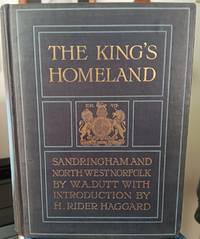
Dutt, W A
The King's Homeland: Sandringham and North-West Norfolk
<p>London: Adam and Charles Black for the Homeland Association. Very Good with no dust jacket; Spine sunned boards lightly worn. 1904. First Edition. Hardcover. Slate blue decorated cloth. TEG xl 264pp index folding map at rear. Introduction by H. Rider Haggard. 37 plates by Gordon Home. History and description of the royal country estate of Sandringham and surrounding area of Norfolk. ; 8vo 8" - 9" tall .</p> Adam and Charles Black for the Homeland Association hardcover
Referentie van de boekhandelaar : 61587
|
|
|
DUTTON Ralph
Normandy and Brittany. BRIGHT, CLEAN COPY IN UNCLIPPED DUSTWRAPPER
8vo., First Edition, with frontispiece, 4 coloured plates, 99 monochrome plates on 66 and 5 maps (4 full-page) in the text; green cloth, gilt back, a very good, clean copy in unclipped dustwrapper.

|
|
|
Dutton, Leonard
THE ANGLO-SAXON KINGDOMS; The Power Struggles from Hengist to Eggberht
SPA in Conjunction With L. Dutton. 1993. Hardcover. Fine in Near Fine dust jacket. Dustjacket is protected in plastic sleeve.; 9.2 X 6.6 X 1.1 inches; 290 pages . 1854211978 . SPA, in Conjunction With L. Dutton hardcover
Referentie van de boekhandelaar : 34836 ISBN : 1854211978 9781854211972
|
|
|
Duun, Olav
Ragnhild : e. Roman-Trilogie / aus d. norweg. Landsmaal übertr. von S. Angermann.
Hamburg : Claassen & Goverts, 1948. 547 S. Titelbild d. Autors gegenüber d. Titelseite montiert (Orig.?). 8°. OPpbd.
Referentie van de boekhandelaar : 10237
|
|
|
DUVAL Pierre (1618 - 1683)
Archeveschez et eveschez d'Allemagne
Rara carta geografica tratta dall'atlante ecclesiastico del Duval dal titolo "Le monde christien ou sont les cartes des archeveschez et des eveschez de l''univers" edito a Parigi, presso l'autore stesso, nel 1662. Incisione in rame, coloritura coeva dei contorni, in ottimo stato di conservazione. A very rare map, taken from "Le monde christien ou sont les cartes des archeveschez et des eveschez de l''univers", the ecclesiastical atlas published in Paris in 1662 by the author Pierre Duval. Copper engraving, original outline coulors, in good condition. Shirley T. Duv 1a, Pastoreau Duval XII, Phillips 3301.

|
|
|
DUVAL Pierre (1618 - 1683)
Archeveschez et Eveschez Schismatiques de Moscovie
Rara carta geografica tratta dall'atlante ecclesiastico del Duval dal titolo "Le monde christien ou sont les cartes des archeveschez et des eveschez de l''univers" edito a Parigi, presso l'autore stesso, nel 1662. Incisione in rame, coloritura coeva dei contorni, in ottimo stato di conservazione. A very rare map, taken from "Le monde christien ou sont les cartes des archeveschez et des eveschez de l''univers", the ecclesiastical atlas published in Paris in 1662 by the author Pierre Duval. Copper engraving, original outline coulors, in good condition. Shirley T. Duv 1a, Pastoreau Duval XII, Phillips 3301.

|
|
|
DUVAL Pierre (1618 - 1683)
L'Europe
Acquaforte, 1656 circa, con coloritura coeva dei contorni, in buone condizioni.Esemplare del secondo stato di due, con l’imprint di Jacques Lagniet e la data del 1661.La mappa proviene dal rarissimo foglio intitolato “L’Europe par P. Du Val Geographe du Roy”, dal quale è stato ritagliato all’epoca - come anche certificato dalle antiche iscrizioni a inchiostro su alcune delle mappe - venendo applicato su un supporto di carta contemporanea, a formare un piccolo atlante in-sedicesimo oblungo.Non abbiamo trovato bibliografia su questo foglio d’Europa, pertanto ci riferiamo alla scarsa letteratura sui fogli che rappresentano gli altri continenti.Secondo Philip Burden (che descrive la carta dell’America), lo scopo di questa rara curiosità cartografica di Pierre Duval non è noto. Fa parte di un insieme di quattro tavole raffiguranti i continenti. Può essere datato, per motivi cartografici, all’incirca nel 1656. Burden descrive un solo esemplare di primo stato e due prove con l’indirizzo di Lagniet.La mappa dell'Asia è stata recentemente descritta da Jason Hubbard, che elenca un solo esemplare di primo stato e 5 di secondo (cfr. Japoniae Insulae, The Mapping of Japan, p. 201).Richard Betz descrive 3 stati del foglio dell’Africa: senza la data, con l’imprint di Jacques Lagniet e la data del 1661, e con tracce di cancellazione sui suoi indirizzi (cfr Betz, The Mapping of Africa, pp. 294, 295). Elenca un solo esemplare di primo stato, tre copie di quello stampato da Lagniet e tre del foglio con l’indirizzo abraso. Di un secondo stato del foglio del continente europeo, siamo stati di censire solo l’esemplare conservato presso la Bibliotheque National de France, unica istituzione che vanta nella propria raccolta tutti e quattro i fogli dei continenti di Pierre Duval e Jacques Lagniet. Etching, circa 1656, with contemporary outline colour, good condition.Example of the second state, with the imprint of Jacques Lagniet and the date 1661.The map comes from the very rare sheet entitled “L’Europe Par le Sieur Du Val Geographe Ord. du Roy”, from which it was cut at the time and laid down on contemporary laid paper support, to form a small atlas, as certified by the ancient ink inscriptions on some of the maps.We have not found bibliography on this sheet of Europe, we therefore refer to the scarce literature on the sheets representing the other continents.According with Philip Burden “The purpose of this rare curiosity by Pierre Duval is not known. It forms part of a set of the four known continents. It can be dated to apporximately 1656 […] The second state bears the additional imprint of Jacques Lagniet and the date 1661” (cf. Burden, The Mapping of North America, pp. 417-418, n. 322). The map of Asia is recently described by Jason Hubbard: “This miniature map of Japan is on a sheet of maps of Asia. Besides the map of the Asian continent there are 17 detailed maps including Turkey, the Holy Land, Georgia and Arabia. […] This map was issued as a loose sheet of Asia maps; similar maps are known for Africa, America and Europe” (cf. Japoniae Insulae, The Mapping of Japan, p. 201).Richard Betz describes 3 states of the broadsheet of Africa: without the date, with the imprint of Jacques Lagniet and the date 1661, and with traces of erasure on his addres (cf. Betz, The Mapping of Africa, pp. 294, 295). According Hubbard the third state of the map of Asia is only an assumption.Of a second state of the broadsheet of Europe, we are able to find only the example at the Bibliotheque National de France. cf. J. Hubbard, Japoniae Insulae. The Mapping of Japan, pp. 199-201, n. 28; cf. Burden, The Mapping of America, n. 322, II/II; cf. Pastoureau (1984) p. 136; cf. Betz, The Mapping of Africa, pp. 294, 295, n. 85.

|
|
|
DUVAL Pierre (1618 - 1683)
L'Ocean pres d'Europe avec les Costes de France, d'Espagne, de Portugal..
Carta nautica dell'Europa occidentale, con le coste dell'oceano Atlantico. Seconda edizione con data 1677.Incisione in rame, coloritura coeva dei contorni, in ottimo stato di conservazione. Very handsome chart by a famous 18th century cartographer, Pierre Du Val (1618-1683) shows the North Atlantic Ocean and the coast of western Europe from Scandinavia and Great Britain down to North Africa. The chart depicts all harbors around the coastlines with no inland detail. The chart includes a rare reference to the Kimmen Line, which indicates a depth of 100 fathoms from Denmark to just west of the Shetland Isles, north of Scotland. Two compass roses with radiating rhumb lines fill the ocean and the Mediterranean. The decorative title cartouche is ornamented with two fighting ships and is topped with a figurehead and scrolls. Copperplate with original outline colour, very good condition.

|
|
|
DUVAL Pierre (1618 - 1683)
L'Ocean pres d'Europe avec les Costes de France, d'Espagne, de Portugal..
Carta nautica dell'Europa occidentale, con le coste dell'oceano Atlantico. Prima edizione con data 1666.Incisione in rame, coloritura coeva dei contorni, in ottimo stato di conservazione. Very handsome chart by a famous 18th century cartographer, Pierre Du Val (1618-1683) shows the North Atlantic Ocean and the coast of western Europe from Scandinavia and Great Britain down to North Africa. The chart depicts all harbors around the coastlines with no inland detail. The chart includes a rare reference to the Kimmen Line, which indicates a depth of 100 fathoms from Denmark to just west of the Shetland Isles, north of Scotland. Two compass roses with radiating rhumb lines fill the ocean and the Mediterranean. The decorative title cartouche is ornamented with two fighting ships and is topped with a figurehead and scrolls. Copperplate with original outline colour, very good condition.

|
|
|
DUVAL Pierre (1618 - 1683)
La Hongrie…
Acquaforte, 1656 circa, con coloritura coeva dei contorni, in buone condizioni.Esemplare del secondo stato di due, con l’imprint di Jacques Lagniet e la data del 1661.La mappa proviene dal rarissimo foglio intitolato “L’Europe par P. Du Val Geographe du Roy”, dal quale è stato ritagliato all’epoca - come anche certificato dalle antiche iscrizioni a inchiostro su alcune delle mappe - venendo applicato su un supporto di carta contemporanea, a formare un piccolo atlante in-sedicesimo oblungo.Non abbiamo trovato bibliografia su questo foglio d’Europa, pertanto ci riferiamo alla scarsa letteratura sui fogli che rappresentano gli altri continenti.Secondo Philip Burden (che descrive la carta dell’America), lo scopo di questa rara curiosità cartografica di Pierre Duval non è noto. Fa parte di un insieme di quattro tavole raffiguranti i continenti. Può essere datato, per motivi cartografici, all’incirca nel 1656. Burden descrive un solo esemplare di primo stato e due prove con l’indirizzo di Lagniet.La mappa dell'Asia è stata recentemente descritta da Jason Hubbard, che elenca un solo esemplare di primo stato e 5 di secondo (cfr. Japoniae Insulae, The Mapping of Japan, p. 201).Richard Betz descrive 3 stati del foglio dell’Africa: senza la data, con l’imprint di Jacques Lagniet e la data del 1661, e con tracce di cancellazione sui suoi indirizzi (cfr Betz, The Mapping of Africa, pp. 294, 295). Elenca un solo esemplare di primo stato, tre copie di quello stampato da Lagniet e tre del foglio con l’indirizzo abraso. Di un secondo stato del foglio del continente europeo, siamo stati di censire solo l’esemplare conservato presso la Bibliotheque National de France, unica istituzione che vanta nella propria raccolta tutti e quattro i fogli dei continenti di Pierre Duval e Jacques Lagniet. Etching, circa 1656, with contemporary outline colour, good condition.Example of the second state, with the imprint of Jacques Lagniet and the date 1661.The map comes from the very rare sheet entitled “L’Europe Par le Sieur Du Val Geographe Ord. du Roy”, from which it was cut at the time and laid down on contemporary laid paper support, to form a small atlas, as certified by the ancient ink inscriptions on some of the maps.We have not found bibliography on this sheet of Europe, we therefore refer to the scarce literature on the sheets representing the other continents.According with Philip Burden “The purpose of this rare curiosity by Pierre Duval is not known. It forms part of a set of the four known continents. It can be dated to apporximately 1656 […] The second state bears the additional imprint of Jacques Lagniet and the date 1661” (cf. Burden, The Mapping of North America, pp. 417-418, n. 322). The map of Asia is recently described by Jason Hubbard: “This miniature map of Japan is on a sheet of maps of Asia. Besides the map of the Asian continent there are 17 detailed maps including Turkey, the Holy Land, Georgia and Arabia. […] This map was issued as a loose sheet of Asia maps; similar maps are known for Africa, America and Europe” (cf. Japoniae Insulae, The Mapping of Japan, p. 201).Richard Betz describes 3 states of the broadsheet of Africa: without the date, with the imprint of Jacques Lagniet and the date 1661, and with traces of erasure on his addres (cf. Betz, The Mapping of Africa, pp. 294, 295). According Hubbard the third state of the map of Asia is only an assumption.Of a second state of the broadsheet of Europe, we are able to find only the example at the Bibliotheque National de France. cf. J. Hubbard, Japoniae Insulae. The Mapping of Japan, pp. 199-201, n. 28; cf. Burden, The Mapping of America, n. 322, II/II; cf. Pastoureau (1984) p. 136; cf. Betz, The Mapping of Africa, pp. 294, 295, n. 85.

|
|
|
DUVAL Pierre (1618 - 1683)
La Lorraine… / La Curlande…
Acquaforte, 1656 circa, con coloritura coeva dei contorni, in buone condizioni.Esemplare del secondo stato di due, con l’imprint di Jacques Lagniet e la data del 1661.La mappa proviene dal rarissimo foglio intitolato “L’Europe par P. Du Val Geographe du Roy”, dal quale è stato ritagliato all’epoca - come anche certificato dalle antiche iscrizioni a inchiostro su alcune delle mappe - venendo applicato su un supporto di carta contemporanea, a formare un piccolo atlante in-sedicesimo oblungo.Non abbiamo trovato bibliografia su questo foglio d’Europa, pertanto ci riferiamo alla scarsa letteratura sui fogli che rappresentano gli altri continenti.Secondo Philip Burden (che descrive la carta dell’America), lo scopo di questa rara curiosità cartografica di Pierre Duval non è noto. Fa parte di un insieme di quattro tavole raffiguranti i continenti. Può essere datato, per motivi cartografici, all’incirca nel 1656. Burden descrive un solo esemplare di primo stato e due prove con l’indirizzo di Lagniet.La mappa dell'Asia è stata recentemente descritta da Jason Hubbard, che elenca un solo esemplare di primo stato e 5 di secondo (cfr. Japoniae Insulae, The Mapping of Japan, p. 201).Richard Betz descrive 3 stati del foglio dell’Africa: senza la data, con l’imprint di Jacques Lagniet e la data del 1661, e con tracce di cancellazione sui suoi indirizzi (cfr Betz, The Mapping of Africa, pp. 294, 295). Elenca un solo esemplare di primo stato, tre copie di quello stampato da Lagniet e tre del foglio con l’indirizzo abraso. Di un secondo stato del foglio del continente europeo, siamo stati di censire solo l’esemplare conservato presso la Bibliotheque National de France, unica istituzione che vanta nella propria raccolta tutti e quattro i fogli dei continenti di Pierre Duval e Jacques Lagniet. Etching, circa 1656, with contemporary outline colour, good condition.Example of the second state, with the imprint of Jacques Lagniet and the date 1661.The map comes from the very rare sheet entitled “L’Europe Par le Sieur Du Val Geographe Ord. du Roy”, from which it was cut at the time and laid down on contemporary laid paper support, to form a small atlas, as certified by the ancient ink inscriptions on some of the maps.We have not found bibliography on this sheet of Europe, we therefore refer to the scarce literature on the sheets representing the other continents.According with Philip Burden “The purpose of this rare curiosity by Pierre Duval is not known. It forms part of a set of the four known continents. It can be dated to apporximately 1656 […] The second state bears the additional imprint of Jacques Lagniet and the date 1661” (cf. Burden, The Mapping of North America, pp. 417-418, n. 322). The map of Asia is recently described by Jason Hubbard: “This miniature map of Japan is on a sheet of maps of Asia. Besides the map of the Asian continent there are 17 detailed maps including Turkey, the Holy Land, Georgia and Arabia. […] This map was issued as a loose sheet of Asia maps; similar maps are known for Africa, America and Europe” (cf. Japoniae Insulae, The Mapping of Japan, p. 201).Richard Betz describes 3 states of the broadsheet of Africa: without the date, with the imprint of Jacques Lagniet and the date 1661, and with traces of erasure on his addres (cf. Betz, The Mapping of Africa, pp. 294, 295). According Hubbard the third state of the map of Asia is only an assumption.Of a second state of the broadsheet of Europe, we are able to find only the example at the Bibliotheque National de France. cf. J. Hubbard, Japoniae Insulae. The Mapping of Japan, pp. 199-201, n. 28; cf. Burden, The Mapping of America, n. 322, II/II; cf. Pastoureau (1984) p. 136; cf. Betz, The Mapping of Africa, pp. 294, 295, n. 85.

|
|
|
DUVAL Pierre (1618 - 1683)
La Moscovie…
Acquaforte, 1656 circa, con coloritura coeva dei contorni, in buone condizioni.Esemplare del secondo stato di due, con l’imprint di Jacques Lagniet e la data del 1661.La mappa proviene dal rarissimo foglio intitolato “L’Europe par P. Du Val Geographe du Roy”, dal quale è stato ritagliato all’epoca - come anche certificato dalle antiche iscrizioni a inchiostro su alcune delle mappe - venendo applicato su un supporto di carta contemporanea, a formare un piccolo atlante in-sedicesimo oblungo.Non abbiamo trovato bibliografia su questo foglio d’Europa, pertanto ci riferiamo alla scarsa letteratura sui fogli che rappresentano gli altri continenti.Secondo Philip Burden (che descrive la carta dell’America), lo scopo di questa rara curiosità cartografica di Pierre Duval non è noto. Fa parte di un insieme di quattro tavole raffiguranti i continenti. Può essere datato, per motivi cartografici, all’incirca nel 1656. Burden descrive un solo esemplare di primo stato e due prove con l’indirizzo di Lagniet.La mappa dell'Asia è stata recentemente descritta da Jason Hubbard, che elenca un solo esemplare di primo stato e 5 di secondo (cfr. Japoniae Insulae, The Mapping of Japan, p. 201).Richard Betz descrive 3 stati del foglio dell’Africa: senza la data, con l’imprint di Jacques Lagniet e la data del 1661, e con tracce di cancellazione sui suoi indirizzi (cfr Betz, The Mapping of Africa, pp. 294, 295). Elenca un solo esemplare di primo stato, tre copie di quello stampato da Lagniet e tre del foglio con l’indirizzo abraso. Di un secondo stato del foglio del continente europeo, siamo stati di censire solo l’esemplare conservato presso la Bibliotheque National de France, unica istituzione che vanta nella propria raccolta tutti e quattro i fogli dei continenti di Pierre Duval e Jacques Lagniet. Etching, circa 1656, with contemporary outline colour, good condition.Example of the second state, with the imprint of Jacques Lagniet and the date 1661.The map comes from the very rare sheet entitled “L’Europe Par le Sieur Du Val Geographe Ord. du Roy”, from which it was cut at the time and laid down on contemporary laid paper support, to form a small atlas, as certified by the ancient ink inscriptions on some of the maps.We have not found bibliography on this sheet of Europe, we therefore refer to the scarce literature on the sheets representing the other continents.According with Philip Burden “The purpose of this rare curiosity by Pierre Duval is not known. It forms part of a set of the four known continents. It can be dated to apporximately 1656 […] The second state bears the additional imprint of Jacques Lagniet and the date 1661” (cf. Burden, The Mapping of North America, pp. 417-418, n. 322). The map of Asia is recently described by Jason Hubbard: “This miniature map of Japan is on a sheet of maps of Asia. Besides the map of the Asian continent there are 17 detailed maps including Turkey, the Holy Land, Georgia and Arabia. […] This map was issued as a loose sheet of Asia maps; similar maps are known for Africa, America and Europe” (cf. Japoniae Insulae, The Mapping of Japan, p. 201).Richard Betz describes 3 states of the broadsheet of Africa: without the date, with the imprint of Jacques Lagniet and the date 1661, and with traces of erasure on his addres (cf. Betz, The Mapping of Africa, pp. 294, 295). According Hubbard the third state of the map of Asia is only an assumption.Of a second state of the broadsheet of Europe, we are able to find only the example at the Bibliotheque National de France. cf. J. Hubbard, Japoniae Insulae. The Mapping of Japan, pp. 199-201, n. 28; cf. Burden, The Mapping of America, n. 322, II/II; cf. Pastoureau (1984) p. 136; cf. Betz, The Mapping of Africa, pp. 294, 295, n. 85.

|
|
|
DUVAL Pierre (1618 - 1683)
La Pologne…
Acquaforte, 1656 circa, con coloritura coeva dei contorni, in buone condizioni.Esemplare del secondo stato di due, con l’imprint di Jacques Lagniet e la data del 1661.La mappa proviene dal rarissimo foglio intitolato “L’Europe par P. Du Val Geographe du Roy”, dal quale è stato ritagliato all’epoca - come anche certificato dalle antiche iscrizioni a inchiostro su alcune delle mappe - venendo applicato su un supporto di carta contemporanea, a formare un piccolo atlante in-sedicesimo oblungo.Non abbiamo trovato bibliografia su questo foglio d’Europa, pertanto ci riferiamo alla scarsa letteratura sui fogli che rappresentano gli altri continenti.Secondo Philip Burden (che descrive la carta dell’America), lo scopo di questa rara curiosità cartografica di Pierre Duval non è noto. Fa parte di un insieme di quattro tavole raffiguranti i continenti. Può essere datato, per motivi cartografici, all’incirca nel 1656. Burden descrive un solo esemplare di primo stato e due prove con l’indirizzo di Lagniet.La mappa dell'Asia è stata recentemente descritta da Jason Hubbard, che elenca un solo esemplare di primo stato e 5 di secondo (cfr. Japoniae Insulae, The Mapping of Japan, p. 201).Richard Betz descrive 3 stati del foglio dell’Africa: senza la data, con l’imprint di Jacques Lagniet e la data del 1661, e con tracce di cancellazione sui suoi indirizzi (cfr Betz, The Mapping of Africa, pp. 294, 295). Elenca un solo esemplare di primo stato, tre copie di quello stampato da Lagniet e tre del foglio con l’indirizzo abraso. Di un secondo stato del foglio del continente europeo, siamo stati di censire solo l’esemplare conservato presso la Bibliotheque National de France, unica istituzione che vanta nella propria raccolta tutti e quattro i fogli dei continenti di Pierre Duval e Jacques Lagniet. Etching, circa 1656, with contemporary outline colour, good condition.Example of the second state, with the imprint of Jacques Lagniet and the date 1661.The map comes from the very rare sheet entitled “L’Europe Par le Sieur Du Val Geographe Ord. du Roy”, from which it was cut at the time and laid down on contemporary laid paper support, to form a small atlas, as certified by the ancient ink inscriptions on some of the maps.We have not found bibliography on this sheet of Europe, we therefore refer to the scarce literature on the sheets representing the other continents.According with Philip Burden “The purpose of this rare curiosity by Pierre Duval is not known. It forms part of a set of the four known continents. It can be dated to apporximately 1656 […] The second state bears the additional imprint of Jacques Lagniet and the date 1661” (cf. Burden, The Mapping of North America, pp. 417-418, n. 322). The map of Asia is recently described by Jason Hubbard: “This miniature map of Japan is on a sheet of maps of Asia. Besides the map of the Asian continent there are 17 detailed maps including Turkey, the Holy Land, Georgia and Arabia. […] This map was issued as a loose sheet of Asia maps; similar maps are known for Africa, America and Europe” (cf. Japoniae Insulae, The Mapping of Japan, p. 201).Richard Betz describes 3 states of the broadsheet of Africa: without the date, with the imprint of Jacques Lagniet and the date 1661, and with traces of erasure on his addres (cf. Betz, The Mapping of Africa, pp. 294, 295). According Hubbard the third state of the map of Asia is only an assumption.Of a second state of the broadsheet of Europe, we are able to find only the example at the Bibliotheque National de France. cf. J. Hubbard, Japoniae Insulae. The Mapping of Japan, pp. 199-201, n. 28; cf. Burden, The Mapping of America, n. 322, II/II; cf. Pastoureau (1984) p. 136; cf. Betz, The Mapping of Africa, pp. 294, 295, n. 85.

|
|
|
DUVAL Pierre (1618 - 1683)
Les Isle Britaniques… / Le Portugal…
Acquaforte, 1656 circa, con coloritura coeva dei contorni, in buone condizioni.Esemplare del secondo stato di due, con l’imprint di Jacques Lagniet e la data del 1661.La mappa proviene dal rarissimo foglio intitolato “L’Europe par P. Du Val Geographe du Roy”, dal quale è stato ritagliato all’epoca - come anche certificato dalle antiche iscrizioni a inchiostro su alcune delle mappe - venendo applicato su un supporto di carta contemporanea, a formare un piccolo atlante in-sedicesimo oblungo.Non abbiamo trovato bibliografia su questo foglio d’Europa, pertanto ci riferiamo alla scarsa letteratura sui fogli che rappresentano gli altri continenti.Secondo Philip Burden (che descrive la carta dell’America), lo scopo di questa rara curiosità cartografica di Pierre Duval non è noto. Fa parte di un insieme di quattro tavole raffiguranti i continenti. Può essere datato, per motivi cartografici, all’incirca nel 1656. Burden descrive un solo esemplare di primo stato e due prove con l’indirizzo di Lagniet.La mappa dell'Asia è stata recentemente descritta da Jason Hubbard, che elenca un solo esemplare di primo stato e 5 di secondo (cfr. Japoniae Insulae, The Mapping of Japan, p. 201).Richard Betz descrive 3 stati del foglio dell’Africa: senza la data, con l’imprint di Jacques Lagniet e la data del 1661, e con tracce di cancellazione sui suoi indirizzi (cfr Betz, The Mapping of Africa, pp. 294, 295). Elenca un solo esemplare di primo stato, tre copie di quello stampato da Lagniet e tre del foglio con l’indirizzo abraso. Di un secondo stato del foglio del continente europeo, siamo stati di censire solo l’esemplare conservato presso la Bibliotheque National de France, unica istituzione che vanta nella propria raccolta tutti e quattro i fogli dei continenti di Pierre Duval e Jacques Lagniet. Etching, circa 1656, with contemporary outline colour, good condition.Example of the second state, with the imprint of Jacques Lagniet and the date 1661.The map comes from the very rare sheet entitled “L’Europe Par le Sieur Du Val Geographe Ord. du Roy”, from which it was cut at the time and laid down on contemporary laid paper support, to form a small atlas, as certified by the ancient ink inscriptions on some of the maps.We have not found bibliography on this sheet of Europe, we therefore refer to the scarce literature on the sheets representing the other continents.According with Philip Burden “The purpose of this rare curiosity by Pierre Duval is not known. It forms part of a set of the four known continents. It can be dated to apporximately 1656 […] The second state bears the additional imprint of Jacques Lagniet and the date 1661” (cf. Burden, The Mapping of North America, pp. 417-418, n. 322). The map of Asia is recently described by Jason Hubbard: “This miniature map of Japan is on a sheet of maps of Asia. Besides the map of the Asian continent there are 17 detailed maps including Turkey, the Holy Land, Georgia and Arabia. […] This map was issued as a loose sheet of Asia maps; similar maps are known for Africa, America and Europe” (cf. Japoniae Insulae, The Mapping of Japan, p. 201).Richard Betz describes 3 states of the broadsheet of Africa: without the date, with the imprint of Jacques Lagniet and the date 1661, and with traces of erasure on his addres (cf. Betz, The Mapping of Africa, pp. 294, 295). According Hubbard the third state of the map of Asia is only an assumption.Of a second state of the broadsheet of Europe, we are able to find only the example at the Bibliotheque National de France. cf. J. Hubbard, Japoniae Insulae. The Mapping of Japan, pp. 199-201, n. 28; cf. Burden, The Mapping of America, n. 322, II/II; cf. Pastoureau (1984) p. 136; cf. Betz, The Mapping of Africa, pp. 294, 295, n. 85.

|
|
|
DUVAL Pierre (1618 - 1683)
Transilvanie, Valachie, Moldavie…
Acquaforte, 1656 circa, con coloritura coeva dei contorni, in buone condizioni.Esemplare del secondo stato di due, con l’imprint di Jacques Lagniet e la data del 1661.La mappa proviene dal rarissimo foglio intitolato “L’Europe par P. Du Val Geographe du Roy”, dal quale è stato ritagliato all’epoca - come anche certificato dalle antiche iscrizioni a inchiostro su alcune delle mappe - venendo applicato su un supporto di carta contemporanea, a formare un piccolo atlante in-sedicesimo oblungo.Non abbiamo trovato bibliografia su questo foglio d’Europa, pertanto ci riferiamo alla scarsa letteratura sui fogli che rappresentano gli altri continenti.Secondo Philip Burden (che descrive la carta dell’America), lo scopo di questa rara curiosità cartografica di Pierre Duval non è noto. Fa parte di un insieme di quattro tavole raffiguranti i continenti. Può essere datato, per motivi cartografici, all’incirca nel 1656. Burden descrive un solo esemplare di primo stato e due prove con l’indirizzo di Lagniet.La mappa dell'Asia è stata recentemente descritta da Jason Hubbard, che elenca un solo esemplare di primo stato e 5 di secondo (cfr. Japoniae Insulae, The Mapping of Japan, p. 201).Richard Betz descrive 3 stati del foglio dell’Africa: senza la data, con l’imprint di Jacques Lagniet e la data del 1661, e con tracce di cancellazione sui suoi indirizzi (cfr Betz, The Mapping of Africa, pp. 294, 295). Elenca un solo esemplare di primo stato, tre copie di quello stampato da Lagniet e tre del foglio con l’indirizzo abraso. Di un secondo stato del foglio del continente europeo, siamo stati di censire solo l’esemplare conservato presso la Bibliotheque National de France, unica istituzione che vanta nella propria raccolta tutti e quattro i fogli dei continenti di Pierre Duval e Jacques Lagniet. Etching, circa 1656, with contemporary outline colour, good condition.Example of the second state, with the imprint of Jacques Lagniet and the date 1661.The map comes from the very rare sheet entitled “L’Europe Par le Sieur Du Val Geographe Ord. du Roy”, from which it was cut at the time and laid down on contemporary laid paper support, to form a small atlas, as certified by the ancient ink inscriptions on some of the maps.We have not found bibliography on this sheet of Europe, we therefore refer to the scarce literature on the sheets representing the other continents.According with Philip Burden “The purpose of this rare curiosity by Pierre Duval is not known. It forms part of a set of the four known continents. It can be dated to apporximately 1656 […] The second state bears the additional imprint of Jacques Lagniet and the date 1661” (cf. Burden, The Mapping of North America, pp. 417-418, n. 322). The map of Asia is recently described by Jason Hubbard: “This miniature map of Japan is on a sheet of maps of Asia. Besides the map of the Asian continent there are 17 detailed maps including Turkey, the Holy Land, Georgia and Arabia. […] This map was issued as a loose sheet of Asia maps; similar maps are known for Africa, America and Europe” (cf. Japoniae Insulae, The Mapping of Japan, p. 201).Richard Betz describes 3 states of the broadsheet of Africa: without the date, with the imprint of Jacques Lagniet and the date 1661, and with traces of erasure on his addres (cf. Betz, The Mapping of Africa, pp. 294, 295). According Hubbard the third state of the map of Asia is only an assumption.Of a second state of the broadsheet of Europe, we are able to find only the example at the Bibliotheque National de France. cf. J. Hubbard, Japoniae Insulae. The Mapping of Japan, pp. 199-201, n. 28; cf. Burden, The Mapping of America, n. 322, II/II; cf. Pastoureau (1984) p. 136; cf. Betz, The Mapping of Africa, pp. 294, 295, n. 85.

|
|
|
DUVERGER Maurice
L'EUROPA DEGLI UOMINI. Una metamorfosi imperfetta.
In-8 (cm. 22.30), cartonato editoriale, sovracoperta editoriale illustrata, pp. 207, (7). Traduzione di Elena Rusconi e Monica Zardoni. Prima edizione. Tracce di polvere alla sovracoperta; peraltro, volume in ottimo stato (nice copy).
|
|
|
Duverger, Maurice
L'europa Degli Uomini
Mm 140x225 Volume in copertina rigida con sovraccoperta illustrata a colori, 211 pagine. Ottimo stato. Spedizione entro 24 ore dalla conferma dell'ordine.
|
|
|
DUVERNEY Jacques GIRARDERT Karl
Un tour en Suisse. Histoire, science, monuments, paysages
- Alfred Mame & fils, Tours 1877, 11,5x18,5cm, 2 volumes reliés en 1. - Troisième édition. Reliure en demi chagrin rouge, dos à quatre fins nerfs orné de sextuples caissons dorés et à froid, légères éraflures sur les mors, encadrement d'un jeu de filets à froid sur les plats de cartonnage rouge, gardes et contreplats de soie moirée blanche, toutes tranches dorées, reliure de l'époque. Ouvrage orné d'illustrations de Karl Girardet. Quelques petites rousseurs sans gravité affectant essentiellement les tous premiers et tous derniers feuillets. [ENGLISH DESCRIPTION ON DEMAND]

|
|
|
Duxbury-Neumann, Susan
What Have the Germans Ever Done For Us?: A History of the German Population of Great Britain
Paperback, like new condition. Unread shop stock. LS. Used
|
|
|
Dvorak, Frantisek [ed]
Videt Prague
Prague: Jaroslav Spousta 1948 Book. Illus. by Photographs by Josef Hanka. Near Fine. Original Wraps. First Edition. Domov a svet ve fotografi sv.1 This book is a celebration of the Ciity of Prague combining an anthology of poems by Jaroslav Seifert Julius Zeyer Svatopluk Cech Karel Toman Josef Hora Jaroslav Vrchlický Vítezslav Nezval Antonín Sova Jan Neruda Frantisek Dvorák and illustrated with vintage photographs by Josef Hanka. 95p. index.Text neat and complete but paper covers slightly scuffed. else near fine. NOTE : Large format 30x21x1cm Only 10 copies of original edition in Worldcat. Jaroslav Spousta paperback
Referentie van de boekhandelaar : 047462
|
|
|
Dwork, Debórah
Kinder mit dem gelben Stern, Europa 1933 - 1945. Aus dem Engl. von Gabriele Krüger-Wirrer.
München : Beck, 1994. 384 S. : Ill., Kt. ; 23 cm. Originalleinen mit illustr. Schutzumschlag.
Referentie van de boekhandelaar : 1158481

|
|
|
Dwork, Debórah
Kinder mit dem gelben Stern, Europa 1933 - 1945. Aus dem Engl. von Gabriele Krüger-Wirrer / Teil von: Anne-Frank-Shoah-Bibliothek
München : Beck Verlag 1994. 384 S. : 39 Abb., 1 Kte ; 23 cm, mit Schutzumschlag Top Zustand, Gewebe, gebundene Ausgabe, Leinen, Exemplar in sehr gutem Erhaltungszustand
Referentie van de boekhandelaar : 51120

|
|
|
Dyczek, Piotr
Rhizon. antyczna perla Czarnogóry anticki biser Crne Gore ancient pearl of Montenegro. [Von Piotr Dyczek].
Warsawa, Risan (Warschau): Center for Research on the Antiquity of Southeastern Europe 2014. 143, (1) Seiten. Mit zahlreichen farbigen Abbildungen. 4° (27 x 23 cm). Farbig illustrierter Orig.-Pappband. [Hardcover / fest gebunden].
Referentie van de boekhandelaar : 2122975

|
|
|
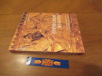
Dyfri Willams
Grecheskoe Zoloto. Yuvelirnoe Iskusstvo Klassicheskoy Epohi V-Iv Vv. Do N.E./ Greek Gold.
St. Petrsburg: Slaviya / British Museum Press 1995. 1st Edition 1st Printing. Soft cover. Fine. 271 Pp. Very Large Format Soft Cover Finely Printed Color Illustrations And Russian Text Throughout. Fine. With The Special Bookmark For This Book. <br/> <br/> Slaviya / British Museum Press paperback
Referentie van de boekhandelaar : 050606 ISBN : 5886540032 9785886540031
|
|
|
Dykyjová, Dagmar and J. Kvet (Eds.)
Pond littoral ecosystems. Structure and functioning: Methods and results of quantitative ecosystem research in the Czechoslovakian IBP Wetland Project. (= Ecological Studies - Volume 28).
Springer, Berlin 1978. XIV, 464 S. mit 183 Abbildungen, Groß 8°, Original-Pappband (Hardcover), sehr gutes und innen sauberes Exemplar, (very good copy),
Referentie van de boekhandelaar : 32502

|
|
|
Dylik, J
Województwo ze stolica bez antenatów. Geografia historyczna województwa lódzkiego.
Lódz, 1971. M. 8 Ktn.-Beil., 1 Kte., 1 Tab. u. 81 Abb. teils auf Taf. 187 S. (Szlakami nauki 15).
Referentie van de boekhandelaar : 238011
|
|
|
Dyroff, Hans-Dieter (Hrsg.)
Protection and Cultural Animation of Monuments, Sites and Historic Towns in Europe The present situation in Belgium, Bulgaria, Canada, the Federal Republic of Germany, France, Greece, Hungary, Italy, The Netherlands, Poland, the United Kingdom, and Yugoslavia
Bonn, German Commission for UNESCO, [1980]. 29,5 cm. 394 S. Mit zahlreichen Ill., Abb. und Karten. Illustrierter Originalkarton (Softcover). Kurzer Vermerk auf Titel, sonst gut erhaltenes Exemplar. Architecture and protection of monuments and sites of historical interest ; 12.
Referentie van de boekhandelaar : 4489AB
|
|
|
Dyson, Stephen L
ROME; A Living Portrait of an Ancient City
Johns Hopkins University Press. 2010. Hardcover. Very Good in No Dust Jacket dust jacket. Minor shelfwear to book.; Stephen L. Dyson has spent a lifetime studying and teaching the history of ancient Rome. That unparalleled knowledge is reflected in his magisterial overview of the Eternal City. Rather than look only at the physical development of the city-its buildings monuments and urban spaces-Dyson also explores its social economic and cultural histories. This unique approach situates Rome against a background of comparative urban history and theory allowing Dyson to examine the dynamic society that once thrived there. In his personal effort to reconstruct the city Dyson populates its streets with the hurried politicians hawking vendors and animated students that once lived worked and studied there bringing the ancient city to life for a new generation of students and tourists. Dyson follows Rome as it developed between the third century BC and the fourth century AD dividing the great megalopolis into distinct neighborhoods and locales. He shows how these communities each with its own unique customs and colorful inhabitants eventually grew into the great imperial capital of the Italian Empire. Dyson integrates the full range of sources available-literary artistic epigraphic and archaeological-to create a comprehensive history of the monumental city. In doing so he offers a dramatic picture of a complex and changing urban center that despite its flaws flourished for centuries.; Ancient Society And History; 6 X 1.39 X 9 inches; 488 pages . 0801892538 . Johns Hopkins University Press hardcover
Referentie van de boekhandelaar : 39747 ISBN : 0801892538 9780801892530

|
|
|
Dzierzykraj-Rogalski, T
Crania et alia ossa Polonica, cmentarzyska neolityczne w Stoku i Lesie Stockim.
Wroclaw, 1958. M. mehr. Abb. (teils auf Taf.) 70 S. (Materialy i prace antopol. 30).
Referentie van de boekhandelaar : 237913
|
|
|
Dänemark
Dänemark 1936. (Handbuch / Nachschlagewerk).
Kopenhagen, Kgl. Dänisches Ministerium des Außeren und dem Staatlichen statistischen Departement, 1936.
Referentie van de boekhandelaar : 172137

|
|
|
Dänemark - Hielscher, Kurt
Danmark. Landschaft, Baukunst, Volksleben. Mit einem Geleitwort von Karin Michaelis. 1. Auflage.
Berlin, Brockhaus Verlag, 1932.
Referentie van de boekhandelaar : 91702

|
|
|
Däniken, Erich von
Im Namen von Zeus : Griechen - Rätsel - Argonauten.
München : Bertelsmann, 1999. 287 S. Ill., Kt. 8°. 1. Aufl. Bibl.- Einbd.
Referentie van de boekhandelaar : 42252
|
|
|
Décsy, Gyula
Die linguistische Struktur Europas. Vergangenheit, Gegenwart, Zukunft.
Wiesbaden, Harrassowitz, 1973. Gr. 8°, 3 Blätter, 300 Seiten. Orig.Leinen mit OSU.
Referentie van de boekhandelaar : 10687
|
|
|
Dépôt des cartes et plans de la Marine
Carte particulière de la còte de Norwège, depuis Alvöe jusqu'à Egefield…
Carta nautica della costa norvegese sudoccidentale.Incisione su rame, in ottimo stato di conservazione. Nautical map coverig the Norway South-West coastline.Copperplate in very good condition.

|
|
|
Dépôt des cartes et plans de la Marine
Carte particulière de la còte de Norwège, depuis Egefield jusqu'à Christiansand
Carta nautica della costa norvegese compresa tra Staltland e Kristiansand.Incisione su rame, in ottimo stato di conservazione. Nautical map coverig the Norway coastline from Statland to Kristiansand.Copperplate in very good condition.

|
|
|

 De zoekresultaten per email ontvangen
 Zoekresultaten downloaden als PDF
 RSS feed
 Permanente link


