|
(cartes postales).
Porcelain from Jingdezhen.
Chine, XXème, 1 sous pochette illustrée, texte en chinois et en anglais à l'intérieur de la pochette. 11 cartes postales en couleurs de 10 x 15 cm ;
Referentie van de boekhandelaar : 17960
|
|
|
(cartes à jouer)
DOMINOS-CARTES
1857 Jeu de dominos-cartes célébrant l'histoire du Premier et du Second Empire jusqu'à la fin de la Guerre de Crimée.Paris (?) : Krum & Cie, vers 1857, chromolithographie avec passage d'or, 28 cartes (complet) 79 x 56 mm, figures doubles variables, coins carrés dos rose.
Referentie van de boekhandelaar : 103363

|
|
|
(cartes à jouer)
Jeu «Alla Russa»
Florence, après 1840, portrait florentin III, 52/52 coins carrés blason survalet de trèfle (Léopold II Habsbourg) lithographie, pochoir coloris manuels.Filigrane fleur de lys (lys de Florence) sur toutes les cartes.Chiari (?) vers 1840-1850, (taxe13,4) tampon sur valet de pique 1840.Non signalé par Sylvia Mann (proche de 202)(103364)
Referentie van de boekhandelaar : 103364

|
|
|
(DELSKAMP, F.W.) / DAUCH, J. Ph. 2 Tafeln gestochen von (gravé par):
1) Le Mont Blanc, la vallée de Chamouny, Col de Balme, Col de la Seigne et la route du grand St. Bernard.2) Partie de la Savoie du Lac d’Annecy , Lac de Bourget, et des Environs de Chambery. (2 Cartes a vol d’oiseau / Vogelschaukarten).
s.d., um 1856. 35 x 57 cm ( la feuille), Cartes gravés tirées de l’Atlas de F.W. Delskamp / J. Ph. Dauch sc.: Malerisches Relief der Schweizer und angrenzenden Alpen. Nach der Natur aufgenommen. Frankfurt a. M., 2 planches.
Referentie van de boekhandelaar : 137054aaf
|
|
|
(Düwel, Robert)
Hamburg und seine schöne Umgebung. (Faltplan. Hrsg. von der Fremdenverkehrs- u. Kongress-Zentrale Hamburg e.V.).
(Hamburg, gedr. bei Gebr. Sülter, 1966). 1 mehrfach gefalt. farb. Ktn.-Skizze, gezeichnet von Heinz Schultchen (ca. 42 x 60 cm), verso Text.
Referentie van de boekhandelaar : 63766

|
|
|
(ed), C C J Bond (Maps) W R Feasby
Official History of the Canadian Medical Services 1939 - 1945 2 Volume Set ; Vol. I: Organization and Campaigns. Vol. II: Clinical Subjects.
Ottawa: Edmond Cloutier Queens' Printer and Controller of Stationery. Very Good in Very Good- dust jacket. 1956. First Edition. Hardcover. Volume I has no dust jacket the red coth covered boards dated 1956 some shelf soil to page edges top back corner bumped. Volume II dated 1953 has chipped DJ 1 inch tear bottom front panel and 2 inch tear top back panel.; Fold-out maps in Vol. I and map endpapers appear undamaged B&W and color illustrations in Vol II; Color Illustrations . Edmond Cloutier, Queens' Printer and Controller of Stationery hardcover
Referentie van de boekhandelaar : 15240

|
|
|
(Galletti, Johann)
Weltkarte. Gestochen von J. N. Champion I. G.
o. O. u. J. (um 1822). Kupferst., altkol., 26 x 36 cm. Kartenbild mit wenigen Braunfl., w. Rand etwas stärker braunfl., einige Gebrauchsspuren, Knickstelle an re. ob. Ecke. Planiglob der östlichen und westlichen Hemisphäre.
Referentie van de boekhandelaar : KART0032

|
|
|
(HOMANN, J.B.).
Rojaumes de Corée et de Iapan.
(Nürnberg, ca. 1730). 51,5x41,5 cm. Engraved map of eastern Asia with part of China and Japan up to Saghalin Island, in original handcolouring. The broad margins a bit browned, orherwise fine.
|
|
|
(HOMANN, J.B.).
Rojaumes de Corée et de Iapan.
(Nürnberg, ca. 1730). 51,5x41,5 cm. Engraved map of eastern Asia with part of China and Japan up to Saghalin Island, in original handcolouring. The broad margins a bit browned, orherwise fine.
Referentie van de boekhandelaar : 27994
|
|
|
(Ireland - maps) Mark Allen
Catholic Ecclesiastical Map of Ireland 1859 and pamphlet KEY to the Catholic Ecclesiastical Map of Ireland
Dublin: Mark Allen 1859. Hardcover. Very Good. Published 1859 the map in 20 panels backed with linen measures 39.75 x 29.5 inches 100.5 x 75 cm hand colored in outline in very good condition small gray spot to blank area lower left in original cloth binding with printed label to front cover light wear and soil to binding. The accompanying pamphlet 31 pp. green wraps very good some of the stitching along spine coming loose. Both map and pamphlet signed Francis L. Casey RCV Cork. Uncommon. Mark Allen hardcover
Referentie van de boekhandelaar : H4454

|
|
|
(Ireland - Maps) George Frederick Cruchley
Cruchley's Tourist's or Tourist Map of Ireland with the Railways Roads &c. 1862
Edinburgh and London: Gall & Inglis 1862. Hardcover. Very Good. Ca. 1862 folded backed in original linen housed in original cloth folder with green printed title label to cover the map measures 26.75 x 22 inches; 67.5 x 56 cm and is in excellent condition with vivid coloring. No date on map or binding but we found an advertisement for this map in another Cruchley production dated 1862 and it feels right. RARE with no copies in OCLC to our knowledge. Gall & Inglis hardcover
Referentie van de boekhandelaar : H4452

|
|
|
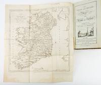
(IRELAND - MAPS). TAYLOR, GEORGE and ANDREW SKINNER
TAYLOR AND SKINNER'S MAPS OF THE ROADS OF IRELAND: SURVEYED IN 1777 AND CORRECTED DOWN TO 1783
London: Engraved by G. Terry and Sold by T. Longman London and W. Wilson Dublin 1783. Second Corrected Edition. 260 x 155 mm. 10 1/4 x 6". XXVII 289 pp. 4 leaves index. <br/> Contemporary half calf over marbled boards flat spine divided into panels by gilt rules red morocco label very neat repair to head of front joint and top of spine. Engraved title page with vignette and dedication leaf large folding map of Ireland and 289 engraved maps. Title page with early ink signature of Jos. Sabine. Moreland & Bannister p. 190; Tooley "Maps and Mapmakers" p. 94. Small signs of age and wear to the binding including slight crackling and nicks to the spine folding map with faint dampstain to tail margin two negligible ink spots to blank area on the map of the Irish Sea but A VERY APPEALING COPY quite clean and remarkably fresh internally and in an entirely solid period binding.<br/> <br/> This is the second corrected edition of the first comprehensive road atlas of Ireland offered here in especially attractive condition. In response to increasing demand for accurate maps of the country's road system the Irish House of Commons commissioned George Taylor and Andrew Skinner who together had previously produced the first road atlas of Scotland among other works to undertake a survey of the land. Taylor and Skinner completed their work in 1777 and published the first edition of their findings in 1778. This second edition includes updates to the year 1783 as well as an additional map no. 289. Renowned for their precision and detail Taylor and Skinner's maps clearly show roads crossroads and bridges as well as topographical features such as hills lakes and rivers including the direction of the water flow; landmarks such as castles churches and ruins; and the names of local landlords and their homes. The maps appear either as half-page strips or in full-page and the distances are given in both Irish and English miles 11 Irish miles being equal to 14 British miles. The robust list of subscribers which includes a number of earls viscounts lords bishops and British and Irish army men demonstrates the great need for and widespread success of this important work. Our former owner may well be the famed and controversial naturalist Joseph Sabine 1770-1837 who often signed his name as "Jos. Sabine" as seen here. He certainly had good reason to own maps of Ireland. He was from an Anglo-Irish family himself and was Honorary Secretary of the Horticultural Society a position which at the time carried great clout in the botanical community and one that presupposed knowledge of geography across the realm. DNB tells us that "Sabine played a leading part in the establishment of the society's garden first at Hammersmith and afterwards at Chiswick; in sending out David Douglas and others as collectors; in starting local societies in connection with the Horticultural Society; and in growing and distributing new and improved varieties of flowers fruits and vegetables throughout the country." While not a rare book this is the kind of volume that would have normally encountered frequent and inevitably damaging use so to find a copy as well preserved as this one is a lucky occurrence. Engraved by G. Terry and Sold by T. Longman, London and W. Wilson, Dublin unknown
Referentie van de boekhandelaar : ST19355
|
|
|
(Klahn, Peter)
Hamburg: Das Elbufer. Von Altona bis Wittenbergen. (Hrsg. von der Hamburg e.V.).
Hamburg, Fremdenverkehrs- u. Kongreß-Zentrale, 1960]. 12seitiges Faltblatt, mit farb. illustr. von Heinz Eimert (simplifizierter Straßenplan). Blatt 20 x 58 cm. Falzmaß 20 cm.
Referentie van de boekhandelaar : 63173

|
|
|
(LÖWENÖRN, P. (POUL) de). - SHETLAND ISLANDS.
Beretning om et forbedret Kaart over de Hetlandske Öer, tilligemed trende Blade med Landtoninger og et speciel Kaart over Valley-Sund paa Hetland. Udgivet fra det Kongelige Söe-Kaarte-Archiv 1787. (Description of a new improved chart of the Islands of...
Kiöbenhavn, Thiele, 1787. 4to. Originale blåmarmorerede omslag. Stempel på titelbladet. 16 pp., 4 kobberstukne plancher (3 foldede med landtoninger samt et kort). Rent velbevaret eksemplar på skrivepapir.
|
|
|
(LÖWENÖRN, P. (POUL) de). - SHETLAND ISLANDS.
Beretning om et forbedret Kaart over de Hetlandske Öer, tilligemed trende Blade med Landtoninger og et speciel Kaart over Valley-Sund paa Hetland. Udgivet fra det Kongelige Söe-Kaarte-Archiv 1787. (Description of a new improved chart of the Islands of...
Kiöbenhavn, Thiele, 1787. 4to. Originale blåmarmorerede omslag. Stempel på titelbladet. 16 pp., 4 kobberstukne plancher (3 foldede med landtoninger samt et kort). Rent velbevaret eksemplar på skrivepapir.
Referentie van de boekhandelaar : 56969
|
|
|
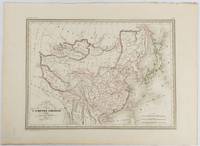
(MALTE-BRUN, CONRAD) THIERRY, ENGRAVERS
Carte Générale de l'Empire Chinois et du Japon.
Paris. circa1837. Engraved map with original outline hand-colour 22 x 30 cm; 28.8 x 38.6 cm sheet marginal repair to the lower corner not affecting the map sheet lightly age-toned in very good condition preserved in a window mount. Fine map of China Japan and Central Asia noting Manchuria "Mandchourie" bordering Northern India and Turkestan in the West and Russia "Russie d'Asie" in the North. <br> <br>From the estate of the late collector and scholar Arthur Hacker with his pencilled catalogue mark on the verso. . unknown
Referentie van de boekhandelaar : 177519
|
|
|
(MAPS)
Automobile Green Book: Vol. I 1920. New England States and Trunk Lines West and South. With the Map.
Boston: Scarborough Motor Guide Company 1920. Narrow octavo. 676 pp. crammed with numerous textual maps and advertisements. Original folding map present and in very good condition. Publisher's stiff green wrappers lettered in black. Small 1/2 inch slit to upper front joint but a remarkably clean and nice copy with the map. Scarborough Motor Guide Company unknown
Referentie van de boekhandelaar : 76159
|
|
|
(MAPS: CANADA)
La Province du Manitoba et le Territoire du Nord-Ouest; Informations pour les Immigrants.
Ottowa: Departement de L'Agriculture 1880. First edition. Octavo. Folding color map as frontispiece short tear 26 1 table of contents 9 ads two full page woodcuts of Manitoba farms and single page governments announcements pp. Publisher's pink printed wrappers. Split at spine but holding strong. A very good copy. Departement de L'Agriculture unknown
Referentie van de boekhandelaar : 74548
|
|
|
(Minnesota Rivers, Maps)
Snake Upper Red and Minnesota Rivers Minnesota; Reservoirs at Sources of rock River Wisconsin and Illinois
Washington DC: U. S. Congress. Very Good. 1881. Pamphlet. Snake Upper Red and Minnesota Rivers Minnesota; Reservoirs at sources of Rock River Wisconsin and Illinois. Letter from the Secretary of War transmitting surveys .United States. War Department. 1881. 16 pages maps 2 folded ; 23 cm. Washington Govt. Print. Off. 1881. Disbound Pamphlet. The contents are nice and the 2 folding maps are bright and clean. . U. S. Congress unknown
Referentie van de boekhandelaar : 74181
|
|
|
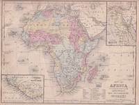
(MITCHELL, SAMUEL AUGUSTUS).
Map of Africa engraved to illustrate Mitchell's New Intermediate Geography.
Philadelphia.: E. H. Butler. circa1869. Lithographed map with original hand-colour 21.2 x 27.6 cm two inset maps of Liberia and Sierra Leone; and Egypt showing the Suez Canal text and engravings for an unrelated entry on the verso; margins dusty top edge worn with small edge tears one affecting the border and marginal chip but in good condition. Detailed map of Africa before the escalation of colonial acquisition in the 1880s. . (E. H. Butler). unknown
Referentie van de boekhandelaar : 176603
|
|
|
(Niebuhr, Carsten)
Nili Brachia ambo majora cum Oppidis et Vicis in utraque ripa sitis. Kupferstich.
(Kopenhagen, 1779]. 29 x 26 cm. Unter Passepartout.
Referentie van de boekhandelaar : 81624

|
|
|
(Petit-Lorraine).
Carte postale humouristique (Vals-les-Bains), illustrée par Robert Petit-Lorraine.
Largentière, Humbert, s.d. (années 50 ou 60), 1 carte postale de 10 x 16 cm, dessinée par le peintre Robert Petit-Lorraine, texte de 3 lignes: "Cure à Vals: "Mais vous avez déja l'air moins... Sucrée !"" ;
Referentie van de boekhandelaar : 10738
|
|
|
(Petit-Lorraine).
Carte postale illustrée par Robert Petit-Lorraine. Vals-les-Bains (Ardèche). Source intermittente.
Largentière, Humbert, s.d. (années 50 ou 60), 1 carte postale de 16 x10 cm, dessin de Petit-Lorraine ;
Referentie van de boekhandelaar : 10749
|
|
|
(Petit-Lorraine).
Carte postale illustrée par Robert Petit-Lorraine. Chassiers, l'église (Ardèche).
Largentière, Humbert, s.d. (années 50 ou 60), 1 carte postale de 16 x10 cm, dessin de Petit-Lorraine.
Referentie van de boekhandelaar : 11926
|
|
|
(Petit-Lorraine).
Carte postale, illustrée par Robert Petit-Lorraine. Largentière, le château (Ardèche).
Largentière, Humbert, s.d. (années 50 ou 60), 1 carte postale de 16 x10 cm, dessin de Petit-Lorraine.
Referentie van de boekhandelaar : 11927
|
|
|
(SALESMAN CATALOG: SHELL ROAD MAPS)
Original Salesman Catalog of Road Maps for the United States and Canada.
San Jose: H.M. Gousha Co. on or before 1956. First edition of this gathering. Folio 13 1/4 x 18 inches. 62 unused road maps in color and with inserts each neatly divided by side tabs. All maps bound on stubs. Original red cloth portfolio with flap and snap fasteners the Shell logo stamped on front cover some soiling or darkening to extremities. The portfolio has some expected wear but the maps are fresh and clean. Shell maps of this era are notable for their high-quality cartography colorful graphics and often included travel tips local advertisements and information about Shell services. None located by OCLC. Harry Mathias Gousha a former Rand McNally went independent in 1926 and relocated to California in 1947. It was a propitious time as the 50s in most respects witnessed the onset of the great American phenomenon of the Road Trip. With the improvement in cars longer and longer trips became feasible. None of the great Interstates as we know them today were in existence at that time so road maps were essential for any successful road trip. The H.M. Gousha Company was one of the "Big Three" major producers of road maps and atlases in the United States during the 25 years following World War II General Drafting and Rand McNally were the other two. Shell maps of this era although free are notable for their high-quality cartography colorful graphics and often included travel tips local advertisements and information about Shell services. The H. M. Gousha Company produced millions of oil company road maps used as marketing tools distributed at no charge at gas stations by customers that included Gulf Oil Conoco Shell Standard Oil and dozens of others. Though most Gousha maps were produced for oil companies many others were issued for customers not related to the petroleum industry including automobile clubs state governments banks and realtors. Ironically the company was purchased by Rand McNally in 1996. H.M. Gousha Co. hardcover
Referentie van de boekhandelaar : 76405
|
|
|
(Schicklmaier, Klaus)
Hamburg. Kultur- und Veranstaltungsführer 1989/90. (Oper, Konzert, Ballett, Theater).
(Hamburg, Kompass-Stadtpläne-Verlag, 1989). 94 S. Mit tls. farb. Abb., 1 farb. gefalt. Plan (verso Plan der Innenstadt, Schnellbahn-Netz, Übersichts-Kte. u. Straßenverzeichnis). (= Kompass-Stadtpläne). OBrosch.
Referentie van de boekhandelaar : 52859
|
|
|
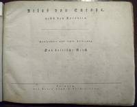
(Schlieben, Wilhelm Ernst August von).
Atlas von Europa nebst den Kolonien für Geschäftsmänner Zeitungsleser und Besitzer des Conversations-Lexicons in einer Folge von Charten und einem alphabetisch eingerichteten Texte. LIEFERUNG 15 von 15 apart: Das BRITISCHE REICH.
Leipzig Georg Joachim Göschen 1830. . Verlags-Bibliographie Göschen 1785-1838 Nr. 1027. Vgl. Studien zur Verlagsgeschichte u. zur Verlegertypologie der Goethezeit S. 190. - Einband stark beschabt Textteil gebräunt/stockfl.; erste Karte gebräunt sonst nur gelegentlich stockfleckig im weißen Kartenrand. - Allgemeine Übersicht. Topographie der vorzüglichsten Orte von A-Z. Grenzkolorierte Karten von Königreiche ENGLAND SCHOTTLAND u. IRLAND; Gibraltar Malta Helgoland Ionien; die Kolonien: Britisch-Ostindien Kap-Kolonie Westindien afrikanische Westküste Goldküste Guinea Mauritius St. Helena Nordamerika Hopparo Britisch-Guyana Australien. - Der königlich sächsische Kammerrat W. E. A. v. Schlieben 1781-1839 Statistiker u. Oberlandfeldmesser war Mitbegründer des Statischen Vereins in Sachsen 1831-1850 u. Leiter des Zentralkomitees des Vereins. Leipzig, Georg Joachim Göschen, 1830. unknown
Referentie van de boekhandelaar : 51860
|
|
|
(Schmidt, Philipp Friedrich Moses Paul)
Hamburg in naturhistorischer und medicinischer Beziehung. Zum Andenken an die im September 1830 statt gefundene Versammlung der deutschen Naturforscher und Aerzte.
Hamburg, 1830. VI, 207 S. Mit lith. Titel mit Binnenalster-Vign., 1 Hamburg-Lithogr. "Hamburg von der Elbe" als Frontispiz (beide von Otto Speckter) u. 2 gefalt. lithogr. Ktn. 18 cm. Marmorierter Pp der Zt. m. goldgepr. RSchild.
Referentie van de boekhandelaar : 89187

|
|
|
(Stereographic Maps) Woodman, T I and H Mutlow
Two engraved maps
London: Harrison & Co 1784. 1 vols. 10 x 7 3/4 inches. Extracted from a volume. Some light marginal discoloration folds else in very good condition. 1 vols. 10 x 7 3/4 inches. The first "A General Stereographic Map on the Plane of the Meridian" and the other showing a "Stereographic Projection on the Plane of the Horizon" and "Orthographic Projection on the pLane of the Meridian" Maps of the Hemispheres. <br/><br/> Harrison & Co unknown
Referentie van de boekhandelaar : 25892

|
|
|
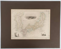
(TALLIS, JOHN), RAPKIN, J, WARREN H, AND KERNOT JH J H
Japan & Corea
London.: The London Printing and Publishing Company. circa1850s. Lithographed map with original outline hand colour 25.8 x 33.5 cm three vignette illustrations decorative border central fold in very good condition presented in a window mount. Attractive decorative map with three vignettes by Rapkin: Yedo; a State barge in sail with penants flying--the paired oarsmen depicted through 10 small windows below deck; and Koreans in traditional costume; the map after the great mapmaker and publisher John Tallis. <br> <br>From the estate of the late collector and scholar Arthur Hacker with his pencilled catalogue mark on the verso. . The London Printing and Publishing Company. unknown
Referentie van de boekhandelaar : 177528
|
|
|
(VAUDONCOURT, GUILLAUME de).
Mémoires pour servir a L'Histoire de la Guerre entre la France et la Russie, en 1812 Avec un Atlas Militaire. Par un Officier de L'État-Major de L'Armée Francaise. 2 vols. (1. Contenant les Mémoires - 2. Contenant L'Atlas Militaire).
Paris, Barrois L'Ainé,1817. 4to. Textvol. in contemp. hcalf with richly gilt spine. A paperlabel pasted on lower part of spine. Atlas-vol. in modest clothbacked boards. Lower part of spine with tears and taped. Stamp on titlepages. IV,358,(1) pp. Atlas: (4) pp. and with 14 mostly large and folded engraved maps.
|
|
|
(Voyages)LE TOURMELIN
Kurun autour du Monde 1949-1952
in 8 demi-cuir marron raciné à nerfs,titre doré,faux-titre,titre,341 pages,cartes croquis,l’aventure vécue 1953 édition originale,couverture et dos conservés.
Referentie van de boekhandelaar : 2033
|
|
|
*
Arrêté de l'administration centrale du département de Lot-et-Garonne concernant les cartes à jouer. Séance du 14 vendémiaire, an VII de la République Française, une et indivisible.
Agen, Imprimerie du département, an VII (1799). Placard 42 x 53 sur vergé.
Referentie van de boekhandelaar : 1202
|
|
|
*
Deux cents patiences Napoléon. Seconde édition.
"P., Haar et Steinert, sans date. In 8 cartonnage orné de l'éditeur, XII pp; et 100 planches en couleurs de réussites, très bel exemplaire dans son emboîtage (un peu défraîchi)."
Referentie van de boekhandelaar : 5853
|
|
|
*
Jeu de 54 cartes ASS, au portrait de fantaisie (jeu noble).
Allemagne, vers 1900.
Referentie van de boekhandelaar : 625
|
|
|
*
Lettres édifiantes et curieuses écrites des Missions étrangères. Mémoires du Levant - Tome troisième.
Lyon, Vernarel- Cabin 1819, in8 br , 492 pp , couverture défraichie avec manque de papier sur le dos Essentielement l' Egypte.
Referentie van de boekhandelaar : M12808
|
|
|
*
NORTHERN PROVINCES OF UNITED STATES
Thomsons (1871) carte coloriée 50cmx 59cm. Excellent etat Langue: Français
Referentie van de boekhandelaar : ML196
|
|
|
***
CARTE POSTALE ANCIENNE - LE PAYS BASQUE - ATTELAGE DU PAYS
EDITIONS D'ART YVON. non daté. In-12. Broché. Bon état, Couv. convenable, Dos satisfaisant, Intérieur frais. 1 carte postale vierge, ancienne en noir et blanc représentant un attelage du pays Basque.. . . . Classification : 220-Cartes Postales Publicitaires
Referentie van de boekhandelaar : RO30049236

|
|
|
***
CARTES POSTALES ANCIENNES - COIFFE D'OLERONNAISE
"EDITEUR ARJAC. non daté. In-12. Broché. Bon état, Couv. convenable, Dos satisfaisant, Intérieur frais. 2 cartes postales anciennes vierges illustrées en noir et blanc représentant des coiffes Oléronnaise ""Le Coiffètte"",""Le Bonnet"".. . . . Classification : 220-Cartes Postales Publicitaires"
Referentie van de boekhandelaar : RO30049238

|
|
|
***
National Geographic Society. MAPS. Washington, 1949 (Etats-Unis, Grands lacs, Canada, Pôle Nord, etc.)
Atlas des Etats-Unis formé de 11 cartes et leur index, les dix premières (USA historique et région par région) en étui, l'ensemble étant relié sous cartonnage toilé de l'éditeur.
Referentie van de boekhandelaar : 2678
|
|
|
-
MONTRÉAL GIANT POSTCARD.- Jeu de 10 cartes postales géantes.
Sans lieu, sans éditeur ni date. (Made in Canada) vers 1930. Carte-lettre 17,8 x 22,3 cm imprimée offset en noir sur carte blanche. Très bel état. Cartes non pliées et vierges d’écriture.
Referentie van de boekhandelaar : 4156
|
|
|
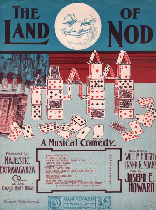
- -
Partition de la chanson : land of nod (The) Juste la couverture, absence de la partition musicale
Partitions sur le Jeu
Referentie van de boekhandelaar : 72247
|
|
|
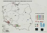
07 [7 Large Folding Maps of the Holocaust in Poland] Pilichowski, Czeslaw, editor; Glo´wna Komisja Badania Zbrodni Hitlerowskich
OBOZY HITLEROWSKIE NA ZIEMIACH POLSKICH 1939 - 1945. INFORMATOR ENCYKLOPEDYCZNY. VOLUME II: MAPY MAP VOLUME STANDS ON ITS OWN 7 LARGE FOLDING MAPS
Warszawa Warsaw: Pan´stw. Wydawn. Naukowe 1979. 1st Edition. Original black printed portfolio 8vo. Portfolio of seven large folding maps on on 4 sheets of heavy paper 3 are double sided 1 is singled sided. Primarily black and white with some color. Text in Polish. <br> Title translates to “Nazi camps in Poland 1939 - 1945. An Encyclopaedic Reference Book: Maps." Collection of 7 maps each 84 cm x 60 cm 33 x 24 inches produced by Jan Laskowski at the Main Commission for the Investigation of Nazi Crimes in Poland. The maps comprise Volume II of the work; Volume I is a heavily illustrated 676-page book of the same title which we offer separately. <br> The Seven maps all present are: <br> - Map 1 Single Sided: Hitlerowskie obozy na ziemiach polskich w latach 1939 - 1945. “Nazi camps in Poland in the years 1939 - 1945â€. Showing: concentration and extermination camps sub-camps of concentration camps extermination centers POW camps more important sub-camps working divisions commandos and temporary POW camps penal labor camps major labor camps prisons transit camps & ghettos. <br> - Map 2A: Getta na ziemiach polskich w okresie okupacji hitlerowskiej w latach 1939 - 1945 “Ghettos in Poland during the Nazi occupation in 1939 - 1945â€. <br> - Map 2B: Hitlerowskie obozy przejsciowe na ziemiach polskich w latach 1939 - 1945 “Nazi transit camps in Poland in 1939-1945â€. <br> - Map 3A: Hitlerowskie wiezienia i areszty na ziemiach polskich w latach 1939 - 1945 “Nazi prisons and arrests in Poland in 1939 - 1945â€. <br> - Map 3B: Hitlerowskie obozy pracy na ziemiach polskich w latach 1939 - 1945 “Nazi labor camps in Poland in the years 1939 - 1945â€. <br> - Map 4A: Hitlerowskie obozy jenieckie na ziemiach polskich w latach 1939 - 1945 “Nazi POW camps in Poland in 1939 - 1945â€. <br> - Map 4B: Hitlerowskie obozy koncentracyjne i osrodki zaglady na ziemiach polskich w latach 1939 - 1945 “Nazi concentration camps and extermination centers in Poland in 1939 - 1945â€. <br> Maps 2A & 2B have been described as a “Terrifying pair of maps showing the locations of German POW and internment camps in Poland during World War II highlighting the widespread locations of these establishments. In some parts of the map the information becomes so dense that three inset maps are shown. This map was designed by Jan Laskowski and printed in 1979 as part of a work on the Nazi extermination machine produced by PWN Warsaw a state-owned research-focused publishing house in Poland.<br> The map on the front is particularly interesting for its depiction of symbols used to classify internees in German camps. The uppermost of these depictions shows the combinations that can be made for different types of prisoners of different levels of importance. The armbands that would have been worn by these prisoners is shown as well as the prison uniforms. Other details are also shown. <br> The map lists hundreds of sites run by Nazi operators throughout the country. These include concentration camps death camps transitional camps and ghettos. The map is divided according to Poland's voivodeships with a key in the lower left. Names of cities too long to spell are also provided in the lower left. <br> This map was produced during a point in Poland's history during which it was actively revisiting the period during the Second World War. Leading social scientists devoted their time to trying to gather all the living as well as the recorded history of the events of the Holocaust and related atrocities before this information vanished. Leading these efforts particularly during the 1960s and 1970s was the Glówna Komisja Scigania Zbrodni przeciwko Narodowi Polskiemu known as the Chief Commission for the Prosecution of Crimes against the Polish Nation. They were active in publishing maps both for domestic educational purposes and for international remembrance and diplomatic efforts regarding the Holocaust. Jan Laskowski was a leading cartographer who produced a number of maps in this field. <br> These maps were produced as part of a series of maps that purported to combine to form an atlas of all of Hitler's crimes in Poland. Many of the large wall maps produced during this period could only show a fraction of the crimes or only the atrocities committed in one region. Thus a series of maps was needed to show all the points necessary which this present work contributes to. <br> Polish Reinterpretations of the Holocaust: Studying the effects of German occupation in Poland is a delicate subject. While it is certain that Poland suffered at least as badly as any other European nation during the Second World War reinterpretations of the Holocaust in the country have also been used to satisfy nationalistic tendencies. It has become evident to Western observers in the last several years that there is a strong nationalist movement in Poland that seeks to place blame for the Holocaust solely on the shoulders of non-Polish actors a movement originally fostered under Soviet rule. This movement has gone so far as to limit freedom of speech criminalizing with a three-year sentence the suggestion that Poland or its citizens in any form participated in the murders committed by Nazis. As such the term ‘Polish concentration camps’ has been deemed unacceptable with the government-approved term being ‘concentration camps on Polish territory.’ <br> All lines of evidence show that this map 2A & 2B was produced using the most accurate and impartial historical sources. The language on the map is simple naming only ‘Hitler's Atrocities’ and there is no evidence of a clear anti-German bias. However it is impossible to separate this map one of the most important productions of the remembrance movement during this period from the social situation in which it was produced. Maps like these can easily be converted into propaganda instruments and today's Polish leaders most of whom grew up during Soviet occupation will have formed their understanding of the Holocaust through maps like these. <br> Soviet Censorship: While the content of the map appears to have been produced free from bias the map still had to go through Soviet censorship. Mentioning prisoner of war camps in which primarily Soviet troops were interned would have been a prerequisite condition upon which the publication of the map rested. Further the lack of mention of any Soviet killings or camps requires no explanation….The map unlike many later maps makes no differentiation between the populations who suffered at the various camps. This represents the Soviet agenda that all nations suffered fought and won equally which sought to limit divisions in this post-identity state†Ruderman 2022. <br> SUBJECTS: World War 1939-1945 -- Prisoners and prisons German. -- Concentration camps -- Poland. Guerre mondiale 1939-1945 -- Prisonniers et prisons des Allemands. -- Camps d'internement -- Pologne. Obozy koncentracyjne -- Polska -- 1900-1945. OCLC: 830885973. <br> Light shelf wear to portfolio as expected. All maps in pristine condition with normal folds as issued. Very Good Condition. Complete and dramatic BR5 holo2-147-19-'cc. Warszawa (Warsaw): Pan´stw. Wydawn. Naukowe unknown
Referentie van de boekhandelaar : 41929
|
|
|
08 [Encyclopaedic Reference Book to Accompany Maps Above] Pilichowski, Czeslaw Glo´wna Komisja Badania Zbrodni Hitlerowskich w P
OBOZY HITLEROWSKIE NA ZIEMIACH POLSKICH 1939-1945: INFORMATOR ENCYKLOPEDYCZNY VOL I TEXT AND PHOTOS; THE SECOND VOLUME A PORTFOLIO OF FOLDING MAPS OFFERED SEPARATELY
Warszawa Warsaw: Pan´stw. Wydawn. Naukowe 1979. Pamphlet. 1st Edition. Original Cloth in dustjacket 8vo 678 2 pages 36 unnumbered leaves of plates with 164 illustrations. 25 cm. In Polish. Title translates to “Nazi camps in Poland 1939 - 1945. An Encyclopaedic Reference Book.†ISBN: 8301000651. <br> A massive encyclopedic record of Nazi camps prisons and ghettos in Poland based on extensive source material in Polish and foreign archives and research carried out by the General Commission for the Investigation of Nazi Crimes in Poland. The 5877 entries pages 87-601 are arranged in alphabetical order of location providing data on the period of existence character of and fundamental information about each site. Pages 11-86 comprise an introduction by Czeslaw Pilichowski "Hitlerowskie obozy i os´rodki przymusowego odosobnienia oraz ich rola w realizacji programu ludobo´jstwa i zaglady narodu polskiego" "Nazi Camps and Forced Detention Centers and Their Role in Implementing the Program of Genocide and Extermination of the Polish Nation". Includes a bibliography and indexes and summaries in Russian English French and German p. 657-676. The last 73 pages contain photographs. <br> SUBJECTS: World War 1939-1945 -- Prisoners and prisons German. -- Concentration camps -- Poland. Guerre mondiale 1939-1945 -- Prisonniers et prisons des Allemands. -- Camps d'internement -- Pologne. Obozy koncentracyjne -- Polska -- 1900-1945. OCLC: 5709074. <br> Top corners bumped some tears to dust jacket otherwise Very Good Condition in Very Good Dustjacket. Important Work. BK5 holo2-147-20. Warszawa (Warsaw): Pan´stw. Wydawn. Naukowe unknown
Referentie van de boekhandelaar : 41930 ISBN : 8301000651 9788301000653
|
|
|
10 maps
Ryuusei Kishida limited edition of 100 copies <Japanese Version>
Bijutsu shubbansha 1952. Soft Cover. Fine. Size: A3 Bijutsu shubbansha paperback
Referentie van de boekhandelaar : 2092902141000174
|
|
|
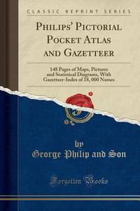
148 Pages of Maps, Pictures and Statistical Diagra
Philips' Pictorial Pocket Atlas and Gazetteer
paperback. Good. Access codes and supplements are not guaranteed with used items. May be an ex-library book. paperback
Referentie van de boekhandelaar : 0365854689.G ISBN : 0365854689 9780365854685
|
|
|
47 maps
Soun Tasaki's Calligraphy Exhibition Catalog <Japanese Version>
Tokyo Mikuraku 1939. Soft Cover. Fine. The book is in fine condition. Tokyo Mikuraku paperback
Referentie van de boekhandelaar : 2092902141000906
|
|
|
:
[ Semois ] Carte de la Semois d'Arlon à Monthermé. Echelle du 1/80.000. Tirage en 8 couleurs.
Chromolith. map in 2 sheets of 28x55cm and 28x51.5cm, folding back into orig. printed paper covers of 18x11cm. Some trace of use to covers, maps very good.
|
|
|
:
Carta Geologica delle Tre Venezie.
Coloured map, scale 1:100,000, each sheet 40x48cm + broad margins incl. colour legend. Plano, rolled. - AVAILABLE SHEETS: 7bis Vetta d'Italia / 7 Monguelfo / 14 Pontebba / 25 Udine / 37 Bassano del Grappa / 48 Peschiera / 49 Verona / 63 Legnago / 64 Rovigo. - PRICE PER SHEET.
|
|

 De zoekresultaten per email ontvangen
 Zoekresultaten downloaden als PDF
 RSS feed
 Permanente link


