|
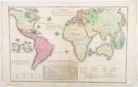
[ANTIQUE WORLD MAP] (SMITH, ROSWELL CHAMBERLAIN), O PELTON (ENGRAVER).
A Chart Exhibiting the Actual and Comparative Size of Each Country Nation or Kingdom; its Population as a Whole and to a Square Mile: Also the Different States of Society Forms of Government Religion &c.
Philadelphia.: W. Marshall. Circa1835. Handcoloured engraved map 26.5 x 41.3 cms; 29.6 x 48.3 cms sheet central fold insets of "Oceanica" and "New Holland" central table some light staining in the image and margins in good condition. Eurocentrism laid bare. This 19th Century map includes a "State of Society" for each part of the world declared with a symbol to represent "Barbarous Half Civilized Civilized and Enlightened Societies" as well as noting religion and ethnicity. It includes a table of distances between chief towns or capitals and between these towns and Washington DC. Australia "New Holland" is styled principally as pagan barbarous unexplored and African a thin sliver of what is now New South Wales and Victoria is labelled civilized European and Protestant. Scarce. . (W. Marshall). unknown
Referentie van de boekhandelaar : 203763
|
|
|
[Arabian Peninsula].
Omoumi Mamalik Mahrousi Shahani [General map of the protected countries. Ottoman Empire]. Istanbul, Matbaa-i Amire [Imperial Military Press], [1896 CE =] 1312 H.
150 x 130 cm. Scale: 1:3,000,000. Colour lithograph, dissected into 24 sections and mounted on original linen. Very rare, monumental wall map of the Ottoman Empire, featuring one of the largest and most detailed printed representations of the Arabian Peninsula produced in the Islamic World prior to World War I. Perhaps more than any other map, it reveals the immense logistic challenges faced by Hajj pilgrims just in advance of the construction of the Baghdad and Hejaz Railway systems. Printed for official use, the map appeared at a time when the Sublime Porte was going to great lengths to shore up its authority in the Red Sea region (Hejaz, Asir, and Yemen), while being pressured by Britain to retreat from the domains it claimed in the Arabian Gulf (Kuwait, Al-Qatif/Hofuf, and Qatar). - Indeed, the present map would have been of great value to Ottoman generals and cabinet officials for strategic planning, as Arabia was increasingly a focus of global attention and interference. It served as the ideal strategic aid to chart the future construction of the Hejaz Railway (built 1900-08) and the Baghdad Railway (extended from the Anatolian Railway, from 1903 onwards) and delineates some of the world's most strategically important railway lines before 1900. - The main map encompasses most of the Arabian Peninsula, from Qatar and the Hadramaut westwards (while far eastern Arabia, including Oman and what is today the United Arab Emirates is featured in an inset, lower left). The coastlines and rivers are crisply depicted; mountain ranges are expressed by delicate tan shading; all cities and towns of note are labelled; the names of regions and tribal areas are revealed, while all key roads and Hajj caravan routes are delineated. The map features stellar coverage of the western Gulf region, labelling Qatar (then an autonomous part of the Ottoman Empire), Bahrain (a British protectorate prized for its fine natural harbour), and Kuwait, an autonomous Sheikhdom within the Ottoman Empire that would shortly become a British protectorate. Inland, the map details the Saudi-Wahhabi domain Nejd, with its capital Riyadh, while to the northwest lies the territory of the rival Al-Rashid clan, with its capital Ha’il. - Minor soiling and waterstaining, occasional light edge wear. Tears in linen partly repaired. A rare survival. Osmanli cografya literatürü tarihi [History of geographical literature during the Ottoman period], pp. 756f. David Rumsey Map Collection 13186.000 (the single other copy known in the trade). Not in Al-Qasimi collection (1493-1931).
|
|
|
[Aramco - Map of Saudi Arabia and the Gulf].
Central Area. Scale 1:1,000,000. [Dhahran, Aramco / USGS, 1953 or shortly after].
763 x 763 mm. Scale 1:1,000,000. Key in English. Printed on cloth. Blueprint map of the Gulf, showing Qatar, Bahrain, and Kuwait, as well as parts of Saudi Arabia, Iran and Iraq. It pays particular attention to oil fields, naming them individually and illustrating oil pipelines and facilities, including the 435 kilometre Qatif-Qaisumah pipeline which connects to the Trans-Arabian pipeline, as well as the offshore terminal and refinery at Ras Tanura. The map records some of the problematic borders within the region, showing the Iraq-Saudi Neutral Zone, the Kuwaiti-Saudi Neutral Zone and Buraimi Oasis. Among the more notable oil fields are Greater Burgan, the world's largest sandstone oil field, consisting of the Burgan field itself along with the much smaller Magwa and Ahmadi fields, as well as the Wafra field discovered in 1953 by the American Independent Oil Company and Pacific Western Oil Company. Wafra was unique in being operated jointly under separate concessions from two countries, Kuwait and Saudi Arabia, granted to American Independent Oil Company and Getty Oil Company (formerly Pacific Western Oil Company) respectively. - Slightly toned along folding lines and lower left margin.
|
|
|
[Armenia].
Arménie Russe. Rossijskaja Armenija. Venice, [Imprimerie des Méchitaristes de] St. Lazare, 1828.
260 x 380 mm. Engraved map mounted on cloth. Matted. Early map of Russian Armenia, featuring the eight provinces annexed by Russia in 1828, with key in French and Russian. Following Qajar Iran's defeat in the Russo-Persian War (1826-28) and the 1828 Treaty of Turkmenchay, Eastern Armenia was, among other territories, ceded to Russia. It would remain part of the Russian Empire until its collapse in 1917. - Printed at the Mechitarists' press on the island of San Lazzaro, Venice, where the Armenian order had set up their colony in 1717. They began their editorial activities as early as the following year and set up a printing press, famed for its typographic capability in many languages and alphabets, in 1789. - Very rare; catalogues list a single specimen in the British Library. OCLC 556404373.
|
|
|
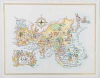
[ASIA - 1960S AVIATION PICTORIAL MAP]. LIOZU, JACQUES
Asie. The President Special Pan American Menu.
Pan American World Airways. 1964. Colour pictographic/pictorial map of Asia 23.2 x 30.1 cms gilt double-rule border printed on a folding decorative menu card 32 x 50 cms open highlighted in gilt text in English French and Japanese central fold and later central vertical crease in very good condition. Pan Am menu card for First Class passengers dubbed "The President Special" the deluxe cuisine by fabled Maxim's of Paris "Good food is the basis for true happiness". Passengers were feted with gourmet meals on bone china with silver cutlery. The witty pictorial cover-map of Asia was by French artist and commercial illustrator Jacques Liozu 1910-1974 also known for his larger scale maps. . Pan American World Airways. unknown
Referentie van de boekhandelaar : 195995
|
|
|
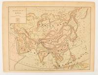
[ASIA - MAP]
Physical map of Asia
New York.: Harper & Brothers. 1875. Map printed in colour polar projection 21 x 27.1 cm marginal spotting and toning small edge tears to the inner margin but in god condition. Prepared for "Harper's School Geography" first published by Harper & Brothers in 1875. The map shows physical features mountains steppes plains rivers and deserts etc. together with sources of primary production: whale fisheries furs coffe tea minerals etc.The verso of the map with references and attractive line engravings part of the entry for Netherlands and Belgium. . Harper & Brothers. unknown
Referentie van de boekhandelaar : 174830
|
|
|
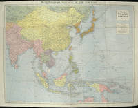
[ASIA - WORLD WAR II MAP].
The Daily Telegraph War Map of the Far East. Daily Telegraph War Map No. 11.
London.: Hutchinson & Co. Circa1940. Full colour folding map 70.7 x 93 cms; 76 x 101.2 cms sheet original folds short fold splits previous owner's neat title markings on the verso but the map in very good condition. A "Geographia" map of the war theatre in Asia and the Pacific including the northernmost coast of Australia. Showing railways and canals roads and steamer routes oilfields and pipe lines and a key to the unfederated states of Malaya. The Spratley Islands are marked as French and Thai territorial claims within French Indo China are marked. . Hutchinson & Co. unknown
Referentie van de boekhandelaar : 205763
|
|
|
[ASIA-PACIFIC - MAP].
Robinson's Pacific Ocean Mercator's Projection. Map no. 1804 : New Map of the Pacific Ocean with Insets showing Island Groups in Detail.
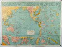
Sydney.: H.E.C. Robinson. Circa1945. Full colour inset maps principal cities and towns marked shipping routes international boundaries and railways. 99 x 73cm. Some small insect damage has been repaired on the verso visible on map as a few small lighter areas in the western Pacific. Pinpoint holes at folds paper repair along cover but a very good clean copy. From the Sydney publisher H.E.C. Robinson the firm founded in 1895 by Herbert Robinson 1857-1933 a founder of the Royal Geographical Society of Australasia. <br> <br>Although the map is undated North and South Korea are shown as divided which occurred in late 1945 and Manchuria is marked as still under Soviet occupation which only lasted until 1946 at which point it was handed over to Communist China. <br> <br>As well as what now would be considered Southeast Asia the main map shows the eastern half of India Tibet and parts of Mongolia the USSR and East Asia. Inset maps include: Caroline Islands Marshall Islands Federation of Malaya Singapore Hong Kong Taiwan Japan Hawaiian Islands Philippine Islands Midway Gaum and Wake Islands Fiji Islands Eastern & Western Samoa Santa Cruz and Solomon Islands New Caledonia Rabaul Tahiti Lord Howe etc. . H.E.C. Robinson. unknown
Referentie van de boekhandelaar : 180206
|
|
|
[Asia] - Gaebler, Eduard.
Asien. Leipzig, [1892].
254 x 201 mm. Lithographed map. Scale 1:50,000,000. Gilt wooden frame (290 x 357 mm). Political map of Asia prior to WWI, showing the Arabian Peninsula and the Gulf, the Ottoman Empire, Russia, China, India, Japan, and South East Asia, including the Philppines and Indonesia, as well as large parts of Europe and the westernmost part of Africa. With an inset map of Tokyo and its surroundings (1:500,000). - Early edition of Eduard Gaebler's map of Asia, published in "Neuester Hand-Atlas über alle Teile der Erde" (Leipzig, Gaebler's Geographisches Institut, 1892). The map saw numerous reissues; a slightly revised edition appeared in Gaebler's "Kleiner Handatlas" as late as 1933. - Slightly foxed. Frame with some traces of worming. An appealing map in an attractive wooden frame with a gilt border.
|
|
|
[AUSTRALIA - ANTIQUE MAP].
Johnson's Australia.
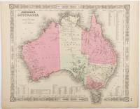
Johnson and Ward. Circa1865. Hand coloured map 32.3 x 39.7 x cms including the decorative border; 35.6 x 45.8 cms sheet key to major centres unrelated text on verso sheet age toned in very good condition. Detailed map from the leading mid 19th Century American firm of Johnson and Ward. Although Tasmania was known as such from 1856 the map refers to "Van Diemen Land". . Johnson and Ward. unknown
Referentie van de boekhandelaar : 214355
|
|
|
[AUTOMOBILE TRAVEL -- LONG ISLAND, NEW YORK MAPS].
Hammond’s new road map of Long Island New York. Special features: quality of roads road names city and village street names interurban electric lines. . . .
New York: C.S. Hammond & Co. Schum Bros. Stationers and Printers 1913. 12mo. 3.5 x 7.5 double-sided colour lithograph map which folds out to 25.25 x 16.5 in. on 28 x 17.75 in. sheet very light dustsoiling slight shelfwear very slight age toning along the folds. Original printed gray-blue pocket portfolio folder blue lettering on recto & verso added affixed label of Schum Bros. over imprint minor age toning still a VG bright clean map. First edition thus of this very scarce Brass Era automobile travel map depicting Manhattan and portions of Long Island from Brooklyn across to Smithtown and Great River. Verso Map includes Long Island fro Great River up to Darlington across to Truman Beach and Bridgehampton with two inset maps: “Contination of North Shore†and “Continuation of South Shore†with “Good Roads†and “Fair Roads†differentiated as well as depiction of the Long Island Railway line and red dots tracing the electric interurban lines. As early as 1906 Hammond & Co. had produced a map for Good Roads enthusiasts and motorists but this updated issue documenting the improved roads was issued in 1913 and then regularly from 1914-1925. No copies in Worldcat. C.S. Hammond & Co., Schum Bros., Stationers and Printers, unknown
Referentie van de boekhandelaar : 63117
|
|
|
[AUTOMOBILE TRAVEL -- MAPS]. LYNCH, FCC (Dir); STEWART, Charles & CORY, WW (Minister & Dep Minister). F C C W W
Sectional map indicating main automobile roads between Canada & United States: Atlantic Sheet; Great Lakes Sheet; Middle West Sheet; Pacific Sheet. . . .
Ottawa ONT: Natural Resources Intelligence Service 1928-1929. Four large folding colour maps. atlas folio w/ largest sized 45 x 35 in. w/ each sheet including an index map indicating there are 4 in total with outlines fold creases as issued minor age toning to fore-edges a few minor closed tears at fold creases still a VG set of maps. Early printing of this four sheet map depicting the automobile roads connecting Canada and the United States during the 1920’s as the Good Roads Movement rapidly expanded through the Northern Country following World War I. These maps depict the burgeoning highway and national road system which had been fostered by urban centers attempting to convince rural municipalities to replace their seasonal dirt roads with those of gravel or crushed stone and facilitate much greater movement of agricultural and manufacturing products across the continent and with the U.S. The Atlantic map stretches from the maritime provinces down to Washington D.C. and over to Niagara Falls and Buffalo NY; The Middle West map documents the main automobile roads and highways from Port Albert to Port Arthur and South from Denver to St. Louis indicating provincial federal and state roads and highways; The Great Lakes section tracks the extensive network of roads and highways surrounding the Great Lakes including those in Iowa Kentucky Wisconsin New York and the Canadian provinces of Quebec and Ontario; while the Pacific Map records the highways from San Francisco to Denver and up through Alberta and over to British Columbia. Uncommon with all four maps present. See: J.I. Little Confronting Rural Localism: The Good Roads Movement in Quebec’s Eastern Townships 1897-1920 Social History/Histoire sociale Vol. 57 No. 117 May 2024. Natural Resources Intelligence Service, unknown
Referentie van de boekhandelaar : 62600
|
|
|
[AUTOMOBILE TRAVEL -- MAPS].
Travel Oregon Coast Highway U.S. 101: In all the World no drive like this no tolls in Oregon. . . .
Marshfield OR: Oregon Coast Highway Association 1938. 4to. 16 pp unpaginated. numerous text illustrations double-page centerfold map by T.J. Greene small closed tear minor creasing self-printed photo-illustrated colour-softcovers center crease and printed in double-columns for folding slight soiling front cover still VG- copy w/ small rubber stamp of Breakers Motor Apts. Crescent City California on front cover. First edition thus of this automobile and bus travel tour guide to the newly completed US Highway 101 which finally had completed paved highway and bridges including the iconic Yaquina Bay bridge designed by Conde B. McCullough. Throughout the 1930’s with substantial support from the WPA and PWA projects as well as the U.S. Bureau of Public Works the highway became a scenic continuous drive. Oregon Coast Highway Association, paperback
Referentie van de boekhandelaar : 60338
|
|
|
[AUTOMOBILE TRAVEL --MAPS].
Washington-Oregon highway Map. The leader gasoline 76. Union Oil Company.
Chicago: Rand McNally Co. ca. 1938. Large colour map 26.5 x 19.5 in. which folds into 12 sections w/ several inset colour maps on verso colour-illustrated Art Deco cover art of couple driving from the front & back advertising Triton Oil minor shelfwear some dustsoiling still VG map. First edition thus including large Highway map on one side of Washington & Oregon along with smaller inset maps for Portland Everett Salem Seattle Spokane and Tacoma before World War II. Rand McNally Co., unknown
Referentie van de boekhandelaar : 49584
|
|
|
[AVIATION -- MAPS].
BEA international route maps. . . .
London & Paris: British European Airways 1949. 4to. 20 pp unpagianted. colour-illustrated maps and red & black text throughout. Self-printed colour-illustrated maps w/ ad for BP Aviation Service and Anglo-Iranian Oil Co. Ltd. on back cover Dunlop tire ad verso of front center crease fold as issued w/ original BEA sleeve from the library of Archibald Angus MacDonald 1892-1977 stepson of famed southern California oil man William F. Byrne as well as oil company and drilling equipment owner and manager of MacDonald & Burns Oil Producers. First edition of this surprisingly scarce BEA route map book issued following World War II and prior to the establishment of the Western US UK and French Zones into the Federal Republic of German and the Soviet Zone into the German Democratic Republic East Germany. In 1946 BEA was established to feed short commuter flights across Europe and until 1950 used a fleet of Douglas DC-3 aircraft based out of Croydon and Northold Airports moving to Heathrow in 1950. No copies in Worldcat. British European Airways, unknown
Referentie van de boekhandelaar : 62765
|
|
|
[AVIATION].-
Aeroplanes in six different positions.-
Oilettes after the Original Drawings by G.T. CLARKSON. Raphael Tuck & Sons. London. Paris & New York. s.d. (vers 1914). 6 belles cartes postales couleurs représentant chacune une position d'aéroplane en plein vol dans leur rare pochette d'origine (un peu passée). Cartes à l'état neuf.|Les mêmes sans la pochette: 250FF.
Referentie van de boekhandelaar : ORD-638
|
|
|
[AVRIL Paul ]
Curiosa : 10 cartes postales illustrées
0 En feuilles
Referentie van de boekhandelaar : 016274
|
|
|
[BAGDAD ARCHAEOLOGICAL CITY GUIDE and HUGE CITY MAP].
Baghdad [Archeological city guide with huge city map]. Foreword by Isa Salman (Director General of Antiquities).
Fine English Paperback. Roy. 8vo. (23 x 14 cm). In English. 29 p., color ills., a huge map (not opened). Baghdad [Archeological city guide with huge city map]. Foreword by Isa Salman (Director General of Antiquities). Very detailed modern guide including architectural works in Baghdad: Historical shrines, mausoleums and mosques, churches, monuments, etc.
|
|
|
[BEARN].-
Carte du Ministère de l'Intérieur au 1/100.000e, feuille, XI-35 : PAU.
P., Hachette, 1924, feuille repliée sous une couverture cartonnée in 12 ; carte en couleurs.
Referentie van de boekhandelaar : 63405
|
|
|
[Beauce ; Cartes à jouer ; Pays chartrain] GARNIER, Jacques-Marin
Histoire de l'imagerie populaire et des cartes à jouer à Chartres : suivie de recherches sur le commerce du colportage des complaintes, canards et chansons des rues / par J.-M. Garnier
Chartres, Imprimerie de Garnier 1869 In-8 20 x 13 cm. Broché, couverture grise, titre en noir sur le dos et le premier plat, VIII-450 pp., notes en bas de page, bandeau, lettrines, culs-de-lampe,50 gravures hors-texte, table des matières, catalogue éditeur in fine, 16 pp. Couverture poussiéreuse, intérieur frais.
Referentie van de boekhandelaar : 105243
|
|
|
[BEIJING TOURIST MAPS, POSTCARDS AND BROCHURES].
Beijing 1970s Travel Ephemera. Six Items.
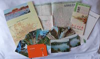
Beijing. 1970s. Collection of six items. <br> <br>Two postcard sets by the Peking Post Office: <br>北京风光 Bei jing feng guang: 8 postcards. <br>北京风景 Bei jing feng jing: 9 postcards. <br>Both in original envelope 8 x 15cm. <br> <br>Two copies of the large colour folding map "北京游览图 Beijing Youlantu" showing with detailed maps of major tourist destinations and bus routes in Beijing. Text in simplified Chinese characters 73 x 51cm folded 18 x 12.5cm. One in original paper case. <br> <br>A trifold brochure with colour map of Beijing text in English 25 x 12cm. <br> <br>"Visitors Guide to Peking" booklet in stapled wrappers folding maps one at rear and another loosely inserted 43pp 23.5 x 10.5cm. Prepared by members of the Australian Embassy for Australian tourists in Beijing. <br> <br>Some minor wear at extremities overall in very good condition. . unknown
Referentie van de boekhandelaar : 223347
|
|
|
[BELLIN , JACQUES-NICOLAS]. (CARTOGRAPHER).
Carte de La Baye d'Hocsieu et des Entrées de La Rivière de Chang.
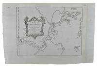
Paris. Circa1749. Engraved map on watermarked laid paper 20 x 27.3 cm of Fuzhou and coastline of Fujian Province original folds designed by the great French cartographer Jacques-Nicolas Bellin. This map is from the impressive 15-volume "Histoire Génèrale des Voyages" compiled by Antoine François Prévost map no. 2 Vol. 6. This map shows the estuary of Yangtze River Rivière de Chang. Very light browning on sheet edges but in very good condition. . unknown
Referentie van de boekhandelaar : 136827
|
|
|
[BELLIN, JACQUES NICHOLAS] (CARTOGRAPHER).
Carte de L'isle de Cheu-Chan ou Isle de Chusan de la Province de Che-Kiang Avec les Costes et Isles voisines.
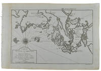
Paris. circa1749. Black and white engraved map on watermarked laid paper 20.9 x 32.7cm showing coastal area of Zhejiang Province Province de Che-kiang including Zhoushan Archipelago Isle de Chusan Zhoushan Bay Bay de Chusan and Xiangshan County Siang-chan-luen a walled city outside of upper border Ningbo Ning-po prefecture under Qing administration title cartouche lower left original folds. This map is No. 3 Vol. 6 from the impressive 15-volume "Histoire Generale des Voyages" compiled by Antoine François Prévost. Even browning mainly to the sheet edges in very good condition. . unknown
Referentie van de boekhandelaar : 136826
|
|
|
[BELLIN, JACQUES-NICOLAS]. (CARTOGRAPHER).
Carte De La Baye De Chin-Chew ou Chang-Chew.
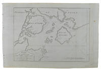
Paris. circa1749. Black and white engraved map of Quanzhou and Zhangzhou 21.1 x 30 cm here spelled Chin-chew and Chang-chew and both final words with added superscript "ou" on watermarked laid paper 25.6 x 38 cm original folds a few marginal spots simplified compass rose and a decorative fleur de lis bottom right in very good condition. Attractive map including the estuary of Quanzhou River Xiamen Emowi and Kinmen or Quemoy Quemowi island. The map was designed by the eminent French cartographer Jacques-Nicolas Bellin and here published as plate No. 22 in the impressive 15 volume compilation of voyages "Histoire Generale des Voyages" by Antoine François Prévost. . unknown
Referentie van de boekhandelaar : 136795
|
|
|
[BELLIN, JACQUES NICOLAS] (CARTOGRAPHER).
Carte de L'entree de la Riviere de Canton. Dressee sur les Observations les plus recentes.
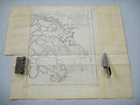
Paris. circa1749. Black and white engraved map on laid paper showing entrance to Pearl/Canton river Macao and the area which would become Hong Kong Sinn-gan-hien folded designed by the prominent French cartographer Jacques-Nicolas Bellin. This map is No. 16 Vol. 5 from the impressive 15-volume "Histoire Generale des Voyages" compiled by French novelist Antoine François Prévost. The walled city of Canton upper section is divided into areas of Tartar and Chinese. <br> <br>Some light even browning on paper added at margins good copy. Map measures 25.7 x 20.5. . unknown
Referentie van de boekhandelaar : 136781
|
|
|
[BELLIN, JACQUES-NICOLAS]. (CARTOGRAPHER).
Plan De la Ville De Peking.
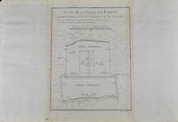
Paris. circa1749. Black and white engraved plan map of Peking on laid paper folded designed by the prominent French cartographer Jacques-Nicolas Bellin. This map is No. 18 Vol. 5 from the impressive 15-volume "Histoire Generale des Voyages" compiled by French novelist Antoine François Prévost. This city map shows two areas of walled cities: Ville Tartare Imperial city and the Forbidden City and Ville Chinoise ethnic Han residential area. <br> <br>Notes A and B represents buildings within the Forbidden City. A: Lieu de Plaisance ou l'on voit une Montagne faite a la main B: Grandes Cours du Palais de l'Empereur. Two missionary buildings French and Portuguese as well as the Tower of Mathematics illustrated within Ville Tartare. Two temples illustrated side by side near the south gate of the Ville Chinoise. <br> <br>Overall in good condition very light browning on edges and darker toning along the borders of the map. Text in French. Map measures 21 x 16.4cm. . unknown
Referentie van de boekhandelaar : 136794
|
|
|
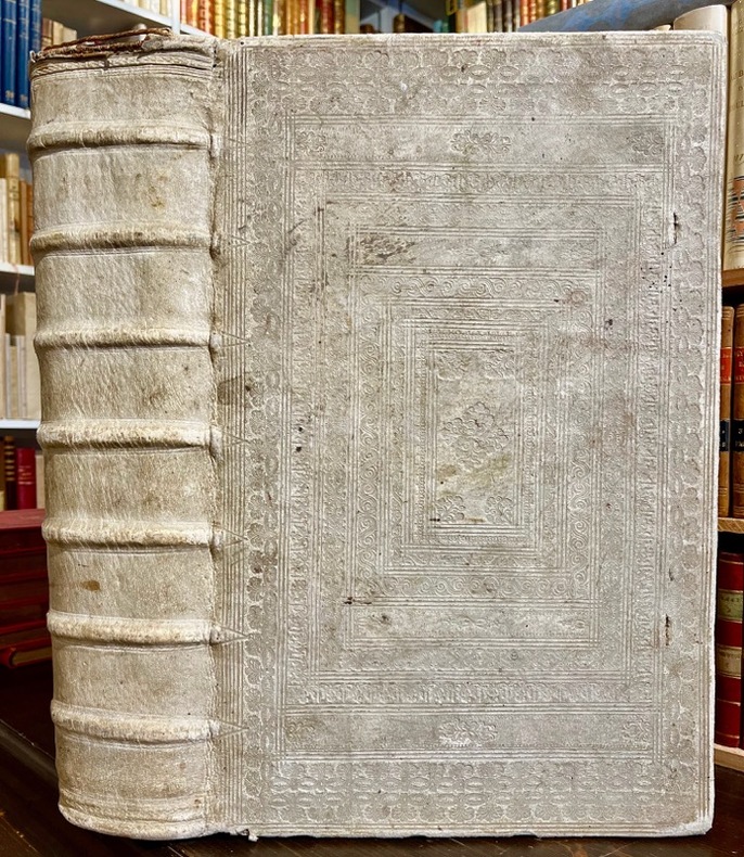
[BIBLE DE GENEVE]; DESMARETS Samuel:
La sainte Bible, qui contient le Vieux et le Nouveau Testament : édition nouvelle, faite sur la version de Genève, reveuë et corrigée, enrichie, outre les anciennes notes, de toutes celles de la Bible flamande, de la plus-part de celles de M. Diodati, et de beaucoup d'autres, de plusieurs cartes curieuses, et de tables fort amples, pour le soulagement de ceux qui lisent l'Escriture sainte. Le tout disposé en cet ordre, par les soins de Samuel des Marets […] et de Henry des Marest, son fils [...].
A Amsterdam, Chez Louys & Daniel Elsevier, 1669. 4 parties en 2 tomes reliés en un volume in-folio, plein vélin estampé à froid, sur ais de bois. Traces d'attaches. [42]-366 ; [2]-162 ; [2]-202 ; 70 feuillets imprimés sur deux colonnes. *4; a-e6 ; f8; A-Z6 ; Aa-Zz6 ; Aaa-Ppp6 [et] A-Z6 ; Aa-Cc6 ; Dd8 [et] *2 ; A-Z6 ; Aa-Kk6 ; Ll4 [et] A-L6 ; M4.
Referentie van de boekhandelaar : 18982
|
|
|
[BILLANCOURT].-
Sortie des ouvriers des Usines Renault.-
Carte postale E.M. 1431. Vers 1905. Carte postale (140 x 91mm) timbrée sur le recto (timbre presque entièrement déchiré). Vue très anîmée des bâtiments avec une grande foule d'ouvriers. Bon exemplaire.
Referentie van de boekhandelaar : ORD-1167
|
|
|
[BLOCQUEL (Simon)]
Les Tours de Cartes les plus amusans, rendus faciles par un grand nombre de figures gravées.
1840 cartonnage modeste. in-16, titre, p.15 à 100, 9 planches comprenant 49 figures plus une sur le titre comprises dans la pagination, gravées sur bois. P. Delarue Lille Castiaux (ca. 1840)
Referentie van de boekhandelaar : 14296
|
|
|
[BORDEAUX]. DELPECH (Ernest).
Nouveau plan de la ville de Bordeaux à l'usage des promeneurs. Dressé d'après les documents les plus récents fournis par les administrations publiques par Ernest Delpech, employé aux travaux publics
Bordeaux, Féret [Imprimerie centrale de Vve Lanefranque], 1870 in-12, [2] ff. n. ch. (réclames), 32 pp. de texte (tableau des voies), [3] ff. n. ch. (réclames), avec un grand plan dépliant (58 x 73 cm) aux contours rehaussés de couleurs, toile chagrinée cerise, dos lisse muet, encadrements à froid sur les plats, titre et armes de Bordeaux poussés au centre du plat supérieur (reliure de l'éditeur).
Referentie van de boekhandelaar : 242581
|
|
|
[BOURDIN] [CARTES POSTALES ANCIENNES]
Le Riz d'Indo-Chine
Sans lieu, 1931. 1 ensemble de 6 cartes postales anciennes représentant les activités liées à la culture du riz en Indo-Chine.
Referentie van de boekhandelaar : 12245
|
|
|
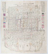
[BOXER REBELLION MAP OF BEIJING].
Map of Peking. 京城內外全圖 .Jing cheng nei wai quan tu.
Circa1900. Large illustrated map of Beijing showing the city in the period following the invasion of the military forces of the Eight National Alliance old folds scale not given. Some scattered light foxing particularly at edges short closed tear at fold lower edge neat non acidic tape repair short section upper edge wear along folds and a couple of small unobtrusive holes with minor image loss. Blocks of text in traditional Chinese right and left upper sections stating each nation's occupied zone Japanese text title accompanies the English title along the upper section of the map. 63.7 x 56.9cm. Very good overall. A rare and significant large Japanese woodblock map of Peking Beijing issued just after the suppression of the Boxer Rebellion. Centred on the Forbidden City the map depicts Peking following the multinational suppression of the Boxer Rebellion or Yihetuan Movement of 1900. The map was issued to illustrate the areas of occupation associated with each of the powers in the Eight Nation Alliance. <br> <br>The map gives measurements of the city walls detailed names of streets and buildings and the boundaries of the inner and outer city including the forbidden city are shown with demarcation lines in pink yellow and blue. The hand coloured eight national flags of the occupation powers are featured at the right and left. <br> <br>This map is essentially a later edition of 京城内外首善全圖 a map of Beijing issued by the Qing for administrative purposes in the mid-19th century. The Japanese seized the wood blocks during the suppression of the Rebellion and subsequently pulled new impressions overprinting them additional details including flags and demarcations of areas of the city held by members of the Alliance. Versions are known in French German Japanese and as with the present example English. An attractive map of great historical interest. . unknown
Referentie van de boekhandelaar : 169765
|
|
|
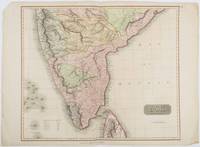
[BRITISH INDIA AND CEYLON - MAP] NEELE, SAMUEL JOHN (ENGRAVER)
British India Southern Part.
London.: Thomson. 1816. Engraved map with full handcolour 50.5 x 59.7 cms ; 53.9 x 73.8 cms sheet central fold a few minor edge tears one intruding into the top border the map unscathed marginal edgewear two corners with some loss but the map in very good crisp condition. An elegant map with great detail prepared for John Thomson's influential "New General Atlas" 1814-1821. Showing India from 20 degrees to 7 degrees north of the equator and includes the northern half of Ceylon with territorial interests attractively coloured. . Thomson. unknown
Referentie van de boekhandelaar : 185242
|
|
|
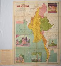
[BURMA - MAP]
Latest Map of Burma. Political showing relief of land.
Delhi.: S.B. Makhija & Brothers. circa1951. Printed colour map 98.6 x 69 cms folding into pictorial wrappers 25.3 x 19.5 cms five pictorial colour inserts of pagodas and the Shwethalyaung reclining Buddha wrappers a little chipped marginal wear and three small fold splits in the map but overall in very good condition. Attractive large map of Burma with the provinces coloured steamship routes shown in red and printed in the booklet a range of information printed based on the 1951 census including climate agriculture and form of government "Burma became an independent nation completely outside the British Empire on January 4 1948 and is now a sovereign independent republic known as the Union of Burma". . S.B. Makhija & Brothers. unknown
Referentie van de boekhandelaar : 214601
|
|
|
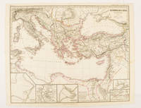
[BYZANTINE EMPIRE - MAP]. SPRUNER, KARL AND MENKE, THEODOR
Oströmisches Reich zu Justinians Zeit.
Gotha.: Justus Perthes. Map with original colour and outline hand-colour 32.2 x 40 cm text in German five inset maps central fold slight marginal toning and spotting on the verso but in very good condition. A most handsome and highly detailed map detailing the Eastern provinces of the Byzantine/Roman Empire in the time of the Roman Emperor Justinian 527-565. The inset maps depict Carthage Rome Constantinople Naples and a Western continuation of the main map originally issued for the "Hand-Atlas für die Geschichte des Mittelatters und die Neueren Zeit" . Justus Perthes. unknown
Referentie van de boekhandelaar : 174950
|
|
|
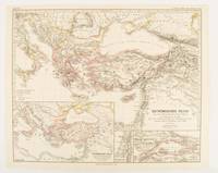
[BYZANTINE EMPIRE - MAP]. SPRUNER, KARL AND MENKE,THEODOR
Oströmisches Reich von der Einwanderung der Ungarn in Ponnonien um 895 bis zur Unterwerfung des Bulgarenreichs durch Kaiser Basilius im J. 1019.
Gotha: Justus Perthes. 1874. Map with original colour and outline hand-colour 32.2 x 40 cm three inset maps text in German central fold slight marginal toning in very good condition. A most handsome map detailing the Eastern Roman Empire from the immigration of Hungarians in Ponnonia around 895 to the subjugation of the Bulgarian Empire by Emperor Basilius in 1019. The inset maps depict Divisions of the Empire Palestine and the Themata around Propontis present day Sea of Marmara issued for the "Hand-Atlas für die Geschichte des Mittelatters und die Neueren Zeit". . Justus Perthes unknown
Referentie van de boekhandelaar : 174914
|
|
|
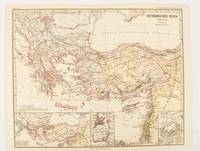
[BYZANTINE EMPIRE - MAP]. SPRUNER, KARL AND MENKE, THEODOR
Oströmisches Reich 1096-1204
Gotha: Justus Perthes. 1876. Map with original colour and outline hand-colour 32.2 x 40 cm text in German four inset maps central fold slight marginal toning and spotting on the verso but in very good condition. A most handsome and highly detailed map detailing the Eastern provinces of the Byzantine/Roman Empire before the Fourth Crusade. The inset maps depict Constantinople Divisions of the Empire and Antioch issued for the "Hand-Atlas für die Geschichte des Mittelatters und die Neueren Zeit" . Justus Perthes unknown
Referentie van de boekhandelaar : 174911
|
|
|
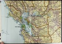
[California]. [Maps]. Heald, Ralph P, compiler
Heald-Menerey's Geographical Commercial and Recreational Map of California
San Francisco and Los Angeles: The Heald-Menerey Company 1928. Very good. Large color map measuring 44 x 64 inches cut into eight sections and folded into book form. Original black limp textured cloth yapp edges titled in pale yellow on front cover. Moderate edge wear titles on front cover almost completely worn away. Internally clean. A rare portable version of the large and impressive Heald-Menerey's Geographical Commercial and Recreational Map of California produced in the late-1920s. According to the sheet of instructions bound before the map: "The first of its kind ever devised for desk home or automobile use. It consists of the California Survey 44 x 64 inches in size cut into eight strips and folded to make a book of 64 pages. Page No. 1 is the extreme northwest corner of our Survey and page No. 64 is the extreme southwest corner." The instructions proceed to inform the user on how to locate points on the map given its form as a book. The verso of the instructions page is a county index keyed to the pages of the map. The cover title begins "California Survey" but the remainder is rubbed beyond readability.<br /> <br /> The map was produced by the Schmidt Lithograph Company of San Francisco. The legend of the map contains symbols representing roads trails railroads streams springs swamps aqueducts lighthouses county and state boundary lines national forests mountain peaks township and range lines base and meridian lines and more. There are also two inset maps - one showing San Francisco and vicinity and the other Los Angeles and its immediate surroundings. OCLC records just a handful of copies of this book-form map published between 1928 and 1933. The Heald-Menerey Company unknown
Referentie van de boekhandelaar : 2443
|
|
|
[CALIFORNIA -- MAPS]. [WHITE, Albert C, VINCENZ, Jean L]
Land use district maps adopted by ordinance No. 2491 of the City of Fresno California. City Planning Commission. . . .
Fresno CA: City Planning Commission 1938. Oblong folio. 13.5 x 9.25 in. 17 blueprint maps variously numbered. w/ first map as the Key Map for the remainders. Stapled at gutter margin w/ protective green-tinted back softcover folded to provide reinforcement at spine from the library of George Reed Volker 1925-2018 former World War II pilot and urban planner in California New York and Washington State. First editions of these exceedingly scarce land use district zoning maps drawn up in 1938 after the passage of the 1937 Housing Act which unfortunately upended much of the spending not only by the WPA but also required any federal money to spent in “blighted†areas. These detailed maps show major streets demarcate singe family housing multi-family housing manufacturing and commercial bases for the community. Eventually the Public Housing which was built in Fresno during World War II began in West Fresno or “Chinatown first with the Sequoia Courts and later the Sierra Plaza followed by others. No copies located in Worldcat; See: Bibliography of Research Projects Reports W.P.A. Technical Series Research and Records Projects Bibliography No. 1 Feb. 2 1940 p. 53 Zoning Ordinance. City Planning Commission, paperback
Referentie van de boekhandelaar : 56963
|
|
|
[California] [Maps] [Eaton Fire]
MAP OF ALTADENA-PASADENA AND VICINITY
Atladena California: Altadena Federal Savings and Loan Association 1960. Printed on both sides on an 18 1/2" x 23 1/2" sheet of white paper that folds to 4" x 9 1/4" 24 panels. There is printing in red and a color rendering of the Altadena Federal Savings building on one side. Handwritten name on the front panel; else near fine. Scarce OCLC locates no holdings.<br /> <br /> Fully indexed street map of the unincorporated Los Angeles County California community that was devastated by the Eaton Fire in January 2025. Situated next to and within the foothills of the San Gabriel Mountains Altadena has long resisted annexation to Pasadena though that city has taken 46 "bites" of it over the years seeking tax revenues. That independent spirit is reflected in the mosaic of ethnic diversity that made Altadena one of the most integrated communities in Southern California. Altadena Federal Savings and Loan Association unknown
Referentie van de boekhandelaar : 78704

|
|
|
[California] [Maps]
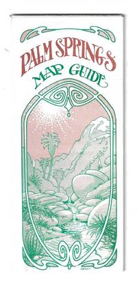
PALM SPRINGS MAP GUIDE
Orange and Palm Springs California: Ken and Ruth Du Maurier The Palm Springs Map Guide 1976. Tourist map to the desort resort city in Riverside County California. In addition to a large street map of Palm Springs there are smaller maps of the city bus route Cathedral City and the Coachella Valley respectively. Also provides a list with addresses of movie star and celebrity homes a brief history of the region a description of the picturesque canyon areas and descriptive lists of local shops restaurants hotels golf courses activities service stations etc. Features photographic illustrations and numerous advertisements. Printed in green and desert rose on a 30" x 25 1/2" sheet of white paper that folds to 3 3/4" x 8 1/2" 48 panels. A fresh and clean example. Scarce OCLC locates only one holding at the Library of Congress. Ken and Ruth Du Maurier, The Palm Springs Map Guide unknown
Referentie van de boekhandelaar : 78705
|
|
|
[CAMPAGNE DE 1757]:
1. Mémoires pour servir à l'histoire des campagnes de 1756 et 1757 en Allemagne, par L. O. H., rédigés et augmentés par M. D. V. [avec] 2. Mémoires pour servir à l'histoire de la campagne des troupes françaises, depuis la convention de Closter Seiven faite en septembre 1757. Augmentée d'un lettre communiquée par l'observateur hollandais par rapport à la ditte convention. [avec] 3. Histoire de la campagne de MDCCLVII. Où l'on voit les circonstances qui ont précédé, accompagné, et suivi la battaille de Rosbach, avec le détail de ce qui s'est passé d'important dans l'Éléctorat d'Hannovre, depuis la convention de Closter-Seven jusqu'au 1 janvier 1758.
A Francfort et Leipsig, aux dépens de la Compagnie, 1758. In-8 de [4]-48 ; 32; 96-64 pages, demi-vélin à coins, titre inscrit à la plume sur le dos. Non rogné.
Referentie van de boekhandelaar : 21322

|
|
|
[CANAL DE SUEZ] Maclure & Macdonald Lithographers to the Queen London
LITHOGRAPHIE ORIGINALE : "A BIRD'S EYE VIEW OF THE SUEZ CANAL" , supplément gratuit du Journal "THE GRAFFIC" du 2 Septembre 1882, Maclure & Macdonald Lithographers to the Queen London,
London THE GRAFFIC 1882 broché une Vue lithographique en couleurs, Format : 26.7 x 10.25 inches ( 83 x 31 cm), supplément gratuit du Journal "THE GRAFFIC" du 2 Septembre 1882, Maclure & Macdonald Lithographers to the Queen London,
Referentie van de boekhandelaar : 28302
|
|
|
[Carte BLONDEL]
Carte FRANCE POLITIQUE, EMPIRE FRANCAIS, ZONE d'OCCUPATION en ALLEMAGNE
Une belle carte en couleurs, format ouvert 910 x 695 mm, éditée en 1931, Blondel La Rougery Editeur, bon état
Referentie van de boekhandelaar : LFA-126737235
|
|
|
[Carte d'Etat-Major]
CARTE d'ETAT-MAJOR : AUTUN
Carte géographique format ouvert 675 x 430 mm, éditée au début du XXe siècle, bon état
Referentie van de boekhandelaar : LFA-126714583
|
|
|
[Carte d'Etat-Major]
CARTE d'ETAT-MAJOR : RODEZ
Carte géographique format ouvert 675 x 430 mm, éditée au début du XXe siècle, bon état
Referentie van de boekhandelaar : LFA-126714593
|
|
|
[Carte de Dion-Bouton]
CARTE de DION-BOUTON I : NORD-OUEST PARIS
Carte géographique toilée format ouvert 660 x 640 mm, éditée au début du XXe siècle, bon état
Referentie van de boekhandelaar : LFA-126714596
|
|
|
[Carte de Dion-Bouton]
CARTE de DION-BOUTON II: NORD-EST PARIS + ALGERIE
Carte géographique toilée format ouvert 660 x 640 mm, éditée au début du XXe siècle, bon état
Referentie van de boekhandelaar : LFA-126714595
|
|
|
[CARTE de la HAUTE SAONE]
Département de la Haute Saône. décrété le 5 février 1790 par l'Assemblée Nationale
,
Referentie van de boekhandelaar : 239285
|
|
|
[Carte manuscrite] Pierroy (Capitaine)
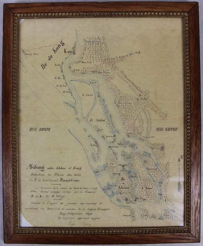
Mékong entre Khône et Kong [Khong]. Réduction au 1/80000 des levés de M. le lieutenant Forestier. Croquis à l’appui du journal des marches et opérations du Bataillon de marche de la Légion étrangère.
Kong, 30 septembre 1893 Carte dessinée en couleurs 42,5 X 35 dans son cadre argenté. Bel état. Rare croquis exploratoire de ce secteur des Quatre mille îles du Mékong dont le franchissement nécessitera la construction d’une ligne de chemin de fer. L’officier reporte l’itinéraire de sa colonne de Hach-Ki-Koaï à Kong [Khong] et les anciens ouvrages édifiés par les Siamois.
Referentie van de boekhandelaar : 31781
|
|

 De zoekresultaten per email ontvangen
 Zoekresultaten downloaden als PDF
 RSS feed
 Permanente link


