|
VV.AA.
ATLAS DE BOLSILLO DE CARRETERAS. RF ALEMANIA 1:800.000.
|
|
|
VV.AA.
ATLAS DE BOLSILLO DE CARRETERAS. SUIZA 1:300.000.
|
|
|
VV.AA.
ATLAS DE BOLSILLO DE CARRETERAS. TORSCANA 1.300.000.
|
|
|
VV.AA.
CARRETERAS DE EUROPA. ALEMANIA OCCIDENTAL.
|
|
|
VV.AA.
CARRETERAS DE EUROPA. AUSTRIA.
|
|
|
VV.AA.
CARRETERAS DE EUROPA. DINAMARCa.
|
|
|
VV.AA.
CARRETERAS DE EUROPA. ESPAÑA NORTE.
|
|
|
VV.AA.
CARRETERAS DE EUROPA. ESPAÑA SUR.
|
|
|
VV.AA.
CARRETERAS DE EUROPA. FRANCIA MERIDIONAL.
|
|
|
VV.AA.
CARRETERAS DE EUROPA. ITALIA.
|
|
|
VV.AA.
CARRETERAS DE EUROPA. PORTUGAL.
|
|
|
VV.AA.
CARRETERAS DE EUROPA.SUIZA.
|
|
|
VV.AA.
Cuadernos de Estudios Caspolinos. Número XI. (Agustín Hernando: Cuatro muestras de la Cartografía Histórica de Caspe; Gabriel Albiac Sebastián: Nonaspe y sus habitantes, 1713 - 1800, entre otros artículos).
Caspe, 1985. 4to.; 203 pp. Ilustraciones fotográficas y la reproducción de un plano en lámina plegada. Cubiertas originales.
|
|
|
VV.AA.
Geographicalia. Revista del Departamento de Geografía de la Universidad de Zaragoza. Número 19 - 20. ( María Teresa Echeverria Arnedo: El valle del río Aguasvivas. Estudio geomorfológico; José María Serrano Martinez: Bienes de rango elevado en el comercio al por menor. Lugares centrales equipados en la región de Murcia; Severino Escolano Utrilla y Francisco J. Serón Arbeloa: Cartografía automática. El trazado de mapas en perspectivas tridimensionales).
Zaragoza, 1983. 4to. mayor; 141 pp. Mapas y gráficos. Cubiertas originales.
|
|
|
VV.AA.
GUIAS-MAPAS DE CARRETERAS DE ESPAÑA Y PORTUGAL Nº3 ( EN 14 MAPAS PLEGABLES).
|
|
|
VV.AA.
GUIAS-MAPAS DE CARRETERAS DE ESPAÑA Y PORTUGAL Nº5 ( EN 14 MAPAS PLEGABLES).
|
|
|
VV.AA.
GUIAS-MAPAS DE CARRETERAS DE ESPAÑA Y PORTUGAL Nº6 ( EN 14 MAPAS PLEGABLES).
|
|
|
VV.AA.
GUIAS-MAPAS DE CARRETERAS DE ESPAÑA Y PORTUGAL Nº7 ( EN 14 MAPAS PLEGABLES).
|
|
|
VV.AA.
MAPA DE CARRETERAS 1:1.000.000 ALEMANIA BELGICA PAISES BAJOS.
|
|
|
VV.AA.
MAPA DE CARRETERAS 1:3.000.000 AUSTRIA.
|
|
|
VV.AA.
MAPA OFICIAL DE CARRETERAS 2007.
|
|
|
VV.AA.
MAPAS DE CARRETERAS 1:1.000.000 SUIZA AUSTRIA.
|
|
|
VV.AA.
MAPAS DE CARRETERAS. ESCANDINAVIA MERIDIONAL 1:800.000.
|
|
|
VV.AA.
MAPAS DE CARRETERAS. EUROPA 1:3.500.000.
|
|
|
VV.AA.
MAPAS DE CARRETERAS. EUROPA 1:3.500.000.
|
|
|
VV.AA.
MAPAS DE CARRETERAS. GRECIA 1:800.000.
|
|
|
VV.AA.
MAPAS DE CARRETERAS. HUNGRIA 1:300.000.
|
|
|
VV.AA.
MAPAS DE CARRETERAS. ITALIA 1:800.000.
|
|
|
VV.AA.
MAPAS DE CARRETERAS. RIVIERA 1:300.000.
|
|
|
VV.AA.
MAPAS DE CARRETERAS. SUIZA 1:300.000.
|
|
|
VV.AA.
MAPAS DE CARRETERAS. TOSCANA 1:300.000.
|
|
|
VV.AA.
Pirineos. Revista del Instituto de Estudios Pirenaicos. Número 24. [Pierre Barrère: Evolution mécanique et nivation sur les versants calcaires de la haute montagne pyrénéenne; Manuel Lucas y María Rosario Miralbés: Una carta de paz entre los valles de Tena y Ossau (1646); Antonio Ubieto Arteta: Gonzalo, rey de Sobrarbe y Ribagorza; M Foncin: Cartographie française des Pyrénées, y otros textos].
Zaragoza, CSIC, 1952. 4to.; 214 pp. Ilustraciones y 16 láminas con mapas y fotografías. Cubiertas originales.

|
|
|
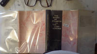
W Scott-Elliot, with 6 Maps, ,Preface, Fold out Map in Back & middle of bk, INNER DJ FLAP £ 150, NOT EX-LIBRARY 1 5
Story of Atlantis The & The Lost Lemuria BY W. Scott-Elliot IN DUSTJACKET 1968 SUNKEN CONTINENT with 2 fold out maps Lemuria a tropical continent at present lying below the level of the Indian Ocean According to Churchward Lemurians developed homes with transparent roofs
<p>HBDJ 1968 EARLY Edition VG/VG- AS-IS Original publisher's blue paper-covered boards pictorial dustjacket large 8vo: xij 108pp. fold-in map in Middle and in back footnotes bibliographical notes. Verynear fine copy.Octavo. 5.5 x 8.5 in. lived to be hundreds of years old and were capable of telepathy astral travel and teleportation.ATLANTIS they became greedy petty and "morally bankrupt" and the gods "became angry because the people had lost their way and turned to immoral pursuits" Orser says. As punishment he says the gods sent "one terrible night of fire and earthquakes" that caused Atlantis to sink into the sea.</p> LONDON, Illinois: Theosophical Publishing House, hardcover
Referenz des Buchhändlers : 30286
|
|
|
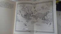
W Scott-Elliot, with 2 FOLD OUT Maps, ,Preface, Fold out Map in Back & middle of bk, BLANK ENDPAPER , Inner DJ FLap Price L
Story of Atlantis The & The Lost Lemuria BY W. Scott-Elliot IN Illustrated Pink & Black DUSTJACKET 1972 Revised Editionwith 2 FOLD OUT Maps SUNKEN CONTINENT Lemuria a tropical continent at present lying below the level of the Indian Ocean
<p>HBDJ 1972 Revised VG-/VG AS-IS Blue cloth lettered in White Interior Nice tight light Wear SOME INK NOTES AND UNDERLINING but has FoX Stains 108 pgs DJ light wear & SCUFFING Extremities DJ 8vo - over 51â„4" - 83â„4" with 2 FOLD OUT Maps</p><p>According to Churchward Lemurians developed homes with transparent roofs lived to be hundreds of years old and were capable of telepathy astral travel and teleportation. ATLANTIS they became greedy petty and "morally bankrupt" and the gods "became angry because the people had lost their way and turned to immoral pursuits" Orser says. As punishment he says the gods sent "one terrible night of fire and earthquakes" that caused Atlantis to sink into the sea.</p> LONDON, Illinois: Theosophical Publishing House, hardcover
Referenz des Buchhändlers : 30289
|
|
|
W.S. van Egmond, M. Mostert
Spelen in de Middeleeuwen over schaken, dammen, dobbelen en kaarten
Hilversum 2001 Verloren Soft cover 1st Edition
Referenz des Buchhändlers : 027476

|
|
|
W.T. Barber
Exploring the Marches and Borderlands of Wales
No marks or inscriptions. No creasing to covers, single crease to spine. A very clean very tight copy with bright unmarked boards and no bumping to corners. 223pp. The author's journeyings over an area of about twenty miles either side of the border from the Severn Estuary to the Dee and Chester. Illustrated.

|
|
|
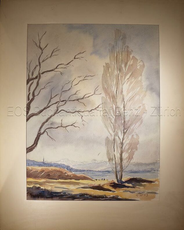
W.W.:
Zürichsee.
1953. Aquarell auf festem Papier. Blattgrösse: 36 x 30 cm.
Referenz des Buchhändlers : 634DG
|
|
|
W.W
Zürichsee.
1953. Aquarell auf festem Papier. Blattgrösse: 36 x 30 cm. + Wichtig: Für unsere Kunden in der EU erfolgt der Versand alle 14 Tage verzollt ab Deutschland / Postbank-Konto in Deutschland vorhanden +, bild
Referenz des Buchhändlers : 634DG

|
|
|
WACE, FB, ICS AND FC BOURNE, ICS F B I C S F C I C S
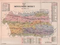
Punjab District Gazetteers. Montgomery District Part A.
Lahore.: Government Printing. Revised Edition. 1935. Four folding colour maps xi 311 pages 26.5 x 18 cms; original papered boards spotted and a trifle scuffed linen backstrip with paper title label worn; foredges and endpapers spotted a few leaves toned but on the whole in very good condition the maps particularly bright and clean. A remarkable association copy: the author Frederick Blyth Wace's copy with his inked initials to the front free endpaper and his humorous unpublished foreword tipped in opposite the preface together with a dedication leaf both in Wace's hand and his business card loose within. As a further dedication makes clear this copy was given by Wace's son a couple of his loose notes on scrap paper are included the eminent botanist Nigel Morritt Wace 1929-2005 late head of the Australian National University's department of Biogeography and Geomorphology in 2003 to his fellow academic and marsupial biologist Dr. Hugh Tyndale-Biscoe. Both Wace and Biscoe were born in India and began their schooling in Kashmir at the school founded by Tyndale-Biscoe's father a Christian missionary and for whom the school is named. <br> <br>From the collection of Hugh Tyndale-Biscoe. . Government Printing. hardcover
Referenz des Buchhändlers : 215892
|
|
|
Waddell, Jane
Hiking Trails II - Southeastern Vancouver Island: Area from Koksilah River Park to Mount Arrowsmith
56 pages. Average wear. Unmarked. Includes maps and much additional helpful information. Book
|
|
|
Wade, Frank
A Midshipman's War : A Young Man in the Mediterranean Naval War, 1941-1943
256 pages. Index. Bibliography. Black and white illustrations. "The author's first hand account is one of continous activity with great detail on all the actions fought and sinkings which occured. This is truly an historic book supported by maps, photographs and extensive data with a full index. There is much anecdotal material including an interview with the German submarine commander who sank the Barham and is now a resident of Canada." - from dust jacket. Book practically as new. Dust jacket in beautiful condition and now in archival-grade Brodart protective cover. Its spine is a different shade of green than that of the front and back panels. We do not know if this is by design or the result of sunning. Gift quality. Excellent copy. Book

|
|
|
WAGNER Mattaheus (1648 - LIpsia 1694)
Roma
Acquaforte e bulino, circa 1690. "In alto al centro lo stemma SPQR sormontato da una corona. Il prototipo iniziale per questo tipologia di panorami è identificabile nel panorama inciso dal Silvestre nel 1642 (si vedano tra l'altro i campanili di San Pietro all'epoca appena costruiti ed immediatamente dopo demoliti per ragioni statiche) e dunque raffigura Roma alla metà del '600. Gli edifici sono poco riconoscibili ed il Tevere segue un errato percorso sotto Trinità dei Monti. La stampa mostra un primo piano con colline ed alberi in controluce senza personaggi, e una legenda di 12 voci. Il nome dell'autore non è scritto sull'incisione ma solo sull'opera che non è stato comunque possibile reperire; non è chiaro neppure se il Wagner sia l'autore o l'editore. Incisa prima del 1694, anno in cui Wagner morì. Secondo alcuni studiosi l'editore potrebbe essere J. Wollf e la data di pubblicazione spostata a circa al 1710" (cfr. Marigliani p. 198). Buono stato di conservazione. Rara. Etching and engraving, circa 1690. In the top centre the SPQR coat of arms surmounted by a crown. The initial prototype for this type of panorama is identifiable in the panorama engraved by Silvestre in 1642 - see among other things the bell towers of St. Peter's that had just been built and immediately afterwards demolished for static reasons - and therefore depicts Rome in the mid 17th century. The buildings are hardly recognisable and the Tiber follows a wrong path under Trinità dei Monti. The print shows a foreground with hills and trees against the light without any characters, and a key-legend of 12 items. The name of the author is not written on the engraving but only on the title page, which could not be found anyway; it is not clear either if Wagner is the author or the publisher. Engraved before 1694, the year Wagner died. According to some scholars the publisher could be J. Wollf and the date of publication moved to around 1710" (cf. Marigliani p. 198). Good state of preservation. Rare. C. Marigliani, "Le Piante di Roma delle collezioni private", tav. 103.

|
|
|
Wagner, David L. ; California ; Division of Mines and Geology ; California.; Department of Conservation.
Geologic map of the San Francisco-San Jose quadrangle, 1990
Four large loose multi-color folded multi-paneled maps, 81 x 149 cm, and a four-page introductory pamphlet, in original printed envelope 31 x 25 cm. Uncommon. Contents: Sheet 1. Geologic map of the San Francisco-San Jose quadrangle, California, 1:250,000 / compilation by D.L. Wagner, E.J. Bortugno, and R.D. McJunkin -- sheet 2. Geologic map explanation of the San Francisco-San Jose quadrangle, California, 1991 -- sheet 3. Index to geologic maps used in compilation of the San Francisco-San Jose quadrangle, California, 1:250,000 -- sheet 4. Location map of rock samples dated radiometrically, San Francisco-San Jose quadrangle, California, 1:250,000 / compilation by T.A. Lindquist, J.D. Morgenthaler, and E.J. Bortugno. -- sheet 5. Map showing recency of faulting, San Francisco-San Jose quadrangle, California, 1:250,000 / compilation by E.J. Bortugno, R.D. McJunkin, and D.L. Wagner. || Geology -- California -- San Francisco Region -- Maps. Geology -- California -- Maps. Geology, Stratigraphic -- Maps. GÈologie -- …tats-Unis -- Californie (…tats-Unis) -- Cartes. Geology. Geology, Stratigraphic.
|
|
|
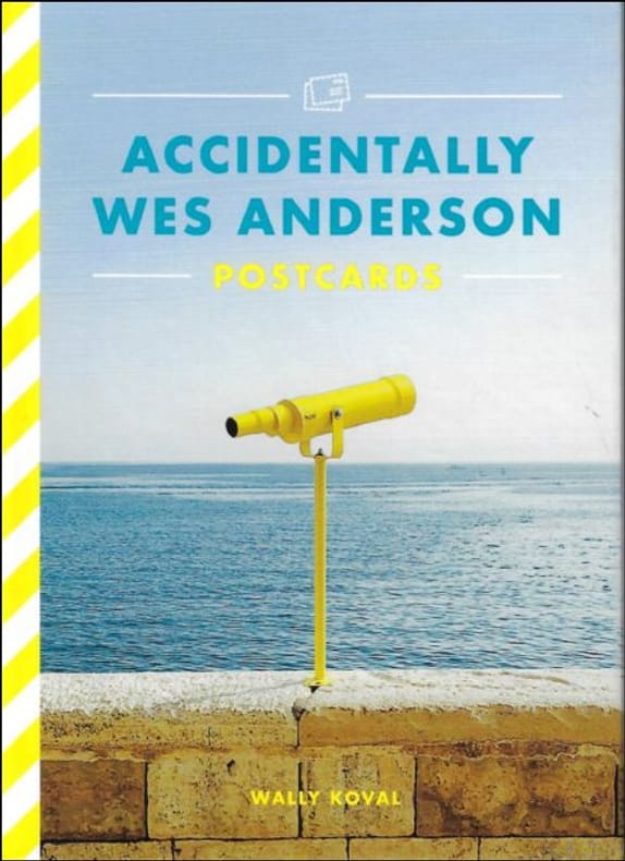
Wally Koval
ACCIDENTALLY WES ANDERSON : POSTCARDS
, Orion (Hachette), 2022 Card Book, ENG, 26 postcards in colour, 160 x 115 mm, NEW, from different places in the world,. ISBN 9781399608725.
Referenz des Buchhändlers : 60288
|
|
|
WALDMANN, René
La Grande Traboule
1991 - broché - Editions Lyonnaises d'Art et d'Histoire (ELAH) - Collection Entreprises et entrepreneurs en Rhône-Alpes, dirigée par Jacques Tournier, N° 2 - 1991 - In-8 (24 x 16 cm) broché - 243 pages - Cartes et photographies en couleurs et en noir et blanc - ISBN : 2-905-203-49-5 - Préface de Frédéric Dugoujon
Referenz des Buchhändlers : 1096

|
|
|
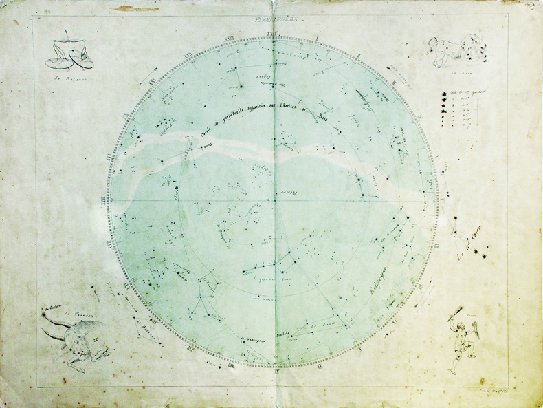
WALFFLÉ (Félix).
Planisphère.
[fin du XVIIIe siècle]. 43,5 x 55 cm, sur une feuille de 48 x 63,5 cm.
Referenz des Buchhändlers : LBW-6627
|
|
|
Walthéry François:
Vestiaire.
[Khani], sans date. Planche sur plastique, parfois annoncée comme "plaque de porte", au format 11 x 25 cm.
Referenz des Buchhändlers : 6245

|
|
|
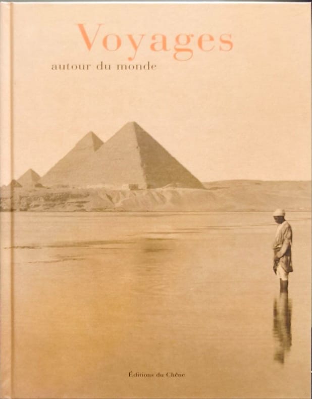
Walter Marc
Voyages Autour Du Monde
Editions du Chêne 2001 319 pages 21 4x4x28 4cm. 2001. Broché. 319 pages. Cet ouvrage est une anthologie littéraire du voyage illustrée de nombreuses photos et cartes postales des XIXe et XXe siècles. Il invite à redécouvrir de grands itinéraires ferroviaires et maritimes avec des escales à Suez ou Bombay et est ponctué d'extraits de textes d'écrivains et voyageurs
Referenz des Buchhändlers : 16579
|
|
|
Walch, Johannes
General Charte über die sämtlich Königlich Preussischen Staaten nach astronomischen Beobachtungen. [Altkolorierter Original-Kupferstich / original colored copper engraving].
o.J. Johann Walch, geboren am 25. November 1757 in Kempten, gestorben am 23. März 1815 in Augsburg. Deutscher Maler, Zeichner, Kupferstecher, Kartograph und Verleger. [4 Warenabbildungen]
Referenz des Buchhändlers : 12030DB

|
|
|
Waldburger, A
Plan von Ragaz mit Spaziergängen und den Anfängen der Wegmarkierung.
Ragaz 1909. 1 mehrfarb. Faltplan m. Textteil. 18x12 cm (35x45 cm). [2 Warenabbildungen]
Referenz des Buchhändlers : 6413

|
|

 Per e-mail erhalten
 Als pdf-Dokument herunterladen
 RSS feed
 Permanenter link


