|
McKenna John McKenna Sally Collins Maps
Ireland the Best: the Insider's Guide to Ireland
HarperCollins Publishers Limited. Used - Very Good. Ships from the UK. Former library book; may include library markings. Used book that is in excellent condition. May show signs of wear or have minor defects. HarperCollins Publishers Limited unknown
Référence libraire : 19115939-20 ISBN : 0008248818 9780008248819

|
|
|
McKenna, John, McKenna, Sally, Collins Maps
Ireland the Best: the Insider's Guide to Ireland
HarperCollins Publishers Limited. Used - Very Good. Former library book; may include library markings. Used book that is in excellent condition. May show signs of wear or have minor defects. HarperCollins Publishers Limited unknown
Référence libraire : 19115939-20 ISBN : 0008248818 9780008248819
|
|
|
McLean, Allan Campbell
Explore the Highlands and Islands
No marks or inscriptions. Faint creasing to covers. A very clean very tight copy with bright unmarked boards, traces of foxing to page edges and no bumping to corners. 63pp. Publicity brochure for parts of Scotland.

|
|
|
McMinnies, W. G.
Signpost : An Intimate and Independent Guide to Pleasant Ports of Call 1959
No marks or inscriptions. A very clean very tight copy with bright unmarked boards and no bumping to corners. Dust jacket not price clipped or marked or torn or creased with minor traces of rubbing and handling. 400pp. A guide to places to visit and stay in Britain, the Channel Isles, Orkney and Scilly

|
|
|
McNally, Rand
Northeastern U.S. Road Atlas and Travel Guide
Boston u.a., Rand McNally & Company, 1990. Broschur, mit farbigem Deckelphoto, Metall-Spiralbindung, ca. DinA 4, 198 Seiten, durchgehend farbige Kartenskizzen, 2 auffaltbare lose Kartenskizzen liegen bei, Einband mit Gebrauchsspuren, Knickspuren, altes Preisschild (lässt sich MÖGLICHERWEISE nicht lösen) am oberen Vorderdeckel, zum Rücken unten minimal eingerissen, Seiten minimal randbeschabt, insgesamt gut erhalten / insgesamt guter Zustand [5 Warenabbildungen]
Référence libraire : 30687ge

|
|
|
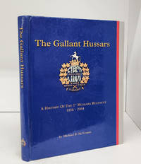
MCNORGAN, Michael R.; JOHNSON, Christopher (maps & drawings)
The Gallant Hussars: A History of the 1st Hussars Regiment 1856-2004
<p>The 1st Hussars Cavalry Fund 2004. Hardcover. ex library-good. 359 p. 29 cm. B&w and colour illustrations. Ex library with ink stamps on top and bottom edges. Scuffed front free endpaper. A few dents and scratches to outside. <br /><br /></p> The 1st Hussars Cavalry Fund hardcover
Référence libraire : 156762 ISBN : 0969465912 9780969465911
|
|
|
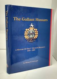
MCNORGAN, Michael R.; JOHNSON, Christopher (maps & drawings)
The Gallant Hussars: A History of the 1st Hussars Regiment 1856-2004
The 1st Hussars Cavalry Fund 2004. Hardcover. Near fine. 359 p. 29 cm. B&w and colour illustrations. Light wear. States this book is the property of the a uthor. <br/><br/> The 1st Hussars Cavalry Fund hardcover
Référence libraire : 154390 ISBN : 0969465912 9780969465911
|
|
|
McReynolds, Don ( 1990 Maps By.)
Hydrologic Atlas for Floyd County Texas
Lubbock Texas: Higfh Plains Underground Water Conserv. Dist. 1990 Eight page explanatory booklet accompannied by four large folded hydrologic maps. Depicting the depth of land surface to water at any point in Floyd County Texas and by extension. a resource for well water waer tables land management and agricultural concerns.Mapping by D.D. Smith geologist. Fine In original envelope. Higfh Plains Underground Water Conserv. Dist. unknown
Référence libraire : 121520

|
|
|
McReynolds, Don ( 1992 Maps By.)
Hydrologic Atlas for Castro County Texas
Lubbock Texas: Higfh Plains Underground Water Conserv. Dist. 1992 Eight page explanatory booklet accompannied by four large folded hydrologic maps. Depicting the depth of land surface to water at any point in Castro County Texas and by extension. a resource for determining water tables well water land management and agricultural concerns.Mapping by D.D. Smith geologist. Fine In original envelope. Higfh Plains Underground Water Conserv. Dist. unknown
Référence libraire : 121522

|
|
|
McReynolds, Don ( 1990 Maps By.)
Hydrologic Atlas for Parmer County Texas
Lubbock Texas: Higfh Plains Underground Water Conserv. Dist. 1990 Eight page explanatory booklet accompannied by four large folded hydrologic maps. Depicting the depth of land surface to water at any point in Parmer County Texas and by extension. a resource for determining water tables well water land management and agricultural concerns.Mapping by D.D. Smith geologist. Fine In original envelope. Higfh Plains Underground Water Conserv. Dist. unknown
Référence libraire : 121519
|
|
|
McReynolds, Don ( 1990 Maps By.)
Hydrologic Atlas for Crosby County Texas
Lubbock Texas: Higfh Plains Underground Water Conserv. Dist. 1990 Eight page explanatory booklet accompannied by four large folded hydrologic maps. Depicting the depth of land surface to water at any point in Crosby County Texas and by extension. a resource for well water land management water tables and agricultural concerns.Mapping by D.D. Smith geologist. Fine In original envelope. Higfh Plains Underground Water Conserv. Dist. unknown
Référence libraire : 121521

|
|
|
MEARES (Capitaine John), BILLECOCQ (J.B.L.J, trad.)
Voyages de la Chine à la côte nord-ouest d'Amérique, faits dans les années 1788 et 1789 Précédé de la relation d'un autre voyage exécuté en 1786 sur le vaisseau le Nootra, parti du Bengale D'un recueil d'observations…. Capitaine John MEARES, commandant le Vaisseau la Felice Traduit de l'anglois par J.B.L.J. Billecocq, citoyen français….
Paris, chez Buisson, An 3 de la République (1795), 4 volumes Texte : 3 tomes in 8° (21x13,5cm), XXIV-391pp, (4) 386pp, et (4) 371pp., veau raciné époque, dos lisse avec pièces de titre rouge et tomaison noire, tranches dorées, frises aux plats, roulettes interne, petits frottements. Atlas : in-4° (31,5x24cm), titre, table des planches, 28 planches HT, portraits, cartes, plans, vues. Exemplaire à toutes marges. Reliure d’attente, dos manquant, carte détachée avec tache aux plis,
Référence libraire : PHO-2286

|
|
|
Med Maps
Martha's Vineyard Pictorial Guide
paperback. Good. Access codes and supplements are not guaranteed with used items. May be an ex-library book. paperback
Référence libraire : 1890463183.G ISBN : 1890463183 9781890463182
|
|
|
Med Maps Inc
New England Lighthouses
Med Maps Inc. Trade. Very Good. Prompt shipment with tracking. we ship in CLEAN SECURE NEW boxes Very Good trade; 4 to; Small nick on bottom edge; prompt shipping with tracking Med Maps Inc unknown
Référence libraire : BING593KSB012
|
|
|
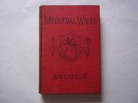
Mediaeval Wales. Chiefly in the twelfth and thirteenth Centuries. with maps and plans.
Little. A.G.
London: T. Fisher Unwin 1902. 1st Edition . Hardcover. Very Good/No Jacket. 8vo - over 7¾" - 9¾" tall. original cloth hardcover 148 pages lacks front flyleaf some internal foxing otherwise very good. We are a real bookshop with real books situated in and shipping from the United Kingdom. <br/> <br/> T. Fisher Unwin hardcover
Référence libraire : 118532
|
|
|
Meds Maps
Nantucket A pictorial guide
Meds Maps no date. Used - Very Good. Very Good condition. A copy that may have a few cosmetic defects. May also contain light spine creasing or a few markings such as an owner’s name short gifter’s inscription or light stamp. Meds Maps, no date unknown
Référence libraire : U02B-04325 ISBN : 1890463248 9781890463243
|
|
|
Meds Maps
Nantucket A pictorial guide
Meds Maps no date. Used - Like New. Like New condition. A near perfect copy that may have very minor cosmetic defects. Meds Maps, no date unknown
Référence libraire : N00D-02750 ISBN : 1890463248 9781890463243
|
|
|
Meds Maps
Nantucket A pictorial guide
Edition: first . Good Condition. No Hassle 30 Day Returns Ships Daily Underlining/Highlighting: NONE Writing: NONE Publisher: Med Maps Pub Date: 1/1/1998 Binding: Paperback Pages: 30 paperback
Référence libraire : 6028898 ISBN : 1890463248 9781890463243
|
|
|
Meds Maps
New England Lighthouses A Pictorial Guide
Meds Maps Inc. Collectible - Good. Signed Copy Collectible - Good. Signed by Robinson on bookplate affixed to front free endpage. From the Art Reference Collection of wildlife artist and outdoorsman Alan James Robinson. This collection was used by Robinson to create his wonderful art and Cheloniidae Press books. lighthouses New England travel ISBN 1555216757 Meds Maps Inc unknown
Référence libraire : SA07H-00198 ISBN : 1890463116 9781890463113

|
|
|
Meds Maps editors of
Nantucket a pictorial guide
Harwich MA: Meds Maps no date. presumed 1st . Soft cover. Fine. 25826 shelf. Unpaginated slim trade paperback photo covers. No names clean text. With stunning color photos. Printed in Italy. Fresh! <br/> <br/> Meds Maps, no date paperback
Référence libraire : 069862 ISBN : 1890463248 9781890463243
|
|
|
Mee, Arthur
Derbyshire : The King's England
No marks or inscriptions to contents. No creasing to covers or to spine. Clean very tight pages with lightly marked red cloth boards, rubbing to ends of sunned spine and to corners. 290pp. First Edition of the classic King's England study of Derbyshire.

|
|
|
Mee, Arthur
London: City and Westminster (King's England S.)
No marks or inscriptions. A very clean very tight copy with bright unmarked boards and no bumping to corners. Dust jacket not price clipped or marked or torn or creased with the tiniest of nicks to top of spine. 436pp. Fully revised new edition of Arthur Mee's classic series.

|
|
|
Mee, Arthur; Saunders, Ann; Kersting, Anthony F.
London North of the Thames except the City and Westminster
Ex-library copy with usual (minimal) marks and stamps - to front end paper and reverse of title page only. (Why? did the library release the book??) Other than the two ex-library marks, the book and jacket are both 'fine'. No other marks or inscriptions. A very clean very tight copy with bright unmarked boards and no bumping to corners. Dust jacket not price clipped or marked or torn or creased. 432pp.

|
|
|
MEES V.
L'ellipse de Tissot et ses applications en cartograpphie. Collection U, N° 18.
Kinshasa, Ed. Centre de Recherches Pédagogiques, s.d. (ca 1980). 15 x 20, 25 pp., 19 figures, broché, très bon état.
Référence libraire : 91153
|
|
|
MEES V.
Les planisphères de la terre en projection cylindrique directe. Collection U, N° 19.
Kinshasa, Ed. Centre de Recherches Pédagogiques, s.d. (ca 1980). 15 x 20, 32 pp., 14 figures, broché, très bon état.
Référence libraire : 91152
|
|
|
MEGRET Luc.
Tous les Jeux de cartes anciens et modernes avec la manière de gagner à l'écarté, à la manille et au poker, suivis de 21 jeux inédits et d'un tableau de la classification des cartes en cartomancie.
Paris, Garnier Frères, 1945, in-8 de 182 pages, sobre reliure pleine toile en très bon état, couverture de l'édition brochée conservée, jtitre doré sur pièce de titre sur dos lisse. Corps frais, reliure solide, un tampon en tête de la grande page de titre. Bon exemplaire.
Référence libraire : 21996

|
|
|
Mehling, Franz M (editor)
Paris and the Ile de France
No marks or inscriptions. Clean bright laminated boards with no bumping to corners. A lovely clean crisp tight copy. 259pp. Phaidon Cultural Guide. Laminated boards. Very well illustrated in colour.

|
|
|
MEHMET SEVKI PASA, (1866-1927).
Çanakkale tâhkimât haritasi. [= Fortifications maps of Gallipoli War]. Edited by Ahmet Tetik, Ayse Seven.
New English Paperback. Folio. (42 x 30 cm). In English and Turkish. [96] p., color maps. Çanakkale tahkimat haritasi. [= Fortifications maps of Gallipoli War]. Edited by Ahmet Tetik, Ayse Seven.
|
|
|
Mehta, Ved; Endpaper Maps [Illustrator]
Portrait of India
Farrar Straus and Co 1970-01-01. Hardcover. Very Good. 9x6x1. Farrar printing. Hardcover and dust jacket. Good binding and cover. Shelf wear. Pages unmarked. Farrar, Straus, and Co hardcover
Référence libraire : 2203160073 ISBN : 0297000721 9780297000723
|
|
|
Meier, Peter.
100 mal Philatelie. De la Philatélie par 100. Philately, a 100 times.
Bern, Museum für Kommunikation 2000, 215x215mm, 208Seiten, Verlegereinband. Exemplar wie neu.
Référence libraire : 59549

|
|
|
Meiji Maps Hisao Hayashi
Are Children Today Happy Appeal to Adults
Meiji Maps Hisao Hayashi 1973. Soft Cover. Fine. The book is in fine condition. Meiji Maps Hisao Hayashi paperback
Référence libraire : 2083002116201937
|
|
|
Meiji Maps Minoru Nagayasu and others
Class development and “Gakukyu Tsushin†activities 2 volumes: Lower grades Middle grades
Meiji Maps Minoru Nagayasu and others 1979. Soft Cover. Fine. Number of books: 2 Meiji Maps Minoru Nagayasu and others paperback
Référence libraire : 2083002116202317
|
|
|
Meiji Maps Katsumi Okada
Class remodeling through group building Elementary school 6th grade
Meiji Maps Katsumi Okada 1980. Soft Cover. Fine. The book is in fine condition. Meiji Maps Katsumi Okada paperback
Référence libraire : 2083002116201553
|
|
|
Meiji Maps Fushimi Takeya
Comprehensive History of Japanese Education
Meiji Maps Fushimi Takeya 1951. Soft Cover. Fine. The book is in fine condition. Meiji Maps Fushimi Takeya paperback
Référence libraire : 2083002116200078
|
|
|
Meiji Maps Gunma Education and Research Center for Disabled Children
Educational guidance for children with disabilities
Meiji Maps Gunma Education and Research Center for Disabled Children 1974. Soft Cover. Fine. The book is in fine condition. Meiji Maps Gunma Education and Research Center for Disabled Children paperback
Référence libraire : 2083002116204191
|
|
|
Meiji Maps Georges Sand translated by Yoshitsura Kubomura
Fairy of Love
Meiji Maps Georges Sand translated by Yoshitsura Kubomura 1987. Soft Cover. Fine. The book is in fine condition. Meiji Maps Georges Sand, translated by Yoshitsura Kubomura paperback
Référence libraire : 2083002116201223
|
|
|
Meiji Maps Tokushima Japanese Language Education Practice Research Society
Japanese Language Studies Double Book 10 Creation of a Japanese language classroom that creates richness
Meiji Zuko Tokushima Japanese Language Education Practice Research Society 1987. Soft Cover. Fine. The book is in fine condition. Meiji Zuko Tokushima Japanese Language Education Practice Research Society paperback
Référence libraire : 2083002116202660
|
|
|
Meiji Maps Tsuneo Takano and others
Lesson guidance for 6th grade science observation
Meiji Maps Tsuneo Takano and others 1975. Soft Cover. Fine. The book is in fine condition. Meiji Maps Tsuneo Takano and others paperback
Référence libraire : 2083002116201760
|
|
|
Meiji Maps Tatsumi Ueno and others
New theory of visual and auditory education
Meiji Maps Tatsumi Ueno and others 1974. Soft Cover. Fine. The book is in fine condition. Meiji Maps Tatsumi Ueno and others paperback
Référence libraire : 2083002116200974
|
|
|
Meiji Maps by Yoshio Tamano and others
Playing happily making paper crafts 2 Childcare instruction materials 7
Meiji Maps by Yoshio Tamano and others 1992. Soft Cover. Fine. The book is in fine condition. Meiji Maps by Yoshio Tamano and others paperback
Référence libraire : 2083002116201558
|
|
|
Meiji Maps Miyasaka Kyouichi and others
Science instruction to develop scientific thinking
Meiji Maps Miyasaka Kyouichi and others 1964. Soft Cover. Fine. The book is in fine condition. Meiji Maps Miyasaka Kyouichi and others paperback
Référence libraire : 2083002116202145
|
|
|
Meiji Maps by Masako Ito and others
Selected books on music education 1 Research on children's singing and choral instruction
Meiji Maps by Masako Ito and others 1976. Soft Cover. Fine. The book is in fine condition. Meiji Maps by Masako Ito and others paperback
Référence libraire : 2083002116200513
|
|
|
Meiji Maps Ministry of Education
Understanding and Teaching Problem Youth
Meiji Maps Ministry of Education 1952. Soft Cover. Fine. The book is in fine condition. Meiji Maps Ministry of Education paperback
Référence libraire : 2083002116200967
|
|
|
MEISNER Daniel (Attivo nella prima metà del XVII sec.)
Roma caput terrae, si legis, est, retrò, Amor.
Veduta tratta dall'edizione del 1678 della celebre Sciagraphia Cosmica nota anche con il titolo Das ist Newes Emblematisches Buechlei, dainen in acht Centurijs die vornembste Stat, Vestung, Schlosser der ganzen Welt... stampata a Norinberga. La Sciagraphia Cosmica, venne ampliata sotto la supervisione di Kieser dopo la morte di Meisner nel 1625, arrivando quindi ad una composizione di 800 magnifiche incisioni. Ogni opera è caratterizzata da un motto sopra l'immagine, e da versi emblematici (in latino o tedesco). L'opera è la combinazione di due generi allora popolari, il libro degli stemmi e il "Teatro delle città". Tra i maestri incisori e miniatori che contribuirono a questa serie ci sono Matthäus Merian, Sebastian Furck, Christian Stimmer e forse anche Meisner stesso, che concepì l'opera e contribuì a buona parte della prosa. Incisione in rame, con margini, in perfetto stato di conservazione. Panorama of the city, taken from the 1678 edition of the famous "Sciagraphia Cosmica" with the title "Das ist Newes Emblematisches Buechlei, dainen in acht Centurijs die vornembste Stat, Vestung, Schlosser der ganzen Welt...Nuremberg, 1678''. "Of little topographical interest, the view shows the Capitoline Hill emerging from the adjacent urban fabric, while the view to the left closes in on a scarcely recognizable St. Peter's. The author's name is only written on the title page. In addition to Meisner himself, the engravers involved included Merian, Furck and Stimmer" (cf. Marigliani p. 194). The Sciagraphia Cosmica was expanded under the supervision of Kieser after Meisner's death in 1625, resulting in a composition of 800 magnificent engravings. Each engraving is characterised by a motto above the image and emblematic verses (in Latin or German). The work is a combination of two popular genres, the Book of Coats of Arms and the Book of City Plants. Among the master engravers and illuminators who contributed to this series are Matthäus Merian, Sebastian Furck, Christian Stimmer and possibly Meisner himself, who conceived the work and contributed much of the prose. Copper engraving, with margins, in perfect condition. Cremonini pagg. 57/58, 45a; C. Marigliani, "Le Piante di Roma delle collezioni private", tav. 97.

|
|
|
Meissen:
Meissen. "Plan der Action, welche d. 20. Sept. 1759 zwischen einem Corps der combinirten Österreichischen und Reichs Armee und einem Preussischen Corps ohnweit Meissen in Sachsen vorgefallen". Schlachtenplan von Meissen in Sachsen, links mit Legende. Kupferstich mit farbigen Truppenaufstellungen aus "Neues Kriegs-Theater", 10. Supplement.
Format: 18 x 29,5 cm. *Leicht gebräunt, insgesamt gut erhalten. Landkarten de
|
|
|
Meißner, [Udo]
Kartenlesen und Entfernungsschätzen für Deutschlands Jugend. Erläutert an Beispielen. 2. Aufl.
Dresden-N. C. Heinrich, [1922]. 43 S. Mit 1 Abb. u. 1 mehrf. gefalt. Kte. 19 cm. OKart. mit VDeckel-Illustr.
Référence libraire : 84688

|
|
|
Mejer, Johannes (Kartogr. u. Hrsg.)
Landtcarte Von dem Lande Wageren. Welches ist das Ostertheil Von Holstein anno 1651. Altkolorierte Kupferstichkarte von Matthias & Nicolaus Peters, Husum.
o.J. 50,5 x 42,5 cm. [Aus: C. Danckwerth, Newe Landesbeschreibung... 1652]. Gerahmt.
Référence libraire : 86076
|
|
|
MELI
La Casa de los Dali en Port-Lligat (Cadaques)
Figueras 0 Cartes postales sous couvertures illustrées En accordéon, couverture illustrée
Référence libraire : 009177
|
|
|
Melton Eduardo Cartes
Oxygen Wars
Paperback / softback. New. paperback
Référence libraire : A9780578405773 ISBN : 0578405776 9780578405773

|
|
|
Melton Eduardo Cartes
Oxygen Wars
Paperback / softback. New. paperback
Référence libraire : B9780578405773 ISBN : 0578405776 9780578405773

|
|
 Recevoir par e-mail
 Télécharger en PDF
 Flux RSS


