|
[CARTE]
Mauriac. et le Nord Est du Bas Lim.. (sic)
A Paris, Chez Vignon, marchand de Cartes de Géographie, (fin XVIIIe) carte dépliante de 60 x 89 cm repliée au format in-8, en feuille, imprimée en noir et blanc entoilée, étiquette de titre manuscrite et étiquette ronde imprimée de l'éditeur au verso, onglet de vélin. Légère usure d'usage, renforcée aux plis, tache centrale, qques petites déchirures.
Referenz des Buchhändlers : 219395
|
|
|
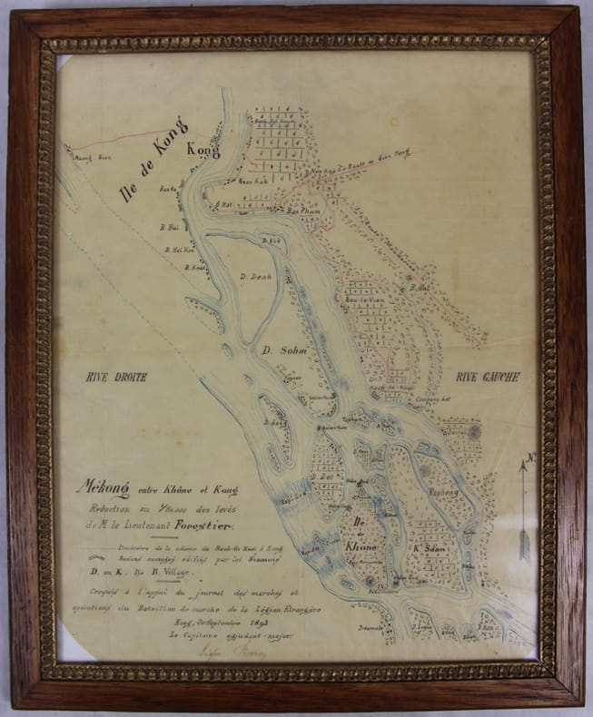
[Carte manuscrite] Pierroy (Capitaine)
Mékong entre Khône et Kong [Khong]. Réduction au 1/80000 des levés de M. le lieutenant Forestier. Croquis à l’appui du journal des marches et opérations du Bataillon de marche de la Légion étrangère.
Kong, 30 septembre 1893 Carte dessinée en couleurs 42,5 X 35 dans son cadre argenté. Bel état. Rare croquis exploratoire de ce secteur des Quatre mille îles du Mékong dont le franchissement nécessitera la construction d’une ligne de chemin de fer. L’officier reporte l’itinéraire de sa colonne de Hach-Ki-Koaï à Kong [Khong] et les anciens ouvrages édifiés par les Siamois.
Referenz des Buchhändlers : 31781
|
|
|
[CARTES POSTALES]
Neudin l'officiel international des cartes postales 1988 (14eme année).
Paris, Neudin, 1987 ; in-8, 536 pp., br.
Referenz des Buchhändlers : 201302834
|
|
|
[CARTES POSTALES]
Neudin l'officiel international des cartes postales 1985.
Paris, Neudin, 1984 ; in-8, 542 pp., br.
Referenz des Buchhändlers : 201302830
|
|
|
[Cartes A. Taride]
Nouvelle Carte Routière des environs de Paris dans un rayon de 60 Kilom. à l'usage des automobilistes, cyclistes, Touristes 1/ 100 000eComprenant : Chantilly, Corbeil, Etampes, Fontainebleau, Mantes, Meaux, Melun, Rambouillet, Senlis, etc., etc.
Carte routière couleur dans son étui d'origine, A. Taride Libraire-Editeur, Paris, SD
Referenz des Buchhändlers : 5775
|
|
|
[CARTE]
N°52. CLERMONT. 1/200 000
Paris, Lanée, Succr de Longuet, (1900) carte dépliante de 51 x 73 cm repliée au format in-12, en feuille, imprimée en couleurs, entoilée, étiquette de titre imprimée ancienne de l'éditeur au verso.
Referenz des Buchhändlers : 219397
|
|
|
[CARTE]
N°58. AURILLAC. 1/200 000
Paris, maison Andriveau-Goujon, Henry Barrère, (début XXe) carte dépliante de 51 x 71 cm repliée au format in-12, en feuille, imprimée en couleurs, entoilée, étiquette de titre imprimée de l'éditeur au verso. Quelques discrètes annotations manuscrites à l'encre noire.
Referenz des Buchhändlers : 219399
|
|
|
[CARTE]
Picardiae, Belgicae regionis descriptio. Joanne Surhonio auctore. Cum Imp. et rég. Privilegio decenn 1579
(c.1579) 32.5 x 51 cm ( composition) - 42 x 56.5 cm (feuille), Mouillures. Pliures. Petite déchirure centrale sur l bord supérieur au niveau de la pliure.
Referenz des Buchhändlers : 231868

|
|
|
[CARTES ET PLANS].
Portefeuilles de plans. Projets et dessins d'ingénieurs militaires en Europe du XVIe au XIXe siècle. Actes du colloque international de Saint-Amand-Montrond, 2 et 3 mars 2001.
Bourges, Conseil général du Cher, 2001 ; in-4. Dos carré collé. 203pp. Nombreuses illustrations in-texte en noir et en couleurs. Couverture couleurs. Très bon état.
Referenz des Buchhändlers : 15131

|
|
|
[CASERNES]
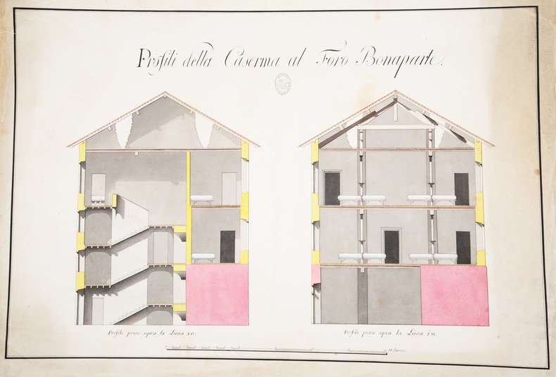
Profili della Caserma (sic) al Foro Bonaparte.
S.l., 450 x 650 mm., deux coupes en élévation sur une planche : coupe des escaliers d'accès et des dortoirs d'une caserne.
Referenz des Buchhändlers : 107696
|
|
|
[CARTES À JOUER].
Règlement pour l'exécution de la nouvelle ferme du droit sur les cartes à jouer.
Avignon, Alexandre Giroud, 1761 in-4 carré, 13 pp., demi-veau cerise, dos lisse fleuronné (reliure moderne). Dos insolé et passé.
Referenz des Buchhändlers : 238715

|
|
|
[CARTES A JOUER - BOSTON].
Tablette de marque du Jeu du Boston.
Tablette recouverte de papier maroquiné rouge, décor de roulettes dorées sur les plats, ardoise façon vélin pour la marque de points d'un coté avec son crayon en étain, tableau imprimé des paiements du Boston au verso, Molette tournante pour le comptage des points (quelques usures sur les tranches). Dix-neuvième siècle, (100 x 155 mm). Bon état compte tenu de la fragilité de l'objet.
Referenz des Buchhändlers : 20567
|
|
|
[CARTE] DEZAUCHE (Jean-Claude)
Théâtre de la guerre, entre les Turcs, les Russes et l'Empereur. Carte de la Mer Noire. comprenant la plus grande partie de l'Empire Ottoman, partie des Etats de l'Empereur, de la Russie, &c. Dressée par Dezauche, géographe, successeur des Srs. Delisle et Phil. Buache, premiers géographes du Roi, et de l'Académie royale des sciences
Paris, chez l'auteur [étiquette de Desnos apposée ultérieurement], 1788 carte in-folio de 80 x 104 cm, contours rehaussés de couleurs, en feuille.
Referenz des Buchhändlers : 206667
|
|
|
[Cartes couleur]
Vieux pays de France
Paris, Laboratoire Marinier ; principautés d'Orange et comtat Venaissin (n°1), Mascon (n°2), Isles de Ré et d'Oléron (n°8), Franche Comté (n°9), Vermandois (n°11), Souveraineté des Dombes (n°13), Aire (n°15), Bresse (n°16), Langres (n°17), Retlois (n°18), Blaisois (n°19), Pays de Turenne (n°20), Beauvoisis (n°21), Valois (n°22), Lac Léman (n°23), Cambrésis (n°24), Le Velay (n°25), Pays Messin (n°27), Duché d'Aiguillon (n°28), Pays de Calais (n°29), Roussillon (n°30), Pays de Luçon (n°32), Le Lieuvin (n°34), Barrois (n°37), Comté de Nice (n°38), Pays de Caux (n°39), Ponthieu (n°41), Chalonnais (n°42), Le Valentinois, Vercors et Diois (n°43), Bourdelois et Prevoste de Born (n°44), Hainault François (n°45), Cotentin (n°46), Vexin François (n°50), Comté de Toulouse (n°51), Verdunois (n°52), Pays de Nantes (n°53), Yveline (n°54), Valromey (n°56), Bugey (n°57), Pays de Vannes (n°58), Pays de Béziers (n°59), Bessin (n°61), Pays de Gex (n°62)
Referenz des Buchhändlers : 4262
|
|
|
[California]. [Maps]. Heald, Ralph P, compiler
Heald-Menerey's Geographical Commercial and Recreational Map of California
San Francisco and Los Angeles: The Heald-Menerey Company 1928. Very good. Large color map measuring 44 x 64 inches cut into eight sections and folded into book form. Original black limp textured cloth yapp edges titled in pale yellow on front cover. Moderate edge wear titles on front cover almost completely worn away. Internally clean. A rare portable version of the large and impressive Heald-Menerey's Geographical Commercial and Recreational Map of California produced in the late-1920s. According to the sheet of instructions bound before the map: "The first of its kind ever devised for desk home or automobile use. It consists of the California Survey 44 x 64 inches in size cut into eight strips and folded to make a book of 64 pages. Page No. 1 is the extreme northwest corner of our Survey and page No. 64 is the extreme southwest corner." The instructions proceed to inform the user on how to locate points on the map given its form as a book. The verso of the instructions page is a county index keyed to the pages of the map. The cover title begins "California Survey" but the remainder is rubbed beyond readability.<br /> <br /> The map was produced by the Schmidt Lithograph Company of San Francisco. The legend of the map contains symbols representing roads trails railroads streams springs swamps aqueducts lighthouses county and state boundary lines national forests mountain peaks township and range lines base and meridian lines and more. There are also two inset maps - one showing San Francisco and vicinity and the other Los Angeles and its immediate surroundings. OCLC records just a handful of copies of this book-form map published between 1928 and 1933. The Heald-Menerey Company unknown
Referenz des Buchhändlers : 2443
|
|
|
[CALIFORNIA -- MAPS]. [WHITE, Albert C, VINCENZ, Jean L]
Land use district maps adopted by ordinance No. 2491 of the City of Fresno California. City Planning Commission. . . .
Fresno CA: City Planning Commission 1938. Oblong folio. 13.5 x 9.25 in. 17 blueprint maps variously numbered. w/ first map as the Key Map for the remainders. Stapled at gutter margin w/ protective green-tinted back softcover folded to provide reinforcement at spine from the library of George Reed Volker 1925-2018 former World War II pilot and urban planner in California New York and Washington State. First editions of these exceedingly scarce land use district zoning maps drawn up in 1938 after the passage of the 1937 Housing Act which unfortunately upended much of the spending not only by the WPA but also required any federal money to spent in “blighted†areas. These detailed maps show major streets demarcate singe family housing multi-family housing manufacturing and commercial bases for the community. Eventually the Public Housing which was built in Fresno during World War II began in West Fresno or “Chinatown first with the Sequoia Courts and later the Sierra Plaza followed by others. No copies located in Worldcat; See: Bibliography of Research Projects Reports W.P.A. Technical Series Research and Records Projects Bibliography No. 1 Feb. 2 1940 p. 53 Zoning Ordinance. City Planning Commission, paperback
Referenz des Buchhändlers : 56963
|
|
|
[California] [Maps] [Eaton Fire]
MAP OF ALTADENA-PASADENA AND VICINITY
Atladena California: Altadena Federal Savings and Loan Association 1960. Printed on both sides on an 18 1/2" x 23 1/2" sheet of white paper that folds to 4" x 9 1/4" 24 panels. There is printing in red and a color rendering of the Altadena Federal Savings building on one side. Handwritten name on the front panel; else near fine. Scarce OCLC locates no holdings.<br /> <br /> Fully indexed street map of the unincorporated Los Angeles County California community that was devastated by the Eaton Fire in January 2025. Situated next to and within the foothills of the San Gabriel Mountains Altadena has long resisted annexation to Pasadena though that city has taken 46 "bites" of it over the years seeking tax revenues. That independent spirit is reflected in the mosaic of ethnic diversity that made Altadena one of the most integrated communities in Southern California. Altadena Federal Savings and Loan Association unknown
Referenz des Buchhändlers : 78704

|
|
|
[California] [Maps]
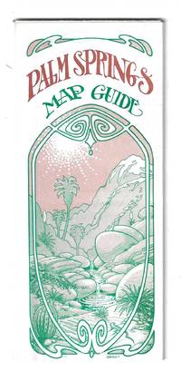
PALM SPRINGS MAP GUIDE
Orange and Palm Springs California: Ken and Ruth Du Maurier The Palm Springs Map Guide 1976. Tourist map to the desort resort city in Riverside County California. In addition to a large street map of Palm Springs there are smaller maps of the city bus route Cathedral City and the Coachella Valley respectively. Also provides a list with addresses of movie star and celebrity homes a brief history of the region a description of the picturesque canyon areas and descriptive lists of local shops restaurants hotels golf courses activities service stations etc. Features photographic illustrations and numerous advertisements. Printed in green and desert rose on a 30" x 25 1/2" sheet of white paper that folds to 3 3/4" x 8 1/2" 48 panels. A fresh and clean example. Scarce OCLC locates only one holding at the Library of Congress. Ken and Ruth Du Maurier, The Palm Springs Map Guide unknown
Referenz des Buchhändlers : 78705
|
|
|
[CARTES DE VISITE]. Darrah, William C
CARTES DE VISITE IN NINETEENTH CENTURY PHOTOGRAPHY
Gettysburg PA: W.C. Darrah Publisher 1981. First edition. 4to. illustrated. A fine copy in a fine dust jacket. SIGNED by the author on the title page. W.C. Darrah, Publisher unknown
Referenz des Buchhändlers : 54177
|
|
|
[CASPIAN SEA - ANTIQUE MAP].
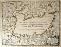
Nouissima et accurata Maris Caspij. Fere nobis incogniti Regionumque adiacentium Delineatio Iussu Petri Alexij Fil. Magni Russorum Principis.
Rainer Ottens. 1723. A most attractive map with early outline hand colour vertical fold barely visible diagonal crease upper half of map few very pale small brown spots otherwise a clean and bright image. Numbering in red pencil few annotations in pencil and light number stamp on reverse however not at all visible from front of map or affecting image. Sheet measures 46.6 x 60.2cm. . Rainer Ottens. unknown
Referenz des Buchhändlers : 54819
|
|
|
[CELEBES AND MOLUCCA - 1943 JAPANESE MAP].
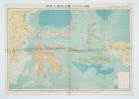
標準大東亜分図: 13 セレベス・モルッカ諸島扁. Hyōjun Dai tōa bunzu: 13 Serebesu・Morukka shotou-hen. Standard Maps of Greater East Asia: 13 - Celebes and the Moluccas.
Tokyo 東京: 統制社Tosei-sha. 昭和 Showa 18. 1943. Colour folding map 54 x 75.5cm with original envelope. Envelope a little torn some occasional browning very good. The 13th map in this Standard Maps of Greater East Asia series of 20 maps. All text in Japanese. Shows railways shipping routes administrative boundaries airfields ports lighthouses mines oil wells etc. . 統制社(Tosei-sha) unknown
Referenz des Buchhändlers : 160554
|
|
|
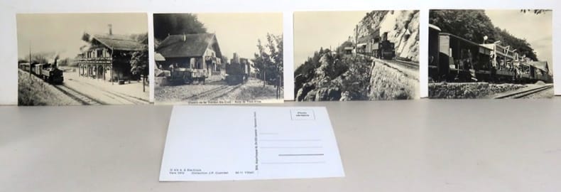
[Chemin de fer Yverdon-Sainte-Croix]:
6 cartes postales anciennes - Chemin de fer Yverdon-Sainte-Croix.
Lausanne, BVA, sans date. 6 cartes postales (non écrites, non envoyées).
Referenz des Buchhändlers : 19927
|
|
|
[Chemins de fer]
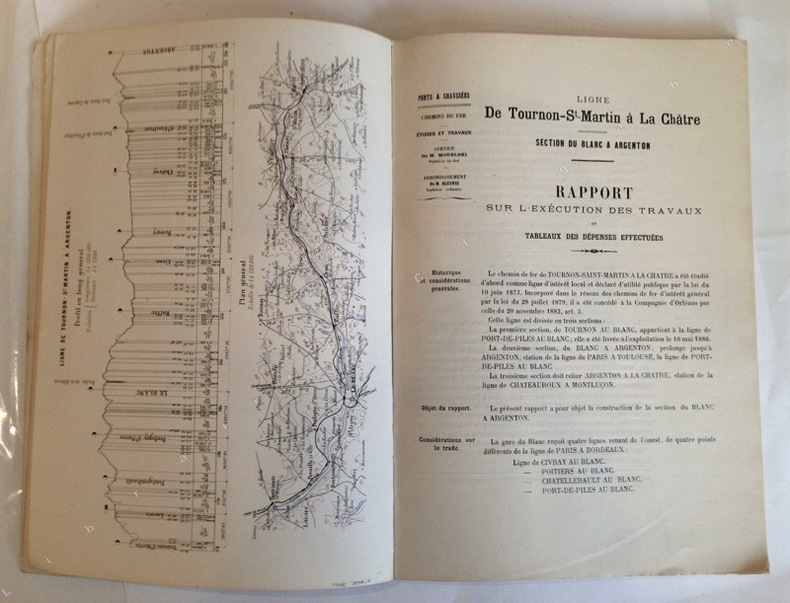
Ligne de Tournon-St-Martin à La Châtre. Section de Blanc à Argenton (sur Creuse) (par E. Modelski, ingénieur en chef de la construction).
Poitiers, Imprimerie Blais, Roy et Cie, 1889 ; grand in-4, broché ; 57 pp., (1) p. bl., profil en long et plan général en couleurs en frontispice, (38) pp. de planches et dessins des principaux ouvrages (viaduc de Villerie ; passage supérieur d'Anzan ; passage supérieur des Zéros ; Pontceau de Bois-Marmin ; pont biais sur la Creuse à Saint-Gaultier ; pont de décharge de St Gaultier ; pont biais sur la Creuse à Conives ; plan d'ensemble des abords du Blanc ; plan de la Gare du Blanc ; plan des stations entre Le Blanc et Argenton), couverture rose.
Referenz des Buchhändlers : 10851
|
|
|
[Chanlaire (Pierre Gilles), Dumez (Pierre)].
Précis élémentaire et méthodique de la nouvelle géographie de la France : suivi d'une table alphabétique des chefs-lieux de cantons indicative des districts et départements auxquels ils appartiennent ; pour servir de développement à l'Atlas national portatif de la France, avec six cartes, dédidé et présenté à l'Assemblée Nationale. Par les Auteurs de l'Atlas National de France.
Paris, Bureau de l'Atlas National, Imprimerie du Cercle social, 1791. In-8 de (4)-XXXIX-(1)-240-(2) pp., 2 tableaux et 7 cartes hors texte repliés, basane granitée, dos lisse orné, pièce de titre en maroquin rouge, tranches rouges (reliure de l'époque).
Referenz des Buchhändlers : 43624
|
|
|
[CHINA - 18TH CENTURY MAP] PARISH, HENRY WILLIAM (MAPMAKER). BAKER, BENJAMIN (ENGRAVER).
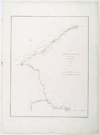
A Sketch of the Pay-ho or White River and of the Road from Pekin to Geho taken 1793.
London.: George Nicol. 1796. Engraved copperplate map on Whatman paper 43.8 x 33.6 cm; 57 x 42 cm sheet including plate markscale in nautical and English miles; light undulation to sheet marginal toning and edgewear but in very good condition. Finely engraved and detailed map of two routes to Pekin Beijing along the White River Baihe from the Gulf of Petcheli and along the Imperial Highway from Jehol and includes commentary locating palaces and gardens type of cultivation "many barges" and "the road shaded by willow trees". The map elegantly drawn by Henry William Parish was published in George Staunton's account of Earl Macartney's embassy to China 1792-1794. . George Nicol. unknown
Referenz des Buchhändlers : 209283
|
|
|
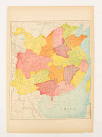
[CHINA - MAP].
China.
circa1900. Map printed in colour text in English provinces shaded in colour 28.3 x 23.2 cm central fold paper toned a small edge tear confined to the outer margin but in good condition. . unknown
Referenz des Buchhändlers : 174904
|
|
|
[CHINA - MAP - WORLD WAR II].
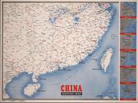
Newsmap for the Armed Forces. 291st Week of the War - 173rd Week of U.S. Participation. Monday 9 April 1945.
New York.: Army Information Branch. Volume III No. 51F. 9 April1945. Folding colour map and six inset maps in a vertical panel 88 x 119 cms sheet and on the recto circular map of Europe smaller inset map of Asia and of the Ryukyu Islands descriptive text original folds in very good bright condition. Scarce Newsmap of "China Southeast Coast" from Shanghai to French Indochina with the islands of Formosa and Hainan. At the right edge are inset maps of the vicinities of Shanghai Wenchow Foochow Swatow Canton and Hong Kong. On the verso is a large map of the European theatre of operations centred on Berlin a map of the Pacific area noting the American occupation of Okinawa with a detailed map of this island. In unusually fine bright condition. . Army Information Branch. unknown
Referenz des Buchhändlers : 194660
|
|
|
[CHINA - RUSSIA - JAPAN - WORLD WAR II MAP] BURKE, HOWARD
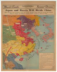
Japan and Russia Will Divide China. Signs Increase That Northern Area and Lower Yangtze Basin Will be Carved Into Puppet States by Stalin and Mikado Leaving South Largely at Mercy of Both.
Los Angeles.: Los Angeles Examiner. 1940. Printed colour pictorial map on a single newspaper leaf 42.3 x 39.9 cms; 54.3 x 42.5 cms sheet archivally laid down on linen slight discoloration to lower centrefold and sheet slightly age-toned but in very good condition. A striking geopolitical map by Los Angeles Examiner artist Howard Burke covering China Japan Southern Russia and the northern part of French Indochina and Siam showing how the "Aggressors Divide China." Areas under Japanese occupation are shown in red and their naval blockade shown by an arc of naval vessels with vivid arrows indicating lines of supply. Text labels including sources of agricultural and raw materials provide a dynamic overview of the geopolitical situation and show the influence of American scientific illustrator and cartographer Richard Edes Harrison who argued for examining geographic issues from multiple perspectives and Los Angeles Times artist Charles Owens. . Los Angeles Examiner. unknown
Referenz des Buchhändlers : 209821
|
|
|
[CHITTAGONG AND SURROUNDING REGION - MAP].
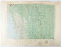
Chittagong.
Washington D.C.: Army Map Service U.S. Army. 1955. Large colour map. 1:250000 scale. Transverse mercator projection. 23°00'N 91°30'E-22°00'N 93°00'E. Series U502 Sheet NF 46-6 Edition 1-AMS. Map measures 57.3 x 75.8cm. Slight wear creasing even light browning small closed tears on edges upper-right corner little foxed. Shows signs of use but map is clean and complete. Corps of Engineers Army Map Service map of Chittagong and surrounds compiled in 1955. Based on the British Indian one-inch and half-inch map series from 1938-43 and 1936-43 respectively. . Army Map Service, U.S. Army. unknown
Referenz des Buchhändlers : 173072
|
|
|
[CIVIL WAR] [MAPS] SCHEDLER, J
The Seat of War: Birds Eye View of Virginia Maryland Delaware and the District of Columbia
New York: W. Schaus; printed by Sarony Major & Knapp 1861. Second Edition. 59 x 76cm open. 19.5x19cm closed. Tinted lithographic map backed in brown silk in black slipcase with printed paper label. Bookseller's ticket of Rev. A. O. Brickman Baltimore. Two ownership inscriptions of "J. M. Deems Maj. 1st MD Cav" and inscribed "Deems" on the slipcase. Trimmed; splits along half of one horizontal fold; minor stains and discoloration to verso not affecting image which is bright and generally Very Good. Hand-made slipcase worn with portion cut out but with manuscript ownership label intact. <br /> <br /> Uncommon Civil War map used by a distinguished Union Army officer. James Monroe Deems 1818-1901 was a composer and music educator from Baltimore who secured a commission as a major in 1861. He was promoted to Lieutenant Colonel in spring 1863; led the First Maryland Cavalry during the Battle of Gettysburg; retired due to rheumatism in November 1863; and was brevetted Brigadier General in 1867. He likely acquired this map in Baltimore near the beginning of his military career and certainly before his promotion in 1863 given the use of "Maj." in his ownership inscriptions. <br /> <br /> The map itself is the second edition of this design by J. Schedler despite the title it is not a bird's-eye view. The more common first edition has two insets showing the Lower Mississippi Valley and the city of Richmond see Stephenson 17.3. This version has only one inset showing the eastern United States. Stephenson describes this edition as having a Washington DC bookseller's ticket; the present copy has a Baltimore bookseller's ticket instead. <br /> <br /> This copy was mounted for use in the field: it was trimmed down to the neatline the captions removed the image cut up into segments and mounted on linen. The printed label on the slipcase appears to be a portion of the original title. This may have been done by the bookseller Brickman possibly at Deems' request. <br /> <br /> Uncommon. OCLC records about 10 similarly titled maps but few listings distinguish between the first and second editions. STEPHENSON LC Civil War Maps 2nd ed 17.35. 61812. [W. Schaus; printed by Sarony, Major & Knapp] unknown
Referenz des Buchhändlers : 61812
|
|
|
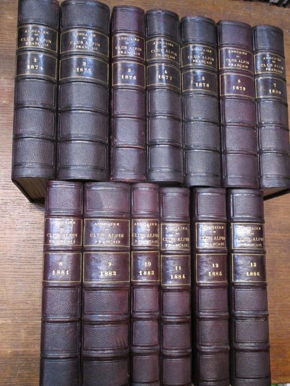
[Collectif, LEMERCIER, JOANNE Adolphe,
[ Revue. 26 années de 1874 à 1899 et 1 table (27 volumes) ] Annuaire du Club alpin français. Première année, 1874 / Deuxième année, 1875 / Troisième année, 1876 / Quatrième année, 1877 / Cinquième année, 1878 / Sixième année, 1879 / Septième année, 1880 / Huitième année, 1881 / Neuvième année, 1882 / Dixième année, 1883 / Onzième année, 1884 / Douzième année, 1885 / Treizième année, 1886 / Quatorzième année, 1887 / Quinzième année, 1888 / Table des quinze premières années / Seizième année, 1889 / Dix-septième année 1890 / Dix-huitième année, 1891 / Dix-neuvième année,1892 / Vingtième année, 1893 / Vingt-et-unième année, 1894 / Vingt-deuxième année, 1895 / Vingt-troisième année, 1896 / Vingt-quatrième année, 1897 / Vingt-cinquième année, 1898 / Vingt-sixième année, 1899.
hachette 1875 - 1899 27 in-8 demi-chagrin Paris, Au siège social du Club Alpin Français, Librairie Hachette, 1875-1899, 27 volumes in-8 de 140x230 mm environ, environ 600 pages par volume, quelques gravures in-texte, nombreux hors-texte et planches dépliantes. Collationnés : quelques erreurs de placement des hors-textes mais il ne manque qu'une seule planche (Année 1874, manque une carte topographique du Mont Pelvoux), en revanche présence de figures, cartes et panoramas supplémentaires, non annoncés. Demi-chagrin aubergine, plats papier imitation chagrin assortis, dos à cinq nerfs portant titres et tomaisons dorées, gardes marbrées. Quelques marques sur le cuir, des frottements sur les dos et les plats, tranches piquées, un défaut d'impression p.68 de l'année 1899, un petit trou p.79 de la table, sinon intérieur propre, certains cahiers non coupés, bon état général, rare et bel ensemble. ATTENTION POUR EXPÉDITION : PLUS DE 35 kg.
Referenz des Buchhändlers : 117927
|
|
|
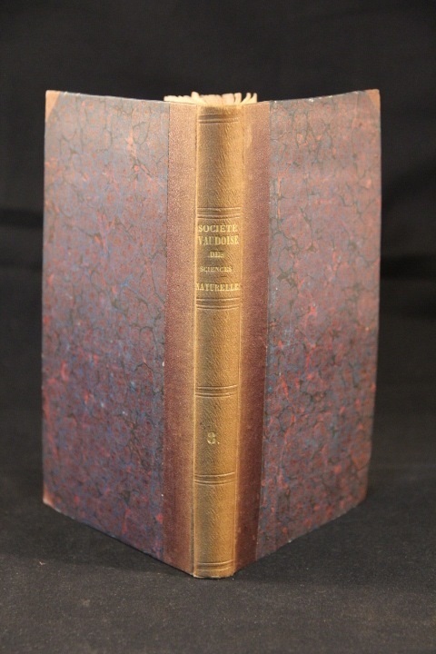
[collectif]:
Bulletins des séances de la Société vaudoise des sciences naturelles. Tome III. Années 1849-1853.
Lausanne, Impr. de J.-S. Blanchard aîné, 1854. 1 vol. in-8 de [1]ff., 8, 300 p., [1 f.]. Demi-percaline marron, dos lisse, passé. Quelques rares rousseurs, nom de possesseur sur titre.
Referenz des Buchhändlers : 2785
|
|
|
[COCHINCHINE] [SAIGON] [CARTES ROUTIERES]
Cartes Routières de la Région de Saigon
Saigon, Service Géographique de l'Indochine, 1953.. 1 ensemble de 2 cartes routières de documentation militaire au 1/250.000 e, dessinées et imprimées au Service Géographique de l'Indochine en 1953. Chaque carte mesure 80 sur 60 cm. Carte No 36 pour la région de Saigon Sud, carte 32 pour la Région de Saigon Nord. Cartes en très bon état.
Referenz des Buchhändlers : 12603
|
|
|
[Collectif]:
Russes et Turcs. La guerre d’Orient.
Paris, Manceaux, 1877. 2 volumes in-4 de 1152 p. [616 + 536] (pagination continue), demi-basane noire, dos lisses ornés. Quelques rousseurs.
Referenz des Buchhändlers : 2047

|
|
|
[COLUMBUS, Christopher] MORISON, Samuel Eliot; Erwin Raisz (maps); Bertram Greene (drawings)
Admiral of the Ocean Sea: A Life of Christopher Columbus
Boston: Little Brown and Company / An Atlantic Monthly Press Book 1942. Octavo 24cm; burgundy cloth-covered boards with titling in gilt on spine and illustration stamped in gilt and black to front cover; black topstain; map endpapers; 680pp; portrait frontispiece with illustrations throughout. Lacking dustwrapper. Modest shelf-wear and -soil light rubbing to board edges faint foxing to edges of textblock and 3" tear to fold of map at p.458; Very Good. Winner of the Pulitzer Prize for Biography. 88863. Little, Brown and Company / An Atlantic Monthly Press Book unknown
Referenz des Buchhändlers : 88863
|
|
|
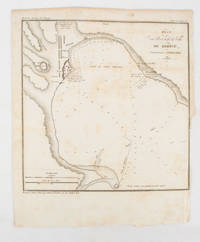
[CRIMEA - MAP]. TARDIEU, AMBROISE
Plan du Port at de la Ville de Kertch Anciennement Panticapée
Paris.: Librairie de Gide. 1839. Engraved map 21.1 x 20.8 cm 27 x 22 cm sheet original folds trimmed to the inner margin with slight loss to the border only map spotted but otherwise in sound condition. Map of the Port of Kerch in Crimea prepared for the 1839 edition of the French Journal "Nouvelles Annales des Voyages." the editors for this edition amongst others the translator and geographer Jean-Baptiste Benoît Eyriès and Alexander von Humboldt founding members of the world's first geographical society the Société de Géographie. . (Librairie de Gide). unknown
Referenz des Buchhändlers : 175248
|
|
|
[DANTZIG].
Plan du siège de Danzig par le 10me corps de la Grande Armée. Avec les travaux des François tels qu'ils étoient le 23 avril 1807
S.l., s.d. carte repliée de 50 x 70 cm, en feuille.
Referenz des Buchhändlers : 234659

|
|
|
[Daun, Leopold Joseph Maria von]
Der deutsche Fabius Cunctator, oder Leben und Thaten Seiner Excellenz, des Herrn Leopold Joseph Maria, Reichsgrafens von Daun ... commandirenden Generals in Oesterreich ob und unter der Ens, Commendantens zu Wien, des Ober- und Unterösterreichischen Iudicii delegati militaris mixti Präsidentens, und Ober-Generaldirectors der adelichen Militar-Cadetsacademie, nebst allen Feldzügen, welchen dieser große Kriegsheld beygewohnet, bis auf gegenwärtige Zeit gründlich und unpartheyisch beschrieben. Deme noch eine kurze Nachricht von dessen berühmten Herrn Vater, dem 1741 verstorbenen kaiserlichen Feldmarschall, wie auch gewesenen Vicekönig von Neapolis, beygefüget ist. Erster [und] zweyter Theil (in 1 Band, komplett).
s.l., 1759-1760. 4°. 21,5 x 17,5 cm. 4 Blatt, 182 Seiten, 3 Blatt, 86 Seiten. Insgesamt 6 Tafeln (inklusive Frontispize). Späterer Pergmanentband im Stile der Zeit auf drei Bünden mit Rundum-Rotschnitt. [2 Warenabbildungen]
Referenz des Buchhändlers : 62498CB

|
|
|
[De Vinci Leonardo]:
Macchine - Leonardo.
Becocci Editore. 16 cartes postales détachables, réunies en leporello. En belle condition.
Referenz des Buchhändlers : 23379

|
|
|
[Descartes, Rene] Des Cartes, Renati; Velthusio, Lamberto [Van Velthuysen, Lambert]
Renati Des Cartes Meditationes de Prima Philosopia in Quibus Dei Existentia & Animae Humanae a Corpore Distinctio Demonstrantur. His Adjungitur Tractatus De Initiis Primae Philosophiae Juxta Fundamenta Clarissimi Cartesii Tradita in Ipsius Meditationibus Nec Non de Deo & Mente Humana. Cum Nova Methodo Qua Traditur Doctrina de Praedestinatione & Gratia
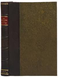
London: Excudebat J.F. James Flesher pro Jona Hart 1664. First Thus. Hard Cover. Near Fine/No Jacket. Rebound with new end sheets: brown leather spine marbled paper over boards red morocco spine label gilt titles and rules. Binding tight pages clean and unmarked. 1664 Hard Cover. viii 230 pp. Last text page misnumbered 216. Descartes's fundamental and originating work of the modern era in Western philosophy bound together with a work by one of the Utrecht Cartesians Lambert van Velthuysen. This is the first British printing of the Meditations though it does not include Descartes's 'Objections and Replies' as many editions do. Velthuysen was connected by marriage to Descartes's friend Henry Regnier and corresponded with scientists and philosophers such as von Leeuenhoek Spinoza and Leibniz. The work included here shows the influence of Thomas Hobbes - unsurprising given that Velthuysen is credited with translating Leviathan into Dutch. John Locke may have met Velthuysen while in Utrecht in 1684/85 and had eight titles by Velthuysen in his personal library including the Rheims edition of the present title. Bound into this volume are two plates not called for in either work which may be taken from the Hart printing of Principia Philosophia which was published the same year. Wolf 736 Wing D1133a. Excudebat J.F. [James Flesher] pro Jona Hart hardcover
Referenz des Buchhändlers : 2341508
|
|
|
[DRAWING - TROMPE-L'OEIL - MAPS].
Trompe-l'oeil drawing of country maps on a decorated background titled: Ciels Saint-Vincent.
France 1888. Brown and black ink watercolour chalk and gold paint on paper mounted on several laminated sheets of paper 69.5 x 52.5 cm. Charming trompe-l'oeil of maps of European countries on a decorated background somewhat reminiscent of a church ceiling. It contains a French inscription "to my beloved parents" which together with some inconsistencies in the use of perspective suggest a young French artist. The maps show some interesting departures from reality: in the Netherlands parts of the province of Gelderland are shifted 50 kilometres to the north replacing Zwolle with Arnhem and Sweden lacks Stockholm but includes Copenhagen in place of Malmö. However the most humorous is in the map of Germany which lacks its western neighbours - the Netherlands Belgium Luxemburg and France - giving it an extensive North Sea coast. The gothic lettering is inconsistent in style with the artist apparently improvising an alphabet for each inscription in the process forgetting Denmark.Somewhat soiled and browned at the edges with several white spots due to overpainting; the sheets are coming loose from one another. unknown
Referenz des Buchhändlers : J4KDIGIVEPWU

|
|
|
[EARLY 20TH CENTURY MANUSCRIPT MAPS OF CHINA AND KOREA].
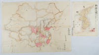
支那全圖. Shina zenzu. 朝鮮の図Chōsen no Zu Maps of China and Korea
Japan. No date. Circa1902. Two very attractive colour folded manuscript maps one showing China and the other Korea. <br> <br>Map of China: Watercolour map 48 x 63.5cm. Closed tear now professionally repaired. <br> <br>Map of Korea: Finely detailed watercolour map a few tiny holes very neatly repaired on the verso with archival washi. 33 x 24.5cm Two delicate hand-painted maps one of China and one of Korea produced by a Japanese student cartographer named Koike Tokushige 小池徳重. <br> <br>The undated map of China appears to have been produced in the first five years of the twentieth century: a time when Japan had recently colonized Taiwan and when Japanese economic and political interest in the region was rapidly expanding. The inscription on the map suggests that it was a third year college project. But the high level of detail suggests that the artist had considerable experience of map making. The map of China shows the main provinces rivers major transport routes the Great Wall and the location of key cities although the names of the cities are not included. It also shows outlines of the Korean Peninsula Taiwan and the Japanese island of Kyushu but not the rest of Japan. <br> <br>The map of Korea is more detailed. It provides an accurate outline of the Korean Peninsula with careful hatching indicating changes in elevation. Rivers and major road routes are shown on the map and the locations of major towns are marked though only Busan and Incheon are named. Dotted lines show coastal sea routes and routes between Kyushu and Busan and between Incheon and China. The map shows the Gyeongin railway line between Seoul and Incheon which was completed in 1899 and route of the Gyeongbu railway line between Busan and Seoul whose construction started from both ends in 1901. But the map depicts only small sections of this line close to Seoul and Busan as being completed with the rest more lightly outlined to show the projected route implying that the map was drawn around 1901-1902 and certainly before the Gyongbu line was opened in 1904. <br> <br>Inserted text gives the land area and population of Korea. Rather strangely though the figure given for the Korean population is vastly underestimated. Ikeda gives this as 5.7 million when in fact at that time is was around 18 million. . unknown
Referenz des Buchhändlers : 220266
|
|
|
[EARLY MEIJI MAPS OF KYOTO AND ITS SURROUNDINGS].
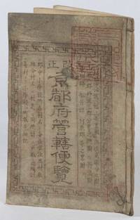
改正京都府管轄便覽. Kaisei Kyōtofu kankatsu binran. Revised Guide for Kyoto Prefecture Area.
京都. Kyoto.: 村上勘兵衛. Murakami Kanbei. Meiji 5 1873. Black and white woodblock maps and city plan 22 x 15.3cm 17 double-folded leaves 4 hole string binding. Covers worn and soiled chop on upper cover. This guide to Kyoto and its surroundings includes two double-page and twelve single-page pictorial maps published around Meiji 5 1873. Each map highlights geographical features place names and major buildings such as Buddhist temples within Kyoto and its surrounding areas. The latter section covers three counties of the Tanba region offering a detailed look at the area beyond Kyoto itself. . 村上勘兵衛. [Murakami Kanbei]. unknown
Referenz des Buchhändlers : 216097
|
|
|
[Eastern European Immigration]. [Maps]
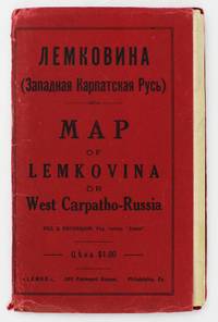
Lemkovina: Map of Lemkovina or West Carpatho-Russia
Philadelphia: Lemko Press 1929. Very good. Lithographed folding map approximately 32 x 40 inches printed in pink and black. Housed in original red wrappers printed in black. Modest wear along folds a couple of small separations at crossfolds light marginal toning. Wrappers with minor spine and edge wear. An extremely rare map of "Lemkovina" the homeland of the Lemko an Eastern Slavic people from the Central Carpathian Mountains where Poland Slovakia and Ukraine meet in the present day. From the late-19th century to the 1920s tens of thousands of Lemkos immigrated to the Unites States and Canada -- fleeing war oppression and seeking better economic opportunities. Once in the United States Lemko intellectuals founded institutions to preserve and promote Lemko culture in the New World and to lobby for sovereignty of the Lemko homeland. The present large-format map is an intriguing artifact of the Lemko-American immigrant experience. The map was drafted by the Lemko-American activist Dmitriy Vislocky and published by the Lemko Press in Philadelphia in 1929; it showcases the areas where the Lemko population prevailed as well as areas of mixed Lemko-Slovakian and Lemko-Polish demographics; while it does not explicitly define Lemkovina as a sovereign state its rhetorical direction is nevertheless clear.<br /> <br /> The Lemko are an Eastern Slavic people who originate from a large area along both slopes of the Central Carpathian Mountains in a region traditionally often referred to as "West Carpatho-Russia" located along the eastern stretch of today's border of Poland and Slovakia and extending slightly east into Ukraine. The Lemko language is akin to Ukrainian and is written in Cyrillic. Traditionally many consider the Lemkos to be a subgroup of Russians or Ukrainians although many Lemkos have tended to self-identify as a distinct ethnicity. The Lemkos have vibrant and sophisticated cultural traditions with distinct music folklore clothing and customs. Most Lemkos are Eastern rite or Byzantine-rite Catholics although some have converted to the Eastern Orthodox faith. The period leading up to during and after World War I was traumatic for the Lemkos. The group splintered their loyalties with some supporting the Russians both Red and White factions while others were sympathetic to Ukrainian nationalism and some either voluntarily or under coercion were allied with Austria-Hungary. Lemkos caught on the wrong side of events often met with cruel fates. In the aftermath of the war Lemkos who supported the Red Russians formed the "Lemko-Rusyn People's Republic" which existed from December 1918 to March 1920 a state that took in part of the northern slope of the Central Carpathians of Lemkovina. Meanwhile further to the east was the pro-Ukrainian "Eastern Lemko Republic" November 1918 to January 24 1919. However these republics were soon extinguished with all Lemkovina being divided between Czechoslovakia and Poland. The Lemkos in Poland would have a very difficult time as the Polish state considered them disloyal. Eventually they were forcibly displaced from their homeland. <br /> <br /> Lemkos began to immigrate to the United States and Canada in the late 19th century in good part due to economic opportunities. The greatest center of activity for Lemko peoples in North America was in Pennsylvania although large communities could be found across the American Northeast and Midwest as well as in places such as Toronto Canada. Many Lemkos found decent jobs initially in the burgeoning manufacturing industry. Smaller but still significant Lemko communities developed as far away as Colorado and Alberta where they were engaged in the ranching and mining industries. Today hundreds of thousands of North Americans count Lemko ancestry. Lemkos adjusted very well to life across the Atlantic and generally met with success. The most famous of all Lemko-Americans was the artist Andy Warhol 1928-1987 who was born in Pittsburgh the son of Lemko immigrant parents. In the 1920s Lemko intellectuals in America largely based in Pennsylvania formed a movement to preserve Lemko culture while lobbying for the eventual resurrection of an autonomous if not sovereign Lemko homeland – Lemkovina. However there was a great deal of internecine dispute over the nature of this proposed state as some favored a pro-Ukraine sovereign entity while others wanted it to be Soviet satellite yet the dream of a future sovereign Lemko nation of any sort was never to be realized as powers ranging from the Czechoslovak and Polish governments to Hitler and Stalin would never allow it. Lemko culture flourished in the U.S. and Canada centered around Lemko halls and churches and beginning in the 1920s a handful of small printing presses were established to serve and educate the community issuing Lemko-language almanacs primers newspapers and pamphlets. One of the most important of these houses was the Lemko Press of Philadelphia which under the leadership of Dmitriy Vislocky published the Lemko Gazette. The circle of the Lemko Press had a pronounced Ukrainophone allegiance and was at odds with some other Lemko-North American groups.<br /> <br /> As a major part of their campaign to define "Lemkovina" and call for its eventual nationhood presumably as a pro-Ukrainian sovereign state in opposition to both the Soviets and Poland Dmitriy Vislocky and the Lemko Press produced the present map. As best as we are aware it is the only large format map of the period to specifically show Lemkovina as a distinct entity and being published in Philadelphia it stands as a remarkable feat of Lemko-American immigrant cartography. The large format map executed to the ample scale of 1:200000 with text in Cyrillic and lithographed from a hand-drawn template shows the Polish-Slovakian frontier region which today extends east into Ukraine along the Central Carpathian Mountains an area traditionally sometimes known as "West Carpatho-Russia." A very rugged and rural area it is roughly framed by the the Dunajec River in the west and the San and Uzh Rivers in the east and with the cities of Nowy S cz Poland to the northwest and Košice Slovakia to the southeast. The map delineates all major rivers roads and railways and locates cities towns and villages. The legend below the title explains the color-coding employed to define demographic areas. Territory shaded in bold pink are of majority ‘Russian’ meaning Lemko and Rusyn population i.e. core Lemkovina while the areas covered by southwest-northeast hashed lines are of mixed Lemko/Rusyn-Slovakian population and the areas with northwest-southeast hashed lines are of mixed Lemko/Rusyn-Polish population. Beyond are labeled the lands of Poland to the north Slovakia to the south Eastern Galicia to the northeast and Sub-Karpatsky Russia Ukraine to the southwest while the map defines the Polish-Czechoslovak border as it was then internationally recognized. While the map does not explicitly state that Lemkovina is a country Dmitriy Vislocky’s sovereignist direction of travel is nevertheless clear.<br /> <br /> The present map is extremely rare. It was likely issued in only a small print run and the survival rate of such fragile ephemeral American immigrant publications is very low. We can trace only a single institutional example of the map held by the David Rumsey Map Collection at Stanford University. Beyond that we are aware of only a single other example as having appeared on the market in the last twenty-five years.<br /> David Rumsey Map Collection Stanford University: 11153.000. Lemko Press unknown
Referenz des Buchhändlers : 5372
|
|
|
[Eastern Mediterranean].
Vostochnoe sredizemnomor'e. Moscow, [Main Directorate of Geodesy and Cartography under the Council of Ministers of the USSR], 1972.
91 x 111 cm. Original colour-printed map. Scale: 1:2,000,000. Rare political map of the Eastern Mediterranean from the Cold War era, showing Turkey, Syria, Lebanon, Israel, Jordan, and large parts of Egypt, Iraq, and northern Saudi Arabia. With Cyrillic titles and captions. - Small marginal flaws. A few annotations in blue ballpoint.
|
|
|
[EDITORIAL UNIT OF WAR DISPATCHES OF MAP, WORKERS' REPRESENTATIVE ASSEMBLY OF CHINA CARTOGRAPHIC PUBLISHING HOUSE REVOLUTIONARY
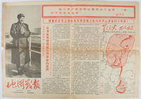
地图戰報: 第6期. Di tu zhan bao: di liu qi. Chinese Cultural Revolution Maps - War Dispatches of Maps. Issue no. 6.
Beijing.: 地图戰報.Di tu zhan bao. September1967. Maps printed in red and black single sheet printed on both sides folded scale not given photographic image of Mao Zedong. Some light browning at edges with tears and losses on left edge still good. Text in Chinese. Sheet measures 26.5 x 38.4cm. Includes a map of Autumn Harvest Uprising and also shows the routes of the military advancing towards Jinggangshan between September and October 1927. On reverse left section a map shows the route along which Chairman Mao led the Fourth Army of the Chinese Red Army marching towards south of Anhui and Jiangxi Provinces in 1929. On reverse right section a map titled "The Long March of The Chinese Workers' and Peasants' Red Army October 1934-October 1935". Quotations of Chairman Mao about the Long March insert on corners of the map. <br> <br>Issue no. 6 of a series of maps with text issued by the Red Guards organisations in the form of Cultural Revolution tabloid-sized newspaper. This issue is designed to celebrate the 40th anniversary of the Autumn Harvest Uprising which was one of the earliest armed uprisings organised by the Chinese Communist Party. . 地图戰報.[Di tu zhan bao]. unknown
Referenz des Buchhändlers : 169746
|
|
|
[EGYPTE] BAEDEKER Karl:
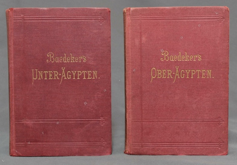
Agypten. I: Unter-Agypten und die Sinai-Halbinsel. II: Ober-Agypten und Nubien bis zum zweiten Katarakt.
Leipzig, Baedeker, 1894 / 1891. 2 volumes in-12 de CLXXXVIII-256 et XL-400 pages, couvertures souples de percaline bordeaux ornées de filets à froid, titre doré aux dos et aux premiers plats, tranches marbrées. Infimes accrocs aux coiffes, 3 coins très légèrement frottés, premières charnières faibles.
Referenz des Buchhändlers : 10496
|
|
|
[EGYPTE] PROKESCH-OSTEN Anton, Grafen von:
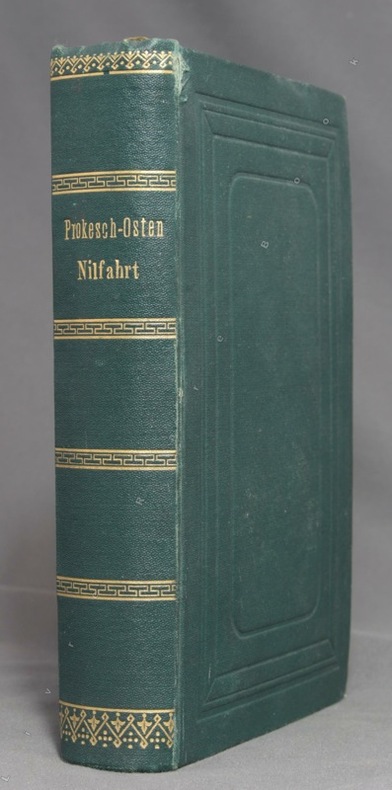
Nilfahrt bis zu den zweiten Katarakten. Ein Führer durch Aegypten und Nubien.
Leipzig, F. A. Brockhaus, 1874. In-12 de XIV-[2]-584 pages, pleine percaline verte, roulettes, titre et filets dorés au dos, plats ornés d'encadrements à froid, tranches marbrées. Tout petit accroc au mors du premier plat. Un prospectus Deutsche Buch-Gemeinschaft glissé dans le livre (et que nous y laissons) a foncé les deux pages entre lesquelles il se trouve.
Referenz des Buchhändlers : 10458
|
|
|
[EGYPTE] VOLNEY (Constantin François, comte de):
Voyage en Syrie et en Egypte pendant les années 1783, 1784 et 1785.
Paris, Desenne et Vollard, 1787. 2 volumes in-8 de XVI-383 et VIII-458-[4] pages, demi-veau brun à coins, dos lisses ornés de filets dorés, pièces de titre et tomaison beige et noire, coins frottés, pâle auréole d'humidité à la fin du second volume. Tampon de propriété: "Fs. Sautter, Pasteur, Ch.[evali]er de la légion d'honneur".
Referenz des Buchhändlers : 13015
|
|
|
[EGYPT - ANTIQUE MAP] JOHNSTON, KEITH, FRSE; JOHNSTON, W & A K (ENGRAVERS). F R S E
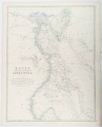
Egypt Arabia Petræa and Lower Nubia.
Edinburgh & London.: William Blackwood & Sons. 1861. Engraved map with original outline hand-colour 57 x 43.8 cm 61.1 x 49 cm sheet central fold very slight edge toning but the map in very good bright condition. First edition. Fine large folding map: the Nile delta and river with attractive original outline colour railways and canals marked and name references to biblical and classical geography. Published for inclusion as map 39 in "Keith Johnston's royal atlas of modern geography" . William Blackwood & Sons. unknown
Referenz des Buchhändlers : 177021
|
|

 Per e-mail erhalten
 Als pdf-Dokument herunterladen
 RSS feed
 Permanenter link


