|
[VIETNAM LAOS CAMBODIA - WAR ERA MAP]
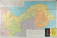
Rand McNally Official Map of Vietnam Laos and Cambodia.
Chicago.: Rand McNally. circa1970. Very large folding colour map 136 x 89 cms folding to 30.5 x 22.8 cms legend and glossary with a gazetteer in an upper corner to North and South Vietnam Cambodia and Laos small fold split no loss in very good condition. Extremely detailed map of Indochina scale of 1 inch to approximately 20 miles with roads paths trails railroads airports marked and indexes to cities and towns and population totals in South Vietnam North Vietnam Cambodia and Laos. Includes a glossary of foreign terms and a brief gazetteer. . Rand McNally. unknown
Riferimento per il libraio : 197689
|
|
|
[VIETNAM WAR - MAPS]
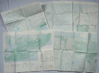
A Series of Five Adjoining Vietnam War Era Maps.
Washington D.C.: Army Map Service. 1967-1968. Five printed colour adjoining topographic maps folded legends to physical features including roads some including footpaths or trails railroads rivers streams lakes mountains boundaries and place names Route Markers Railroads airfields bridges and detailed terrain a few including tea plantations rice fields coffee and rubber plantations. glossary of Vietnamese terms in very good unused condition: <br> <br>1. Special Use S.E. Asia. Xuat-Banlan Thu. Sheet 6026. Series L607. <br>Map 57.3 x 73 cms sheet inset map of Hon Khoai Island; <br> <br>2. Special Use S.E. Asia. Sheet 5927. Series L607. Khoang Cach Deu Vong Cao-DQ. <br>Map 72.3 x 57.3 cms sheet. he Viet Cong stronghold of Quan Long Cà Mau is shown; <br> <br>3. Special Use S.E. Asia. Sheet 6027. Series L607. Vietnam. <br>Map 72.3 x 57.3 cms sheet legend showing boundaries villages elevation and hydrographic data glossary of Vietnamese terms in very good unused condition. Southeast Vietnam and the Mekong delta. The town of Vĩnh Lợi Bạc Liêu is at the mid right edge of map.; <br> <br>4. Special Use S.E. Asia. Sheet 6028. Series L607. Vietnam. Do Cao Toi-da Duoi 5 met. <br>Map 54.5 x 54.5 cms 73.3 x 56.6 cms sheet; <br> <br>5. Special Use S.E. Asia. Sheet 5928. Series L607. Vietnam. Hon Rai. <br>Map 55 x 55 cms 74.3 x 56.7 cms sheet inset map of Hon Rai. <br>The caption has the note: "Dense forest or jungle indicates more than 25% of ground is concealed by canopy with undergrowth generally impassable on foot". Detailed topographic maps in unusually fine condition of Central and Southern Vietnam issued during the Vietnam War by the United States Corps of Engineers. . Army Map Service. unknown
Riferimento per il libraio : 203843
|
|
|
[VILA I DINARÉS, Pau].
Miscel·lània Pau Vila. Biografia. Bibliografia. Treballs d' Homenatge de la Societat Catalana de Geografia. Pròleg per Josep Iglésies.
Granollers, Editorial Montblanc-Martin, 1975. 4to. mayor; 2 hs., 546 pp. Numerosas ilustraciones fotográficas y mapas plegados fuera de texto. Cubiertas originales.

|
|
|
[VIN, CARTES POSTALES]
de Kintzheim à Cleebourg-La route du vin d'alsace, les plus belles cartes postales (die elsassische weinstrasse).
Strasbourg, DIFAL, 1991 ; in-4, 126 pp., cartonnage de l'éditeur. De Kintzheim à Cleebourg (tome 2) texte bilingue très bon état avec sa jaquette.
Riferimento per il libraio : 202204346
|
|
|
[VIN, CARTES POSTALES]
La route du vin d'alsace, les plus belles cartes postales (die elsassische weinstrasse).
Strasbourg, DIFAL, 1991 ; in-4, 126 pp., cartonnage d'éditeur avec jaquette (neuf sous blister). De Kintzheim àà Cleebourg (tome 2) texte bilingue.
Riferimento per il libraio : 200916116
|
|
|
[VIN, CARTES POSTALES]
La route du vin d'alsace, les plus belles cartes postales (die elsassische weinstrasse).
Strasbourg, DIFAL, 1991 ; in-4, 126 pp., cartonnage d'éditeur avec jaquette (neuf sous blister). De Kintzheim àà Cleebourg (tome 2) texte bilingue.
Riferimento per il libraio : 200916114
|
|
|
[VIN, CARTES POSTALES]
La route du vin d'alsace, les plus belles cartes postales (die elsassische weinstrasse).
Strasbourg, DIFAL, 1991 ; in-4, 126 pp., cartonnage d'éditeur avec jaquette (neuf sous blister). De Kintzheim àà Cleebourg (tome 2) texte bilingue.
Riferimento per il libraio : 200916113
|
|
|
[VIN, CARTES POSTALES]
La route du vin d'alsace, les plus belles cartes postales (die elsassische weinstrasse).
Strasbourg, DIFAL, 1991 ; in-4, 126 pp., cartonnage d'éditeur avec jaquette (neuf sous blister). De Kintzheim àà Cleebourg (tome 2) texte bilingue.
Riferimento per il libraio : 200916112
|
|
|
[VIN, CARTES POSTALES]
La route du vin d'alsace, les plus belles cartes postales (die elsassische weinstrasse).
Strasbourg, DIFAL, 1991 ; in-4, 126 pp., cartonnage d'éditeur avec jaquette (neuf sous blister). De Kintzheim àà Cleebourg (tome 2) texte bilingue.
Riferimento per il libraio : 200916111
|
|
|
[VIN, CARTES POSTALES]
La route du vin d'alsace, les plus belles cartes postales (die elsassische weinstrasse).
Strasbourg, DIFAL, 1991 ; in-4, 126 pp., cartonnage d'éditeur avec jaquette (neuf sous blister). De Kintzheim àà Cleebourg (tome 2) texte bilingue.
Riferimento per il libraio : 200916110
|
|
|
[VIN, CARTES POSTALES]
La route du vin d'alsace, les plus belles cartes postales (die elsassische weinstrasse).
Strasbourg, DIFAL, 1991 ; in-4, 126 pp., cartonnage d'éditeur avec jaquette (neuf sous blister). De Kintzheim àà Cleebourg (tome 2) texte bilingue.
Riferimento per il libraio : 200916109
|
|
|
[VIN, CARTES POSTALES]
La route du vin d'alsace, les plus belles cartes postales (die elsassische weinstrasse).
Strasbourg, DIFAL, 1991 ; in-4, 126 pp., cartonnage d'éditeur avec jaquette (neuf sous blister). De Kintzheim àà Cleebourg (tome 2) texte bilingue.
Riferimento per il libraio : 200916108
|
|
|
[VIN, CARTES POSTALES]
La route du vin d'alsace, les plus belles cartes postales (die elsassische weinstrasse).
Strasbourg, DIFAL, 1991 ; in-4, 126 pp., cartonnage d'éditeur avec jaquette (neuf sous blister). De Kintzheim àà Cleebourg (tome 2) texte bilingue.
Riferimento per il libraio : 200916107
|
|
|
[VIN, CARTES POSTALES]
La route du vin d'alsace, les plus belles cartes postales (die elsassische weinstrasse).
Strasbourg, DIFAL, 1991 ; in-4, 126 pp., cartonnage d'éditeur avec jaquette (neuf). De Kintzheim àà Cleebourg (tome 2) texte bilingue.
Riferimento per il libraio : 200916105
|
|
|
[VIN] MONTORGUEIL Georges; FOREST Louis:
Monseigneur le vin.
Paris, Etablissements Nicolas, 1925-1927. 4 volumes in-8, reliés en 3 volumes, demi-toile lie-de-vin, pièces de titre verte, couvertures conservées; têtes grises.
Riferimento per il libraio : 19045
|
|
|
[VOLTAIRE François Marie Arouet]:
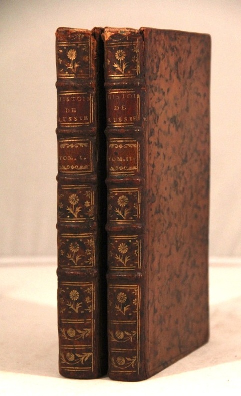
Histoire de l'Empire de Russie sous Pierre le Grand, par l'auteur de l'histoire de Charles XII.
sans lieu [Genève], sans nom [Cramer], 1759 - 1763. 2 volumes in-8 de XXXIX, 302p., + [2]ff., XVI, 318p. plein veau marbré brun, dos à nerfs orné de filets et fleurons dorés, pièces de titre et tomaison rouge, coiffes sup. manquantes, mors un peu fendus, tampon répété sur les deux page de titre "L. Derôme". Le titre de la première partie est imprimé en rouge et noir, celui de la seconde partie en noir. Sans l'errata du tome 1er, mais les 3 fautes ont été corrigées.
Riferimento per il libraio : 5671
|
|
|
[WESTERN INDIA - MAP] BARTHOLOMEW, J (ILLUS).
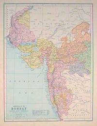
Presidency of Bombay Indore Agency Berar &c.
Edinburgh.: J. Bartholomew. circa1880s. Map 40.2 x 30.4 cms with printed colour and outline hand colour in very good condition. Handsome map with colonial interests attractively coloured. . J. Bartholomew unknown
Riferimento per il libraio : 187528
|
|
|
[Wien-Plan v. 1547].
Bonifaz Wohlmuth’s Steinmetzten und Baumeister Kaiser Ferdinands I., Grundriss der Stadt-Wien vom Jahre 1547. Gezeichnet von Albert Camesina [...] Herausgegeben durch den Alterthums-Verein zu Wien im Jahre 1857 und 1858. Wien, k. k. Hof- und Staatsdruckerei, 1856-1858.
Farblithographie in 9 Blättern nach der kolorierten Originalfederzeichnung im Historischen Museum der Stadt Wien, bezeichnet “Alb: Camesina fe: 1856”. Auf Leinen als Wandkarte aufgezogen. 188:228 cm. Der von Albert Camesina (1806-1881) lithographierte und in kleiner Auflage gedruckte Plan erschien über zwei Jahre in einzelnen Lieferungen, was - neben dem übergroßen Format der Wandkarte und der verhältnismäßig kleinen Auflage - einen der Hauptgründe für seine Seltenheit darstellt. Der Wienplan des Mitarbeiters Augustin Hirschvogels Bonifaz Wolmut “stellte eine Kombination von ausgeführten und projektierten Festungsanlagen zur Diskussion. Darüber hinaus ergeben die detaillierte Wiedergabe des Grundrisses der Innenstadt [...] und die in freier Perspektive festgehaltenen Vorstadtränder eine grundlegende Dokumentation Wiens (Wien im Mittelalter, Kat. des Historischen Museums der Stadt Wien, 1975/6, Nr. 364). - Nur zwei der neun Segmente unbedeutend fleckig, am rechten unteren Rand etwas bestoßen, im Ganzen aber von sehr ansprechender Erhaltung. Fischler, Historischer Atlas des Wiener Stadtbildes, 12f. Oppl, Wien im Bild historischer Karten, Tafel 5.

|
|
|
[Wien-Plan v. 1547].
Bonifaz Wohlmuth’s Steinmetzten und Baumeister Kaiser Ferdinands I., Grundriss der Stadt-Wien vom Jahre 1547. Gezeichnet von Albert Camesina [...] Herausgegeben durch den Alterthums-Verein zu Wien im Jahre 1857 und 1858. Wien, k. k. Hof- und Staatsdruckerei, 1856-1858.
Farblithographie in 9 Blättern nach der kolorierten Originalfederzeichnung im Historischen Museum der Stadt Wien, bezeichnet "Alb: Camesina fe: 1856". Einzeln unter Passepartouts montiert. Jeweils 700:850 mm. Der von Albert Camesina (1806-1881) lithographierte und in kleiner Auflage gedruckte Plan erschien über zwei Jahre in einzelnen Lieferungen, was - neben dem übergroßen Format und der verhältnismäßig kleinen Auflage - einen der Hauptgründe für seine Seltenheit darstellt. Der Wienplan des Mitarbeiters Augustin Hirschvogels Bonifaz Wolmut “stellte eine Kombination von ausgeführten und projektierten Festungsanlagen zur Diskussion. Darüber hinaus ergeben die detaillierte Wiedergabe des Grundrisses der Innenstadt [...] und die in freier Perspektive festgehaltenen Vorstadtränder eine grundlegende Dokumentation Wiens (Wien im Mittelalter, Kat. des Historischen Museums der Stadt Wien, 1975/6, Nr. 364). - Tadelloses u. fleckenfreies, in den originalen Einzelsegmenten erhaltenes Exemplar. Fischler, Historischer Atlas des Wiener Stadtbildes, 12f. Oppl, Wien im Bild historischer Karten, Tafel 5.

|
|
|
[Wien].
Vue de Vienne prise du coté du chateau de Schönbrunn. Paris, Guérin, ca. 1830.
Kolorierte Umrissradierung. Unter Glas gerahmt. 630:840 mm. Prachtvolle Gesamtansicht der Stadt Wien, von der Westseite gezeichnet von Högl, gest. von Schwartz. - Ansprechendes, großformatiges Blatt im Originalkolorit der Zeit.

|
|
|
[WILKES, J].
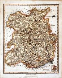
Shropshire.
London.: J. Wilkes. 1827. Attractive hand coloured map of Shropshire 27.5 x 21.5 cm. very occasional light foxing on reverse but not visible on the image itself. A most attractive map. . [J. Wilkes.] unknown
Riferimento per il libraio : 61872
|
|
|
[WORLD MAP OF MAJOR RELIGIONS].
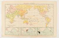
Religions of the World.
London.: Times Atlas of the World. 1895. Map printed in colour 23.2 x 35.9 cm. two edges gilt with three inset maps key to religions outlined in colour bottom margin chipped edges browned a few silverfish abrasions affecting the verso but in good condition. . (Times Atlas of the World) unknown
Riferimento per il libraio : 175135
|
|
|
[WORLD MAP - WORLD WAR II]
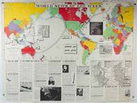
World News of the Week. Monday Apr. 13 1942. Covering period Apr. 3 to Apr. 9. Military Edition.
Army Orientation Course. / News Map of the Week Inc. Volume 4 No. 32. 13 April1942. Folding colour pictorial map on sheet 88 x 119 cms blank on verso inset maps two photographic diagrams and black and white photographic illustrations descriptive text top edge chipped a few short edge tears and lower corner torn no loss pinholes at the corners inoffensive tidemark at a lower corner in good condition. Colour world map showing political boundaries and military events of World War II from April 3 to 9 1942. with descriptive text beneath including: the loss of two British Cruisers off Ceylon; the occupation of Bataan by the Japanese and their landing on Manus; Japanese war tactics revealed by Malay prisoners and the increasing importance of Central Africa to the Allied war effort. The. Map is indexed according to these notes. Two inset maps of Europe chart Hitler's gains in 1941 and activity on the Russian Front. Additional diagrams on the main world map show war spending and the civilian and war output of US industries. . Army Orientation Course. / News Map of the Week, Inc. unknown
Riferimento per il libraio : 202620
|
|
|
[WORLD WAR II MAPS]
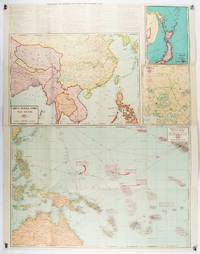
China Burma India War Sector etc. Chronology of Important War Events since December 7 1941.
Chicago.: Geographical Publishing Company. 1943. 10 printed colour maps on a large single sheet 91 x 71 cms small inset map of the European theatre chronology of events original folds a few short fold splits archivally sealed; in very good condition. A suite of numbered U.S. war maps with Allied action overstamped in red by the publisher that for Germany and France with pictorial stamps for strategic targets including "Chemical Factories" and "Airplane Factories". The maps numbered 1 to 10: English Channel; Italy; Southern Greece; Western Mediterranean Sea; Germany and France; Baltic Sea and Scandinavia; China Burma India; Japan; Tokyo; and Greater Pacific Battle Zone: a large half sheet map noting the placement of US and Japanese bases. The "Chronology of Important War Events" lists action from the bombing of Pearl Harbour: "Japan's day of Infamy: Japanese air attack cripples American Fleet at Pearl Harbour" to March 21 1944 "Germans take over key political posts in Bulgaria and Romania". <br> <br>Issued by the Geographical Publishing Company of Chicago this educational sheet includes an advertisement for WLS Chicago "The prairie farmer station" with a list of their war broadcasts and a world clock. . Geographical Publishing Company. unknown
Riferimento per il libraio : 206908
|
|
|
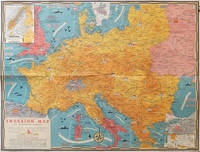
[WORLD WAR II MAP] TURNER, STANLEY (CARTOGRAPHER).
Dated Events Invasion Map of Fortress Europe.
Toronto.: C.C. Petersen. 1944. Colour pictorial map 51 x 67 cms two small inset maps of Scandinavia and the Baltic and South Greece and the Dodecanese on the verso a black and white world map showing the Pacific Theatre marking keys events of the war and in European world history folding into the original pictorial pocket a little toned and marked 25.8 x 17.7 cms small fold split but in very good condition. A scarce map in the "Dated Events" series published by C.C. Petersen in Canada and distributed throughout North America commemorating D-Day. The colour map by Stanley Turner encompasses the area from England as far south as the French border with Spain and as far east as the USSR and Turkey. "With this invasion map you will be able to follow the progress of the Allied troops on their way to smash Germany.". The text at lower left goes on to elaborate on the features shown on the map from elevation "major battles are seldom fought on the tops of mountains" to pictographs of bombs falling. <br> <br>The black and white map on the verso shows the Far Eastern theatre of war centring on the Pacific Ocean with the Asian landmass including India and the USSR at upper left Australia at lower left and North America and the coast of South America at right of the map. Naval bases are shown and significant events in the war are noted in text boxes. <br> <br>A handsome production of a scarce map rarely seen with the original pictorial pocket. . C.C. Petersen. unknown
Riferimento per il libraio : 206781
|
|
|
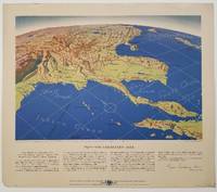
[WORLD WAR II MAPS] THOMPSON, KENNETH W (ARTIST); ELIOT, GEORGE FIELDING
Five WWII Bird's-eye View Maps including the Pacific and Southeast Asia.
Remington Rand. 1944. Five printed colour maps each: 31.4 x 47 cms; 46.3 x 53.3 cms sheet central fold marginal edge wear chips and a few small edge tears tidemark affecting the ocean at the outer edge of Map VII but all the maps in very good condition. From a series of World War II battlefront maps "for the delight of arm-chair strategists" published by the Library Bureau of Remington Rand seven were published. Taken from a bird's eye view of the globe and with relief artistically rendered by artist Kenneth Thompson 1907-1996 and descriptive text by George Fielding Eliot 1894-1971. Eliot spent his youth in Australia attending Melbourne University serving with distinction in the Australian Infantry in WWI. Moving to the United States after a short stint in Canada serving with the RCMP her served as a reserve officer in the U.S. Army reserve in military intelligence from 1922 to 1933 and during WWII Eliot famously broadcast the first extended television coverage following the attack on Pearl Harbor. He continued to write books and articles about military strategy and world politics into the 1960s. <br> <br>In keeping with the "aviation-age" cartography of Richard Edes Harrison the unusual perspective of the maps--from above and often with a direction other than north at the top of the map--challenges the viewer to reconsider the geopolitical situation with the text of Eliot as a further prompt his captions below: <br> <br>Map III Italy & South France "Hannibal Caesar and Napoleon made their reputations here" <br>Map IV The Western Front "Will the cockpit of 1918 see the decisive battles of 1944" <br>Map V Southeastern Asia "The road to Mandalay -- and to China --along which bombs for Tokyo must travel" <br>Map VI The Southwest Pacific "Island-hopping toward Japan -- in short and long hops" <br>Map V11 The North Pacific "Here the enemy trusts in the protection of vast ocean distances" . Remington Rand. unknown
Riferimento per il libraio : 200808
|
|
|
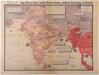
[WORLD WAR II - MAP] BURKE, HOWARD; CAB C A B
Jap Drive into India perils entire Allied strategy in Pacific
Los Angeles.: Los Angeles Examiner. April 31944. Colour pictorial map on a single newspaper leaf 37 x 50 cms; 41.5 x 54.6 cms sheet unrelated text on the verso although with an interesting account from a soldier's letter about an air raid in China toning more marked at the central fold two small splits no loss to the map edge wear with several small marginal edge tears neatly repaired on the verso with archival washi map unaffected in good condition. A dynamic map prepared and illustrated by the Examiner's art critic and editor Howard Burke covering the area surrounding India and Central Asia showing Japanese conquered territory in Malaya Thailand Indo-China and Burma; and in India British-controlled states and native feudal and protected states. <br> <br>Text boxes and pictographs give an overview of the geopolitical situation from the Allied perspective. One box notes "Chanda Bose has many adherents and fanatical followers in Bengal. They may prove to be a powerful fifth column in India". Text at lower edge opines "The situation in India is critical and has grown more so as the all-out offensive against Japan has been delayed. If the Allies do not act at once and with great force all our gains may be wiped out and the war in the Pacific prolonged indefinitely." <br> <br>The decisive and devastating bombings that were to signal such an end were four months away. <br> <br>Rare on the market. . Los Angeles Examiner. unknown
Riferimento per il libraio : 214362
|
|
|
[WORLD WAR II -- PICTORIAL MAPS]. MANNING, FE F E
Target Berlin: Newsmap Monday October 25 1943. . . 215th week of the War - 97th Week of U.S. Participation Volume II No. 27. . . 536110.
Washington D.C.: Prepared and distributed by Army Orientation Course Special Service Division 1943. One double-sided double-atlas folio colour map sized 35 x 47 in. 6.25 x 12 in. when folded as issued colour lithographic hemispherican map on recto 4 inset 2-colour maps on verso text in blue & black w/ photo illustrations as well original fold creases slight age toning very minor shelfwear folds w/ minor rubbing still a VG bright copy. First edition of this remarkable World War II propaganda pictorial map featuring Berlin Germany situated at the center of concentric bulls-eye circles and the artist has wonderfully detailed how they created this simulated 3-dimensional image as well as a detachable scale to be cut-off and used by the educational viewer. Within days of this map’s publications Allied bombers directed by British Air Marshall Arthur “bomber†Harris directed destructive air raids against the city lasting until March 1944 which also demonstrated the ineffectiveness of bombing population centers in order to alter the course of a War. The Newsmap portion detailing the course of the War in the 215th Week includes the inset maps of Bridgeheads across the Dnepr River as the Soviet forces began pushing German Army units back along the Eastern Front stretching from Leningrad to the Sea of Azov; the New Britain campaigns in the South Pacific; Operations in Burma including pushes over the Burma Road against the Japanese and bombing routes into Italy Germany and central Europe. Manning fl. 1940-1945 was a cartographer with the Chicago Sun and during World War II produced a number of propaganda maps for the Army Orientation Course of the Special Service Division Army Service Forces as part of the United States War Department. Prepared and distributed by Army Orientation Course, Special Service Division, unknown
Riferimento per il libraio : 64219
|
|
|
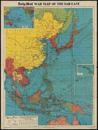
[WORLD WAR II MAP OF EAST ASIA].
The Daily Mail War Map of the Far East.
London.: George Philip & Son. 1944. Full colour folding map 101.5 x 76cm sheet inset maps legend folding into title wrapper 25.7 x 19.4 cms covers a little dusty and discoloured a few short fold splits without loss but the map in very good bright condition. Map of the Pacific Theatre of World War II with borders drawn as they stood in 1937 - complete with Chinese claims on Mongolia Tuva and Tibet. <br> <br>Shows transportation routes principal railways oil fields Allied naval bases territory occupied by the British Empire French Empire and the United States. This map shows only the northernmost section of Australia which allows for much better detail of the countries of East Asia. Small inset map of the Hawaiin Islands at mid right. Inset map of the Pacific Ocean at upper left. . George Philip & Son. unknown
Riferimento per il libraio : 205765
|
|
|
[WORLD WAR II -- SUBMARINES & MAPS].
Your submarine: versatile warship. Newsmap for the armed forces: 268th week of the War -- 150th week of U.S. participation. . . Vol. III No. 28F.
Washington D.C. & New York NY: Navy distribution by Educational Services Section; Prepared and distributed by Army Information Branch Army Service Forces 1944. Oblong double atlas folio. 47 x 34.5 in. One large double-sided colour lithograph map and panoramic cutaway view minor dustsoiling light age toning very minor creasing at folds still a NF copy. First edition of this splendid educational panorama with cutaway view of a World War II Balao-class submarine conning tower lines have been altered to prevent enemy identification when surfacing which improved upon the Gato class with higher yield-strength steel pressure hull skins and increased depth to 400 feet. The four inset maps on verso track the campaigns in the Philippine Islands with maps for Manila Bay and Cebu Leyte & Samar separately as well as maps tracking the Western Front progress in 1944 just 4 months after D-Day. Navy distribution by Educational Services Section; Prepared and distributed by Army Information Branch, Army Service Forces, unknown
Riferimento per il libraio : 63900
|
|
|
[WWII JAPANESE MAP OF AUSTRALIA].
標準大東亞分圖・オーストラリヤ篇 Hyōjun Daitōa bunzu daitōa bunzu: Ōsutorariyahen. Standard Maps of Greater East Asia: Complete Map of Australia.
Tokyo.: Tōseisha. Showa 18 1943. Folding colour map of Australia 54.2 x 76.4cm. Some foxing particularly along folds and upper right margins a few repaired tears and small holes at folds.With original sleeve. The 15th map in the Standard Maps of Greater East Asia series of 20 maps. Shows the natural resources such as sheep gold pearl diary regions opals etc. Tasmania appears as an inset in the bottom right corner. Text in Japanese. . Tōseisha. unknown
Riferimento per il libraio : 162103

|
|
|
[WWII MAP OF JAPAN AND THE PACIFIC]
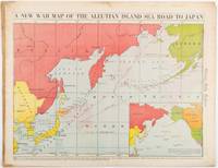
A New War Map of the Aleutian Island Sea Road to Japan. caption title
Chicago.: Chicago Daily Tribune. 28 January1942. Printed colour map 40.3 x 53.6 cm; 46.5 x 60 cm sheet inset map of the North Pacific back cover from a section of the Chicago Daily Tribune newspaper pages 21-34 January 28 1942; central fold edgewear and browning with a few minor tears not affecting the map in very good condition. Based on a Rand McNally map and issued less than two months after the bombing of Pearl Harbour by the Japanese. The Tribune briskly got to work issuing maps for readers showing the beginnings of the war with Japan. Later maps were also published for sale separately but remarkably few have survived. The map shows "the nearness of our Aleutian Island chain west of Alaska to the islands of Japan. At Dutch Harbor and other points in the Aleutians are actual and potential sea and air bases lying on the shortest route from northwestern United States to Japan." The inset map at lower right situates the areas in the larger map in respect to the countries bordering the North Pacific Ocean. <br> <br>Included with the map is the complete newspaper section from which it is the final full page. Covering sport and the market with half a dozen popular comic strips including "Dick Tracy" and "Little Orphan Annie" it shows a domestic United States a world away from what had been seen as a European War. <br> <br>". the historic Chicago Tribune was an innovator in color inks and printing but also a pioneer in bringing colorful art in the form of illustrations photographs cartoons and advertisements to the average person in an everyday medium." see The Janet A. Ginsburg Chicago Tribune Collection Michigan State University Libraries." . Chicago Daily Tribune. unknown
Riferimento per il libraio : 206849
|
|
|
[WWII MAP OF EAST ASIA & THE PACIFIC]. WISNER, W H
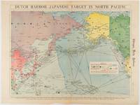
Dutch Harbor -- Japanese Target in the North Pacific.
Chicago.: Chicago Daily Tribune. Friday June 51942. Printed colour map on a single newspaper leaf 37.5 x 53.2 cm; 44.7 x 59.8 cm sheet inset legend marginal browning and at the folds some undulation of paper and tide mark along lower section but in remarkably bright very good condition. Strategic map published in the Chicago Daily Tribune "The World's Greatest Newspaper" on June 5th 1942 two days after the Japanese attack on Dutch Harbor the site of the US army and navy bases in the Aleutians and as it transpired at the outset of the Battle of MIdway. The owner and proprietor of the Tribune Robert McCormick was staunchly against the United States entering the war and had firm views once it had occurred that American resources should not be used defending the British Empire. Famously the Tribune published the "Victory Program" Roosevelt’s military plan to prepare the United States for possible entry into World War II and was subject to prosecution for an alleged violation of the Espionage Act relating to the newspaper’s front-page account of the Battle of Midway 4-7 June 1942. It became an important test case for the limits of free speech and censorship during war-time. <br> <br>The Legend shows territorial Control of Ocean Areas marking Japanese Naval and Air bases as of 1941 and "according to latest reports" those established in the first six months of 1942. Also shown are pre-war sovereignties as at the bombing of Pearl Harbour on December 7th 1941. The Anson Archipelago is shown but a question mark "indicates islands etc. whose existence or give position is doubtful…". . Chicago Daily Tribune. unknown
Riferimento per il libraio : 180751
|
|
|
[WWII MAP OF JAPAN] TSUTSUKI, T
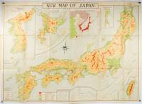
New Map of Japan.
Tokyo.: Nihon-Kenkyusha. 1935. Large folding colour map of Japan 74.3 x 10⁵ cms; folding into printed card covers 27 x 19.5 cms: 9 insets: Chosen Korea; Hokkaido; Chisima Islands; General Map of Japan and Manchuokuo; Karafuto Saghalien; Okinawa Loochoo; Taiwan Formosa; Micronesia; Ogasawara; Hajijoshima; the covers a litle worn and marked and the sheet slightly toned but the map is in very bright clean condition. Scarce World War II era map of Japan including Korea published in English by Kenkyusha. Founded in 1907 it had a history of publishing for students of English and the English market. An attractively composed map in remarkbable condition; with the insets circled around the islands of Japan heights marked in graduations from green to red and showing provinces railways roads steamer routes Buddhist and Shinto Temples. . Nihon-Kenkyusha. unknown
Riferimento per il libraio : 214827
|
|
|
[WWII MAP OF ASIA] WISNER, W H
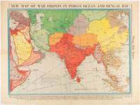
New Map of War Fronts in Indian Ocean and Bengal Bay.
Chicago.: Chicago Daily Tribune. April 211942. Printed colour map on a single newspaper leaf 37.5 x 53.2 cm; 60 x 45 x 59.6 cm sheet marginal browning and at the folds but remarkably bright in very good condition. World War II map of Asia save for Japan showing British allies colonies and lines of supply and marking Japanese territorial occupation published in the Chicago Daily Tribune "The World's Greatest Newspaper" in April 1942. <br>"The Indian Ocean and the Bay of Bengal are the strategic waters in this campaign in which the occupied parts of Burma and the Andaman Islands serve as bases" caption <br>". the historic Chicago Tribune was an innovator in color inks and printing but also a pioneer in bringing colorful art in the form of illustrations photographs cartoons and advertisements to the average person in an everyday medium." see The Janet A. Ginsburg Chicago Tribune Collection Michigan State University Libraries. . Chicago Daily Tribune. unknown
Riferimento per il libraio : 180782
|
|
|
[WWII MAP OF SOUTHEAST ASIA] WISNER, W H
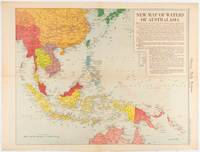
New Map of Waters of Australasia.
Chicago.: Chicago Daily Tribune. December 161942. Printed colour map on a single newspaper leaf 41.6 x 52.8 cm; 45 x 60 cm sheet inset legends marginal browning and at the folds but remarkably bright in very good condition. Map of Southeast Asia published in the Chicago Daily Tribune "The World's Greatest Newspaper" delineating the Pacific theatre of war with a detailed text legend. "This is a new war map of the far east showing an important part of southeastern Asia and Australasian waters from a station in which according to Prime Minister Curtin of Australia a United States fleet will operate." Interestingly New Guinea is marked as British rather than as an Australian administrative region which it became following the Treaty of Versailles. <br> <br>"… the historic Chicago Tribune was an innovator in color inks and printing but also a pioneer in bringing colorful art in the form of illustrations photographs cartoons and advertisements to the average person in an everyday medium." see The Janet A. Ginsburg Chicago Tribune Collection Michigan State University Libraries. . Chicago Daily Tribune. unknown
Riferimento per il libraio : 180757
|
|
|
[WWII MAP OF ASIA] WISNER, W H
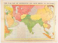
New War Map of Continental Asia from Siberia to Singapore
Chicago.: Chicago Daily Tribune. January 91942. Printed colour map on a single newspaper leaf 37.2 x 53.4 cm; 45 x 59.9 cm sheet inset legend marginal browning and at the folds lower margin with small edges tears not affecting the caption but remarkably bright in very good condition. Rare map of Asia "Between Suez on the west and Shanghai on the east" showing territorial interests and theatres of war published in the Chicago Daily Tribune in January 1942 barely two months after the Uniited States had joined the war effort after the bombing of Pearl Harbour. Thailand and Vietnam "French Indo-China" are marked "Occupied by the Japanese" and north-eastern China similarly marked Iran "Anglo-Russian Occupation" and the Gulf states "British Ally". The caption notes that "The map inludes waters thru which runs the British life line from the Suez canal to remote Australia and New Zealand. Nearly half the people in the world live in the lands shown on this map--more than 450 million for example in China and more than 375 million in India". <br> <br>". the historic Chicago Tribune was an innovator in color inks and printing but also a pioneer in bringing colorful art in the form of illustrations photographs cartoons and advertisements to the average person in an everyday medium." see The Janet A. Ginsburg Chicago Tribune Collection Michigan State University Libraries. . Chicago Daily Tribune. unknown
Riferimento per il libraio : 180760
|
|
|
[WWII MAP OF THE JAPANESE EMPIRE]
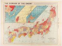
The Domain of the Enemy
Chicago.: Chicago Daily Tribune. December 121941. Printed colour map on a single newspaper leaf 41.5 x 53 cm; 45.1 x 59.9 cm sheet three inset maps of the Japanese Empire; Taiwan and Ryukyu Islands; and Hokkaido and Chisima marginal browning and at the central fold but remarkably bright in very good condition. Map of the Japanese Empire ominously titled published in the Chicago Daily Tribune one week after the bombing of Pearl Harbour. Prefectures are attractively coloured. <br> <br>Based on a Rand McNally map the Tribune briskly got to work issuing maps for readers showing the beginnings of the war with Japan. Later maps were also published for sale separately but remarkably few have survived. <br>". the historic Chicago Tribune was an innovator in color inks and printing but also a pioneer in bringing colorful art in the form of illustrations photographs cartoons and advertisements to the average person in an everyday medium." see The Janet A. Ginsburg Chicago Tribune Collection Michigan State University Libraries. . Chicago Daily Tribune. unknown
Riferimento per il libraio : 180789
|
|
|
[WWII MAP OF THE JAPANESE EMPIRE] WISNER, W H
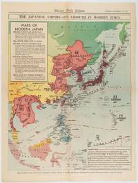
The Japanese Empire -- Its Growth in Modern Times
Chicago.: Chicago Daily Tribune. December 161941. Printed colour map on a single newspaper leaf 50 x 41.5 cm; 60 x 45 cm sheet two inset legends marginal browning and at the folds but remarkably bright in very good condition. Map of the Japanese Empire published in the Chicago Daily Tribune "The World's Greatest Newspaper" on December 16th 1941 9 days after the bombing of Pearl Harbour. The two legends list the "Wars of Modern Japan" from 1894 with territorial gains marked noting that "Each seizure of mainland areas has given Japan new field of raw materials." <br> <br>"… the historic Chicago Tribune was an innovator in color inks and printing but also a pioneer in bringing colorful art in the form of illustrations photographs cartoons and advertisements to the average person in an everyday medium." see The Janet A. Ginsburg Chicago Tribune Collection Michigan State University Libraries. . Chicago Daily Tribune. unknown
Riferimento per il libraio : 180755
|
|
|
[WWII MAP OF CHINA]
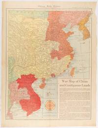
War Map of China and Contiguous Lands.
Chicago.: Chicago Daily Tribune. January 151942. Printed colour map on a single newspaper leaf 53 x 40.7 cm; 59.8 x 45 cm sheet inset text box marginal browning and at the folds but remarkably bright in very good condition. WWII map of China showing most of China Indo-China Thailand and Korea with territory captured and controlled by Japan shaded in orange and red published by the Chicago Daily Tribune barely six weeks after the bombing of Pearl Harbour. The text on the map reads "Since 1937 China has been at war with Japan. Lacking many essentials of war the Chinese nevertheless have managed to maintain a front against the aggressors. China's principal life line is the Burma road shown on the map which starts at Lashio Burma and extends to Kunming Yunnan province where it links with connections to Chunking the present Chinese capital". <br> <br>Based on a Rand McNally map the Tribune briskly got to work issuing maps for readers showing the beginnings of the war with Japan. Later maps were also published for sale separately but remarkably few have survived. <br>"… the historic Chicago Tribune was an innovator in color inks and printing but also a pioneer in bringing colorful art in the form of illustrations photographs cartoons and advertisements to the average person in an everyday medium." see The Janet A. Ginsburg Chicago Tribune Collection Michigan State University Libraries. . Chicago Daily Tribune. unknown
Riferimento per il libraio : 180794
|
|
|
[Yemen].
Manuscript map of Yemen Vilayet. [Probably Istanbul, ca. 1915].
Ca. 230 x 190 mm. Original hand-coloured map on tissue paper. In Ottoman script and Arabic. Hand-drawn map of the Yemen vilayet, distinctly outlining the sanjaks of Sana'a, Ta'izz, Hudeyde, and Asir, bordered by the Arabian Desert, the Hejaz vilayet, the Red Sea, and the Umman Sea. Maps such as this, executed on thin tracing paper, were commonly made as educational tools at elite Ottoman schools and universities during the early 20th century, although few such specimens survive. The manuscript notes suggest that the map was used for military purposes during the last Ottoman imperial period. - At the beginning of the 20th century, the vilayet covered an area of 200,000 square kilometers, its population having reached 2,500,000 by 1885. When World War I broke out, Imam Yahya remained nominally loyal to the Sultan but at the same time strove to negotiate with Britain. Turkish forces withdrew in 1918, and Imam Yahya strengthened his control over northern Yemen, creating the Mutawakkilite Kingdom of Yemen. - Very well preserved.
|
|
|
[YOUGOSLAVIE]:
Royaume de Yougoslavie 1919-1929.
Beograd, Bureau central de presse auprès de la présidence du conseil des ministres, 1930. In-8 broché de LXIV-48 pages. couverture de papier fort, écru, orné des armes du Royaume.
Riferimento per il libraio : 20709

|
|
|
[ZHANG YONGRU]. (EDITED BY).
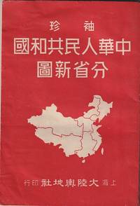
袖珍中華人民共和國分省新圖. Zhenxiu Zhonghua renmin gongheguo fensheng xintu. Pocket Sized Atlas of People's Republic of China by Province.
大陸輿地社. 1952. Charming pocket size atlas with double page coloured map showing China as a whole and the provinces with inset maps of special geographical features and a description of key information about each province vertical text. Text in traditional Chinese characters names on map read from right to left or vertically. Light wear little light browning but maps very clean and bright very good condition 14.5 x 9.8cm. . 大陸輿地社. unknown
Riferimento per il libraio : 215851
|
|
|
[ZHU, YULIAN]. (CARTOGRAPHER). 朱育蓮 繪.
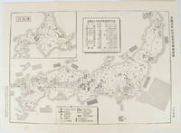
美國在日本的主要軍事基地圖. Meiguo zai Riben de zhu yao jun shi di tu. Map of Major U.S. Military Bases in Japan.
No publication details. Circa1955. Chinese black and white military map of Japan based on a map issued by 赤旗報 Shimbun Akahata on 24 June 1953. No scale given inset map of Hokkaido upper left corner legend lower section showing air and navy bases military exercise bases ammunition dump shooting ranges for the air force and navy headquarters of the coast guard etc. Text upper section provides details of the different types of US military bases and infrastructure. Text in traditional Chinese. 25.8 x 35.8cm. . No publication details. unknown
Riferimento per il libraio : 172396
|
|
|
[ZURLAUBEN Beat Fidel Anton von]:
Tableaux de la Suisse ou voyage pittoresque fait les treize cantons et états alliés du corps helvétique.
Genève, Slatkine, 1977. 4 volumes grand in-folio de [12]-10-[2]-134-[4]; [6]-p.135 à 368-LXVI-[2]; [8]-322-[2] et [6]- p. 323 à 578-[4]-II-7-8-129 (table analytique) pages, plein skyvertex vert, dos lisses ornés de roulettes, encadrements, fleurons, titre et tomaison dorés, étiquettes de titre et tomaison noires, triple roulettes dorées ornant les plats. Un coin un peu tapé, pour le reste en belle condition.
Riferimento per il libraio : 9738

|
|
|
[ŌBUCHI ZENKICHI]. 大淵善吉.
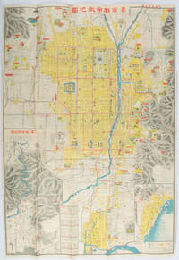
最新京都市街地圖. Saishin Kyōto shigai chizu. Most Recent Map of Kyoto City.
京都. Kyoto.: 山中書房. Yamanaka Shobō. 大正 11 1922. Attractive colour folding map of Kyoto with a quite detailed illustrated tourist guide printed in blue and white on the reverse some light browning holes at some folds good copy. 78.5 x 54cm This 1922 colour folding tourist map of Kyoto offers sightseeing information each panel showing a photographic monochrome image of the site discussed. <br> <br>The two inset maps on the Kyoto map show Otsu city on the shore of Lake Biwa and the Arashiyama area north of Kyoto. The main map highlights the major temples and famous sights in red geographic features such as rivers and hills are shown and an inset chart shows distances of sights from the nearby stations. The information on the reverse gives more detail on the famous sights a calendar of events seasonal highlights and details of the Imperial graves around Kyoto. . 山中書房. [Yamanaka Shobō]. unknown
Riferimento per il libraio : 171899
|
|
|
A .Devogelaere
Het leven in kaart gebracht
2002 A.Devogelaere Soft cover Fine
Riferimento per il libraio : 016444 ISBN : 909015583
|
|
|
A .Devogelaere
Het leven in kaart gebracht
2002 A.Devogelaere Soft cover Fine
Riferimento per il libraio : 025572
|
|
|
A cura di D. Salvadori Guidi.
Guida alla scoperta delle opere d?arte del ?900 a Firenze. Progetto IRRSAE Toscana.
cm. 17 x 24, xxvi-262 pp. con 171 ill. in b.n. e 83 a col. n.t. Cultura e memoria L'opera ? preceduta da una parte introduttiva che consente un inquadramento storico-artistico sulla situazione fiorentina e toscana delle arti visive di questo secolo. Il lavoro ? organizzato in schede, relative a collezioni o singole opere, in cui sono riportati dati generali, notizie storico-artistiche, dati tecnici e descrizioni semplici, che consentono per? anche una lettura formale, sia pur breve, delle opere. Le schede sono suddivise per quartieri, all'interno di ognuno dei quali esse sono segnalate secondo un percorso indicato in una cartina allegata. This work is preceded by an introduction giving an historical artistic outline of the Florentine and Tuscan situation of this century's visive art. The work is organized in cards, relating to collections or single works, providing general information, historical artistic notes, technical data and simple descriptions which permit a formal reading, even if brief, of the works themselves. The cards are divided into districts where the actual works are to be found according to an itinerary marked out on an enclosed map. 780 gr. xxvi-262 p.
|
|
|
A cura di D. Salvadori Guidi.
Guida alla scoperta delle opere d?arte del ?900 nella provincia di Firenze. Progetto IRRSAE Toscana.
cm. 17 x 24, xvi-214 pp. con 62 ill. a colori, 129 in b.n. e 1 pieghevole. Cultura e memoria Questo lavoro si presenta come una guida organizzata in ordine alfabetico per Comuni, all?interno dei quali si indica un itinerario preferenziale e possibile, che invita alla scoperta delle opere dal ?900 a oggi presenti nel territorio della provincia in luoghi visitabili. Offre una documentazione variata e ampia sulle modalit? con cui si muove il territorio della provincia nei confronti del mondo artistico contemporaneo locale e non. A guide book offering preferential and possible itineraries through the various Communes, listed in alphabetical order, inviting one to discover works of art of the early 20th century to the present day. A vast and as yet unpublished selection of documents of these works of art to be found in the Province of Florence. 575 gr. xvi-214 p.
|
|

 Ricevere i risultati per e-mail
 Scaricare i risultati in PDF
 RSS feed
 Link
Link


