|
REBOUR Guy
Pour apprendre à jouer au bridge. Tous les jeux et leurs règles.
Paris, Bornemann, 1967. 13 x 18, 104 pp., broché, très bon état.
Bookseller reference : 26580
|
|
|
REBOUX Paul
plats nouveaux 300 recettes inédites ou singulières
essai de gastronomie moderne in 12 carré pleine toile verte à la bradel pièce de titre cuir vert,faux-titre,titre,383 pages E.Flammarion 1927 premier plat de couverture conservé avec un petit manque
Bookseller reference : 2696
|
|
|
REBUFFAT Gaston
Chamonix Mont-Blanc 1900
Grands vents. 1981. In-4. Broché. Bon état, Couv. convenable, Dos satisfaisant, Intérieur frais. 142p, tres illustré de photos noir et blanc, de reporduction d'affiches couleurs hors texte de peinture de Coppier, de cartes postales couleurs et noir et blanc et aquarelles... . . . Classification Dewey : 741.68-Illustrations des cartes postales
Bookseller reference : RO20017266
|
|
|
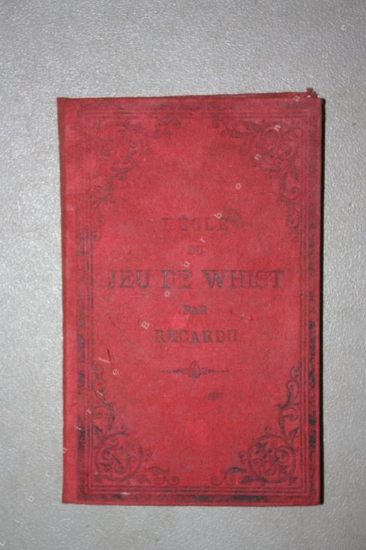
RECARDU.
Règle du jeu de Whist. Pouvant se jouer à quatre ou au Mort.
P., E. Bernard et Cie, 1885 ; petit in-8 ( 18 x 12 cm). Percaline rouge d'éditeur. Titre en noir sur le premeir plat, partiellement effacé. 1 livret de 30 pages et un grand tableau dépliant avec les cartes coloriées.
Bookseller reference : 11043
|
|
|
RECLUS (Elisée)
L'homme et la terre. Géographie, histoire. Richement documenté (planches en couleurs, héliogravures, gravures, dessins, cartes).
Paris, librairie universelle s.d.(vers 1908). 6 beaux volumes reliés, reliures demi cuir ornées d'éd., forts in-4, plus de 3500 pages.
Bookseller reference : AUB-4635
|
|
|
RECLUS Elisée
l’Europe centrale
Nouvelle géographie universelle Terre et les hommes III : Suisse Austro-Hongrie, Allemagne) l in 4 demi-chagrin vert à nerfs,titre,tomaison dorés, plats percaline verte filets à froid en encadrement, faux-titre, titre, 982 pages,1 pages d’errata,78 gravures hors-texte,10 cartes en couleurs tirées à part,210 cartes dans le texte Hachette & Cie 1878 rousseurs éparses habituelles plus fortes en début et fin de volume
Bookseller reference : 8070
|
|
|
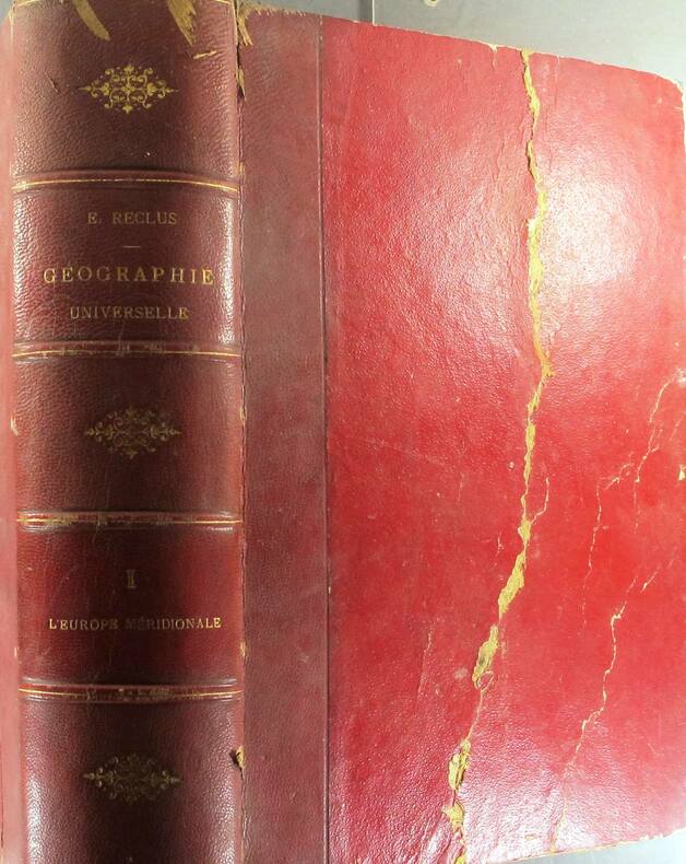
RECLUS Elisée
l’Europe méridionale
Nouvelle géographie universelle La Terre et les hommes I : l’Europe méridionale Grèce,Turquie, Roumanie, Serbie, Italie, Espagne,Portugal in 4 demi-cuir rouge à nerfs et à coins,titre,tomaison dorés, double filet dorés sur les plats,faux-titre,titre,1012 pages,non rogné, tête dorée,73 gravures hors-texte,4 cartes en couleurs tirées à part,174 cartes dans le texte Hachette & Cie 1876 rousseurs éparses plus ou moins fortes,habituelles, mais plus fortes en début et fin de volume
Bookseller reference : 8069
|
|
|
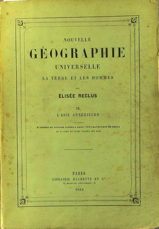
RECLUS Elisée 5 cartes en couleurs, 155 cartes dans le texte. Nombreuses gravures.
Nouvelle géographie universelle. La terre et les hommes. IX : L'Asie antérieure.
Couverture souple. Broché. 952 pages. 19 x 28 cm. Rousseurs. Dos réparé.
Bookseller reference : 130815
|
|
|
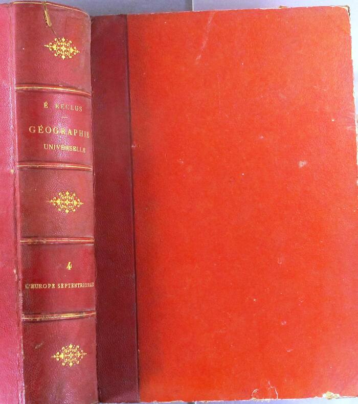
RECLUS Elisée 6 cartes en couleurs, 205 cartes dans le texte. Nombreuses gravures.
Nouvelle géographie universelle. La terre et les hommes. IV : L'Europe du Nord-Ouest. (Belgique, Hollande, Iles britanniques).
Couverture rigide. Reliure demi-chagrin rouge. 965 pages. 19 x 28 cm. Couverture légèrement défraîchie. Rousseurs.
Bookseller reference : 130811
|
|
|
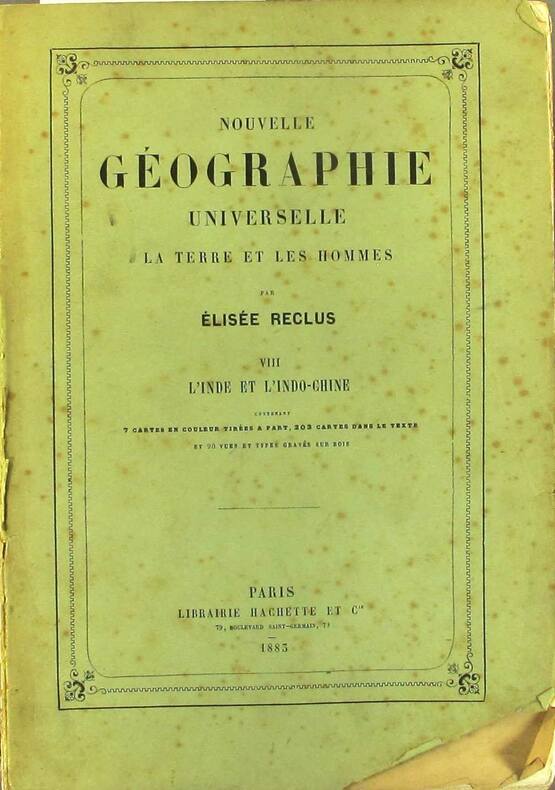
RECLUS Elisée 7 cartes en couleurs, 203 cartes dans le texte. Nombreuses gravures.
Nouvelle géographie universelle. La terre et les hommes. VIII : L'Inde et l'Indo-Chine.
Couverture souple. Broché. 982 pages. 19 x 28 cm. Rousseurs. Dos réparé.
Bookseller reference : 130814
|
|
|
RECLUS Elisée 73 gravures, 4 cartes en couleurs. Nombreuses gravures.
Nouvelle géographie universelle. La terre et les hommes. I : L'Europe méridionale. (Grèce, Turquie, Roumanie, Serbie, Italie, Espagne et Portugal)
Couverture rigide. Reliure demi-chagrin rouge. 1011 pages. 19 x 28 cm. Couverture défraîchie. Rousseurs. Pli au 1er plat.
Bookseller reference : 130810
|
|
|
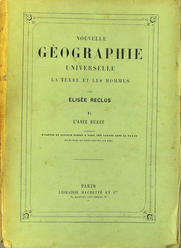
RECLUS Elisée 8 cartes en couleurs, 182 cartes dans le texte. Nombreuses gravures.
Nouvelle géographie universelle. La terre et les hommes. VI : L'Asie russe.
Couverture souple. Broché. 919 pages. 19 x 28 cm. Rousseurs. Dos réparé.
Bookseller reference : 130812
|
|
|
Reclus, (Jean-Jacques-) Elisee.
THE EARTH: A DESCRIPTIVE HISTORY OF THE PHENOMENA OF THE LIFE OF THE GLOBE. Translated by the Late B. B. Woodward and Edited by Henry Woodward, British Museum.
pp. 573 + Publisher's ads (2p.) + 23 color maps. Illustrated with 230 text maps and drawings. 8vo. 24 cm. Worn original publisher's green cloth binding. LOC?
|
|
|
Red Maps
Madrid & Sevilla Street Map and City Guide
NEW. unknown
Bookseller reference : BIB-NOV-14-2025-66311 ISBN : 1892238942 9781892238948
|
|
|
Red Maps
Red Map Brooklyn with Long Island City - City Travel Guide
2016-12-01. 2016. map. New. 5.29x0.06x3.18. Buy with confidence. Excellent Customer Service & Return policy. unknown
Bookseller reference : DADAX1892238861 ISBN : 1892238861 9781892238863
|
|
|
Red Maps
Red Map Los Angeles City Travel Guide
Red Maps 2017-01-01. map. Good. 4x0x8. Travel guide brochure is pre-owned and in good shape with minimal to some signs of wear or use . An entirely readable and usable copy! Red Maps unknown
Bookseller reference : TZVI-gs-LATravel-062123- ISBN : 1892238799 9781892238795
|
|
|
Red Maps
Red Map New York City City Travel Guide
2017-04-01. 2017. map. New. 5.15x0.06x3.27. Buy with confidence. Excellent Customer Service & Return policy. unknown
Bookseller reference : DADAX1892238802 ISBN : 1892238802 9781892238801
|
|
|
Red Maps
Red Map New York City City Travel Guide
2017-04-01. 2017. map. Used: Good. 5.15x0.06x3.27. Buy with confidence. Excellent Customer Service & Return policy. unknown
Bookseller reference : SONG1892238802 ISBN : 1892238802 9781892238801
|
|
|
Red Maps
Red Map Philadelphia City Travel Guide
2017-01-01. map. New. 9.17x0.06x3.58. Buy with confidence. Excellent Customer Service & Return policy. unknown
Bookseller reference : DADAX1892238993 ISBN : 1892238993 9781892238993
|
|
|
Red Maps
Red Map Soho-Nolita & Little Italy NYC - City Travel Guide
Paperback. Very Good. paperback
Bookseller reference : GOR011034021 ISBN : 1892238845 9781892238849
|
|
|
Red Maps
Red Maps CHICAGO Street Map and City Guide
map. Good. Access codes and supplements are not guaranteed with used items. May be an ex-library book. unknown
Bookseller reference : 1892238853.G ISBN : 1892238853 9781892238856
|
|
|
Red Maps
Red Maps LONDON Street Map and City Guide
Paperback. Very Good. paperback
Bookseller reference : GOR013673933 ISBN : 1892238888 9781892238887
|
|
|
Red Maps
Red Maps SAN FRANCISCO Street Map and City Guide
map. Good. Access codes and supplements are not guaranteed with used items. May be an ex-library book. unknown
Bookseller reference : 1892238772.G ISBN : 1892238772 9781892238771
|
|
|
Red Maps
Red Maps WASHINGTON DC Street Map and City Guide
map. Good. Access codes and supplements are not guaranteed with used items. May be an ex-library book. unknown
Bookseller reference : 1892238780.G ISBN : 1892238780 9781892238788
|
|
|
Red Maps (Firm)
Amsterdam
Red Maps Firm 2012. Map. New. 2013 edition. 1 pages. 9.30x4.00x0.40 inches. Red Maps (Firm) unknown
Bookseller reference : 1-1892238918 ISBN : 1892238918 9781892238917
|
|
|
Red Maps (Firm)
Barcelona
map. Good. Access codes and supplements are not guaranteed with used items. May be an ex-library book. unknown
Bookseller reference : 1892238705.G ISBN : 1892238705 9781892238702
|
|
|
Red Maps (Firm)
Berlin/Potsdam
map. Good. Access codes and supplements are not guaranteed with used items. May be an ex-library book. unknown
Bookseller reference : 1892238489.G ISBN : 1892238489 9781892238481
|
|
|
Red Maps (Firm)
Florence
map. Good. Access codes and supplements are not guaranteed with used items. May be an ex-library book. unknown
Bookseller reference : 1892238608.G ISBN : 1892238608 9781892238603
|
|
|
Red Maps (Firm)
Las Vegas
map. Good. Access codes and supplements are not guaranteed with used items. May be an ex-library book. unknown
Bookseller reference : 1892238640.G ISBN : 1892238640 9781892238641
|
|
|
Red Maps (Firm)
Madrid & Sevilla
Red Maps Firm 2012. Map. New. 2013 edition. 1 pages. 9.40x3.90x0.10 inches. Red Maps (Firm) unknown
Bookseller reference : 1-1892238942 ISBN : 1892238942 9781892238948
|
|
|
Red Maps (Firm)
Philadelphia
map. Good. Access codes and supplements are not guaranteed with used items. May be an ex-library book. unknown
Bookseller reference : 1892238403.G ISBN : 1892238403 9781892238405
|
|
|
Red Maps (Firm)
Venice
Red Maps Firm 2008. Map. New. 1 pages. 9.20x3.50x0.10 inches. Red Maps (Firm) unknown
Bookseller reference : 1-1892238748 ISBN : 1892238748 9781892238740
|
|
|
Red Maps (Firm)
Venice Map and City Guide
map. Good. Access codes and supplements are not guaranteed with used items. May be an ex-library book. unknown
Bookseller reference : 1892238748.G ISBN : 1892238748 9781892238740
|
|
|
Redding, M. Wolcott.
ANTIQUITIES OF THE ORIENT UNVEILED. A Concise Description of the Ruins of King Solomon's Cities.
pp. 541, (3) [Publisher's catalogue] + Color lithograph folding map of Jerusalem and Color lithograph Frontis + Ninety full page engravings. Map has 1 1/2" tear in left margin with no loss. Some engravings have dampstaining in margins. Text elaborately ruled throughout. Lacks front and rear marbled fly leaves. 225mm. Front board detached. Spine very worn. Virtually disbound. This perhaps should best be considered a candidate for rebinding. **PRICE JUST REDUCED! HOLY LAND BX 1
|
|
|
Redgrave, J J ; Serton, P (ed) ; Paulick, H (maps and drawings by)
Our Friends Across the Sea - Europe Revised and Enlarged
Maskew Miller Limited Cape Town. 2nd Edition. Soft cover. Poor/No Jacket. 112 pages complete. In general poor to fair condition. No marked publication date but judging from the womens' hats and clinched waists we can assume this to be about '52/ '53/ '54. It should be remarked that the illustrations for all nations in Western Europe are photographic. Those for the Soviet Union are propaganda shots for all other Eastern Block countries illustrations are by drawing only! The book is scruffy and worn. The covers are worn marked creased stained stoically cheerful. The spine is secure tenacious very worn. The contents are worn about the edges. There are previous owner annotations to fore and aft. The contents are benign amiable comfortable against the binding. The pages are clear clean tidy and assured. fk. Our orders are shipped using tracked courier delivery services. Maskew Miller Limited, Cape Town paperback
Bookseller reference : atpu

|
|
|
REED KILNE, Naomi.
Maps of Medieval Thought.
Suffolk, The Boydell Pres 2001, 240x170mm, XIII - 261pages, paperback. Book in good condition.
Bookseller reference : 89919

|
|
|
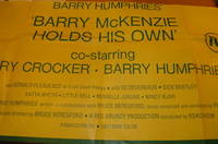
Reg Grundy Productions; Bruce Beresford (director & producer); MAPS Litho Pty. Ltd (litho).
Barry Humphries' 'Barry McKenzie Holds His Own'.
Sydney Australia: Reg Grundy Productions 1974. Lithograph Poster. 40" x 20.5" Folded Poster Good with some minor tears at edges. [Sydney], Australia: Reg Grundy Productions, 1974. unknown
Bookseller reference : 68-0786
|
|
|
Regards. Gérant : Zeyons
Regards En couverture : Les dessous des cartes. Révélations sur la presse françaiseM. Boussac - M. Dubridet veut fonder un journal (Louis Maréchot) - Les journaux communistes et démocratiques mènent l'offensive - Au service de la vérité (Serge Zeyons, photos Jacques Kanapa) - Les journaux qui vous défendent, vous conseillent, vous distraient - Des ouvriers imprimeurs vous racontent (eux-même) la naissance de "Regards" - Le journal des lecteurs. L'insigne, nouvelle de Paul Saux - Travailleurs de France - Gosses de Paris et d'ailleurs - Akoutou, et le préjugé du Zoe, nouvelle de Fozoo Ekabe (Cameroun) - Vallauris la pacifique (reportage photo André Villers) - Poèmes pour la paix - Une petite ville - Dans le monde des champignons - ...
n° 371 - novembre 1953 - nouvelle série - revue illustrée - in-4 broché - 50 pages
Bookseller reference : 60930
|
|
|
REGNE Jean
R?pertoire des plans cadastraux parcellaires de l'Ard?che. Lettre-pr?face de Marc Bloch.
Broch?. 70 pages. Couverture en mauvais ?tat. Importantes rousseurs.
|
|
|
REGUIN Olivier:
Saint-Georges. Village, prieuré et seigneurie à la fin du Moyen Age.
Lausanne, Bibliothèque Historique Vaudoise, 2000. In-8 broché de 219 pages, couverture illustrée en couleurs.
Bookseller reference : 1104

|
|
|
Reich, Erhard - Ortelius, Abraham
Palatinatus Bavariae descriptio, Erhardo Reych Tirolense Auctore. [um 1590]. [Altkolorierter Original-Kupferstich, gerahmt / old colored original copper engraving, framed]
o.J. Abraham Ortelius, geboren am 4. oder 14. April 1527 in Antwerpen, gestorben am 28. Juni 1598 ebenda. Flämischer Geograph und Kartograf. [3 Warenabbildungen]
Bookseller reference : 59507BB

|
|
|
REICH, HANS/ VALK, MAPS.
KINDEREN UIT HEEL DE WERELD.
Den Haag Nederlandse Boekenclub 1958. . Gebonden originele geillustreerde uitgeversomslag in kleur 185x235cm 119pp rijkelijk geillustreerd z/w. Den Haag, Nederlandse Boekenclub, 1958. unknown
Bookseller reference : 9746
|
|
|
REICH, HANS/ VALK, MAPS.
KINDEREN UIT HEEL DE WERELD.
, Den Haag, Nederlandse Boekenclub, 1958., Gebonden, originele geillustreerde uitgeversomslag in kleur, 18,5x23,5cm, 119pp, rijkelijk geillustreerd z/w.
Bookseller reference : 9746
|
|
|
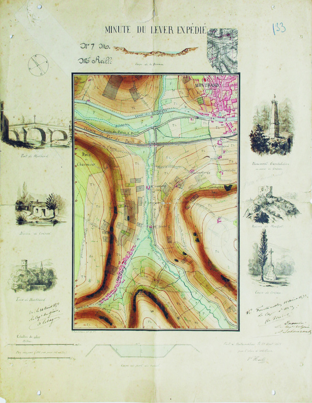
REILLE (Victor).
Minute du lever expédié.
Fontainebleau, 1871. 47,8 x 38,3 cm.
Bookseller reference : LBW-6565
|
|
|
Reilly, Franz Johann Joseph von
Das Herzogthum Geldern. Kurbrandenburgischen Antheils mit dem Fürstenthume Mörs. Nro. 268 (um 1790). [Altkolorierter Kupferstich, gerahmt / handcoloured copper engraving, framed].
o.J. [3 Warenabbildungen] (Franz Johann Joseph von Reilly, geb. 18.08.1766 in Wien, gest, 06.07.1820 ebenda, österreichischer Verleger, Kartograf
Bookseller reference : 66102CB

|
|
|
Reilly, Franz Johann Joseph von
Das Koenigreich Sklavonien und Herzogthum Syrmien (No. 3). Teilkolorierte Kupferstichkarte aus "Schauplatz der fünf Theile der Welt".
Wien, Reilly, ca. 1789. 20 x 29 cm (Blattgröße 22 x 32 cm).
Bookseller reference : 110609

|
|
|
Reilly, Franz Johann Joseph von
Der gefürsteten Grafschaft Tirol Viertel Unterinn und Wipp-Thal. Teilkolorierte Kupferstichkarte (No. 146) aus "Schauplatz der fünf Theile der Welt".
Wien, Reilly, ca. 1791. 22 x 29 cm (Blattgröße 24 x 32 cm).
Bookseller reference : 110618

|
|
|
Reilly, Franz Johann Joseph von:
Das Koenigreich Sklavonien und Herzogthum Syrmien (No. 3). Teilkolorierte Kupferstichkarte aus "Schauplatz der fünf Theile der Welt".
20 x 29 cm (Blattgröße 22 x 32 cm). *Reilly ist bekannt für seine exakten Detailkarten, die vorliegende Karte Slowenien mit Belgrad im Osten und die Kleine Walachei mit Kialiova im Westen (linke Ecke oben mit leichtem Fleck). - Map from the Atlas of Reilly`s "Schauplatz der fünf Theile der Welt", which appeared 1789 to 1806 in 3 parts with more than 1000 maps of Europe. This atlas is famous for his exact and detailed maps. - Original copperplate engraving [Vienna, about 1789]. Some original colouring, good condition. Landkarten de
|
|
|
Reilly, Franz Johann Joseph von:
Der gefürsteten Grafschaft Tirol Viertel Unterinn und Wipp-Thal. Teilkolorierte Kupferstichkarte (No. 146) aus "Schauplatz der fünf Theile der Welt".
22 x 29 cm (Blattgröße 24 x 32 cm). *Reilly ist bekannt für seine exakten Detailkarten, die vorliegende Karte zeigt das Österreichische Teilgebiet Unterinn mit Kufstein im Norden. - Map from the Atlas of Reilly`s "Schauplatz der fünf Theile der Welt", which appeared 1789 to 1806 in 3 parts with more than 1000 maps of Europe. This atlas is famous for his exact and detailed maps. - Original copperplate engraving [Vienna, 1789]. Some original colouring, good condition. Landkarten de
|
|
|
Reilly, Franz Johann Joseph von:
Die Markgrafschaft Niederlausitz chursächsischen und preussischen Antheils und in ihre Kreise eingetheilt. Nro 104"
22 x 29 cm. Blattgröße 30 x 42 cm. Teilkolorierte Kupferstichkarte. *Reilly ist bekannt für seine exakten Detailkarten, die vorliegende Karte zeigt das Gebiet der Niederlausitz mit Lübben, Spreewald, Cottbus und Guben. Aus dem Werk "Aus: Schauplatz der fünf Theile der Welt". - Sehr gut erhalten. Landkarten de
|
|
 Receive by email
 Download as PDF document
 RSS feed


