|
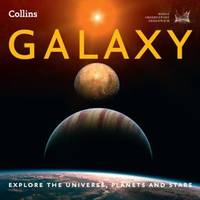
Royal Observatory Greenwich Collins Maps
Galaxy : Explore the Universe Planets and Stars
HarperCollins Publishers Limited. Used - Good. Ships from the UK. Former library book; may include library markings. Used book that is in clean average condition without any missing pages. HarperCollins Publishers Limited unknown
Bookseller reference : GRP84744826 ISBN : 0007501242 9780007501243
|
|
|
RUFFIN Daniel
LES EVENTAILS DE CARTES
1980 plaquette in-octavo, couverture rouge illustrée sur le recto - un léger manque de papier sur le verso, illustrations photographiques in-texte par Serge Bourdin, bas de la page 23-24 légèrement abîmé, 24 pages, les années 70 Paris Revue de lAssociation Française des Artistes Prestidigitateurs Ordre des Illusionnistes,
Bookseller reference : 5318
|
|
|
RUMEBE, B.
Plan de la Ville de Toulon indiquant les Agrandissements au Nord et à l'Ouest
1 carte dépliante format 64 x 48 cm, B. Rumèbe, Toulon, s.d. (seconde partie XIXe siècle) Bon exemplaire Français

|
|
|
RUMEBE, B.
Plan de la Ville de Toulon indiquant les Agrandissements au Nord et à l'Ouest
1 carte dépliante format 64 x 48 cm, B. Rumèbe, Toulon, s.d. (seconde partie XIXe siècle)
Bookseller reference : 55569

|
|
|
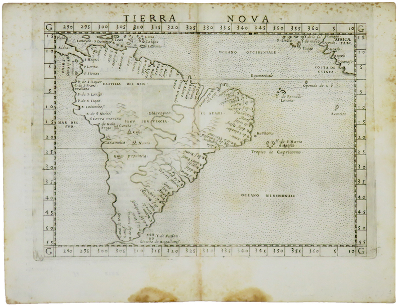
RUSCELLI (Girolamo) & PTOLÉMÉE (Claude).
Tierra nova.
[Venise, 1561]. 184 x 245 mm.
Bookseller reference : LBW-5048
|
|
|
RUSCELLI Girolamo (Viterbo 1504 – Venezia 1566)
Carta Marina Nuova Tavola
La mappa di Ruscelli è molto interessante per la sua rappresentazione dei cinque continenti conosciuti, legati tra loro come una superficie continua. Questa mappa presenta una vista della superficie terrestre già piuttosto obsoleta ai tempi della sua pubblicazione. Già in precedenza, altri cartografi, partendo da Matrin Waldseemuller nel 1507, avevano messo in dubbio l’affermazione di Colombo secondo cui Asia e America fossero un unico continente. I viaggi di Magellano e altri esploratori, che permisero di conoscere definitivamente la reale estensione dell’oceano Pacifico, diedero ulteriore sostegno a tali dubbi, sebbene lasciassero aperta la possibilità di una connessione amer-asiatica a settentrione. Intorno alla metà del XVI secolo, tuttavia, anche questa ultima ipotesi venne completamente screditata, per essere rimpiazzata dall’idea di un ipotetico “stretto di Anian”. Altra interessante caratteristica di questa mappa è l’intreccio di “linee dei sestanti” radianti da 16 punti focali intorno alla mappa. Le linee dei sestanti erano strumenti di navigazione che aiutavano a mantenere la medesima posizione della bussola per raggiungere un qualsiasi punto di una linea da un altro punto della medesima. Queste sono semplicemente ornamentali e illustrative, in quanto la mappa è troppo piccola per essere funzionale. Carta tratta dalla "Geographia di Claudio Tolomeo", a cura del Ruscelli, pubblicata in Venezia in pù edizioni tra il 1561 ed il 1598. La carta è basata sulla "Geografia" di Giacomo Gastaldi, che probabilmente disegnò personalmente anche queste mappe, che vennero incise dai fratelli Sanuto. La peculiarità di queste mappe è che sono incise due per lastra e successivamente tagliate; questo il motivo per cui il segno del rame appare solo in tre lati della mappa. Il testo del Ruscelli e le sue carte sono considerate come il miglior atlante moderno fino alla prima versione del Thatrum di Ortelius, 1570. Solo la loro enorme diffusione ne impedisce una valutazione sostenuta nel mercato antiquario. L'opera infatti ebbe una prima stesura nel 1561, stampata da Vincenzo Valgrisi che ne curò anche la ristampa del 1562. Tre sono le edizioni firmate da Giordano Ziletti (due nel 1564 e una del 1574), mentre nel 1597 viene edita dai fratelli Calignani. Tutte queste edizioni contengono 64 tavole. Nel 1598 e 1599 vengono alla luce le due edizioni curate da Giuseppe Rosaccio e stampate dagli Eredi di Melchior Sessa. Queste ultime due edizioni comprendono 69 tavole; sono infatti aggiunte la carta del planisfero e dei continenti del Rosaccio. Nice example of Ruscelli’s Carta Marina, based upon Gastaldi’s map of 1548. Gastaldi's Carta Marina includes the earliest obtainable depictions of the California peninsula, is the earliest obtainable copperplate world map for collectors. Includes Gastaldi's belief in a continuous northern landmass, the isthmus reported by Verrazano in 1524, which closes the northern continents into as unbroken ring. The Asia-America connection was a standard concept, and one of which Gastaldi actively advocated. The joining of North America and Europe is unusual, resulting from two errors. In the east, Gastaldi depicts Greenland as an outgrowth of Scandinavia, based upon Waldseemuller. In the west, Gastaldi follows Verrazano’s model of North America. On the Atlantic coast by Gastaldi notes a green mountain and a large, unnamed cape pointing upwards. This cape, based upon Ramusio’s' map of 1534, first appeared in Ribero’s manuscript chart of 1529, as well as later works, such as Jode’s North America. The cape is believed to be Cape Cod, as both the Ribero and Ramusio maps reflect the reconnaissance along the New England coast by Estavao Gomes, who is believed to have coasted the region. The writing’s of Marco Polo are evident in Asia, with modern corrections.Map, taken from Ruscelli edition of Ptolemy's "Geographia", printed in Venice from 1561 to 1598. Ruscelli's Atlas is an expanded edition of Gastaldi's "Geografia" of 1548, which has been called the most comprehensive atlas produced between Martin Waldseemüller's Geographiae of 1513, and the Abraham Ortelius Theatrum of 1570. Ruscelli and Gastaldi's maps were beautifully engraved on copper, marking a turning point in the history of cartography. From that point forward, the majority of cartographic works used this medium. As it was a harder material than wood it gave the engraver the ability to render more detail. Gastaldi sought the most up-to-date geographical information available, making the modern maps in Ruscelli's Geographia among the best modern maps of the period. The maps are engraved by the Sanuto borthers.Only their enormous diffusion prevents a sustained evaluation in the antique market. The work in fact had a first issue in 1561, printed by Vincenzo Valgrisi who also edited the reprint of 1562. There are three editions signed by Giordano Ziletti (two in 1564 and one in 1574), while in 1597 it was edited by the Calignani brothers. All these editions contain 64 engraved maps. In 1598 and 1599 the two editions edited by Giuseppe Rosaccio and printed by the heirs of Melchior Sessa come to light. These last two editions include 69 plates; in fact the map of the planisphere and of the continents of Rosaccio are added. R. W. Shirley, "The Mapping of the world", 111

|
|
|
RUSCELLI Girolamo (Viterbo 1504 – Venezia 1566)
Carta Marina Nuova Tavola
Acquaforte e bulino, circa 1561. Magnifica prova, impressa su carta vergata coeva, con margini, in perfetto stato di conservazione. Esemplare in meravigliosa coloritura coeva.La mappa di Ruscelli è molto interessante per la sua rappresentazione dei cinque continenti conosciuti, legati tra loro come una superficie continua. Questa mappa presenta una proiezione della superficie terrestre già piuttosto obsoleta ai tempi della sua pubblicazione. Già in precedenza, altri cartografi, partendo da Matrin Waldseemuller nel 1507, avevano messo in dubbio l’affermazione di Colombo secondo cui Asia e America formassero un unico continente. I viaggi di Magellano e di altri esploratori, che permisero di conoscere definitivamente la reale estensione dell’oceano Pacifico, diedero ulteriore sostegno a tali dubbi, sebbene lasciassero aperta la possibilità di una connessione America-Asia a settentrione. Intorno alla metà del XVI secolo, tuttavia, anche questa ultima ipotesi venne completamente screditata, per essere rimpiazzata dall’idea di un ipotetico “stretto di Anian”. Altra interessante caratteristica di questa mappa è l’intreccio di “linee dei sestanti” radianti da 16 punti focali. Il sestante era uno strumento indispensabile per misurare e tracciare, la rotta di navigazione. In questo caso, le linee tracciate sulla mappa sono esclusivamente ornamentali e illustrative, in quanto la carta è troppo piccola per poter essere funzionale. Carta tratta dalla "Geographia di Claudio Tolomeo", a cura del Ruscelli, pubblicata in Venezia in pù edizioni tra il 1561 ed il 1598. La carta è basata sulla "Geografia" di Giacomo Gastaldi, che probabilmente disegnò personalmente anche queste mappe, che vennero incise dai fratelli Sanuto. La peculiarità di queste mappe è che sono incise due per lastra e successivamente tagliate; questo il motivo per cui il segno del rame appare solo in tre lati della mappa. Il testo del Ruscelli e le sue carte sono considerate come il miglior atlante moderno fino alla prima versione del Thatrum di Ortelius, 1570. Solo la loro enorme diffusione ne impedisce una valutazione sostenuta nel mercato antiquario. L'opera infatti ebbe una prima stesura nel 1561, stampata da Vincenzo Valgrisi che ne curò anche la ristampa del 1562. Tre sono le edizioni firmate da Giordano Ziletti (due nel 1564 e una del 1574), mentre nel 1597 viene edita dai fratelli Calignani. Tutte queste edizioni contengono 64 tavole. Nel 1598 e 1599 vengono alla luce le due edizioni curate da Giuseppe Rosaccio e stampate dagli Eredi di Melchior Sessa. Queste ultime due edizioni comprendono 69 tavole; sono infatti aggiunte la carta del planisfero e dei continenti del Rosaccio.Gli esemplari delle carte del Ruscelli in coloritura coeva sono assolutamente rarissimi. - ORIGINAL COLOURING -Etching with engraving, about 1561. Magnificent proof, printed on contemporary laid paper, with margins, in perfect condition. Example in wonderful contemporary coloring.The map of Ruscelli is very interesting for its representation of the five known continents, linked together like a continuous surface. This map shows a projection of the Earth's surface rather obsolete already at the time of its publication. Previously, other cartographers, starting from Martin Waldseemuller in 1507, had questioned the assertion of Columbus that Asia and America form a single continent. The travels of Magellan and other explorers, which allowed him to finally know the true extent of the Pacific Ocean, gave further support to these concerns, although leave open the possibility of a free America-Asia to the north. Around the middle of the sixteenth century, however, this latter hypothesis was completely discredited, to be replaced by the idea of a hypothetical "Strait of Anian." Another interesting feature of this map is the plot of "lines of sextants" radiant 16 focal points. The sextant was an indispensable tool to measure and track, the navigation route. In this case, the lines drawn on the map are exclusively ornamental and illustrative, because the paper is too small to be functional. The map comes from Ptolemy's Geographia, edited by Ruscelli, published in Venice in multiple editions between 1561 and 1598. The map is based on the same work of Giacomo Gastaldi (1548), which probably also personally drew these maps, engraved by the brothers Livio and Giulio Sanuto. The peculiarity of these maps is that they are recorded two for plate and subsequently cut, consequently the sign of the copper appears only on three sides for each map. The text of Ruscelli and his maps are considered as the best modern atlas to the first version of the Theatrum Orbis Terrarum by Ortelius of 1570. Only their ubiquity prevents an assessment supported in the antique market.Girolamo Ruscelli (Viterbo 1504 - Venice 1566), scholar and polygraph native of Viterbo, was formed in Rome but soon moved in Veneto where he treated, for typography Valgrisi, numerous editions of Italian classics. Ruscelli was also the curator of the revised and expanded version of Ptolemy's Geographia, printed in Venice several times between 1561 and the end of the century. The maps are based on those by Giacomo Gastaldi for the Venetian edition of 1548, and engraved by the brothers Sanuto.Example of Ruscelli’s maps in contemporary coloring are absolutely rare. Shirley, The Mapping of the World, 111. Dimensioni 260x195.

|
|
|
RUSCELLI Girolamo (Viterbo 1504 – Venezia 1566)
Orbis descriptio
Acquaforte e bulino, circa 1561. Magnifica prova, impressa su carta vergata coeva, con margini, in perfetto stato di conservazione. Esemplare in meravigliosa coloritura coeva.Carta tratta dalla "Geographia di Claudio Tolomeo", a cura del Ruscelli, pubblicata in Venezia in pù edizioni tra il 1561 ed il 1598. La carta è basata sulla "Geografia" di Giacomo Gastaldi, che probabilmente disegnò personalmente anche queste mappe, che vennero incise dai fratelli Sanuto. La peculiarità di queste mappe è che sono incise due per lastra e successivamente tagliate; questo il motivo per cui il segno del rame appare solo in tre lati della mappa. Il testo del Ruscelli e le sue carte sono considerate come il miglior atlante moderno fino alla prima versione del Thatrum di Ortelius, 1570. Solo la loro enorme diffusione ne impedisce una valutazione sostenuta nel mercato antiquario. L'opera infatti ebbe una prima stesura nel 1561, stampata da Vincenzo Valgrisi che ne curò anche la ristampa del 1562. Tre sono le edizioni firmate da Giordano Ziletti (due nel 1564 e una del 1574), mentre nel 1597 viene edita dai fratelli Calignani. Tutte queste edizioni contengono 64 tavole. Nel 1598 e 1599 vengono alla luce le due edizioni curate da Giuseppe Rosaccio e stampate dagli Eredi di Melchior Sessa. Queste ultime due edizioni comprendono 69 tavole; sono infatti aggiunte la carta del planisfero e dei continenti del Rosaccio. ORIGINAL COLOURINGEtching with engraving, about 1561. Magnificent proof, printed on contemporary laid paper, with margins, in perfect condition. Example in wonderful contemporary coloring.Map, taken from Ruscelli edition of Ptolemy's "Geographia", printed in Venice from 1561 to 1598. Ruscelli's Atlas is an expanded edition of Gastaldi's "Geografia" of 1548, which has been called the most comprehensive atlas produced between Martin Waldseemüller's Geographiae of 1513, and the Abraham Ortelius Theatrum of 1570. Ruscelli and Gastaldi's maps were beautifully engraved on copper, marking a turning point in the history of cartography. From that point forward, the majority of cartographic works used this medium. As it was a harder material than wood it gave the engraver the ability to render more detail. Gastaldi sought the most up-to-date geographical information available, making the modern maps in Ruscelli's Geographia among the best modern maps of the period. The maps are engraved by the Sanuto borthers.Only their enormous diffusion prevents a sustained evaluation in the antique market. The work in fact had a first issue in 1561, printed by Vincenzo Valgrisi who also edited the reprint of 1562. There are three editions signed by Giordano Ziletti (two in 1564 and one in 1574), while in 1597 it was edited by the Calignani brothers. All these editions contain 64 engraved maps. In 1598 and 1599 the two editions edited by Giuseppe Rosaccio and printed by the heirs of Melchior Sessa come to light. These last two editions include 69 plates; in fact the map of the planisphere and of the continents of Rosaccio are added.Only their ubiquity prevents an assessment supported in the antique market.

|
|
|
RUSCELLI Girolamo (Viterbo 1504 – Venezia 1566)
Orbis Descriptio
Carta tratta dalla "Geographia di Claudio Tolomeo", a cura del Ruscelli, pubblicata in Venezia in pù edizioni tra il 1561 ed il 1598. La carta è basata sulla "Geografia" di Giacomo Gastaldi, che probabilmente disegnò personalmente anche queste mappe, che vennero incise dai fratelli Sanuto. La peculiarità di queste mappe è che sono incise due per lastra e successivamente tagliate; questo il motivo per cui il segno del rame appare solo in tre lati della mappa. Il testo del Ruscelli e le sue carte sono considerate come il miglior atlante moderno fino alla prima versione del Thatrum di Ortelius, 1570. Solo la loro enorme diffusione ne impedisce una valutazione sostenuta nel mercato antiquario. L'opera infatti ebbe una prima stesura nel 1561, stampata da Vincenzo Valgrisi che ne curò anche la ristampa del 1562. Tre sono le edizioni firmate da Giordano Ziletti (due nel 1564 e una del 1574), mentre nel 1597 viene edita dai fratelli Calignani. Tutte queste edizioni contengono 64 tavole. Nel 1598 e 1599 vengono alla luce le due edizioni curate da Giuseppe Rosaccio e stampate dagli Eredi di Melchior Sessa. Queste ultime due edizioni comprendono 69 tavole; sono infatti aggiunte la carta del planisfero e dei continenti del Rosaccio.Buon esemplare. A nice example of Ruscelli's map of the world from his Geografia, the first double hemisphere world map to appear in an Atlas. One of two modern world maps in Ruscelli's Geografia, based upon Gastaldi's world map of 1548. The map is a copper plate engraving by Sanuto. The map is adapted from the oval projection used in Gastaldi's larger world map and is presented on Roger Bacon's circular projection, also used by Tramezzino's large world map of 1554. No southern continent is shown. The map clearly shows the broad mass of land joining Asia and America as Terra Incognita and the coastline as Littus Incongmitum. Map, taken from Ruscelli edition of Ptolemy's "Geographia", printed in Venice from 1561 to 1598. Ruscelli's Atlas is an expanded edition of Gastaldi's "Geografia" of 1548, which has been called the most comprehensive atlas produced between Martin Waldseemüller's Geographiae of 1513, and the Abraham Ortelius Theatrum of 1570. Ruscelli and Gastaldi's maps were beautifully engraved on copper, marking a turning point in the history of cartography. From that point forward, the majority of cartographic works used this medium. As it was a harder material than wood it gave the engraver the ability to render more detail. Gastaldi sought the most up-to-date geographical information available, making the modern maps in Ruscelli's Geographia among the best modern maps of the period. The maps are engraved by the Sanuto borthers.Only their enormous diffusion prevents a sustained evaluation in the antique market. The work in fact had a first issue in 1561, printed by Vincenzo Valgrisi who also edited the reprint of 1562. There are three editions signed by Giordano Ziletti (two in 1564 and one in 1574), while in 1597 it was edited by the Calignani brothers. All these editions contain 64 engraved maps. In 1598 and 1599 the two editions edited by Giuseppe Rosaccio and printed by the heirs of Melchior Sessa come to light. These last two editions include 69 plates; in fact the map of the planisphere and of the continents of Rosaccio are added.Small repairs at the white margins, otherwise very good. R. W. Shirley, "The Mapping of the world", 110

|
|
|
RUSCELLI Girolamo (Viterbo 1504 – Venezia 1566)
Ptolemaei Typus
Carta tratta dalla "Geographia di Claudio Tolomeo", a cura del Ruscelli, pubblicata in Venezia in pù edizioni tra il 1561 ed il 1598. La carta è basata sulla "Geografia" di Giacomo Gastaldi, che probabilmente disegnò personalmente anche queste mappe, che vennero incise dai fratelli Sanuto. La peculiarità di queste mappe è che sono incise due per lastra e successivamente tagliate; questo il motivo per cui il segno del rame appare solo in tre lati della mappa. Il testo del Ruscelli e le sue carte sono considerate come il miglior atlante moderno fino alla prima versione del Thatrum di Ortelius, 1570. Solo la loro enorme diffusione ne impedisce una valutazione sostenuta nel mercato antiquario. L'opera infatti ebbe una prima stesura nel 1561, stampata da Vincenzo Valgrisi che ne curò anche la ristampa del 1562. Tre sono le edizioni firmate da Giordano Ziletti (due nel 1564 e una del 1574), mentre nel 1597 viene edita dai fratelli Calignani. Tutte queste edizioni contengono 64 tavole. Nel 1598 e 1599 vengono alla luce le due edizioni curate da Giuseppe Rosaccio e stampate dagli Eredi di Melchior Sessa. Queste ultime due edizioni comprendono 69 tavole; sono infatti aggiunte la carta del planisfero e dei continenti del Rosaccio. Map, taken from Ruscelli edition of Ptolemy's "Geographia", printed in Venice from 1561 to 1598. Ruscelli's Atlas is an expanded edition of Gastaldi's Atlas of 1548, which has been called the most comprehensive atlas produced between Martin Waldseemüller's Geographiae of 1513, and the Abraham Ortelius Theatrum of 1570.Ruscelli and Gastaldi's maps were beautifully engraved on copper, marking a turning point in the history of cartography. From that point forward, the majority of cartographic works used this medium. As it was a harder material than wood it gave the engraver the ability to render more detail. Gastaldi sought the most up-to-date geographical information available, making the modern maps in Ruscelli's Geographia among the best modern maps of the period. The maps are engraved by the Sanuto borthers.Copperplate, good condition.

|
|
|
Rusenberg Auguste
THE SUEZ CANAL MAP AND NOTES OF THE WORLD'S MOST IMPORTANT WATERWAY (in English, French, German and Italian) (1933)
Port-Saïd The Oriental Commercial Bureau August Rüsenberg 1933 in-8 broché une carte dépliante brochée in-octavo Editeur (10,5 x 24 cm), couverture illustrée en bleu marron et jaune de la statue de Ferdinand de Lesseps, avec explications des Sites intéressants au long du Canal de Suez, en Anglais, français et Allemand + une grande carte dépliante en couleur du canal, format déplié : 22,8 x 85 cm , sans date (1933) Port-Saïd The Oriental Commercial Bureau August Rüsenberg Editeur,
Bookseller reference : 21187
|
|
|
RUSSELL, DICK; GIVEN, EBEN (maps)
Eye of the Whale: Epic Passage from Naja to Siberia
Simon & Schuster 2001. Ex-library. 8vo hardcover VG in d/w VG; all our specials have minimal description to keep listing them viable. They are at least reading copies complete and in reasonable condition but usually secondhand; frequently they are superior examples. Ordering more than one book will reduce your overall postage costs Simon & Schuster 2001 hardcover
Bookseller reference : 337604
|
|
|
RUSSELL, J. C.
SOUTH AMERICA Inc. Falkland Islands ORIGINAL ANTIQUE MAP
Map. Very Good. Unframed. No date but circa 1840. A fine original copper engraved map entitled SOUTH AMERICA; the Falklands islands are also depicted. Plate mark measuing 22 x 27.5cm. Originally from an atlas - this is map 26. J. C. Russell del. et sculpt. Very good condition with slight dust marking. unknown
Bookseller reference : 020931

|
|
|
Russell-Killough (Comte Henri)
Les Grandes Ascensions des Pyrénées d'une mer à l'autre. Guide spécial du piéton orné de douze cartes.
Paris, Toulouse Hachette, Privat 1866 Un volume in-12 broché, couverture verte, 297 pages, complet de ses 12 cartes. Bon état.
Bookseller reference : 10181
|
|
|
Ruth H. McCuaig (Signed)
Our Pointe Au Baril
Signed and inscribed by author atop first blank leaf. xii, 322 pages. Bibliography. Index. Generously illustrated with black and white reproductions of archival photos. Presents the history of this community on the eastern shore of Georgian Bay in the Parry Sound District. Chapters include: The French; The Fur Trade; The Cartographers; Nineteenth Century Transients; The Loggers; The Fishermen; The Hotels; The Summer People; Pointe au Baril Station; The Islanders' Association; The Arts; and more. Average wear. Binding intact. A sound copy of this informative local history. Book

|
|
|
Ruth, Kent maps: MacLean, Robert
TOURING THE OLD WEST
Brattleboro VT: Stephen Greene Press. VG/G. 1971. . Cloth. 8vo. 218 pp. DJ chipped . Stephen Greene Press hardcover
Bookseller reference : BOOKS18161 ISBN : 0828901295 9780828901291
|
|
|
Région de Lyon.
Carte géologique détaillée de la France. Lyon N° 168.
1890 carte toilée 61 x 112 cms, texte entourant la carte, en couleurs. P. Baudry 1890,
Bookseller reference : 7703
|
|
|
Röder, Franz; Röder, Karl [Hrsg.]
Der Kriegszug Napoleons gegen Rußland im Jahr 1812. Nach den besten Quellen und seinen eignen Tagebüchern dargestellt nach der Zeitfolge der Begebenheiten von Franz Röder. Nach des Verfassers Tode herausgegeben von dessen Sohn Karl Röder.
Leipzig, Verlag von Wilhelm Engelmann, 1848. 8°. 21 cm. XXX, 567 Seiten, X Blatt. Pappband der Zeit, gebunden. Mit goldgeprägtem Rückentitel.
Bookseller reference : 6469DB

|
|
|
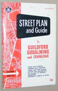
S P Maps
Street Plan and Guide to Guildford Godalming and Cranleigh
Shoreham-by-Sea: Service Publications Map. Good. Map. 9th edition. Folded map in very good condition card cover foxed with light shelfwear. Undated cover price 45p. Service Publications Paperback
Bookseller reference : 23032732-83
|
|
|
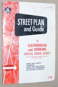
S P Maps
Street Plan and Guide to Leatherhead and Dorking Ashtead Cobham Oxshott including Bookham Fetcham Westcott and Beare Green
Shoreham-by-Sea: Service Publications Map. Good. Map. 1st Edition. Folded map in good condition card cover foxed with light shelfwear both map and cover have old damp damage to top corner. Undated cover price £1.05. Service Publications Paperback
Bookseller reference : 23032733-83 ISBN : 1852820497 9781852820497
|
|
|
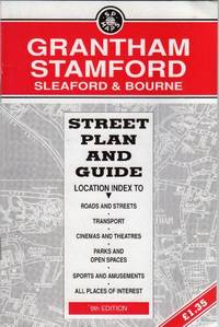
S P Maps - Service Publications
Grantham Stamford Sleaford & Bourne - Street Plan and Guide - 9th Edition
Service Publications Ltd 1994T. map. Very Good. in x in x in. Service Publications Ltd unknown
Bookseller reference : mon0000480632 ISBN : 1852821590 9781852821593
|
|
|
S P Maps - Service Publications
Grantham Stamford Sleaford & Bourne - Street Plan and Guide - 9th Edition
Paperback. Very Good. paperback
Bookseller reference : GOR004591233 ISBN : 1852821590 9781852821593
|
|
|
s. l.d. d'Annemie Buffels. Avec une introduction de Willem Elias
Art du jeu, 75 ans de Loterie Nationale
Bruxelles, Fonds Mercator/ Mercatorfonds , 2009 Hardback, 280x240mm, 224p, French ( FR ) edition ISBN 978906153912413.
Bookseller reference : 24404
|
|
|
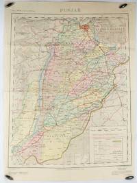
S. Q. HASAN, SURVEYOR GENERAL OF PAKISTAN.
Map of Punjab. Second Edition.
Rawalpindi.: Survey of Pakistan. 1973. Large folding map printed in colour 73.8 x 58 cm small inset plan "Administrative Index" noting the interests of: Afghanistan; Jammu & Kasmir; Baluchistan; and Sind; large key of References with the note in red "The State of Jammu & Kashmir is in dispute: its accession to India or Pakistan has not been decided through plebiscite under the United Nations." two fold tears affecting the margin and small fold splits to the map without loss four pinholes to the corners but in good condition. . Survey of Pakistan. unknown
Bookseller reference : 175114
|
|
|
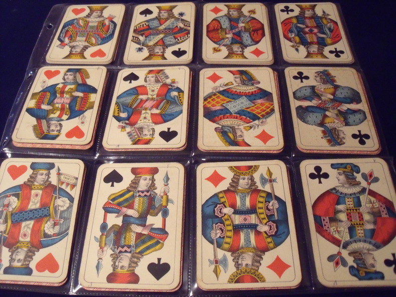
S.D.MODIANO ://:
WIENER BILD.
Wiener Bild.Portrait Viennois. Jeu Des Couronnes.Kaffée Haus KARTEN.(cartes des maisons de café.)type A. 52cartes.complet.1906.Fabricant:SD.ModianoTriest.Italie.Trés bon état .Sans boite.
Bookseller reference : 0631906
|
|
|
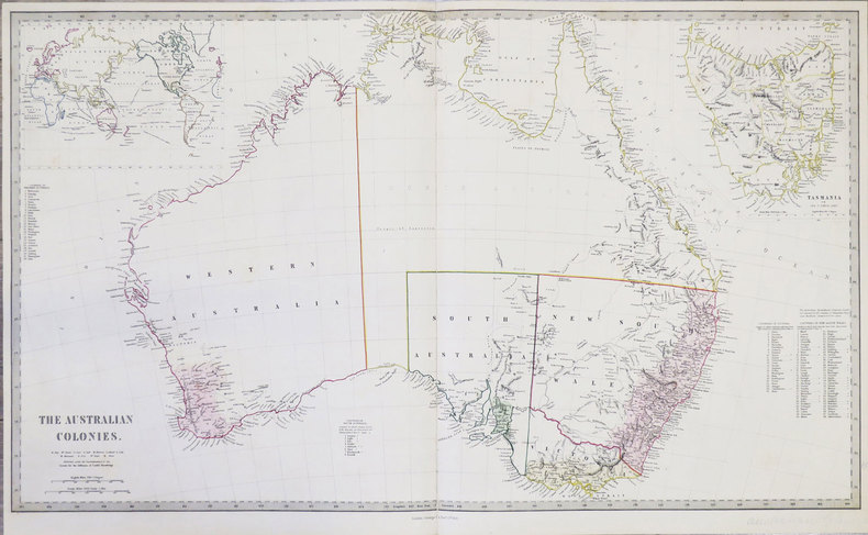
S.D.U.K.
[AUSTRALIE] The Australian colonies.
London, George Cox, 1853. 405 x 684 mm.
Bookseller reference : LBW-855
|
|
|
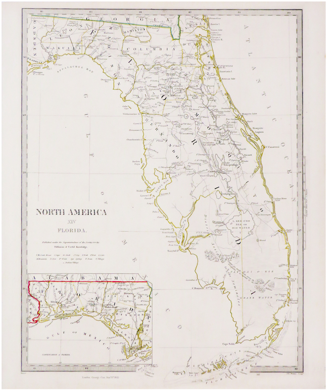
S.D.U.K.
[FLORIDE] North America XIV Florida.
London, George Cox, 1852. 410 x 312 mm.
Bookseller reference : LBW-3494
|
|
|
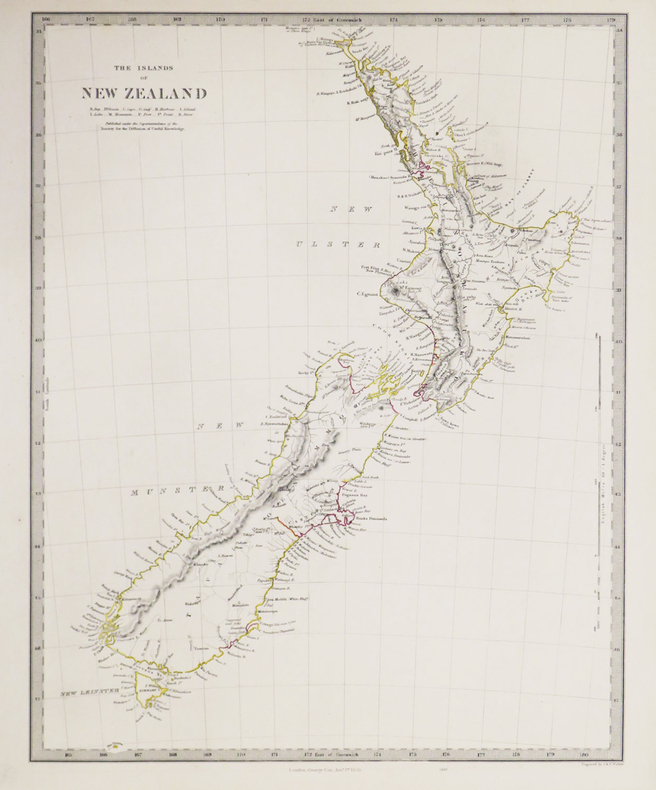
S.D.U.K.
[NOUVELLE-ZÉLANDE] The Islands of New Zealand.
London, George Cox, 1853. 400 x 310 mm.
Bookseller reference : LBW-3418
|
|
|
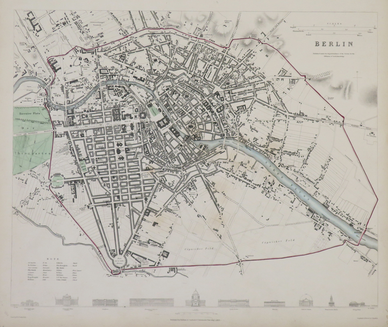
S.D.U.K.
Berlin.
Londres, Baldwin & Cradock, 1833. 310 x 365 mm.
Bookseller reference : LBW-4317
|
|
|
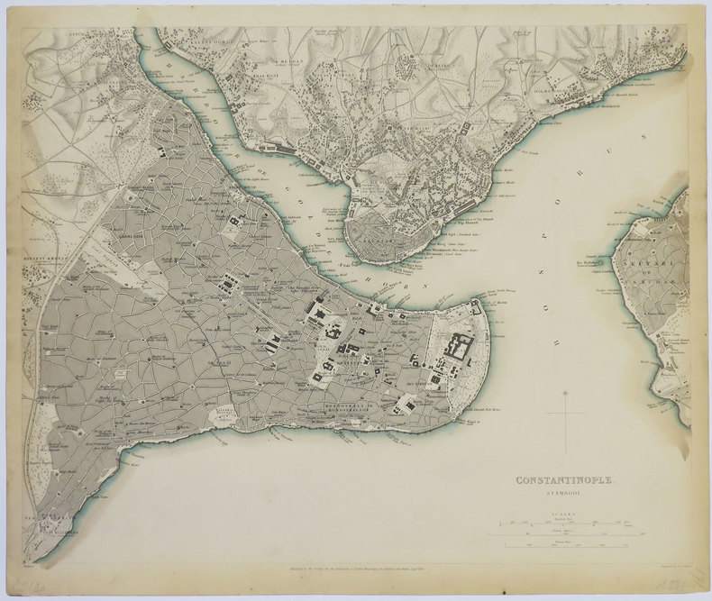
S.D.U.K.
Constantinople. Stambool.
Londres, 1840. 320 x 391 mm.
Bookseller reference : LBW-3552
|
|
|
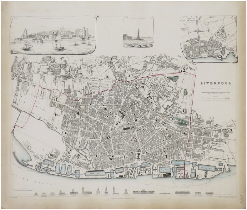
S.D.U.K.
Liverpool reduced by permission from Mr. Gage's elaborate survey.
Londres, Baldwin & Cradock, 1836. 380 x 385 mm.
Bookseller reference : LBW-1765
|
|
|
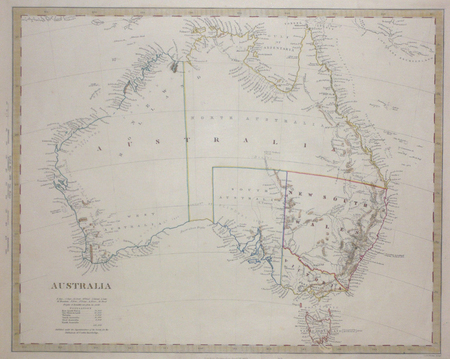
S.D.U.K.;
[AUSTRALIE] Australia.
Londres Society for the Diffusion of Useful Knowledge 1853 317 x 395 mm.
Bookseller reference : LBW0072b
|
|
|
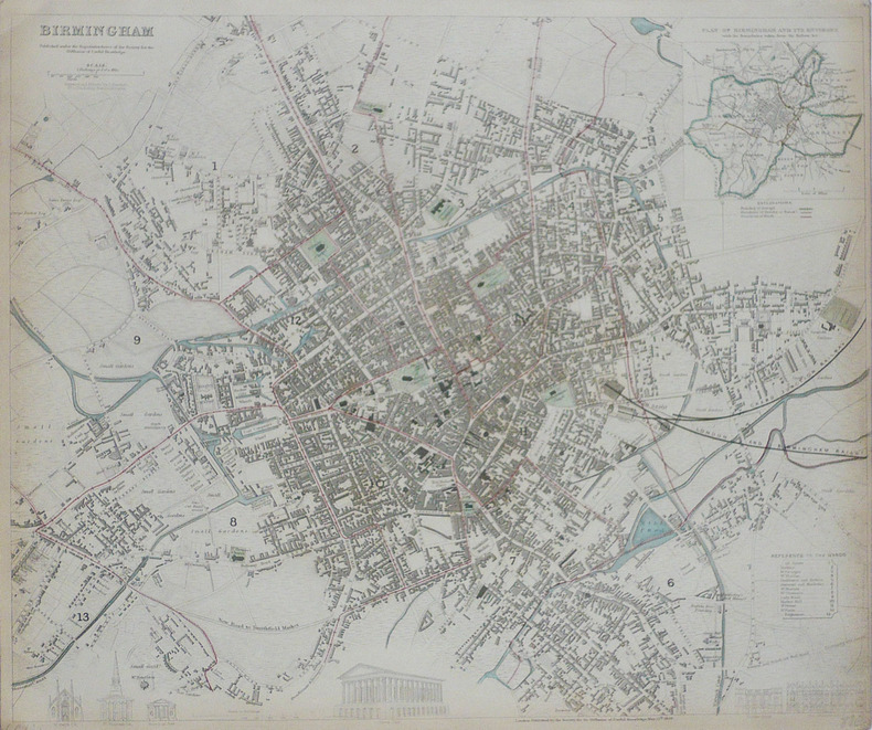
S.D.U.K.;
Birmingham.
Londres Society for the Diffusion of Useful Knowledge 1839 332 x 403 mm.
Bookseller reference : LBW-1767
|
|
|
S.I.- Neris les bains
Cartes de Neris les bains et ses environs
S.I.- Neris les bains, grandes cartes dépliantes,texte au dos,rare
Bookseller reference : 25585

|
|
|
Saalfeld:
Saalfeld. "Plan des Marches einiger Königl. Preussischen Trouppen nach Salfeld und der dabey vorgefallenen Gefangennehmung zweyer Bataillons der combinirten Reichs-Armee, d. 2. April 1761". Schlachtenplan von Saalfeld. Kupferstich mit farbigen Truppenaufstellungen aus "Neues Kriegs-Theater ...", No. 38.
Format: 18 x 29,5 cm. *Leicht gebräunt, insgesamt gut erhalten. Landkarten de
|
|
|
SAARBRUCKEN
Carte d'Etat-Major au 1/200 000?. Fin XIXe.
1 feuille repli?e. 32x49 cm.
|
|
|
Saccone, Richard
Travel Korea Your Way
213 pages including index. Describes over 60 of the most popular attractions Korea has to offer. Includes over 160 spectacular color photos and 20 informative maps. Provides everything you need to plan a wonderful vacation in Korea. Price clipped from flap of back cover. Minimal traces of wear. Tiny rubber date stamp upon bottom edge of textblock. Book
|
|
|
Sack Manfred
Playgirls d'Antan.
Duculot In-12°, 171 pages, bel ouvrage orné de 77 clichés à pleine page au format carte postale en noir et en couleurs. Agréable ex. (petite tache sur le plat)
Bookseller reference : 9183

|
|
|
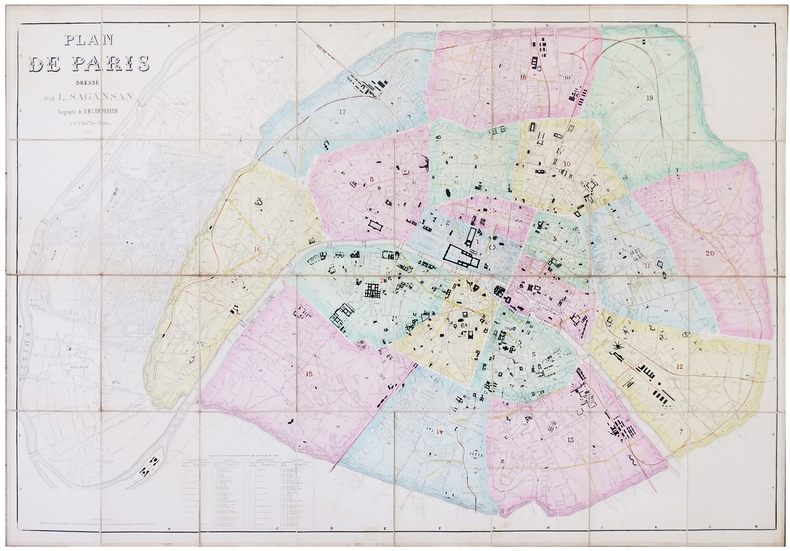
SAGANSAN (L.).
Plan de Paris.
1866. En 32 sections montées sur toile et pliées, formant une carte de 0,80 x 1,14 m ; étiquette de l'éditeur Lanée au dos de la carte ; sous étui de papier marbré.
Bookseller reference : LBW-5780
|
|
|
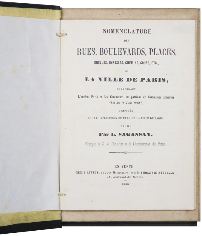
SAGANSAN (L.).
Plan de Paris.
Paris, chez l'auteur, 1860. En 36 sections montées sur toile et pliées, formant un plan de 0,79 x 1,14 m ; monté dans sa reliure éditeur en percaline noire (20,5 x 13 cm), contenant une nomenclature des rues de 104 pages ; titre en lettres dorées sur le premier plat.
Bookseller reference : LBW-6199
|
|
|
SAGANSAN (Léonard).
Carte des postes de l'Empire français. indiquant toutes les voies de communication, dressée d'après les documents officiels les plus récents par ordre de M. Éd. Vandal, conseiller d'État, directeur général des postes
Paris, 1870 grande carte dépliante (119 X 132 cm) repliée au format in-8, contours rehaussés de couleurs, en feuilles, entoilées.
Bookseller reference : 242647
|
|
|
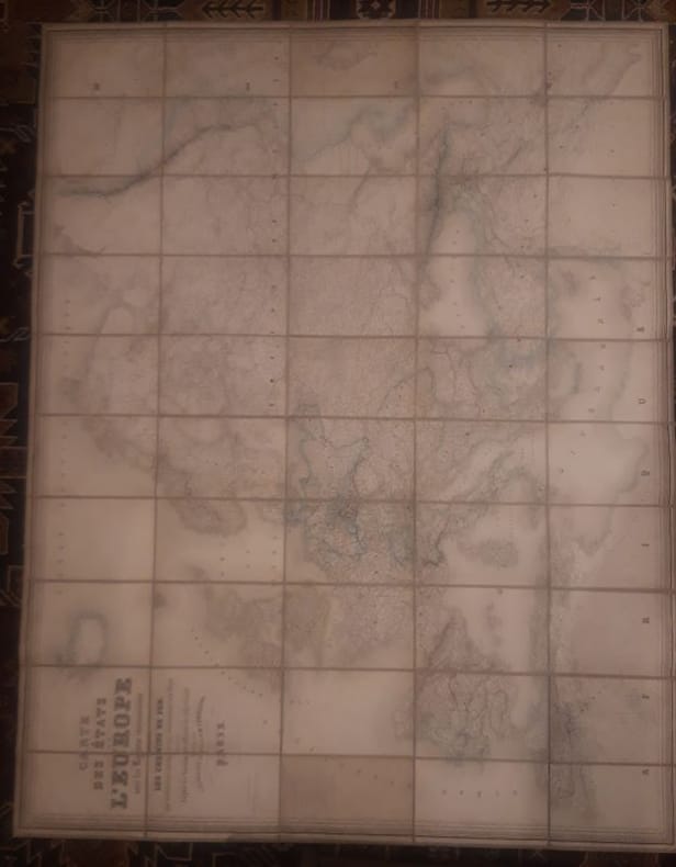
Sagansan.
Carte des Etats de l'Europe avec les régions circonvoisines, indiquant les chemins de fer, les principales routes et les subdivisions des états, dressée d'après les documents officiels les plus récents.
1868 1 160 cm x 120cms Carte Entoilée indiquant les chemins de fer, les principales routes et les subdivisions des états, dressée d'après les documents officiels les plus récents.Géographie gravée par Blondeau et écritures par Rousset.
Bookseller reference : LCI-4059
|
|
|
Sagebrush Maps
Eugene Springfield Oregon: Street Atlas
paperback. Good. Access codes and supplements are not guaranteed with used items. May be an ex-library book. paperback
Bookseller reference : 0929591674.G ISBN : 0929591674 9780929591674

|
|
|
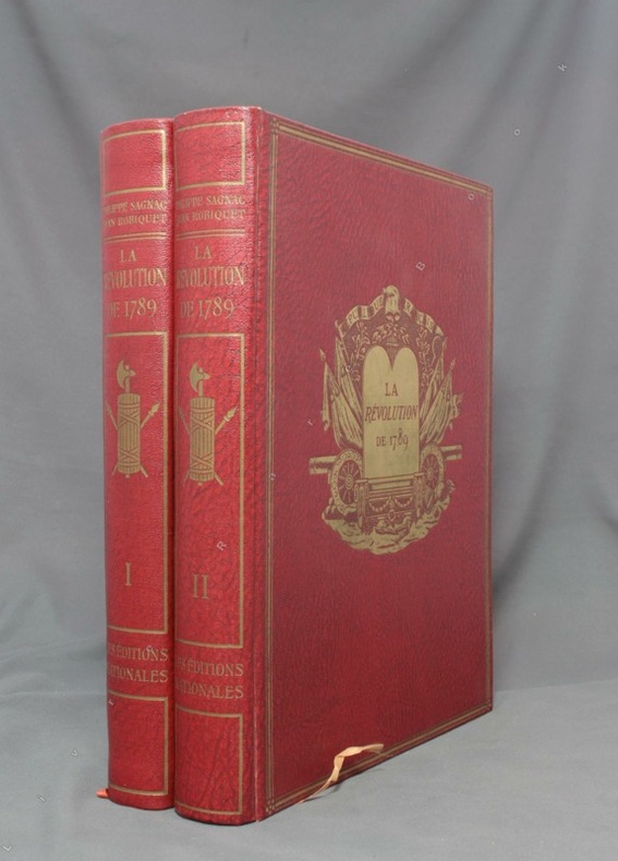
SAGNAC Philippe:
La Révolution de 1789.
A Paris, Les Ed. nationales, 1934. 2 volumes in-4 de XV-390-[6] + 412-[12] pages, reliure d’éditeur percailne rouge, dos lisses ornés, plats ornés d’un médaillon doré en leur centre et encadré de 3 filets dorés, couvertures conservées.
Bookseller reference : 1643
|
|
|
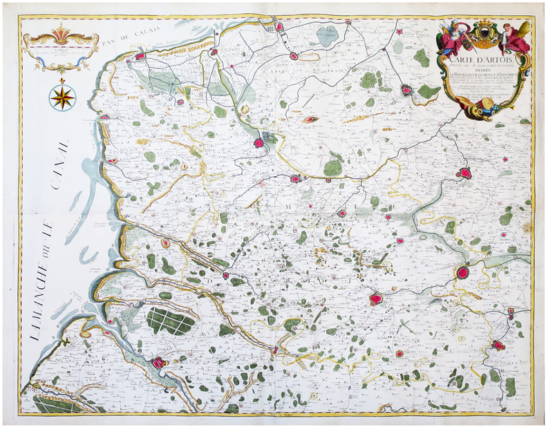
SAINT-ALEXIS (Constantin de).
[ARTOIS] Carte d’Artois dressée sur de nouveaux mémoires.
Arras, Barbier, 1741. En quatre feuilles jointes formant une carte de 97,3 x 119,6 cm.
Bookseller reference : LBW-6681
|
|
|
SAINT-GERMAIN.-
Maître Pierre, ou le Savant de village. Géographie de la France.
Paris, Chez F.G. Levrault, 1834, in-12°, 216 p. + 3 cartes dépliantes, envois ms à la première page + stempel 'Hospice du Simplon', en page de titre. cartonnage originale illustrée. Bel exemplaire.
Bookseller reference : 50921aaf
|
|
|
SAINT-OMER. MANUSCRIT.
Plan de S.t Omer.
[circa 1710]. En 2 feuilles jointes de 510 x 715 mm.
Bookseller reference : LBW-4193

|
|
|
SAINT-OMER. MANUSCRIT.
Plan de St Omer.
[circa 1750]. En 2 feuilles jointes de 435 x 600 mm, sur papier fin huilé.
Bookseller reference : LBW-4194

|
|
|
SAINTE-CROIX par Ernest-Louis PAILLARD.
Les vallons de Sainte-Croix et des Granges de Sainte-Croix, dans le Haut Jura vaudois. Etude de géographie avec 22 cartes, dessins et graphiques dans le texte.
Ntel, société neuchâteloise de géographie 1943. Bel ex. broché, couv. D'orig. Gd in-8, 152 p. pour cette étude avec introductions, illustrations et sources.
Bookseller reference : AUB-7920
|
|
|
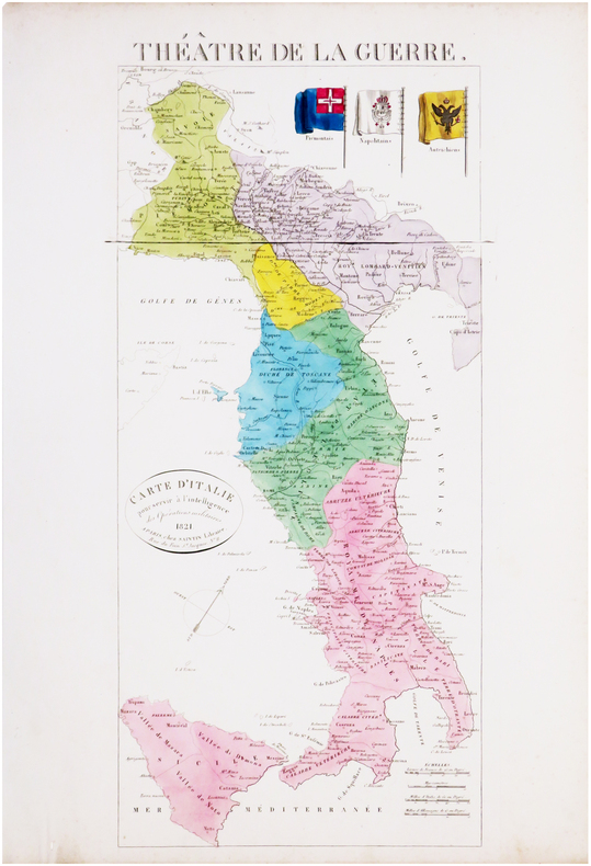
SAINTIN (Claude-Auguste).
Théâtre de la guerre. Carte d'Italie pour servir à l'intelligence des opérations militaires.
Paris, Saintin, 1821. 535 x 241 mm.
Bookseller reference : LBW-8033
|
|
 Receive by email
 Download as PDF document
 RSS feed


