|
|
|
BOURGOIN Graveur
[ Recueil de 25 cartes et planches par Bourgoin : ] Introduction à la géographie. Carte des diverses positions de la Sphère, des Systèmes de l'Univers, des Planettes, des Eclypses &c. en deux feuilles, [s.l.n.d.] contient notamment Sphère armillaire oblique, globe céleste, globe terreste [ Avec : ] Mappe monde Carte universelle de la Terre dressée sur les Nouvelles Observations de Messieurs de l'Académie Royale des Sciences, 1773 [Avec : ] Carte itinéraire de la France divisée par Gouvernements Militaires et en ses Provinces. Première Feuille contenant la Bretagne, la Normandie, le Maine et Perche, 1773 [ Avec : ] Deuxième feuille contenant la Flandre Françoise, Picardie, Artois, Isle de France, Champagne, Lorraine et Alsace [ Avec : ] Troisième feuille contenant une partie de la Bretagne, l'Anjou, la Touraine, le Poitou, la Saintonge, la Marche et le Limosin [ Avec : ] Cinquième feuille contenant la Guienne, le Bearn, la Basse Navarre, le Comté de Foix et une partie du Languedoc [ Avec : ] Sixième feuille contenant le Languedoc, le Dauphiné, la Provence et le Roussillon [ Avec : ] Carte de l'Amérique Septentrionale [ Avec : ] Carte de l'Amérique Méridionale [ Avec : ] Carte de l'Asie Divisée en ses principaux Empires et Royaumes [Avec : ] Carte de l'Europe Divisée en ses Grands Etats [Avec : ] Cartes des Isles Britanniques [Avec : ] Carte du Royaume d'Espagne et de Portugal Divisé par Provinces et Royaumes [ Avec : ] Carte du Royaume de France divisé par Provinces, 1765 [ Avec : ] Carte des Pays Bas Divisée en Provinces Hollandoises, Autrichiennes et Françoises [ Avec : ] Carte de l'Empire d'Allemagne Divisée par Cercles [ Avec : ] Carte de l'Italie et des Isles adjacentes [ Avec : ] Carte des XIII Cantons Suisses leurs Alliés et leurs Sujets [ Avec : ] Royaume d'Hongrie Principauté de Transilvanie et Banat de Temeswar [ Avec : ] Carte de l'Empire de Turquie en Europe [ Avec : ] Carte du Royaume du Dannemarck [ Avec : ] Carte du Royaume de Suède Norwege et Partie du Dannemarck [ Avec : ] Carte de l'Empire des Russies en Europe Partie Septentrionale, 1765 [ Avec : ] Carte de la Judée ou Terre Sainte pour l'Intelligence de l'Histoire Sacrée
Recueil de cartes et planches en 25 feuilles de format 36 x 50 cm (mesures en marges), en 1 vol. petit in-folio cartonnage moderne (XXe siècle) demi-basane verte, Contient : Carte des diverses positions de la Sphère, des Systèmes de l'Univers, des Planettes, des Eclypses &c. en deux feuilles, [s.l.n.d.] contient notamment Sphère armillaire oblique, globe céleste, globe terreste [ Avec : ] Mappe monde Carte universelle de la Terre dressée sur les Nouvelles Observations de Messieurs de l'Académie Royale des Sciences, Chez Bourgoin Graveur, Rue de la Harpe vis-à-vis le passage des Jacobins à côté du café de Condé, Paris, 1773 [Avec : ] Carte itinéraire de la France divisée par Gouvernements Militaires et en ses Provinces Contenant les Routes Royales et Particulières, Dressée sur la Carte des Triangles levée géométriquement, Première Feuille contenant la Bretagne, la Normandie, le Maine et Perche, Chez Bourgoin 1773 [ Avec : ] Deuxième feuille contenant la Flandre Françoise, Picardie, Artois, Isle de France, Champagne, Lorraine et Alsace [ Avec : ] Troisième feuille contenant une partie de la Bretagne, l'Anjou, la Touraine, le Poitou, la Saintonge, la Marche et le Limosin [ Avec : ] Cinquième feuille contenant la Guienne, le Bearn, la Basse Navarre, le Comté de Foix et une partie du Languedoc [ Avec : ] Sixième feuille contenant le Languedoc, le Dauphiné, la Provence et le Roussillon [ Avec : ] Carte de l'Amérique Septentrionale, Chez Bourgoin, s.d. avec une note sur les découvertes de l'Amiral de Fonte jugées suspectes "Dans cette Partie on avoit mis les pretendues Decouvertes de l'Amiral de Fonte. La relation en ayant eté trouvé suspecte par plusieurs Auteurs on n'a pas cru devoir les mettre dans cette Carte, dans la Mappemonde elles sont pointées en attendant la verification" [ Avec : ] Carte de l'Amérique Méridionale, Chez Bourgoin, Paris, s.d. [ Avec : ] Carte de l'Asie Divisée en ses principaux Empires et Royaumes, Chez Bourgoin, Paris, s.d. avec cette précision : "Cette Projection supposant l'œil du Spectateur au Centre de l'Equateur représente cette Partie comme détachée d'un grand Globe et applatie, les Meridiens et les Paralleles du centre se trouvant plus resserrées et s'elargissant a mesure quils s'en éloignent, cette projection et toutes celles de cette nature ne peuvent souffrir d'Echelles, les quelles seroient fausses" [Avec : ] Carte de l'Europe Divisée en ses Grands Etats, Chez Bourgoin, Paris, s.d. [Avec : ] Cartes des Isles Britanniques, Chez Bourgoin, Paris, s.d. [Avec : ] Carte du Royaume d'Espagne et de Portugal Divisé par Provinces et Royaumes, Chez Bourgoin, Paris, s.d. [ Avec : ] Carte du Royaume de France divisé par Provinces, Chez Bourgoin, Paris, 1765 [ Avec : ] Carte des Pays Bas Divisée en Provinces Hollandoises, Autrichiennes et Françoises, Chez Bourgoin, Paris, s.d. [ Avec : ] Carte de l'Empire d'Allemagne Divisée par Cercles, Chez Bourgoin, Paris, s.d. [ Avec : ] Carte de l'Italie et des Isles adjacentes, Chez Bourgoin, Paris, s.d. [ Avec : ] Carte des XIII Cantons Suisses leurs Alliés et leurs Sujets, Chez Bourgoin, Paris, s.d. [ Avec : ] Royaume d'Hongrie Principauté de Transilvanie et Banat de Temeswar, Chez Bourgoin, Paris, s.d. [ Avec : ] Carte de l'Empire de Turquie en Europe, Chez Bourgoin, Paris, s.d. [ Avec : ] Carte du Royaume du Dannemarck, Chez Bourgoin, Paris, s.d. [ Avec : ] Carte du Royaume de Suède Norwege et Partie du Dannemarck, Chez Bourgoin, Paris, s.d. [ Avec : ] Carte de l'Empire des Russies en Europe Partie Septentrionale, Chez Bourgoin, Paris, 1765 [ Avec : ] Carte de la Judée ou Terre Sainte pour l'Intelligence de l'Histoire Sacréen Chez Bourgoin, Paris, s.d.
Referentie van de boekhandelaar : 70765
|
|
|
BOURGUIGNON D' ANVILLE, Jean Baptiste (1697 - 1782).
Carte du Royaume d' Aragon. Dressée sur plusieurs Cartes manuscrites et imprimées, sur les Mémoires composés dans le pays par l' Abbé de Vairac (et) sur les Cartes topographiques des Pirenées levées sur les lieux par M. Roussel. 1719. Cartela de encabezamiento con la mención: "Theatre de la Guerre d'Espagne". Reproducción facsímil.
Zaragoza, 1980. 104 x 82 cms. Ejemplar coloreado a mano, a la aguada. Impresión sobre papel fuerte superior.

|
|
|
BOURILLON Florence, CLERGEOT Pierre, VIVIER Nadine
"De l'estime au cadastre en Europe; les systèmes cadastraux au XIXe et XXe siècles."
Paris, Comité pour l'Histoire Economique et Financière de la France, 2008. 16 x 22, 423 pp., quelques cartes, graphiques et illustrations, broché, très bon état.
Referentie van de boekhandelaar : 91156 ISBN : 2110953764
|
|
|
Bournis, Theodoritos
I was in the isle of Patmos ...
A short guide to the island of Patmos, particularly the Monastery of St. John the Theologian by the Archimandrite.63p. illus. A small welcome brochure is laid in Book
|
|
|
BOUSQUEL (Auguste).
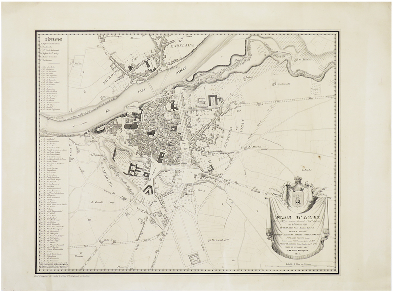
[ALBI] Plan d'Albi.
Paris, Gratia, 1843. 390 x 478 mm.
Referentie van de boekhandelaar : LBW-6397
|
|
|
BOUSSENARD (Louis)
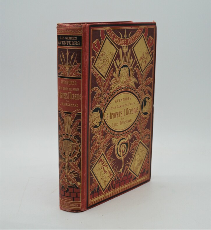
Aventures d'un gamin de Paris à travers l'Océanie
Paris, Marpon et Flammarion, sans date (circa 1880). grand in-8, 603 pages. Reliure éditeur pleine percaline rouge au décor richement orné avec plantes et animaux sauvage , dos lisse orné avec auteur , titre, etc. (Engel), tranches dorées , coins légèrement usés ,quelques rousseurs , bel exemplaire.P2-4E
Referentie van de boekhandelaar : PHO-1062
|
|
|
BOUTET, Gérard
Les Compagnons du Savoir-Faire, Artisans d’Aujourd’hui
Jean-Cyrille Godefroy, JCG/SELD 1998 In-8, broché couv. illustrée, photographies et croquis en n. & b., 148 pp. Bon état d’occasion.
Referentie van de boekhandelaar : 20365
|
|
|
BOUTONNET-TRANIER, Jean-Marc - D'ORPEO, Valtarus
Les quatre songes du bateau mat. Tarots, rouleaux magiques, mythes & symboles.
2022 Editions Dumerchez - 2022 - In-8, broché, couverture à rabats illustrée en couleurs - 75 pages - Nombreuses illustrations en couleurs in-texte
Referentie van de boekhandelaar : 119871

|
|
|
BOUVARD (René) & LAPRÉE (André).
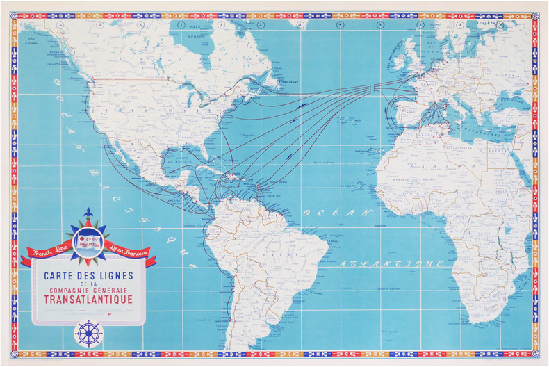
French Line - Linea Francesa. Carte des lignes de la Compagnie Générale Transatlantique.
Paris, Éditions Blondel La Rougery, 1951. 0,73 x 1,09 m.
Referentie van de boekhandelaar : LBW-8627
|
|
|
BOUVET Jean
En descendant la Sorgue au début du siècle.
Editions A. Barthélémy, Avignon, 1990.
Referentie van de boekhandelaar : 22117
|
|
|
BOUVIER Nicolas; VERNET Thierry:
L'usage du monde.
Paris, Julliard, 1964. In-8 broché de 374-[6]p., couverture à rabats illustrée.
Referentie van de boekhandelaar : 20925

|
|
|
BOVARD Pierre-André / BUVELOT Jacques
La côte au bon vieux temps : de Saint-Sulpice à Mies.
Payot, 1975, 176 p., cartonnage éditeur sous jaquette, un ex-libris sur le premier contreplat, l'adhésif de la jaquette se décolle, bon état pour le reste.
Referentie van de boekhandelaar : 86441
|
|
|
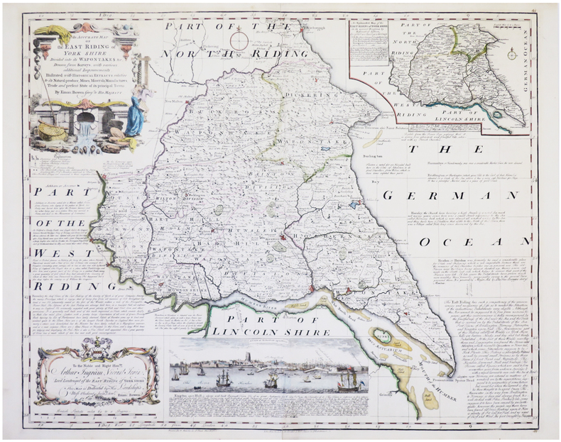
BOWEN (Emanuel).
[YORKSHIRE] An accurate map of the East Riding of York Shire divided into its wapontakes &c.
Londres, John Bowles & Son, & Rob.t Sayer, [circa 1750]. 525 x 652 mm.
Referentie van de boekhandelaar : LBW-7675
|
|
|
Bowles, Samuel.
OUR NEW WEST. Records of Travel Between the Mississippi River and the Pacific Ocean. A Full Description of the Pacific Railroad; and of the Life of the Mormons, Indians, and Chinese.
524p. + Plus Engraved Frontis, map and full page plates. Large 8vo. Disbound. ". Over the plains - over the mountains - through the great interior basin-over the Sierra Nevadas-to and up and down the Pacific coast. With details of the wonderful natural scenery, agriculture, mines, busines, social life, progress, and prospects of Colorado, Wyoming, Utah, Idaho, Montana, Nevada, California, Oregon, Washington, and British Columbia; including a full description of the Pacific Railroad; and of the life of the Mormons, Indians, and Chinese." Rader 432; Flake 767; Sabin 7079. AMERICANA BOX 6
|
|
|
Boyd, Andrew
An Atlas of World Affairs
160 pages, maps, index, slight wear to covers, (University Paperbacks ; UP91) eng
|
|
|
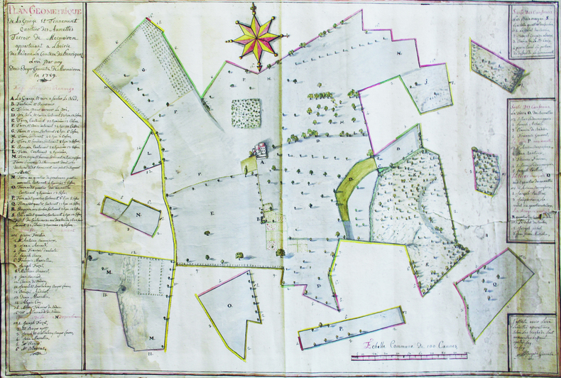
BOYER (Denis).
Plan géométrique de la grange et tennement, quartier des Aumettes, terroir de Mormoiron, appartenant à l'hoirie de Madame la Comtesse des Henriquez. Levé par moy, Denis Boyer, géomètre de Mormoiron, en 1789.
1789. 63 x 94 cm, sur une feuille de 66 x 96,5 cm.
Referentie van de boekhandelaar : LBW-6641
|
|
|
Boyle, R.W.
A Decrepitation Study of Quartz from the Campbell and Negus-Rycon Shear Zone Systems, Yellowknife, Northwest Territories
vi, 20 pages with two maps in pocket at back. Geological Survey of Canada Bulletin 30 (Thirty). Bit of writing and two faint stamps on front cover. Average wear. Binding intact. A sound copy. Book

|
|
|
BP
Wales
1 folded map. Good. Scale 4 miles = 1 inch. (BP touring service). 14644. eng
|
|
|
Braby
Braby?s Directories Cover Southern Afrika (Road and Rail Map)
LTD, Brown Davis & Platt, o.J. Faltkarte, einseitig bedruckt mit farbiger Landkarte von Südafrika, Teilstücke von Afrika (Rhodesia, Zambia and Malawi), Statistik-Tabelle und Werbeanzeigen sowie Index, 100x70 cm groß, leichte Einrisse und Kantenbeschabungen, wenige Bleistifteinträge, gebräunt, insgesamt noch ordentlicher Zustand
Referentie van de boekhandelaar : 262704ge

|
|
|
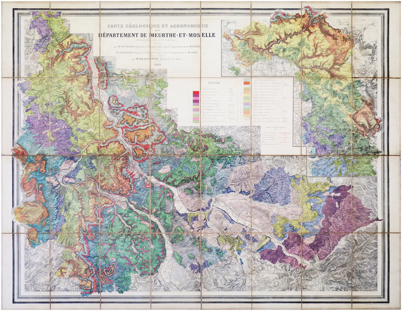
BRACONNIER (Alfred).
[MEURTHE-et-MOSELLE] Carte géologique et agronomique du département de Meurthe-et-Moselle.
1882. En 32 sections montées sur toile et repliées, formant une carte de 1,14 x 1,44 m.
Referentie van de boekhandelaar : LBW-7953
|
|
|
Bradley, John
Allied Intervention in Russia
251 pages. Index of names. Bibliography. Maps. "Almost 50 years after the event, the Alliled intervention in Russia following the Bolshevik seizure of power in 1917 remains a conroversial issue. For that reason, and because so much government documentary material has remained inaccessible, it has been badly neglected by professional historians... Provides a wealth of completely new material... The obscure beginnings of the intervention, November 1917 to August 1918, are thoroughly explained, and the role of Japan and Czechoslovakia Corps in the military strategy of the Allies is examined." - from dust jacket. Usual library markings. Above-average wear. Front hinge open. Reading copy only. Book

|
|
|
Bradshaw, Marian Hahn
Canadian Collector Magazine, May/June 1985, Volume 20, No. 3: The Lachine Rapids
100 pages. Features: The Lachine Rapids and their mark on history; Indian trade silver in the McCord Museum collection; Lords of the Lakes - the North West Company 1784-1821; Wintering Dishes - recalling the famed Beaver Club dinners (with recipes!); Trade and Empire - Fishermen began fur trade in New France; The Challenge of Heritage Conservation (in English and French); Several articles in French; Domestic Interiors - Parks Canada's designated houses in Quebec; Exhibit of five centuries of old and rare maps; The Liliane Stewart Collection; Counterfeit Canadiana I; Paperweights. Light wear. Quality copy. Book

|
|
|
BRAIVE (Georges).
[ÎLE d'YEU/VENDÉE] Île Dieu. Île d'Yeu, anc.t Insula de Oya, Oias, puis Oys.
Île d'Yeu, G. Penaud, "Nouvelles Galeries Insulaires", 1938. 237 x 349 mm.
Referentie van de boekhandelaar : LBW-8221

|
|
|
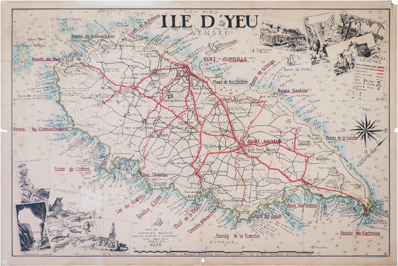
BRAIVE (Georges).
[ÎLE d'YEU/VENDÉE] Île Dieu. Île d'Yeu, anc.t Insula de Oya, Oias, puis Oys.
Île d'Yeu, L. Penaud - Nouvelles Galeries Insulaires, 1938-1954. 0,71 x 1,05 m.
Referentie van de boekhandelaar : LBW-8820
|
|
|
BRAMBILLA Ambrogio attivo a Roma tra il 1579 ed il 1599
Nova Urbis Romae Descriptio Anni 1587
Rarissima pianta prospettica della città dal Gianicolo, incisa da Ambrogio Brambilla per il tipografo Girolamo Franzini. Si tratta di una piccola pianta, dipendente da quella che il Brambilla stesso incise per Claudio Duchetti nel 1582, aggiornata in parte alla riforma urbanistica di Sisto V. Sono raffigurati gli obelischi di S. Pietro, S. Giovanni e S. M. Maggiore e la via Nova. L’opera è di grandissima rarità; Hülsen (1915) descrive due esemplari nei cataloghi di inizio secolo delle librerie antiquarie romane Rappaport e Lang. Marigliani (2007) riproduce l’esemplare di una collezione privata romana, con una legenda è molto nutrita, addirittura stampata su una lastra separata; è composta da 136 rimandi, dei quali i primi 114 derivano dalla pianta del 1582.In alto, nel riquadro di sinistra, troviamo il titolo e le indicazioni editoriali: NOVA URBIS ROMAE DESCRIPTIO ANNI 1587. Per Ambrosiu s brambilla spictore[m] delineatu s et incisa m. Nel riquadro di destra si legge: Roma fu edifficata gl’anni del mondo 5550 e da poi la destruttione de Troia anni 753 da Romolo, e Remo, fratelli nati da Silvia figliola de Numitore Re de Albano: fu anticame[n]te il suo circuito de le mura miglia 32.Orientazione nei quattro lati al centro con il nome dei punti cardinali: SEPTENTRIO, MERIDIES, OCCIDENS, ORIENS, il nord è a sinistra. Acquaforte e bulino, stampata su carta vergata coeva, con ampi margini, in perfetto stato di conservazione.BibliografiaBifolco - Ronca, Cartografia e Topografia italiana del XVI secolo (2018), pp. 2406-2407, tav. 1238; Ganado (1994): II, n. 116 e III. n. 93; Hülsen (1915): XVIa, p. 63-64, n. 80; Marigliani (2007): n. 60. A very rare map of the city from the Janiculum Hill, engraved by Ambrogio Brambilla for the publisher Girolamo Franzini. It is a small map, based on the one that Brambilla himself engraved for Claudio Duchetti in 1582, partly updated to the urban reform of Sixtus V. The obelisks of S. Pietro, S. Giovanni and S. M. Maggiore and the via Nova are represented. The work is of great rarity; Hülsen (1915) describes two examples in the catalogs of the beginning of the century of the Roman antique bookshops Rappaport and Lang. Marigliani (2007) reproduces the exemple of a private Roman collection, with a very large legend, even printed on a separate plate; it is composed of 136 references, of which the first 114 derive from the map of 1582.Above, in the left box, we find the title and the printing details: NOVA URBIS ROMAE DESCRIPTIO ANNI 1587. For Ambrosiu s brambilla spictore[m] delineatu s et incisa m. Orientation in the four sides with the name of the cardinal points: SEPTENTRIO, MERIDIES, OCCIDENS, ORIENS, the north is on the left. Etching and engraving, printed on contempoary laid paper, with wide margins, in perfect condition.LiteratureBifolco - Ronca, Cartografia e Topografia italiana del XVI secolo (2018), pp. 2406-2407, tav. 1238; Ganado (1994): II, n. 116 e III. n. 93; Hülsen (1915): XVIa, p. 63-64, n. 80; Marigliani (2007): n. 60. Bifolco - Ronca, Cartografia e Topografia italiana del XVI secolo (2018), pp. 2406-2407, tav. 1238.

|
|
|
Branch, Melville C.
An Atlas of Rare City Maps: Comparative Urban Design, 1830-1842
This is a very good hardcover copy in a very good dust jacket. The jacket is a little toned and has a bit of light soil. Internally completely clean. Maps of 40 cities in Europe, Russia, America and Asia are presented in full-page color plates. All maps were drawn and published between 1830 - 42. 13" high X 15" wide, 102 pages. Large heavy book. Foreign shipping will be extra. This book will be securely wrapped and packed in a sturdy box and sent with tracking.
|
|
|
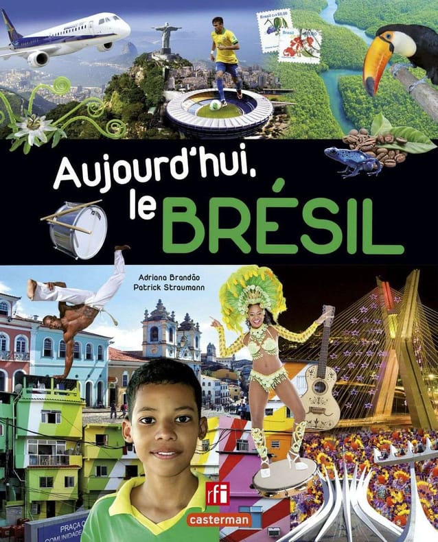
Brandao Adriana
Aujourd'hui le Bresil
Casterman 2014 144 pages 20 2x25 1x1 1cm. 2014. Relié. 144 pages.
Referentie van de boekhandelaar : 500058969

|
|
|
Brandao Adriana
Aujourd'hui le Bresil
Casterman 2014 144 pages 20 2x25 1x1 1cm. 2014. Relié. 144 pages.
Referentie van de boekhandelaar : 500078500
|
|
|
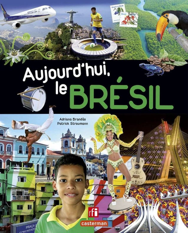
Brandao Adriana
Aujourd'hui le Bresil
Casterman 2014 144 pages 20 2x25 1x1 1cm. 2014. Relié. 144 pages.
Referentie van de boekhandelaar : 500078508
|
|
|
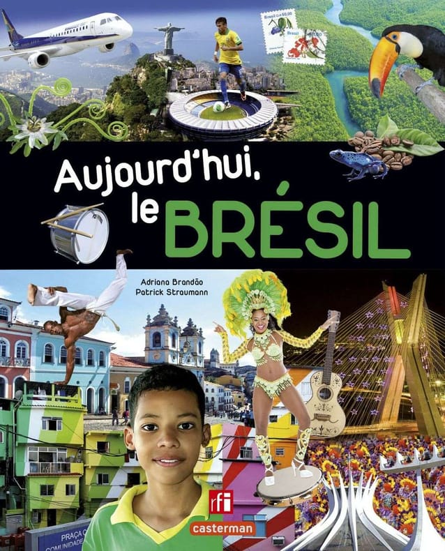
Brandao Adriana
Aujourd'hui le Bresil
Casterman 2014 144 pages 20 2x25 1x1 1cm. 2014. Relié. 144 pages.
Referentie van de boekhandelaar : 500093062
|
|
|
Brandao Adriana
Aujourd'hui le Bresil
Casterman 2014 144 pages 20 2x25 1x1 1cm. 2014. Relié. 144 pages.
Referentie van de boekhandelaar : 500095025

|
|
|
Brandao Adriana
Aujourd'hui le Bresil
Casterman 2014 144 pages 20 2x25 1x1 1cm. 2014. Relié. 144 pages.
Referentie van de boekhandelaar : 500121600

|
|
|
Brandlmayr, John; et al
Northwest Sportsman Magazine - Fishing, Hunting and Boating in B.C., May 1961 - Revised Fresh Water Fishing Spots and Maps of British Columbia
42 pages. Features: Revised Fresh Water Fishing Spots and Maps of British Columbia; Nice one-page illustrated ad for Gibbs fishing tackle; One-page illustrated ad for Hardy and Milward split cane fishing rods from England; Marine fir plywood ad; Clay Chips - article with photos of Mr. & Mrs. Bert Whelan, Ray Gray, Virgil Poppe, Rudy Wiley, Earl Caldwell, Don McKay, Paul Maylor, Larry French, C.H. Reinhard, and Verne Greensword; Yacht Bureau begins research and product testing program; Boats; Nice framable one-page ad inside back cover by the B.C. Department of Recreation and Conservation entitled "Good Fishing!"; Nice photo-illustrated Lucky Lager ad on back cover; Many additional nostalgic ads. Unmarked with moderate wear. A quality vintage copy. Book

|
|
|
Brass, R.A.
White Rock (British Columbia) By the Sea: Town Map
24" x 18" map of White Rock, British Columbia. Undated but appears to be circa 1978. Includes directory and locations of local businesses. Light wear. Unmarked. A quality copy of this nice White Rock memento. Map

|
|
|
BRASSAI.
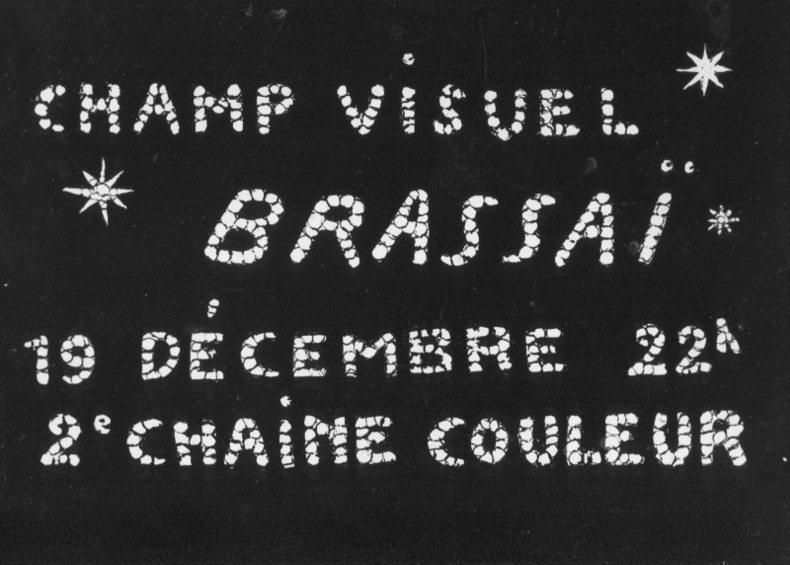
Photo-carte avec la signature autographe de Brassaï au verso (années 1970).
Carte postale (10,5 x 15 cm), années 70. Annonce du documentaire télévisé "Champ visuel Brassaï - 19 décembre 22 h - 2e chaîne couleur". Signé au dos par le photographe.
Referentie van de boekhandelaar : 68129
|
|
|
BRASSAI.
Photo-carte avec la signature autographe de Brassaï au verso (années 1970).
Carte postale (10,5 x 15 cm), années 70. Annonce du documentaire télévisé "Champ visuel Brassaï - 19 décembre 22 h - 2e chaîne couleur". Signé au dos par le photographe.
Referentie van de boekhandelaar : 68129
|
|
|
BRAUN & Franz HOGENBERG Georg
Antiqua Urbis Roma Imago Accuratissima
Grande pianta della città stampata su due fogli, ispirata alla celebre carta del Pirro Ligorio, tratta dal Civitates Orbis Terrarum. Questa straordinaria ricostruzione di Roma durante il regno di Augusto, arricchita da una cospicua legenda con 269 richiami, costituisce il lavorò più ambizioso contenuto nel Civitates Orbis Terrarum, del quale oltretutto è una delle sole tre mappe a doppio foglio. L’opera è inserita nel Civitates Orbis Terrarum, il primo atlante devoto esclusivamente alle piante e vedute delle principali città del mondo. Il primo volume delle Civitates Orbis Terrarum fu pubblicato a Colonia nel 1572. Il sesto e ultimo volume apparve nel 1617. Questo grande atlante di città – cartografia urbana - curato da Georg Braun e inciso in gran parte da Franz Hogenberg, conteneva 546 prospettive, vedute a volo d'uccello e vedute cartografiche di città di tutto il mondo. Franz Hogenberg realizzò le tavole dei primi quattro volumi e Simon van den Neuwel (Novellanus, attivo dal 1580) quelle dei volumi V e VI. Georg Braun (1541-1622), un ecclesiastico di Colonia, fu il principale redattore dell'opera e fu molto aiutato nel suo progetto dalla vicinanza e dal continuo interesse di Abraham Ortelius, il cui Theatrum Orbis Terrarum del 1570 fu, come raccolta sistematica e completa di mappe di stile uniforme, il primo vero atlante. Le Civitates, in effetti, erano destinate ad accompagnare il Theatrum, come indicato dalla somiglianza dei titoli e dai riferimenti contemporanei sulla natura complementare delle due opere. Tuttavia, le Civitates erano progettate per avere un approccio più popolare, senza dubbio perché la novità di una raccolta di piante e vedute di città rappresentava un'impresa commerciale più rischiosa di un atlante mondiale, per il quale c'erano stati diversi precedenti di successo. Franz Hogenberg (1535-1590) era figlio di un incisore di Monaco che si era stabilito a Malines. Incise la maggior parte delle tavole del Theatrum di Ortelius e la maggior parte di quelle delle Civitates, e potrebbe essere anche indicato come il responsabile dell'origine del progetto. Oltre un centinaio di artisti e cartografi diversi, il più importante dei quali fu l'artista di Anversa Georg Hoefnagel (1542-1600), fornirono i disegni per le tavole delle Civitates. Hoefnagel non solo contribuì alla maggior parte del materiale originale per le città spagnole e italiane, ma rielaborò e modificò anche quello di altri collaboratori. Dopo la morte di Hoefnagel, il figlio Jakob continuò il lavoro per le Civitates. Gli autori della raccolta si proponevano di raffigurare "non icones et typi urbium", cioè non immagini generiche e tipizzate, "sed urbes ipsae admirabili caelaturae artificio, spectantium oculis subiectae appareant": non intendeva alludere o idealizzare, ma rappresentare fedelmente sulla carta, riprodurre esattamente, e in tempo reale, ciò che l'occhio vede, come annunciato nella prefazione al primo volume delle Civitates Orbis Terrarum. Incisione in rame, bella coloritura coeva, leggeri restauri perfettamente eseguiti per il resto in buono stato di conservazione. A good example, with fine original colour, of the Braun & Hogenberg Plan of Rome, first published in the 1588 edition of the Civitates Orbis Terrarum.Braun & Hogenberg's view is based upon the work of Pirro Ligorio. However, the title banner and lower key embellishments are completely revised, the former lacking the strapwork used by Braun & Hogenberg and replaced with a tapestry style fringe, while the lower key is now embellished with images of two nobles.Rome is shown from the west in a bird's-eye view that was a major achievement in its day. It includes the most important buildings from antiquity, several aqueducts, the Aurelian Wall and large arterial streets. The three figures in Roman garb in the foreground underscore the aim of meticulous reconstruction.Mont Testaccio is shown on the far side of the Tiber in the lower right-hand edge of the picture, with the Pyramid of Cestius above it to the right. At the center of the illustration the Marcellus Theatre can be identified above the island in the Tiber, with the vast Circus Maximus, used for chariot races, just above it to the right. Above that is the Palatine represented with intricately detailed buildings, an indication of the confusion at the time about how the seat of imperial power actually looked.To the north the Coliseum flanks the Palatine. In the lower left-hand part of the picture field is the Campus Martius, with the stadium of Domitian at the center, site of the modern Piazza Navona. Slightly higher up is the Pantheon with its monumental dome, looking as it does today. On the lower left edge the two great imperial mausoleums are shown as they would have appeared during the Roman epoch. Above the mausoleum of Augustus and below, at the bend in the river, is that of Hadrian.In the lower left-hand corner, the Mons Vaticanus with the Circus built by Caligua and a Neronian palace are recognizable outside the city. The baths of Diocletan dominate the northeastern part of the city. The Castra Praetoria, the barracks of the Praetorian Guard, is shown below the city walls in the upper left-hand corner. The work is included in the Civitates Orbis Terrarum, the first atlas devoted exclusively to plans and views of the world's major cities. Printed in six volumes between 1572 and 1617 it was so successful and widespread that several editions translated into Latin, German and French were printed. The first volume of the Civitates Orbis Terrarum was published in Cologne in 1572. The sixth and the final volume appeared in 1617. This great city atlas, edited by Georg Braun and largely engraved by Franz Hogenberg, eventually contained 546 prospects, bird-eye views and map views of cities from all over the world. Fransz Hogenberg produced the plates for the first four books, and Simon van den Neuwel (Novellanus, active since 1580) those for volumes V and VI. Georg Braun (1541-1622), a cleric of Cologne, was the principal editor of the work, and was greatly assisted in his project by the close, and continued interest of Abraham Ortelius, whose Theatrum Orbis Terrarum of 1570 was, as a systematic and comprehensive collection of maps of uniform style, the first true atlas. The Civitates, indeed, was intended as a companion for the Theatrum, as indicated by the similarity in the titles and by contemporary references regarding the complementary nature of two works. Nevertheless, the Civitates was designs to be more popular in approach, no doubt because the novelty of a collection of city plans and views represented a more hazardous commercial undertaking than a world atlas, for which there had been a number of successful precedents. Franz Hogenberg (1535-1590) was the son of a Munich engraves who settled in Malines. He engraved most of the plates for Ortelius's Theatrum and the majority of those in the Civitates, and may have been responsible for originating the project. Over a hundred of different artists and cartographers, the most significant of w... Fauser, A. 11932; Huelsen (1915) n. 38; Caldana, Roma Antica, p. 84, n. I.17.

|
|
|
BRAUN & Franz HOGENBERG Georg
Roma
Sorprendente veduta a volo d'uccello di Roma con cartiglio decorativo con titolo, che mostra la città com'era nel 1550. Sono incluse varie strutture superstiti dell'antica Roma: le mura circostanti, il Pantheon, il Colosseo, l'Arco di Costantino e il Foro Romano. Nell'angolo sinistro in primo piano si possono vedere il Palazzo Papale e l'Obelisco dal circo di Caligola e Nerone. In basso due figure in primo piano e due ampie tabelle con la legenda."E' una copia ridotta della pianta del Camocio (o della precedente di Leon Pitor come sostiene Scaccia Scarafoni) nella quale la città è ritratta a volo d'uccello dal Gianicolo" (cfr. Marigliani p. 152). L’opera è inserita nel Civitates Orbis Terrarum, il primo atlante devoto esclusivamente alle piante e vedute delle principali città del mondo. Il primo volume delle Civitates Orbis Terrarum fu pubblicato a Colonia nel 1572. Il sesto e ultimo volume apparve nel 1617. Questo grande atlante di città – cartografia urbana - curato da Georg Braun e inciso in gran parte da Franz Hogenberg, conteneva 546 prospettive, vedute a volo d'uccello e vedute cartografiche di città di tutto il mondo. Franz Hogenberg realizzò le tavole dei primi quattro volumi e Simon van den Neuwel (Novellanus, attivo dal 1580) quelle dei volumi V e VI. Georg Braun (1541-1622), un ecclesiastico di Colonia, fu il principale redattore dell'opera e fu molto aiutato nel suo progetto dalla vicinanza e dal continuo interesse di Abraham Ortelius, il cui Theatrum Orbis Terrarum del 1570 fu, come raccolta sistematica e completa di mappe di stile uniforme, il primo vero atlante. Le Civitates, in effetti, erano destinate ad accompagnare il Theatrum, come indicato dalla somiglianza dei titoli e dai riferimenti contemporanei sulla natura complementare delle due opere. Tuttavia, le Civitates erano progettate per avere un approccio più popolare, senza dubbio perché la novità di una raccolta di piante e vedute di città rappresentava un'impresa commerciale più rischiosa di un atlante mondiale, per il quale c'erano stati diversi precedenti di successo. Franz Hogenberg (1535-1590) era figlio di un incisore di Monaco che si era stabilito a Malines. Incise la maggior parte delle tavole del Theatrum di Ortelius e la maggior parte di quelle delle Civitates, e potrebbe essere anche indicato come il responsabile dell'origine del progetto. Oltre un centinaio di artisti e cartografi diversi, il più importante dei quali fu l'artista di Anversa Georg Hoefnagel (1542-1600), fornirono i disegni per le tavole delle Civitates. Hoefnagel non solo contribuì alla maggior parte del materiale originale per le città spagnole e italiane, ma rielaborò e modificò anche quello di altri collaboratori. Dopo la morte di Hoefnagel, il figlio Jakob continuò il lavoro per le Civitates. Gli autori della raccolta si proponevano di raffigurare "non icones et typi urbium", cioè non immagini generiche e tipizzate, "sed urbes ipsae admirabili caelaturae artificio, spectantium oculis subiectae appareant": non intendeva alludere o idealizzare, ma rappresentare fedelmente sulla carta, riprodurre esattamente, e in tempo reale, ciò che l'occhio vede, come annunciato nella prefazione al primo volume delle Civitates Orbis Terrarum. Incisione in rame, finemente colorata a mano, lieve gora d'acqua nel margine inferiore destro, piega di carta centrale, per il resto in ottimo stato di conservazione.BibliografiaA. P. Frutaz, "Le piante di Roma", tav. 123; C. Marigliani, "Le Piante di Roma delle collezioni private", n. 52; M. Gori Sassoli (a cura di), "Roma Veduta" n. 12; Scaccia Scarafoni, "Le Piante di Roma", n. 156. Striking bird's-eye plan of Rome with decorative title cartouche, showing the city as it was c. 1550. Included are various surviving features of ancient Rome: the surrounding walls, the Pantheon, the Coliseum, the Arch of Constantine, and the Forum Romanum. In the left corner in the foreground can be seen the Papal Palace and the Obelisk from the circus of Caligula and Nero. With two figures in the foreground, and two extensive tables of explanations."E' una copia ridotta della pianta del Camocio (o della precedente di Leon Pitor come sostiene Scaccia Scarafoni) nella quale la città è ritratta a volo d'uccello dal Gianicolo" (cfr. Marigliani p. 152). The work is included in the Civitates Orbis Terrarum, the first atlas devoted exclusively to plans and views of the world's major cities. Printed in six volumes between 1572 and 1617 it was so successful and widespread that several editions translated into Latin, German and French were printed. The first volume of the Civitates Orbis Terrarum was published in Cologne in 1572. The sixth and the final volume appeared in 1617. This great city atlas, edited by Georg Braun and largely engraved by Franz Hogenberg, eventually contained 546 prospects, bird-eye views and map views of cities from all over the world. Fransz Hogenberg produced the plates for the first four books, and Simon van den Neuwel (Novellanus, active since 1580) those for volumes V and VI. Georg Braun (1541-1622), a cleric of Cologne, was the principal editor of the work, and was greatly assisted in his project by the close, and continued interest of Abraham Ortelius, whose Theatrum Orbis Terrarum of 1570 was, as a systematic and comprehensive collection of maps of uniform style, the first true atlas. The Civitates, indeed, was intended as a companion for the Theatrum, as indicated by the similarity in the titles and by contemporary references regarding the complementary nature of two works. Nevertheless, the Civitates was designs to be more popular in approach, no doubt because the novelty of a collection of city plans and views represented a more hazardous commercial undertaking than a world atlas, for which there had been a number of successful precedents. Franz Hogenberg (1535-1590) was the son of a Munich engraves who settled in Malines. He engraved most of the plates for Ortelius's Theatrum and the majority of those in the Civitates, and may have been responsible for originating the project. Over a hundred of different artists and cartographers, the most significant of whom was Antwerp artist Georg Hoefnagel (1542-1600), engraved the cooper-plates of the Civitates from drawings. He not only contributed most of the original material for the Spanish and Italian towns but also reworked and modified those of other contributors. After Hoefnagel's death his son Jakob continued the work for the Civitates. The author set out to depict "non icones et typi urbium," that is, not generic and typified images, "sed urbes ipsae admirabili caelaturae artificio, spectantium oculis subiectae appareant": not intended to allude or idealize but to represent faithfully on paper, to reproduce exactly, and in real time, what the eye sees, as announced in the preface to the first volume of Civitates Orbis Terrarum. Etching on copperplate with original hand colour, a light waterstain in the lower right corner, otherwise in good conditions.BibliografiaA. P. Frutaz, "Le piante di Roma", tav. 123; C. Marigliani, "Le Piante di Roma delle collezioni private", n. 52; M. Gori Sassoli (a cura di), "Roma Veduta" n. 12; Scaccia Scarafoni, "Le Piante di Roma", n. 156.

|
|
|
BRAUN & Franz HOGENBERG Georg
Urbis Romae Situs Cum Iis Quae Adhuc Conspiciuntur Veter Monumet Reliquiis Pyrrho Ligorio...
Pianta archeologica di Roma, a proiezione verticale obliqua, orientata con il nord in alto.La pianta deriva da quella che Pirro Ligorio disegna per l'editore Michele Tramezzino nel 1552. Si tratta della prima derivazione stampata all'estero ed è ridotta leggermente nelle dimensioni. Erroneamente viene indicata come data d'esecuzioni il 1570, invece del 1552. Appare per la prima volta nel 1575, inserita nel Civitates Orbis Terrarum, il primo atlante devoto esclusivamente alle piante e vedute delle principali città del mondo. L’opera è inserita nel Civitates Orbis Terrarum, il primo atlante devoto esclusivamente alle piante e vedute delle principali città del mondo. Il primo volume delle Civitates Orbis Terrarum fu pubblicato a Colonia nel 1572. Il sesto e ultimo volume apparve nel 1617. Questo grande atlante di città – cartografia urbana - curato da Georg Braun e inciso in gran parte da Franz Hogenberg, conteneva 546 prospettive, vedute a volo d'uccello e vedute cartografiche di città di tutto il mondo. Franz Hogenberg realizzò le tavole dei primi quattro volumi e Simon van den Neuwel (Novellanus, attivo dal 1580) quelle dei volumi V e VI. Georg Braun (1541-1622), un ecclesiastico di Colonia, fu il principale redattore dell'opera e fu molto aiutato nel suo progetto dalla vicinanza e dal continuo interesse di Abraham Ortelius, il cui Theatrum Orbis Terrarum del 1570 fu, come raccolta sistematica e completa di mappe di stile uniforme, il primo vero atlante. Le Civitates, in effetti, erano destinate ad accompagnare il Theatrum, come indicato dalla somiglianza dei titoli e dai riferimenti contemporanei sulla natura complementare delle due opere. Tuttavia, le Civitates erano progettate per avere un approccio più popolare, senza dubbio perché la novità di una raccolta di piante e vedute di città rappresentava un'impresa commerciale più rischiosa di un atlante mondiale, per il quale c'erano stati diversi precedenti di successo. Franz Hogenberg (1535-1590) era figlio di un incisore di Monaco che si era stabilito a Malines. Incise la maggior parte delle tavole del Theatrum di Ortelius e la maggior parte di quelle delle Civitates, e potrebbe essere anche indicato come il responsabile dell'origine del progetto. Oltre un centinaio di artisti e cartografi diversi, il più importante dei quali fu l'artista di Anversa Georg Hoefnagel (1542-1600), fornirono i disegni per le tavole delle Civitates. Hoefnagel non solo contribuì alla maggior parte del materiale originale per le città spagnole e italiane, ma rielaborò e modificò anche quello di altri collaboratori. Dopo la morte di Hoefnagel, il figlio Jakob continuò il lavoro per le Civitates. Gli autori della raccolta si proponevano di raffigurare "non icones et typi urbium", cioè non immagini generiche e tipizzate, "sed urbes ipsae admirabili caelaturae artificio, spectantium oculis subiectae appareant": non intendeva alludere o idealizzare, ma rappresentare fedelmente sulla carta, riprodurre esattamente, e in tempo reale, ciò che l'occhio vede, come annunciato nella prefazione al primo volume delle Civitates Orbis Terrarum. Incisione in rame, finemente colorata a mano, in ottimo stato di conservazione. Archeological map of Rome published in the Civitates Orbis Terrarum of 1575.The map is a close copy of the Pirro Ligorio map of Rome (1552, published by Michele Tramezzino) reduced in size. Latin text edition. The work is included in the Civitates Orbis Terrarum, the first atlas devoted exclusively to plans and views of the world's major cities. Printed in six volumes between 1572 and 1617 it was so successful and widespread that several editions translated into Latin, German and French were printed. The first volume of the Civitates Orbis Terrarum was published in Cologne in 1572. The sixth and the final volume appeared in 1617. This great city atlas, edited by Georg Braun and largely engraved by Franz Hogenberg, eventually contained 546 prospects, bird-eye views and map views of cities from all over the world. Fransz Hogenberg produced the plates for the first four books, and Simon van den Neuwel (Novellanus, active since 1580) those for volumes V and VI. Georg Braun (1541-1622), a cleric of Cologne, was the principal editor of the work, and was greatly assisted in his project by the close, and continued interest of Abraham Ortelius, whose Theatrum Orbis Terrarum of 1570 was, as a systematic and comprehensive collection of maps of uniform style, the first true atlas. The Civitates, indeed, was intended as a companion for the Theatrum, as indicated by the similarity in the titles and by contemporary references regarding the complementary nature of two works. Nevertheless, the Civitates was designs to be more popular in approach, no doubt because the novelty of a collection of city plans and views represented a more hazardous commercial undertaking than a world atlas, for which there had been a number of successful precedents. Franz Hogenberg (1535-1590) was the son of a Munich engraves who settled in Malines. He engraved most of the plates for Ortelius's Theatrum and the majority of those in the Civitates, and may have been responsible for originating the project. Over a hundred of different artists and cartographers, the most significant of whom was Antwerp artist Georg Hoefnagel (1542-1600), engraved the cooper-plates of the Civitates from drawings. He not only contributed most of the original material for the Spanish and Italian towns but also reworked and modified those of other contributors. After Hoefnagel's death his son Jakob continued the work for the Civitates. The author set out to depict "non icones et typi urbium," that is, not generic and typified images, "sed urbes ipsae admirabili caelaturae artificio, spectantium oculis subiectae appareant": not intended to allude or idealize but to represent faithfully on paper, to reproduce exactly, and in real time, what the eye sees, as announced in the preface to the first volume of Civitates Orbis Terrarum. Copperplate with fine later hand colour, good condition. Scaccia Scarafoni p. 29, n. 22.

|
|
|
BRAUN (Georg) & HOGENBERG (Abraham) & HOGENBERG (Frans).
[STRASBOURG] Argentoratum - Strassburg.
[Cologne, 1620]. 339 x 425 mm pour le plan, et 214 x 384 mm pour la vue contrecollée au dos.
Referentie van de boekhandelaar : LBW-8932

|
|
|
BRAUN (Georg) & HOGENBERG (Abraham).
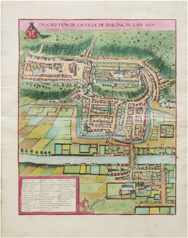
[BAR-le-DUC] Description de la ville de Bar faicte l'an 1617.
[Cologne, 1618]. 438 x 347 mm.
Referentie van de boekhandelaar : LBW-9011
|
|
|
BRAUN (Georg) & HOGENBERG (Frans) & JANSSON (Johannes).
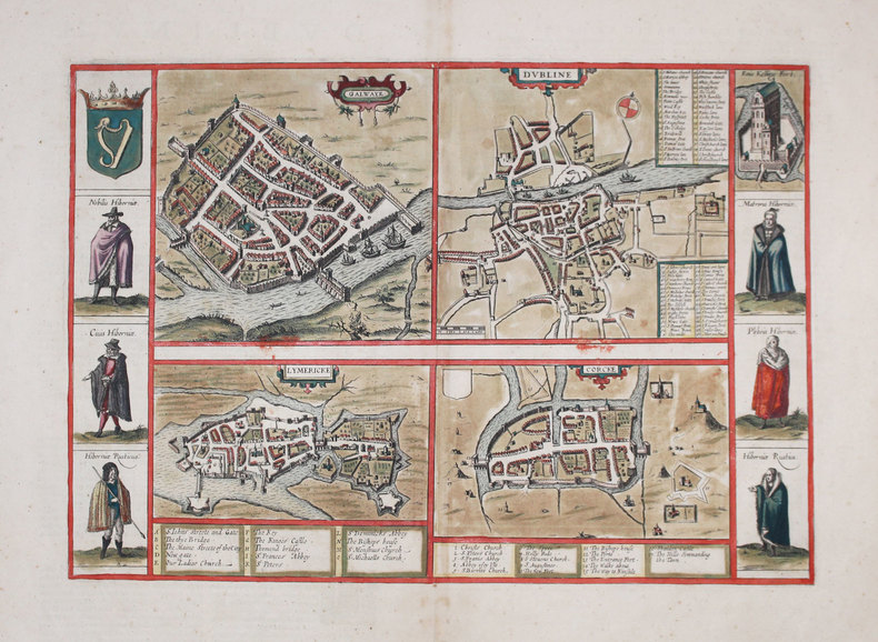
[IRLANDE] Galwaye - Dubline - Lymericke - Corcke.
[Amsterdam, 1657]. 306 x 438 mm.
Referentie van de boekhandelaar : LBW-3186
|
|
|
BRAUN (Georg) & HOGENBERG (Frans).
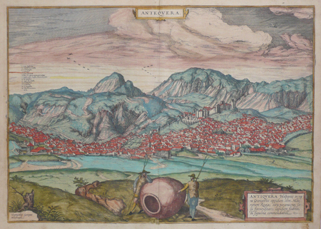
[ANDALOUSIE] Antequera.
[Cologne, 1572]. 351 x 497 mm.
Referentie van de boekhandelaar : LBW0621c
|
|
|
BRAUN (Georg) & HOGENBERG (Frans).
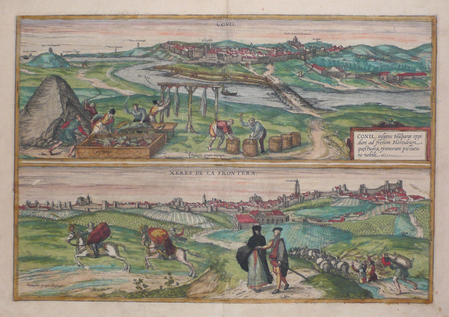
[ANDALOUSIE] Conil - Xeres de la Frontera.
[Cologne, 1572]. 351 x 497 mm.
Referentie van de boekhandelaar : LBW0621b
|
|
|
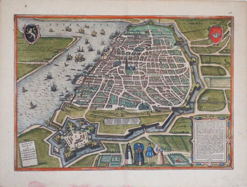
BRAUN (Georg) & HOGENBERG (Frans).
[ANVERS] Anverpia.
[Cologne, 1572]. 338 x 479 mm.
Referentie van de boekhandelaar : LBW-3249
|
|
|
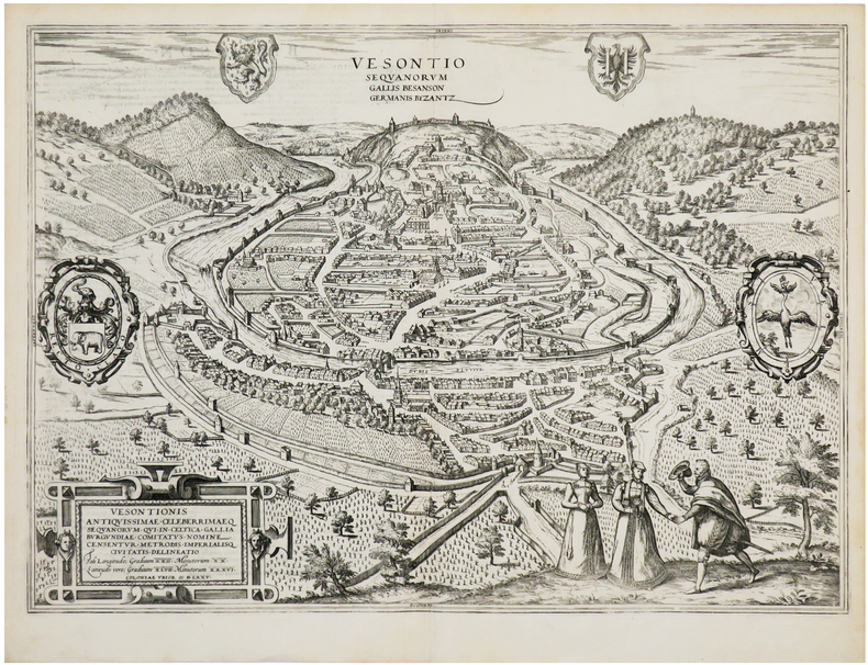
BRAUN (Georg) & HOGENBERG (Frans).
[BESANÇON] Vesontio Sequanorum Gallis Besanson Germanis Byzantz.
[Cologne, 1575]. 353 x 493 mm.
Referentie van de boekhandelaar : LBW-7194
|
|
|
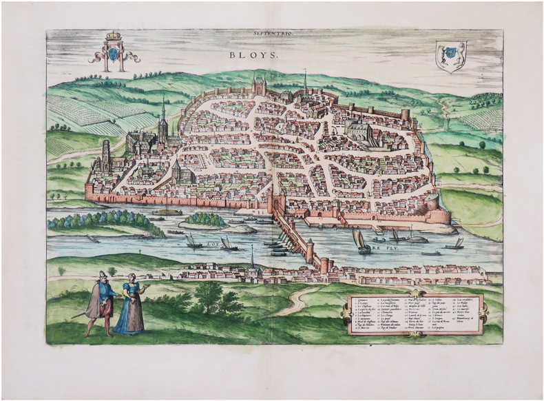
BRAUN (Georg) & HOGENBERG (Frans).
[BLOIS] Bloys.
[Cologne, 1575]. 308 x 438 mm.
Referentie van de boekhandelaar : LBW-7902
|
|
|
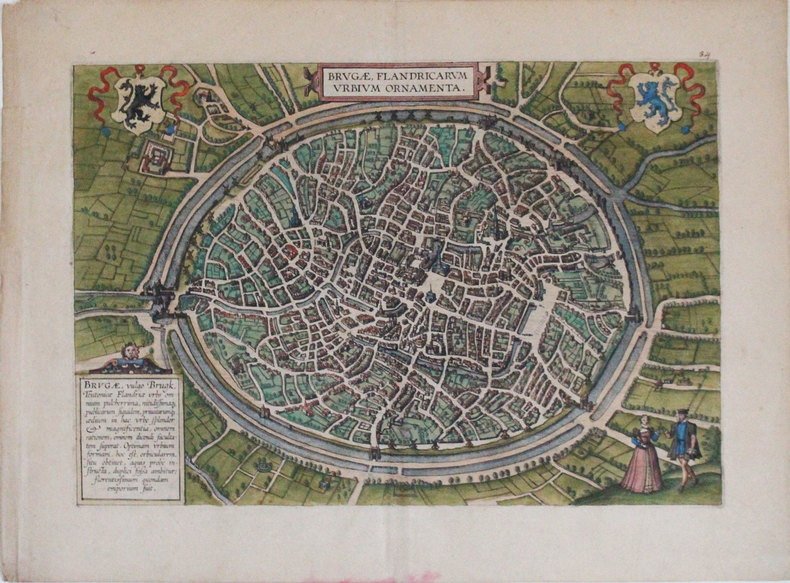
BRAUN (Georg) & HOGENBERG (Frans).
[BRUGES] Brugæ, Flandricarum urbium ornamenta.
[Cologne, 1572]. 310 x 453 mm.
Referentie van de boekhandelaar : LBW-3254
|
|
|
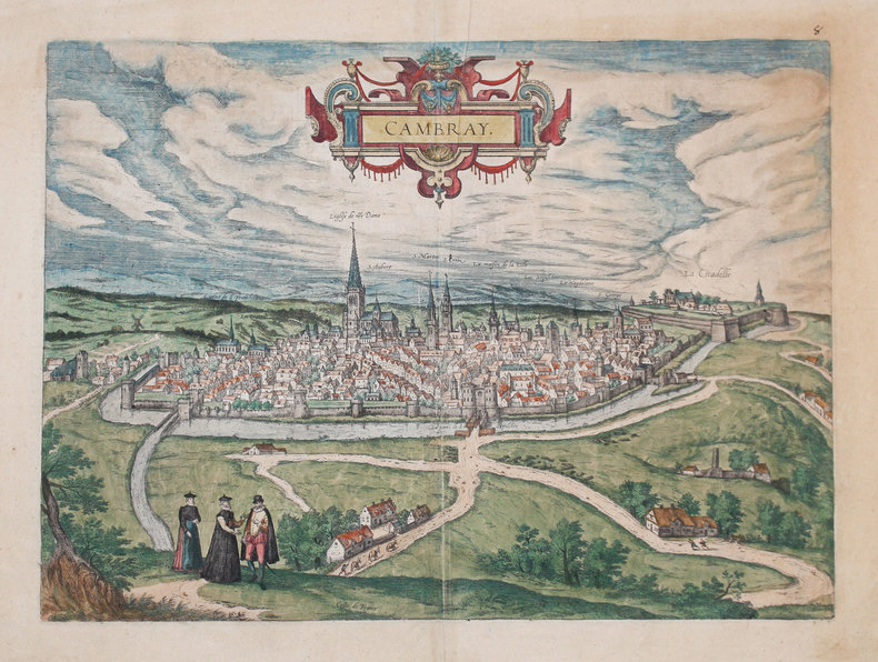
BRAUN (Georg) & HOGENBERG (Frans).
[CAMBRAI] Cambray.
[Cologne, 1588]. 355 x 495 mm.
Referentie van de boekhandelaar : LBW-3234
|
|
|
BRAUN (Georg) & HOGENBERG (Frans).
[CANTERBURY] Cantuarbury.
[Cologne, 1588]. 289 x 431 mm.
Referentie van de boekhandelaar : LBW-3243

|
|
|

 De zoekresultaten per email ontvangen
 Zoekresultaten downloaden als PDF
 RSS feed
 Permanente link


