|
GIRARD (Émile) & BARRÈRE (Henry).
[OUESSANT] Carte touristique et guide de l'île d'Ouessant (Enez Eusa).
Paris, E. Girard, 1929-1936. In-12 broché de 12 ff. et une carte repliée de 459 x 613 mm (marges comprises).
Riferimento per il libraio : LBW-8926

|
|
|
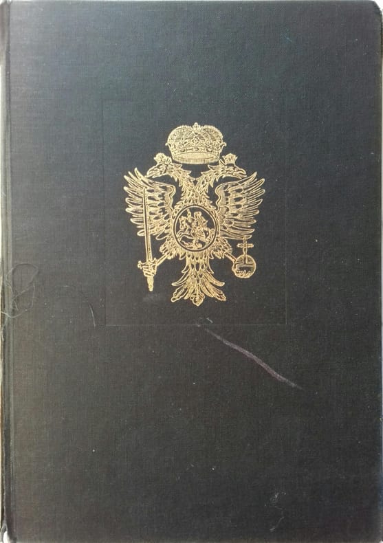
GIRAULT DE SAINT-FARGEAU
Guide pittoresque du voyageur en France
Six volumes in 8 demi-veau glacé fauve,fers dorés en long,titre doré,tranches marbrées,texte sur 2 colonnes. Contient la statistique et la description complète des 86 départements,orné de 740 vignettes et portraits gravés sur acier.de 86 cartes de départements.Par une société de gens de lettres,de géographes et d'artistes.sans la grande carte de France annoncée.Firmin Didot frères éditeur 1838.quelques charnières restaurées.Bon état d'ensemble.
Riferimento per il libraio : 295
|
|
|
Giry Annick de La Boulaye Anne de Billet Marion
Le Jeu de l'oie des monuments de Paris
SEUIL JEUNESSE 2009 64 pages 30 2x1x21 2cm. 2009. Relié. 64 pages.
Riferimento per il libraio : 500098238

|
|
|
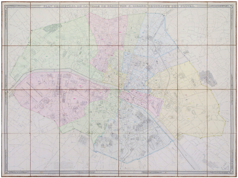
GIRARD (Xavier).
Plan géométral de la ville de Paris.
Paris, J. Andriveau-Goujon, 1844. En 32 sections montées sur toile et pliées, formant une carte de 0,99 x 1,30 m, étiquette de l'éditeur au dos de la carte.
Riferimento per il libraio : LBW-6096
|
|
|
GIRAUD R
Réservé à la correspondance
Denoël. 1965. In-8. Broché. Bon état, Couv. convenable, Dos satisfaisant, Intérieur bon état. 104p. Nombreuses gravures noir et blanc.. . . . Classification Dewey : 741.68-Illustrations des cartes postales
Riferimento per il libraio : ROD0030725
|
|
|
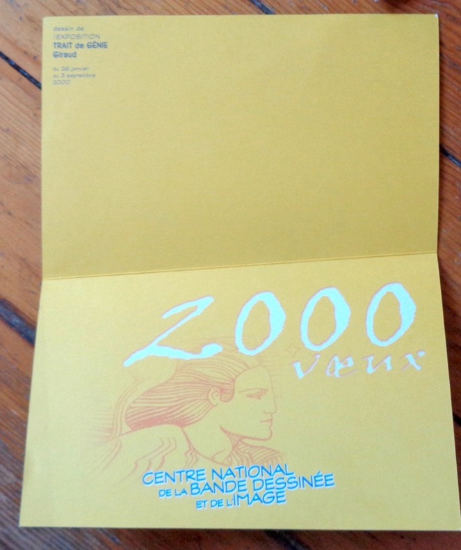
Giraud Jean:
Voeux 2000.
Angoulême, Centre National de la Bande Dessinée et de l'Image, 2000. Carte de voeux, avec pli décalé du plus heureux effet. Présentait les voeux du Centre pour l'an 2000. Illustrée d'un dessin issu de l'exposition "Trait de génie - Giraud".
Riferimento per il libraio : 9052
|
|
|
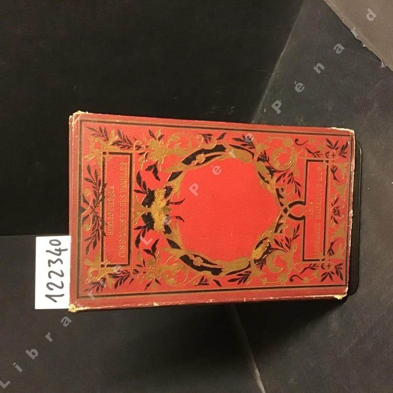
GIRARDIN, J.
Voyages et découvertes des Compagnons de Colomb d'après Washington Irving. Récits d'explorations et de découvertes.
1880 Editions Librairie Hachette, Bibliothèque des écoles et des familles - 1880 - In-8, pleine percaline rouge avec décors dorés - 206 pages - Illustrations en N&B hors-texte
Riferimento per il libraio : 122340
|
|
|
Girschek, Michael (Hrsg.)
Golfatlas Europa - European Golf Atlas - Atlas d'Europe du Golf. 3038 Courses
Gümlingen: Verlag Michael Girschek, 1994. 29,5 cm ; Pp.
Riferimento per il libraio : 106273

|
|
|
GISBORNE, Lionel
The Isthmus of Darien in 1852; Journal of the Expedition of Inquiry for the Junction of the Atlantic and Pacific Oceans
12mo [20.5 x 13 cm]; vi, 238, 4 [ads dated Feb 1853] pp, 4 folding colored maps complete. original blind-stamped cloth, gilt title lettering on spine and cover, spine faded but lettering clear, light stains on cover, some minor foxing on title and few other leaves, but very good overall. A picture of this book is available upon request by emai Welch 188. Sabin 27512. A narrative of the author's travels in northern Columbia, Panama, Darien, with observations of social customs, native life, the Panama railway, gold mines, climate, topography, Cartagena, forests, conditions, etc.
|
|
|
GITERMANN Valentin 65 illustrations et 7 cartes.
Geschichte Russlands. Zweiter band. Cachets de la bibliothèque de l'Université de Vincennes.
Couverture souple. Reliure toile. 540 pages. Cachets.
Riferimento per il libraio : 135241
|
|
|
GITERMANN Valentin 62 illustrations et 5 cartes.
Geschichte Russlands. Dritter band.
Couverture souple. Reliure toile. 679 pages. Mors fendus.
Riferimento per il libraio : 135242
|
|
|
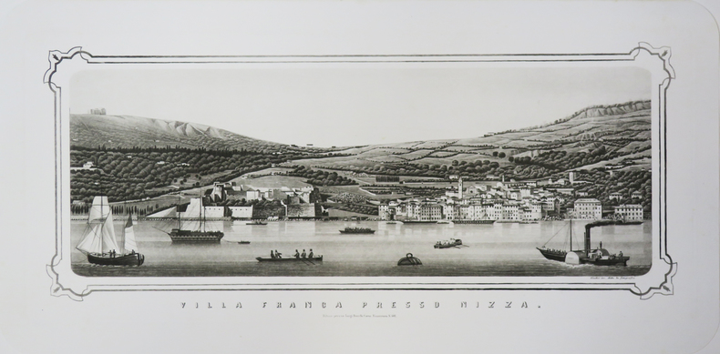
GIUDICI (Giuseppe).
[VILLEFRANCHE-sur-MER] Villa Franca presso Nizza.
Milano, Luigi Ronchi, [circa 1850]. 235 x 550 mm.
Riferimento per il libraio : LBW-3464
|
|
|
GIVERNY
10 CARTES DOUBLES ET ENVELOPPES / 10 NOTECARDS AND ENVELOPES.
RMN. 2002. In-12. Broché. Bon état, Couv. convenable, Dos satisfaisant, Intérieur frais. 10 cartes illustrées en couleur + 10 enveloppes blanches. Dans une chemise cartonnées illustrée.. . Sous Emboitage. . Classification Dewey : 741.68-Illustrations des cartes postales
Riferimento per il libraio : R200027540
|
|
|
GIVET. . .
Carte au 1/200 000e. Sans date.
Une feuille 32x50 cm.
|
|
|
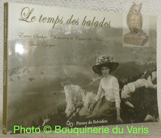
GLAUSER, Daniel.
Le temps des balades. Entre Suchet, Chasseron et Creux-du-Van à la Belle Epoque. Cartes postales de la collection Susanne Gloor. Légendes de Daniel Glauser et Jean-Claude Piguet.
Sainte-Croix, Les Presses du Belvédère 2005, 165x240mm, 99pages, broché. Format à l’italienne. Inscriptions manuscrites sur la page de garde supérieure, autrement bel exemplaire.
Riferimento per il libraio : 96926
|
|
|
Glaser, Mordechai & Elgavi, Yvonne (translator)
Sinai and the Red Sea
Inscription opposite half-title page. No other marks A very clean very tight copy with bright unmarked boards and no bumping to corners. Dust jacket not price clipped or marked with rubbing to all edges.and corners and small enclosed tear to rear fore edge. Unpaginated ca 150pp. Description, culture, history and travel around the Sinai Peninsula of Israel and the Gulf of Elat. Extremely well illustrated.

|
|
|
Glazier, Captain Willard.
DOWN THE GREAT RIVER; EMBRACING AN ACCOUNT OF THE DISCOVERY OF THE TRUE SOURCE OF THE MISSISSIPPI, Together With Views, Descriptive and Pictorial, of the Cities, Towns, Villages. During a Canoe Voyage of over Three Thousand Miles from its Head Waters to
pp. 443, lii [Publisher's Appendix] + Portrait Frontis and full page plates, maps and a large folding map on tissue paper. Inked ownership of Clifton Wright, Oct. 6, 1888 from his father. Floral endpapers. 8vo. Original full cloth binding. Front board decorated with a design in gold and black of the Mississippi River and rear board decorated with the source of the river in Minnesota. Gilt lettered and decorated spine. Beveled edges. Small loss at head and tail of spine. Binding slightly soiled. Hardbound. AMERICANA BOX 4.
|
|
|
Globus.
Globus terrestris ad sphaeram obliquam delineatus. Globus coelestis cum Astrodictico artificiali iunctus. Augsburg, Tobias Conrad Lotter, 1774.
Altkolorierter Kupferstich. Großfolio. Schöne altkolorierte Doppeldarstellung von Erd- und Himmelsglobus mit ausführlicher Beschreibung in deutsch-lateinischem Paralleltext.
|
|
|
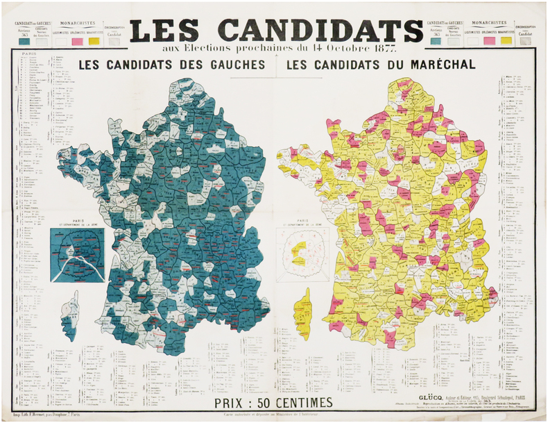
GLÜCQ (Gaston Lucq, dit).
[ÉLECTIONS LÉGISLATIVES de 1877] Les candidats aux élections prochaines du 14 octobre 1877.
Paris, Glücq, 1877. 472 x 623 mm.
Riferimento per il libraio : LBW-7601
|
|
|
GODEFIN (Pierre-Joseph).
[LOIRE] Carte de l'arrondissement de S.t Étienne. Département de la Loire - Département de la Loire. Carte de l'arrondissement de Roanne partie nord. - Département de la Loire. Carte de l'arrondissement de Montbrison partie nord et Roanne partie sud - Département de la Loire. Carte de l'arrondissement de Montbrison partie sud.
Paris, 1840-1845. Étui de papier de l'époque à motif fleuri pour chaque feuille, avec pièce de titre rouge au dos, le tout sous emboîtage de papier de l'époque, avec pièce de titre verte au dos.
Riferimento per il libraio : LBW-8073

|
|
|
Godon Jean-Christian
les années 1900 à la Trinité / Mer Regards sur 2 villages du Morbihan
BEL EXEMPLAIRE in-reliure illustrée éditeur de 73 pages
Riferimento per il libraio : yam0507
|
|
|
Godí Antoni
Modernismo in Barcelona
Taschen Grande collection Dos carré collé 1992 In-12 (11,5 x 16,3 cm), dos carré collé, couverture illustrée, non paginé, 30 cartes postales en couleur ; petites marques d'usage sur les plats, par ailleurs très bon état général. Livraison a domicile (La Poste) ou en Mondial Relay sur simple demande.
Riferimento per il libraio : qi1884
|
|
|
GOGEARD (Clément).
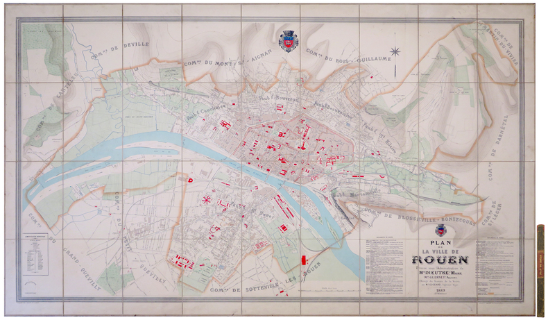
[ROUEN] Plan de la ville de Rouen.
1889. En 36 sections montées sur toile et repliées, formant un plan de 1,18 x 1,94 m ; étiquette au dos de l'éditeur parisien Lanée, successeur de Longuet ; sous chemise et étui de papier marbré de l'époque, avec pièce de titre rouge au dos.
Riferimento per il libraio : LBW-8076
|
|
|
GOGUE A.
La cuisine Française
in 12 demi-chagrin ver à nerfs titre fers dorés filets à froid faux-titre,titre,VIII,536 pages,45 gravures sur bois dans le texte par ROUYER Hachette & Cie 1869 Bon exemplaire
Riferimento per il libraio : 2676
|
|
|
GOLAY, Laurent / Cosinschi-Meunier, Micheline / HEFTI, Jocelyne:
Images du monde : une histoire de la cartographie.
Lausanne : Musée historique de Lausanne, 2004, in-4to oblong, 111 p., ill., brochure originale illustrée.
Riferimento per il libraio : 135094aaf
|
|
|
Goldberg Rube:
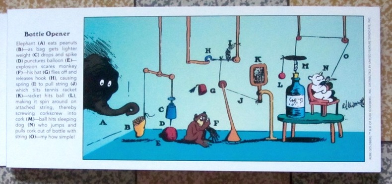
Inventions! 30 Rube Goldberg Postcards.
Stewart, Tabori & Chang, 1996. 30 cartes postales d'inventions loufoques et hilarantes par Rube Goldberg. Trace d'étiquette de prix au second plat, pour le reste à l'état de neuf.
Riferimento per il libraio : 1278
|
|
|
GOLTZ Baron Colmar von der; CHABERT (trad.):
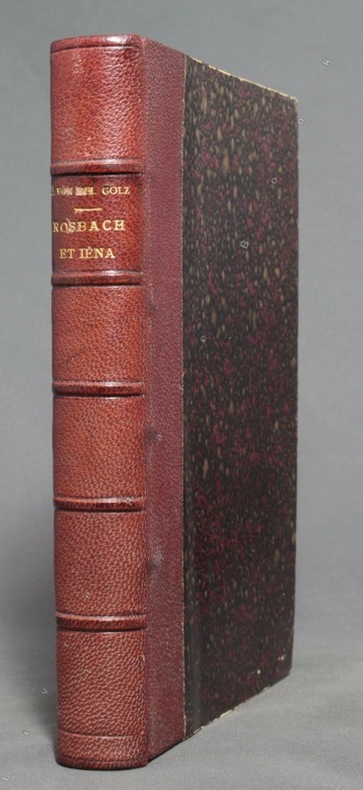
Rosbach & Iéna. Recherches sur l'état physique et intellectuel de l'Armée Prussienne pendant l'époque de transition du XVIIIe au XIXe siècle.
Paris, W. Hinrichsen, 1890. In-8 de VI-486-[2] pages, demi-chagrin bordeaux, dos à 5 nerfs avec titre doré. Bords légèrement frottés.
Riferimento per il libraio : 9801
|
|
|
Goldsborough, Gordon
More Abandoned Manitoba: Rivers, Rails and Ruins
Book is in excellent condition. Binding is solid and square, covers have sharp corners, exterior shows no blemishes, text/interior is clean and free of marking of any kind. 280 pages, loaded with color & b&w photos, maps, charts, tables.
|
|
|
GOMBOUST (Jacques).
Dieppe. La Manche ou Mer Britannique.
Jacques Gomboust. Ingenieur du Roy delineat (circia 1650). Gravure en noir, 365 x 310 mm, bon état.
Riferimento per il libraio : 21650

|
|
|
GOMBOUST (d'après Jacques).
ROTHOMAGUS, ROUEN 1655.
Rouen, co-édition Librairie Bertran et Editions Point de Vues, 2003. Portfolio de 15 planches sous chemise cartonnée (42 x 55 cm, 147,5 x 101 cm une fois les 6 planches et le texte assemblés). Parfait état.
Riferimento per il libraio : 11990
|
|
|
GOMBOUST (Jacques).
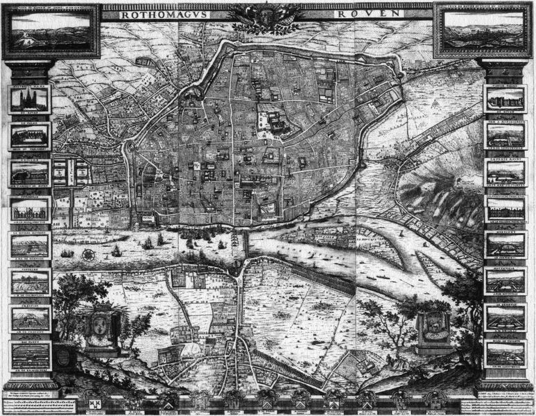
ROTHOMAGUS, ROUEN.
Paris chez l'autheur, Rouen chez Martinot, 1655. En 6 feuilles émargées (38 x 44 cm), (110 x 88 cm une fois assemblé). Quelques minimes manques de papier en haut du plan.
Riferimento per il libraio : 16539
|
|
|
GOMES DE MATTOS, Francisco Jaguaribe.
Evolution des idées sur la Physiographie Sud-Américaine. Communication présentée au IIIème Congrès International d'Histoire des Sciences.
Lisboa, 1937 [Extrait du des "Actes, Conférences et Communications du Congrès International d'Histoire des Sciences"]. 4to. mayor; VIII-52 - VII pp., 2 hs. Con un plano plegado entre el texto y un gran mapa potamografico de América del Sur, plegado y contenido en un sobre aparte. Ejemplar con envío autógrafo del autor. Cubiertas originales.

|
|
|
Goncharov/Translated by Tokumitsu Yagawa, Meiji Maps
Educational Theory and School Reform
Not Available 1962. Soft Cover. Fine. The book is in fine condition. Not Available paperback
Riferimento per il libraio : 2080502106908338
|
|
|
Goode, James M & Bruce M White & Photographer & Floor Plans and Maps by Paul Davidson
Capital Houses Historic Residences of Washington D.C. and Its Environs 1735-1965
Acanthus Press. New. 2015. Hardcover. 0926494910 . FREE UPGRADE to Courier/Priority Shipping Upon Request - IN STOCK AND IMMEDIATELY AVAILABLE FOR SHIPMENT - IN STOCK AND IMMEDIATELY AVAILABLE FOR SHIPMENT - Flawless copy brand new pristine never opened - -- with a bonus offer-- . Acanthus Press hardcover
Riferimento per il libraio : 114822 ISBN : 0926494910 9780926494916

|
|
|
Goodwin, Godfrey
Ottoman Turkey: Islamic Architecture
No marks or inscriptions to contents. Very faint creasing to covers, none to spine. A very clean very tight copy with very lightly marked boards, minor rubbing to edges and no bumping to corners. 192pp.

|
|
|
Gordon, Susan
Explore Britain's Villages
No marks or inscriptions. No creasing to covers or to spine. A very clean very tight copy with bright unmarked laminated boards and no bumping to corners. 160pp. The history of change and development in Britain's villages is an intriguing story, described in the introduction to this book. Over 115 villages are featured and beautifully illustrated, from cosy thatched cottages, to the wild and remote hamlets of the Scottish Highlands.

|
|
|
GOSPORT.
Burrows Pointer Guide Map of Gosport including Lee-on-the-Solent & Stokes Bay.
Large folding map printed in red and black on paper measuring 25.0 x 20.0 ins (approx. 63.5 x 51.0 cms) folding in 12 panels to 10.0 x 6.25 ins (approx. 25.5 x 16.0 cms); original printed wrappers, folded as issued, yapped edges, a very good, bright, clean copy. With the original 'pointer' tape mounted on map.'With the aid of the pointer any important street, public building, or any feature of interest may be instantly found'. Copies with the original pointer intact are scarce.

|
|
|
GOSPORT.
Burrows Pointer Guide Map of Gosport including Lee-on-the-Solent & Stokes Bay. Third Edition.
Large folding map printed in red and black on paper measuring 25.0 x 20.0 ins (approx. 63.5 x 51.0 cms) folding in 12 panels to 10.0 x 6.25 ins (approx. 25.5 x 16.0 cms); original printed wrappers, folded as issued, yapped edges, a very good, bright, clean copy. With the original 'pointer' tape mounted on map. 'With the aid of the pointer any important street, public building, or any feature of interest may be instantly found.' Copies with the original pointer intact are scarce.

|
|
|
GOTHARD par Karl LÜÖND et Karl ITEN.
Le Saint-Gothard.Histoire, contes. Richement documenté (planches en couleurs, photos, cartes, figures).
Ed. Ringier 1980. Bel exemplaire relié, reliure pleine toile et jaquette ornées d'éd., gd. in-4, 192 pages.
Riferimento per il libraio : AUB-5329
|
|
|
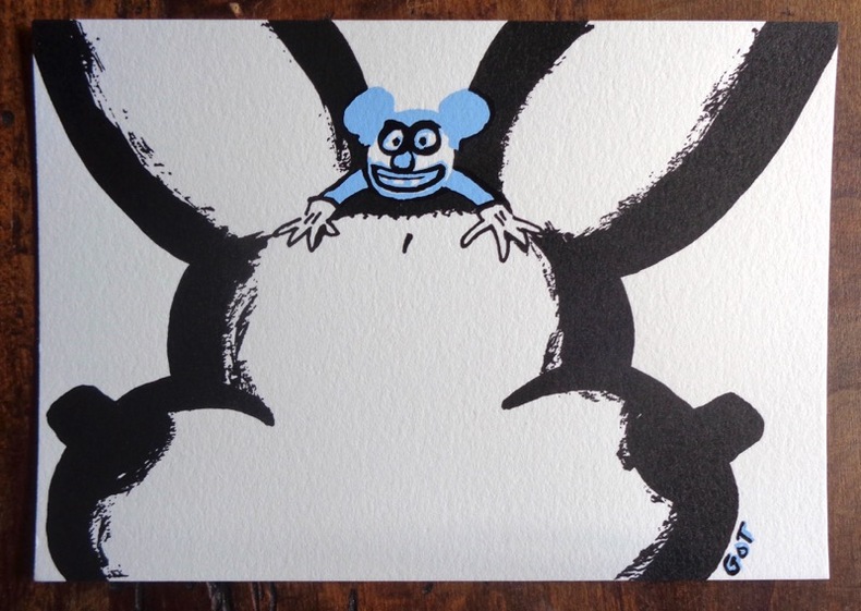
Got Yves:
Petite sérigraphie.
Petite sérigraphie coquine, format carte postale. A l'état de neuf.
Riferimento per il libraio : 968
|
|
|
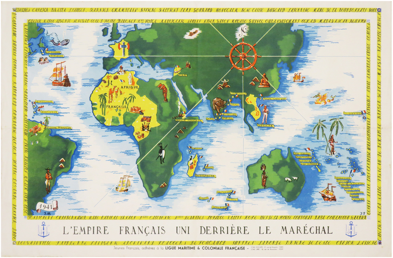
GOUVERNEMENT de VICHY.
[PROPAGANDE SECONDE GUERRE MONDIALE] L'Empire français uni derrière le Maréchal. Jeunes Français, adhérez à la Ligue Maritime & Coloniale Française.
1941. Affiche en couleurs de 305 x 470 mm.
Riferimento per il libraio : LBW-7405
|
|
|
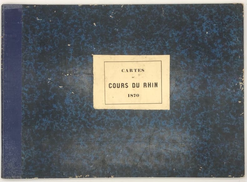
GOUDRIAAN (B. H.)
Carte des rivières le Haut et le Bas Rhin, le Lek et la Nouvelle Meuse. depuis Lobith jusqu'à Brielle, en vingt feuilles, avec deux feuilles supplémentaires pour le Vieux-Rhin et pour le Nord
Paris, Dépot des Cartes et Plans de la Marine, 1868 in-4 à l'italienne, titre, 20 planches, une grande planche repliée (carte index), demi-percaline bleue (rel. de l'époque). Ex-libris Exelmans.
Riferimento per il libraio : 155847
|
|
|
GOUILLOUX (Noël).
Menu illustré d'une gravure originale signée.
Paris Les Impénitents 1973 2 vol. Broché Menu dépliant sur Arches illustré d'une eau-forte (14 x 7 cm) signée par Noël Gouilloux. En parfait état.
Riferimento per il libraio : 109103
|
|
|
GOUILLOUX (Noël).
Menu illustré d'une gravure originale signée.
Paris Les Impénitents 1973 2 vol. Broché Menu dépliant sur Arches illustré d'une eau-forte (14 x 7 cm) signée par Noël Gouilloux. En parfait état.
Riferimento per il libraio : 109103
|
|
|
Goulzadian, Anne
L'empire du dernier tsar. 410 cartes postales 1896 - 1917
Éditions Astrid (Collection "Les Peuples par l'image"), 1982. 32 cm ; kart.
Riferimento per il libraio : 91239

|
|
|
Government of British Columbia
British Columbia Invites You To the Land of the Golden Twilight (document 25M-330-9790)
36 pages. Incudes 17 pages of maps of Provincial locales. Sepia-tone reproductions of photos of picturesque Provincial scenes. Unmarked. Average wear and external soiling. Binding intact. A sound copy of the lovely B.C. tourism memento. Book

|
|
|
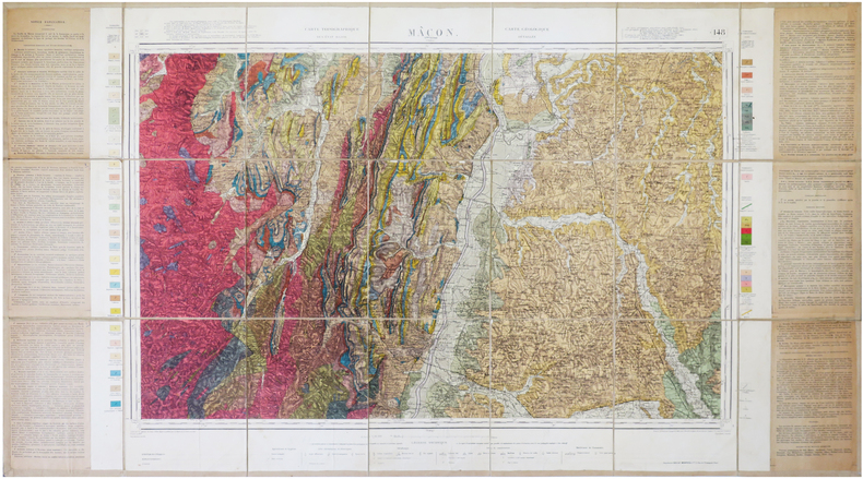
GRANDJEAN (François).
[MÂCON/GÉOLOGIE] Carte géologique détaillée. Mâcon. Feuille n°148.
1941. En 21 sections montées sur toile et repliées, formant une carte de 0,65 x 1,19 m ; étiquette au dos.
Riferimento per il libraio : LBW-7868
|
|
|
GRAY (James).
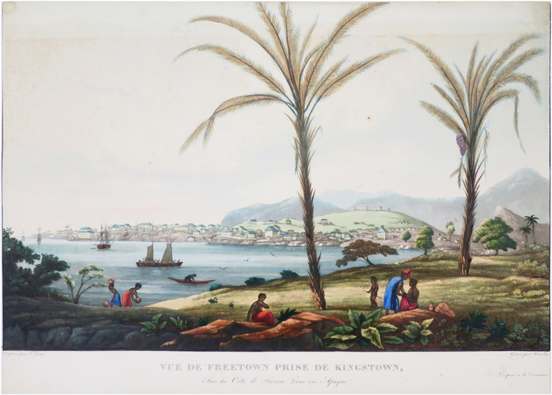
[SIERRA LEONE/FREETOWN] Vue de Freetown prise de Kingstown, sur la côte de Sierra Leone en Afrique.
[circa 1830]. 307 x 436 mm.
Riferimento per il libraio : LBW-8071
|
|
|
GRAND HOTEL DU CENTRE, à COLMAR
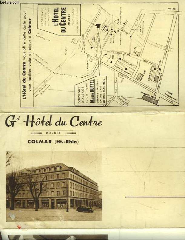
Carte Postale Ancienne Publicitaire du Grand Hôtel du Centre, Colmar (Haut-Rhin)
CHEZ L'AUTEUR. Non daté. In-8. En feuillets. Bon état, Couv. convenable, Dos satisfaisant, Intérieur frais. Carte Postale dépliante en 3 volets. Quelques photos en héliogravure et un plan en noir et blanc.. . . . Classification : 220-Cartes Postales Publicitaires
Riferimento per il libraio : RO80092901
|
|
|
GRANGEZ
CARTE DEPARTEMENT DU CALVADOS
1950 rel. toil. rouge in-12, d. passé, étiquette éd. / 1er pl., carte en coul. avec les armes de caen, région nord n ° 15, carte imprimée par monin, revue et rectifiée par grangez, et gravée / acier par laguillermie et abel malo - s.d. - atlas des départements de france
Riferimento per il libraio : 936
|
|

 Ricevere i risultati per e-mail
 Scaricare i risultati in PDF
 RSS feed
 Link
Link


