|
LA FERTE
Carte au 1/200 000e. Sans date.
Une feuille 32x50 cm.
|
|
|
LA GUERCHE
Carte couleur au 1/100 000?. Feuille IX-17. Mise ? jour 1923.
Une feuille 57x45 cm.
|
|
|
LA MARE Nicolas de COQUART A. & DE FER N.
Ensemble complet des plans de la ville de Paris tirés du Traité de la Police
- S.n., Paris 1705, reliure : 34,5x50cm ; cartes : 60x48,5cm et 61x48,5cm et 59x47cm et 60x48cm et 60x48cm et 61x48cm et 61x48,5cm et 57,5x47,5cm, montées sur onglets sous reliure. - Edition originale. Sept plans réalisés par Coquart et un par De Fer : - Lutèce ou premier plan de la ville de Paris - Lutèce conquise par les François sur les Romains - Troisième plan de la ville de Paris, son étendüe et les Bourgs dont elle étoit environnée sous le règne de Loüis le Ieune VIIème du nom - Quatrième plan de la ville de Paris, son accroissement et l'état ou elle êtoit sous le regne de Philippe Auguste - Cinquième plan de la ville de Paris, son accroissement et sa quatrième clôture commancée sous Charles V l'an 1367 et finie sous Charles VI l'an 1383 - Sixième plan de la ville de Paris, et ses accroissements, depuis le commencement du Règne de Charles VII l'an 1422 jusqu'a la fin du regne d'Henry III l'an 1589 - Septième plan de la ville de Paris, son acroissement et ses embelissemens sous Henry IIII et Louis XIII depuis 1589 jusqu'en 1643 - Huitième plan de Paris divisé en ses vingts quartiers. Reliure en plein cartonnage bleu moderne, dos lisse, étiquette ancienne conservée sur le premier plat. Quelques petites restaurations marginales au verso de certaines planches. Très bel ensemble. [ENGLISH DESCRIPTION ON DEMAND]

|
|
|
LABORATOIRES MARINIER - CARTES DE BLAEU
La France : Provinces. Reproductions de 30 cartes de Blaeu 1620-1680.
- Brochure de 24 pages. 15 x 23 cm. Légèrement défraîchie.
书商的参考编号 : 74419

|
|
|
LABOULAIS Isabelle (sous la direction de)
Les usages des cartes (XVIIe - XIXe siècle). Pour une approche pragmatique des productions cartographiques
Presses Universitaires de Strasbourg, 2008, 285 p., in-8 br., coll. "Sciences de l'Histoire", ouvrage publié dans le cadre du programme ANR HistCarto, 21 fig. in-t., 69 planches h.-t., jaquette, état de neuf
书商的参考编号 : QWA-5431

|
|
|
LABOURASSE H.
Petite géographie de la Meuse.
Précédée de notices ce géographie générale à l’usage des écoles primaires du département.Par H.LABOURASSE maître de pension.3ème édition revue et corrigée.In 16 cartonné, plats imprimés;dos demi toile bleue,Faux-titre,titre,142 pages,Saint-Mihiel 1859.Rousseurs habituelles.Description des cantons etc.Peu courant
书商的参考编号 : 5061
|
|
|
LABAUME (Eugène).
Relation circonstanciée de la Campagne de Russie, en 1812; ornée des plans de la bataille de la Moskwa, du combat de Malo-Jaroslavetz, … 4e édition.
Paris, C. L. F. Panckoucke et Magimel, février 1815. In-8, demi-basane fauve, dos lisse orné de filets dorés, pièce de titre basane rouge, tranches jaspées.
书商的参考编号 : PHO-1757

|
|
|
LABBE, Vincent.
Secret défense.
Editions Le bridgeur, 1994. Un volume in-8°, broché.
书商的参考编号 : 17332
|
|
|
LABORATOIRES MARINIER - CARTES DE BLAEU
La France : Provinces. Reproductions de 30 cartes de Blaeu 1620-1680.
Laboratoires Marinier 1939. map. <b>Carte géographique en français</b>. - Brochure de 24 pages. 15 x 23 cm. Légèrement défraîchie. <i>ref. 74419</i> Laboratoires Marinier unknown
书商的参考编号 : 74419
|
|
|
LACROIX (E.).
[CHARENTE-MARITIME] France communale & cantonale. Dép.t de la Charente-Inférieure. Arrondissement de Saintes. Atlas du canton de Gémozac.
Paris, Imprimerie Lithographique P. Dupont, 1855. In-folio ; titre imprimé sur le premier plat (cartonnage de l'éditeur).
书商的参考编号 : LBW-8675

|
|
|
LACROIX (E.).
[CHARENTE-MARITIME] France communale & cantonale. Dép.t de la Charente-Inférieure. Arrondissement de Saintes. Atlas du canton de Pons.
Paris, Imprimerie Lithographique P. Dupont, 1854. In-folio ; titre imprimé sur le premier plat (cartonnage de l'éditeur).
书商的参考编号 : LBW-8683

|
|
|
LACROIX (E.).
[CHARENTE-MARITIME] France communale & cantonale. Dép.t de la Charente-Inférieure. Arrondissement de Saintes. Atlas du canton de Burie.
Paris, Imprimerie Lithographique P. Dupont, 1853. In-folio ; titre imprimé sur le premier plat (cartonnage de l'éditeur).
书商的参考编号 : LBW-8702

|
|
|
LACOMBE, Benjamin
Il était une fois... (Pop-up, livre à système)
2010 Editions Seuil Jeunesse - 2010 - In-4, cartonnage illustré - 8 belles illustrations en couleurs en pop-up
书商的参考编号 : 119774

|
|
|
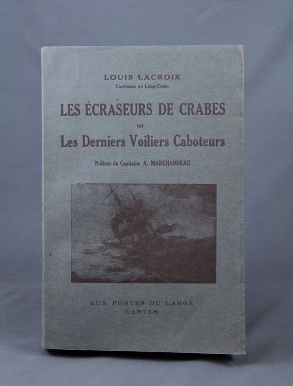
LACROIX Louis
les écraseurs de crabes sur les derniers voiliers caboteurs.
Préface du capitaine A. MARCHAANDEAU. In 8 broché, couverture illustrée, faux-titre, titre, 348 pages, annexe XXXVI- illustrations photos hors-texte, 2 cartes dépliantes en fin de volume. Aux portes du large- Nantes 1947. Edition originale, envoi manuscrit autographe de l’auteur.
书商的参考编号 : 11770

|
|
|
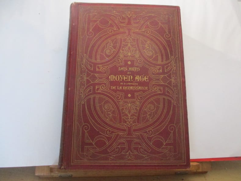
LACROIX Paul, Conservateur de la Bibliothèque National de l'Arsenal - (Pseudonyme "Bibliophile Jacob") .
LES ARTS AU MOYEN-AGE ET A L'EPOQUE DE LA RENAISSANCE
PARIS, Firmin-Didot Frères, Fils & Cie - 1869 - Grand In-4° - Reliure polychrome ornée de l'éditeur -(frottée) Dos lisse orné de caissons ornés - Toutes tranches dorées - Ouvrage illustré de 19 planches chromolithographiques exécutées par F. KELLERHOVEN et de 400 gravures sur bois - légères rousseurs - 548 pages - bon exemplaire.
书商的参考编号 : 669
|
|
|
LACROIX Louis; MARCHANDEAU Capitaine A. (préf.):
Les écraseurs de crabes sur les Derniers Voiliers Caboteurs.
Nantes, Aux portes du large, 1947. In-8 broché de 348-XXXVI pages, couverture illustrée. Belle condition.
书商的参考编号 : 2380
|
|
|
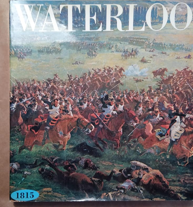
LACHOUQUE Henri Illustrations de Louis de Beaufort. Cartes de Jean-Claude Quennevat.
Waterloo. 1815.
Couverture souple. Broché. 204 pages. 26 x 28 cm.
书商的参考编号 : 142887
|
|
|
LACROIX Paul, Conservateur de la Bibliothèque National de l'Arsenal - (Pseudonyme "Bibliophile Jacob") .
LES ARTS AU MOYEN-AGE ET A L'EPOQUE DE LA RENAISSANCE
PARIS, Firmin-Didot Frères, Fils & Cie - 1869 - Grand In-4° - Reliure polychrome ornée de l'éditeur -(frottée) Dos lisse orné de caissons ornés - Toutes tranches dorées - Ouvrage illustré de 19 planches chromolithographiques exécutées par F. KELLERHOVEN et de 400 gravures sur bois - légères rousseurs - 548 pages - bon exemplaire.
|
|
|
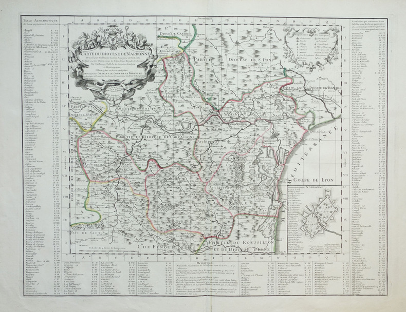
LAFONT (Guillaume) & L'ISLE (Guillaume de).
[NARBONNE] Carte du diocèse de Narbonne.
Paris, G. de l'Isle, 1704. 460 x 602 mm.
书商的参考编号 : LBW-1897
|
|
|
LAFFON Caroline & Martine
Dessiner le monde : histoires de géographie.
Le Grand Livre du Mois, sans date, 187 p., cartonnage sous jaquette oblong, environ 26x30cm, bon état.
书商的参考编号 : 105325
|
|
|
LAFRERI Antonio (Orgelet 1512 - Roma 1577)
Rome, Ville tres fameuse…
Rarissima ristampa della lastra anonima - attribuita ad Antonio Lafreri e databile al 1555/60. Esemplare nel terzo stato di quattro descritto e illustrato in Bifolco-Ronca, pagina 2377.In alto a sinistra l’iscrizione Urbis Rome totius olim orbis domitricis, situs: cum adhuc extantibus, sacrosancte vetustatis monumentis PIRRHO LIGORIO NEAP. INVENTOR. Orientazione nei quattro lati al centro con il nome dei punti cardinali SEPTENTRIO, MERIDIES, ORIENS, OCCIDENS, il nord a sinistra.Anonima pianta prospettica della città, basata sulla pianta di Pirro Ligorio, edita da Michele Tramezzini nel 1552. La pianta è inserita in alcuni esemplari dello Speculum Romanae Magnificentiae di Antonio Lafreri, al quale pertanto viene attribuita. Il grande interesse storico di questa pianta non è dato dall’opera stessa, una semplice copia del lavoro del Ligorio, ma è rappresentato dalle tirature successive di questa lastra. Il secondo stato, databile alla seconda metà del XVII secolo, è completamente emendato ed arricchito da toponomastica in lingua francese. Viene inserita anche una lunga descrizione della città, sempre in lingua francese. E’ noto che, alla morte di Antonio Lafreri (1577), i due terzi delle lastre furono divisi tra i nipoti Stefano e Claudio Duchetti. Il restante terzo venne suddiviso tra più editori. Questa lastra quindi potrebbe avere preso la via di Parigi, dove venne ristampata circa un secolo dopo. In alternativa la carta potrebbe essere stampata Roma ed emendata in lingua francese. Tale edizione viene descritta da Hülsen (1915), che la annovera tra le “Copie e ristampe”, come "Incisa nel sec. XVII ex.ovvero XVIII. Ne vidi una copia presso il sig. Lang nel 1914" (la libreria antiquaria Lang di Roma). Un altro esemplare, che tuttavia potrebbe essere lo stesso citato da Hülsen, è descritto nella biblioteca della British School of Rome, appartenuto alla celebre collezione di Thomas Ashby (1874-1931), direttore dell’accademia dal 1906 al 1925. Sempre Hülsen cataloga lo stato finale dell’opera, con l’indirizzo dell’editore francese Francois Jollain. Acquaforte e bulino, stampata su carta vergata coeva, in ottimo stato di conservazione. Bibliografia Bifolco-Ronca, Cartografia e topografia italiana del XVI secolo (2018): pp. 2376-77, tav. 1123, III/IV; Frutaz (1962): n. XVI e tav. 25; Hülsen (1915): II, p. 42, n. 11 e p. 43, nn. 13-14; Karrow (1993): n. 51/1.1; Marigliani (2007): n. 36; Marigliani (2016): n. XI.5. A very rare map of the city, published in Paris in the mid-seventeenth century using the plate made in Rome by Antonio Lafreri.Example of the third state of four.The map is based on that of Pirro Ligorio, 1552, edited by Michele Tramezini in Rome, and its subsequent and numerous variants.The only example known today of this map is in the library of the British School of Rome, belonged to the famous collection of Thomas Ashby (1874-1931), director of the British School at Rome from 1906 to 1925.For the stile of type this work can be attributed to the French publisher Francois Jollain. The plate appears to be yet more ancient, even '500, to which were added numerous inscriptions in French, starting from the extensive description in the bottom right corner.Copper engraving, perfect condition. An extremely rare work.LiteratureBifolco-Ronca, Cartografia e topografia italiana del XVI secolo (2018): pp. 2376-77, tav. 1123, III/IV;Frutaz (1962): n. XVI e tav. 25; Hülsen (1915): II, p. 42, n. 11 e p. 43, nn. 13-14; Karrow (1993): n. 51/1.1; Marigliani (2007): n. 36; Marigliani (2016): n. XI.5. Frutaz (1962): n. XVI e tav. 25; Hülsen (1915): II, p. 42, n. 11 e p. 43, nn. 13-14; Karrow (1993): n. 51/1.1; Marigliani (2007): n. 36; Marigliani (2016): n. XI.5. DI ROMA DAL 1551 AL 1748, (1915) 43e.

|
|
|
LAFRERI Antonio (Orgelet 1512 - Roma 1577)
Urbis Rome, totius olim orbis dominitricis, situs: cum adhuit extantibus, sacrosancte…
Rarissima ristampa della lastra anonima - attribuita ad Antonio Lafreri, databile al 1555/60. Esemplare nel quarto stato di quattro descritto in Bifolco-Ronca, pagina 2377, con l'indirizzo di Jollain. In alto a sinistra l’iscrizione Urbis Rome totius olim orbis domitricis, situs: cum adhuc extantibus, sacrosancte vetustatis monumentis PIRRHO LIGORIO NEAP. INVENTOR. Orientazione nei quattro lati al centro con il nome dei punti cardinali SEPTENTRIO, MERIDIES, ORIENS, OCCIDENS, il nord a sinistra. Anonima pianta prospettica della città, basata sulla pianta di Pirro Ligorio, edita da Michele Tramezzini nel 1552. La pianta è inserita in alcuni esemplari dello Speculum Romanae Magnificentiae di Antonio Lafreri, al quale, pertanto, viene attribuita. Il grande interesse storico di questa pianta non è dato dall’opera stessa, una semplice copia del lavoro del Ligorio, ma è rappresentato dalle tirature successive di questa lastra. Il secondo stato, databile alla seconda metà del XVII secolo, è completamente emendato ed arricchito da toponomastica in lingua francese. Viene inserita anche una lunga descrizione della città, sempre in lingua francese. Alla morte di Antonio Lafreri (1577), i due terzi delle lastre furono divisi tra i nipoti Stefano e Claudio Duchetti. Il restante terzo venne suddiviso tra più editori. Questa lastra, quindi, potrebbe avere preso la via di Parigi, dove venne ristampata circa un secolo dopo. In alternativa, la carta potrebbe essere stampata Roma ed emendata in lingua francese. Tale edizione viene descritta da Hülsen (1915), che la annovera tra le “Copie e ristampe”, come "Incisa nel sec. XVII ex.ovvero XVIII. Ne vidi una copia presso il sig. Lang nel 1914" (la libreria antiquaria Lang di Roma). Un altro esemplare, che tuttavia potrebbe essere lo stesso citato da Hülsen, è descritto nella biblioteca della British School of Rome, appartenuto alla celebre collezione di Thomas Ashby (1874-1931), direttore dell’accademia dal 1906 al 1925. Sempre Hülsen cataloga lo stato finale dell’opera, con l’indirizzo dell’editore francese Francois Jollain. L’opera appartiene allo Speculum Romanae Magnificentiae, la prima iconografia della Roma antica. Lo Speculum ebbe origine nelle attività editoriali di Antonio Salamanca e Antonio Lafreri (Lafrery). Durante la loro carriera editoriale romana, i due editori - che hanno lavorato insieme tra il 1553 e il 1563 - hanno avviato la produzione di stampe di architettura, statuaria e vedutistica della città legate alla Roma antica e moderna. Le stampe potevano essere acquistate individualmente da turisti e collezionisti, ma venivano anche acquistate in gruppi più grandi che erano spesso legati insieme in un album. Nel 1573, Lafreri commissionò a questo scopo un frontespizio, dove compare per la prima volta il titolo Speculum Romanae Magnificentiae. Alla morte di Lafreri, due terzi delle lastre di rame esistenti andarono alla famiglia Duchetti (Claudio e Stefano), mentre un altro terzo fu distribuito tra diversi editori. Claudio Duchetti continuò l’attività editoriale, implementando le lastre dello Speculum con copie di quelle “perdute” nella divisione ereditaria, che fece incidere al milanese Amborgio Brambilla. Alla morte di Claudio (1585) le lastre furono cedute – dopo un breve periodo di pubblicazione degli eredi, in particolare nella figura di Giacomo Gherardi - a Giovanni Orlandi, che nel 1614 vendette la sua tipografia al fiammingo Hendrick van Schoel. Stefano Duchetti, al contrario, cedette le proprie matrici all’editore Paolo Graziani, che si associò con Pietro de Nobili; il fondo confluì nella tipografia De Rossi passando per le mani di editori come Marcello Clodio, Claudio Arbotti e Giovan Battista de Cavalleris. Il restante terzo di matrici della divisione Lafreri fu suddiviso e scisso tra diversi editori, in parte anche francesi: curioso vedere come alcune tavole vengano ristampate a Parigi da Francois Jollain alla m... A very rare map of the city, published in Paris in the mid-seventeenth century using the plate made in Rome by Antonio Lafreri. Example of the fourth state of four, with the Jollain's imprint. The map is based on that of Pirro Ligorio, 1552, edited by Michele Tramezini in Rome, and its subsequent and numerous variants. In the upper left the inscription Urbis Rome totius olim orbis domitricis, situs: cum adhuc extantibus, sacrosancte vetustatis monumentis PIRRHO LIGORIO NEAP. INVENTOR. Orientation in the four sides to the center with the name of the cardinal points SEPTENTRIO, MERIDIES, ORIENS, OCCIDENS, the north on the left. Anonymous map of the city, based on the work byPirro Ligorio, published by Michele Tramezzini in 1552. The ma is inserted in some of the Speculum Romanae Magnificentiae of Antonio Lafreri, to which therefore it is attributed. The great historical interest of this map is not given by the work itself, a simple copy of Ligorio's work, but is represented by the subsequent issues of this plate. The second state, datable to the second half of the seventeenth century, is completely amended and enriched by toponymy in French. A long description of the city is also included, again in French. It is known that, at the death of Antonio Lafreri (1577), two thirds of the plates were divided between his nephews Stefano and Claudio Duchetti. The remaining third was divided among several publishers. This plate therefore may have taken the road to Paris, where it was reprinted about a century later. This edition is described by Hülsen (1915), who lists it among the "Copies and reprints", as "Engraved in the seventeenth century ex.ovvero XVIII. According with Bifolco-Ronca this is the final state of the work, with the address of the French publisher Francois Jollain. The work belongs to the Speculum Romanae Magnificentiae, the earliest iconography of ancient Rome. The Speculum originated in the publishing activities of Antonio Salamanca and Antonio Lafreri (Lafrery). During their Roman publishing careers, the two editors-who worked together between 1553 and 1563-started the production of prints of architecture, statuary, and city views related to ancient and modern Rome. The prints could be purchased individually by tourists and collectors, but they were also purchased in larger groups that were often bound together in an album. In 1573, Lafreri commissioned a frontispiece for this purpose, where the title Speculum Romanae Magnificentiae appears for the first time. Upon Lafreri's death, two-thirds of the existing copperplates went to the Duchetti family (Claudio and Stefano), while another third was distributed among several publishers. Claudio Duchetti continued the publishing activity, implementing the Speculum plates with copies of those "lost" in the hereditary division, which he had engraved by the Milanese Amborgio Brambilla. Upon Claudio's death (1585) the plates were sold - after a brief period of publication by the heirs, particularly in the figure of Giacomo Gherardi - to Giovanni Orlandi, who in 1614 sold his printing house to the Flemish publisher Hendrick van Schoel. Stefano Duchetti, on the other hand, sold his own plates to the publisher Paolo Graziani, who partnered with Pietro de Nobili; the stock flowed into the De Rossi typography passing through the hands of publishers such as Marcello Clodio, Claudio Arbotti and Giovan Battista de Cavalleris. The remaining third of plates in the Lafreri division was divided and split among different publishers, some of them French: curious to see how some plates were reprinted in Paris by Francois Jollain in the mid-17th century. Different way had some plates printed by Antonio Salamanca in his early period; through his son Francesco, they goes to Nicolas van Aelst's. Other editors who contributed to the Speculum were the brothers Michele and Francesco Tramezzino (authors of numerous plates that flowed in part to the Lafreri printing house), Tommaso Barlacchi,...

|
|
|
LAGIER-FORNERY
Plan de la Ville & du Territoire d'Avignon avec les Sections cadastrales, Clos, Quartiers, Campagnes, chemins de fer, gares, cours d'eau et pays environnants dressé par Lagier-Fornery lithographe.
Avignon Lagier-Fornery 1879 540 x 710 mm 1 feuille
书商的参考编号 : 17343
|
|
|
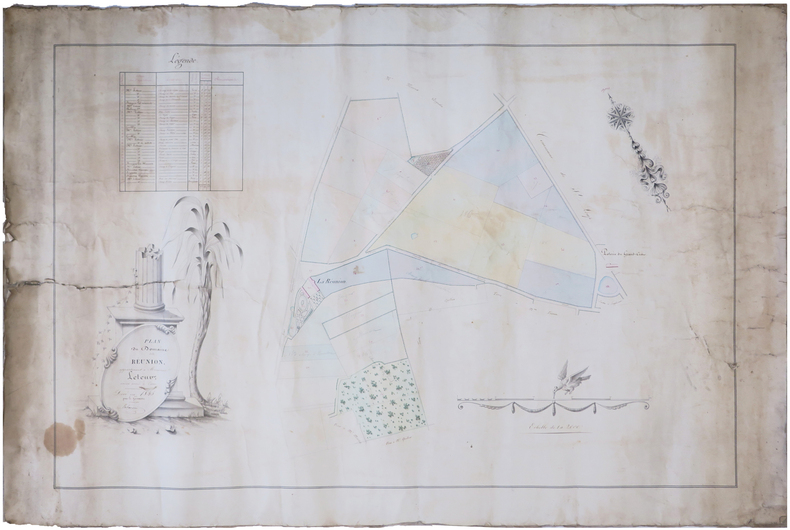
LAHAUSSOIS.
[NIÈVRE] Plan du domaine de la Réunion, appartenant à Monsieur Leteur, ancien avoué à Cosne.
1845. 57,5 x 89 cm, montée sur toile.
书商的参考编号 : LBW-7477
|
|
|
LAHURE Charles
le whist à trois ou mort
in 12 pleine toile bleue d’éditeur,titre en noir au dos, en long et sur le premier plat avec un triple filet noir en encadrement.Faux-titre,titre en noir et rouge 76 pages avec illustrations dans le texte et hors-texte,à la suite 10 problèmes avec leurs solutions,1 feuillet de table,204 pages au total.A.Lahure éditeur 1886
书商的参考编号 : 6762
|
|
|
LAIGLE
Carte couleurs au 1/100 000?me. Feuille XIII-13.
Une feuille 57x45 cm.
|
|
|
Laishley, A. L.
The City of York
Name to top of title page. No other marks or inscriptions. No creasing to covers. A very clean very tight booklet with bright unmarked boards, minor traces of storage and no bumping to corners. 32pp. Illustrated guide to York. Tucked in are two copies of a town plan and things to do leaflet. Undated ca 1960s.

|
|
|
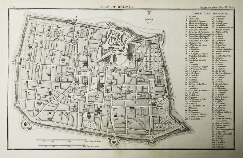
LALANDE (Joseph-Jérome Le François de).
[BRESCIA] Plan de Brescia.
[Paris, 1786]. 227 x 359 mm.
书商的参考编号 : LBW-3486
|
|
|
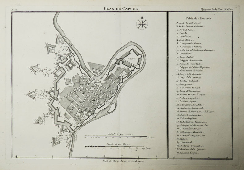
LALANDE (Joseph-Jérome Le François de).
[CAPOUE] Plan de Capoue.
[Paris, 1786]. 236 x 338 mm.
书商的参考编号 : LBW-3481
|
|
|
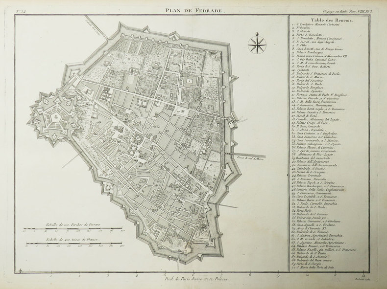
LALANDE (Joseph-Jérome Le François de).
[FERRARE] Plan de Ferrare.
[Paris, 1786]. 259 x 333 mm.
书商的参考编号 : LBW-3483
|
|
|
Lalobbe, E. de :
Cours de topographie élémentaire à l'usage des officiers de l'Armée.
Paris, J.Dumaine, (Versailles, Beau jeune), 1856 ; in-12, broché ; XVIII, 285, (1) pp., (1) f. d'errata ; 8 planches lithographiées dépliantes hors-texte.
书商的参考编号 : 6966
|
|
|
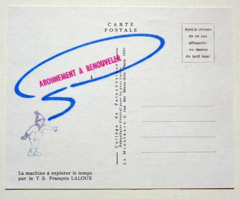
Laloux François:
La machine à explorer le temps.
Collège de Pataphysique. 1989. Carte postale au format 15 x 12 cm., au recto la composition de Laloux, au verso, un tampon appelant au renouvellement de l'abonnement.
书商的参考编号 : 4912
|
|
|
LALLEMAND, ADRIEN TOUSSAINT
Carte du Théâtre de La Guerre dans L'Empire Ottoman donnant une grande partie des Empires de Russie d.Autriche et de Perse; des Provinces et des Mers ou passent les operations Militaires.
Paris.: Ministère d'Etampes et de Géographies. 1853. Engraved map with outline hand colour 67.2 x 75.1 cm sectioned and linen-backed two large vignettes: a view of Constantinople; and costumed Turks and European soldiers facing off across a stream the linen browned with some loss but not affecting the map with the fine nineteenth century label of Charles Delarue & Hivert on the verso. Fine map with beautiful vignettes by Adrien Toussaint Lallemand 1793 - c.1856 geographer and engraver at the Depôt de la Guerre. Lallemand was appointed at a precociously young age and later set up in business on his own the quality of his work assuring him of the continued business of the Depôt. <br> <br>Highly attractive map of the Ottoman Empire published at the outset time of the Crimean War 1853-1856. <br> <br>This item is held off-site. Please note there may be a few days delay while it is brought into our shop for viewing or mailing to you. Thank you for your understanding. . Ministère d'Etampes et de Géographies unknown
书商的参考编号 : 176118
|
|
|
LAMANDÉ (François Laurent).
[LE HAVRE] Plan du Havre avec le projet des ouvrages pour l'amélioration du port et l'agrandissement de la ville proposé par les ingénieurs des Ponts et Chaussées et approuvé le 2 février 1787. Ce projet est celui qu'on exécute.
1787. 565 x 843 mm ; contrecollé sur carton fin.
书商的参考编号 : LBW-8608

|
|
|
LAMBERT J. (Ingénieur des Ponts-et-Chaussées)
CARTE ROUTIERE ET VELOCIPEDIQUE DU DEPARTEMENT DES ARDENNES ET PLANS DE VILLES DE MEZIERES, SEDAN ET RETHEL
Reims Matot-Braine - Henri Matot et Fils Successeur 1899 -in-12 carte papier en couleurs (map in paper in colours) coupée en 2 - repliée sous une chemise rouge imprimée - éditeur in-octavo (folding under editor jacket), dimensions (size in Inches) : 49 centimètres de largeur (width : 19,29) sur 60 de hauteur (height : 23,62), petites déchirures aux plis (small tears with the folds), dressée par Lambert, 1899 à Reims Matot-Braine - Henri Matot et Fils Successeur Imprimeurs Libraires Editeurs,
书商的参考编号 : 1686
|
|
|
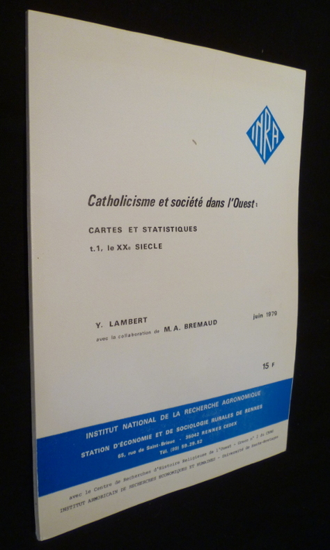
Lambert Yves
Catholicisme et société dans l'Ouest: cartes et statistiques (t.1, le XXe siècle)
INRA Revue en brochure d'éditeur 1979 In-4 (21 x 30 cm.), revue brochée, 51 pages, cartes et figures en noir in-texte ; menus incidents aux plats, bon état. Livraison a domicile (La Poste) ou en Mondial Relay sur simple demande.
书商的参考编号 : cg81
|
|
|
Lamoureux Sophie
Comment parler de l'Europe aux enfants
Le baron perché Editions 2013 13 4x1x21 8cm. 2013. Broché.
书商的参考编号 : 500059367

|
|
|
Lamoureux Sophie
Comment parler de l'Europe aux enfants
Le baron perché Editions 2013 13 4x1x21 8cm. 2013. Broché.
书商的参考编号 : 500072454

|
|
|
Lamoureux Sophie
Comment parler de l'Europe aux enfants
Le baron perché Editions 2013 13 4x1x21 8cm. 2013. Broché.
书商的参考编号 : 500072485

|
|
|
Lamoureux Sophie
Comment parler de l'Europe aux enfants
Le baron perché Editions 2013 13 4x1x21 8cm. 2013. Broché.
书商的参考编号 : 500072622

|
|
|
Lamoureux Sophie
Comment parler de l'Europe aux enfants
Le baron perché Editions 2013 13 4x1x21 8cm. 2013. Broché.
书商的参考编号 : 500075463

|
|
|
Lamoureux Sophie
Comment parler de l'Europe aux enfants
Le baron perché Editions 2013 13 4x1x21 8cm. 2013. Broché.
书商的参考编号 : 500077119

|
|
|
Lamoureux Sophie
Comment parler de l'Europe aux enfants
Le baron perché Editions 2013 13 4x1x21 8cm. 2013. Broché.
书商的参考编号 : 500094707

|
|
|
Lamoureux Sophie
Comment parler de l'Europe aux enfants
Le baron perché Editions 2013 13 4x1x21 8cm. 2013. Broché.
书商的参考编号 : 500096904

|
|
|
LAMORLETTE L. (Dir.) Nombreuses cartes et illustrations.
L'Europe. Géographie en 2 volumes.
Couverture rigide. 2 volumes, reliure de l'éditeur. 856 pages. 25 x 32 cm.
书商的参考编号 : 48584
|
|
|
LAMORLETTE L. (Dir.) Nombreuses cartes et illustrations.
La France. Géographie en 2 volumes.
Couverture rigide. 2 volumes, reliure de l'éditeur. 855 pages. 25 x 32 cm.
书商的参考编号 : 48583
|
|
|
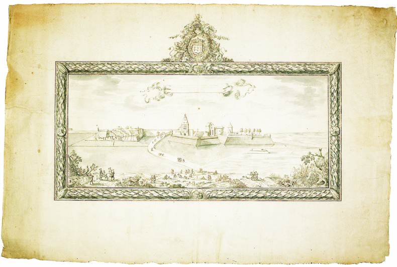
LAMOTHE. MANUSCRIT.
Profil du bastion royal de Péronne par Lamothe de Lamyre mousquetairedu roy commis par S.M. à la conduitte et direction des fortifications de Picardie et de Haynault.
[circa 1660]. En deux feuilles jointes de 390 x 586 mm.
书商的参考编号 : LBW-4146
|
|
|
Lamb, Harold & Maps On End Papers
The March of Muscovy Ivan the Terrible and the Growth of the Russian Empire 1400-1648
Doubleday. Good with no dust jacket. 1948. Hardcover. 309 pages; Copyright page does not state edition or printing. Likely 1st edition judging from date. Foxing heavy to the exterior edge of pages only. Yellowing to pages. Otherwise in good condition. No writing or major blemishes. ; - We're committed to your satisfaction. We offer free returns and respond promptly to all inquiries. Your item will be carefully wrapped in bubble wrap and securely boxed. All orders ship on the same or next business day. Buy with confidence. . Doubleday hardcover
书商的参考编号 : TOB217-32701-A-0.50
|
|
|
LANÉE (Eugène).
[FORÊT de HALATTE] Équipage d'Halatte.
Paris, Lanée, 1899. En 18 sections montées sur toile et repliées, formant une carte de 368 x 509 mm ; étiquette au dos du graveur-éditeur parisien de cartes géographiques Eugène Lanée, successeur de Longuet ; sous étui de papier marbré bleu de l'époque (127 x 90 mm), avec pièce de titre de chagrin vert sur le premier plat.
书商的参考编号 : LBW-8950

|
|
|
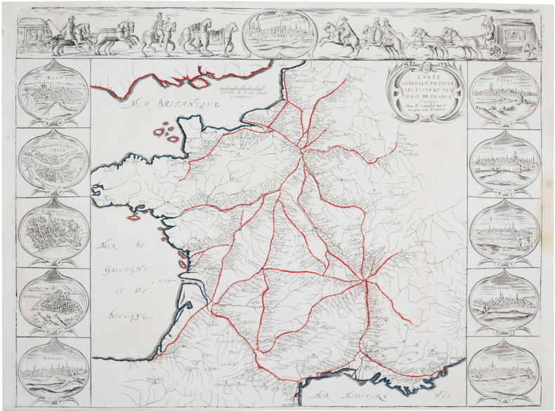
LANGLOIS (Nicolas).
[POSTES] Carte générale de toute les poste et traverse de France.
Paris, N. Langlois, [circa 1670]. 400 x 528 mm.
书商的参考编号 : LBW-7365
|
|

 ?????????
 ?????PDF???
 RSS feed
 ??
??


