|
MARTINET (François-Nicolas) & BUFFON (Georges Louis Leclerc, comte de).
[MOLUQUES] Calao des Moluques.
[Paris, 1771-1786]. 233 x 180 mm.
书商的参考编号 : LBW-4342

|
|
|
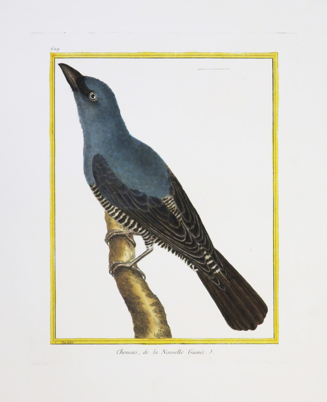
MARTINET (François-Nicolas) & BUFFON (Georges Louis Leclerc, comte de).
[NOUVELLE-GUINÉE] Choucas, de la Nouvelle Guinée.
[Paris, 1771-1786]. 230 x 175 mm.
书商的参考编号 : LBW-4346
|
|
|
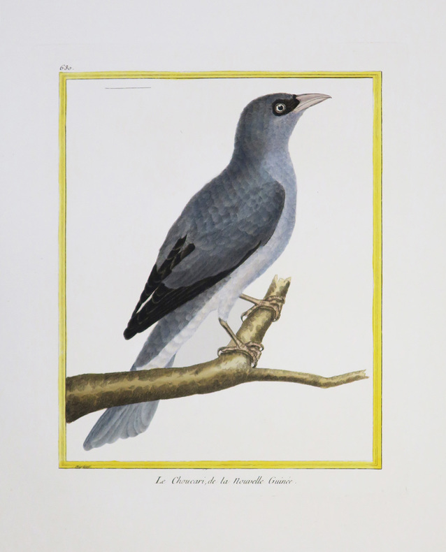
MARTINET (François-Nicolas) & BUFFON (Georges Louis Leclerc, comte de).
[NOUVELLE-GUINÉE] Le Choucari, de la Nouvelle Guinée.
[Paris, 1771-1786]. 231 x 177 mm.
书商的参考编号 : LBW-4344
|
|
|
MARTINET (François-Nicolas) & BUFFON (Georges Louis Leclerc, comte de).
[SAINT-DOMINGUE] 1. Le Rocou, de St. Domingue. 2 et 3. Le Nacré, de St. Domingue. 3. Le Quinteraye, de St. Domingue.
[Paris, 1771-1786]. 237 x 179 mm.
书商的参考编号 : LBW-4391

|
|
|
MARTINET (François-Nicolas) & BUFFON (Georges Louis Leclerc, comte de).
[SURINAM] 1 et 2. Le Parasol de Surinam. 3 et 4. Le Guidon de Surinam.
[Paris, 1771-1786]. 233 x 182 mm.
书商的参考编号 : LBW-4388

|
|
|
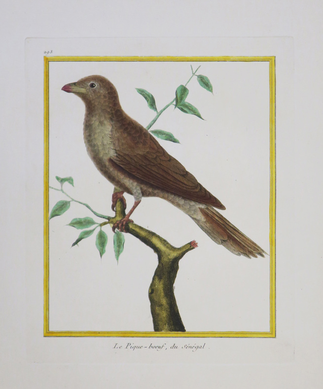
MARTINET (François-Nicolas) & BUFFON (Georges Louis Leclerc, comte de).
[SÉNÉGAL] Le Pique-bœuf, du Sénégal.
[Paris, 1771-1786]. 229 x 180 mm.
书商的参考编号 : LBW-4345
|
|
|
MARTINET Fils.
[LE HAVRE] I.RE Vue de la ville du Havre de Grâce.
[Paris, 1786]. 340 x 596 mm.
书商的参考编号 : LBW-6804

|
|
|
MARTINY DE RIEZ G. Portraits et cartes coloriées.
Histoire illustrée de la guerre de 1870-1871 et de la guerre civile à Paris. Réflexions morales et politiques.
Couverture rigide. Reliure demi-basane rouge à nerfs. 406 pages. Nombreuses rousseurs.
书商的参考编号 : 147610

|
|
|
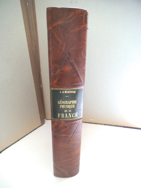
MARTONE A de
Géographie physique de la France.
In 4 demi- cuir marron raciné, pièce de titre cuir vert, filets à froid. Faux-titre, titre, 463 pages, nombreuses illustrations 167 cartes, figures, dans le texte144 photographies et une carte en couleurs hors-texte ; Librairie Armand Colin 1942. Très bon état
书商的参考编号 : 13333
|
|
|
Martres, Laurent
Photographing the Soutwest : Volume 1 - A Guide to the Natural Landmarks of Southern Utah
No marks or inscriptions. No creasing to covers or to spine. A very clean very tight copy with bright unmarked boards and no bumping to corners. 320pp. A travel guide to the natural landmarks of Southern Utah including Grand Circle, Red Rock Country and Dinosaur National Monument with emphasis on the opportunities for spectacular photography and with over 240 full-color photographs.
|
|
|
MARZOLLA Benedetto (Brindisi, 1801 - Napoli, 1858)
Impero di Alessandro
Carta storica raffigurante i territori dell'Impero di Alessandro Magno intorno al 323 a.C. Tratta dall’ Atlante geografico. Corredato di notizie relative alla geografia fisica politica, ed in generale alla statistica delle varie regioni del Globo. Compilato ed eseguito in litografia per cura e sotto la direzione di Benedetto Marzolla edito a Napoli nel 1858. Marzolla, autore di importanti atlanti sulle provincie del Regno di Napoli, è anche autore di diverse carte sulle Circoscrizioni Ecclesiastiche nel Regno delle Due Sicilie, pubblicate postume, nello stesso anno della morte (1858) a Napoli nello Stabilimento Geografico diretto da Luigi Manzella. Benedetto Marzolla fu disegnatore topografo e litografo; geografo e cartografo; membro della Commissione di statistica presso il Ministero dell'Interno. Personaggio di grandissimo rilievo nella cartografia napoletana ed italiana del XIX secolo, Marzolla ottenne in vita pubblici riconoscimenti ed attestati per la produzione cartografica di altissima qualità. La sua notorietà si è lentamente dissolta dopo la morte; va tuttavia osservato che solo la mancanza di uno spiccato coinvolgimento politico in senso risorgimentale e di una valenza letteraria nella sua opera non lo hanno reso famoso come i contemporanei Francesco Costantino Marmocchi (1805-1858) e Attilio Zuccagni-Orlandini (1783-1872), con i quali può certamente confrontarsi. I progetti culturali didattici e editoriali di Marzolla furono e rimangono di straordinaria modernità; egli inventò, è il caso di dire, un nuovo modo di intendere e di disegnare la carta geografica, fornendo una visione assolutamente originale della comunicazione dei dati geografici attraverso la combinazione di testo e immagine. Con tale operazione, egli riuscì a fondere in un'unica opera, storia, geografia, economia, statistica e cartografia, raggiungendo un equilibrio grafico di rara efficacia (cfr. V. Valerio, Benedetto Marzolla Brindisino, Geografo e Cartografo dell'800 Europeo, Brindisi 2008). Bell’esemplare con coloritura coeva dei contorni, in ottimo stato di conservazione. Bibliografia V. Valerio, Benedetto Marzolla Brindisino, Geografo e Cartografo dell’800 Europeo (2008). Historical map depicting the territories of Alexander the Great's empire, around 323 BC. Taken from the Atlante geografico. Corredato di notizie relative alla geografia fisica politica, ed in generale alla statistica delle varie regioni del Globo. Compilato ed eseguito in litografia per cura e sotto la direzione di Benedetto Marzolla published in Naples in 1858. Marzolla, author of important atlases on the provinces of the Kingdom of Naples, is also the author of several maps on the Ecclesiastical Circumscriptions in the Kingdom of the Two Sicilies, published posthumously in the same year of his death (1858) in Naples in the Stabilimento Geografico directed by Luigi Manzella. Benedetto Marzolla was draftsman topographer and lithographer, geographer and cartographer. Character of great importance in the Neapolitan and Italian cartography of the nineteenth century, Marzolla obtained during his life public recognition and certificates for the production of high quality cartography. His notoriety slowly faded after his death; it should be noted, however, that only the lack of a strong political involvement in the sense of the Risorgimento and of a literary value in his work did not make him as famous as his contemporaries Francesco Costantino Marmocchi (1805-1858) and Attilio Zuccagni-Orlandini (1783-1872), with whom he can certainly compare himself. Marzolla's cultural, didactic and editorial projects were, and remain, extraordinarily modern; he invented a new way of understanding and drawing maps, providing an absolutely original vision of the communication of geographical data through the combination of text and image. With this operation, he was able to merge in a single work, history, geography, economics, statistics and cartography, achieving a graphic balance of rare effectiveness. Benedetto Marzolla is famous for being among the most important cartographers of the XIX century, for being the one to print geographic maps using high quality lithographies.His Atlante Geografico, made of 58 maps, presents finely sketched works. Six maps depict North America, among them famous map of gold diggers in California, deriving from Hippolite Ferry. Extremely relevant are also the maps of Antarctic, South Africa with the plan of Cape Town and those about Australia.Though the maps are dated between 1843 and 1856, this 1858 edition, printed in Naples at the Stabilimento Geografico Strada San Carlo (founded by Marzolla himself), represents the final version of his atlas, the last one before his death. A posthumous edition will be published in 1865.The atlas is pretty rare, is not actually listed in Phillips, British Library e OCLC. Beautiful specimen with contemporary coloring of the contours, in excellent condition. Bibliografia V. Valerio, Benedetto Marzolla Brindisino, Geografo e Cartografo dell’800 Europeo (2008).

|
|
|
Masao Tamai / Written by Historical Maps
my chikuho story
Not Available 1980. Soft Cover. Fine. The book is in fine condition. Not Available paperback
书商的参考编号 : 2090502113713456
|
|
|
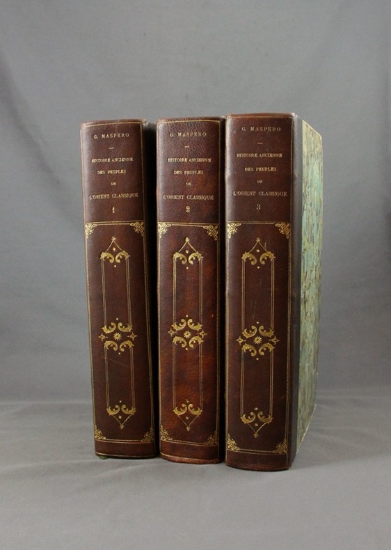
MASPERO G:
Histoire ancienne des peuples de l’Orient classique.
Paris, Lib. Hachette, 1895-1899. 3 vol. in-4 de 804 + 798 + 826 pp. demi-maroquin noir, dos lisse orné de fers d’inspiration romantiques, couv. d’origine cons. Bel état.
书商的参考编号 : 1570
|
|
|
MASSIP Catherine - Emmanuel Le Roy Ladurie (préface) - Avec la participation des Départements ds Cartes et Plans, des Estampes, des Livres imprimés, des Manuscrits occidentaux et orientaux, des Médailles, et de la Musique de la Bibliothèque Nationale
Le chant d'Euterpe, l'aventure de la musique
1991 Hervas, collection Banque Nationale de Paris - 1991 - In-4 couverture cartonnée noire décorée - 188 pages - nombreuses reproductions photographiques
书商的参考编号 : 98357
|
|
|
Mathews, W.H. (compiler); et al
Geology of the Cordilleran Orogen in Canada - Geology of North America, Volume G-2/Geology of Canada No. 4
Large slipcase contains the following maps: 1701A - Physiographic Map of the Canadian Cordillera; 17.1 Structural cross-sections of the Canadian Cordillera; 1714A Metamorphic Map of the Canadian Cordillera; 15.1 Distribution of Proterozoic to Miocene plutonic suites; 19.1A to I; 1713A Terrane Map of the Canadian Cordillera (sheets 1 and 2); Correlation chart for Canadian Cordillera (3 sheets). Minor reference markings to slipcase and each map. Please note: we are offering the map set only. Book not included. Book

|
|
|
MATHIEU F-A Colonel
Précis De Topographie
Paris L. Fournier & Cie 1945 In-12, 2 Volumes 153 + 119 pp
书商的参考编号 : 19977
|
|
|
Mathioulakis,Christos Z
Crete : Tourist Guide to Crete (With Tourist Map , Scale 1:300,000)
Locally produced vintge guidebook, including good street maps of Heraklion and other towns. 96p,+ colored plsted, illus, maps and diagrams. Large scale fold-out map of Crete at the back. Book
|
|
|
Mathioulakis,Christos Z
Crete : Tourist Guide to Crete (With Tourist Map , Scale 1:300,000)
Locally produced guidebook to Crete, ,including good street maps of Heraklion and other towns. Pbk. 96p.illus + coloured plates, Maps Crisp tight unmarked copy copy, but fold-out map is missing [3 copies of this edition found in WorldCat Book
|
|
|
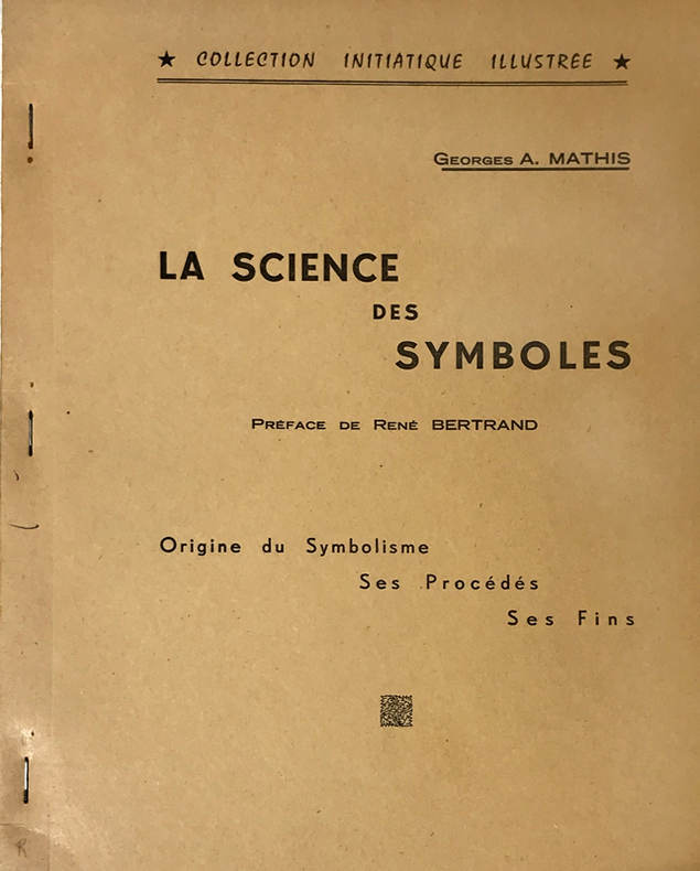
Mathis (Georges A.) :
Science (La) des Symboles. Préface de René Bertrand. Origine du Symbolisme, ses Procédés, ses Fins.
Rueil-Malmaison, Marcel Spaeth, "Collection Initiatique Illustrée", 1961 ; in-4 polycopié ; (2), IV, 105, (1) ff. recto seul.
书商的参考编号 : 14766
|
|
|
Matkin, Robert B.
Map Reading
Name/date to front end paper. No other marks or inscriptions. No creasing to covers. A very clean very tight copy with bright unmarked boards and no bumping to corners. 32pp. A guide to understanding maps and map reading. Illustrated.

|
|
|
Matthews, Brian R.[Signed]
A History of Pointe Claire
324 pages. Index. Bibliography. Black and white illustrations. Author's signature upon front free endpaper. "Traces the development of the town of Pointe Claire from its beginnings as a stretch of lonely farms to its present as a major municipality. Covers three hundred years of Canadian history as it affected the people of the West Island community. Old maps, photos and the words of contemporary observers take the reader into a past where the pioneer farmers struggled to defeat Indians, the land, the climate and foreign invaders... This is the only complete history of the town." - from dust jacket. Gift greetings atop title page else book clean, bright and unmarked with negligible wear. Very light wear to dust jacket which has touches of yellowing to flaps, and is now preserved in a glossy new Brodart cover. A premium copy. Book

|
|
|
Matthiae, Karl / Thiel, Winfried
Biblische Zeittafeln Geschichtliche Abrisse, chronologische Übersichten, Überblickstafeln und Landkarten zur alt- und neutestamentlichen Zeit
8' in a worn yellow hard slipcase and in a white soft slipcase. softocover booklet and numerous tables and maps. else in good condition.
|
|
|
MATTHIEU P.
Histoire des Derniers troubles de France sous le Règne des Rois Très Chrétiens Henry III Roy de France et de Pologne et Henry IIII Roy de France et de Navarre.
S.N. Lyon 1594 Un volume in-8 ( 170 X 110 mn ), reliure velin à rabats avec reste de lacet. Notre volume contient les 2 premiers livres ( 1bl, titre, épître et discours ), 118 pages - 203 pages. 4 bandeaux et 4 lettrines.
书商的参考编号 : 191923

|
|
|
MATTON Raymond - MATTO Lya 270 photographies hors texte et 21 cartes et plans.
Athènes et ses monuments du XVIIe siècle à nos jours. Villes et paysages de Grèce.
Couverture souple. Broché. 342 pages + cahier d'illustrations.
书商的参考编号 : 147115
|
|
|
Matvejevitch Predrag
Bréviaire méditerranéen
Fayard 1992 In-8 broché 23 cm sur 15. 264 pages. Très bon état d’occasion.
书商的参考编号 : 107863
|
|
|
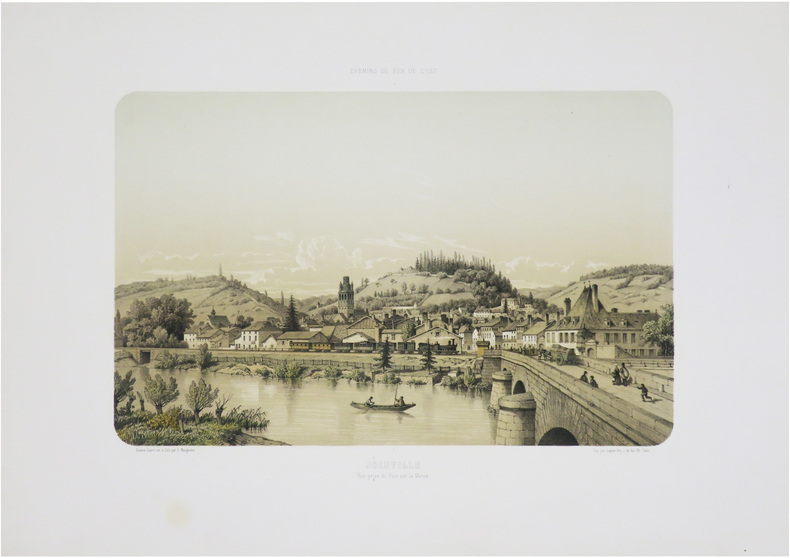
MAUGENDRE (Adolphe).
[JOINVILLE] Chemins de fer de l'Est. Joinville. Vue prise du pont sur la Marne.
Paris, Auguste Bry, [1857]. 280 x 380 mm.
书商的参考编号 : LBW-9008
|
|
|
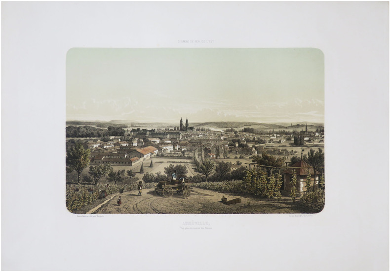
MAUGENDRE (Adolphe).
[LUNÉVILLE] Chemins de fer de l'Est. Lunéville, vue prise du canton des Novions.
Paris, Auguste Bry, [1857]. 275 x 375 mm.
书商的参考编号 : LBW-9013
|
|
|
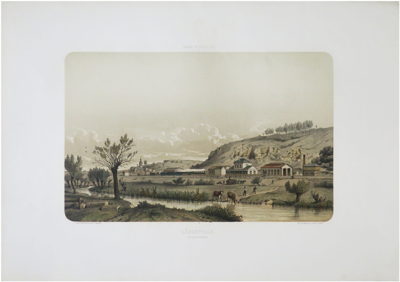
MAUGENDRE (Adolphe).
[LÉROUVILLE] Chemins de fer de l'Est. Lérouville, vue prise de la Prairie.
Paris, Auguste Bry, [1857]. 272 x 380 mm.
书商的参考编号 : LBW-9012
|
|
|
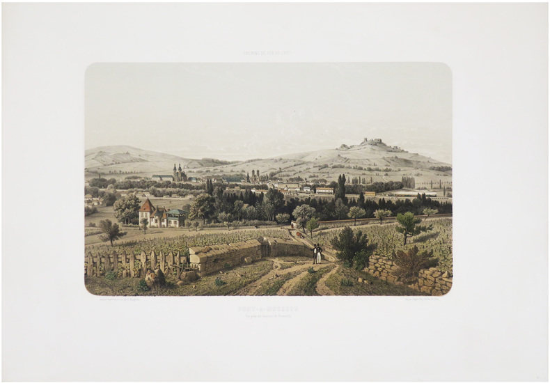
MAUGENDRE (Adolphe).
[PONT-à-MOUSSON] Chemins de fer de l'Est. Pont-à-Mousson. Vue prise des hauteurs de Peuvenelle.
Paris, Auguste Bry, [1857]. 279 x 381 mm.
书商的参考编号 : LBW-9009
|
|
|
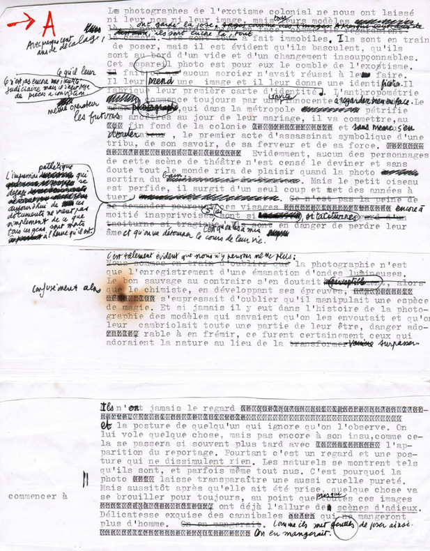
Maurel, Christian (1931-2011, écrivain et journaliste)
Tapuscrit de L'Exotisme colonial
1980 Ensemble comprenant : 1) Le tapuscrit de premier jet avec de nombreuses corrections autographes : environ 16 ff. in-4 assemblés ; 2) Le tapuscrit définitif, y compris tables, crédits photographiques, 4e de couverture... : 29 ff. in-4 souvent reconstitués ; 3) Instructions pour les retouches de photos : 3 pp. tapuscrites in-4 avec corrections autographes, 2 pp. manuscrites in-12.
书商的参考编号 : 2665
|
|
|
MAURIAC
Carte d'?tat-major ? l'?chelle 1/80 000?.
1 feuille entoil?e (repli?e). 60x84 cm. Mouillure en marge.
|
|
|
Maurice Colbeck
Village Yorkshire
No marks or inscriptions. A very clean very tight copy with bright unmarked boards and no bumping to corners. Dust jacket price clipped but not marked or torn or creased with minor traces of storage. 160pp. A tour around scores of Yorkshire villages. Well illustrated.

|
|
|
MAURITANIE par Odette de PUIGAUDEAU.
La grande foire des dattes. Adrar mauritanien. Illustré (héliogravures, cartes).
Paris, éd. Plon 1937. Bon exemplaire broché, couverture décorée d'éd., in-8, 281 pages + planches.
书商的参考编号 : AUB-4024
|
|
|
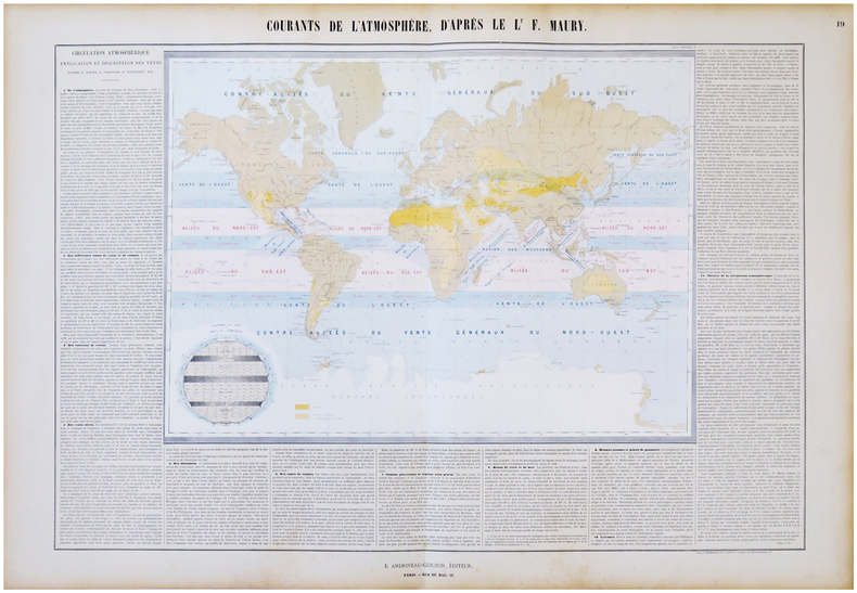
MAURY (Matthew Fontaine) & ANDRIVEAU-GOUJON (Eugène).
Courants de l'atmosphère, d'après le L.t F. Maury.
Paris, E. Andriveau-Goujon, 1864. En deux feuilles jointes de 665 x 887 mm.
书商的参考编号 : LBW-6843
|
|
|
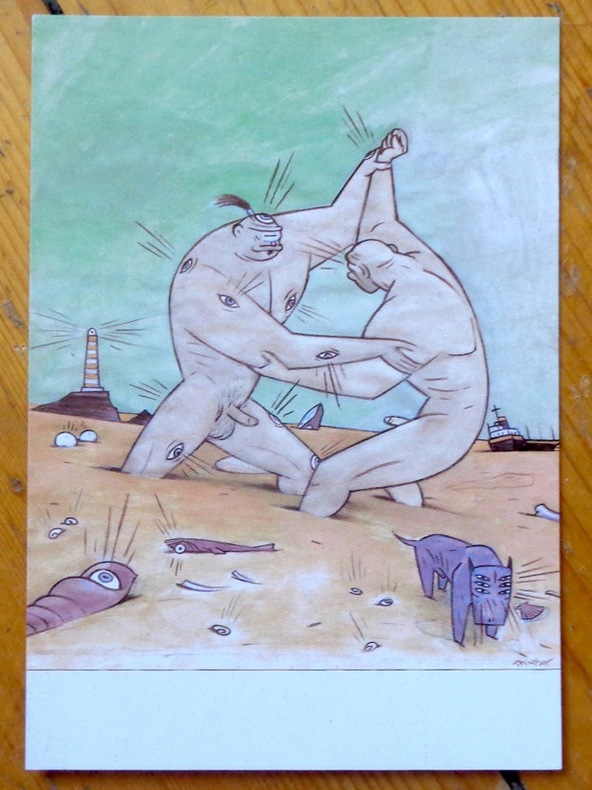
Max:
Argos and Cyclops playing on the beach.
Chez l'auteur, 1997. Avis de changement d'adresse du dessinateur, au format carte postale.
书商的参考编号 : 9047
|
|
|
Max:
Buen rollito 2000 !
Carte de voeux en triptyque par le dessinateur espagnol.
书商的参考编号 : 23826

|
|
|
Maxwell A Kreindler, With Assistance Of Alexis Lichine And Frank Schoonmaker, Etc Maps By Charles E Skaggs
Jack & Charlie's 21 Wine List
New York Ny: Jack And Charlie's "Twenty-One" / "21 1954. 1st Edition . Hardcover. Near Fine. 71 Pp. Red Cloth Gilt And Stamped In Blind. #343 Of A Limited Edition Of 1000 Copies. Lightly Used No Fraying Or Stains Gilt Brilliant. Ownership Stamp Of Fred Herrington 1898-1971 A California Lawyer Whose Collection Of Menus Is Held At Uc Davis. <br/> <br/> Jack And Charlie's "Twenty-One" / "21 hardcover
书商的参考编号 : 058667
|
|
|
MAY Helmut - MILLER Henry
Hans Reichel. 1892-1958. Ein eutscher maler in Paris
Köln Wallraf-Richartz-Museum 1960 plaquette in-8 Agrafé, couverture illustrée
书商的参考编号 : 014320
|
|
|
May, Dr Jacques M.
Thailand, Around the World Program; American Geographical Society
No marks or inscriptions. Tiny crease to lower corner of rear cover. A very clean very tight copy with very slightly dusty boards, rusty staples and no bumping to corners. All twenty-five coloured stickers present and attached. 64pp. An introduction to Thailand in the 1960s and earlier. Very well illustrated. We do not use stock photos, the picture displayed is of the actual book for sale. Every one of our books is in stock in the UK ready for immediate delivery.

|
|
|
May, Jutta
The Visitor's Guide to Corsica
Ex library book with usual marks and stamps. Clean tight pages with bright unmarked tape-free red cloth boards and no bumping to corners. Dust jacket not price clipped or marked or torn with creasing. 231pp. An ideal detailed guide for the independent motoring traveller in Corsica.

|
|
|
MAYER, TOBIAS & HOMANN - POLAND.
Mappa Geographica Regni Poloniae ex novissimis quotquot sunt mappis specialibus composita at ad LL stereographica projectionis revocata a Tob. Mayero...
Nürnberg, Homannianos Heredes, 1773. 48,5x53,5 cm. Engraved and original hancoloured map of Poland and neighbouring areas. A tear in upper margin just touching the coloured image area. A very small hole in lower part of map in the folding.
书商的参考编号 : 32941
|
|
|
MAYER, TOBIAS & HOMANN - POLAND.
Mappa Geographica Regni Poloniae ex novissimis quotquot sunt mappis specialibus composita at ad LL stereographica projectionis revocata a Tob. Mayero...
Nürnberg, Homannianos Heredes, 1773. 48,5x53,5 cm. Engraved and original hancoloured map of Poland and neighbouring areas. A tear in upper margin just touching the coloured image area. A very small hole in lower part of map in the folding.
|
|
|
MAZIERS, Micel.
Rhode-Saint-Genèse en cartes postales anciennes.- Sint-Genesius-Rode in oude prentkaarten.
Petit in-8 oblong, 76 cartes en n&b., reliure cartonnage editeur illustrée.- RARE Bel exemplaire. [BU-11]
|
|
|
McCarta, Robertson
Cyprus (Nelles guides)
Clean neat copy, comprehensive travel guide to Cyprus. 256p. illus (col) index. Neat and complete, with one library "sold" stamp P Ex-Library
|
|
|
McClellan, George B.
REPORT ON THE ORGANIZATION AND CAMPAIGNS OF THE ARMY OF THE POTOMAC: To Which Is Added An Account Of The Campaign In Western Virginia, With Plans Of Battle-Fields.
pp. 465, (14) [Publisher's catalogue] + Frontis folding map of Antietam battle field, old tape repair at top fold, and full page plans of battle fields. Age stained. Inked ownership of H. R. Pratt, 1935. Large 12mo. Original full cloth binding, lacks spine. Hardbound. SHELF W29
|
|
|
McCorquodale, Anna (editor)
Debrett's Cities of the World : London
No marks or inscriptions. No creasing to covers or to spine. A very clean very tight copy with bright unmarked boards and no bumping to corners. 303pp. The volume which is distributed to peers and baronets, chairmen, managing directors, Members of Parliament, and Members of the European Parliament and others selected from Debretts (of Debrett's Peerage Ltd fame) - primarily those living within a 150 mile radius of London. A limited number is circulated among London's top hotels. A heavy book.

|
|
|
McCoy, Alfred W.; Read, Cathleen R.; Adams, Leonard P.
The Politics of Heroin in Southeast Asia
464 pages including notes, index, black and white photographic plates and illustrations. "In spite of recent well-publicized seizures of massive shipments of heroin from Southeast Asia, heroin continues to flood the country, spreading into every level of this society and shredding the fabric of everyday life. U.S. government estimates of the number of addicts has leaped from 315,000 in 1969 to over 560,000 in 1972. This book puts all the pieces of this ghastly puzzle together, and then maps the possible avenues out of the horror, suggesting that America may have to choose between our commitments in Southeast Asia and getting heroin out of our high schools." - from dust jacket. Moderate wear. Book clean and unmarked. Small closed tear to dust jacket. Nice copy. Book
|
|
|
McDermott, John W; Illustrated by B&w maps [Illustrator]
How to Get Lost and Found in Fiji
Waikiki 1978-01-01. Paperback. New. In shrink wrap. Waikiki paperback
书商的参考编号 : COD-00178
|
|
|
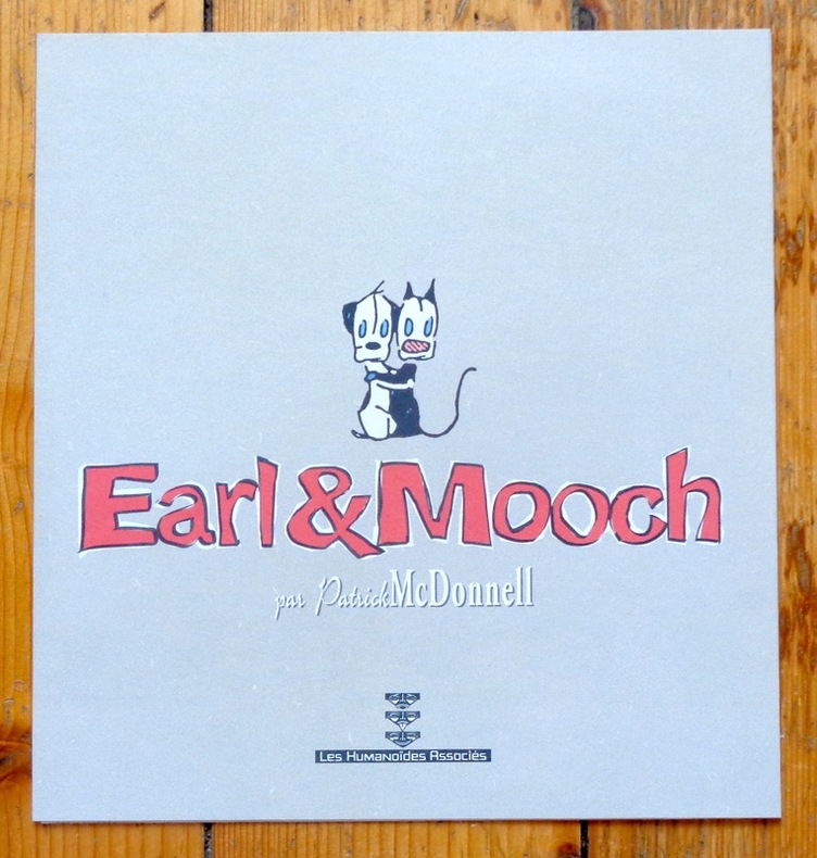
McDonnell Patrick:
Triptyque Earl & Mooch.
Les Humanoïdes Associés. Ravissant triptyque de présentation, à l'état de neuf.
书商的参考编号 : 5406
|
|
|
McDougall, Duncan
Victoria : The Garden City
Inscription inside front cover and light indenting to front cover. No other marks, light creasing to covers and spine. A clean very tight copy with lightly rubbed covers and no bumping to corners. 72pp. With coloured photographs and black & white line drawings of this Canadian city with a little text.

|
|

 ?????????
 ?????PDF???
 RSS feed
 ??
??


