|
Stark, James H..; Maps, Engravings, Photo-Prints (Illustrator)
Stark's Illustrated Bermuda Guide; Containing a Description of Everything on or About These Places of Which the Visitor or Resident May Desire Information
Boston / London: James H. Stark Publisher 1902. Hardcover. Very Good. 12mo 6.75 - 7.75'' tall. Hardcover. Book Condition: Very Good. James H. Stark Publisher Boston / London 1902. Ads 158 pages. Nice Firm Clean copy ! Light general wear. With a lovely folding map! Size: 12mo 6.75 - 7.75'' tall. Travel::Antique History::Localities Maps 6272 6272 James H. Stark Publisher hardcover
Bookseller reference : 127907
|
|
|
Commission, Massachusetts Historical; Illus. With Maps (Illustrator)
Historic and Archaeological Resources of the Connecticut Valley: A Framework for Preservation Decisions
MA Historical Commission 1988. Paperback. Very Good. L 4to 9.75 - 12'' tall. Paperback. Book Condition: Very Good. MA Historical Commission 1988. 321 pages. Nice Firm Clean copy ! Light general wear. Size: L 4to 9.75 - 12'' tall. History::Archaeology New England::History 6958L 6958L MA Historical Commission paperback
Bookseller reference : 106854
|
|
|
MAPS. Periodical
The Map Collector. Nos. 23 28 51
London. 1980-1990 1990. Soft cover. Fine. 4to. 30cm colour printed stiff wraps fine N13PRICED INDIVIDUALLY NOT AS LOT. PLEASE INDICATE WHICH VOLUME. London. 1980-1990 unknown
Bookseller reference : 14438
|
|
|
NEW BRUNSWICK. Maps]
In New Brunswick You'll Find It. 1969
Fredericton. Department of Natural Resources. 1969. Soft cover. Oblong format24cmx31cm 58 full-page maps stiff wraps with map on front coil backed fine. Mmds A series of maps covering the whole of New Brunswick based on vertical aerial photos taken from 1962 to 1967. The maps in this booklet are at the scale 1"=3 miles. Fredericton. Department of Natural Resources. 1969 unknown
Bookseller reference : 8530
|
|
|
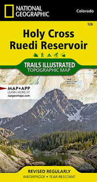
National Geographic Maps - Trails Illustrated
Holy Cross Ruedi Reservoir Map National Geographic Trails Illustrated Map 126
map. Good. Access codes and supplements are not guaranteed with used items. May be an ex-library book. unknown
Bookseller reference : 1566952921.G ISBN : 1566952921 9781566952927
|
|
|
Kiwi Maps
North Island Complete Drivers Atlas With Indexed Country Roads
Kiwi Maps 2014 Spiral bound book. The cover has a little wear. Books listed here are not stored at the shop. Please contact us if you want to pick up a book from Newtown. Paperback. Very Good. Kiwi Maps paperback
Bookseller reference : 179440 ISBN : 5871002668 9785871002667
|
|
|
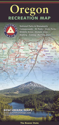
Benchmark Maps
Oregon Recreation Map 2024 Edition
map. Good. Access codes and supplements are not guaranteed with used items. May be an ex-library book. unknown
Bookseller reference : 0783499663.G ISBN : 0783499663 9780783499666
|
|
|
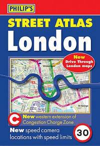
Philip's Maps
Philip's Street Atlas London Philip's Street Atlases
paperback. Good. Access codes and supplements are not guaranteed with used items. May be an ex-library book. paperback
Bookseller reference : 0540090360.G ISBN : 0540090360 9780540090365
|
|
|
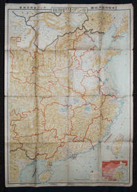
[KINGU HENSHū-KYOKU / KINGU EDITORIAL OFFICE] キング編輯局.
最新支那明細大地圖/滿・蒙・ソ聯國境大地圖. Saishin Shina meisai daichizu / Man Mō Soren kokkyō daichizu. Latest Large Detailed Map of China/Large Map of Manchuria Mongolia and the Soviet Union Borders.
Tokyo: 大日本雄辯會講談社 Dainihon Yūbenkai Kōdansha. Shōwa 13. 1938. Two large detailed maps of China and on the reverse of the Soviet Union in Asia Manchuria and Mongolia printed double sided on a single large sheet. Issued as a supplement to Volume 14 Number 1 of the magazine Kingu on New Year's Day in 1938. <br> <br>Holes at a number of holes causing a small amount of loss some occasional browning some chipping on margins. The map has clearly been used but is still largely complete. The colourful map of China on a scale of 1:2600000 includes part of Manchukuo and Inner and Outer Mongolia on the north and part of French Indochina to the south-west. It shows East Hebei Autonomous Anti- Communist Council Jidong Fanggong Zizhi Zhengfu 冀東防共自治政府 south of Manchukuo which existed from late 1935 until February the 1st1938. The legend includes national and provincial borders cities roads railways sea and air routes and undersea cables. There is an inset map of East Asia titled "Present Situation of Far East" on the lower right corner which shows the areas under influence of Communism and those under influence of/controlled or colonised by the United Kingdom France Japan and China. <br> <br>The map on the reverse printed in blue and black shows the Asian section of the Soviet Union Manchuria and Mongolia on a scale of 1:3000000. There is an inset map of Asia titled "Asian Continent" at the upper left corner the area enclosed by a rectangle which indicates the area covered in this map. The legend includes cities railways roads national borders district borders province borders and air routes. . 大日本雄辯會講談社 [Dainihon Yūbenkai Kōdansha]. unknown
Bookseller reference : 159295
|
|
|
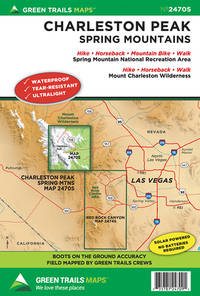
Maps, Green Trails
Charleston Peak NV No. 2470S Green Trails Maps
Green Trails Maps. New. Special order direct from the distributor Green Trails Maps unknown
Bookseller reference : ING9781680513653 ISBN : 1680513656 9781680513653
|
|
|
Collins Maps
Collins Ramblers Best Walks Britain
hardcover. Good. Access codes and supplements are not guaranteed with used items. May be an ex-library book. hardcover
Bookseller reference : 0007367082.G ISBN : 0007367082 9780007367085

|
|
|
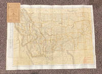
[MAPS]
Indexed Pocket Map: Tourists' and Shippers' Guide to Montana
Chicago & New York: Rand McNally & Co 1920. 12mo. 32 pp text; large color folding map 20 1/2" x 27 1/2"; printed on both sides. The front side shows railroads electric lines counties cities towns villages post offices lakes rivers etc. The verso shows the Montana automobile road map. Montana is home to two of the country's most beautiful and iconic National Parks - Yellowstone and Glacier. Printed stiff brown wrappers in fine condition; 3 short closed tears along lower edge of map. Rand McNally & Co unknown
Bookseller reference : 20799
|
|
|
Herbert RC. Carr Member of the Alpine Club with illustrations diagrams and sketch maps. Issued by the Climbers' Club. R. C.
A climbers' guide to Snowdon and the Beddgelert District
Burrup Mathieson & Company Ltd 1926. Hardback. Very Good. in x in x in. First thus. Pages clean and bright no markings light wear to edges. Burrup, Mathieson & Company, Ltd hardcover
Bookseller reference : mon0000965725
|
|
|
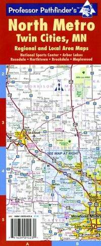
Hedberg Maps
Twin Cities MN North Metro Area Lam
map. Good. Access codes and supplements are not guaranteed with used items. May be an ex-library book. unknown
Bookseller reference : 1593530234.G ISBN : 1593530234 9781593530235
|
|
|
GA. Henty; with Ten Page Illustrations by Alfred Pears and Four Maps G. A.
By England's Aid Or The Freeing of the Netherlands 1585-1604
Blackie and Son Limited S.a.--but probably early 20th c. Hardcover. Good. 384 p. plus catalog of other books by author as well as "Blackie's Books for Boys" and "Blackie's Books for Girls" all clean and unmarked anywhere; additional ill. in back catalog plus photo portrait of author; binding firm; unfaded green pictorial boards showing helmeted soldiers with torches and pikes; gilt lettering still bright despite absence of d.j.; slight bumping of corners but minimal edge wear. Blackie and Son Limited hardcover
Bookseller reference : 052803
|
|
|
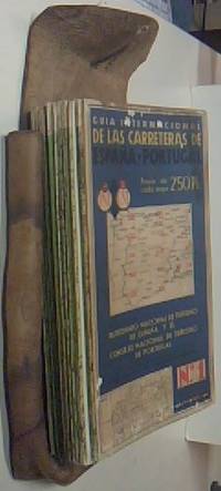
AA. VV. - MAPAS:
GuÃa internacional de carreteras de España y Portugal. 14 MAPAS PLEGADOS CON ESTUCHE CUERO. COMPLETO
.- Barcelona . 1970. Publicitas. 48x104 desplegados. 1 tomo. 14 mapas color. Estuche de cuero con marcas. Muy buen estado general. . . GeografÃa / Mapas CartografÃa unknown
Bookseller reference : $A34816
|
|
|
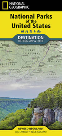
National Geographic Maps
National Parks of the United States Map National Geographic Destination Map
map. Good. Access codes and supplements are not guaranteed with used items. May be an ex-library book. unknown
Bookseller reference : 1566957516.G ISBN : 1566957516 9781566957519
|
|
|
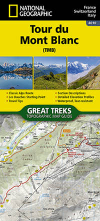
National Geographic Maps - Trails Illustrated
Tour du Mont Blanc Map National Geographic Trails Illustrated Map 4010
map. Good. Access codes and supplements are not guaranteed with used items. May be an ex-library book. unknown
Bookseller reference : 1566959543.G ISBN : 1566959543 9781566959544
|
|
|
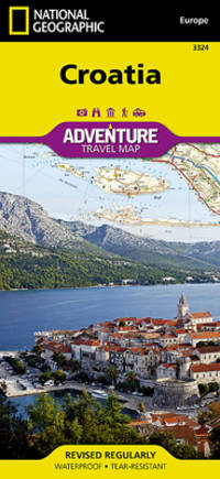
National Geographic Maps - Adventure
Croatia Map National Geographic Adventure Map 3324
map. Good. Access codes and supplements are not guaranteed with used items. May be an ex-library book. unknown
Bookseller reference : 1566956439.G ISBN : 1566956439 9781566956437
|
|
|
Philip's Maps
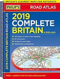
Philip's 2019 Complete Road Atlas Britain and Ireland - Spiral: Spiral binding Philips Road Atlas
Paperback. Very Good. paperback
Bookseller reference : GOR009381298 ISBN : 1849074690 9781849074698
|
|
|
Hedberg Maps Inc.
Twin Cities Metro Area: Minneapolis-St Paul
map. Good. Access codes and supplements are not guaranteed with used items. May be an ex-library book. unknown
Bookseller reference : 1885508867.G ISBN : 1885508867 9781885508867
|
|
|
Berndtson Maps
Thailand
map. Good. Access codes and supplements are not guaranteed with used items. May be an ex-library book. unknown
Bookseller reference : 386592171X.G ISBN : 386592171X 9783865921710
|
|
|
Cloete, Stuat, Illustrated by Cloete, Rehna (Photographs and Maps)
THE AFRICAN GIANT: The Story of a Journey
London: Collins 1960 1960. Hard Cover. Used: Good. Hard Cover. Good/No Jacket. B & W photos. Pencil line indicating some paragraphs. Good reading copy. London: Collins, 1960 hardcover
Bookseller reference : 2022
|
|
|
(Compiler), Benchmark Maps
Washington Road & Recreation Atlas Benchmark Maps
US: National Geographic Maps 2015. National Geographic Maps 2015 5th Edition Very Good/ Bright glossy cover with light scratching and light corner creasing to bottom front corner. Printed in 2011. Color maps. 127 pages. OVERSIZE HEAVY ITEM 1.25 Pounds. Size: 15 3/8 x 10 3/4 x 1/4 inches. 5th Edition. Paperback. Very Good. No Exp. National Geographic Maps Paperback
Bookseller reference : 362557 ISBN : 0929591984 9780929591988

|
|
|
Thomas Brothers Maps
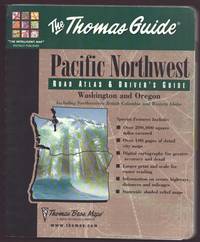
THE THOMAS GUIDE PACIFIC NORTHWEST Road Atlas & Driver's Guide
Thomas Brothers Maps. VG. 2000. Spiral bound. Paperback in Very Good condition. 0.5 X 8.25 X 11.25 inches. 445 pages. Quick shipping excellent customer service. All books carefully packaged in boxes and ship with tracking information. . Thomas Brothers Maps unknown
Bookseller reference : 66416 ISBN : 1581742045 9781581742046
|
|
|
Hedberg Maps Inc
Minneapolis and Saint Paul Downtown
map. Good. Access codes and supplements are not guaranteed with used items. May be an ex-library book. unknown
Bookseller reference : 1593530501.G ISBN : 1593530501 9781593530501
|
|
|
Barnett, A. Doak; End Paper Maps [Illustrator]
COMMUNIST CHINA AND ASIA CHallenge to American Policy. Council on Foreign Affairs Study
Harper & Brothers 1960-01-01. Hardcover. Very Good. 0x0x0. Hardcover. Very Good in Very Good dust jacket. Clean tight. Name inside. Harper & Brothers hardcover
Bookseller reference : UT1513415

|
|
|
A?Z Maps
Nottingham A-Z Street Atlas
paperback. Good. Access codes and supplements are not guaranteed with used items. May be an ex-library book. paperback
Bookseller reference : 0008445184.G ISBN : 0008445184 9780008445188
|
|
|
A?Z Maps
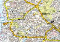
Plymouth Pocket Street Map
map. Good. Access codes and supplements are not guaranteed with used items. May be an ex-library book. unknown
Bookseller reference : 0008445133.G ISBN : 0008445133 9780008445133
|
|
|
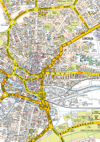
A?Z Maps
Lincoln Pocket Street Map
map. Good. Access codes and supplements are not guaranteed with used items. May be an ex-library book. unknown
Bookseller reference : 0008445176.G ISBN : 0008445176 9780008445171
|
|
|
A?Z Maps
Isle of Wight Pocket Map
map. Good. Access codes and supplements are not guaranteed with used items. May be an ex-library book. unknown
Bookseller reference : 000844515X.G ISBN : 000844515X 9780008445157
|
|
|
Collins Maps
Refugee Boy Edexcel GCSE 9-1 English Literature Text Guide: Ideal for home learning 2022 and 2023 exams Collins GCSE Grade 9-1 SNAP Revision
paperback. Good. Access codes and supplements are not guaranteed with used items. May be an ex-library book. paperback
Bookseller reference : 0008520313.G ISBN : 0008520313 9780008520311

|
|
|
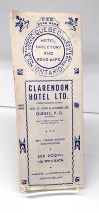
EZE Road Maps
Quebec-Ontario Hotel Directory and Road Map
nd. 1940s. Very good. Fold-out map shows southern Ontario and Quebec Maritimes and northern New York Ohio New England. Blue ink on white background. Reverse has various roads in segments. Some hotel listings not exhaustive. A little soiling. <br/><br/> unknown
Bookseller reference : 152565
|
|
|
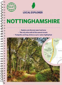
Philip's Maps
Philip's Local Explorer Street Atlas Nottinghamshire
Spiral bound. New. <b>Philip's created this new series for walkers cyclists and local explorers at a scale that provides greener options to uncover all the nature and hidden gems in your local area. From Beeston to Tickwell we cover </b><b>Nottinghamshire</b><b> in enticing detail.</b> unknown
Bookseller reference : A9781849076425 ISBN : 1849076421 9781849076425
|
|
|
A?Z Maps
Cardiff A-Z Street Atlas
paperback. Good. Access codes and supplements are not guaranteed with used items. May be an ex-library book. paperback
Bookseller reference : 0008445192.G ISBN : 0008445192 9780008445195
|
|
|
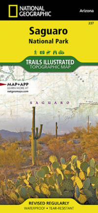
National Geographic Maps - Trails Illustrated
Saguaro National Park Map National Geographic Trails Illustrated Map 237
map. Good. Access codes and supplements are not guaranteed with used items. May be an ex-library book. unknown
Bookseller reference : 1566952409.G ISBN : 1566952409 9781566952408
|
|
|
Maps, Thomas Bros.
King County Street Guide & Directory: 1988 Updated Edition
Irvine CA: Thomas Bros. Maps. Very Good-. 1988. Spiral bound. 0881302457 . Bottom-most loop of metal spiral has come out of metal punches without tearing wrapper former owner's rubber stamp with address appears on front wrapper inside front wrapper first page third page. ; Oblong 8vo ; 122 pages . Thomas Bros. Maps unknown
Bookseller reference : 275950 ISBN : 0881302457 9780881302455
|
|
|
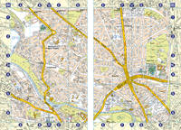
Philip's Maps
Ordnance Survey London Street Atlas Standard Street Atlas
paperback. Good. Access codes and supplements are not guaranteed with used items. May be an ex-library book. paperback
Bookseller reference : 0540078115.G ISBN : 0540078115 9780540078110
|
|
|
Philip's Maps
Street Atlas Bristol and Bath Pocket Edition
paperback. Good. Access codes and supplements are not guaranteed with used items. May be an ex-library book. paperback
Bookseller reference : 0540085251.G ISBN : 0540085251 9780540085255
|
|
|
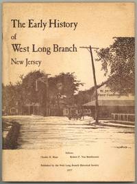
MAPS, Charles H., Robert Van Benthuysen
The Early History of West Long Branch New Jersey
West Long Branch: West Long Branch Historical Society 1977. Softcover. Very Good. First edition. Quarto. 86pp. Illustrated. Stapled illustrated wrappers. Small bookplate foxing on wrappers and a few leaves else very good. West Long Branch Historical Society unknown
Bookseller reference : 598584
|
|
|
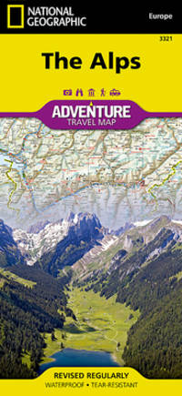
National Geographic Maps Adventure
Alps Map National Geographic Adventure Map 3321
map. Good. Access codes and supplements are not guaranteed with used items. May be an ex-library book. unknown
Bookseller reference : 1566956404.G ISBN : 1566956404 9781566956406
|
|
|
Harvey Maps
Cotswold Way XT40 Route Maps
Harvey Maps 2014. Map. New. 1 pages. 9.69x5.51x0.16 inches. Harvey Maps unknown
Bookseller reference : 2-1851374183 ISBN : 1851374183 9781851374182
|
|
|
Nelles Maps
India East Nelles Maps
map. Good. Access codes and supplements are not guaranteed with used items. May be an ex-library book. unknown
Bookseller reference : 3865740367.G ISBN : 3865740367 9783865740366
|
|
|
National Geographic Maps
High Uintas Wilderness Map
map. Good. Access codes and supplements are not guaranteed with used items. May be an ex-library book. unknown
Bookseller reference : 1566953715.G ISBN : 1566953715 9781566953719
|
|
|
Hedberg Maps Inc
Madison: UW & Capitol Area
map. Good. Access codes and supplements are not guaranteed with used items. May be an ex-library book. unknown
Bookseller reference : 1885508859.G ISBN : 1885508859 9781885508850
|
|
|
Nelles Maps
Uganda Nelles Map1:700000- 2012 English French and German Edition
map. Good. Access codes and supplements are not guaranteed with used items. May be an ex-library book. unknown
Bookseller reference : 3865742645.G ISBN : 3865742645 9783865742643
|
|
|
National Geographic Maps
Barcelona Map National Geographic Destination City Map
map. Good. Access codes and supplements are not guaranteed with used items. May be an ex-library book. unknown
Bookseller reference : 1597754579.G ISBN : 1597754579 9781597754576
|
|
|
National Geographic Maps
Appalachian Trail: Mount Carlo to Pleasant Pond Map Maine National Geographic Topographic Map Guide 1512
map. Good. Access codes and supplements are not guaranteed with used items. May be an ex-library book. unknown
Bookseller reference : 1597756490.G ISBN : 1597756490 9781597756495
|
|
|
Thomas Bros Maps
Golden Gate Popular Street Atlas: San Francisco Marin San Mateo Santa Clara Counties
Los Angeles: Thomas Bros Maps. Very Good. 1980. Ring-bound paperback. General wear but clean and solid. ; Color Maps; Oblong 4to; 142 pages . Thomas Bros Maps paperback
Bookseller reference : 295641
|
|
|
HEMA Maps
Northern Territory Handy 1:900000 Handy Hema
map. Good. Access codes and supplements are not guaranteed with used items. May be an ex-library book. unknown
Bookseller reference : 1865005673.G ISBN : 1865005673 9781865005676
|
|
 Receive by email
 Download as PDF document
 RSS feed


