|
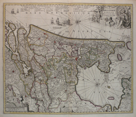
ALLARD (Carel);
[HOLLANDE] Comitatus Hollandiae tabula.
Amsterdam circa 1700 472 x 560 mm.
Bookseller reference : LBW0416c
|
|
|
VISSCHER (Nicolas);
[BRABANT] Brabantiae Batavae pars occidentalis.
Amsterdam circa 1700 490 x 578 mm.
Bookseller reference : LBW0416d

|
|
|
SANSON d'ABBEVILLE (Nicolas) & SCHENK (Petrus).
[PAYS-BAS] Le cours de la rivière du Rhein depuis sa source jusques à son emboucheure où sont distingués toutes les estats et souverainetés.
Amsterdam, Pierre Schenk, [circa 1700]. 472 x 575 mm.
Bookseller reference : LBW0416f

|
|
|
BLAEU (Johannes);
[BRESIL] Nova et accurata Brasiliae totius tabula.
Amsterdam Petrus Schenk circa 1680 497 x 588 mm.
Bookseller reference : LBW04170

|
|
|
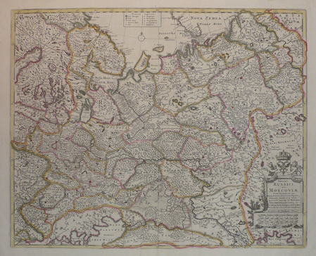
WIT (Frederick de).
[RUSSIE] Imperii Russici, sive Moscoviae.
London, Christopher Browne, [circa 1700]. 450 x 558 mm.
Bookseller reference : LBW04171
|
|
|
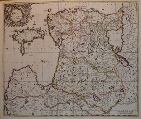
VALK (Gerard).
[LETTONIE/ESTONIE] Tabula ducatuum Livoniae et Curlandiae.
Amsterdam, [circa 1700]. 487 x 578 mm.
Bookseller reference : LBW04172
|
|
|
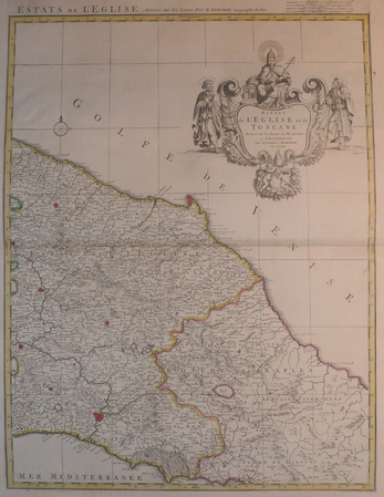
SANSON d'ABBEVILLE (Nicolas) & COVENS et MORTIER.
[TOSCANE/ETATS DE L'EGLISE] Estats de l'Eglise et de Toscane.
Amsterdam, Covens et Mortier, [circa 1710]. 580 x 445 mm.
Bookseller reference : LBW04176
|
|
|
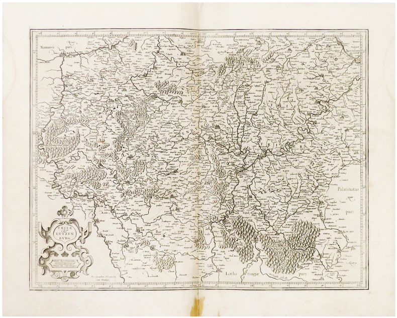
MERCATOR (Gerard).
[LUXEMBOURG] Trier & Lutzenburg.
[Amsterdam, 1603-1622]. 366 x 474 mm.
Bookseller reference : LBW04179
|
|
|
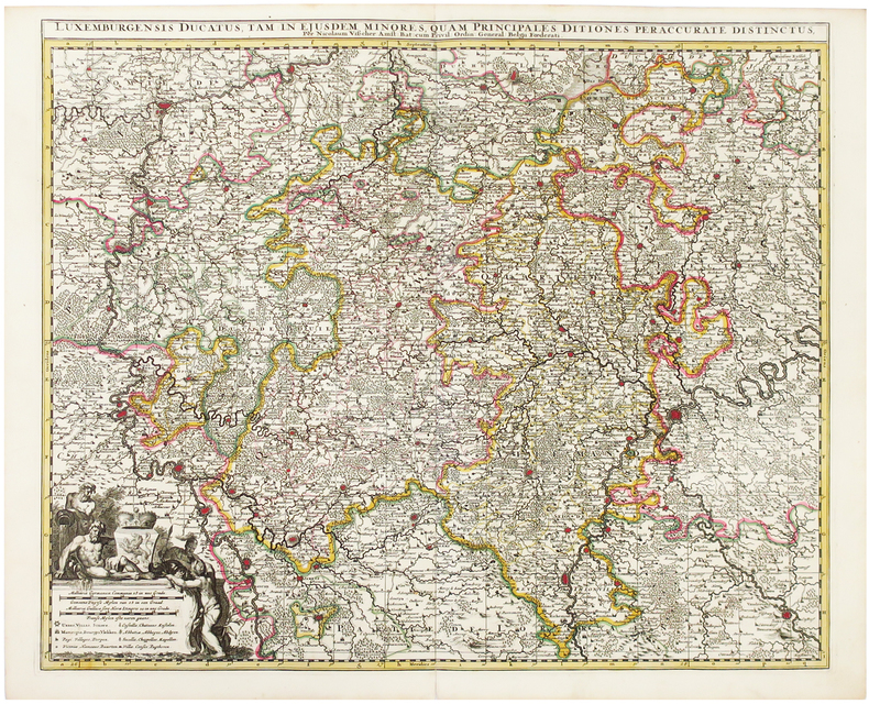
VISSCHER (Nicolas).
[LUXEMBOURG] Luxemburgensis ducatus.
Amsterdam, [circa 1700]. 489 x 585 mm.
Bookseller reference : LBW0417a
|
|
|
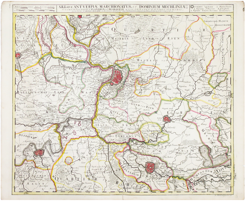
ALLARD (Carel).
[BELGIQUE/ANVERS] S.R.I. Antverpiae Marchionatus et dominium Mechliniae.
Amsterdam, [circa 1700]. 500 x 582 mm.
Bookseller reference : LBW0417b
|
|
|
VISSCHER (Nicolas);
[BELGIQUE/BRUXELLES] Bruxellensis tetrarchia.
Amsterdam circa 1700 574 x 464 mm.
Bookseller reference : LBW0417c
|
|
|
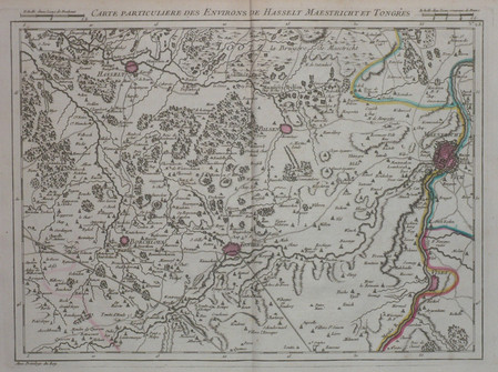
DHEULLAND (Guillaume);
[PAYS-BAS/MAASTRICHT] Carte particulière des environs de Hasselt Maestricht et Tongres.
Paris 1747 227 x 305 mm.
Bookseller reference : LBW04184
|
|
|
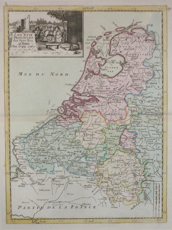
LE ROUGE (Georges-Louis);
[PAYS-BAS] Les XVII provinces des Pays-Bas.
Paris Crépy 1767 271 x 200 mm.
Bookseller reference : LBW04185
|
|
|
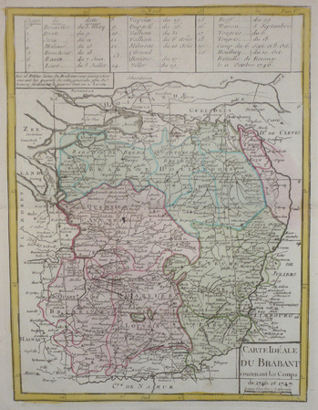
LE ROUGE (Georges-Louis);
[PAYS-BAS/BRABANT] Carte idéale du Brabant contenant les camps de 1746 et 1747.
Paris Crépy 1767 276 x 209 mm.
Bookseller reference : LBW04187
|
|
|
SANSON d'ABBEVILLE (Nicolas);
[PERSE] L'Empire du Sophy des Perses.
1652 192 x 242 mm.
Bookseller reference : LBW0418a
|
|
|
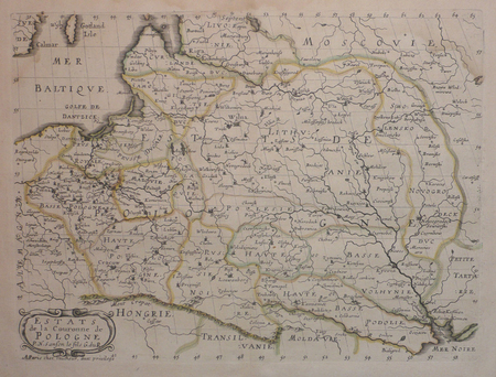
SANSON d'ABBEVILLE (Nicolas);
Estats de la couronne de Pologne.
Paris chez l'autheur 1657 191 x 253 mm.
Bookseller reference : LBW0418d
|
|
|
SANSON d'ABBEVILLE (Nicolas).
[CONGO] Royaume de Congo, &c.
1656. 205 x 278 mm.
Bookseller reference : LBW0418e

|
|
|
SANSON d'ABBEVILLE (Nicolas).
Partie de l'Inde au delà du Gange - Presqu'isle de l'Inde au delà du Gange.
1652. 188 x 251 mm.
Bookseller reference : LBW04196
|
|
|
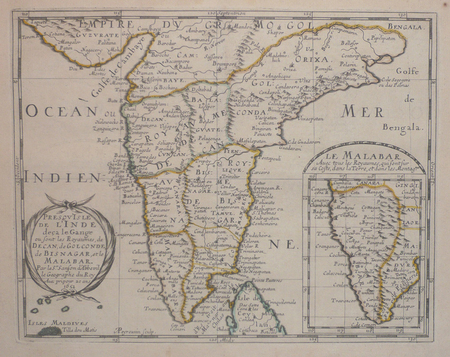
SANSON d'ABBEVILLE (Nicolas);
Presqu'isle de l'Inde deça le Gange où sont les royaumes de Decan, de Golconde, de Bisnagar, et le Malabar.
1652 192 x 243 mm.
Bookseller reference : LBW04197
|
|
|
DHEULLAND (Guillaume);
[PAYS-BAS/UTRECHT] Carte particulière des environs d'Utrecht Goude et Woerden.
Paris 1747 228 x 305 mm.
Bookseller reference : LBW0419f
|
|
|
DHEULLAND (Guillaume);
[PAYS-BAS/LA HAYE] Carte particulière des environs de La Haye Leyden et Delft.
Paris 1747 227 x 306 mm.
Bookseller reference : LBW041a0
|
|
|
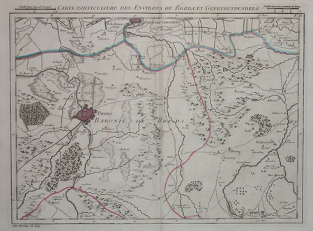
DHEULLAND (Guillaume);
[PAYS-BAS/BREDA] Carte particulière des environs de Breda et Geertruydenberg.
Paris 1747 227 x 305 mm.
Bookseller reference : LBW041a1
|
|
|
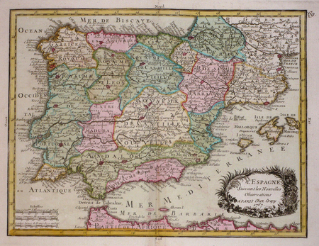
LE ROUGE (Georges-Louis).
[ESPAGNE] L'Espagne suivant les nouvelles observations.
[Paris, Crépy, 1767]. 196 x 257 mm.
Bookseller reference : LBW03d1a
|
|
|
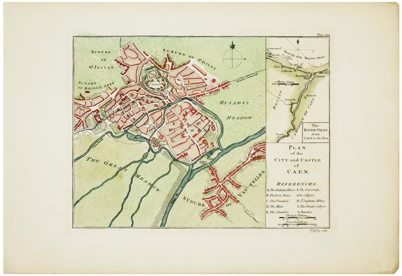
JEFFERYS (Thomas).
[CAEN] Plan of the city and castle of Caen.
[London, 1774]. 187 x 251 mm.
Bookseller reference : LBW03d3d
|
|
|
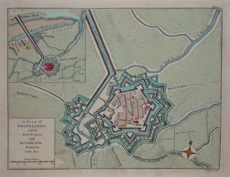
JEFFERYS (Thomas);
[GRAVELINES] A plan of Gravelines, with the new canal and the course of the river Aa to the sea.
London 1774 189 x 250 mm.
Bookseller reference : LBW03d42
|
|
|
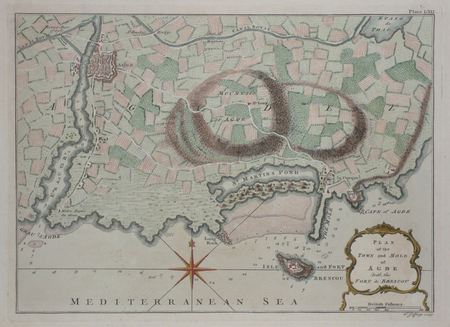
JEFFERYS (Thomas);
[AGDE] Plan of the town and mole of Agde with the fort de Brescou.
London 1774 197 x 276 mm.
Bookseller reference : LBW03d43
|
|
|
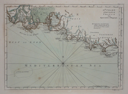
JEFFERYS (Thomas).
[PROVENCE] 15th chart of the coast of France from Aigues Mortes to Brégançon.
London, 1774. 180 x 248 mm.
Bookseller reference : LBW03d44
|
|
|
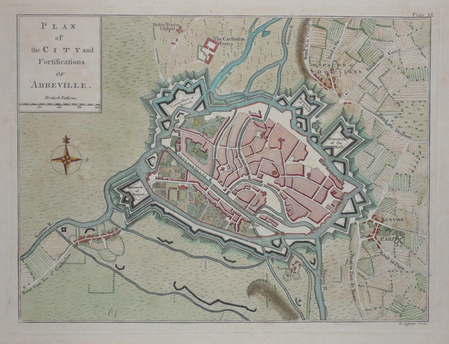
JEFFERYS (Thomas);
[ABBEVILLE] Plan of the city and fortifications of Abbeville.
London 1774 187 x 251 mm.
Bookseller reference : LBW03d46
|
|
|
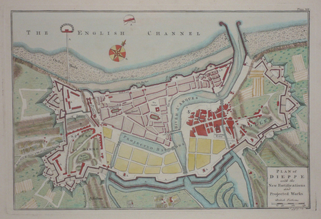
JEFFERYS (Thomas);
[DIEPPE] Plan of Dieppe with the new fortifications and projected works.
London 1774 209 x 312 mm.
Bookseller reference : LBW03d47
|
|
|
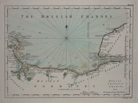
JEFFERYS (Thomas);
[NORMANDIE] 5th chart of the coast of France, from Fécamp to Cape Barfleur.
London 1774 180 x 248 mm.
Bookseller reference : LBW03d48
|
|
|
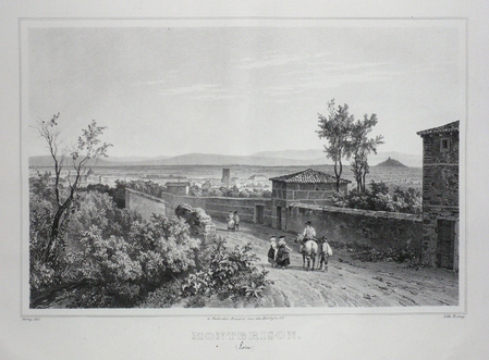
DEROY;
MONTBRISON (Loire).
Paris Benard circa 1850 221 x 295 mm.
Bookseller reference : LBW03d4b
|
|
|
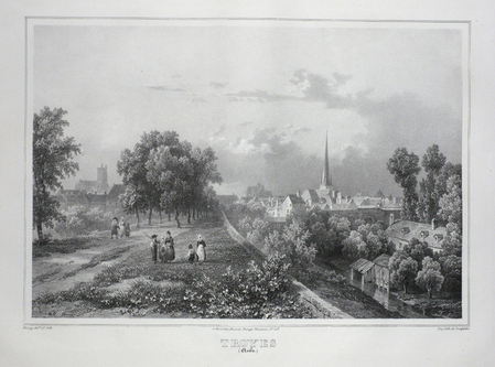
DEROY;
TROYES (Aube).
Paris Benard circa 1850 224 x 298 mm.
Bookseller reference : LBW03d4c
|
|
|
SANDMANN;
STRASBOURG (Bas-Rhin).
Paris Benard circa 1850 217 x 294 mm.
Bookseller reference : LBW03d4d

|
|
|
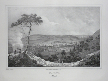
SANDMANN;
NANCY (Meurthe).
Paris Benard circa 1850 218 x 293 mm.
Bookseller reference : LBW03d4e
|
|
|
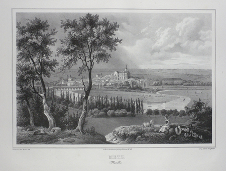
SANDMANN;
METZ (Moselle).
Paris Benard circa 1850 224 x 292 mm.
Bookseller reference : LBW03d4f
|
|
|
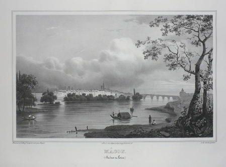
VIARD;
MACON (Saône et Loire).
Paris Benard circa 1850 210 x 289 mm.
Bookseller reference : LBW03d50
|
|
|
TIRPENNE & MONTHELIER.
LYON (Rhône).
Paris, Benard, [circa 1850]. 221 x 292 mm.
Bookseller reference : LBW03d51

|
|
|
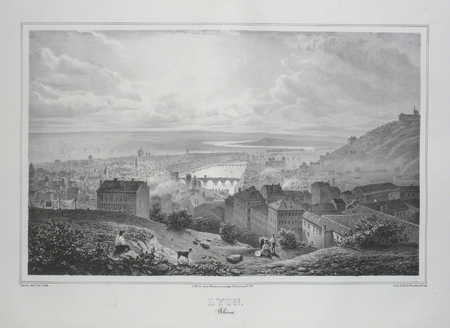
VIARD.
LYON (Rhône).
Paris, Benard, [circa 1850]. 217 x 302 mm.
Bookseller reference : LBW03d52
|
|
|
DEROY;
DIJON (Côte-d'Or).
Paris Benard circa 1850 226 x 298 mm.
Bookseller reference : LBW03d54

|
|
|
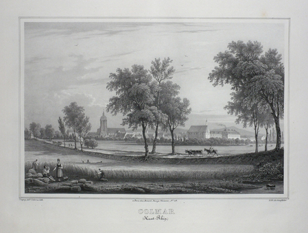
CHAPUY;
COLMAR (Haut-Rhin).
Paris Benard circa 1850 218 x 291 mm.
Bookseller reference : LBW03d55
|
|
|
LEBORNE;
CHALONS (Marne).
Paris Benard circa 1850 225 x 295 mm.
Bookseller reference : LBW03d56
|
|
|
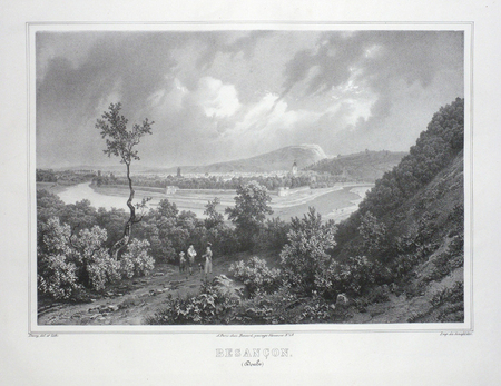
DEROY;
BESANCON (Doubs).
Paris Benard circa 1850 231 x 298 mm.
Bookseller reference : LBW03d57
|
|
|
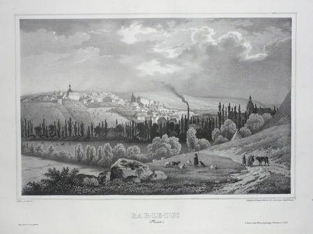
SANDMANN;
BAR-LE-DUC (Meuse).
Paris Benard circa 1850 222 x 295 mm.
Bookseller reference : LBW03d58
|
|
|
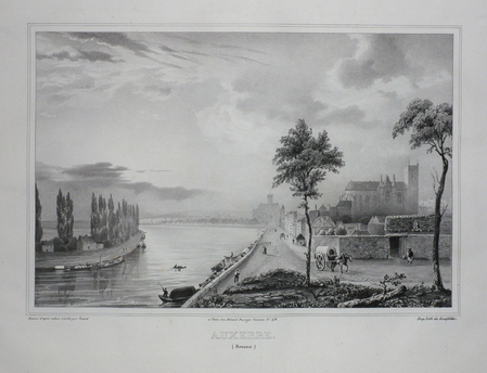
VIARD;
AUXERRE (Yonne).
Paris Benard circa 1850 220 x 291 mm.
Bookseller reference : LBW03d59
|
|
|
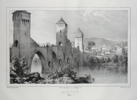
HOSTEIN;
CAHORS (Lot).
Paris Benard circa 1850 213 x 298 mm.
Bookseller reference : LBW03d5a
|
|
|
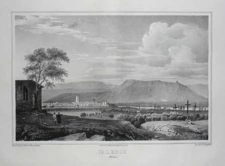
VIARD;
VALENCE (Drôme).
Paris Benard circa 1850 218 x 297 mm.
Bookseller reference : LBW03d5c
|
|
|
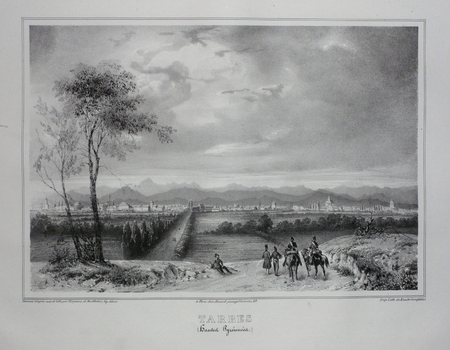
TIRPENNE;MONTHELIER;
TARBES (Hautes Pyrénnées).
Paris Benard circa 1850 219 x 281 mm.
Bookseller reference : LBW03d5d
|
|
|
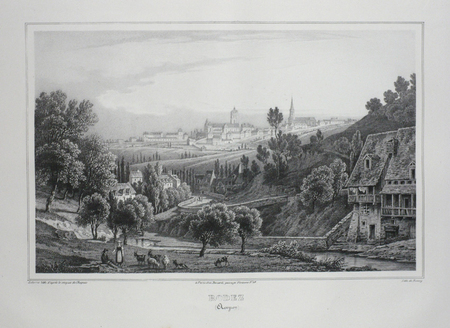
CHAPUIS;
RODEZ (Aveyron).
Paris Benard circa 1850 217 x 298 mm.
Bookseller reference : LBW03d5e
|
|
|
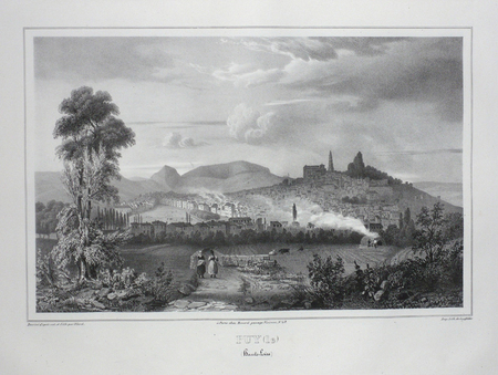
VIARD;
PUY (LE) (Haute-Loire).
Paris Benard circa 1850 215 x 292 mm.
Bookseller reference : LBW03d5f
|
|
|
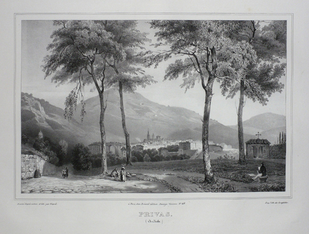
VIARD;
PRIVAS (Ardèche).
Paris Benard circa 1850 225 x 298 mm.
Bookseller reference : LBW03d60
|
|
 Receive by email
 Download as PDF document
 RSS feed


