|
Philip's Maps
Philip's 2019 Multiscale Road Atlas Europe: A4 Spiral binding Philips Road Atlas
Philip's 2018. Spiral-bound. New. 280 pages. 11.50x8.58x0.55 inches. Philip's unknown
Bookseller reference : 2-184907478X ISBN : 184907478X 9781849074780
|
|
|
Hema Maps
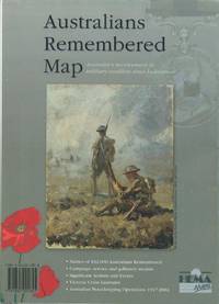
Australians remembered map : Australia's involvement in military conflicts since Federation.
Brisbane: Hema Maps 2002. soft cover. VG. Very good condition with light shelf wear to covers small mark on front from price label./No Jacket. Large fold-out map. Hema Maps paperback
Bookseller reference : 38925 ISBN : 1865001848 9781865001845
|
|
|
Hema Maps
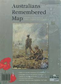
Australians remembered map : Australia's involvement in military conflicts since Federation.
Brisbane: Hema Maps 2002. soft cover. VG. Very good condition with light shelf wear to covers small mark on front from price label slight rubbing./No Jacket. Large fold-out map. Hema Maps paperback
Bookseller reference : 38926 ISBN : 1865001848 9781865001845
|
|
|
[EIGHT MANUSCRIPT PROVINCAL COLOR GOUACHE MAPS OF KOREA]
P'ALTO CHIDO OR EIGHT PROVINCES KOREA MAPS. KOREAN PROVINCAL MANUSCRIPT MAPS
Korea late 18th-early 19th century 1780-1810. Eight color gouache pastel tinted maps ca. 57.5 x 90.1 cm.contemporary re-backing very solid clean examples complete set of all provinces hand-painted gouache manuscripts. RARE & OBSCURE . . . . A RARE & COMPLETE SET OF ANTIQUARIAN MANUSCRIPT KOREAN . . . YI PERIOD PROVINCIAL MAPS . . "PALTO CHIDO" OR "EIGHT PROVINCES MAPS" . . . DELUXE ELEPHANT FOLIO SIZE SHEETS . . . HAND-COLORED GOUACHE PASTELS . This is a very RARE & COMPLETE set of eight Korean provincial manuscript maps. Drawn circa 1780-1810 by an unsigned Korean cartographer. These maps are of historical importance giving place names isolating the time frame. . Painted on very thin finely hand-made mulberry-fiber tissue paper contemporary re-backed with a stiff hand-made paper. Beautifully hand-painted & colored in gouache pastels. . The record shows several reliable verities of manuscript maps showing the eight ancient Korean provinces. . Commonly these maps had no title cartographer's name date or other critical bibliographic colophon data. This is a common theme with Korean manuscript maps. . Political divisions of Korea are by and large mostly stable making name comparisons easier. . PROBABLE MAP TITLES INCLUDE: . a. The "SINJUNG-TONGGUK-YOJI-SUNGNAM:" "EIGHT SEPARATE MAPS EACH SHOWING ONE COMPLETE PROVINCE OF THE EIGHT KOREAN PROVINCES similar in intention to the "PALTO CHIDO." . The eight provinces were established during the Chosen dynasty 1392-1910 alternately and commonly called the Yi dynasty. . The eight provinces are from the north to south: . 1. Hamgyong 2. P'yong'an 3. P'yongyang 4. Kangwon 5. Hwanghae 6. Kanghwa 7. Kyongsang 8. Cholla'ungch'ong . During the Sejo reign 1455-68 Yang Songji made the first "P'Alt-do "PALTO CHIDO" type maps of the eight provinces this type and style became the "standard" for future examples. There after his style and format were copied by others for centuries. . b. A second version and style of the above eight provinces maps is called "TONGGUK CHIDO: MAP OF THE EASTERN COUNTRY i.e. KOREA" showing a compressed northern frontier along Manchuria the characteristic "CHONG CH'OK" style. . c. A third similar map: "P'ALDO-CHONGDO: A SINGLE MAP SHOWING THE EIGHT PROVINCES OF KOREA." . These maps are pictorially beautiful and artistically drawn in detail. Graphics expressing a primitive naive folk charm depicts prominent geological landscape features. Mountain ranges hills forests in green streams/rivers blues political district seats distinctively painted cartouches box-like in various differing colors for each province. Roads paddy coastal shore line & islands in blue tints with other features nicely colored. . There are a large number of name throughout each map all written in Hanzi traditional Chinese characters called "Hanja" in Korean as was the common practice at that time for Koreans. There are no Hangul characters at all. The Hanja identify navigational directions names of surrounding ocean harbors beaches geographical names city towns villages mountains rivers roads and the like. . Each of the eight maps illustrates a complete single province. Within each of the various political divisions and boundaries outlined and named. . RARITY OF KOREAN ANTIQUITIES: Antiquarian Korean examples are sparse when compared to items of the same period in China and Japan. Korean works are less than 10% of those created elsewhere. . Fewer Korean items were made survived and preserved. The attrition rate: bad weather unstable ancient mud building structures fires natural disasters earthquakes war and other factors diminished the remaining examples. . Those the numbers that come to marked are steadily reduced while the value continues to appreciate. Many never return to market when acquired by institutions or private collectors who eventually donate to museums. . DATING THESE MAPS: These were mostly undated. . There are three possible methods of dating. . a. BY PLACE NAME: there are details in the reference books about county seat names being colored or put in various kinds of 'boxes' on the map depending on that according to the resources approximate dates can be derived. . b. PAPER TECHNOLOGY & FIBERS: Koreans have been using hand-made mulberry bark and fiber paper from the Zhenguan period AD 627-649 printing Buddhist sutras by woodblocks on similar kinds of paper. . These two technologies papermaking and woodblock printing was transmitted to Japan around 700 AD. . Since that time both Koreans & Japanese have utilized mulberry paper Washi in Japanese to woodblock print and paint a large variety of items including maps books and single page works. . By comparing the paper of these maps with known dated printed Japanese books a very close approximate date can be derived. . These Korean map papers are nearly identical to dated woodblock-printed Japanese examples we have. It is therefore highly possible these maps were painted on hand-made mulberry paper from circa 1780-1810 period. . In ancient times sheet size was limited to a small size then joined to other sheets to create a large size single sheet. These maps are of that format. See McCune below where he states the kind of paper used which matches our examples. . CONDITION: Per McCune we summarize: as usual these maps were folded several times from their creation time so they could be safely stored and carried in small 'book' format in covers with a tied string. See McCune below. . Being painted on very fine & thin hand-made mulberry paper most all examples were eventually re-backed. Ours as typical have period re-backing using the same character hand-made mulberry fiber paper of a thicker quality. . They are well preserved however nevertheless as usual there remains some old original wear at the folds the expected light water stains dustiness with other typical very minor flaws for an item of this grand size being 200 years old. These do not detract from the overall excellent impression and stunning appeal. . RARITY: . The complete set is RARE! The work is nicely executed in a firm hand with artistic value illustrating artistically hills mountains and other features of the map pictorially. It is not only a map but a work of art. Tastefully colored in subtle pastels nice representation of water rives and sea. . Such early and beautifully artistic examples seldom come to market. . A RARE AND FRESH EXAMPLE NEVER BEEN ON THE MARKET IN THE LAST 120 YEARS ! . PROVENANCE: These items were acquired from a former missionary's estate who was stationed in Korea from circa 1900-1930's. They have been in this private collection since and have never been on the market. . Color scans are posted to our website. . REFERENCES: . TOOLEY Ronald V. et al.: Article: Shannon McCune: SOME KOREAN MAPS pp.70-102 with illustrations. McCUNE Shannon.: KOREAN MAPS OF THE YI DYNASTY KOREAN CULTURE Korean Consulate General L.A. Ca. Sept. 1983 pp.21-31 34 back cover color plate color & b.w. illustrated. . He discusses "PALTO CHIDO""EIGHT PROVINCES MAP" origins maps without scale and were copies of a Korean scholar named Won his title was: Haksaeng works based on Chong Choks 1390-1475 TONGGUK CHIDO MAP OF THE EASTERN COUNTRY then modified by Won to be the more typical "PALTO CHIDO" "EIGHT PROVINCES MAP" but in his new style. This new style clearly resembles our maps in layout format color of county seats and similar boxes around them and other critical details. KOREAN CONSUL GENERAL KOREAN CULTURE September 1983 pp.21-31 34 color map on back cover color and b.w. illustrated. . It was from these maps that the later versions similar to ours eventually emerged mostly by Imperial Order by the ".Yi Dynasty court specifically decreed that both magistrates and governors should prepare up-to-date maps of their territories udder their supervision." p.25. HARLEY J.B. ed. et al.: CARTOGRAPHY IN THE TRADITIONAL EAST AND SOUTHEAST ASIAN SOCIETIES. Ahead of Title: THE HISTORY OF CARTOGRAPHY Vol. 2 Book 2 an excellent article by Gari Ledyard: CARTOGRAPHY IN KOREA pp. 235-345239 figures 10.23 10.24 et al. NAKAMURA Hiroshi.: EAST ASIA IN OLD MAPS. . --. NIHON KO CHIZU TAISEI: GREAT COLLECTION OF OLD JAPANESE MAPS MONUMENTA CARTOGRAPHICA JAPONICA . --. OLD CHINESE WORLD MAPS PRESERVED BY THE KOREANS. Article in IMAGO MUNDI IV 1958. LEE Chan. CH'AN Yi.: OLD MAPS OF KOREA. Han'guk ko chido. By: Ch'an Yi Hong-gyu Che Han'guk Tosogwanhak Yon'guhoe. He discusses and illustrates a good number of similar examples. On pp.226-27 he outlines an early Yi Dynasty example of: THE MAP OF EIGHT provinces found in TONGGUK YOJI SUNGNAM Chong Sang-gi's Tongguk Chido. These manuscripts were on large paper one province per sheet. Many other fine related examples are illustrated & discussed. . --. OLD MAPS OF KOREA: HISTORICAL SKETCH. He traces the early origins of Early Yi dynasty1392-1910 Eight Provinces Map origins and progressions excellent lucid article with illustrations and references to Yi HOEs MAP OF EIGHT PROVINCES. Excellent essay on provincial maps. SHIN Michael D. ed.: KOREAN HISTORY IN MAPS: From Prehistory to the Twenty-First Century. British Museum similar examples cited: commons.wikimedia.org/wiki/Category:Room_67_British_Museum# /media/File:Map_of_the_Jeolla_Province_British_Library_c.27. f.14_fol.12_n02.jpg Library of Congress: https://www.loc.gov/item/84117116 THROWER NORMAN J.W. & Young Il Kim: dong-kookyu-do: A RECENTLY DISCOVERED MANUSCRIPT OF A MAP OF KOREA. Imago Mundi vol.21 1967 pp.31-49 illustrated. . . unknown
Bookseller reference : 38009901

|
|
|
Tucker, Glenn ; Tucker, Maps, WT. W. T.
Poltroons and Patriots: A Popular Account of the War of 1812 Two volumes
Bobbs-Merrill 1954. Very Good. Tucker Glenn . Poltroons and Patriots: A Popular Account of the War of 1812 Two volumes. Tucker Maps W.T. Indianapolis: Bobbs-Merrill 1954. 812pp. Indexed. Illustrated. 8vo. Cloth with gilt lettering. Book condition: Very good with lightly bumped and yellowed spines. Slipcase is very good with light rubbing and yellowing. Includes monthly bulletin of American History Publication Society. Bobbs-Merrill hardcover
Bookseller reference : UTUCPOL00JMJ
|
|
|
Bear Grylls; Collins Maps Staff; Times Books Staff
Extreme Survivors : 60 of the World's Most Extreme Survival Stories
HarperCollins Publishers Limited 2012. Paperback. Acceptable. Readable copy. Pages may have considerable notes/highlighting. ~ ThriftBooks: Read More Spend Less.Dust jacket quality is not guaranteed. HarperCollins Publishers Limited paperback
Bookseller reference : G0007482779I5N00 ISBN : 0007482779 9780007482771

|
|
|
Compass Maps Ltd
Italian Speakout
Map Group The 2005. Paperback. Acceptable. Disclaimer:A readable copy. All pages are intact and the cover is intact. Pages can include considerable notes-in pen or highlighter-but the notes cannot obscure the text. At ThriftBooks our motto is: Read More Spend Less.Dust jacket quality is not guaranteed. Map Group, The paperback
Bookseller reference : G1904766358I5N00 ISBN : 1904766358 9781904766353

|
|
|
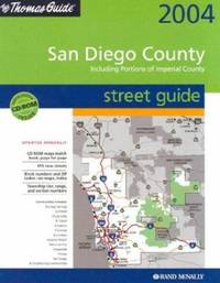
Thomas Bros Maps
Thomas Guide 2004 San Diego Including Portions of Imperial County: Street Guide San Diego County Including Portions of Imperial County Street Guide and Directory
Thomas Brothers Maps 2003. Paperback. Acceptable. Readable copy. Pages may have considerable notes/highlighting. ~ ThriftBooks: Read More Spend Less.Dust jacket quality is not guaranteed. Thomas Brothers Maps paperback
Bookseller reference : G0528999303I5N00 ISBN : 0528999303 9780528999307
|
|
|
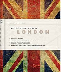
Philip's Maps
Philip's Gift Edition Street Atlas London - new hardback edition: De Luxe Edition Union Jack Philip's Street Atlas
Paperback. Very Good. paperback
Bookseller reference : GOR009716632 ISBN : 1849074550 9781849074551
|
|
|
MURRAY'S HANDY CLASSICAL MAPS.
Italia and Sicilia. Edited by G.B. Grundy. Including Index.
London John Murray n.d. ca. 1903 11 index p. Two folding maps 47x60 cm in red cloth binding. 24 cm The maps arew mounted on cloth and also bound in a cloth case Back slightly damaged. Some wear to the folds of the maps hardcover
Bookseller reference : 155159
|
|
|
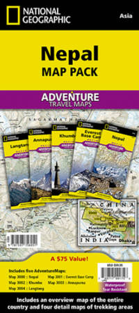
National Geographic Maps - Adventure
Nepal Map Pack Bundle National Geographic Adventure Map
National Geographic 2023-01-01. 2023. map. New. 4.72x1.02x9.06. Buy with confidence. Excellent Customer Service & Return policy. National Geographic unknown
Bookseller reference : DADAX1597756059 ISBN : 1597756059 9781597756051
|
|
|
maps, Nicolson
Edinburgh City Atlas
Nicolson Maps. Very Good. 2000. Paperback. 1860970826 . Minor signs of ownership shelf wear to corners & edges only ow clean and tight. ; 2nd; 8vo 8" - 9" tall; 100 pages . Nicolson Maps paperback
Bookseller reference : 22316 ISBN : 1860970826 9781860970825
|
|
|
National Geographic Maps
Benchmark California Road & Recreation Atlas
National Geographic 2013-01-01. 9. map. Used: Good. 11.00x0.25x15.50. Buy with confidence. Excellent Customer Service & Return policy. National Geographic unknown
Bookseller reference : SONG0929591496 ISBN : 0929591496 9780929591490

|
|
|
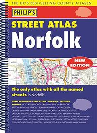
Philip's Maps
Philip's Street Atlas Norfolk: Spiral Edition
Paperback. Very Good. paperback
Bookseller reference : GOR008843537 ISBN : 1849074283 9781849074285
|
|
|
Collins Maps
Short Walks in the Cotswolds: Guide to 20 Local Walks
HarperCollins Publishers Limited. Used - Very Good. Ships from the UK. Former library book; may include library markings. Used book that is in excellent condition. May show signs of wear or have minor defects. HarperCollins Publishers Limited unknown
Bookseller reference : GRP95877949 ISBN : 0007555008 9780007555000

|
|
|
Cartes Taride:
Midi De La France: section centrale
Cartes Taride Pour Cyclistes et Autmobiles Paris no date : 1930's Linen-backed folding coloured map; No. 18 in the series; Somewhat dirtied 'Royal Automobile Club Touring Department' stamp also a previous private owner's signature vg. Cartes Taride Pour Cyclistes et Autmobiles, Paris, no date : 1930's ? unknown
Bookseller reference : 7368

|
|
|
Cartes Taride:
Lyonnais: Savoie Dauphine
Cartes Taride Pour Cyclistes Et Automobilistes Paris no date: 1930's Cloth backed folding coloured map; No. 14 in the series; Some staining vg. Cartes Taride Pour Cyclistes Et Automobilistes, Paris, no date: 1930's ? hardcover
Bookseller reference : 7369

|
|
|
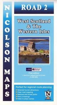
Nicolson Maps
Road 2: West Scotland & The Western Isles
Paperback. Very Good. paperback
Bookseller reference : GOR006735234 ISBN : 1860973353 9781860973352
|
|
|
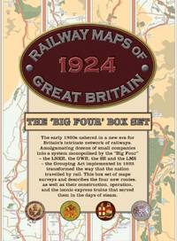
Old House Books & Maps
Railway Maps of Great Britain 1924: The âBig Fourâ Box-set
Paperback. Very Good. paperback
Bookseller reference : GOR006268288 ISBN : 1908402318 9781908402318
|
|
|
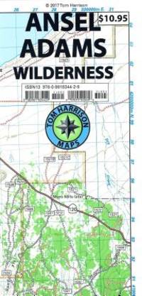
Tom Harrison Maps
Ansel Adams Wilderness Trail Map Tom Harrison Maps
Ingramcontent 2017-05-01. 2. map. New. 4.00x0.05x7.40. Buy with confidence. Excellent Customer Service & Return policy. Ingramcontent unknown
Bookseller reference : DADAX0981834426 ISBN : 0981834426 9780981834429
|
|
|
Kingsolver, Barbara; Cartes (translator), Rebeca
Another America Otra America with Spanish Translations
Seal Press 1992. Very Good. Kingsolver Barbara. Another America Otra America with Spanish Translations. Cartes translator Rebeca. Seattle: Seal Press 1992. 103pp. 12mo. Paperback. Book condition: Very good with lightly rubbed and bumped edges. Seal Press paperback
Bookseller reference : UKINANO00CCW
|
|
|
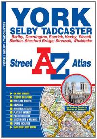
AaZ maps
York A-Z Street Atlas
Paperback. Very Good. paperback
Bookseller reference : GOR005524906 ISBN : 1843488094 9781843488095
|
|
|
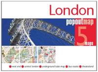
Popout Maps
London PopOut Map: 5 maps: west end central london underground tube map bus routes theatreland PopOut Maps
Paperback. Very Good. paperback
Bookseller reference : GOR005369203 ISBN : 1845878558 9781845878559
|
|
|
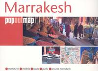
Maps, Compass
Marrakesh
Compass Maps. As New. 2007. Map. 1845877047 . Clean tight & bright no marks or inscriptions as new. Handy pocket size. ; Popout Map; 5.91 X 3.46 X 0.47 inches; 1 pages . Compass Maps unknown
Bookseller reference : 18226 ISBN : 1845877047 9781845877040
|
|
|
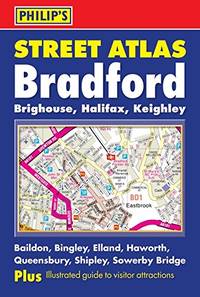
Philip's Maps
Philip's Street Atlas Bradford: Brighouse Halifax Keighley
Paperback. Very Good. paperback
Bookseller reference : GOR005059074 ISBN : 0540091715 9780540091713
|
|
|
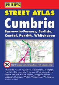
Philip's Maps
Philip's Street Atlas Cumbria: Pocket Edition
Paperback. Very Good. paperback
Bookseller reference : GOR004987579 ISBN : 1849071802 9781849071802
|
|
|
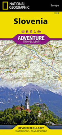
National Geographic Maps - Adventure
Slovenia Map National Geographic Adventure Map 3311
National Geographic 2022-01-01. 2022. map. Used: Good. 4.25x0.16x9.25. Buy with confidence. Excellent Customer Service & Return policy. National Geographic unknown
Bookseller reference : SONG1566955432 ISBN : 1566955432 9781566955430
|
|
|
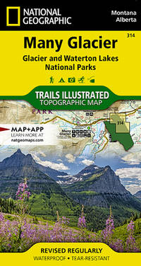
National Geographic Maps
Many Glacier: Glacier and Waterton Lakes National Parks Map National Geographic Trails Illustrated Map 314
Natl Geographic Society Maps 2021-03-20. 2021. map. Used: Good. 3.90x0.40x7.10. Buy with confidence. Excellent Customer Service & Return policy. Natl Geographic Society Maps unknown
Bookseller reference : SONG1566954703 ISBN : 1566954703 9781566954709
|
|
|
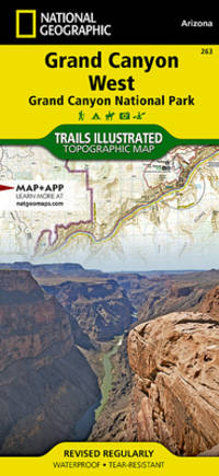
National Geographic Maps
Grand Canyon West Grand Canyon National Park National Geographic Trails Illustrated Map National Geographic Trails Illustrated Map 263
Natl Geographic Society Maps 2024-01-01. 2024. map. Used: Good. 4.25x0.16x9.25. Buy with confidence. Excellent Customer Service & Return policy. Natl Geographic Society Maps unknown
Bookseller reference : SONG1566954967 ISBN : 1566954967 9781566954969
|
|
|
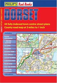
Philip's Maps
Philip's Red Books Dorset
Paperback. Good. paperback
Bookseller reference : GOR004607305 ISBN : 0540094714 9780540094714
|
|
|
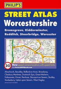
Philip's Maps
Philip's Street Atlas Worcestershire Philip's Street Atlases
Paperback. Very Good. paperback
Bookseller reference : GOR004622515 ISBN : 0540092126 9780540092123
|
|
|
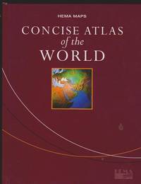
Hema Maps Staff
Concise Atlas of the World
Brisbane Australia: Hema Maps Pty Ltd 2003 The cover has minor shelf wear. 176 pages. Books listed here are not stored at the shop. Please contact us if you want to pick up a book from Newtown. Hard Cover. Very Good/No Dust Jacket. Size F: 9"-10" Tall 228-254mm. Hema Maps Pty Ltd hardcover
Bookseller reference : 119581 ISBN : 186500250x 9781865002507
|
|
|
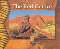
Hema Maps Staff
The Pocket Guide to the Red Centre
Eight Mile Plains QLD Australia: Hema Maps Pty Limited 2003 158 pages. Books listed here are not stored at the shop. Please contact us if you want to pick up a book from Newtown. Paperback. Very Good. Size B: 5"-6" Tall 125-151mm. Hema Maps Pty, Limited paperback
Bookseller reference : 47847 ISBN : 1865001406 9781865001401
|
|
|
Philip's Maps
Philip's Street Atlas Berkshire
Hardback. Very Good. hardcover
Bookseller reference : GOR003416006 ISBN : 0540084921 9780540084920

|
|
|
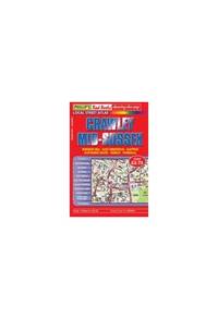
Philip's Maps
Philip's Red Books Crawley and Mid-Sussex
Paperback. Very Good. paperback
Bookseller reference : GOR002750082 ISBN : 0540093556 9780540093557
|
|
|
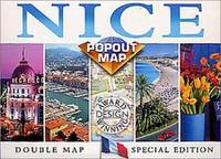
Compass Maps
Nice Europe Popout Maps
Paperback. Very Good. paperback
Bookseller reference : GOR002464537 ISBN : 1841393614 9781841393612
|
|
|
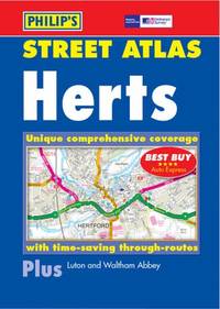
Philip's Maps
Hertfordshire Street Atlas
Paperback. Very Good. paperback
Bookseller reference : GOR002990680 ISBN : 0540076821 9780540076826
|
|
|
Philip's Maps
Hertfordshire Street Atlas
Paperback. Acceptable. paperback
Bookseller reference : GOR002138718 ISBN : 0540076821 9780540076826

|
|
|
Philip's Maps
Philip's Red Books Crawley and Mid-Sussex
Paperback. Good. paperback
Bookseller reference : GOR002505935 ISBN : 0540093556 9780540093557

|
|
|
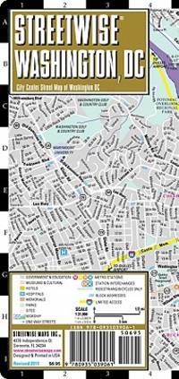
Streetwise Maps
Streetwise Washington DC Map - Laminated City Center Street Map of Washington DC
StreetWise 2010-01-01. map. Used: Good. 3.75x0.25x8.50. Buy with confidence. Excellent Customer Service & Return policy. StreetWise unknown
Bookseller reference : SONG0935039066 ISBN : 0935039066 9780935039061
|
|
|
Heyerdahl, Thor
Kon-Tiki: A Special Rand McNally Edition for Young People
Sturtevant Wisconsin U.S.A.: Rand McNally 1975. First Thus . Soft cover. Fine. 4to - over 9¾" - 12" tall. Very large sturdy softcover heavy glossy textured wrappers with color-illustration of raft upon the seas on front and back wrappers 165 heavy pages profusely illustrated color-illustrations of big fish inside front wrapper and adjacent end paper color maps with routes inside back wrappers and adjacent end paper. Price near top front tip inked out. Near Very Fine. <br/> <br/> Rand McNally paperback
Bookseller reference : 39790 ISBN : 0528871757 9780528871757
|
|
|
Hammond Maps
HAMMOND'S ILLUSTRATED ATLAS FOR YOUNG AMERICA
Maplewood NJ: C.S. Hammond and Company 1956. Yellow hardcover binding soiled square and tight. Bumped corners. Bit of paper missing along spine. Endpapers with index and facts hinges good. 92 pages with a few small closed tears. Part of the Weekly Reader Children's Book Club - full color maps and up-to-date well through 1956! facts with new concepts about our physical and political world. Size: 8vo - over 7¾" - 9¾" tall. Illus. by Illustrated. Hardcover. Good/No Jacket. C.S. Hammond and Company Hardcover
Bookseller reference : 08337
|
|
|
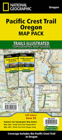
National Geographic Maps - Trails Illust
Pacific Crest Trail: Oregon Map Pack Bundle National Geographic Trails Illustrated Map
Natl Geographic Society Maps. New. Special order direct from the distributor Natl Geographic Society Maps unknown
Bookseller reference : ING9781566958189 ISBN : 1566958180 9781566958189
|
|
|
Hema Maps (Firm)
Sydney Handy Map
map. Good. Access codes and supplements are not guaranteed with used items. May be an ex-library book. unknown
Bookseller reference : 1875992413.G ISBN : 1875992413 9781875992416
|
|
|
Hedberg Maps
Colleges & Universities of the US
map. Good. Access codes and supplements are not guaranteed with used items. May be an ex-library book. unknown
Bookseller reference : 1885508328.G ISBN : 1885508328 9781885508324

|
|
|
A-Z Maps
Great Britain A-Z Super Scale Road Atlas 2025 A3 Spiral
Geographers� A-Z Map Co Ltd 28/03/2024 00:00:01. spiral_bound. Good. 1.2990 in x 37.9711 in x 28.7781 in. Geographers� A-Z Map Co Ltd unknown
Bookseller reference : mon0000497700 ISBN : 0008652953 9780008652951
|
|
|
Wide World Of Maps
Tucson Metropolitan Street Atlas 2002 Edition
Wide World of Maps Incorporated 2002. Unknown. Very Good. May have limited writing in cover pages. Pages are unmarked. ~ ThriftBooks: Read More Spend Less.Dust jacket quality is not guaranteed. Wide World of Maps, Incorporated unknown
Bookseller reference : G1887749330I4N00 ISBN : 1887749330 9781887749336
|
|
|
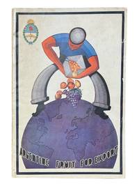
[Argentina] [Maps] Ministry of Agriculture
Argentine Fruit for Export January 1935
Buenos Aires: Argentine Republic Ministry of Agriculture Division of Control of Fruit Production 1935. First edition. 8vo 36pp plus fold out map at rear showing fruit producing zones of Argentina. In English with photos throughout. Illustrated wrappers with light chipping to edges. Clean internally and very good. <br /> <br /> Scarce and attractive Buenos Aires imprint with fold out map. OCLC cites 6 holdings. Argentine Republic, Ministry of Agriculture, Division of Control of Fruit Production unknown
Bookseller reference : 9159
|
|
|
[Pennsylvania] [Pictorial Maps] King, Samuel A.
Cornplanter's Kingdom: The Allegheny National Forest and Environs
DuBois PA: Samuel A. King 1952. Revised 1952. Folding map 25x19" printed in red and black. Sportsman's club label to upper margin with some offsetting to lower. Small split at fold intersections title and a few stains to blank verso otherwise a clean near fine example. <br /> <br /> Very popular map which was originally designed and published by Samuel A. King in 1951 and revised in 1952 and 54. According to OCLC there were also 1960s and 70s printings under slightly different titles. This map shows the Allegheny National Forest and surrounding counties with animal silhouettes tracks and a portrait of John O'Bail the Cornplanter last of the great Seneca chiefs. Made for motorists hunters and anglers it shows paved and clay roads trails pipe and power lines fire and lookout towers state parks game lands airports and towns with post offices.  <br /> <br /> The early copies of this map are somewhat scarce and there are many modern reprints available. OCLC cites 8 holdings for the '51-54 editions with just 1 being the '52. A lovely example.  . Samuel A. King unknown
Bookseller reference : 9160

|
|
|
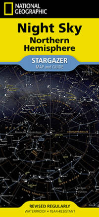
National Geographic Maps - Reference
National Geographic Night Sky - Northern Hemisphere Map Stargazer folded National Geographic Reference Map
National Geographic 2024-03-06. 2024. map. Used: Good. 4.25x0.10x9.25. Buy with confidence. Excellent Customer Service & Return policy. National Geographic unknown
Bookseller reference : SONG1566959500 ISBN : 1566959500 9781566959506
|
|
 Receive by email
 Download as PDF document
 RSS feed


