|
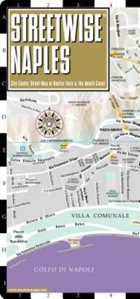
Streetwise Maps
Streetwise Naples Map - Laminated City Center Street Map of Naples Italy - Folding pocket size travel map with metro lines & stations
map. Good. Access codes and supplements are not guaranteed with used items. May be an ex-library book. unknown
Referentie van de boekhandelaar : 1886705968.G ISBN : 1886705968 9781886705968
|
|
|
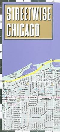
Streetwise Maps
Streetwise Chicago Map - Laminated City Center Street Map of Chicago Illinois - Folding pocket size travel map with CTA Metra map Streetwise Maps
map. Good. Access codes and supplements are not guaranteed with used items. May be an ex-library book. unknown
Referentie van de boekhandelaar : 1931257345.G ISBN : 1931257345 9781931257343
|
|
|
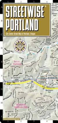
Streetwise Maps
Streetwise Portland Map - Laminated City Center Street Map of Portland Oregon - Folding pocket size travel map with Max Light Rail map
map. Good. Access codes and supplements are not guaranteed with used items. May be an ex-library book. unknown
Referentie van de boekhandelaar : 1886705518.G ISBN : 1886705518 9781886705517
|
|
|
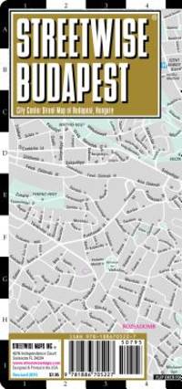
Streetwise Maps
Streetwise Budapest Map - Laminated City Center Street Map of Budapest Hungary - Folding pocket size travel map with metro map
map. Good. Access codes and supplements are not guaranteed with used items. May be an ex-library book. unknown
Referentie van de boekhandelaar : 1886705224.G ISBN : 1886705224 9781886705227
|
|
|
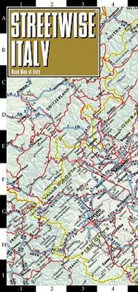
Streetwise Maps
Streetwise Italy Map - Laminated Country Road Map of Italy - Folding pocket size travel map with major city distance chart
map. Good. Access codes and supplements are not guaranteed with used items. May be an ex-library book. unknown
Referentie van de boekhandelaar : 1886705569.G ISBN : 1886705569 9781886705562
|
|
|
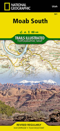
National Geographic Maps - Trails Illustrated
Moab South National Geographic Trails Illustrated Map 501
map. Good. Access codes and supplements are not guaranteed with used items. May be an ex-library book. unknown
Referentie van de boekhandelaar : 1566953561.G ISBN : 1566953561 9781566953566
|
|
|
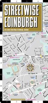
Streetwise Maps Inc.
Streetwise Edinburgh Map - Laminated City Center Street Map of Edinburgh Scotland Streetwise Streetwise Maps
map. Good. Access codes and supplements are not guaranteed with used items. May be an ex-library book. unknown
Referentie van de boekhandelaar : 1931257450.G ISBN : 1931257450 9781931257459
|
|
|
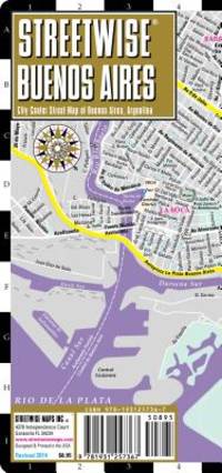
Streetwise Maps
Streetwise Buenos Aires Map - Laminated City Center Street Map of Buenos Aires Argentina
map. Good. Access codes and supplements are not guaranteed with used items. May be an ex-library book. unknown
Referentie van de boekhandelaar : 1931257361.G ISBN : 1931257361 9781931257367
|
|
|
Streetwise Maps
Streetwise Prague Map - Laminated City Center Street Map of Prague Czech Republic
map. Good. Access codes and supplements are not guaranteed with used items. May be an ex-library book. unknown
Referentie van de boekhandelaar : 1886705208.G ISBN : 1886705208 9781886705203

|
|
|
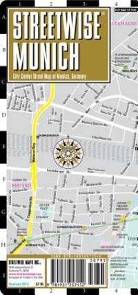
Streetwise Maps
Streetwise Munich Map - Laminated City Center Street Map of Munich Germany - Folding pocket size travel map with metro map including S-Bahn & U-Bahn
map. Good. Access codes and supplements are not guaranteed with used items. May be an ex-library book. unknown
Referentie van de boekhandelaar : 1931257159.G ISBN : 1931257159 9781931257152
|
|
|
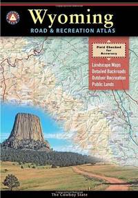
Benchmark Maps
Benchmark Wyoming Road and Recreation Atlas
paperback. Good. Access codes and supplements are not guaranteed with used items. May be an ex-library book. paperback
Referentie van de boekhandelaar : 0929591968.G ISBN : 0929591968 9780929591964
|
|
|
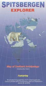
Ocean Explorer Maps
Spitsbergen Explorer Map by Ocean Explorer Maps
map. Good. Access codes and supplements are not guaranteed with used items. May be an ex-library book. unknown
Referentie van de boekhandelaar : 0953861813.G ISBN : 0953861813 9780953861811
|
|
|
Collins Maps
Scotland Touring Map: Ideal for exploring
map. Good. Access codes and supplements are not guaranteed with used items. May be an ex-library book. unknown
Referentie van de boekhandelaar : 0008320373.G ISBN : 0008320373 9780008320379

|
|
|
Mary Welsh, illus Margaret Clarke and David Macaulay, maps by Don Clarke
Walks on the Isle of Skye
Westmorland Gazette 1990 37 walks in all parts of the island. Name to title page otherwise VG. Westmorland Gazette paperback
Referentie van de boekhandelaar : 13226 ISBN : 0902272837 9780902272835

|
|
|
FOUR LARGE COLOUR MAPS OF RHUM: North West North East South West and South East. Scale 1:10000
Glasgow: Nature Conservancy/University of Glasgow 1972. Map. Very Good. Unframed. First Edition. 77 x 78 Cm. "Produced in the Department of Geography University of Glasgow on behalf of the Nature Conservancy. Printed by J. Bartholomew and Son Ltd. Edinburgh" Each map approximately 77 x 78 cm. These maps have been kept in a tube probably since published and have a little wear to edges and from being unrolled but are essentially in very good condition. Scarce. Nature Conservancy/University of Glasgow unknown
Referentie van de boekhandelaar : 034433
|
|
|
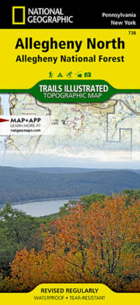
National Geographic Maps - Trails Illustrated
Allegheny North Map Allegheny National Forest National Geographic Trails Illustrated Map 738
map. Good. Access codes and supplements are not guaranteed with used items. May be an ex-library book. unknown
Referentie van de boekhandelaar : 1566956315.G ISBN : 1566956315 9781566956314
|
|
|
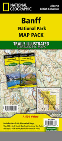
National Geographic Maps - Trails Illustrated
Banff National Park Map Pack Bundle National Geographic Trails Illustrated Map
map. Good. Access codes and supplements are not guaranteed with used items. May be an ex-library book. unknown
Referentie van de boekhandelaar : 1566957389.G ISBN : 1566957389 9781566957380
|
|
|
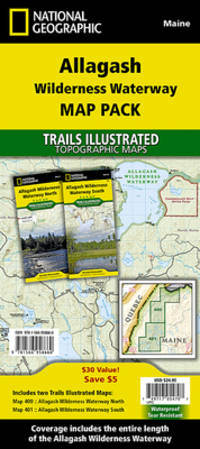
National Geographic Maps - Trails Illustrated
Allagash Wilderness Waterway Map Pack Bundle National Geographic Trails Illustrated Map
map. Good. Access codes and supplements are not guaranteed with used items. May be an ex-library book. unknown
Referentie van de boekhandelaar : 1566958660.G ISBN : 1566958660 9781566958660
|
|
|
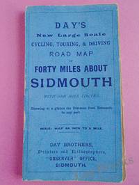
Day Brothers
DAY'S NEW LARGE SCALE CYCLING TOURING & DRIVING ROAD MAP OF FORTY MILES ABOUT SIDMOUTH With One Mile Circles Showing at a Glance the Distance from Sidmouth to any Part
Sidmouth: Day Brothers 1900. Map. Very Good. Unframed. New Edition. Undated but circa 1900 Engraved map main roads coloured orange 445 x 575 mm folding down to 150 x 85 mm with printed blue covers published by Day Brothers "Printers Stationers & Booksellers Observer Office Sidmouth". Generally in very good condition with light general wear and some rubbing to edges of covers. An attractive map. Scarce. Day Brothers unknown
Referentie van de boekhandelaar : 033970
|
|
|
A Z Maps
Oxford Map 2015 Britain
MAP. good. TRAV-EU unknown
Referentie van de boekhandelaar : sku1748
|
|
|
International Travel maps
Nepal: Travel Map
ITMB Publishing Ltd 2009. MAP. New. 4x0x9. 2009. Third edition. ITMB maps are often the best maps available for the regions covered. Scale: 1:530000. ITMB publishes folded travel maps in color with multiple levels of highways and roads often including seasonal roads and tracks. Color changes show elevation levels. Maps include national parks eco-tourist sites and other places of interest. Icons locate archeological sites hotels museums beaches active volcanoes surfings sites filling stations bird sanctuaries border crossings palm groves lighthouses reefs swamps. Icons distinguish international airports domestic airports and landing strips. Index to help locate towns and cities. Latitude/longitude grid. ITMB Publishing Ltd unknown
Referentie van de boekhandelaar : 12050 ISBN : 1553413415 9781553413417

|
|
|
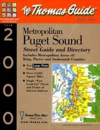
Thomas Brothers Maps Staff
Metropolitan Puget Sound Street Guide and Directory
Thomas Brothers Maps 1999. Spiral-bound. Good. Disclaimer:A copy that has been read but remains in clean condition. All pages are intact and the cover is intact. The spine may show signs of wear. Pages can include limited notes and highlighting and the copy can include previous owner inscriptions. At ThriftBooks our motto is: Read More Spend Less.Dust jacket quality is not guaranteed. Thomas Brothers Maps unknown
Referentie van de boekhandelaar : G1581742096I3N00 ISBN : 1581742096 9781581742091

|
|
|
Thomas Brothers Maps Staff
Metropolitan Puget Sound Street Guide and Directory
Thomas Brothers Maps 1999. Spiral-bound. Acceptable. Disclaimer:A readable copy. All pages are intact and the cover is intact. Pages can include considerable notes-in pen or highlighter-but the notes cannot obscure the text. At ThriftBooks our motto is: Read More Spend Less.Dust jacket quality is not guaranteed. Thomas Brothers Maps unknown
Referentie van de boekhandelaar : G1581742096I5N00 ISBN : 1581742096 9781581742091
|
|
|
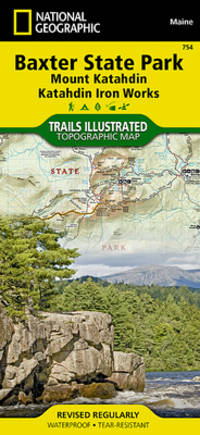
National Geographic Maps - Trails Illustrated
Baxter State Park Map Mount Katahdin Katahdin Iron Works National Geographic Trails Illustrated Map 754
National Geographic 2020-01-01. 2020. map. New. 3.80x0.30x9.00. Buy with confidence. Excellent Customer Service & Return policy. National Geographic unknown
Referentie van de boekhandelaar : DADAX1566955858 ISBN : 1566955858 9781566955850
|
|
|
Woolf, Virginia) Bell, Quentin and Maps on End Papers; b/w Photos
Virginia Woolf: Vol.2: Mrs Woolf 1912-1941: A Biography
Hardcover. Very Good. Near fine book & jacket hardcover
Referentie van de boekhandelaar : Y4-80S1-CTV5
|
|
|
Hermann, John and B/w Illustrations and Maps
Motorcycle Journeys Through the Alps
Paperback. Fine. paperback
Referentie van de boekhandelaar : 37-16KC-MF7A
|
|
|
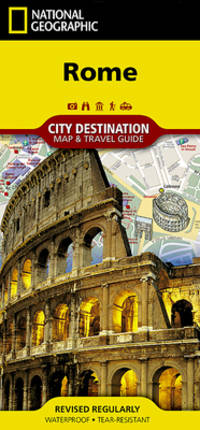
National Geographic Maps
Rome National Geographic Destination City Map
National Geographic Maps. New. Special order direct from the distributor National Geographic Maps unknown
Referentie van de boekhandelaar : ING9781566957700 ISBN : 1566957702 9781566957700
|
|
|
International Travel Maps
Bangkok & Thailand South: Travel Map
ITMB 2014-08-30. Map. New. 65x1x154. Scale: 1: 10000/900000. 2nd Edition. Bangkok is a very interesting city with many temples pagodas and historic buildings. It is also an airline hub and as a result of not being a member of IATA is a bargain-lover's city for lower-cost airfares. This updated edition includes the new airport recently-completed transit lines and additional information for embassies. In this edition the city map has been combined with a travel map for the southern half of the country which means the peninsula connecting to Malaysia and including the most-visited parts of Thailand - the beach resorts located in the vicinity of Phuket. This edition has been upgraded to plastic paper both for the tropical humidity and for durability. ITMB unknown
Referentie van de boekhandelaar : 14799 ISBN : 1553414780 9781553414780

|
|
|
Philip's Maps
Philip's Ireland Road Map Philip's Sheet Maps
Paperback. Very Good. paperback
Referentie van de boekhandelaar : GOR008270103 ISBN : 1849073597 9781849073592

|
|
|
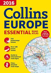
Collins Maps
2016 Collins Essential Road Atlas Europe
Paperback. Good. paperback
Referentie van de boekhandelaar : GOR007901646 ISBN : 0008146373 9780008146375
|
|
|
No Author
Road Map scale: 3 Miles to 1 inch for Motoring Cycling and Hiking: Section LL Exeter Torquay Plymouth Dartmoor Barnstaple Etc.
W. & A. K. Johnston Ltd 1949. Book. Very Good. Paperback. code 12/49 presumed to be December 1949. Large colour printed map folding down into pictorial card covers printed in red and green. Covers very good with light wear only. Map clean and bright no annotations or inscriptions a single 1cm split at central folding otherwise very light wear. A very good copy. W. & A. K. Johnston Ltd Paperback
Referentie van de boekhandelaar : 029337

|
|
|
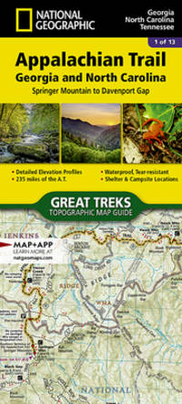
National Geographic Maps - Trails Illust
Appalachian Trail Springer Mountain to Davenport Gap Georgia North Carolina Tennessee National Geographic Topographic Map Guide 1501
National Geographic Maps. New. Special order direct from the distributor National Geographic Maps unknown
Referentie van de boekhandelaar : ING9781597756389 ISBN : 1597756385 9781597756389
|
|
|
Lavoisne (CV.). C. V.
LAVOISNE'S COMPLETE GENEALOGICAL HISTORICAL CHRONOLOGICAL AND GEOGRAPHICAL ATLAS
London: Printed and Published By J. Barfield 1840. Book. Very Good. Hardcover. Fourth Edition. Folio 30 x 46cm. "Revised Collated and Considerably Enlarged by John Satchell Esq." Seventy-four double-page engraved genealogical tables and geographical maps all with original hand colouring contemporary . half black morocco gilt with green cloth boards. Binding good with some general wear and rubbing leather chipped with loss to the base of the spine joints rubbed but still strong corners worn. All edges gilt./ Contents clean and tight contemporary ink stain effecting the fore-edges of the first few pages but not affecting text or maps most noticeable to the front end papers with also have a pencil inscription dated 30 November 1935. All maps and charts in very good condition. Notwitstanding wear to the binding a very good copy. Printed and Published By J. Barfield Hardcover
Referentie van de boekhandelaar : 018232
|
|
|
Chapman, K. F.; Lewis, C. C.; Lewis, F. V. (drawings and maps); Osborne, N. (photography)
Norton Lindsey
Warwick: H. H. Lacy 1970. 1st Edition 1st Printing. Paperback. Very Good/No Jacket. 8vo - over 7¾ - 9¾" tall. Lewis F. V. drawings and maps; Osborne N. photography. No date - circa 1970. Octavo paperback pamphlet 86 pp. Black & white drawings maps and photographs. Very Good condition. No inscriptions <br/> <br/> H. H. Lacy paperback
Referentie van de boekhandelaar : 055030
|
|
|
Philip's Maps
Philip's Encyclopedia 2002
Hardback. Very Good. hardcover
Referentie van de boekhandelaar : GOR002168404 ISBN : 0540080446 9780540080441

|
|
|
Young, Otis E.; Lenon, Robert
WESTERN MINING An Informal Account of Precious Metals Prospecting Placering Lode Mining and Milling on the American Frontier from Spanish Times to 1893
Oklahoma: University of Oklahoma Press 1970. Book. Very Good. Hardcover. First Edition. 8vo. pp xv 342; b/w illustrations throughout. Original dust jacket very good with some wear to edges not price-clipped now protected in a clear removable archival sleeve. Contents clean and tight unmarked. A very good copy of the first edition. University of Oklahoma Press Hardcover
Referentie van de boekhandelaar : 025236 ISBN : 0806109092 9780806109091

|
|
|
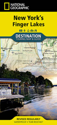
National Geographic Maps
New York's Finger Lakes National Geographic Destination Map
National Geographic Maps. New. Special order direct from the distributor National Geographic Maps unknown
Referentie van de boekhandelaar : ING9781597755153 ISBN : 159775515x 9781597755153
|
|
|
Anon
THE AMICABLE QUIXOTE OR ENTHUSIASM OF FRIENDSHIP 4 volumes
London: Printed for J. Walker 1788. Book. Very Good. Hardcover. First Edition. 12mo. A very good four volume set in contemporary full tree calf binding with double lettering pieces in red and green. Complete pp. iii-vii 1 222; 2 206; 2 238 & 2 198. No half-titles which may or may not be wanting but the pagination for the prelims to vol. I might suggest that one is required Very good bindings with a little rubbing a couple of volumes slightly chipped to the head/tail of the spines corners lightly bruised. Contents clean and tight manuscript Greek initials to title pages dated 1788 otherwise unmarked no foxing paper crisp. A very good set. A Rare Eighteenth Century Novel. We have managed to located just one other copy at auction in the last thirty years and that at Sotheby's sale of July 21 1993 where it made £1000 on the hammer though seemingly not such a nice copy. Referenced by: ESTC T068744. Printed for J. Walker Hardcover
Referentie van de boekhandelaar : 024356

|
|
|
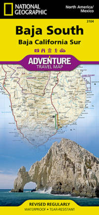
National Geographic Maps - Adventure
Baja South: Baja California Sur Mexico National Geographic Adventure Map 3104
National Geographic Maps. New. Special order direct from the distributor National Geographic Maps unknown
Referentie van de boekhandelaar : ING9781566952446 ISBN : 1566952441 9781566952446
|
|
|
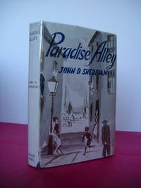
Sheridan, John D.
PARADISE ALLEY A Novel
Dublin: The Talbot Press 1945. Book. Fine. Hardback. First Edition. 8vo. 273 pages. Original dust jacket bright without browning; a little rubbing and general wear lightly scuffed to head/tail of the spine and corners small chip to centre of front spine fold and several marginal tears repaired to the reverse with archival materials now protected in a clear removable archival sleeve. Hard-back binding very good. Contents clean and tight no inscriptions no foxing. A fine first edition copy in a very good jacket. Scarce first edition. The Talbot Press Hardcover
Referentie van de boekhandelaar : 023064
|
|
|
Directorate of Fisheries Research
Atlas of the Seas Around the British Isles
London: MINISTRy of Agriculture Fisheries and Food 1981. Book. Near Fine. Hardcover. First Edition. Folio. unpaginated colour and b/w maps Original hardback binding spiral bound fine with minimal wear. Contents clean and tight small water mark to the endpaper no inscriptions. A near fine copy. MINISTRy of Agriculture Fisheries and Food Hardcover
Referentie van de boekhandelaar : 022777 ISBN : 0907545009 9780907545002

|
|
|
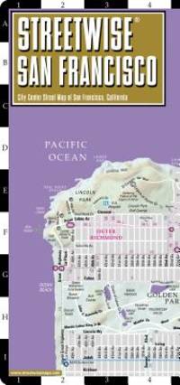
Streetwise Maps
Streetwise San Francisco Map - Laminated City Center Street Map of San Francisco California - Folding pocket size travel map with BART map MUNI lines bus routes
StreetWise 2015-01-01. map. New. 4.25x0.25x8.75. Buy with confidence. Excellent Customer Service & Return policy. StreetWise unknown
Referentie van de boekhandelaar : DADAX0935039201 ISBN : 0935039201 9780935039207
|
|
|
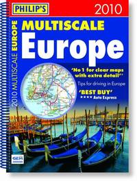
Philip's Maps
Philip's Multiscale Europe 2010: Spiral A4 Road Atlases
Paperback. Very Good. paperback
Referentie van de boekhandelaar : GOR004009594 ISBN : 1849070504 9781849070508
|
|
|
LEWIS, John Frederick
LEWIS'S ILLUSTRATIONS OF CONSTANTINOPLE Made During a Residence in That City in the Years 1835-6
London: T. McLean D.& P. Colnaghi and John F. Lewis 1838. 1838. Book. Illus. by John F. Lewis. Near Fine. Hardcover. First Edition. Folio approx. 55 x 36.5cm. Complete with all Lithographic plates as called for; tinted frontispiece tinted title-vignette further 27 tinted views on 25 leaves all by Lewis after Coke Smyth. A very clean bright copy. Finely bound in modern brown morocco to style with gilt lettering to the spine and gilt bands to the top and bottom of the spine. Contents clean and tight new light brown endpapers in keeping with the new binding two blank leaves to the front and rear all pages have been professionally cleaned and restored by a paper conservator minimal and unobtrusive water staining remains to some pages and plates mostly confined to the margins and blank areas most plates unaffected new archival paper guards to all plates no inscriptions. A fine complete copy beautifully rebound. References -. Abbey Travel II 394; Atabey 722; Blackmer 1015; Contominas 413; RIBA 1886. T. McLean, D.& P. Colnaghi and John F. Lewis [1838]. Hardcover
Referentie van de boekhandelaar : 021038

|
|
|
No Author
THE ISLAND OF SUMATRA ORIGINAL COLOUR MAP
London: Edward Stanford Map. Very Good. Unframed. No date but circa 1910. A fine coloured map of the island of Sumatra measuing 19. x 32.5cm. Originally from an atlas with 3 fold lines. Very good condition. Edward Stanford unknown
Referentie van de boekhandelaar : 020930

|
|
|
RUSSELL, J. C.
SOUTH AMERICA Inc. Falkland Islands ORIGINAL ANTIQUE MAP
Map. Very Good. Unframed. No date but circa 1840. A fine original copper engraved map entitled SOUTH AMERICA; the Falklands islands are also depicted. Plate mark measuing 22 x 27.5cm. Originally from an atlas - this is map 26. J. C. Russell del. et sculpt. Very good condition with slight dust marking. unknown
Referentie van de boekhandelaar : 020931

|
|
|
No Author
SOUTH AMERICA From the Best Authorities Inc. Falkland Islands ORIGINAL ANTIQUE MAP
T. Tegg Map. Very Good. Unframed. No date but circa 1840. An original copper engraved map entitled SOUTH AMERICA From the Best Authorities; the Falklands islands are also depicted. Plate measures 21.2 x 24.5cm. Originally from an atlas with a central fold. Very good condition with slight dust marking. T. Tegg unknown
Referentie van de boekhandelaar : 020932

|
|
|
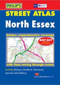
Philip's Maps
Philip's Street Atlas North Essex: Pocket
Paperback. Good. paperback
Referentie van de boekhandelaar : GOR003727224 ISBN : 0540082864 9780540082865
|
|
|
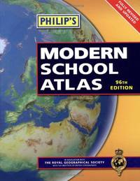
Philip's Maps
Philip's Modern School Atlas: 96th Edition Hardback
Hardback. Very Good. hardcover
Referentie van de boekhandelaar : GOR003205302 ISBN : 1849070121 9781849070126
|
|
|
Philip's Maps
Daily Strength for Daily Needs
Paperback. Good. paperback
Referentie van de boekhandelaar : GOR003667975 ISBN : 1851520910 9781851520916

|
|
 De zoekresultaten per email ontvangen
 Zoekresultaten downloaden als PDF
 RSS feed


