|
Curtis, William
ORIGINAL HAND-COLOURED ENGRAVING - Ilex chinensis FROM CURTIS'S BOTANICAL MAGAZINE - Plate No. 2043 dated 1819
W. Curtis 1819. Print. Very Good. Unframed. First Edition. A fine original hand-coloured copper-engraved plate from this famous work size approx. 14 x 24cm. The condition is very good colours bright and fresh paper bright minimal offsetting supplied without accompanying text and without mount. The quality of the illustrations in the Botanical Magazine is outstanding both accurate and decorative the colours vibrant. William Curtis 1746-1799 was a trained apothecary living in London although his passion was for natural history particularly plants and insects. He maintained a large well-stocked garden and began the publication of the Botanical Magazine in February 1787 which has gone on to become the most famous and influential botanical publication of its type; it is still published today making it the longest running scientific periodical of all time. Curtis edited the first 13 volumes and was then succeeded by John Simms 1800-1826 William Jackson Hooker 1827-1865 and Joseph Dalton Hooker 1865-1904 the current editor of the magazine is Martyn Rix. The fine illustrations were by many artists including Sydenham Edwards William Graves James Sowerby John Curtis William Jackson Hooker W.H. Fitch J. N. Fitch Matilda Smith Lillian Snelling and Stella Rose Craig. The plates were hand-coloured up to 1948! all being copper engravings to around 1840 and then stone or zinc lithography until the introduction of color printing in 1948. References: Blunt;The Art of Botanical Illustration Great Flower Books pp. 156 - 157 Nissen BPI 2350 Staflue 1290. Please Note: we do not break books for plates nor do we condone this practice. Our plates have either been purchased loose or have come from books that are so defective or incomplete that they are irreparable. W. Curtis unknown
Referentie van de boekhandelaar : 020307

|
|
|
HARDENDALE FELL; WESTMORLAND SHEET XIV. 14. - Very Large Ordnance Survey Map 1898; Scale 1:2500
Southampton: Ordnance Survey 1898. Map/Print. Very Good. Unframed. Second Edition. A very large original map measuring 104 x 136cm 64 sections dissected onto a linen backing; folding into original brown covers the upper with a label of Edward Stanford Ltd London. A very good copy in very good condition. Ordnance Survey unknown
Referentie van de boekhandelaar : 019859
|
|
|
Southwell, R. V.
RELAXATION METHODS IN ENGINEERING SCIENCE
Oxford: Oxford at the Clarendon Press 1951. Book. Very Good. Hardcover. Reprint. 8vo. pp. vi ii 252; b/w illustrations fold-out plans. Original dust jacket very good slightly marked with a little rubbing to edges spine with some toning and slightly chipped to the head price-clipped and repriced by publisher now attractively presented in a loose-fitting clear archival sleeve. Hard-back binding very good. Contents clean and tight previous owner's initials to the front end paper otherwise unmarked no foxing. A very good clean copy. Oxford at the Clarendon Press Hardcover
Referentie van de boekhandelaar : 019367

|
|
|
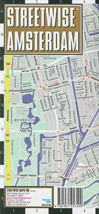
Streetwise Maps
Streetwise Amsterdam Map - Laminated City Center Street Map of Amsterdam Netherlands
StreetWise 2010-01-01. map. Used: Good. 4.00x0.25x8.25. Buy with confidence. Excellent Customer Service & Return policy. StreetWise unknown
Referentie van de boekhandelaar : SONG1931257299 ISBN : 1931257299 9781931257299
|
|
|
Nordhagen, Rolf
NORSK FLORA Illustrasjonsbind. Annet Hefte Enfrobladete Monocotyeldoneae
Oslo: H. Aschehoug & Co 1948. Book. Fine. Hardcover. 8vo. b/w plates 65-380 covering the monocotyledons. Original green cloth binding with gilt lettering fine with minimal wear gitl slightly dulled. Contents clean and tight minimal pencil annotation referencing the plates otherwise unmarked. A fine tight copy. H. Aschehoug & Co Hardcover
Referentie van de boekhandelaar : 018924
|
|
|
Barbara Kingsolver; Rebeca Cartes
Another America/Otra America
Seattle: Seal Press 1992. First Edition . Hardcover. Fine/Near Fine. Fine in near fine dust jacket with light rubbing. <br/> <br/> Seal Press hardcover
Referentie van de boekhandelaar : b17993 ISBN : 1878067141 9781878067142

|
|
|
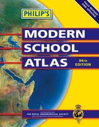
Philip's Maps
Philip's Modern School Atlas Philip's School Atlases
Hardback. Very Good. hardcover
Referentie van de boekhandelaar : GOR001370843 ISBN : 0540087459 9780540087457
|
|
|
Turner, Reverend Mr.
A VIEW OF THE EARTH: Being a Short But Comprehensive System of Modern Geography
London: Printed for S. Crowder 1766. Book. Very Good. Hardcover. The Second Edition. Folio 21 x 32cm. The second edition with additions and improvements; pp. iv 45 iii publisher's adverts; engraved frontispiece map of the world five further engraved plates of maps and one engraved plate of globes ten engraved figures and diagrams within the text. Contemporary half textured calf binding with marbled paper boards expertly restored with a new spine in matching style re-corned. contents clean and tight a few small marks/reading wear; frontispiece plate with a couple of short edge-tears expertly and inconspicuously repaired a few corners re-tipped. A very good well-presented copy. Scarce. Printed for S. Crowder Hardcover
Referentie van de boekhandelaar : 016077

|
|
|
Anon
INDICATEUR EXACT DES RUES DE PARIS 1919
Paris: Thibault Fils 1919. Book. Good. Paperback. 24mo 8 x 12cm. Title page reads "NOUVEAU GUIDE DES RUES DE PARIS" 92 pages. Original red card covers with silver gilt lettering good with some general wear and rubbing a little marked. Contents good some pages creased at edges. A good copy. Thibault Fils Paperback
Referentie van de boekhandelaar : 011910
|
|
|
Clyde, James
SCHOOL GEOGRAPHY
Edinburgh: Oliver and Boyd 1886. Book. Very Good. Hardcover. Twenty-third Edition. 8vo 12 X 18cm. "Revised throughout and partly recast. With Nine Maps" pp. 551 24 pages of adverts 9 colour folding maps. Original brown cloth binding with gilt lettering very good and bright with slight wear only. Contents clean and tight small neat signature dated 16.10.87 to front end paper otherwise no inscriptions. A very good to fine copy. Oliver and Boyd Hardcover
Referentie van de boekhandelaar : 010484
|
|
|
Carr, John
A STRANGER IN IRELAND OR A TOUR IN THE SOUTHERN AND WESTERN PART OF THAT COUNTRY IN THE YEAR 1805
London: Printed for Richard Phillips Sold By Souter No. 1 Pater-noster-row. 1806. Book. Very Good. Hardcover. First Edition. Large 4to. A very good "large paper" copy with uncut edges leaf size approximately 285mm x 225mm with a few additional items bound in. Pp. xiv 2 530 ii ii. 16 hand-tinted aquatints of which several folding map plus an additional contemporary hand-coloured map of Ireland as frontispiece. Contents: frontispiece quarto format map - engraved for the Poem of Erin. The folding plate of Dublin shown as the frontispiece in the "Directions for Placing the Plates" has been bound in opposite the first page of text title page dedication prefacecontents errata directions for placing the engravings main body of the text additional page on St. Patrick from "Guide to Knowledge" bound in at rear before the Publisher's adverts cutting from the Times 1842 entitled "Robert Emmet and the Gaoler of Kilmainham" pasted to rear paste-down. Original paper-covered boards with recent pebbled cloth spine to match original with the original paper title-label applied to the spine binding in very good condition. Contents very good the uncut edges are a little worn in places and a couple of a small near-contemporary oval stamps of the "Baptist College Bristol" to the front end paper no other marks. Paper in very good condition without any obvious staining minimal foxing almost completly confined to the tissue guards maps and plates all very good clean and crisp short repaired tear to the edge of page 318 not nearly affecting the text. A very good to fine copy. Printed for Richard Phillips, Sold By Souter, No. 1, Pater-noster-row. Hardcover
Referentie van de boekhandelaar : 009589

|
|
|
n/a
Karte Nr. 35. Ravenstein's Rad- u. Automobil-Karte für den Regierungsbezirk LIEGNITZ Sowie Die Umgend Von Gorlitz Und Zittau. 1: 300 000.
Frankfurt: Ludwig Ravenstein Map. Very Good. Map. No date circa 1910 Cloth backed coloured map - approximately 80 x 60cm. In very good condition some - towns underlined in blue. A very good copy. Ludwig Ravenstein hardcover
Referentie van de boekhandelaar : 007202

|
|
|
Gross, Alexander
GEOGRAPHERS' STANDARD MAP OF ENGLAND AND WALES
London: Geographers' Map Co Ltd. Map/Print. Very Good. Unframed. No date. Circa 1950. Very large colour linen-backed map approximately 102 x 136cm dissected into 25 sections folding into green cloth-backed boards. In very good condiion boards with a little wear to spine map very good map excellent clean paper slightly toned. Bookplate of The Iron and Steel Institute The Institute of Metals to inside front board - dated Jan 1953 - cost of map £1 15s single stamp of the same to the rear of the map. A very good copy of this excellent map. 0. Geographers' Map Co Ltd. hardcover
Referentie van de boekhandelaar : 006594
|
|
|
Not Cited
PHILIPS JUNIOR HISTORICAL ATLAS Prepared Under the Direction of the Historical Association
London: George Philip & Son Limited 1929. Book. Very Good. Paperback. Fifth Edition. 4to. 40 colour maps. Cloth backed card covers good with some general wear a little grubby. Contents tight some general reading wear and finger marks title page somewhat marked with a small scuff mark. A good to very good copy. George Philip & Son Limited Paperback
Referentie van de boekhandelaar : 006602
|
|
|
Spiegl, Fritz
FOUR CENTURIES OF LIVERPOOL The Growth of a City A Collection of Maps and Views
Liverpool: Scouse Press 1970. Book. Very Good. Paperback. 2nd Printing. 4to. This is the revised "Liverpool Packet No. 2" with the additional maps. Numerous maps and plans - all present and correct- checked against contents list some colour and many folding printed on different colour papers historical notes also present. In original plastic wallet which is a little worn and marked. The title page is faded and has a number written to the reverse otherwise no other marks or inscriptions to maps or notes. Some maps with small creases to corners and some a little browned along edges. A good to very set. Scouse Press Paperback
Referentie van de boekhandelaar : 007181
|
|
|
Cartes BRGM
Carte géologique : L'Eau
Editions du BRGM 2000. Paperback. Good. Former library book. Ammareal gives back up to 15% of this item's net price to charity organizations. Editions du BRGM paperback
Referentie van de boekhandelaar : G-836-410 ISBN : 9792715908198 9792715908
|
|
|
Thomas Brothers Maps
San Diego Orange 1997-Map Thomas Guide San Diego/Orange Counties Street Guide & Directory
Thomas Brothers Maps 1996. Paperback. Good. Pages can have notes/highlighting. Spine may show signs of wear. ~ ThriftBooks: Read More Spend Less.Dust jacket quality is not guaranteed. Thomas Brothers Maps paperback
Referentie van de boekhandelaar : G0881308412I3N00 ISBN : 0881308412 9780881308419
|
|
|
Cartes LOCAL Michelin
Carte routière : Calvados - Manche N° 11303
Michelin Editions des Voyages 2002. Paperback. Very Good. Edition 2002. Ammareal gives back up to 15% of this item's net price to charity organizations. Michelin Editions des Voyages paperback
Referentie van de boekhandelaar : G-911-593 ISBN : 2061003648 9782061003640
|
|
|
Cartes REGIONAL Michelin
Carte routière : Nord-Pas-de-Calais Picardie
Michelin Editions des Voyages 2004. Good. Edition 2004. Ammareal gives back up to 15% of this item's net price to charity organizations. Michelin Editions des Voyages unknown
Referentie van de boekhandelaar : G-911-594 ISBN : 206710568x 9782067105683
|
|
|
Cartes BRGM
Carte géologique : Au coeur de la fournaise
Editions du BRGM 2000. Hardcover. Good. Ammareal gives back up to 15% of this item's net price to charity organizations. Editions du BRGM hardcover
Referentie van de boekhandelaar : G-962-731 ISBN : 2715949936 9782715949935
|
|
|
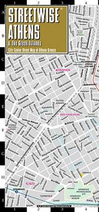
Streetwise Maps
Streetwise Athens Map - Laminated City Street Map of Athens Greece
Used - Very Good. Used book that is in excellent condition. May show signs of wear or have minor defects. unknown
Referentie van de boekhandelaar : 8778011-6 ISBN : 1886705348 9781886705340
|
|
|
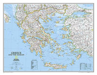
National Geographic Maps
National Geographic Greece Wall Map - Classic 30.25 x 23.5 in National Geographic Reference Map
National Geographic 2022-01-19. 2022. map. Used: Good. 3.00x3.00x27.00. Buy with confidence. Excellent Customer Service & Return policy. National Geographic unknown
Referentie van de boekhandelaar : SONG0792249690 ISBN : 0792249690 9780792249696
|
|
|
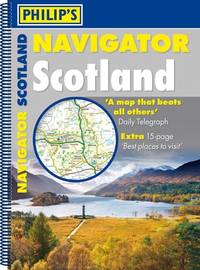
Philip's Maps
Philip's Navigator Scotland: A4 Spiral binding
Paperback. Like New. paperback
Referentie van de boekhandelaar : GOR014650034 ISBN : 1849072043 9781849072045
|
|
|
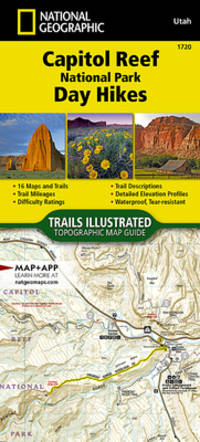
National Geographic Maps - Trails Illustrated
Capitol Reef National Park Day Hikes National Geographic Topographic Map Guide 1720
map. Good. Access codes and supplements are not guaranteed with used items. May be an ex-library book. unknown
Referentie van de boekhandelaar : 1566959756.G ISBN : 1566959756 9781566959759
|
|
|
Cartes Kummerly + Frey
Atlas routiers : Suisse 35 villes atlas à spirales
Kümmerly et Frey 2004. Very Good. Edition 2004. Ammareal gives back up to 15% of this item's net price to charity organizations. Kümmerly et Frey unknown
Referentie van de boekhandelaar : G-549-244 ISBN : 3259015167 9783259015162
|
|
|
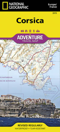
National Geographic Maps - Adventure
Corsica Map France National Geographic Adventure Map 3315
Natl Geographic Society Maps 2012. Good. Edition 2012. Ammareal gives back up to 15% of this item's net price to charity organizations. Natl Geographic Society Maps unknown
Referentie van de boekhandelaar : G-628-244 ISBN : 1566956064 9781566956062
|
|
|
Collins Maps
2020 Collins Essential Road Atlas Britain and Northern Ireland
Collins 2019. Very Good. Edition 2019. Ammareal gives back up to 15% of this item's net price to charity organizations. Collins unknown
Referentie van de boekhandelaar : G-429-038 ISBN : 0008318700 9780008318703

|
|
|
Cartes Epshom
Carte marine : Baie de Morlaix
Epshom 2002. Very Good. Former library book. Edition 2002. Ammareal gives back up to 15% of this item's net price to charity organizations. Epshom unknown
Referentie van de boekhandelaar : G-405-987 ISBN : 3518081770952 3518081770
|
|
|
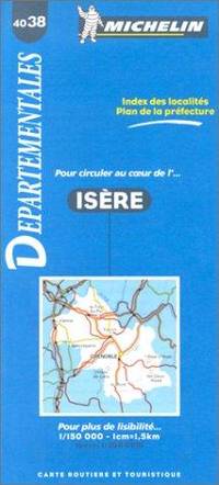
Cartes Michelin
Carte routière : Isère N°4038
Michelin Editions des Voyages 1999. Very Good. Ammareal gives back up to 15% of this item's net price to charity organizations. Michelin Editions des Voyages unknown
Referentie van de boekhandelaar : G-479-861 ISBN : 2067040383 9782067040380
|
|
|
Benchmark Maps
California Road & Recreation Atlas - 12th Edition 2024 Benchmark
Benchmark Maps 2024-01-01. 2024th ed. spiral_bound. Used: Good. 10.75x1.00x15.35. Buy with confidence. Excellent Customer Service & Return policy. Benchmark Maps unknown
Referentie van de boekhandelaar : SONGB0CS48MKN2
|
|
|
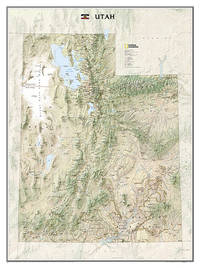
National Geographic Maps - Reference
National Geographic Utah Wall Map - Laminated 30.25 x 40.5 in National Geographic Reference Map
National Geographic 2024-10-15. 2024. map. New. 37.00x2.25x2.25. Buy with confidence. Excellent Customer Service & Return policy. National Geographic unknown
Referentie van de boekhandelaar : DADAX1597752479 ISBN : 1597752479 9781597752473
|
|
|
Cartes LOCAL Michelin
Carte routière : Loiret - Loir-et-Cher N° 11318
Michelin Editions des Voyages 2002. Paperback. Good. Edition 2002. Ammareal gives back up to 15% of this item's net price to charity organizations. Michelin Editions des Voyages paperback
Referentie van de boekhandelaar : G-511-448 ISBN : 2061003796 9782061003794
|
|
|
Cartes LOCAL Michelin
Carte routière : Creuse - Haute-Vienne N° 11325
Michelin Editions des Voyages 2002. Paperback. Good. Edition 2002. Ammareal gives back up to 15% of this item's net price to charity organizations. Michelin Editions des Voyages paperback
Referentie van de boekhandelaar : G-511-447 ISBN : 2061003869 9782061003862
|
|
|
Philip's Maps
Philip's 2019 Essential Road Atlas Britain and Ireland - Spiral A4: Spiral binding Philips Road Atlas
Philip's 2018. Very Good. Edition 2018. Ammareal gives back up to 15% of this item's net price to charity organizations. Philip's unknown
Referentie van de boekhandelaar : G-520-073 ISBN : 1849074712 9781849074711
|
|
|
Hema Maps PtyLtd y. Lt
Sydney & Region Handy Map 1:100K- 2014: HEMA
Hema Maps Pty.Ltd 2015. Very Good. Ammareal gives back up to 15% of this item's net price to charity organizations. Hema Maps Pty.Ltd unknown
Referentie van de boekhandelaar : G-535-134 ISBN : 1865007218 9781865007212
|
|
|
Cartes BRGM
Carte géologique : St-Martin-Vésubie
Editions du BRGM 2001. Fine. Edition 2001. Ammareal gives back up to 15% of this item's net price to charity organizations. Editions du BRGM unknown
Referentie van de boekhandelaar : G-534-261 ISBN : 2715919476 9782715919471
|
|
|
Charles-Laurent Salch. Pref. Philippe Dollinger. Cartes de MAurice Frey. Photos
L'Atlas des villes et villages fortifiés en France Moyen Age
1978. Hardcover. Good. Former library book. Edition 1978. Refurbished library book. Ammareal gives back up to 15% of this item's net price to charity organizations. hardcover
Referentie van de boekhandelaar : G-533-168
|
|
|
Outdoor Books & Maps
San Juan National Forest Colorado All-Activities Guidebook
Outdoor Books & Maps 2012. Paperback. Good. Missing dust jacket; Pages can have notes/highlighting. Spine may show signs of wear. ~ ThriftBooks: Read More Spend Less.Dust jacket quality is not guaranteed. Outdoor Books & Maps paperback
Referentie van de boekhandelaar : G0930657594I3N01 ISBN : 0930657594 9780930657598
|
|
|
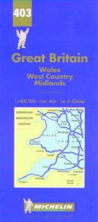
Cartes Michelin
Carte routière : Pays de Galles - Angleterre Sud-Ouest et Midlands N° 403
Michelin Editions des Voyages 1997. Very Good. Ammareal gives back up to 15% of this item's net price to charity organizations. Michelin Editions des Voyages unknown
Referentie van de boekhandelaar : G-566-299 ISBN : 2067004034 9782067004030
|
|
|
Cartes Office Federal de Topographie Suisse
Carte routière : Beatenberg
Office Fédéral de Topographie Suisse 1993. Very Good. Different cover. Ammareal gives back up to 15% of this item's net price to charity organizations. Office Fédéral de Topographie Suisse unknown
Referentie van de boekhandelaar : G-558-327 ISBN : 330201208x 9783302012087
|
|
|
Cartes Office Federal de Topographie Suisse
Carte routière : Beatenberg
Office Fédéral de Topographie Suisse 1993. Very Good. Different cover. Ammareal gives back up to 15% of this item's net price to charity organizations. Office Fédéral de Topographie Suisse unknown
Referentie van de boekhandelaar : G-558-328 ISBN : 330201208x 9783302012087
|
|
|
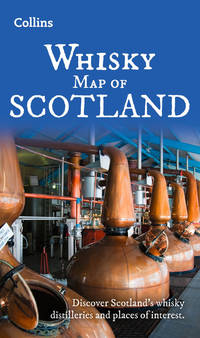
Collins Maps
Whisky Map of Scotland: Discover where Scotlands national drink is produced Collins Pictorial Maps
paperback. Good. Access codes and supplements are not guaranteed with used items. May be an ex-library book. paperback
Referentie van de boekhandelaar : 0008664994.G ISBN : 0008664994 9780008664992
|
|
|
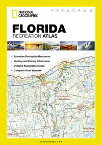
National Geographic Maps
Florida Recreation Atlas National Geographic Recreation Atlas
National Geographic Maps 2012-10-01. paperback. Very Good. 9x0x15. Paperback--cover shows slight wear otherwise excellent condition National Geographic Maps paperback
Referentie van de boekhandelaar : TA250505077Y03 ISBN : 1597755222 9781597755221
|
|
|
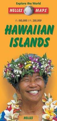
Nelles Maps
NELLES HAWAIIAN ISLANDS TI 4 HAWAI
Nelles Verlag 1900. Good. Former library book. Edition 1900. Ammareal gives back up to 15% of this item's net price to charity organizations. Nelles Verlag unknown
Referentie van de boekhandelaar : G-297-012 ISBN : 3886188728 9783886188727
|
|
|
National Geographic Maps
Road Atlas: United States and Canada RV & Camping Edition
National Geographic Society Maps 2005-05-01. paperback. Good. 11x1x14. National Geographic Maps. Spiral binding--no marking on pages--cover good National Geographic Society Maps paperback
Referentie van de boekhandelaar : CL250404030XT1 ISBN : 159775000X 9781597750004
|
|
|
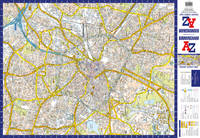
A-Z Maps
Birmingham A-Z Pocket Street Map: Accurate Street Map For Easy Navigation
Harpercollins Publishers 2025. Sheet Map Folded. New. 2 pages. 3.54x0.16x5.51 inches. Harpercollins Publishers unknown
Referentie van de boekhandelaar : __0008725500 ISBN : 0008725500 9780008725501
|
|
|
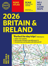
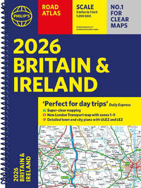
Philip's Maps
2026 Philip’s Road Atlas Britain & Ireland: A4 Paperback
Paperback / softback. New. <i>2026 Philip's Road Atlas of Britain and Ireland</i> is a top-of-the-range A4-sized paperback atlas featuring fully updated maps from the Philip's digital database. The maps have enhanced clarity and have been voted Britain's clearest and most detailed in an independent consumer survey. paperback
Referentie van de boekhandelaar : A9781849077163 ISBN : 1849077169 9781849077163
|
|
|
Philip's Maps
2026 Philip’s Road Atlas Britain & Ireland: A4 Spiral Bound
Spiral bound. New. <i>2026 Philip's Road Atlas of Britain and Ireland</i> is a top-of-the-range A4-sized spiral-bound atlas featuring fully updated maps from the Philip's digital database. The maps have enhanced clarity and have been voted Britain's clearest and most detailed in an independent consumer survey. unknown
Referentie van de boekhandelaar : A9781849077170 ISBN : 1849077177 9781849077170
|
|
|
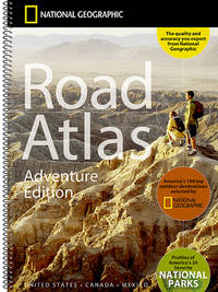
National Geographic Maps
National Geographic Road Atlas 2025: Adventure Edition United States Canada Mexico
National Geographic Maps 2024-06-10. spiral_bound. Very Good. 11x0x15. Spiral bound--cover shows slight wear otherwise excellent condition National Geographic Maps unknown
Referentie van de boekhandelaar : CL250529097B3 ISBN : 0792289897 9780792289890
|
|
|
Philip's Maps
A Great Weekend in Stockholm
Philip's 2003. Paperback. Very Good. Edition 2003. Ammareal gives back up to 15% of this item's net price to charity organizations. Philip's paperback
Referentie van de boekhandelaar : G-086-242 ISBN : 0540083186 9780540083183
|
|
 De zoekresultaten per email ontvangen
 Zoekresultaten downloaden als PDF
 RSS feed


