4.079 Ergebnisse
1794Best.-Nr. 46191794 London, Laurie & Whittle, 1794 Carte gravée sur cuivre (50,5 x 57 cm hors marges, 54 x 73 cm toutes marges comprises). Tirage de l'époque. Quelques traces d'une autre carte en surimpression. Map on copperplate (50,5 x 57 cm without the margins, 54 x 73 cm with the margins). Contemporary printing. Several light printed marks of another map.
(Oblong) 8vo. 2 folding billets. With 2 autograph envelopes. To Mrs. Honeycutt in Tulsa, Oklahoma, signed by Velma, Tommy and Pam. A birthday card with good wishes: "Sorry you are not well. Hope you will feel better soon. I sent a check [...]". - With illustrations featuring a camel caravan and a flower bouquet. Margins slightly creased.
Albumen prints on cardboard, dated on the reverse. Measurements 279:219 and 285:225 mm. The photographs show "Pilgrims entering Bethlehem on Christmas day" and an apparently English party of three tweed-clad gentlemen, one lady, a photographer-manservant, and two Arab guides posing before the Dead Sea. - The view of Bethlehem shows some fading and bears a caption the French and English, as well as the publisher's name, "Bonfils".
150 x 205 mm. AP press photo showing Sayid Idris al-Senussi in London shaking hands with Eric de Candole, British Administrator of Cyrenaica, and his wife. Captioned on the reverse: "Senussi leader arrives in London. The Emir Sayid Idris el Senussi, head of the state of Cyrenaica, photographed on arrival in London last night July 15. He is shaking hands with Mr. E. A. V. Candole, British Chief Administrator of Cyrenaica. At centre is Mrs. Candole. The Emir travelled from Derna to Marseilles in the battleship 'Vanguard' and thence across France. It is the Emir's first visit to England. While here he will have talks with Mr. Bevin on the future of Cyrenaica". Well preserved.
Scale 1:1,500,000. Equal-area conic projection (ravnougol'naia konicheskaia proektsiia). Relief shown by gradient tints, shading, and spot heights. Depths shown by soundings. 68.5 x 87.5 cm. Accompanied by text and index by E. A. Shukin (13 pp.). Stored in original printed sleeve. Third edition of the Soviet 1:1,500,000 reference map of Iraq, edited by Z. P. Pekhova. Includes insets: "Ekonomicheskaia karta" (1:5,000,000), "Karta plotnosti naseleniia" and "Karta narodov" (1:10,000,000). The accompanying text contains a capsule geographical account of the country. - Title repeated with ballpoint in Latvian on sleeve's spine. In excellent condition. OCLC 5448870.
Chromo-lithographed map, c. 60 x 48 cm, folded in original printed wrapper (with portrait of Sultan Abdulaziz). With text and 9 engr. illustrations printed on the reverse. Louis Vivien de Saint-Martin's map of Morocco, drawn by Chesneau and Weinreb. With topographical notes by Franz Schrader. - Edges slightly frayed; some tears to folds; wrapper dusty and waterstained. OCLC 163347954.
Oblong 8vo. Captioned in English, French and Arabic. Rare, early black and white photographic views of two important petroleum refineries in Africa: Suez and Fedala. The latter is featured in a photograph by the French military photographer Marcel Flandrin (1889-1957), a pioneer of aerial photography in Morocco. Taken from an aeroplane and published by the Syndicat d'Inititative, the image shows the bonding warehouses at Fedala refinery amidst a rough Atlantic. - The second postcard, published by Vitta & Cie., shows a general view of the Suez refinery against the backdrop of the Ataka Mountains. - In addition to the printed captions, the postcard of Suez bears handwritten captions in German and English on recto and verso in ink and pencil. - The postcard of Suez pierced in two places. A very well preserved set.
Colour-printed map. Ca. 84 x 63 cm. Constant ratio linear horizontal scale: 1:2,000,000. Relief shown as gradient tints and spot heights. - With: Lembke, Herbert. Jährliche Niederschlagsmenge im westlichen Vorderasien. Gotha, Justus Perthes, 1940 (Petermanns Georg. Mitteilungen, 86. Jg., Tafel 26). Colour-printed map, scale 1:3,700,000. Ca. 66 x 42 cm. French-produced map of the western portion of Turkey, showing the eastern tip of Bulgaria, the Aegean, Crete, Cyprus, the northern coast of Africa, and Asia Minor to Ankara. Issued by the French military just prior to the Second World War. - Folded, some tears to margins. Formerly in the collections of the Geographical Institute of the University of Berlin, accessioned during wartime as part of the German military' spoils, with requisite stamp and shelfmarks. - Includes a German wartime map of Turkey, also removed from the University of Berlin, showing the average annual rainfall. OCLC 497879161, 495083198.
4to. (4), 74 pp. With 28 plates with 55 black-and-white photographic prints, as well as 1 plan of Burchhardt's itinerary on page 9. Original printed wrappers. First edition. Rare travelogue of Yemen, enriched with striking photographs. In Arabic and German parallel text. Prepared by Ahmed ibn Muhammad al-Garadi, the secretary, Arabic teacher and companion of the German explorer Hermann Burchardt (1857-1909), the book describes Burchardt's travels in the south of the Arabian Peninsula, where he was ambushed and killed by gunmen in December 1909. Containing "important ethnographical information on crafts and the Jewish population", the account also boasts a wealth of photographs "of great documentary value" (Speake), including city views and landmarks of Sanaa, Taizz, and Mocha, such as tower houses in Sanaa's old town, the Ashrafiya Mosque, the Grand Mosque in Mocha, and the ruined palace of Sultan Hasan, as well as pictures of local children, a group of Jews studying scripture in the synagogue, several men sitting around a water pipe, bedouins, farmers, and workers. The images impressively portray the destitution of the Yemenite population in the early 20th century. - In addition, the work includes annotations to the text of the travelogue, a list of examples of the Sanaa idiom, and an index prepared by the German orientalist Eugen Mittwoch, who also translated the Arabic text. Published as a festschrift for the Vierter Deutscher Orientalistentag in Hamburg. - A few edge flaws to wrappers professionally repaired. Lower right corner of first two leaves chipped, but interior very well preserved in general. Never seen at auction. Speake, Literature of Travel and Exploration III, 1305. OCLC 907363736.
Small folio (218 x 330 mm) and oblong 8vo. (3) pp. With typescript envelope. Freight manifest for a box of personal effects of Paul Stiehl, an employee of Aramco, shipped from Dhahran to New York. Signed by W. J. Kiefer. - The document includes a customs clearance authorization as well as a specification of the contents of the box signed by Stiehl. The shipment contained 4 prayer rugs, 12 towels, and 5 bed sheets. - Some rust spots. A unique survival.
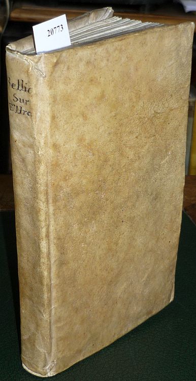
1757Best.-Nr. 20773Paris, Ch. Ant. Jombert, 1757. 8vo. Mit 38 (statt 42) teils gef. Kupfertaf. XXXXI, 84 S. Pgt. d. Zeit m. hs. Rückentitel.
8vo. (2), VII, (1), 750, (2) pp. Publisher's blue boards. Reprint of this important "Cyclopaedia of the Doctrines, Rites, Ceremonies, and Customs, Together with the Technical and Theological Terms, of the Muhammadan Religion" (subtitle). - Largely well-preserved.
VII, (3), 180 SS. Rotes Leinen über den originalen rot-schwarz gemusterten Deckeln mit dem Namen des Verfassers auf goldenem Feld mit Rankenverzierung in Rot. 12mo. Schöne zweite Auflage der "Bruchstücke", erstmals 1852 erschienen, und "in Format und Einband ganz der Diamant-Ausgabe von Bodenstedts 'Mirza Schaffy' ähnlich" (Rabenlechner). Ibn Yemini lebte im 14. Jahrhundert und war der Sohn eines aus Turkestan stammenden, in Khorassan ansässigen Emirs, dessen Güter er nach dessen Tode verwaltete. Die "Bruchstücke" sind Dichtungen vorwiegend philosophisch-didaktischen Inhalts. - Mit Besitzvermerk "D. Rasellina", dat. 11. X. 1943, am Vorsatz. Nachgebunden unter Verwendung des Originaleinbandes. Vorsatzblatt eingerissen. Rabenlechner I, 124. Vgl. Wurzbach XXX, 65. Graesse III, 407 (1852). Nicht bei Zenker.
1860Large 8vo. 3 vols. (instead of 5). I: (4), 328 pp. II: (4), 245, (1) pp., last blank f. IV.1: (8), 218 pp. 58 pp. 78 pp. Contemporary half calf. Islamic history of the world from creation to the Ottoman Empire. - Wants vols. III and IV.2. Babinger, p. 124.
301 pp. Original wrappers. Ahmad Lutfi al-Sayyid (1872-1963) was a leading spokesman for Egyptian modernism in the first half of the 20th century. Throughout his career he held a number of political and nonpolitical positions, including several academic posts. Owing to his career in education and his influence upon young Egyptians, he came to be known as Ustadh al-Jil (“Educator of the Generation”). - With ms. notes. Covers a little worn, otherwise in excellent condition. OCLC 18299627.
8vo. 2 parts in 1 volume. XII, 303, (1) pp. VIII, 262 pp., final blank. Contemporary hald cloth with handwritten spine label. First edition of this history of the Ottoman Empire between 1826 and 1856, by the Prussian orientalist and diplomat Rosen (1821-91). - From the library of the German diplomat Friedrich Werner von der Schulenburg (1875-1944), one of the conspirators against Hitler. From 1922 to 1931 Schulenburg served as German envoy to Iran. His handwritten ownership is dated "Tehran, 1928"; his bookplate is on the front pastedown. For his involvement in the tragically failed plot of 20 July 1944, Schulenburg was executed on November 10. - Well preserved copy.
Folio (229 x 297 mm).108 pp. Original printed wrappers. Monthly magazine of the Saudi Arabian Airlines. The present issue covers King Fahd's expansion project for the two Holy Mosques, a development to increase the capacity of the mosques of Mecca and Medina to more than 730,000 and 650,000 worshippers respectively - numbers that could be increased to 2 million on peak days. Other topics of the issue include reports on Saudi Airlines catering, northern Spain, hovercrafts, and the benefit of glass houses to cultivate exotic plants in the northern hemisphere. In addition, the magazine provides two maps of domestic and international routes served by Saudi Airlines.
8vo. (33)-47 pp. Original wrappers. Offprint from the Journal of the Royal Asiatic Society, April 1951. Part 1 only, recounting the "Land Dispute". Part 2 (pp. 156-169, "Dispute over the Runaway Wife") would appear in the October issue. - An excellent copy. OCLC 77797713.
Folio (231 x 308 mm). 24 pp. With numerous illustrations in colour and black-and-white. Original printed wrappers. Stapled. Illustrated corporate magazine of Standard Oil, celebrating the company's international activities. It includes reports on trade with European countries, the recently established Antwerp refinery, the kerosene-powered Seguin lighthouse in Maine, advancing infrastructure in North Africa, and the recycling of oil barrels as musical instruments in the Caribbean. The final three pages display sketched impressions of the Jersey Standard headquarters in New York by the artist Bettina Steinke. OCLC 1755500.
8vo. XIII, (3), 286, (2) pp. With 1 map of the Hadhramaut printed on green paper, 20 double-sided plates, 3 illustrations in the text on pp. 76, 77 and 85, a few small tail pieces throughout, and a green ornament on the title-page. Green cloth with gold lettering on spine. Third part of Freya Stark's (1893-1993) autobiography, in which she describes her life and especially the travels she undertook between 1933 and 1939. During this time, her first four works were published, starting with "The Valley of the Assassins" in 1934. The present account focuses mostly on Stark's travels in South Arabia and is illustrated with images of photographs she took herself. It is a very personal account of her life and travel experiences, alongside significant historical, political, geographical and anthropological information about the places she visited. This writing style was quite unique and unusual for her time, but since she was one of the first European travellers in parts of Southern Arabia, "unique and unusual" were, in a positive way, accurate descriptors. - Edge at the head of the book is green and the edge at the foot is untrimmed. Small marking in blue ink on p. 79, lacking dust jacket, otherwise in very good condition. Blackmer 1470. Howgego IV, S 61. Shapero, The Islamic World (2003), 458. Cf. article "Freya Stark" in Encyclopaedia Britannica.
1747Best.-Nr. 143611747. Bellin Jacques Nicolas. Ile d'Ormus ou de Jerun 1747 depicts Hormuz and the surrounding Persian Gulf maritime landscape more than a century after an Anglo-Persian force ended Portuguese control of the island in 1622. Published in Histoire générale des voyages the engraving identifies the Persian coast islands anchorages fortifications and channels while distinguishing Arab vessels from large-masted European sailing ships. Its concentration on ships coastal defenses and approaches to Hormuz records the strategic geography of a passage that connected Persian Gulf ports with Indian Ocean trading routes. Bellin Jacques Nicolas. Ile d'Ormus ou de Jerun. From Histoire générale des voyages 1747. Overall sheet size 13.5 x 9.5 inches; image size 7.5 x 9.75 inches. The upper portion identifies the "Cote de Perse" while inscriptions throughout the engraving include "Fortresse" "Ile de Kishom ou Quixema" "Entre des Vaisseaux" "Porte de derriere" "Parade Alkoran" "St. Lucia" and "Lardimira." Five Arab vessels occupy the foreground while additional Arab shipping appears at left and European ships with tall masts and multiple sails appear at right. The fortified settlement on Hormuz includes the fortress associated with Portuguese occupation of the island. Hormuz had been seized in 1507 by the Portuguese commander Afonso de Albuquerque and Portuguese control made the island a fortified base for regulating maritime commerce at the entrance to the Persian Gulf. The Portuguese constructed the Fort of Our Lady of the Conception there; in 1622 forces of Shah Abbas I assisted by ships of the English East India Company captured Hormuz and ended Portuguese rule on the island. Bellin's 1747 engraving therefore records a landscape shaped by earlier Portuguese fortification but returned to Persian control while its juxtaposition of Arab and European vessels documents the continuing international maritime character of the strait. Paper folded three times consistent with its original publication format. Overall very good condition. unknown
1747Best.-Nr. 143611747. Bellin Jacques Nicolas. Ile d'Ormus ou de Jerun 1747 depicts Hormuz and the surrounding Persian Gulf maritime landscape more than a century after an Anglo-Persian force ended Portuguese control of the island in 1622. Published in Histoire générale des voyages the engraving identifies the Persian coast islands anchorages fortifications and channels while distinguishing Arab vessels from large-masted European sailing ships. Its concentration on ships coastal defenses and approaches to Hormuz records the strategic geography of a passage that connected Persian Gulf ports with Indian Ocean trading routes. Bellin Jacques Nicolas. Ile d'Ormus ou de Jerun. From Histoire générale des voyages 1747. Overall sheet size 13.5 x 9.5 inches; image size 7.5 x 9.75 inches. The upper portion identifies the "Cote de Perse" while inscriptions throughout the engraving include "Fortresse" "Ile de Kishom ou Quixema" "Entre des Vaisseaux" "Porte de derriere" "Parade Alkoran" "St. Lucia" and "Lardimira." Five Arab vessels occupy the foreground while additional Arab shipping appears at left and European ships with tall masts and multiple sails appear at right. The fortified settlement on Hormuz includes the fortress associated with Portuguese occupation of the island. Hormuz had been seized in 1507 by the Portuguese commander Afonso de Albuquerque and Portuguese control made the island a fortified base for regulating maritime commerce at the entrance to the Persian Gulf. The Portuguese constructed the Fort of Our Lady of the Conception there; in 1622 forces of Shah Abbas I assisted by ships of the English East India Company captured Hormuz and ended Portuguese rule on the island. Bellin's 1747 engraving therefore records a landscape shaped by earlier Portuguese fortification but returned to Persian control while its juxtaposition of Arab and European vessels documents the continuing international maritime character of the strait. Paper folded three times consistent with its original publication format. Overall very good condition. unknown books
1989Quarto in black cotton and silk cloth backed boards ; 162 p. : col. ill. ; 31 cm. Numnerous tipped in color plates. Box. Limited edition of 5,000 copies and this exemplar 313. In English. Contents: A history of Golf / by David Stirk -- Golf museums, libraries and documents / by Bobby Burnet -- Profiles -- Golf 2000 or What we are coming to / by J.A.C.K. (J. McCullough) -- Introduction / by Guido Almansi. // Golf -- History. Golfers -- Biography.
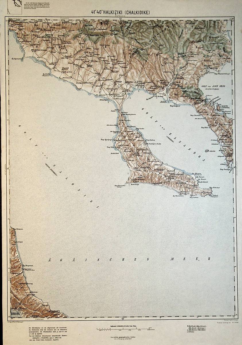
1913Best.-Nr. A111-124Wien, Kaiserlich-K?nigliches Milit?r-Geographisches Institut, 1913. Hochformat, ca. 42 x 55 cm, Ausgabe: mehrf?rbig; Zustand: gut +
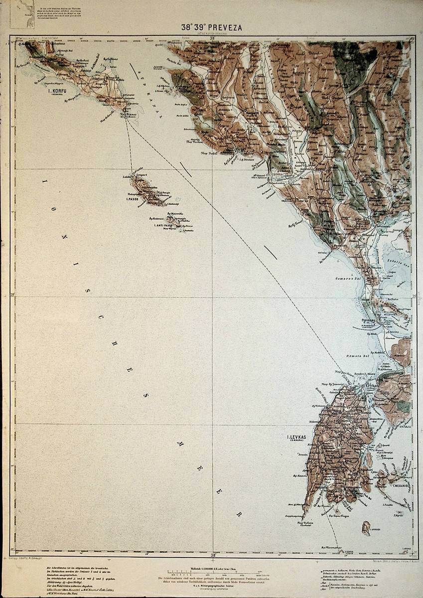
1912Best.-Nr. A111-096Wien, Kaiserlich-K?nigliches Milit?r-Geographisches Institut, 1912. Hochformat, ca. 42 x 55 cm, Ausgabe: mehrf?rbig; Zustand: gut +