Multiple ContributorsMareMagnum

4.079 Ergebnisse
1962318 pages. Cover painting entitled "Mount Robson and Emperor Falls" by Jack L. MacLean. Great back cover colour photo ad for various models and colours of phones. Includes 192 pages of vintage local yellow pages ads plus several pages of ads for contemporary phone products. Average wear. Binding intact. Unmarked. A sound copy of this wonderful 1962 snapshot of Victoria, B.C. Book
194056 pages. Features: Nice color Bermuda tourism ad inside front cover features golf scene with young black caddy; Nice one-page photo ad for Plymouth cars; 1/3-page ad for United Air Lines with photos; Mercury 8 one-page illustrated car ad; Lawrence Olivier and Jill Esmond divorce; Orson Welles and Virginia Nicolson divorce; Novelist Adela Rogers St. Johns is jailed; Brief obituary for Dr. George De Bothezat, builder of the first successful helicopter; Nice one-page photo ad for Dodge cars; The work of Martin Dies; Rev. Charles Coughlin under attack by the Jewish People's Committee; Census Revolt; Photo of tent city build for Californai Okies; Punxsutawney, PA groundhog predicts weather; The Convoy System - Britain depends on it; A look at the Finnish situation; Poultney Bigelow reveals ex-Kaiser Wilhelm wants the Nazis to turn on the Bolsheviks; Swedish volunteers help Finns resist Russia; Bombers supplanting U-Boats and Mines in Blockade Duel; Eddie Arcaro Rides Winners; Photo of basketball being played on skaes!; "Grapes of Wrath" hits movie screen as powerful social drama - with photo of Henry Fonda and his movie parents; Nice one-page color ad for the Good Year Double Eagle Air Wheel (tire); James Jefferson Davis Hall is the Bishop of Wall St.; Photo and write-up on the Air Corps' new 400 mph Airacobra; Nice 2/3-page two-color ad for Beech-Nut Gum features young lady reading mystery book; Neutrality Dodge - photo of big Lockheed bomber, destined for Allied war service, crossing the North Dakota/Canada border behind a team of horses; Big Pepsi-Cola skywriting contract; Nice color-photo ad for Four Roses Whiskey on back cover; and much more. Middle page holding by one staple. Average wear. Unmarked. A sound vintage copy. Book
1947610 pages. Text in Swedish. Black and white photos in text. Somewhat above-average wear. Unmarked. Book
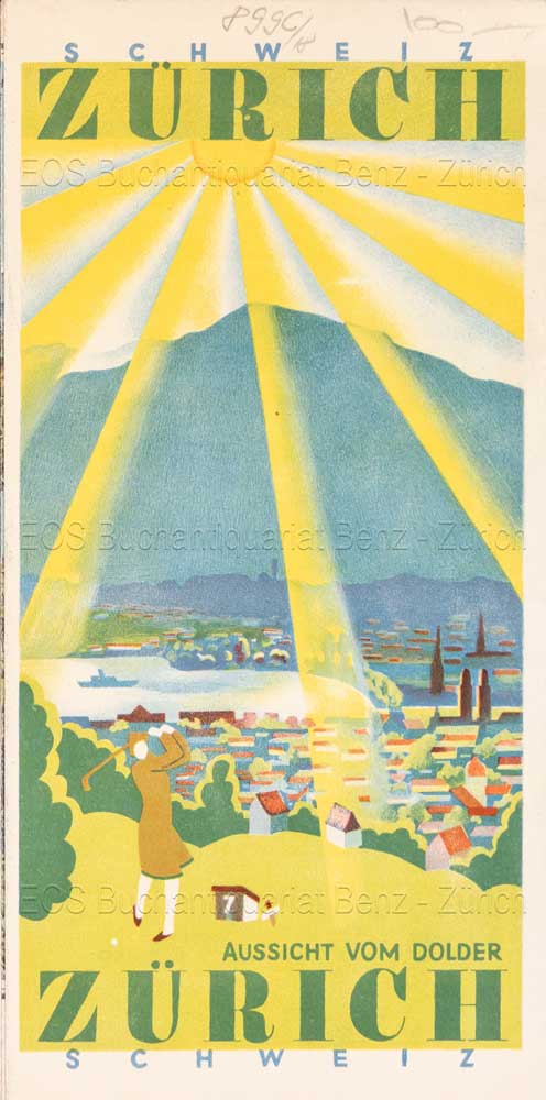
1929Best.-Nr. 899CG(1929). Farbige Lithograhpie 17,5 x 29 cm (farb. Panorama). + Wichtig: Für unsere Kunden in der EU erfolgt der Versand alle 14 Tage verzollt ab Deutschland / Postbank-Konto in Deutschland vorhanden +, Abb.
8vo. pp. 97-105. With 2 photoplates. Modern wrappers. Early account of a visit to the seaport of Dhofar (Oman) on the southern coast of the Peninsula, including an interesting account of the local boats and the sailing skills of their owners. The illustrations show Makalla in Hadramaut, a camel drawing water in Dhofar, and the ruins of the temple of al-Bilad. Macro, Bibliography of the Arabian Peninsula, 777. OCLC 49427292.
8vo. (2), V, (1), 18, (6) pp. Original printed wrappers. Rare information booklet for Aramco workers, outlining the dental care expense benefits extended to the company's full-time salaried or retired employees and their dependents under Aramco's dental insurance plan. - Well preserved.
4to. (8), 279, (1 blank) pp. Red cloth, with title on front board and on spine. Beautifully illustrated handbook on Aramco and Saudi Arabia for Aramco employees. - "The Aramco Handbook was originated to fill the void in comprehensive texts written in English about the Middle East. Employees of the Arabian American Oil Company coming to Saudi Arabia from abroad, principally Americans, needed reliable and fairly detailed knowledge of the kingdom. … In order to describe the Aramco venture in perspective, an unusual range of topics must be covered in the pages of this handbook: the history, culture, geography, geography, religion and economic development of Saudi Arabia; the fundamentals of the oil industry; Aramco's early history and its present operations" (introduction). It was first published in 1950 in five spiral-bound booklets. - A very good copy.
8vo. 108 pp. With an engraved frontispiece and 5 engraved plates, all in original hand colour. Remains of wrappers. Third edition of this early 19th century French primer. The reading matter with its lively illustrations is chiefly drawn from Aesop's Fables. - Brownstained throughout. Untrimmed, partly uncut copy with marked edge flaws; wants binding. Rare. OCLC 460509998.
Large coloured map (136.5 x 90.5 cm). Scale 1:945,200. Relief shown by hachures and spot heights. Detailed nautical chart of the Gulf of Aden, showing the waters between the Horn of Africa and the South-western coast of Saudi Arabia. "From British, French, and Italian surveys to 1940 with additions and corrections to 1951", this 15th edition issued in 1955 and revised 21 May 1962. With inset maps of Bandar Risut and Qishn Bay (stamped "Cancelled"). Signs of contemporary use, with a 1964 stamp, several pencil markings, duststains and waterstains. Cf. OCLC 31674450 (17th ed., 1978). Not in Al Ankary; Al-Qasimi.
Large 4to. A total of 2 pp. (one leaf and one bifolium), each with French translation (one on a separate leaf, the other on the verso of the bifolium). By a "Girgès" (Jirjis) to "Monsieur Le Baron de Hamm" who had invited him to Vienna during a visit to Upper Egypt. The recipient is likely Carl von Hammer, the eldest son of the important Austrian oriental scholar Joseph Baron Hammer-Purgstall: "Vous avez bien voulu à votre voyage à Lougsor [= Luxor] vous interessé a moi en m'offrant de me faire venir à Vienne. Je suis en ce moment au Caire à votre disposition. Voici l'été et le changement de climat me sera très favorable. Persuadé, Monsieur le Baron, que vous voudrez bien vous souvenir d'un pauvre orphelin et me faire l'honneur d'une réponse, je suis [...]" (Cairo, 26 March 1870, from the French translation). - "Monsieur le Baron Ham / Je viens vous dire que vous n'avez fait aucune reponse à mes lettres par lesquelles je vous priais de m'envoyer ses reponses. Ce procédé m'etonne d'autant plus qu'il n'est pas en rapport avec la promesse que vous m'avez fait a Loqsur, aussi je suis arrivé a Alexandrie depuis deux mois en attendant vos nouvelles. Pour tout cela je vous prie d'avoir la bonté de m'envoyer une lettre en y vous me fairais apprendre si vous voulez me faire apporter chez vous en Vienne ou non [...]" (Alexandria, 10 July 1870, from the French translation). - Slight edge tears and wrinkles, otherwise fine. - Carl von Hammer-Purgstall, born in Vienna on 20 January 1817, inherited Hainfeld Castle in Styria from his father. He retired from the Imperial army holding the rank of captain and served as member of the Styrian Landtag. He died in Trieste on 12 February 1879. - The great orientalist's youngest brother, the Graz-based lawyer Dr. Wilhelm von Hammer (1784-1872), was also still alive in 1870, but his advanced age at the time makes him appear an unlikely tourist of Egypt.
Scale 1:2,500,000. Equal-area conic projection (ravnougol'naia konicheskaia proektsiia). Relief shown by gradient tints, shading, and spot heights. Depths shown by soundings. 89 x 77.5 cm. In original printed sleeve. Third edition of the Soviet 1:2,500,000 reference map of Iran (Persia), edited by Z. P. Pekhova. Includes insets: "Karta narodov" and "Ekonomicheskaia karta" (1:7,500,000). Index printed on reverse. - Title repeated with ballpoint in Latvian on sleeve's spine. In excellent condition. OCLC 255529903.
Scale 1:4,000,000. Equal-area conic projection (ravnougol'naia konicheskaia proektsiia). Relief shown by gradient tints, shading, and spot heights. Depths shown by gradient tints and soundings. 77 x 65.5 cm. Index printed on verso. Stored in original printed sleeve. Re-issued third edition of the Soviet 1:4,000,000 reference map of the Arabian Peninsula, edited by N. I. Arep'ev with O. L. Kuznechov and K. D. Volkov. Includes insets (in 1:15,000,000 scale): "Ekonomicheskaia karta", "Karta plotnosti naseleniia i razmeshcheniia arabskikh plemen". - Old reference label "2" pasted to sleeve's cover. In excellent condition. Rare.
Colour-printed map. Ca. 92 x 70 cm. Constant ratio linear horizontal scale 1:850,000. Relief shown by hachures and spot heights. German map of Mesopotamia printed during the early years of the First World War, showing the travel route of Max Oppenheim during his 1893-94 journey from Cairo through the Syrian desert and Mesopotamia to Basra. Eastern sheet, reaching from Diyarbakir in south-eastern Anatolia to Kerbala and Babylon in Iraq. Includes populated places, roads, and trails, with the railways updated to 1915. - Folded; a few edge tears. Formerly in the collections of the Geographical Institute of the University of Berlin with their stamps and shelfmarks. Well preserved. OCLC 179717182.
19008vo. Pt. 1 (of 2) only. XXIV, 170 pp. With folding engraved map. Contemporary blue wrappers. Probably a pirated version of the first German edition (Hamburg, Villaume); translated from the English "Copies of original letters from the Army of General Bonaparte in Egypt". Also published in French ("Correspondence interceptée de Bonaparte et de son armée en Egypte"). The map shows the Nile delta from Giza to the Mediterranean estuary. - Untrimmed copy; some defects to spine. Ibrahim-Hilmy 245. Cf. Gay 1990. Not in Kainbacher.
4to (165 x 205 mm). (18), (11 blank) ff. Decorated with hand-drawn maps in ink and crayon, labelled in handwritten Hebrew. Original black wrappers. All edges red. Unique private copybook of folk art hand-coloured maps from an unknown Jewish girl named Sarah Klein. Klein was likely a schoolgirl; most of the maps she has drawn and labelled in neat Hebrew are of European countries, including Spain, Italy, Greece, Yugoslavia, Bulgaria, Turkey, Great Britain and Ireland, Iceland, France, Portugal, and Scandinavia, as well as one map of the entirety of Africa. The northern coast of France is shown twice and in greater detail than many others. Most of the maps are carefully hand-coloured in crayon or perhaps oil pastels, often indicating rivers and mountain ranges. - A unique preservation of a Jewish schoolgirl's vision of her world. - Light wear, one leaf detached but present, altogether well-preserved.
Image dimensions ca. 35 x 24 cm (sheet size cs. 43 x 29 cm). Matted. Rare lithograph of the ruins of the Domitian Gate in the Greco-Roman city of Hierapolis, situated immediately above the famous travertine terraces of Pamukkale. From Laborde's "Asia Minor". - Some wrinkling; small tear at upper edge (not touching image).
Hand-coloured engraved map, 440 x 315 mm. Constant ratio linear horizontal scale, ca 1:8,122,000. Includes the entire Gulf coast of the Arabian Peninsula, showing Kuwait, El Katif, Bahrain, Qatar, and the Musandam Peninsula, including the territory of today's United Arab Emirates (here still labeled the "Pirate Coast"). "Debai", Sharja", "Ras-el-Khaimah", "Khorfakan" and "Fejerah" are identified. - Well preserved. Issued as plate XXXVIII in Sidney Hall's General Atlas of the World. OCLC 781690561.
Ca. 25 x 30 cm. Black-and-white gelatin silver print (vintage). A letterboard in a Karachi hotel lobby, announcing a "Lunch in Honour of Mr. Ali A. Ansari, Personal Representative of the Ruler of Qatar". Ali ibn Ahmed Al-Ansari served as Minister of Labour and Social Affairs unter HH Sheikh Khalifa bin Hamad Al Thani, Ruler of Qatar. - Provenance: collection of Azhar Abbas Hashmi (1940-2016), Pakistani financial manager and eminent literary patron with close ties to Karachi University. Long with United Bank Limited, Hashmi would serve as the bank's Vice President of Gulf Operations before founding several important cultural organisations and becoming known as a man of letters in his own right.
8vo. 7, (1) pp. Original wrapperless covers. Trade agreement regulating the trade of goods destined for or exported from ports in Saudi Arabia, and carried in ships calling at Bahrain. In English and Arabic. - Some rust-staining in gutter.
19564to. 4 pp. Speech of Herbert H. Lehman in the Senate of the United States, March 1, 1956, on "The Saudi Arabian Policy of Discrimination Against Americans of Jewish Faith", including subsequent correspondence. - Folded.
1786Engraved map (plate size: 53 x 44.5 cm), with coloured borders. Engraved map showing the Near East, especially the areas of today’s Syria and Iraq. From Schalbacher’s and Schrämbl’s “Großer Allgemeiner Atlas”. A good, clean impression. Dörflinger/Hühnel I, 136, 97.
8vo. 175, (1) pp. With a portrait frontispiece of Gamal Abdel Nasser. Original printed and illustrated wrappers. Second edition, revised by Shawki Sukkary. Abbas al-Aqqad (1889-1964) remains well known in Egypt as a versatile journalist, poet and literary critic. Translated from the Arabic original ("Athar al-`Arab fi al-hadarah al-Awrubbiyah") by Ismail Cashmiry and Muhammad al-Hadi and published under the auspices of the Supreme Council for Islamic Affairs. Chapters include Arabic beliefs, life, writing, trade, science, arts, music, philosophy, state's organisation, religious movements, nationalism, the press, etc. "To sum up the situation of the Arab world today", al-Aqqad writes: "It is a situation in which the future looks as good as the past, and pride in our fathers is not divorced from hope for our sons". - Binding slightly duststained and chipped in places, but still a good copy. OCLC 16771175.
8vo. X, 273, (1 blank) pp. With two black and white maps on the endpapers. Brown cloth with publisher's illustrated dust jacket. First and only edition of a thorough description of the history of the nine Arab states of the Lower Gulf, that gained independence in 1971, just four years before the publication of this book. The author has managed to discuss the individual politics of each state and that of the bigger picture, making this a handbook for all who wish to learn more about Bahrain, Qatar and the United Arab Emirates (Ajman, Dubai, Fujairah, Ras Al Khaimah, Sharjah and Umm Al Quwain). The several infographics that are used to explain the political structures are very helpful in this respect. Oil plays a key role in the relationship between the individual states and this is intricately laid out by the American author. Because this book was written in such a key moment in the history of the region, it has gained much importance. The author Dr. John Duke Anthony is a leading figure in United States-Arab relations and has held many influential government positions in this field. Amongst others, he is the founder and president of the National Council on U.S.-Arab Relations and he is part of the United States Department of State Advisory Committee on International Economic Policy's Subcommittee on Sanctions. He holds a Ph.D. in International Relations and Middle East Studies at the School of Advanced International Studies. In the years leading up to this publication the author has conducted first-hand research on the Lower Gulf region's political and socio-economic structures, obviously with oil playing a major role. The fruits of this research are presented in this book, offering the reader a comprehensive overview of a complex subject. This book was published in The James Terry Duce Memorial Series, which started in 1966. The first and second volumes were on North Africa and Jerusalem respectively, this is the final volume of the series. - Ink annotations in the margins throughout. A good copy with the original dustjacket well preserved. OCLC 1700964.
560 x 430 mm. Folding poster with several black-and-white photographic illustrations. Aramco poster celebrating technological advances in Saudi Arabia triggered by their cooperation with America. Featuring pictures taken by Aramco employees, it presents the Saudi Arabians' industrial achievements and their growing infrastructure, including railways, loading cranes, accurate scales, gas stations, and machines manufacturing blocks of concrete. The text accompanying the images bursts with praise for the Saudi spirit: "For over two decades now the Saudi Arabs have been building their ancient land into a modern nation [...] The drilling bit that bored down into the desert did more than strike oil - it quickened the life blood of a whole nation".