4.361 Ergebnisse
8vo. XIII, (3), 286, (2) pp. With 1 map of the Hadhramaut printed on green paper, 20 double-sided plates, 3 illustrations in the text on pp. 76, 77 and 85, a few small tail pieces throughout, and a green ornament on the title-page. Green cloth with gold lettering on spine. Third part of Freya Stark's (1893-1993) autobiography, in which she describes her life and especially the travels she undertook between 1933 and 1939. During this time, her first four works were published, starting with "The Valley of the Assassins" in 1934. The present account focuses mostly on Stark's travels in South Arabia and is illustrated with images of photographs she took herself. It is a very personal account of her life and travel experiences, alongside significant historical, political, geographical and anthropological information about the places she visited. This writing style was quite unique and unusual for her time, but since she was one of the first European travellers in parts of Southern Arabia, "unique and unusual" were, in a positive way, accurate descriptors. - Edge at the head of the book is green and the edge at the foot is untrimmed. Small marking in blue ink on p. 79, lacking dust jacket, otherwise in very good condition. Blackmer 1470. Howgego IV, S 61. Shapero, The Islamic World (2003), 458. Cf. article "Freya Stark" in Encyclopaedia Britannica.
Best.-Nr. DADAX0415968526New unknown
1747Best.-Nr. 143611747. Bellin Jacques Nicolas. Ile d'Ormus ou de Jerun 1747 depicts Hormuz and the surrounding Persian Gulf maritime landscape more than a century after an Anglo-Persian force ended Portuguese control of the island in 1622. Published in Histoire générale des voyages the engraving identifies the Persian coast islands anchorages fortifications and channels while distinguishing Arab vessels from large-masted European sailing ships. Its concentration on ships coastal defenses and approaches to Hormuz records the strategic geography of a passage that connected Persian Gulf ports with Indian Ocean trading routes. Bellin Jacques Nicolas. Ile d'Ormus ou de Jerun. From Histoire générale des voyages 1747. Overall sheet size 13.5 x 9.5 inches; image size 7.5 x 9.75 inches. The upper portion identifies the "Cote de Perse" while inscriptions throughout the engraving include "Fortresse" "Ile de Kishom ou Quixema" "Entre des Vaisseaux" "Porte de derriere" "Parade Alkoran" "St. Lucia" and "Lardimira." Five Arab vessels occupy the foreground while additional Arab shipping appears at left and European ships with tall masts and multiple sails appear at right. The fortified settlement on Hormuz includes the fortress associated with Portuguese occupation of the island. Hormuz had been seized in 1507 by the Portuguese commander Afonso de Albuquerque and Portuguese control made the island a fortified base for regulating maritime commerce at the entrance to the Persian Gulf. The Portuguese constructed the Fort of Our Lady of the Conception there; in 1622 forces of Shah Abbas I assisted by ships of the English East India Company captured Hormuz and ended Portuguese rule on the island. Bellin's 1747 engraving therefore records a landscape shaped by earlier Portuguese fortification but returned to Persian control while its juxtaposition of Arab and European vessels documents the continuing international maritime character of the strait. Paper folded three times consistent with its original publication format. Overall very good condition. unknown
1747Best.-Nr. 143611747. Bellin Jacques Nicolas. Ile d'Ormus ou de Jerun 1747 depicts Hormuz and the surrounding Persian Gulf maritime landscape more than a century after an Anglo-Persian force ended Portuguese control of the island in 1622. Published in Histoire générale des voyages the engraving identifies the Persian coast islands anchorages fortifications and channels while distinguishing Arab vessels from large-masted European sailing ships. Its concentration on ships coastal defenses and approaches to Hormuz records the strategic geography of a passage that connected Persian Gulf ports with Indian Ocean trading routes. Bellin Jacques Nicolas. Ile d'Ormus ou de Jerun. From Histoire générale des voyages 1747. Overall sheet size 13.5 x 9.5 inches; image size 7.5 x 9.75 inches. The upper portion identifies the "Cote de Perse" while inscriptions throughout the engraving include "Fortresse" "Ile de Kishom ou Quixema" "Entre des Vaisseaux" "Porte de derriere" "Parade Alkoran" "St. Lucia" and "Lardimira." Five Arab vessels occupy the foreground while additional Arab shipping appears at left and European ships with tall masts and multiple sails appear at right. The fortified settlement on Hormuz includes the fortress associated with Portuguese occupation of the island. Hormuz had been seized in 1507 by the Portuguese commander Afonso de Albuquerque and Portuguese control made the island a fortified base for regulating maritime commerce at the entrance to the Persian Gulf. The Portuguese constructed the Fort of Our Lady of the Conception there; in 1622 forces of Shah Abbas I assisted by ships of the English East India Company captured Hormuz and ended Portuguese rule on the island. Bellin's 1747 engraving therefore records a landscape shaped by earlier Portuguese fortification but returned to Persian control while its juxtaposition of Arab and European vessels documents the continuing international maritime character of the strait. Paper folded three times consistent with its original publication format. Overall very good condition. unknown books
1989Quarto in black cotton and silk cloth backed boards ; 162 p. : col. ill. ; 31 cm. Numnerous tipped in color plates. Box. Limited edition of 5,000 copies and this exemplar 313. In English. Contents: A history of Golf / by David Stirk -- Golf museums, libraries and documents / by Bobby Burnet -- Profiles -- Golf 2000 or What we are coming to / by J.A.C.K. (J. McCullough) -- Introduction / by Guido Almansi. // Golf -- History. Golfers -- Biography.
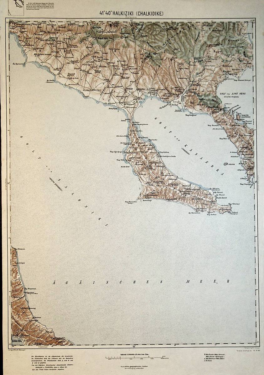
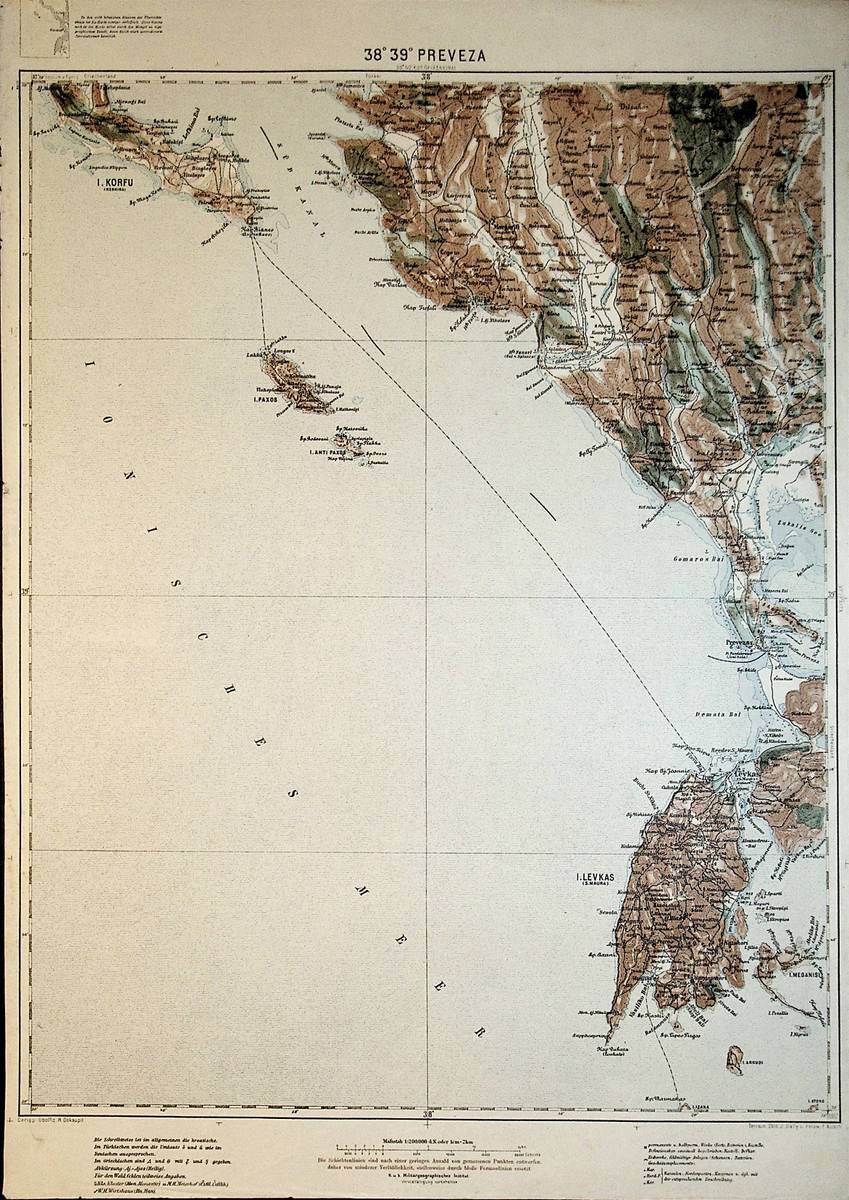
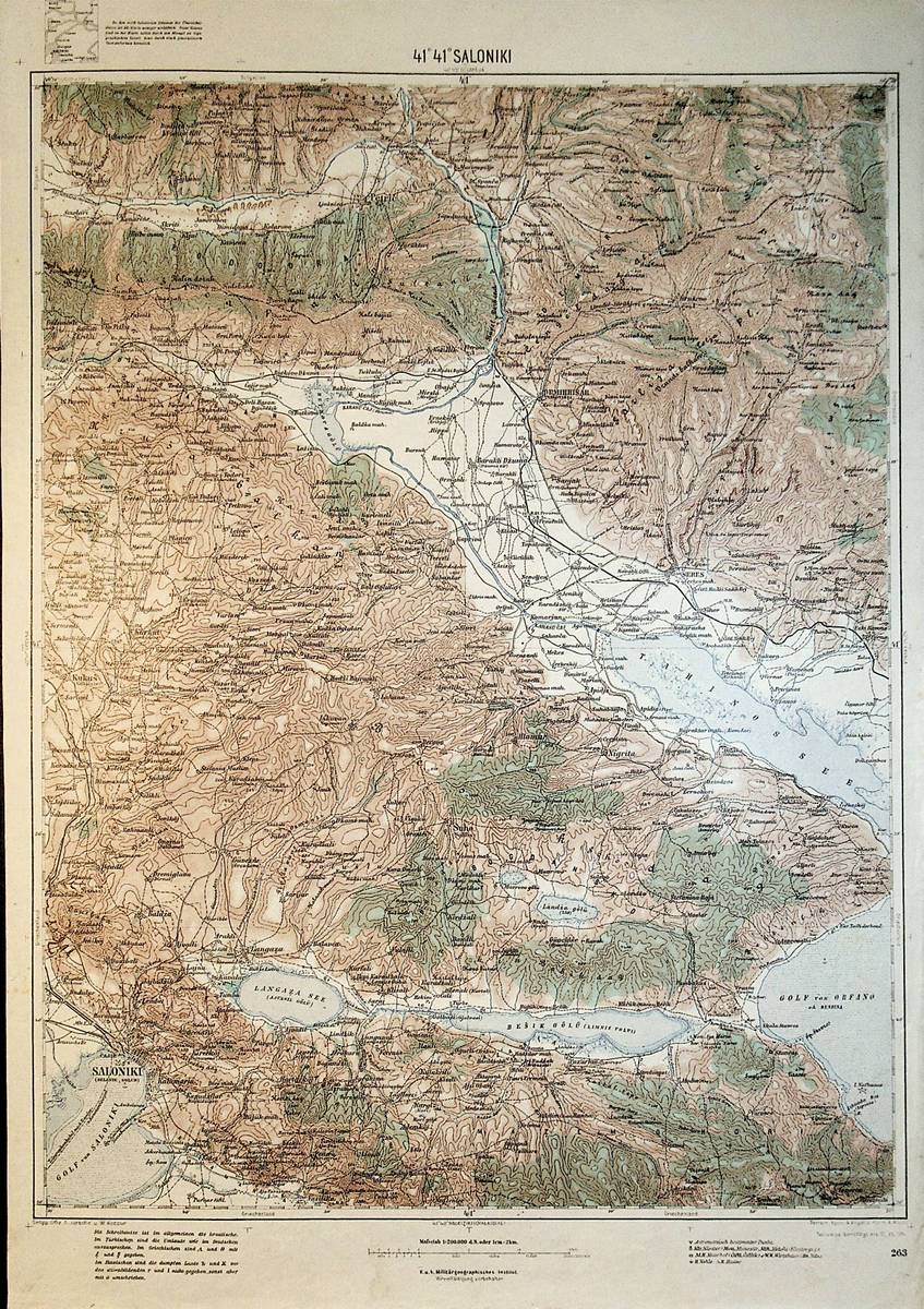
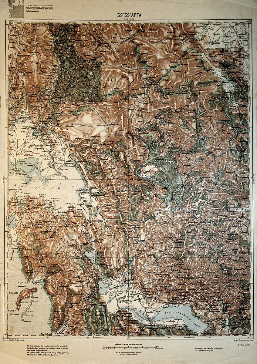
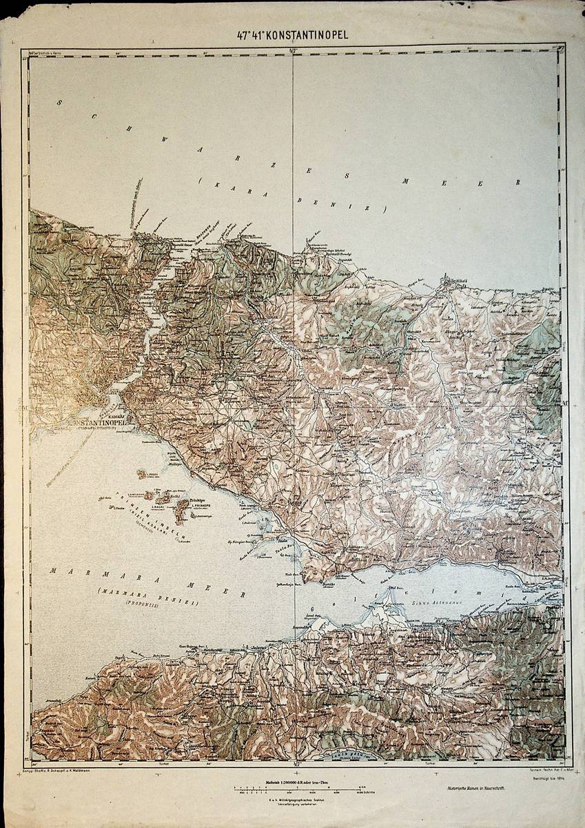
1913Best.-Nr. A111-124Wien, Kaiserlich-K?nigliches Milit?r-Geographisches Institut, 1913. Hochformat, ca. 42 x 55 cm, Ausgabe: mehrf?rbig; Zustand: gut +
1912Best.-Nr. A111-096Wien, Kaiserlich-K?nigliches Milit?r-Geographisches Institut, 1912. Hochformat, ca. 42 x 55 cm, Ausgabe: mehrf?rbig; Zustand: gut +
1914Best.-Nr. A111-125Wien, Kaiserlich-K?nigliches Milit?r-Geographisches Institut, 1914. Hochformat, ca. 42 x 55 cm, Ausgabe: mehrf?rbig; Zustand: gut +
Best.-Nr. DADAX0230206700New unknown
Best.-Nr. DADAX0471161748New unknown
Best.-Nr. DADAX0128202882New unknown
Best.-Nr. DADAX0333573269New unknown
Best.-Nr. DADAX0292752067New unknown
Best.-Nr. DADAX1575870932New unknown
1914Best.-Nr. A111-098Wien, Kaiserlich-K?nigliches Milit?r-Geographisches Institut, 1914. Hochformat, ca. 42 x 55 c,m, Ausgabe: mehrf?rbig; Zustand: gut +
1914Best.-Nr. A111-199Wien, Kaiserlich-K?nigliches Milit?r-Geographisches Institut, 1914. Hochformat, ca. 42 x 55 cm, Ausgabe: mehrf?rbig; Zustand: gut +
Best.-Nr. 16530Under printed heading: 'Weekly Labour Bill. Sandwich Kent. Wm. Rutherford Esq. Hon. Sec. 3 Plowden Buildings Temple E.C.' 24 February 1900. 1p. 4to. Beneath the heading is the following printed statement with Hunter's additions in square brackets: 'DEAR SIR Annexed is a correct statement of money expended on Course from 19th February to 24th February Your obedient Servant Ramsay Hunter'. Beneath this are five printed columns: Name; Days; Rate; Amount; Signature. The workers each of whom signs are: H. Carlton who for example works for seven days at a rate of 3/ earning a guinea; C. Norris; W. Holman; W. Reynolds 2; Thomas Wright; R. Smith; F. Knowles; A. Knowles; John Sackett; J. Wood; Coleman; Fagg. Wood and Fagg each sign with a cross. The total bill is £12 7s 6d. B. J. W. Hill and Peter Hill in their 'History of Royal St. George's Golf Course' 1987 refer to Hunter as an experienced Scottish professional Green Keeper and Caddie Master and possible designer of the course and supervisor of the work force which created it. Hunter relinquished his business in 1900 after which his accounts were handled by the bankers Emmerson & Co. of Sandwich. Under printed heading: 'Weekly Labour Bill. | Sandwich, Kent. | Wm. Rutherford, Esq. Hon. Sec., | 3, Plowden Buildings, | Temple unknown
Best.-Nr. SONG0309305861Used: Good unknown
1929Best.-Nr. 205593New York: Horace Liveright 1929. First edition. Bookplate; tips slightly rubbed else fine in an edgeworn dust jacket with a scratch on the spine and evidence of general dampness book unaffected. 8vo 167pp; cloth-backed plush green boards mimicking the manicured texture of a putting green. A psychological study of the game. Gene Sarazen was a dominant golfer of his generation winner of seven major tournaments and a career grand slam. Bookplate of H.E. McFaddin apparently a Maryland businessman. Horace Liveright unknown
Best.-Nr. 15755344like new. unknown
1939Best.-Nr. 29148n.p. 1939. 1 vols. Image 12 x 12 inches. 1 vols. Image 12 x 12 inches. One hole does not a champion make. Collier a talented illustrator did the pictures for Charlie Gaal's Your Golf 1949. unknown
1939Best.-Nr. 29146n.p. 1939. 1 vols. Image 12 x 12 inches. 1 vols. Image 12 x 12 inches. A slight disagreement over the score. Collier a talented illustrator did the pictures for Charlie Gaal's Your Golf 1949. unknown
1939Best.-Nr. 29148n.p. 1939. 1 vols. Image 12 x 12 inches. 1 vols. Image 12 x 12 inches. One hole does not a champion make. Collier a talented illustrator did the pictures for Charlie Gaal's Your Golf 1949. unknown books
1939Best.-Nr. 29146n.p. 1939. 1 vols. Image 12 x 12 inches. 1 vols. Image 12 x 12 inches. A slight disagreement over the score. Collier a talented illustrator did the pictures for Charlie Gaal's Your Golf 1949. unknown books