Rigobert BonneLivre Rare Book
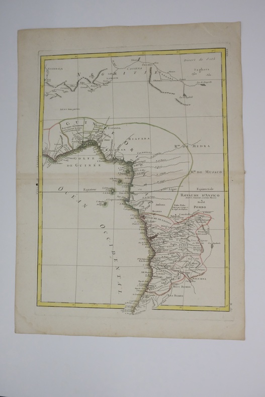
Carte de l'Afrique de l'Ouest (Guinée, Golfe du Bénin, Congo) Map of West Africa (Guinea, the Bight of Benin, Congo)
1770Best.-Nr. carte180b12Français : Un bel exemple de la carte décorative de l'Afrique de l'Ouest de Rigobert Bonne datant de 1770. Couvre de la Gold Coast (Ghana moderne), au sud autour du golfe du Bénin (Biafara) jusqu'au Gabon, au Congo et à l'Angola. Comprend les pays modernes du Ghana, du Togo, du Bénin, du Nigeria, du Cameroun, de la Guinée équatoriale, du Gabon, du Congo et de l'Angola. Comme la plupart des cartes de l’Afrique, cette carte montre d’excellents détails le long de la côte et uniquement des spéculations à l’intérieur. Donner la preuve d’importantes activités cartographiques belges à travers le Congo. Nomme de nombreux royaumes africains, dont Anzico, Mujaco, Bembe, Lubolo, Pemba, Dembi, Calbongo, Bake-Bake, Bénin et d'autres. Tentatives de cartographier le fleuve Niger quant à ses écoulements dans le désert de Seth ou Saghara, mais la plupart de cette cartographie est au mieux spéculative. Dessiné par R. Bonne en 1770 pour émission sous la planche no. B 30 dans le numéro de 1776 de Jean Lattre de l'Atlas Moderne English: A beautiful example of Rigobert Bonne's 1770 decorative map of West Africa. Covers from the Gold Coast (modern day Ghana), south around the Bight of Benin (Biafara) to Gabon, Congo and Angola. Includes the modern day countries of Ghana, Togo, Benin, Nigeria, Cameroon, Equatorial Guinea, Gabon, Congo and Angola. As with most maps of Africa, this map shows excellent detail along the coast and only speculation in the interior. Give evidence of significant Belgian mapping activities throughout the Congo. Names numerous African Kingdoms including Anzico, Mujaco, Bembe, Lubolo, Pemba, Dembi, Calbongo, Bake-Bake, Benin and others. Attempts to map the Niger River as to flows into the Desert de Seth or Saghara, but most of this cartography is speculative at best. Drawn by R. Bonne in 1770 for issue as plate no. B 30 in Jean Lattre's 1776 issue of the Atlas Moderne .
Librairie du Levant · Bayonne, Frankreich270,00 €
