4577 risultati
565 x 425 mm. Colour lithograph, signed "A. Jawa". Mounted on styrofoam board. Bilingual safety poster in Arabic and English. - Traces of folds. Numbered "B61-2" in blue pen below the horizonat fold on the right.
965 x 710 mm. Scale 1:500,000. In excellent condition.
1020:710 mm. Scale 1:500,000. "For use by War and Navy Department Agencies only. Not for Sale or distribution". - In good condition.
Colour lithographed postcard, 130 x 90 mm. A very rare Ottoman postcard depicting a map of Yemen, including the Ottoman-dominated northern and western parts of the country (Sana'a, Taiz, and Al Hodeidah), as well as the British-dominated southern regions (Aden). The card was part of a series made by Ibrahim Hilmi, one of the premier Istanbul cartographers of the era. - Ibrahim Hilmi Cigiracan (1876-1963) was one of the most important publishers and cartographers of the late Ottoman Empire. Born in Tulcea (now in Romania), he founded his first printing shop in Istanbul in 1896, under the name "Kitaphane-i Islami" (Islamic Library), largely producing religious books. Subsequently, Hilmi became interested in military affairs, geography and history, and changed the name of his press to "Kitaphane-i Islam ve Askeri" (Islamic and Military Library). He published about 200 military books, and his atlases (especially his "Pocket Atlas") were among the most popular cartographic items throughout the empire. During WWI, Hilmi gained the affection of the public for his charitable programme of sending free books to poor children in Anatolia. - Hilmi's enterprise thrived until Atatürk's Republican regime nationalized the publishing of law and school books in the 1920s, undercutting the most lucrative part of his business. However, Hilmi left an enduring legacy, having published over a thousand books on a wide variety of topics over three decades. - Very good, overall clean and crisp, just some very light even toning and slight stains to verso.
Engraved map, outline coloured. 580 x 260 mm. An antique map showing the East African coastline, extending from the mouth of the Red Sea to the Island of Zanzibar. The work was originally included in Karl Müller's "Geographi Graeci minores", along with many other maps of the region. - The map is highly detailed, showing many settlements, mountains, wadis, and more. The map is composed of four insets, with the largest focusing on the Somali coast. Most interestingly, Müller models one inset after a Greco-Roman periplus describing the western Indian Ocean. On this inset, Müller notes the travel times between adjacent ports, ostensibly following the notes in the periplus. - Fold toning.
915:625 mm. Scale: 1:1,000,000. Second edition. Map of the coast of Oman from Salala in the West to Duqm in the North. - In excellent condition.
33 x 44 cm (neat line). Pencil on paper. Charming dressage scene between an Arab in back view and two bridled Arabian horses with luxurious saddles and a backdrop of tents. The stallion on the left is carrying a round shield and a bow. The signing artist Charles Paris was probably an amateur and is not otherwise known. - Professionally restored. The upper and right margins show traces of tears and brittleness, probably due to old water damage. Browning and minor foxing overall. Some light spotting to the lower margin. The drawing is little affected by the paper flaws.
rif. 19792Paris Imprimerie Royale 1838 in 8 (22x14) 1 volume reliure à la bradel demi percaline bleue, dos lisse, pièce de titre de cuir marron, XXIII et 296 pages, avec 1 planche gravée hors-texte, quelques rousseurs sur les premières et les dernières pages. Reliure fin XIXème. Ouvrage posthume publié sous les auspices du Ministère de l'Instruction Publique. Saint-Martin Antoine-Jean, membre de l'Académie royales des Inscriptions. Rare. Bel exemplaire ( Photographies sur demande / We can send pictures of this book on simple request )
Hand-coloured engraved map (260 x 243 mm). Dutch title beneath lower margin. No scale. The Dutch edition of Jacques-Nicolas Bellin’s map, from Prévost's "Histoire générale des voyages (Paris, 1746). "This map is perhaps the original of the maps appearing in Prévost" (Tibbetts). Map of Arabia and the Red Sea emphasizes the coastlines and the interior is primarily left blank. The shoals and navigational hazards in the Red Sea and the pearl banks off the coast of Bahrain are also noted. Decorated with a title cartouche. - Well preserved. Tibbetts 267. Al Ankary 173. Not in Al-Qasimi.
17768vo. XX, 324 pp. With woodcut title vignette. Contemporary calf with giltstamped spine label and attractively gilt spine. All edges red. Marbled endpapers. Second Latin edition of the "Memoires secrets de la guerre de Hongrie" (1771). 1771 had also seen the publication of the "Memoriae secretae belli hungarici annis 1737, 38, 39", of which a German edition was published in 1772 ("Geheime Nachrichten von dem Kriege in Ungarn in denen Feldzügen 1737, 1738 und 1739"). - The Prussian officer F. W. K. Gf. von Schmettau (1742-1806), a member of the military staff of Frederick the Great, was known for his topographical maps. For the translator, the Tyrnau theologian and professor of oratory Michael Horvath (1728-1810), cf. de Backer/S. IV, 470. - A pretty copy. Petrik 1712-1860, III. OCLC 80119364. Cf. Atabey 1099 (2nd French ed.). Not in Apponyi or De Backer/Sommervogel.
8vo. 160 pp. Illustrated. Original pale blue wrappers titled in navy. First edition of "The Campaign for the Liberation of Israel": a rare publication on the First Arab-Israeli war by Israeli geographer Zev Vilnay (1900-88). Better known for his lectures on outdoor hiking and touring in Israel, Vilnay also served as a military topographer in Haganah and later the Israel Defense forces. His work, written in Hebrew, is profusely illustrated with maps showing transportation corridors, troop movements, and military and civilian installations. Vilnay's maps depict battles in and around Jerusalem, Haifa, Tel Aviv, the Upper and Eastern Galilee, and many more, discussing strategy and the use of infrastructure and landscape in waging war. An interesting geographer's view of Israeli military action during the 1948 Arab-Israeli War. - Light wear to spine. OCLC 19195703.
Hand-coloured lithograph. 380 x 555 mm. Fine image of a Sparrowhawk, from John Gould's monumental "Birds of Great Britain" (London, 1862-1873, 5 vols.). Joseph Wolf (1820-99) "was the first bird artist to understand and use the new freedom of style that lithography allowed [...] He introduced natural settings and a feeling of motion into his paintings. Early training in lithography and art [...] opened the door to Wolf's development into one of the first and finest true bird artists. He breathed life into the stiff 'bird on a perch' portrayals so characteristic of bird art of the day. Wolf liked especially to paint birds of prey and game birds, with their subtle browns and grays" (Cornell University Library). Fine Bird Books 102. Nissen IVB 372. Sauer 23. Wood 365. Zimmer 261.
8vo. X, (11-)54 pp. 27 ff. Original lithographed wrappers bound in splendid blue morocco with giltstamped cover borders, green inlays, title to gilt spine, marbled endpapers. Stored in marbled slipcase. First editon, with the first German translation of this collection of moralizing addresses by the Arabic-Persian scholar Zamakhshari (1075-1144). Another translation, by H. L. Fleischer, appeared that same year in Leipzig. The present copy, untrimmed and partly uncut in the original lithographic wrappers, boasts a fine full morocco binding of the early 20th century with green morocco inlays and elaborate gilt ornamentation. - Some foxing throughout; spine sunned. A beautiful copy from an Austrian private collection. GAL I, 292, no. XVI (p. 349). Zenker I, 164, 1347. Fück 165, 175. WG² 47. Goedeke VII, 766, 90. Wurzbach VII, 277, 49. Brieger 965. Hirschberg 195. Kosch VII, 242. OCLC 978579284.
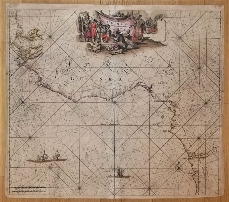
1700rif. 17369Amsterdam, de Wit, 1675 (recte um 1700). Ca. 49,5 cm x 57 cm. [4 Warenabbildungen]
8vo. pp. 97-105 (entire volume: iv, 65-128 pp., with 18 photographic illustrations and a folding colour map). Original printed blue wrappers. Early account of a visit to the seaport of Dhofar (Oman) on the southern coast of the Peninsula, including an interesting account of the local boats and the sailing skills of their owners. The illustrations show Makalla in Hadramaut, a camel drawing water in Dhofar, and the ruins of the temple of al-Bilad. Macro 777. OCLC 49427292.
12mo. 180 pp. Rebound in green buckram. Title page with engraved vignette of a Kangaroo and three full page engraved plates. First edition. - A third hand account of the travels of one Captain Blisset, "an Englishman of birth and large fortune", in company with William Walsh, from Bombay, to the Arabian Gulf, having toured which they pass on to Muscat and Mecca, thence to the Holy Land. Nothing seems to be known of Blisset. Possibly a fictitious account, but the detail seems firmly based on fact, save for the incongruous Kangaroo on the title page.
4to (185 x 248 mm). 80 pp. Illustrated throughout with photographs, diagrams, and maps. Original light blue printed wrappers. Pamphlet covering the history of Kuwait, the operations of the Kuwait Oil Company, and the "New Kuwait" of the 1950s. The Kuwait Oil Company was founded in 1934 and was heavily involved in the modernization of Kuwait, whose large petroleum and natural gas reserves were first tapped at Burgan Field in 1938, with production beginning in 1946. The pamphlet focuses on the changes brought to Kuwait by the oil industry in the first ten years since its inception: graphs and photographic illustrations show the rise in oil production, numerous scenes of the refineries, pipelines, workers' houses, mosques, and recreational scenes at Ahmadi, and an early gas station and new housing in Kuwait City. Also explained is the family history of the al Sabah rulers of Kuwait, with a family tree and portraits of previous and contemporary rulers, including Sheikh Mubarak Al-Sabah (1837-1915), Sheikh Ahmad Al-Jaber Al-Sabah (1885-1950), and Sheikh Abdullah Al-Salim Al-Sabah (1895-1965), first Emir of Kuwait; one image depicts him ceremonially opening an oil well. - Wrappers slightly browned at extremities, quite well preserved. OCLC 21880314.
Colour printed map, 540 x 680 mm, with yellow covers (195 x 110 mm). Map of Iran, Iraq and parts of the surrounding countries, including modern Kuwait, Bahrain, Qatar and the UAE, in the 1930s, published in the series "Philips' authentic imperial maps for tourists & travellers". Published in the early years of the discovery of oil in the Middle East, the map shows roads and railways, but also caravan routes, submarine cables and oil pipelines. - Slightly soiled, in very good condition.
Folio. 2 pp. Clichy provides 25 horses in fulfilment of a mandate issued on September 4, concerning the requisition of 40,000 horses. - Somewhat spotty and browned.
8vo. 279, (1), (6, publisher's catalogue) pp., final blank leaf. With 5 maps in the text. Original illustrated green wrappers. First French translation, by Geneviève and Pierre-François Caillé, of Captain Armstrong's 1934 biography of Abdulaziz Ibn Saud (1875-1953), the founder and first monarch of Saudi Arabia, "Lord of Arabia, Ibn Saud", revised and expanded with a new chapter by the author. - From the library of Vittorio Emanuele III, King of Italy, with shelfmark label of the royal library to spine. An excellent copy.
8vo. 368 pp. With numerous illustrations in the text. Modern green half calf. First edition of this account of the author's pilgrimage to Mecca. The writer and Islamic scholar Abd al-Wahhab Azzam (1895-1959), nephew of the Pan-Arabist statesman Abd al-Rahman Azzam, was educated at London's School of Oriental Studies and at Cairo University, then taught at the latter institution, where he became dean in 1945. "Appointed Egypt's ambassador to Pakistan in 1950 and to Saudi Arabia in 1954, he founded King Saud University in Riyadh and in 1957 became its first director [...] Azzam was Egypt's foremost pan-Arab intellectual" (Goldschmidt, Biographical Dictionary of Modern Egypt, p. 29f.). - An excellent copy. Rare; OCLC lists only nine copies in libraries worldwide. OCLC 23512537.
Large 8vo (180 x 250 mm). (288) ff. Full auburn leather, titled on paper spine label. A volume of medical pathology printed lithographically in Persian (with occasional Arabic), featuring detailed descriptions of physical ailments, including the appearances of ailing organs as might be seen by a surgeon, the areas of the world in which a particular disease or ailment was more common, and the history of a disease as known to medical science at the time. Each entry is titled and numbered, though not always consecutively, and a table of contents can be found at the rear. - An interesting and detailed medical textbook, covering everything from the venereal to the cardiovascular, probably reproduced lithographically from a contemporary manuscript. The likely scribe of that original manuscript, named in the colophon, was Muhammad Baqir ibn Muhammad Jawad al-Mussawi al-Asfahani. - Blindstamps from the library of the Fabryky Sergyeva, Ukraine, appear on some pages. Light exterior wear. Title-page loose with edge flaws, occasional light stains, otherwise generally in good condition.
8vo. (2), 73, (1) pp. Original green printed wrappers. First edition. The author was Director of Revenue and Customs for the Government of Palestine and was put in charge of supervising the religious endowments. Finding no European work on the subject of wakfs, he was compelled to publish his notes on the subject. - A few small splits to spine, small area of loss to rear wrapper, otherwise good. Duplicate stamp and partially erased reference stamp to front wrapper. OCLC 42828458.
8vo. VIII, 9-253, (1) pp., final blank. With 8 photographic plates and several illustrations in the text. Contemporary full blindstamped cloth with silver-stamped title to cover and spine. First edition, rare. A classic of falconry describing the training and care of hawks, by the renowned falconer Blaine, drawing on more than 40 years of experience in the field. When the book was reprinted in 1970, the publisher's blurb noted that the book was "extremely scarce and second-hand copies are making as much as eight guineas in the sales rooms". - Blaine, a longtime member of the Old Hawking Club, "was one of those legendary figures who seems to come along in falconry every so often, raising the standards of the sport as well as pushing the envelope of what can be accomplished" (Gallagher). His useful handbook provides an introduction to the sport, and includes a glossary of falconry terms as well as a short bibliography on the subject, mentioning an English edition of the famous Persian falconry treatise "Baz-Nama-Yi Nasiri". - The plates show a greenland falcon, a falcon eyass, a passage falcon, a falcon pluming a grouse, two eyass tiercels, a goshawk, and a team of passage hawks weathering. The smaller illustrations in the text display falconer's equipment, the beaks of falcons and hawks, and the technique of repairing damaged feathers. - Handwritten ownership of Charles Henry Stanley Garton (b. 1920), dated Kingswood 1946, to front pastedown. Two black and white photographic illustrations clipped from a magazine, showing tiercels, are loosely inserted. - Somewhat browned and brownstained throughout. A single copy in auction records. Gallagher, Falcon Fever 177. U.S. Air Force Academy Library, Special Bibliography Series 3, 2. OCLC 603525547.
8vo. (4), VI, 299, (1) pp. With one folding map. Publisher's yellow printed wrappers. First edition of Bonet-Maury's study of Abrahamic religions in Africa, supporting both Christianity and Islam as superior alternatives to local beliefs. A protestant clergyman and academic, Gaston Bonet-Maury (1842-1919) wrote extensively on monotheistic faiths and their unity, proposing them as a significant factor in the development of Western civilisation. - Slight marginal toning, a few light marks, otherwise a very good copy. From the library of Vittorio Emanuele III, King of Italy, with manuscript pencil poem to final blank and shelfmark label of the royal library to spine.