4.361 Ergebnisse
Standard issue, 514 x 690 mm. Scales 1:8,250 and 1:94,700. Nautical chart of Perim Harbour, Beilul Bay and the Rakhmat Island anchorage in the Red Sea, prepared by the British Admiralty. The island of Perim divides the Strait of Mandeb into two channels. The island, as a dependency of Aden, was part of the British Empire between 1857 and 1967. - Perim encloses a deep and comparatively large natural harbour on the southwestern coast. The chart labels the pilot's and coal agent's houses, piers, coal stacks, the hospital, the Lloyd's signal station, and leisure facilities like a tennis court and a cricket ground. Other prominent places on the island include the fishing village of Meyun, Murray Point, William Bay, the old fort, and a parade ground. The two smaller maps of Beilul Bay and Rakhmat Island detail lava formations, mangroves, and swamps. - The British Admiralty has produced nautical charts since 1795 under the auspices of the United Kingdom Hydrographic Office (HO). Its main task was to provide the Royal Navy with navigational products and service, but since 1821 it has also sold charts to the public. The present chart was composed after Admiralty surveys of 1885; it was first published in 1886 and saw several corrections up to 1919. Captioned in former collectors' hands on verso.
Standard issue, 687 x 860 mm. Scale 1:17,980. Nautical chart of the southernmost part of the Red Sea with Perim Island, prepared by the British Admiralty. With a view of the Strait of Bab-el-Mandeb near lower margin. - Perim Island, as a dependency of Aden, was part of the British Empire between 1857 and 1967. The island encloses a deep and comparatively large natural harbour on the southwestern coast. The chart labels the pilot's house, piers, coal stacks, the hospital, and the Lloyd's signal station. Other prominent places on the island include the fishing village of Meyun, Murray Point, William Bay, the old fort, and a parade ground. The chart includes the Arabian coast of the Bab-el-Mandeb strait, detailing Sheikh Malu or Oyster Island, Ras Sheikh Syed, and Jebel Manhali. - The British Admiralty has produced nautical charts since 1795 under the auspices of the United Kingdom Hydrographic Office (HO). Its main task was to provide the Royal Navy with navigational products and service, but since 1821 it has also sold charts to the public. The present chart was composed after Admiralty surveys between 1874 and 1918; it was first published in 1874 and saw several corrections up to 1924. - With a single fold. Some manuscript corrections and a note in pencil: "Caution / The 2 Red Lights on Lloyd's Signal Station are now discontinued". With a stamp "Increase 50%" near lower right corner. Captioned in print and in a former collector's hand on verso. A large tear in the centrefold.
Standard issue, 696 x 1020 mm. Scale 1:200,000. Nautical chart of the Gulf of Aden from the Bab al-Mandab Strait to the city of Aden, prepared by the British Admiralty. The chart details the approximate western boundary of the British Protectorate and pays particular attention to geological features, labelling the Jebel Arror or Chimney Peaks, as well as numerous other hills along the coast including the Sugarloaf near Aden. Among the most prominent labelled places are Perim Island, Jezirath Sowabih, Jebel Manhali, Sakiah, Ras al Ara, Aden, and Aden Harbour. - The British Admiralty has produced nautical charts since 1795 under the auspices of the United Kingdom Hydrographic Office (HO). Its main task was to provide the Royal Navy with navigational products and service, but since 1821 it has also sold charts to the public. The present chart was composed after Admiralty surveys of 1900 and 1929; it was first published in 1930 and saw several corrections up to 1935. - With a single fold. Small ruststains near lower corners; a few manuscript notes. Captioned in print and in a former collector's hand on verso.
1040 x 710 mm. Scale 1:150,000. Nautical chart of the Arabian Gulf off the coast of Ras Tanura on the north-eastern coast of the Arabian Peninsula. Including tidal information, compass roses, soundings, seabed notations, currents, sandbanks, shoals, inland elevations. This edition first published in 1951, re-engraved in 1958, with revisions in 1962, 1963 and (overstamped or handwritten) 1964. - Folded; very well preserved. Provenance: from the archives of Lilley & Reynolds Ltd., suppliers of Navigation Equipment.
1040 x 710 mm. Scale 1:350,000. Nautical chart of the Arabian Gulf off the coast of Ras Tanura on the north-eastern coast of the Arabian Peninsula, with parts of the southern coastline of Persia. Including tidal information, compass roses, soundings, seabed notations, currents, sandbanks, shoals, inland elevations (including a "conspicuous tree" on the island of Shaikh Shu'aib). This edition first published in 1955, with large corrections in 1958 and smaller ones in the subsequent years to 1964 (overstamped or handwritten). - Folded; some pencil annotations but very well preserved. Provenance: from the archives of Lilley & Reynolds Ltd., suppliers of Navigation Equipment.
Standard issue, 710 x 864 mm. Various scales. Nautical chart of the northern Red Sea, showing the Sinai Peninsula, the Gulf of Suez and the Gulf of Aqaba, prepared by the British Admiralty. With 4 inset maps displaying the Tiran Island anchorage, Sherm Yahar, Sherm Jubba, and El Tor harbour. - The chart details major cities including Sharm-el-Sheikh, Hurghada, Aqaba, Magna, and Suez, as well as historic landmarks like Mowila fort. In addition, the chart warns the mariner of dangerous currents in the Red Sea as well as tidal streams in the Gulf of Suez. The inset map of El Tor harbour shows hospital buildings, a well of fresh water, pilgrims' baracks, mosques, ruins, and the camel track to Wadi Sillah. - With a small illustration of the Ashrafi lighthouse. - The British Admiralty has produced nautical charts since 1795 under the auspices of the United Kingdom Hydrographic Office (HO). Its main task was to provide the Royal Navy with navigational products and service, but since 1821 it has also sold charts to the public. The present chart was composed after Admiralty surveys of 1830-34 and 1911; it was first published in 1873 and saw several corrections up to 1931. - Small tear in lower margin, not touching image. Top margin slightly creased. A single fold; a few manuscript notes. With a stamp "Increase 50%" near lower right corner. Captioned in print and in a former collector's hand on verso.
132.5 x 55 cm. Includes the Arabian Peninsula with the Arabian Gulf. Engraved chart, with tidal information, compass roses, soundings, seabed notations, currents and sandbanks. Lighthouses and beacons picked out in red and yellow. Signs of contemporary use, with several pencil markings. Not in the Al Ankary or Al-Qasimi collections
8vo. 15, (1) pp. With 6 photographic illustrations and decorative borders. Original stapled green wrappers with a photographic portrait of King Faisal and gilt title. A scarce, appealing booklet commemorating King Faisal's speech at a banquet in honour of notable pilgrims and heads of official Hajj missions, given at the Bat-Haa Palace in Mecca on 30 December 1973. Includes the full speech as well as several illustrations showing the king kneeling in prayer, during his speech behind an array of microphones, and seated among the audience. - Spine slightly rubbed. Ballpoint initials to upper cover. Very rare, no copy traced in libraries worldwide.
Colour-printed map, 590 x 855 mm. Bilingual road map of the Arabian Peninsula for Aramco employees. Focused on Saudi Arabia, the map shows the main roads, as well as surfaced roads, trails, roads under constructions and even proposed roads. A list titled "hints for survival" mentions extremely logical traffic rules such as "come to a complete stop at stop signs and observe stop-and-go signals" and "observe speed laws in the community where you live as well as on the highway". Placing common traffic rules under the header "hints for survival" makes one fear the worst for Saudi Arabian traffic in this period. The Arabic side of the map contains the same "hints" as well as a list of road signs in Arabic and English. - In very good condition.
808:640 mm. Scale: 1:1,000,000. Folded. First edition. Map of the western coast of Saudi Arabia from Abu Shaibana in the north to Rakah in the south, and from Rabigh and Jeddah in the west to Turbah in the interior. Including parts of Anglo-Egyptian Sudan and Egypt. Compiled by W. O. 1939, drawn and heliographed by O. S. 1940. With 2 printed straight lines giving degrees of longitude dated December 1943. - Inscribed "Mecca 5" by a former collector near lower margin. - A few small tears and creases.
11 photographs (135 x 87 mm), individually numbered in the negative and mounted on cardboard (170 x 120 mm). Showing polo teams during a match, portraits of athletes with their horses, etc. - A well-preserved, uncommon set.
Folio. (2), 1, (1) pp. Bifolium. Full text of the agreement between the British and Sultan Abdullah bin Omer Al Quaiti, Jemedar of Shuhr (Ash-Shihr) in the Qu'aiti State in Hadhramaut (Yemen) "to abolish and prohibit the import and export of slaves to or from the port of Shuhr". - Disbound from a volume of parliamentary papers but otherwise as issued, foxed.
8vo. 3 vols. Contemporary giltstamped calf with double giltstamped black spine labels; spines gilt; giltstamped borders to covers. First edition of this encompassing study by the Rev. Robert Adam (1770-1825), long a standard work on the world's religions. - A prettily bound set from the library of the British philosopher of religion, David Arthur Pailin (b. 1936), with his bookplate. OCLC 1615651. Cf. Chauvin XII, 53 (later edition 1823).
570 x 425 mm. Colour lithograph, signed "Ibrahim K.". Mounted on styrofoam board. Bilingual safety poster in Arabic and English. - Traces of folds.
570 x 420 mm. Colour lithograph, signed "Ibrahim K.". Mounted on styrofoam board. Bilingual safety poster in Arabic and English. - Traces of folds.
Folio. 1 page. On uncut wove paper, bearing the Schoellers-Parole blind embossed seal, margins uncut. The original autograph contribution of Aberrahman ou Rabah to the Committee of the World League for Peace (Ligue Mondiale pour la Paix), a remarkable organization formed in 1925 with close ties to the League of Nations. The Committee itself was composed of such notaries as Queen Elizabeth of Belgium, King Carol II of Romania, John D Rockefeller, Marie Curie, and Albert Einstein, who personally gathered the present manuscripts over the course of seven years (1925-32). Among the public figures who contributed to the project were dignitaries from the newly-created League of Nations' member states. "Our wish, we French Muslims of Algeria, like that of all Frenchmen, is the peace in dignity of France and the safeguarding of her global interests. But if this peace that we wish for so ardently might prove impossible, on a troubled day, the native Algerians would be, as we well know, in the front ranks of the defenders of the country. [Signed] Abberrahman Ou Rabah, Bachagha, Member of the Supreme Council of the Government, Member of the Chamber of Agriculture, Grand Officer of the Legion of Honour". Pax Mundi. Livre d'or de la paix. Enquete universelle de la Ligue mondiale pour la paix sous le haut patronage de son comite d'honneur avec l'approbation de la Societe des nations, du Bureau international du travail et de la Cour permanente de justice internationale. Geneve, Societe paxunis, 1932.
18968vo. (2), 236 pp. With frontispiece, large folding panorama, and 30 wood-engraved text illustrations (some full-page). Contemp. green half calf with giltstamped title to spine. Marbled endpapers. Second edition. - Jules Gervais-Courtellemont (1863-1931), a convert to Islam, was one of the few Western visitors to Mecca during his time. His classic account of his pilgrimage is of special interest for the numerous illustrations engraved after photographs by the author. Many of the buildings and sites thus documented have since changed significantly or disappeared altogether. - Foxed throughout; old library stamp on t. p. Binding rubbed and bumped; spine faded. From the library of the "Cercle Militaire d'Amiens" with their name giltstamped to lower spine-end. Macro, Bibliography of the Arabian Peninsula, 1016. OCLC 490071086.
8vo. 255, (1) pp. With 13 photo illustrations and a map. Original red publisher's cloth with giltstamped spine title. Original dust jacket. Second printing of the first edition. A documentary of a year spent by the author in the Arabian Gulf, discussing Bahrain, Abu Dhabi, Buraimi Oasis, Qatar, Kuwait; hunting and falconry. Dedicated "to the honour and glory of His Excellency Sheikh Shakhbut bin Sultan Albufalah, Ruler of Abu Dhabi". - Ink inscriptions (dated 1958) to flyleaf and pastedown. Now rare. Not in Macro, Bibliography of the Arabian Peninsula.
8vo. 255, (1) pp. With 13 photo illustrations and a map. Original red publisher's cloth with giltstamped spine title. Original dust jacket. Second printing of the first edition. A documentary of a year spent by the author in the Arabian Gulf, discussing Bahrain, Abu Dhabi, Buraimi Oasis, Qatar, Kuwait; hunting and falconry. Dedicated "to the honour and glory of His Excellency Sheikh Shakhbut bin Sultan Albufalah, Ruler of Abu Dhabi". - Dust jacket slightly frayed, otherwise a good copy of this now-rare title, inscribed "Laurie Tinckler / Bahrain / July 1958" on flyleaf. Not in Macro, Bibliography of the Arabian Peninsula.
Small folio (238 x 298 mm). (4), XXVII, (1), 470, (2) pp. Later 19th century marbled half calf with giltstamped title to gilt spine. Marbled endpapers. First edition. - Since 1815 Peyron (1785-1870) taught oriental languages at the University of Turin. He was a specialist in the Coptic language, the latest stage of Egyptian and spoken in Egypt until at least the 17th century. His research in this field gained him an international renown that was consolidated by his Coptic dictionary, the earliest of its kind. It remained unsurpassed until Wilhelm Spiegelberg's "Koptisches Handwörterbuch" in 1921. - From the library of the Ducs de Luynes at the Château de Dampierre: their bookplate reproducing the arms of Charles Marie d'Albert de Luynes (1783-1839), 7th Duc de Luynes, on pastedown. An excellent copy. Ibrahim-Hilmy II, 113. Gay 2337. Zaunmüller 228. Vater/Jülg 209. Brunet IV, 584. Graesse V, 247. OCLC 2786885.
18858vo. XIV, 322, (2) pp. Original brown cloth with giltstamped title to spine. First edition of the standard work by W. Robertson Smith, Lord Almoner's Professor of Arabic at Cambridge. - Removed from the Harvard College Library (with duplicate stamp). A single ink marking in the margin, otherwise fine. Remains of shelfmark labels. Another copy sold for £1,500 at Sotheby's in 1998 (Oct 14, lot 1125: some underlining of text & marks in margins). Macro, Bibliography of the Arabian Peninsula, 1921. Fück 210. OCLC 2156214.
1987Ballpoint, heightened with white. 373 x 276 mm. Matted. A sheet of annotated preliminary sketches (one on recto, two on verso) for Upton's watercolour portrait of the three Arab mares Gold Roseifa, Russallka, and Roxiralot.
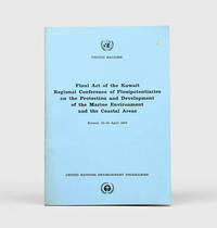
1978Best.-Nr. 172055Perhaps Kuwait: United Nations Environment Programme 1978. First and sole edition untraced in Middle Eastern libraries of this plan enshrining environmental protection as a priority for future development along the Arabian coast. The regional conference highlighted the dangers posed by oil spills and committed to pollution-control measures for future projects. Participants included delegates from Bahrain Iran Iraq Kuwait Oman Qatar Saudi Arabia and the UAE. Attendees also agreed on a regional trust fund funded in different proportions by eight governments including the UAE and Saudi Arabia to finance initiatives. In the United Kingdom copies can be found at the universities of Oxford Durham and Southampton. We have also located three each in the US and Canada two in Germany two in Switzerland and one each in Austria and Sweden. Octavo. Original pale blue wrappers wire-stitched as issued front cover lettered in black. Light peripheral toning to covers small rust mark at top corner of front cover back cover slightly creased: a very good copy. unknown
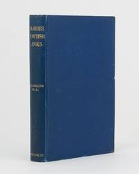
1911Best.-Nr. 75830Edinburgh: R. and R. Clark 1911. First Edition. Hardcover. Very Good. Edinburgh R. and R. Clark 1911. Octavo viii 150 pages plus 2 plates. Original blue cloth slightly rubbed at the extremities and lightly marked; tiny bump to the leading edge of the front cover; bottom corner of the rear board cracked creating a ripple in the cloth along the fracture and cracking the pastedown but the corner is firm and stable; edges endpapers and first and last pages foxed; a very good copy. Inscribed and dated 26 December 1913 by the author. R. and R. Clark hardcover
8vo. (4), 176 pp. With woodcut title-vignette, 45 numbered and several unnumbered woodcut illustrations in the text. With the original printed wrappers bound in at the end. Later half calf over marbled boards with giltstamped spine-title. First edition. - A classic of falconry, this pocket-sized manual is a supplement to the second volume of the ornithological textbook "Leçons élémentaires sur l'histoire naturelle des oiseaux" (1862-63) by the French zoologist Chenu (1808-79) and the ornithologist Des Murs (1804-94). The illustrations show various kinds of falcons, as well as their training and typical flight paths, sometimes displaying specific parts of the birds' bodies like wings and claws in detail. Figure no. 5 ("Faucon sur une Gazelle") is copied from the plate of "Goshawk and Gazelle" by Joseph Wolf, which forms the frontispiece to Richard F. Burton's 1852 work "Falconry in the Valley of the Indus". - Ownership of Charles Henry Stanley Garton (b. 1920), dated Kingswood, 13 October 1943, to front pastedown. Occasional light spotting; traces of the title-page being glued to the first page near the gutter. Harting 200. Schwerdt I, 109. Thiébaud 192. Souhart 100. OCLC 944664144.