4.361 Ergebnisse
Ca. 235 x 190 mm. Original hand-coloured map on tissue paper. In Ottoman script and Arabic. Two hand-drawn maps on a single sheet, made in the Ottoman Empire, likely in Istanbul, near the beginning of the 20th century. The map to the left depicts the Baghdad Vilayet, embracing Central Iraq. The map on the right features the Basra Vilayet, extending from Southern Iraq down the southern coast of the Arabian Gulf to include Kuwait, what is now the Dhahran area of Saudi Arabia, Bahrain, and Qatar. By the late 19th century the Gulf States had become de-facto British protectorates and were no longer practically subject to Ottoman rule; still, the Sublime Porte never relinquished its sovereignty. - Maps such as this, executed on thin tracing paper, were commonly made as educational tools at elite Ottoman schools and universities during the early 20th century, although few such specimens survive. - Clean and bright, with light creasing and traces of an old vertical centrefold.
36 vintage small format silver gelatin photographs, plus a photographic postcard of Faisal II as a boy. A small collection of highly accomplished amateur photos of inter-war Iraq. With a handful of exceptions, the photographs show the local population, often children, recorded with a sensitive and sympathetic eye. - Though there is no material evidence to support the attribution, they came from a collection of similar material said to belong to Christopher Warren, who worked as an Intelligence Officer in Iraq, Lebanon and Kuwait in the 1930s. Other photographs, offered for sale at the same time as these, show that he was active in those locations and was, at one point, based at Dar Al Qamar (Moon House), Karradat Mariam, Baghdad. - The many intimate and beautiful portraits would suggest the photographer spoke Arabic and understood enough about his subjects to foment the mutual comfort necessary for such candid images. Several show young people from both the city and the countryside: the sons of shop-owners at ease in the hustle and bustle of Baghdad and children gathering crops, hunting and playing reed flutes in the open expanse of the desert. Some, such as the portrait of a suited young man in a local boat, potentially imply a professional relationship. Viewed together, the images express a peacefulness far removed from the tensions of the interwar period, in which protests against British influence were common, even after the independence of the country in 1932. Only a photographic postcard, present with the images, reminds one of the broader historical context: a portrait of Faisal II, still a child but standing upright in military dress. - All photographs clearly removed from an album, with residual scraps of brown album paper to versos.
4to. 8 pp. Sewn. Rare 1758 Portuguese account of the city of Isfahan, formerly the capital of Persia, published during the uneasy period in Iranian history between the end of Nader Shah's reign and the rise of the Qajar dynasty, more than a century after the Portuguese had withdrawn from the Gulf. WorldCat lists copies in Harvard, Ann Arbor, Princeton, British Library, Cambridge Univ., and Tübingen. - Well-preserved. Floor/Hakimzadeh, Acta Iranica, p. 32. OCLC 22325642.
255 x 364 mm. Colour print. Showing several holy Islamic pilgrim sites in Saudi Arabia. The Baitullah Sharif in Mecca in the centre of the print is surrounded by eight illustrations, including Mount Arafat, Al-Masjid an-Nabawi in Medina, the mosque of Ta'if, and the cemeteries Jannatul Mualla and Al-Baqi'. The outer part of the oval shows by 24 illustrations of landscapes and architecture near Mecca (Jabal al-Nour, Muzdalifa, etc.). The corners are filled in with calligraphy. - Some chipping; edges professionally repaired. Cf. Murat Kargili, The Holy Journey. The Hajj Route through Postcards, Istanbul 2014, p. 277.
8vo. 116 pp. Contemporary grey wrappers. Extremely rare, anonymous account of the "Life and opinions of Muhammad, the Prophet of the Muslims, and founder of a great monarchy, with the history of Arabia" (as the book is titled in German). Chauvin attributes the work to the Altdorf professor Wolfgang Jäger (1734-95), who taught Western languages but was not an oriental scholar. The chapter on modern life in the Arabian Peninsula is based on Niebuhr, while the section on Arab women and the liberties and privileges they enjoy is credited to John Richardson (being an original translation from his "Dissertation on the Languages, Literature, and Manners of Eastern Nations"). - A few professional restorations, spine rebacked, otherwise well preserved. Chauvin X, 586. Not in Holzmann/Bohatta.
Folio. XIII, (1), 80, (4) pp. Orange cloth with giltstamped spine title, boards blindstamped "Foreign Office". First English translation of Kâtib Çelebi's great work on the history of the Ottoman navy, "The Gift to the Great Ones on Naval Campaigns". Written in 1657, the book was the second to be printed at Ibrahim Müteferrika's famous Constantinople press (in 1729). It emphasises the importance of the Turkish activities in the seas and the Ottoman contribution to the navigational history, long a strangely neglected subject. Kâtib Çelebi, who is one of the outstanding names of the Ottoman world of scholarship in 17th century and one of the most prolific authors in terms of the number and types of his works during that period, was a man of knowledge, ideas and culture who was widely spoken about in the Ottoman period of the Islamic World. - Withdrawn from the Foreign Office Library with their engraved armorial bookplate and withdrawal stamp. OCLC 29073533.
4to. XI, (1), 418 pp. With folding lithographed frontispiece and a lithographed plate, both in original hand colour. Ca. 1940s giltstamped full blue morocco with spine-title. Leading edges gilt. Marbled endpapers. All edges gilt. First edition of this classic of Middle Eastern travel literature, published anonymously. The first literary venture by the English travel writer and historian Kingslake, in which he described a journey he made about ten years earlier in Syria, Palestine and Egypt, together with his Eton contemporary Lord Pollington. According to the Irish traveller and novelist Elliot Warburton, the book evoked "the East itself in vital actual reality", and it was instantly successful. - Packed with intimate details of a traveller's life and emotions, the narrative includes vivid accounts of Kinglake's encounter with Lady Hester Stanhope (1776-1839), one of the most famous travellers of her age, at her home near Sidon in Lebanon, as well as of a severe outbreak of the plague during his 15-day sojourn in Cairo: "When I first arrived, it was said that the daily number of 'accidents' by the plague, out of a population of about 200,000, did not exceed four or five hundred, but before I went away, the deaths were reckoned at twelve hundred a day [...] When first I arrived at Cairo, the funerals that daily passed under my windows were many, but still there were frequent, and long intervals without a single howl. Every day, however [...] these intervals became less frequent, and shorter, and at last, the passing of the howlers from morn to noon was almost incessant. I believe that about one half of the whole people was carried off by this visitation [...]" (p. 283ff.). - The frontispiece shows a group of travellers on horseback passing the skeletons of impaled robbers in the Balkans, captioned "Eastern Travel". The plate shows a baggage raft and some swimmers crossing the River Jordan. - Upper hinges slightly rubbed. Frontispiece worn in the folds; occasional very slight foxing. Provenance: pastedown has bookplate of Frank Goldsmith, possibly the Kentish-born photographer of that name (1902-82) who survived the sinking of the Titanic as a nine-year-old and relocated to the USA after WWII. A fine copy in an sumptuous blue morocco binding produced by the Bayntun-Riviere bindery in Bath, England. Blackmer 911. OCLC 1191005987. Cf. Weber 369 (1845 2nd edition). Atabey 635 (1847 French edition). Not in Aboussouan.
240 x 340 mm. Coloured print. Matted. Plate K VI from Knorr's "Deliciae naturae selectae oder auserlesenes Naturalien-Cabinet welches aus den drey Reichen der Natur zeiget, was von curiösen Liebhabern aufbehalten und gesammlet zu werden verdienet [...]". Begun by Knorr as early as 1751, it was continued by his heirs after his death in 1761. The book describes items from the great contemporary natural history collections. Cf. Nissen, ZBI 2227. Horn/Schenkling 12038. Hagen I, 426. Dean I, 696. Graesse IV, 35.
4to. (8) pp. With woodcut Papal arms and the Saints Peter and Paul on the title-page. Modern wrappers. Rare pamphlet of litanies and prayers invoking Divine assistance against the Ottoman threat during the Great Turkish War of 1683 to 1699. Previously issued in 1683, and again in 1716, during the Ottoman-Venetian War. OCLC lists a single copy at the Biblioteca Nazionale Centrale di Roma. - A waterstain throughout, else fine. OCLC 954866405.
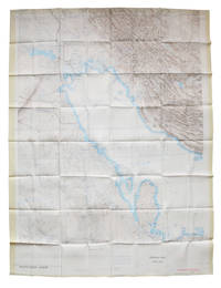
1967Best.-Nr. L6CEZZVCL8UFSt Louis: Aeronautical chart and information center United States Air Force 1967. Two maps colour printed on both sides of a sheet of silk 103 x 78.5 cm on a scale of ca. 1:1000000. The two maps ONC-H-6 & ONC-H-7 show one continuous area. Rayon pilot's map of the Arabian Gulf region focusing on the Trucial States modern UAE Qatar Bahrain Oman Iran and Saudi Arabia including main oil installations. Items of specific interest to aircraft such as airfields and even seaplane bases are particularly listed. Warnings to stay within the specific flying routes while in Iran are placed on multiple locations. While the map depicts a continuous area on both side on of one sheets it actually consist of two maps originally published separately. Slightly frayed at the edges. In very good condition. Aeronautical chart and information center, United States Air Force, unknown
Map (1030 x 785 mm), colour-printed on two sides. Scale 1:1,000,000. Rayon pilot's map of the Arabian Gulf region focusing on the Trucial States (modern UAE), Qatar, Bahrain, Oman, Iran and Saudi Arabia, including main oil installations. Items of specific interest to aircraft, such as airfields and even seaplane bases, are particularly listed. Warnings to stay within the specific flying routes while in Iran are placed on multiple locations. - Slightly frayed at the edges. In very good condition.
Colour printed map, 540 x 400 mm. Map of the Arabian Peninsula and parts of the USSR, Turkey, Iran and the British, French and Italian colonies in Africa, possibly coming form an edition of the "Commercial atlas of the world". Printed in yellow are oil fields and pipelines, including the legendary Kirkuk-Haifa/Tripoli oil pipeline. Detailed maps of Iran and of British controlled Palestine are printed on the other side. - With a few small holes near the inner margin.
Folio (280 x 374 mm). 12 pp. With 15 phototypes. Printed original boards. Fine, beautifully illustrated and extensively annotated catalogue of Martin's collection of Islamic textiles, including the fragment of a 19th century Kiswah: the elaborately embroidered cloth curtain that covers the Kaaba in Mecca, replaced every year. Translated from Swedish by C. O. Nordgren. A perfect copy. Rare. OCLC 9140858.
808:640 mm. Scale: 1:1,000,000. First edition. Map of the western coast of Saudi Arabia from Abu Shaibana in the north to Rakah in the south, and from Rabigh and Jeddah in the west to Turbah in the interior. Including parts of Anglo-Egyptian Sudan and Egypt. Compiled by W.O. 1939, drawn and heliographed by O.S. 1940. With 2 printed straight lines giving degrees of longitude dated December 1943. - In excellent condition.
Ca. 560 x 800 mm. Ottoman Turkish manuscript with large Tughra. 1 page. Black ink on single sheet of sturdy, polished laid paper. A scarce example of a Levantine manuscript firman granting permission to travel. In the lower corner of the verso are the words "Circassian" and "Black Sea Papers". The tughra appears to be that of Mehmed VI (ruled 1918-1922).
Halftone photolitho, 50 x 67 cm. A large bird's-eye view of Mecca showing the city with its main pilgrimage routes, centered on the Kaaba. The principal monuments and places in the city and its surroundings are identified by 64 numbers, with the key printed in the lower margin. The view is based on the classic engraving issued by the Austrian orientalist Andreas Hunglinger in 1803, itself a copy of a print by Ignace Mouradgea d'Ohsson made in 1791. - Overall in good condition.
Lithographed map, 632 x 704 mm, printed in brown and blue. Cut into sections, mounted on cloth, folded. 1907 War Office map, with additions and corrections dated August 1916, covering south-eastern Iraq, south-western Iran, Kuwait, and the upper Gulf. Shows physical features, the Turco-Persian frontier, ethnic and tribal society, populated places, cultivated land, major ancient and modern roads, railways, waterways, and communication lines ("a telephone runs along the Anglo-Persian Oil Company's pipe line"). Relief shown by gradient tints, contour, and spot heights. Includes geographic notes on selected locations, reference to Arabic words, and bibliographic sources of additional information. - One segment nearly detached; trimmed closely along lower edge. Ownership of the Rev. S. Strachen Rogers, C.F., on title label. Geographical Section, General Staff, No. 2563.
4to. 8 pp. Marbled boards. Account of a pilgrimage to Mecca ordered by the Ottoman court to invoke divine assistance against the Christian forces in the Austro-Turkish War of 1716-18. In fact, the practical value of this pilgrimage turned out to be limited: in August that same year, Prince Eugene of Savoy defeated the Turks at Petrovaradin; in 1717 he recaptured Belgrade, defeating the Turkish forces with an overwhelmingly outnumbered army; in 1718 the Treaty of Passarowitz was signed, in which the Ottomans had to surrender large areas to Habsburg Empire, which now reached its greatest territorial expanse in history. - Translated into Portuguese and published by José Freire de Monterroyo Mascarenhas (1670-1760), the polyglot editor of numerous travel accounts and topical pamphlets. Rare; OCLC lists only two copies in America (Yale, Toronto). OCLC 222370772. Cf. Apponyi 2402, 2405.
8vo. XLIV, 224 pp, 2 blank leaves. Modern half calf with giltstamped red spine label. First translation (by Károly Comte de Reviczky) of Müteferrika's discussion of the reform of the Ottoman military, which the author himself had published at his own press in 1732. This is the second issue, without the Arabic words "Usul al-hikam fi nizam al-umam" or the word "la" on the title-page and a new page-count (agreeing with the copy in the BSB). - Ownership and bookplate of an Italian collector Antuzzi on flyleaf. Untrimmed; a good copy. Rare, no copy can be traced in auction or trade records. Seemann (Trattner) 1958. Giese 1005. Petrik II, 200. Kriegsarchiv-Bibliothek Dg. 13. Oravetz, 119. Oravetz S., 25.
8 issues bound in 11 volumes. Each volume with a frontispiece photographic portrait of Sultan Qaboos bin Said, one in colour. With numerous black-and-white and colour photographic illustrations, maps, plans and charts in the text or as plates. Original printed wrappers. Scholarly journal on aspects of natural and cultural heritage relevant to the Sultanate of Oman. Includes occasional remarks on neighbouring countries, such as a list of documents relating to foreign relations between 1790 to 1970, and mentioning the 1896 treaty between Oman and Abu Dhabi which invested the latter with an annual payment of 3,000 dollars to keep the peace in the al-Buraimi area. For the most part the research focuses on prehistoric times and on early settlements along the Gulf. Interestingly, one paper points out a scarcity of prehistoric communities in large areas of the present-day United Arab Emirates, as "a paucity of suitable anchorages such as can be found at Abu Dhabi, Umm an-Nar, or Jazirat Yas [...] and a lack of fresh water along the coast from Abu Dhabi to Qatar probably restricted prehistoric settlement in the area" (vol. 4, p. 32). Apart from prehistoric sites and archaeological findings, the journal addresses matters of social history, discussing the diminishing Shawawi population of Northern Oman, many members of which migrated to more prosperous areas such as Abu Dhabi, Dubai and Bahrain, as well as questions of biology, including papers on falcon breeding as well as the life of the Arabian tahr on the Musandam Peninsula. - Vol. 3 part 2 has an additional title-page loosely inserted. Wrappers occasionally slightly worn; interior in excellent condition. An academic publication of great scientific value drawing attention to the rich cultural heritage of Oman. OCLC 263595432.
Poster (ca. 52.5 × 32.5 cm) printed in black and red, with an image of four armed Arabian horsemen, with Arabic text above and below, and with the title in Spanish, French and English at the foot of the poster, together with the logo of the OSPAAAL. Rare propaganda poster of the OSPAAAL, the Organization of Solidarity with the People of Asia, Africa and Latin America, designed by Olivio Martinez. The poster depicts four Arabian (Bedouin?) men on horseback, holding guns and galloping towards the viewer, with the text "Unity of the Arab peoples - Nationalization of oil" in Arabic above and below the image. At the foot of the poster is the logo of the OSPAAAL, flanked by the same text, given English, Spanish and French. OSPAAAL is a socialist Cuban political movement against imperialism and to defend human rights. The organization was founded in 1966 and was especially active in less developed countries. The posters were often stapled into copies of Tricontinental, the organization's magazine. - With only a small fold in the lower right corner, otherwise in very good condition. R. Frick, The Tricontinental Solidarity Poster (2003).
4to. (11) pp., final blank page. Sewn. Scarce Portuguese account of the Third Battle of the Dardanelles in the Sixth Ottoman-Venetian War, the heaviest defeat the Ottomans had suffered since the Battle of Lepanto. Since 1645, Venice and the Ottoman Empire had been at war over the possession of the island of Crete. Ottoman forces had captured most of the island in the early years of the war, but were unable to seize its capital, the heavily fortified city of Candia (modern Iraklio). The Venetians had endeavoured to cut off the Ottoman army's supplies and reinforcements, and attempted several times to blockade the Straits of the Dardanelles, through which the Ottoman fleet had to sail to reach the Aegean from its base around Constantinople. In the morning of 26 June 1656 the wind was from the north, and the Ottomans made good progress, the Venetian galleys being unable to assist their sailing ships. Then the wind backed, trapping the Ottomans against the Asian side of the strait just below the Narrows, and a mêlée ensued. Kenan Pasha got back past the Narrows with 14 galleys but the rest were either captured, sunk or burned. - Numbered "17" in ink on first page. Small rust spot on first page, otherwise very well preserved. BGUC Misc. 3, 58. OCLC 1045393175.
8vo. 276 pp. With a folding table printed on both sides. Early 20th c. half cloth over marbled boards with giltstamped spine title. First edition. - Contains the text of the Trade Agreement of 24 March 1784 as well as earlier similar treaties: trade and shipping accords closed as part of the Treaty of Passarowitz in 1718, articles concerning trade as part of the Peace of Carlowitz in 1739, and the 1783 trade engagement between Russia and the Ottoman Empire. The extensive final section (pp. 165ff.) contains tables of the prices for various products manufactured in Austrian factories "to facilitate and make more transparent the trade with Turkey", giving prices for a vast array of wares, such as mirrors, crockery, silverware, boxes and cases, toys, cloth and socks, etc.). - Title-page stained and wrinkled with and old Hungarian stamp and paper flaws (rebacked with insignificant loss), some further staining to fol. G1, otherwise a very good copy. Kress p. 5073. Wernigg 5849.
8vo. 14 pp. With a folding map. Original printed wrappers. Only edition of this rare pamphlet. "The only chance of peace, and of immediate advance towards self-governing institutions, appears to lie in so framing the constitution of the country as to give to each the greatest practicable measure of power to manage its own affairs". - An uncommon and important publication, detailing the Morrison-Grady Plan for the division of Palestine into four areas. The plan was based upon the work of British and American "expert delegations", who believed the political aspirations of the Arab and Jewish communities were irreconcilable and the best course of action was to give them their own territories and autonomy, albeit under a central government. - A little light water-staining to top of front wrapper, otherwise very good. The folding map, titled the "Provincial Autonomy Plan", shows the four areas: an Arab Province, a Jewish Province, a District of Jerusalem, and a District of the Negeb.
Small 4to. Altogether 3 pp. 1. Birth certificate of the foal Tulip, born of a thoroughbred mare "d'espèce de Selle" and a royal stud of the same stud farm, Pompadour (document partly printed, signed by the domain administrator de Pompadour). 2. Certificate of Affiliation. 3. Document concerning the mare's sale.