4355 resultados
Hand-coloured engraved map (740 x 555 mm). A fascinating 1804 map of Persia by Christian Gottlieb Reichard. It covers from the Black Sea south as far as the Gulf and east as far as Punjab in India, including the modern day nations of Iran, Iraq, Georgia, Armenia, Azerbaijan, Turkmenistan, Afghanistan and Pakistan. The map identifies numerous towns, villages, deserts, mountain ranges, river systems and a host of other topographical features. The map is color coded according to territories and boundaries. The map curiously divides the country, as the title suggests, into the Eastern and Western Empire, suggesting suspicious political evidence. Furthermore, the islands in the Gulf are also erroneously shown as independent territories, suggesting political aspirations of the time. The map represents Persia under the Qajar Dynasty. In 1794, Aga Muhammad Khan of the Qajar Dynasty overthrew Loft Ali Khan, the last Shah of the Zand Dynasty, and relocated the capital to the new city of Tehran. The subsequent era, the Qajar Dynasty, witnessed numerous military conflicts with the rising powers of Imperial Russia and the loss of much of Persia's territory. Al-Qasimi 218. Not in Tibbetts, Al Ankary.
ref. 31713n.p. n.d. turn-of-the-century. 1 vols. Image 18 x 10 inches; matted and framed. Framed and glazed. 1 vols. Image 18 x 10 inches; matted and framed. A charming professonal rendering in colors of a handsome trio of Gibson-type Girls one of whom is evidently an early devotee of golf. Possibly done for a poster or a magazine cover. UNIQUE AND HISTORIC. unknown books
ref. 31713n.p. n.d. turn-of-the-century. 1 vols. Image 18 x 10 inches; matted and framed. Framed and glazed. 1 vols. Image 18 x 10 inches; matted and framed. A charming professonal rendering in colors of a handsome trio of Gibson-type Girls one of whom is evidently an early devotee of golf. Possibly done for a poster or a magazine cover. UNIQUE AND HISTORIC. unknown
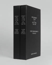
ref. 121999Minneapolis East View 2026. . 2 vols 8vo 25.5 x 16.5 cm; includes maps charts & tables; publisher's black cloth lettered white to boards and spines a fine copy. The complete collection of planning documents for Abu Dhabi from 1962 to 1979 the development plan review for Dubai of 1971 and the Federal Economic and Social Development Plan 1975 to 1980. Minneapolis, East View, 2026. hardcover
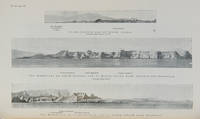
ref. 112658London Hydrographic Department Admiralty 1955. . Tenth edition with the second supplement dated 1959; 8vo 24.5 x 16 cm; supplement loosely inserted at rear 4 coloured plates of diagrams two maps acting as an index for admiralty charts 16 double-sided plates showing numerous coastal views further in-text weather diagrams notice of supplement tipped in to face title; publisher's blue cloth lettered in yellow spine a little sunned joints professionally restored very good copy; l 312 1 pp. A scarce pilot guide of the Persian gulf describing Bahrain Kuwait Qatar Dubai and Abu Dhabi and numerous other villages and towns along the Arabian coast. Includes coastal views of Ras Al Hadd Sur Qalhat As Suwaiq Sohar Fujairah Khasab the Tunb Islands Abu Musa Sirri Island Al Jazirah Al Hamra Al Shebeakah Rams Ajman Qasr Al Hosn in Abu Dhabi Sir Bani Yas the Doha Fort Bahrain Harbour and Tarut Island amongst others. The guide was published to give accurate sailing directions to the ports towns and safe anchorages along the Arabian coast from Ras al Hadd on the eastern peninsular of Oman to Shatt al Arab in the North and back along the coast of Iran to Bandar Abbas and beyond. With much early information on the principal settlements of the United Arab Emirates Qatar Bahrain Kuwait and Oman and an interesting glossary of Arabic-English key terms. By 1955 it was clear how the oil boom had changed the economy of the region. The first chapter gives an overview and includes the character of the sea and ports description of major towns and cities and their respective populations for example 18000 in Qatar the main economic imports and exports of each locale and considerable weather information. Dubai is described as well as Daira: 'Daira is a large suburb consisting of mat huts amongst which stand a number of well-built houses.' 'Dibai Dubai contains the residence of the Shaikh. There are several tall towers in Dibai; the fort is a conspicuous square building with a round tower. from which the Shaikh's flag is displayed. There is a hospital.' Abu Dhabi is similarly described: 'This town consists for the most part of huts and extends along the coast for nearly two miles. In the town there is a small fort partially surrounded by trees with five towers close together. The coast in the vicinity of Abu Dhabi is very low and the beach is of white sand'. The fort is given it's own view on one of the plates. The great pearl bank is also given attention: 'this extensive bank. fills the great bight in the southern part of the Persian Gulf.' 'Many islands both close to the coast and far offshore lie on the bank. With the exception of Dalma none has permanent inhabitants though they are frequented by the pearl boats during the summer and by fisherman from Abu Dhabi in the winter.' 'The best pilots for the coast are to be obtained at Abu Dhabi.' Much detail is also given to Qatar and Doha: 'This town situated on the southern side of the harbour is the capital of Al Qatar peninsula and had a population in 1947 of about 12000.' ' The Shaik's palace. is a large building with many colonnades and an open balustrade round its roof.' ' The chief exports are gutch fish and pearls; imports are food timber and manufactured goods.' Bahrain is also described with Manama being called the 'principal town and port' and as well as the trade being described there is also note of the health of the region: 'Manama is more liable to epidemics than the smaller ports; since 1920 however there have been no more epidemics in Bahrain than in any other of the larger Gulf ports.' It is interesting also that one of the major changes of the supplement is changing the name 'Bahrein' to 'Bahrain'. Kuwait is described as greatly altered by the oil wealth: ' Wealth derived from oil revenues is being spent on completely replanning and rebuilding the town. Government offices schools hospitals electric generating and water distillation stations private houses and blocks of flats are all being built in the most modern style'. 'Pearl fishing is now practically extinct. There are to all intents and purposes no exports. The chief imports are food of all kinds machinery motor vehicles and building materials.' London, Hydrographic Department, Admiralty, 1955. hardcover
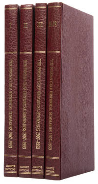
ref. 113476London Archive Editions 1987. . First edition; 4 vols 8vo includes a volume of maps and genealogical tables original brown cloth gilt a fine set. An historical summary of events in the Arabian Gulf concerning British interests from 1907. also includes oil agreements and concessions in the region particularly Muscat and Oman. London, Archive Editions, 1987. hardcover
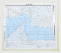
1957ref. 182684London: War Office; Printed for D. Survey WO and AM by Balding and Mansell Ltd 1957. A bright example of this detailed Gulf map Classified "restricted" and issued for military use at the time of the Jebel Akhdar War this double-sided sheet shows much of the modern-day UAE extending northwards from the latitude of Abu Dhabi and the Buraimi Oasis as well as the eastern Arabian Peninsula from the Trucial Coast to Jubail. As with other contemporary GSGS maps the sheet covers six degrees of longitude and highlights towns of significance and other standout features for example oil pipelines and wells water systems and roads and railways. Rayon sheet 630 x 710 mm printed both sides in colour folded as issued. A fine example. unknown
8vo. (2), L, 312, (2) pp. With several maps and plates. Original cloth. "The Persian Gulf Pilot contains sailing directions for the Persian gulf and the approaches thereto, from Ras al Hadd, in the south-west, to Cape Monze, in the East". - Also includes copious information on politics, population, languages, trade, currencies, pearl fishery, meteorological information (climate, winds, weather, temperature, humidity), as well as currents, tides, communications and other miscellaneous information. - Binding slightly rubbed. Only two copies in auction records of the past decades (Peter Hopkirk's copy fetching £1,300 at Sotheby's, Oct 14, 1998, lot 1043). Hydrographic Office Publication 158. OCLC 709448977. Cf. Wilson 171.
8vo. 24 pp. With woodcut printer's device to title page. Modern red half calf with marbled covers. Brief introduction to the Persian language for Catholic missionaries in the Middle East, with a table of the alphabet and the Lord's Prayer in Persian. "The best known products of the Propaganda Press, apart from its missals, grammars, and dictionaries, are the Alphabeta" (Smitskamp 193). This is, perhaps, litte surprise, for the missionaries sent forth to all parts of the globe by the Roman see through the Sacra Congregatio de Propaganda Fide, founded by Pope Gregory XV in 1622 for the purpose of spreading the Catholic interpretation of the Gospel, depended on language study textbooks such as these. The production of such alphabets was taken up as early as 1630 and was not discontinued until the early years of the 18th century; in 1812 the Congregation's in-house printing office was dissolved. - Slight waterstain to margins. Untrimmed copy. Smitskamp 210. Graesse I, 85. Brill II, 2109.
3 booklets, a magazine, and a menu. (1) EL-KHATIB, M. Fatallah (foreword). Basic Documents of the Arab Unifications. New York, Arab Information Center, June 1958. 8vo. 43 pp. Includes: the Proclamation of the United Arab Republic, the Proclamation of the Arab Union, the Provisional Constitution of the United Arab Republic, the Charter of the United Arab States and the Constitution of the Arab Union. - (2) OMRAN, Abdel-Rahim. Public Health & Welfare in the Arab States: Past, Present and Future. New York, Arab Information Center, November 1959. 8vo. 32 pp. The booklet opens with a history of the Arab contributions to medicine followed by modern statistics. - (3) WRIGHT, Esmond. The Arab World. Current Affairs no. 125. London, Bureau of Current Affairs, 3 February 1951. 8vo. 19, (1) pp. Short overview of the Arab world. - (4) [MENU]. P&O menu. On board the S.S. Arcadia, Sunday 25 March 1962. 8vo. Menu with on front a coloured illustration of a Dhow in the Arabian Sea. Probably offered during a cruise in the Gulf.
Large folding map (60 × 90.5 cm), printed in light orange with darker purple, depicting the Kingdom of Saudi Arabia and its main roads. With on the right the title in both Arabic and English and a table with the distances from one city to another. Large folding map, published by the Arabian American Oil Company, depicting the Kingdom of Saudi Arabia. It depicts the country’s roads, trails, railroads, roads that are still under construction and proposed roads, as well as cities, villages, airports and deserts. The table on the right shows the distance in kilometres from several towns and cities to some of the major cities: Buraidah, Dhahran, Dammam, Hofuf, Jeddah, Mecca, Medina, Riyadh and Ta’if. - Slightly discoloured along the folds, with only some very minor tears along the folds. Otherwise in very good condition
8vo. pp. 137-171 (entire volume: x, 137-262, (6) pp., with 28 photographic illustrations, numerous sketch maps in the text, and two folding maps, one in colour, loosely inserted). Original printed blue wrappers. The famous British explorer's extensive account of his expedition in the interior of Oman; much of the territory crossed now is part of the United Arab Emirates. Thesiger (1910-2003) set out from Abu Dhabi in 1948; the large and detailed colour map shows his journeys from 1945 to 1950. - Thesiger later expanded on the subject to produce his classic travelogue, "Arabian Sands" (1959). Thesiger's highly regarded photographs depict the desert of the Empty Quarter, a settlement at Liwa, sand vegetation after heavy rain, a falconer mounted on a camel, a peregrine falcon with a caught hare, peregrine falcons on the blocks, Sheikh Wahiba of Yahahif and a young Wahiba girl, a thoroughbred Batina camel, the Farai well in Wahib country, portraits of Musallim bin al-Kamam and Salim bin Kabina, and a view of Jabal Kaur from the wadi Saifam. The paper was read in the presence of the Second Secretary at the Saudi Arabian Embassy, H.E. Abdul Rahman Halassie. Not in Macro.
Ink and watercolours on paper, backed with cloth. Calligraphic and armorial headpiece; historiated initials; two coloured illustrations (a hunter loading his gun; a hawk devouring a goose). Four red wax seals. 77 x 55 cms, rolled and stored in a contemporary marbled tube. A certificate of apprenticeship for the hunter Anton Spiallek (Spialleck) of Wiegstädtel near Opava in Silesia, signed by Franz Spialeck (possibly a relation) and four other district hunting officials of Dombrau and Mittel-Suchau (Prostrední Suchá), owned by Richard Baron Mattencloit. The art of hunting had long included falconry also in Silesia, and it was among the favourite pastimes of the nobility.
Standard issue, 700 x 1024 mm. Scale 1:50,000. Detailed nautical chart of the approaches to Mina Salman, the primary cargo port and customs point of Bahrain, prepared by the British Admiralty. Undoubtedly one of the better antiquarian maps of northern Bahrain. - The chart details the approaches to Mina Salman as well as the Sitra anchorage. Approach channels to Mina Salman were built in 1954, and a pier was constructed in 1956, mainly used by dhows. In 1958 it became a free port, and in 1962 a deep water wharf composed of six berths was constructed. The wharf allowed cargo to be directly loaded onto the port for the first time. In the 1960s, the port had refrigeration, storage facilities and equipment for handling large ships. - The map includes the cities of Muharraq and Manama, showing numerous minarets. Bahrain Fort, the Portuguese Fort, Abu Mahur Fort, and the Sheikh's palace are labelled. Another prominent site is Muharraq Airfield, a military base established by the Royal Air Force in April 1943 as RAF Bahrain (later RAF Muharraq) that remained in use until 1971, when Bahrain declared independence. - The British Admiralty has produced nautical charts since 1795 under the auspices of the United Kingdom Hydrographic Office (HO). Its main task was to provide the Royal Navy with navigational products and service, but since 1821 it has also sold charts to the public. The present chart was composed after Admiralty surveys from 1932 to 1960. The 1951 first edition saw revisions and corrections in 1962-65. - Very well preserved with a single fold. Provenance: stamps of Maria K. Iatrou, seller of nautical charts, books and instruments in Piraeus, Greece.
207 x 177 mm each, colour-printed. A set of two maps removed from an Ottoman atlas published shortly before the Great War. The first map shows the Near East, Egypt and Northern Arabia with the Hejaz Railroad's branches as completed by 1911. Diagrams in the margin depict the elevation of the railroad along its line. The second map shows the Arabian Peninsula and its railroads; an inset shows the Suez Canal (with the date of its completion given as 1869 CE and 1285 Rumi calendar). - A soft central fold and tiny edge tears. Traces of former tab-mounting within an atlas; handwritten Ottoman Turkish titles in black ink on verso.
Small folio (310 x 235 mm). 46 window-mounted albumen photograph cartes-de-visite (84 x 52 mm), Contemporary pebbled green cloth, all edges gilt, remains of metal clasp. Moirée endpapers. An elegant example of the early photography souvenirs which were becoming increasingly popular in the 1890s, especially in tourism of the Holy Land. The cartes-de-visite distinctively illustrate the moment visual souvenirs began to evolve from etchings and prints to photographs: all are, in fact, photographs of paintings depicting church scenes and architecture. There are 48 cartes-de-visite, though only 46 are photographs, the final two being handwritten and hand illuminated well-wishes in French. - Gentle wear and fading, but well preserved.
Folio. (2), 11, (1) pp. Loosely sewn as issued. Rare British parliamentary papers and correspondence with local agents and officers on the slave trade in the Arabian Gulf, with special mention of slaves received at Bandar Lengeh from the Agent at Sharjah as well as first-hand observations on child slaves and the so-called "domestic servants" in demand in Basrah and Bushire. - Chipped edges reinforced; sewing renewed; paper a little browned throughout but a good copy.
Folio. XVIII, 276 pp. Modern blue wrappers with cover label. Top edge gilt. British papers and correspondence with local agents on the international slave trade, including missives exchanged with the Governor of Jeddah, and further details about the possible appointment of a Pasha of Jeddah who might labour to suppress the slave trade. - Well-preserved.
Folio. XXVIII, 467, (1) pp. Modern blue wrappers with cover label. British papers and correspondence with local agents on the international slave trade, including a Vizirial letter to the Governor of Jeddah to abolish the slave trade in his territories. - Well-preserved.
Folio (210 x 320 mm). 16 pp. Cloth-covered spine. Rare documentary material on the interception of the ships and the seizure of slaves on board. British-operated ships continuously carried hajjis between Jeddah and ports in the Gulf, and the steamers were often used for the transport of slaves, sometimes with the cognizance of the captain. "The system of issuing tickets by the agents of British vessels at Jeddah without any name being inserted thereon, and the absence of passenger lists, no doubt render it extremely difficeult for the masters of ships to ascertain whether any of their passengers are slaves; and [...] it is one which cannot but place the gravest obstacles in our way in the suppression of the Slave Trade [...] The majority of the inhabitants of the Hedjaz and Yemen, from highest to the lowest, are interested in the Slave Trade, domestic slaves being a matter of necessity, servants not being procurable, what few there are bad [...] The Mahommedans consider the institution of slavery to be one of mutual benefit, and the slaves are geenrally the best dressed and best fed members of the household [...] It is very difficult to make any Mahommedan consider that slavery is a crime. He usually contends that the negro is recued from barbarism, and is taught the Mahommedan religion, and on that ground he defends the system; and indeed, he regards himself somewhat in the light of a missionary, and thinks he is extending his faith. The question is, therefore, beset with some difficulty [...]". - Occasional edge repairs. OCLC 872281698 (Internet resource only).
5 colour-printed topographic maps, sheets ca. 77 x 63 cm each or smaller. Constant ratio linear horizontal scale 1:200,000. A rare set of 5 maps from the French military's cartography of the Levant, produced from the mid-1920s until the Second World War. The maps comprise: Antioche (Antakya and Iskenderun), Palmyre (Tadmur, Palmyra), Haiffa (Haifa, Acre, and Tyre), and Homs (2 different sheets). Considered products of military intelligence by the French government, the maps fell into German hands when Germany invaded France in 1940. The present maps were subsequently accessioned by the Geographical Institute of the University of Berlin and bear the Institute's stamps and pencil shelfmarks. - Two maps folded. Occasional edge and corner flaws, some wrinkling, duststaining and minor chips and tears to margins, but altogether well preserved. OCLC 904341885.
8vo. VI, 41, (1), 8 pp. With 4 folding lithographed maps and 3 plates (2 folding). 19th century half cloth. Second edition of this German description of Constantinople, its environs and local customs, expanded by two plates. "The author, Zrecin, is mentioned in the Mainz edition [...], but the wirk seems to have been edited by C. V. Sommerlatt whose name occurs at the end of the preface in this edition. An enlarged edition appeared at Coblenz in 1829" (Atabey). Contains a map and a view of Constantinople, a map of European Turkey, a view of the fortress of Shumen, one portrait of Sultan Mahmud II, a "copy of a Turkish firman", and a letterpress plate enumerating the "Muslim articles of faith". - Occasional slight foxing; with faint marginal waterstains to final leaves. Ownership stamp of Walter Seydel (1946) on verso of title page. Blackmer 1872; Atabey 1356 (note).
Ca. 550 x 770 mm. Ottoman Turkish manuscript with large Tughra of Sultan Abdülmecid I (reigned 1839-61). 1 page. Black ink on single sheet of sturdy, smoothed laid paper (watermark: "GFA"; Fratelli Gava manufactory of Lombardy & Venice?). A scarce example of a mid-19th century Levantine manuscript firman granting permission to travel in the Ottoman Empire, issued to Sir Jacob Henry Preston (1812-91), 2nd baronet of Beeston St Lawrence. Preston was educated at Westminster and Trinity College, Cambridge (B.A. 1832); his seat was at Beeston Hall near Norwich in Norfolk. - Traces of old folds. Small stain with related small hole not affecting text; contemporary ink annotation on verso: "Travelling firman for Sir Jacob Henry Preston". In fine condition.
Large 4to. (8), 206, (4) pp. With 8 engraved plates. Contemp. full calf with giltstamped cover borders and giltstamped red label to gilt spine. Only edition. - The theologian J. G. Ch. Adler (1756-1834) had spent a long time in Rome and visited Europe's great libraries. During his scholarly journeys he had immersed himself in Greek and oriental manuscripts, studying especially the Syrian documents with a view to Biblical textual criticism. One of the scientific results of his labours is the present study: "notes regarding the manuscript Syriac translations so important for New Testament criticism" (cf. ADB). The plates show specimens from the Syrian manuscripts. - Evenly browned throughout with occasional insignificant staining. Appealingly bound. Hamberger/Meusel I, 29. ADB I, 86. Silvestre de Sacy 704. Darlow/Moule 8975 (note.). OCLC 5987315.
Original silver gelatin photograph (820 x 139 mm), signed in dark blue ink. A handsome photographic portrait of Isa bin Salman Al Khalifa, who was the first Emir of Bahrain, ruling for 38 years. - A few light creases to bottom left corner. Stamp of State of Bahrain, Ministry of Information and ms. caption in pencil to reverse. With an official State of Bahrain, Ministry of Information envelope, dated 1973.