GULF AVIATIONBiblio.com
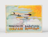
1974rif. 168084Bahrain: Gulf Public Relations 1974. First edition first printing of this pop-up book published by Gulf Air Public Relations in around 1970 with dual Arabic-English text by Ib Penick and illustrations by Gloria Nixon. The narrative revolves around Ahmed a boy who is flying from Manama to London with his parents. Quarto. 8 double-page full-colour illustrations by Gloria Nixon each one with a pop up all except the last with moving parts. Original coloured pictorial boards spine lettered in gold covers illustrated in colour and lettered in black and gold. Boards lightly toned spine lettering faded covers slightly soiled contents bright all moving parts in working order. A very good copy. hardcover
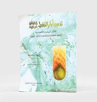
1995rif. 182920Kuwait: Markaz al-buhuth wa-al-dirasat al-Kuwaytiyah 1995. First edition of this well-illustrated study on the environmental impact of the destruction of oil wells in Kuwait based on government documents issued by the Iraqi government during the Gulf War. The work presents this damage substantiated by copious data as a main goal of the Iraqi war strategy of delayed sabotage. An appendix lists names of Iraqi officers accused of being "environmental criminals" as they took part in the identification of targets and methods and the execution of the plan - phases which are carefully described in the first part. The second part discusses subsequent damages to the economy public health and the environment including air and water pollution and their impact on living organisms. The third part describes the strategies employed to limit the damage such as the efforts of firefighters in extinguishing burning oil wells. Quarto. With facsimiles of documents colour illustrations and maps. Text in Arabic. Original pictorial wrappers wire-stitched as issued. Pencilled Arabic word at head of last verso. Extremities a trifle rubbed or creased contents clean: a very good copy. unknown
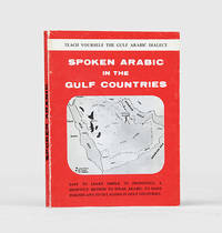
1971rif. 171721al-Khobar: The International Publications Industries 1971. Keep the following in mind and everything will be easy Fourth printing of this institutionally rare phrasebook which adopts "a short cut method simple and easy enough for a businessman to teach himself the spoken Arabic while relaxing in the Aircraft or in his Hotel room. Many of the oil industry people in Arabia owe their local friendship to this book". Arranged by topic the book has sections on greetings shopping food and drink and other practicalities such as taking one's car to a mechanic. The unnamed author places a premium on language as a key to understanding local culture: "you will find the Gulf Arabs intensely loyal to their friends as well as to their families. Most of them are blessed with a keen sense of humor. For these and other reasons such as their hospitality and courtesy you will enjoy getting acquainted with them". Further sections discuss the etiquette of being a guest at a traditional wedding and how to behave if invited to a private house as a guest. WorldCat lists only four copies in institutions Oxford National Library of Wales National Library of Israel Bilkent University. Small octavo 115 x 117 mm. Wire stitched in the original printed wrappers spine lettered in black. Minor wear to wrappers contents lightly toned not affecting text. A very good copy. unknown
rif. 686284to. 265 pp. 23-24 & 173-174 missing 11 pages unused page 71 repeated i.e. 251 of 300 numbered pages employed for the manuscript minutes of board meetings and for occasional other purposes; several typed pages or notes laid in or affixed to a page. Minutes in pen and pencil in the hands of recording secretaries Harry Hartmeir Frank Piaget John Connolly and others. Founded in 1895 as the Paterson Golf Club and incorporated as the North Jersey Country Club in 1897 this minute book covers an important period in club history as plans to build roads through the Paterson location occasioned a move to Wayne in 1917 the purchase of the 327 acre Greenbrook Farm in 1921 and the building of a new club house there in 1922; the construction of its new golf course designed by Walter Travis began the same year opening in 1923. The club and course continue today. Contemporary notebook half-leather and black pebbled cloth very worn leather spine gone leather corners mostly gone edges bumped and worn; interior very good and quite legible. unknown
1807rif. 145581807. Waring Edward Scott. A Tour to Sheeraz 1807 travel narrative describing Persia during the early nineteenth century written by an officer of the British East India Company who journeyed to Shiraz in 1802 by way of the Persian Gulf. The work documents British encounters with Persian society at a moment when commercial diplomatic and strategic interests increasingly connected the Persian Gulf with British imperial networks centered in India. Waring records observations of Persian customs language literature and law while also describing economic activity and regional cultures encountered along the Gulf coast. His account places particular attention on the intellectual traditions of Persian literature and the social practices of Persian society providing commentary on classical Persian poetry as well as everyday cultural life. Waring Edward Scott. A Tour to Sheeraz by the Route of Kazroon and Feerozabad; with various remarks on the manners customs laws language and literature of the Persians. London: W. Bulmer for T. Cadell & W. Davies 1807. Second edition revised. Waring recounts his expedition to Shiraz and provides descriptions of landscapes towns and cultural practices encountered along the journey. The narrative includes discussions of hawk hunting Arabian horses and pearl fishing in the Persian Gulf with references to coastal communities stretching from Ras al Khaimah and Qatar to Bahrain and Kuwait. Waring also records an early European account of Muhammad ibn Abd al Wahhab and the religious movement associated with Wahhabi Islam. Throughout the text he comments on Persian language and literary traditions including references to major poets such as Hafiz and Saadi as well as the intellectual influence of Sufi thought. Travel literature concerning Persia and the Persian Gulf formed an important component of European knowledge about the region during the late eighteenth and early nineteenth centuries. British officials and merchants traveling between India and the Middle East produced accounts that combined geographic description with commentary on local society trade networks and political developments. Waring's narrative reflects this tradition presenting observations on Persian history and social customs alongside discussions of the literary heritage that shaped Persian intellectual culture. The author himself noted that the earlier 1804 edition printed in Bombay contained numerous errors that required correction leading to the publication of this revised edition. Folio volume containing 329 pages bound in quarter leather over original boards. The two plates called for are absent. Front board detached but present text block solid with staining and water damage visible throughout and writing on both front and rear pastedowns. Overall good condition. unknown
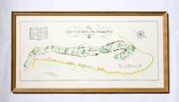
rif. 258j2741Glasgow Scotland: McCorquodale Ltd. Fine. Reprint. Framed Print. Beautiful framed colour print illustrating the famed St. Andrews golf course. Includes the name and length of each hole. Recent reprint of the original created by Golf Course Architect A. Mackenzie in 1924. 27" x 14". The beige wooden frame is attractively colour-co-ordinated with gilt and green trim. In excellent condition. 2kg.; Artist; Folio . McCorquodale Ltd. unknown
1896rif. r3847aEdinburgh: T & A Constable. G : in good condition. Modern rebind with new eps. 1896. First Edition. Marbled hardback boards with blue cloth spine. 300mm x 220mm 12" x 9". xix 516pp xxxiv plates. 9 b/w & sepia plates. 270 b/w vignettes. Heavy book extra shipping needed for overseas. . T & A Constable hardcover
1902rif. 997D. Appleton NY 1902. HB NODJ 1902 1st edition 1st printing with #1 on last page of Text as Required Green decorated Cloth with minor Rub Wear Tiny Chip Tears Extremities Interior Nice & Tight with light Fox Wear & few loose protruding pages reattached with small tape at Inner Hinge & Vox NF/NF AS-IS NODJ 328 pages page with pencil underlining. Signed by Illustrator. First Edition. Hard Cover. D. Appleton NY hardcover
1890rif. 3061London: Day & Son; Simpkin Marshall Hamilton Kent & Co Ltd. G : in Good condition. Cover rubbed. Slight foxing. 1890. First Edition. Maroon hardback cloth cover. 190mm x 250mm 7" x 10". 27pp 25pp ads. According to the Badminton Library. . Day & Son; Simpkin, Marshall, Hamilton, Kent & Co Ltd hardcover
1908rif. 54496St. Louis: Parker Engraving n. d. ca 1908. 1908. TEXAS. A 21" x 26 1/2" one sheet printed on both sides and folded to 18 panels 8 3/4" x 3 1/2" per each. The booklet is undated but statistics for 1907 are cited. The outside portion of the sheet is printed in brown ink and has photographs and the text relates to land in Wharton County that is being offered for sale by the Gulf Coast Land and Investment Company of St. Louis whose regional office is located in El Campo Texas. The land is basically agricultural and the Company emphasizes the easy ability to grow crops without irrigation being required. The inside portion features a large map of Texas that is devoted to the MKT Railway Company and is printed in green. A small portion is printed in sepia and show the location of the holdings of the Gulf Coast Land and Investment Company. Black dotted lines show the current routes and markets served in Texas and a portion of Indian Territory Oklahoma. Also a chart is provided to show the mean annual temperatures of Texas. Tiny tears to two fold-crease areas else a near fine booklet. World Cat shows several identically titled maps issued by other land companies but their is only one holding for this Gulf Coast listing. Parker Engraving, n. d. (ca 1908). unknown
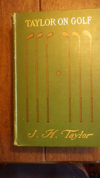
2001rif. 29577HBDJ Stated 1st Printing OCT 2001 1st edition 9TH PRINTING NF/NFINE OVERSIZED green cloth titled in white on spine cover Signed by Tiger Woods on FFL page; Hardcover dust jacket not clipped; green cloth coverlight wear to corners solid binding straight spine clean illustrated pages; no marks; 306 PGS GOLF DIGEST WARNER BOOKS TIME hardcover
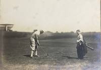
1926rif. 58065Youngstown OH: n.p. 1926. Oblong folio. 17 x 9.5 in. 13 leaves unnumbered. on thick gray-green textured boards all mounted on linen hinges at gutter margin with 35 tipped-in silver gelatin photographs sized from 4.5 x 9.5 in. up to 6.75 x 14 in. Full green morocco gilt lettering stamped on front cover decorative Italian patterned endpapers minor scuffing & wear to fore-edges very light sunning to front cover still a VG exemplar. This excellent souvenir photo album depicts the golf tourney hosted by the Youngstown Country Club in honor of Campbell’s 1854-1933 72nd birthday in 1926. The opening photo depicts all the participants and dignitaries at the Country Club followed by images of players on the greens. The 18-hole course was built on the 131-acre Holland Farm and designed by Walter Travis featuring a $ 60000 Clubhouse which was noted for elegance and model comfort. These images depict the quintessential 1920’s golfing excursion including those of players the greens the roughs caddies and even an image of what appears to be Walter Travis himself taking a turn on the links. The year before in 1925 the Youngstown Country Club had hosted the 25th Open Championship of the Western Golf Assoc. and legends of the game including Walter Hagen Gene Sarazen and Tommy Armour III all played the course. Campbell was an enthusiastic golfer until his death holding a similar tourney in 1929 on his 75th birthday. He had begun his business career by forming the Youngstown Ice Co. in the summer of 1884 and by 1890 was hired as manager of the Trumbull Iron Co. later consolidated into Union Iron & Steel Co. In 1901 he founded Youngstown Steel and Tube Co. but after a failed merger at the beginning of the Great Depression his health declined. See: Ted Heineman James A. Campbell Riverside Cemetery Journal 2009; History & Golf Outings Youngstown Country Club 2021; James A. Campbell’s 75th Birthday Celebration Youngstown Sheet & Tube Audiovisual Archives YHC MSS 0140 Box 10 Folder 186 n.p., hardcover
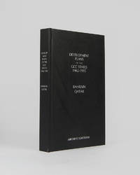
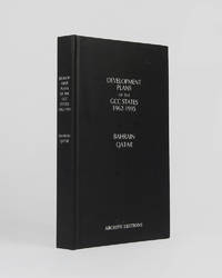
rif. 121997Minneapolis East View 2026. . 8vo 25.5 x 17 cm; includes many maps tables graphs and charts text in English and Arabic; publisher's black cloth lettered white to board and spine a fine copy. The complete development plan of Bahrain in 1982-85 including the report of the same and the development plan of Qatar of 1977 as well as planning studies and long term plans. Minneapolis, East View, 2026. hardcover
rif. 121998Minneapolis East View 2026. . 8vo 25.5 x 17 cm; includes many maps tables graphs and charts text in English and Arabic; publisher's black cloth lettered white to board and spine a fine copy. The complete development plan of Bahrain in 1982-85 including the report of the same and the development plan of Qatar of 1977 as well as planning studies and long term plans. Minneapolis, East View, 2026. hardcover
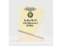
1985rif. 177401Bahrain: Printed by the Arab Printing and Publishing Establishment 1985. Second edition of this booklet produced to showcase the Arab Thought Forum held in Riyadh in April 1985. The first part comprises "Arab Unity: A General Outlook" a speech delivered by Prince Saud al-Faisal Foreign Minister of the Kingdom of Saudi Arabia. It is concerned with the difference between the "failed" concepts of Arab unity and Arab nationalism and their relationship with Islamic doctrines. The second part is devoted to a research paper by the GCC Secretary General concerning the role of the GCC in the achievement of Arab unity. It analyzes regional changes in the decade 1971-1981 and the "Arab degeneration and decline and the downfall of the unity of Arab security" before the establishment of the GCC. Octavo 240 x 165 mm. Text in English and Arabic. Original yellow printed wrappers wire-stitched as issued. Extremities and covers a bit rubbed sunned and foxed first recto and last verso toned: a very good copy. unknown
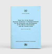
1978rif. 172055Perhaps Kuwait: United Nations Environment Programme 1978. First and sole edition untraced in Middle Eastern libraries of this plan enshrining environmental protection as a priority for future development along the Arabian coast. The regional conference highlighted the dangers posed by oil spills and committed to pollution-control measures for future projects. Participants included delegates from Bahrain Iran Iraq Kuwait Oman Qatar Saudi Arabia and the UAE. Attendees also agreed on a regional trust fund funded in different proportions by eight governments including the UAE and Saudi Arabia to finance initiatives. In the United Kingdom copies can be found at the universities of Oxford Durham and Southampton. We have also located three each in the US and Canada two in Germany two in Switzerland and one each in Austria and Sweden. Octavo. Original pale blue wrappers wire-stitched as issued front cover lettered in black. Light peripheral toning to covers small rust mark at top corner of front cover back cover slightly creased: a very good copy. unknown
1911rif. 75830Edinburgh: R. and R. Clark 1911. First Edition. Hardcover. Very Good. Edinburgh R. and R. Clark 1911. Octavo viii 150 pages plus 2 plates. Original blue cloth slightly rubbed at the extremities and lightly marked; tiny bump to the leading edge of the front cover; bottom corner of the rear board cracked creating a ripple in the cloth along the fracture and cracking the pastedown but the corner is firm and stable; edges endpapers and first and last pages foxed; a very good copy. Inscribed and dated 26 December 1913 by the author. R. and R. Clark hardcover
1925rif. 49705Pittsburgh PA & Port Arthur TX: Gulf Refining Co. ca. 1925. Folio. 11.5 x 14.25 in. 5 large oversize folding leaves of typed descriptions measurements specifications; mounted 7 linen-backed photo leaves 2 folding -- w/ 39 images printed on 34 silver gelatin photos. Original split-pin post-binder blue silk red cloth corners brass split pins minor edgewear rubbing minor fraying to corners first typed leaf w/ creasing minor closed tears still a VG exemplar from the library of John W. Jackson former Marketing & Sales executive with Gulf Oil Corporation Tulsa OK. This spectacular packaging catalogue for Gulf Oil Company petroleum products in the 1920s provides an incomparable photographic reference for all of the available products their dimensions sizes specific directions about tin lithograph colours as well as the cardboard and wooden shipping crates. Gulf Oil Corporation was initially organized in May 1901 by J.M. Guffy Andrew W. Mellon and others. By 1907 they had built a 400-mile pipeline from Port Arthur to the Glenn Pool Field in Oklahoma and started refining Oklahoma crude by 1907. By the 1920s this integrated Oil Company had built service stations across the country sold Good Gulf Gasoline and actively promoted automobile travel with Gulf Maps marketing promotions and more. This catalogue begins with photos of 1 5 10 and 25 lb. tins of Gulf Supreme Grease Transmission Grease Red Top Axle Grease Gulf Petrol-atum Gulf High Pressure Grease and Gulf Lubricant with all of the product tins carefully sized by stack showing their side graphics sizes lids and lid configurations. The oil cans include Tractor Oil Auto Oil Harvester Oil Gulf Motorcycle Oil small illustration of 1920s era motorcycle with Gulf Logo and even the blank tin soldered cans of assorted sizes. Of particular interest are the images of all the specialty products Gulf Oil was marketing during the Flapper Era including Venom pesticide & bug killer in glass bottles with screw-top tin lids & corks; Gulf Gas-o-Clenz cans in 1/2 pint 1 pint 1 quart and 1 gallon sizes; Gulf Gleam Cans Gulf Jelly Clens tubes Gulf Grease tubes and more. The last group of photos show all of the varieties of Gulf Venom Jelly-Clenz Gulf Pressure Grease Gulf Gleam cardboard and wooden packaging complete with printed labels lithograph labels Venom hand-sprayers and packaging and crates in assorted sizes and amounts. These types of photographic sales catalogues for the Petroleum industry are quite scarce and often unique items. Gulf Refining Co., hardcover
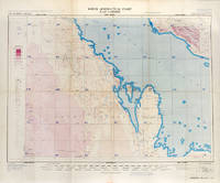
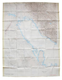
rif. 113506London War Office Geographical section 1951. . First edition GSGS 4622 Sheet 2547; Coloured printed map of Bahrain and Qatar on single sheet with extensive legend printed on reverse size: 62.5 x 77 cm; scale 1:1000000 text in English a little faded along folds a very good copy. First edition of the 1951 issue of the R.A.F. Aeronautical map of Bahrain and Qatar. The War office issued the R.A.F. series alongside a separate US Airforce Series: the R.A.F. series only covers Europe Africa Arabia and up to the end of 1951 had only covered Britain the east coast of Africa and this sheet of Arabia. The odd selection of this region aside from east Africa is made clearer by looking at the content of the map. The map does not show the 'delineation of international boundaries' or 'danger zones' but the topography largely the elevation and depression of the terrain with indications of marshy areas. The only indicated features other than towns and roads are of oil fields and pipelines. In 1941 Britain had gained control of much of Iraq's oil after the Anglo-Iraqi War and sought to expand its influence. The allies had seen the strategical benefits of Bahrain and after the discovery of oil in the region in 1932 it became even more pertinent to grow relations with the entire Middle Eastern command moving from Bushehr in Iran to Bahrain in 1935. But after the war relations had soured with the 1947 anti-Jewish riots in Manama Bahrain largely in reaction to Britain's disastrous orchestration of the Partition of Palestine. At the same time Iran had sought to break free of British control of their oil and in March 1951 voted to nationalise their oil production: in response Britain boycotted Iranian exports. It was in that same month that this map was finalised and published in July in the midst of the tense negotiations Iran was conducting with both Britain and the USA. In 1951 Britain was clearly searching for new regions to extract oil from and this map is captivating evidence of the fractious relationship Britain had fostered with the state of the Arabian Gulf. [London], War Office, Geographical section, 1951. unknown
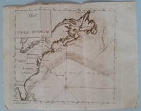
1789rif. 3818Appearing in the March 1789 issue of the American Museum magazine this engraving is the second American version of Franklin's famous chart of the Gulf Stream printed in America. Both American versions were preceded by English and French printings. The Chart of the Gulf Stream accompanies Franklin's "Remarks upon the navigation from Newfoundland to New York." p. 213 in the magazine. Franklin prepared the chart in 1768 while serving in London as a deputy postmaster general for mail service to and from the American colonies. It was Franklin's cousin Timothy Folger of Nantucket who provided him with a practical seafarer's knowledge of the Gulf Stream and its importance in trans-Atlantic crossings. The previous American publication of the chart was in 1786 in The Transactions of the American Philosophical Society. This updated version provides a more accurate depiction of the North American coast. State boundary lines are partially indicated. One curious boundary delineation in the chart has a portion of the District of Maine extending over the northern boundaries of New Hampshire and part of Vermont. References: Wheat & Brun Maps & Charts Published in America before 1800: 723. Condition: Folded as issued with misfolding along one fold line. Light to occasionally moderate soiling. Edge roughness primarily at upper left edge. ICN 7794.1 Mathew Carey
rif. 112618London War Office printed for D. Survey WO and AM by Balding and Mansell Ltd. 1957. . Coloured double-sided map of the Arabian Gulf on 1 sheet printed on silk; edition I-GSGS; sheet size: 64 x 72.5 cm; scale 1:1000000 text in English very slight fading to outer margin otherwise near fine. An excellent example of a double-sided coloured escape map of the Arabian Gulf showing the UAE and Oman to recto and Qatar to verso. With a key to topographical features railways main roads and important settlements including the tribal and official names of provinces and a useful Arabic-English glossary translating key terms such as 'Bir' for 'Well' 'Ain' for Spring' 'Qasr' for 'Fort/Castle'. The recto extends from Kumzat in the North to Hafit in the South and Abu Dhabi in the West to al-Qasbiyat in the East showing the six remaining emirates of Dibai Dubai Sharja Ajman Umm al-Qaiwan Ras al-Khaima and Fujaira. The verso runs South from Ras es Safaniya to Ei Abd and from Awania in the West to Rudaim in the East including the principal settlements of Jubail Bahrein Hofuf showing Doha Wakra and Lusail on the Qatar Peninsular. [London], War Office, printed for D. Survey (WO and AM) by Balding and Mansell Ltd., 1957. unknown
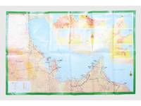
rif. 181557Saudi Arabia: Kruger for I.P.A. International Bookshops Dharan Airport 1977. Road construction faster than map production A folding road map of the Gulf and an interesting snapshot of its natural and human geography in the 1970s with 25 attractive photographs of Dubai. The map extends from Kuwait to Oman's Jabal al-Akhdar showing primary metalled roads roads under construction secondary roads towns wadis oil wells and pipelines oilfields and the morphology of the terrain. It also features 7 inset maps of the city centres of Manama Doha Abu Dhabi Kuwait Dubai Mutrah and Muscat. The small print in the reference section explains that "all roads under construction are being completed as the progress was faster than our production". The photos of Dubai include views of Dubai Creek dhows dromedaries and camels local inhabitants and the main heritage sites. Colour printed map folded 295 x 157 mm; unfolded 585 x 910 mm. Text in Arabic and English. Seven inset maps of Gulf capital cities verso with 25 colour photograph views of Dubai by Said Salah. Original colour self-wrappers printed in yellow black and white on a red and green ground. A few tiny chips or light wear to some folds couple of minor creases to outer corners: a very good exemplar. unknown
1942rif. 191335Washington DC: Army Map Service April 1942. The Gulf when America joined the war An expansive wartime flight chart "the advance edition" classified as "Restricted" for use by the U.S. Army Air Forces. It covers the whole of the Arabian Gulf and a substantial part of the Arabian Peninsula including Saudi Arabia Trucial Oman and Kuwait. After the United States joined the Allies in December 1941 they began operations in the Middle East most notably by providing support in North Africa as part of the Second Battle of El Alamein and Operation Torch. Over the following years the American government began to recognise the importance of Middle Eastern resources extending the Lend-Lease programme to Saudi Arabia Iran and Israel as well as indirectly supporting British colonies in the region. To protect these resources they set up Persian Gulf Command and manned the "Persian Corridor" from Iran through to Azerbaijan. They also participated in the Tehran Conference in late 1943. Further west the Ninth Air Force ran regular sorties out of Egypt and Libya to assist in the European theatre securing air dominance and denying the enemy the opportunity to replenish their supplies. The reverse of the chart features three inset maps of Bahrain Cyprus and Rhodes. They are accompanied by sectional views of their coastlines. The first two countries were host to RAF and Royal Navy bases while Rhodes was occupied by Italy and later Germany after the Battle of Rhodes in 1943. We have traced no copies of this map in institutions and one copy of a 1944 coloured edition in commerce. Single sheet 965 x 1305 mm maps and sectional views printed both sides highlights and compass roses printed in blue key on recto. Rolled tidemarks and creasing in upper margin not past neatlines: a very good copy. unknown
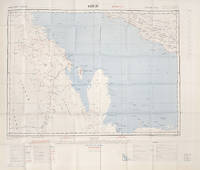
1967rif. L6CEZZVCL8UFSt Louis: Aeronautical chart and information center United States Air Force 1967. Two maps colour printed on both sides of a sheet of silk 103 x 78.5 cm on a scale of ca. 1:1000000. The two maps ONC-H-6 & ONC-H-7 show one continuous area. Rayon pilot's map of the Arabian Gulf region focusing on the Trucial States modern UAE Qatar Bahrain Oman Iran and Saudi Arabia including main oil installations. Items of specific interest to aircraft such as airfields and even seaplane bases are particularly listed. Warnings to stay within the specific flying routes while in Iran are placed on multiple locations. While the map depicts a continuous area on both side on of one sheets it actually consist of two maps originally published separately. Slightly frayed at the edges. In very good condition. Aeronautical chart and information center, United States Air Force, unknown
1930rif. ALB-1091930. Photo album; Silver prints 25. A boldly designed promotional album for John Schmook's Gulf Service Station in Lancaster Pennsylvania. The album produced by Gulf and distributed to franchised gas stations displays printed slogans and handwritten captions consistent with the album's roadside aesthetic as well as prescribed placeholders for predetermined photographs to accompany the customer-service driven catchphrases and service descriptions. The images primarily depict station attendants performing basic services such as oil changes radiator checks and tire replacements all while adhering to the "Gulf Guide of Gulflex Service" alongside interior and exterior shots of Schmook's station. Come and get "That Good Gulf Gasoline." Images 2 1/4 x 3 1/4 to 8 x 10 inches mounted to 10 x 13 inch pages with graphically printed captions and slogans. unknown