3989 risultati
2008rif. DADAX1602393265Skyhorse 2008-11-17. First Edition. hardcover. New. 8.50x9.00x11.00. Buy with confidence. Excellent Customer Service & Return policy. Skyhorse hardcover
2012rif. SONG1619427818Brand: Nova Science Publishers Inc 2012-06-01. UK ed. hardcover. Used: Good. 7.25x0.75x10.00. Buy with confidence. Excellent Customer Service & Return policy. Brand: Nova Science Publishers, Inc hardcover
1942rif. b24975New York 1942. First Edition . Soft cover. Near Fine. Near fine in original wrappers. paperback
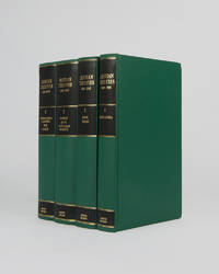
rif. 121944London Archive Editions 1992. . 4 vols 8vo 25 x 16.5 cm; includes maps and tables; publisher's original green cloth gilt lettering pieces to spines top edges gilt a fine set. Extensive collection of international and governmental treaties of the Gulf states of Iraq Kuwait Bahrain Qatar the United Arab Emirates Oman Yemen and Saudi Arabia. Improves on the previous work of Aitchison by including inter-regional and inter-state treaties rather than ones specifically related to Britain. London, Archive Editions, 1992. hardcover
1948rif. GB009AE8MLQI4N00A.S. Barnes and Company 1948. Paperback. Very Good. May have limited writing in cover pages. Pages are unmarked. ~ ThriftBooks: Read More Spend Less.Dust jacket quality is not guaranteed. A.S. Barnes and Company paperback
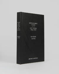
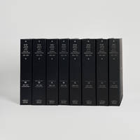
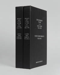
rif. 121997Minneapolis East View 2026. . 8vo 25.5 x 17 cm; includes many maps tables graphs and charts text in English and Arabic; publisher's black cloth lettered white to board and spine a fine copy. The complete development plan of Bahrain in 1982-85 including the report of the same and the development plan of Qatar of 1977 as well as planning studies and long term plans. Minneapolis, East View, 2026. hardcover
rif. 121956London Archive editions 1990. . 5 vols 8vo; 1 vol. text with index map & 4 vols map portfolios containing 55 maps charts and views; original blue cloth gilt a fine set. The first systematic examination of the coastal topography of the Arabian Gulf. A remarkable collection of sea charts harbour plans coastal views and topographical descriptions produced during the survey of the shores and islands of the Persian Gulf carried out between 1820 and 1829 by officers of the Bombay Marine on the orders of the Bombay government. London, Archive editions, 1990. hardcover
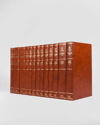
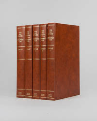
rif. 121946London Archive Editions 1994. . 14 vols 8vo 25.5 x 16.5 cm; includes maps charts & diagrams; publisher's original orange-brown cloth gilt lettering to spines top edges gilt a fine set. The complete development plans of Saudi Arabia from 1970 to 1995 with supplementary documents and reports including the master plans for Jeddah. London, Archive Editions, 1994. hardcover
rif. 121947Cambridge Cambridge Archive Editions 2020. . 2 works in 8 vols 25.5 x 16.5 cm; publisher's original black cloth silver gilt lettering a fine set. An extensive collection of documents and letters covering the reign of King Abdulaziz also known as Ibn Saud and the first king of a unified Saudi Arabia from the reconquest of Riyadh in 1902 until his death in 1953. Many of the documents and letters here are published for the first time and many of the letters are reproduced in facsimile in King Abdulaziz's own hand. Cambridge, Cambridge Archive Editions, 2020. hardcover
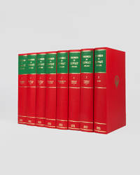
rif. 121949London Archive Editions 1989. . 8 vols 8vo 25.5 x 16.5 cm; 7 vols text & map portfolio containing 9 large folding maps and 2 tables; publisher's original red cloth gilt royal arms of Kuwait to upper boards spines in gilt with green labels top edges gilt a fine set. An impressive set of records documenting the history of Kuwait from 1899 to 1961 covering the period from the first treaty signed between Britain and Mubarak Al-Sabah to the establshiment of Kuwait as an independent state in 1961. London, Archive Editions, 1989. hardcover
rif. 121996London Archive Editions 1994. . 5 vols 8vo 25.5 x 16.5 cm; numerous charts maps plans graphs and tables; publisher's original orange-brown cloth gilt lettering to spines top edges gilt a fine set. The full development plan for Kuwait of 196/7-1971/2 as well as master plan for the city studies for the National Physical Plan and of urban development the statistics and figures for the years 1963-1988 and the statistical abstract for 1990-91. With numerous maps graphs and charts illustrating the reports as well as the full first five year plan reproduced in Arabic. London, Archive Editions, 1994. hardcover
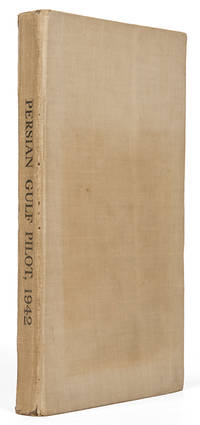
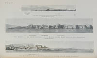
rif. 119766London Hydrographic Department Admiralty 1942. . Ninth edition with the fourth supplement dated 1948; 8vo 24.5 x 16 cm; supplement tipped to front pastedown 2 maps acting as an index for admiralty charts folding meteorological chart 21 plates showing numerous coastal views with additional view of Abu Dhabi fort tipped in from supplement further in-text weather diagrams notice of supplement tipped in to face title numerous annotations making good the corrections from the supplement; publisher's tan cloth lettered in black touch of rubbing to spine very good copy; xxvi 286 pp. A scarce pilot guide of the Persian gulf describing Bahrain Kuwait Qatar Dubai and Abu Dhabi and numerous other villages and towns along the Arabian coast. Includes coastal views of Ras Al Hadd Sur Qalhat As Suwaiq Sohar Fujairah Khasab the Tunb Islands Abu Musa the Doha Fort Bahrain Harbour and Tarut Island amongst others. The guide was published to give accurate sailing directions to the ports towns and safe anchorages along the Arabian coast from Ras al Hadd on the eastern peninsular of Oman to Shatt al Arab in the North and back along the coast of Iran to Bandar Abbas and beyond. With much early information on the principal settlements of the United Arab Emirates Qatar Bahrain Kuwait and Oman and an interesting glossary of Arabic-English key terms. Dubai is described as well as Daira: 'Daira is a large suburb consisting of mat huts amongst which stand a number of well-built houses.' 'Dibai Dubai contains the residence of the Shaikh. There are several tall towers in Dibai; the fort is a conspicuous square building with a round tower. from which the Shaikh's flag is displayed.' Abu Dhabi is similarly described: 'This town consists for the most part of huts and extends along the coast for nearly two miles. In the town there is a small fort partially surrounded by trees with five towers close together. The coast in the vicinity of Abu Dhabi is very low and the beach is of white sand'. There are two views of Qasr Al Hosn one of which appears here with the 1948 supplement for the first time. The great pearl bank is also given attention: 'this extensive bank. fills the great bight in the southern part of the Persian Gulf.' 'Many islands both close to the coast and far offshore lie on the bank. With the exception of Dalma none has permanent inhabitants though they are frequented by the pearl boats during the summer and by fisherman from Abu Dhabi in the winter.' 'The best pilots for the coast are to be obtained at Abu Dhabi.' Much of the information of Qatar and Doha is amended by the supplement and appropriately altered by the annotations showing its quickly changing nature. Bahrain is also described and there is also note of the health of the region: 'Manama. is more liable to epidemics than the smaller ports; since 1920 however there have been no more epidemics in Bahrain than in any other of the larger Gulf ports.' Kuwait is described 'The Shaikh's palace. has a small roof which is the highest point of any building in the town.' 'The principal export is pearls; the chief imports are rice sugar tea flour piece goods matches hardware wheat and barley.' London, Hydrographic Department, Admiralty, 1942. hardcover
rif. 112658London Hydrographic Department Admiralty 1955. . Tenth edition with the second supplement dated 1959; 8vo 24.5 x 16 cm; supplement loosely inserted at rear 4 coloured plates of diagrams two maps acting as an index for admiralty charts 16 double-sided plates showing numerous coastal views further in-text weather diagrams notice of supplement tipped in to face title; publisher's blue cloth lettered in yellow spine a little sunned joints professionally restored very good copy; l 312 1 pp. A scarce pilot guide of the Persian gulf describing Bahrain Kuwait Qatar Dubai and Abu Dhabi and numerous other villages and towns along the Arabian coast. Includes coastal views of Ras Al Hadd Sur Qalhat As Suwaiq Sohar Fujairah Khasab the Tunb Islands Abu Musa Sirri Island Al Jazirah Al Hamra Al Shebeakah Rams Ajman Qasr Al Hosn in Abu Dhabi Sir Bani Yas the Doha Fort Bahrain Harbour and Tarut Island amongst others. The guide was published to give accurate sailing directions to the ports towns and safe anchorages along the Arabian coast from Ras al Hadd on the eastern peninsular of Oman to Shatt al Arab in the North and back along the coast of Iran to Bandar Abbas and beyond. With much early information on the principal settlements of the United Arab Emirates Qatar Bahrain Kuwait and Oman and an interesting glossary of Arabic-English key terms. By 1955 it was clear how the oil boom had changed the economy of the region. The first chapter gives an overview and includes the character of the sea and ports description of major towns and cities and their respective populations for example 18000 in Qatar the main economic imports and exports of each locale and considerable weather information. Dubai is described as well as Daira: 'Daira is a large suburb consisting of mat huts amongst which stand a number of well-built houses.' 'Dibai Dubai contains the residence of the Shaikh. There are several tall towers in Dibai; the fort is a conspicuous square building with a round tower. from which the Shaikh's flag is displayed. There is a hospital.' Abu Dhabi is similarly described: 'This town consists for the most part of huts and extends along the coast for nearly two miles. In the town there is a small fort partially surrounded by trees with five towers close together. The coast in the vicinity of Abu Dhabi is very low and the beach is of white sand'. The fort is given it's own view on one of the plates. The great pearl bank is also given attention: 'this extensive bank. fills the great bight in the southern part of the Persian Gulf.' 'Many islands both close to the coast and far offshore lie on the bank. With the exception of Dalma none has permanent inhabitants though they are frequented by the pearl boats during the summer and by fisherman from Abu Dhabi in the winter.' 'The best pilots for the coast are to be obtained at Abu Dhabi.' Much detail is also given to Qatar and Doha: 'This town situated on the southern side of the harbour is the capital of Al Qatar peninsula and had a population in 1947 of about 12000.' ' The Shaik's palace. is a large building with many colonnades and an open balustrade round its roof.' ' The chief exports are gutch fish and pearls; imports are food timber and manufactured goods.' Bahrain is also described with Manama being called the 'principal town and port' and as well as the trade being described there is also note of the health of the region: 'Manama is more liable to epidemics than the smaller ports; since 1920 however there have been no more epidemics in Bahrain than in any other of the larger Gulf ports.' It is interesting also that one of the major changes of the supplement is changing the name 'Bahrein' to 'Bahrain'. Kuwait is described as greatly altered by the oil wealth: ' Wealth derived from oil revenues is being spent on completely replanning and rebuilding the town. Government offices schools hospitals electric generating and water distillation stations private houses and blocks of flats are all being built in the most modern style'. 'Pearl fishing is now practically extinct. There are to all intents and purposes no exports. The chief imports are food of all kinds machinery motor vehicles and building materials.' London, Hydrographic Department, Admiralty, 1955. hardcover
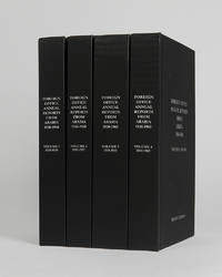
rif. 122002Minneapolis East View 2026. . 4 vols 8vo 25.5 x 16.5; publisher's black cloth lettered white to boards and spines a fine copy. A comprehensive collection of annual reports produced by the British Foreign Office concerning the major regions of Arabia often intended as internal circulars and never for direct publication. Minneapolis, East View, 2026. hardcover
rif. 121954London Archive Editions 1991. . 8 vols 8vo 25.5 x 16.5 cm; 7 vols text & map portfolio containing 12 large folding maps; publisher's original green cloth gilt arms of Qatar to upper boards gilt lettering to spines with red lettering pieces top edges gilt a fine set. An unrivalled collection of material revealing the history of Qatar from 1820 to 1960 focussing on primary documents charting the history of the peninsular from Qatar's first maritime treaty with Britain in 1820 up to the abdication of Ali bin Abdullah in 1960. Many of the documents within are published for the first time. London, Archive Editions, 1991. hardcover
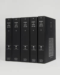
rif. 121953Cambridge Cambridge Archive Editions 2021. . 4 vols 8vo 25.5 x 16.5 cm; 5 large folding maps loose in rear pocket; publisher's original black cloth silver gilt lettering a fine set. A comprehensive collection of documents recording the history of Qatar between the years 1966 and 1971 which saw the withdrawal of Britain from the region and the eventual establishment of Qatar as an independent nation rather than joining the Emirates in a confederation. Cambridge, Cambridge Archive Editions, 2021. hardcover
rif. 121999Minneapolis East View 2026. . 2 vols 8vo 25.5 x 16.5 cm; includes maps charts & tables; publisher's black cloth lettered white to boards and spines a fine copy. The complete collection of planning documents for Abu Dhabi from 1962 to 1979 the development plan review for Dubai of 1971 and the Federal Economic and Social Development Plan 1975 to 1980. Minneapolis, East View, 2026. hardcover
rif. 121951Cambridge Cambridge Archive Editions 2021. . 5 vols 25.5 x 16.5 cm; publisher's original black cloth silver gilt lettering a fine set. A very important collection of documents charting the the history of Qatar during the years 1961 to 1965 including the rise of the National Unity Front the growth of the Qatar Petroleum Company and the decline of British-Qatari relations. Chapters divide the documents into sections: the Royal Court Council of Ministers communications economy foreign affairs internal affairs judiciary labour and oil among others. Cambridge, Cambridge Archive Editions, 2021. hardcover
rif. 121943Cambridge Cambridge Archive Editions 2020. . 4 vols 8vo 25.5. x 16.5 cm; publisher's original black cloth lettered in silver a fine set. A valuable collection of records detailing the development and growth of the cities of Kuwait Manama Doha Abu Dhabi Dubai Sharjah Muscat and Mattrah from as early as 1818 right the way through until the mid-1960s before the Gulf War. Chapters are divided into: topography municipality water electricity health education communication lines urban development port development and social history with many royal decrees reproduced. Cambridge, Cambridge Archive Editions, 2020. hardcover
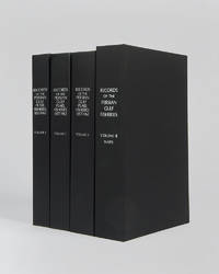
rif. 122017London Archive editions 2026. . 4 vols 8vo; includes a map portfolio with 7 maps original black cloth lettered in white a fine set. A very important work on the pearl fisheries of the Arabian Gulf bringing together in a single research collection all relevant documents from British government records relating to the pearl industry the most important economic activity in the Gulf before the oil era. London, Archive editions, 2026. hardcover
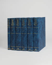
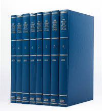
rif. 121085London Archive Editions 1989. . 8 vols 8vo; original blue cloth gilt a fine set. A complete set of this handsome facsimile edition of all eight Persian Gulf pilots published between 1870 to 1932. Invaluable not only for sailing directions but also for descriptions of the coast and its towns and villages and how they have grown over the period. London, Archive Editions, 1989. hardcover
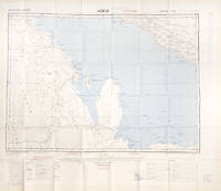
rif. 112618London War Office printed for D. Survey WO and AM by Balding and Mansell Ltd. 1957. . Coloured double-sided map of the Arabian Gulf on 1 sheet printed on silk; edition I-GSGS; sheet size: 64 x 72.5 cm; scale 1:1000000 text in English very slight fading to outer margin otherwise near fine. An excellent example of a double-sided coloured escape map of the Arabian Gulf showing the UAE and Oman to recto and Qatar to verso. With a key to topographical features railways main roads and important settlements including the tribal and official names of provinces and a useful Arabic-English glossary translating key terms such as 'Bir' for 'Well' 'Ain' for Spring' 'Qasr' for 'Fort/Castle'. The recto extends from Kumzat in the North to Hafit in the South and Abu Dhabi in the West to al-Qasbiyat in the East showing the six remaining emirates of Dibai Dubai Sharja Ajman Umm al-Qaiwan Ras al-Khaima and Fujaira. The verso runs South from Ras es Safaniya to Ei Abd and from Awania in the West to Rudaim in the East including the principal settlements of Jubail Bahrein Hofuf showing Doha Wakra and Lusail on the Qatar Peninsular. [London], War Office, printed for D. Survey (WO and AM) by Balding and Mansell Ltd., 1957. unknown
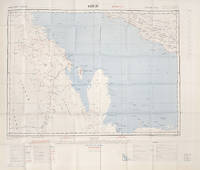
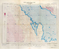
rif. 113506London War Office Geographical section 1951. . First edition GSGS 4622 Sheet 2547; Coloured printed map of Bahrain and Qatar on single sheet with extensive legend printed on reverse size: 62.5 x 77 cm; scale 1:1000000 text in English a little faded along folds a very good copy. First edition of the 1951 issue of the R.A.F. Aeronautical map of Bahrain and Qatar. The War office issued the R.A.F. series alongside a separate US Airforce Series: the R.A.F. series only covers Europe Africa Arabia and up to the end of 1951 had only covered Britain the east coast of Africa and this sheet of Arabia. The odd selection of this region aside from east Africa is made clearer by looking at the content of the map. The map does not show the 'delineation of international boundaries' or 'danger zones' but the topography largely the elevation and depression of the terrain with indications of marshy areas. The only indicated features other than towns and roads are of oil fields and pipelines. In 1941 Britain had gained control of much of Iraq's oil after the Anglo-Iraqi War and sought to expand its influence. The allies had seen the strategical benefits of Bahrain and after the discovery of oil in the region in 1932 it became even more pertinent to grow relations with the entire Middle Eastern command moving from Bushehr in Iran to Bahrain in 1935. But after the war relations had soured with the 1947 anti-Jewish riots in Manama Bahrain largely in reaction to Britain's disastrous orchestration of the Partition of Palestine. At the same time Iran had sought to break free of British control of their oil and in March 1951 voted to nationalise their oil production: in response Britain boycotted Iranian exports. It was in that same month that this map was finalised and published in July in the midst of the tense negotiations Iran was conducting with both Britain and the USA. In 1951 Britain was clearly searching for new regions to extract oil from and this map is captivating evidence of the fractious relationship Britain had fostered with the state of the Arabian Gulf. [London], War Office, Geographical section, 1951. unknown
rif. 112628London War Office printed for D. Survey WO and AM by Balding and Mansell Ltd. 1957. . Coloured double-sided map of the Arabian Gulf on 1 sheet printed on silk; edition I-GSGS; sheet size: 64 x 72.5 cm; scale 1:1000000 text in English slight fading to creases otherwise near fine. An excellent example of a double-sided coloured escape map of the Arabian Gulf showing the UAE and Oman to recto and Qatar to verso. With a key to topographical features railways main roads and important settlements including the tribal and official names of provinces and a useful Arabic-English glossary translating key terms such as 'Bir' for 'Well' 'Ain' for Spring' 'Qasr' for 'Fort/Castle'. The recto extends from Kumzat in the North to Hafit in the South and Abu Dhabi in the West to al-Qasbiyat in the East showing the six remaining emirates of Dibai Dubai Sharja Ajman Umm al-Qaiwan Ras al-Khaima and Fujaira. The verso runs South from Ras es Safaniya to Ei Abd and from Awania in the West to Rudaim in the East including the principal settlements of Jubail Bahrein Hofuf showing Doha Wakra and Lusail on the Qatar Peninsular.Arabian Gulf Fabric Map of Hofuf and Bandar Abbas 1957 [London], War Office, printed for D. Survey (WO and AM) by Balding and Mansell Ltd., 1957. unknown
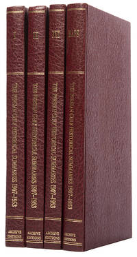
rif. 113476London Archive Editions 1987. . First edition; 4 vols 8vo includes a volume of maps and genealogical tables original brown cloth gilt a fine set. An historical summary of events in the Arabian Gulf concerning British interests from 1907. also includes oil agreements and concessions in the region particularly Muscat and Oman. London, Archive Editions, 1987. hardcover