4361 risultati
rif. DADAX0816677328New unknown
rif. DADAX0940889064New unknown
rif. DADAX0965303926New unknown
rif. DADAX0979346924New unknown
rif. DADAX0199732205New unknown
rif. DADAX0199609527New unknown
rif. DADAX0802085458New unknown
rif. DADAX1886947104New unknown
rif. SONG1886947309Used: Good unknown
rif. SONG0967561973Used: Good unknown
rif. SONG0896596842Used: Good unknown
1948rif. GB009AE8MLQI4N00A.S. Barnes and Company 1948. Paperback. Very Good. May have limited writing in cover pages. Pages are unmarked. ~ ThriftBooks: Read More Spend Less.Dust jacket quality is not guaranteed. A.S. Barnes and Company paperback
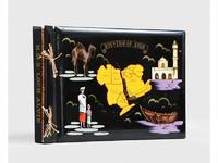
1955rif. 188201On board HMS Loch Alvie: South Asia and Arabian Gulf 1955-56. Striking visual record of the Gulf at the dawn of the oil boom An attractive photograph album compiled by a Royal Navy rating during service in the Gulf in 1955-56 notable for its early views of Abu Dhabi and other sites in the present-day UAE on the eve of the oil transformation. Drawn to the stark coastline and improvised shore installations he recorded places that within a decade would be reshaped by petroleum infrastructure and urban expansion. Several images relate to Abu Dhabi. A view of Das Island dated 11 April 1956 shows a bare shoreline with oil drums and rudimentary structures in the first phase of development linked to the Umm Shaif field. At Khawr al Bazm 19 April 1956 he photographed the coast from the ship and the firing of a 21-gun salute for the Queen's birthday juxtaposing imperial ceremony with an undeveloped littoral. Four deckle-edged photographs depict Dalma Island - then a remote outpost - including a grave the remains of a wrecked dhow and the stretch of coast where the vessel was driven ashore in bad weather. Today Dalma is recognised as a major archaeological site within Abu Dhabi emirate. Dubai appears in a 22 April 1956 view of water taxis and the souq along Dubai Creek still a modest mercantile settlement. The following day Lord and Lady Mountbatten paused there during their return from Asia and Australasia an event marked by guards of honour and captured in the album. A coastal view of Dibba on the Musandam Peninsula - now divided between Oman and the UAE - records the rugged shoreline before modern development. Although centred on the Gulf the album also includes related regional material - Bahrain including Juffair naval base Qatar's early oil installations at Umm Said and Halul Island and shipboard scenes - placing the UAE images within the wider strategic network of Britain's post-war naval presence east of Suez. The volume concludes with an official photograph of HMS Loch Alvie and a track chart of her cruise under Captain C. J. Matthews sailing from Chatham in July 1955 and returning in July 1956. Landscape folio 270 × 390 mm. 88 mounted silver gelatine photographs the majority personal rather than purchase and 24 of which relate to the Gulf various formats mostly 105 x 80 mm the great majority captioned in white ink leaves additionally decorated with small sketches and various ephemera. Asian black lacquer album silk ties at the spine typical of those available at the Liberty Stores Aden lettered "Souvenir of Aden" on the front cover with a hand-painted map of the Arabian Peninsula and Red Sea surrounded by images of a mosque camel dhow and local inhabitants HMS Loch Alvie cap tally pasted to spine edges gilt decorative gold and silver leaf spackled endpapers; black card mounting leaves. Corners a little bumped and worn a couple of cracks to the lacquer to the back cover; some tissue guards a little creased contents otherwise clean sound and complete; very good. unknown
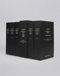
rif. 122010London Archive Editions 2003. . 6 vols 8vo 25.5 x 16.5 cm; includes maps & genealogical tables; publisher's original black cloth white lettering to upper board and spine a fine set. Lorimer's Gazetteer of the Persian Gulf was compiled by officials of the British Government in India during the decade after Lord Curzon's Vice-Regal tour of the Gulf in 1903. When first issued in 1915 it was classified as Secret and for Official Use Only and just a few dozen copies were printed for circulation to British Government departments and agencies. The work was planned in two parts; the first comprising a history of the Gulf region the second being a geographical dictionary but grew to encompass all aspects of Gulf life culture cities towns tribes and topography. Lorimer was an official of the India Civil Service who had spent most of his career on the North West Frontier. He was placed on 'special duty' to compile the Gulf handbook which was intended to be completed in six months but due to Lorimer's dedication and extensive field trips the work took some ten years to complete. The present edition printed from the India Office Records makes available one of the most important primary sources for the study of the Gulf region from the seventeenth to the early twentieth century. London, Archive Editions, 2003. hardcover
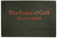
rif. 117551London Perrier / Golf Illustrated 1905. . First edition; landscape folio 29.5 x 45.5 cm; 1 half-size sheet detailing sales information 1 copyright page "Copyright of Perrier" 24 colour plates each with Perrier copyright and details to verso 1 advertising leaf at rear a couple small marginal nicks to rules XVI and XXIII plates fresh and bright; publisher's green cloth-backed boards upper board lettered in red and black boards lightly rubbed a very good copy. Crombie's amusing look at golf in a bygone age. London, Perrier / Golf Illustrated, [1905]. hardcover
rif. DADAX0128213418New unknown
rif. 46890215-nnew. unknown
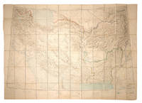
rif. 108381Calcutta Survey of India Office 1912-1923. . Heliozincographed colour map four sheets dissected and mounted on linen as one folding out to 108 x 152 cm in size scale 1:2000000 1.014 inches to 32 miles original paper covers with manuscript title label faint crayon lines confined to the area around Quetta a couple minor marginal tears repaired linen a little fragile in a few places but still a sturdy and attractive copy. Four sheets of the Survey of India Southern Asia Series 1912-1945 covering the Gulf Persia Afghanistan Boluchistan and western India stretching from Riyadh in the south-west to Bukhara in the north-east. The sheet covering the Arabian Gulf titled 'Southern Persia' is dated 1912 and shows the main travel routes along the Gulf and into the interior as far as Riyadh with none of the roads being depicted as suitable for wheeled vehicles and totally absent of railways or telegraph lines. Kuwait Bahrain Qatar Abu Dhabi and Dubai are all identified. Sir Sidney Gerald Burrard 1860-1943 initially served in the Survey offices at Dehra Dun before being made Surveyor General in 1908. In 1912 it was his decision to produce a new set of maps which would correct trigonometric errors in previous surveys and give a totally accurate mapping of Arabia and Central Asia centred on the oil reserves in Persia which Britain had a controlling interest in. Calcutta, Survey of India Office, 1912-1923. unknown
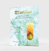
1995rif. 182920Kuwait: Markaz al-buhuth wa-al-dirasat al-Kuwaytiyah 1995. First edition of this well-illustrated study on the environmental impact of the destruction of oil wells in Kuwait based on government documents issued by the Iraqi government during the Gulf War. The work presents this damage substantiated by copious data as a main goal of the Iraqi war strategy of delayed sabotage. An appendix lists names of Iraqi officers accused of being "environmental criminals" as they took part in the identification of targets and methods and the execution of the plan - phases which are carefully described in the first part. The second part discusses subsequent damages to the economy public health and the environment including air and water pollution and their impact on living organisms. The third part describes the strategies employed to limit the damage such as the efforts of firefighters in extinguishing burning oil wells. Quarto. With facsimiles of documents colour illustrations and maps. Text in Arabic. Original pictorial wrappers wire-stitched as issued. Pencilled Arabic word at head of last verso. Extremities a trifle rubbed or creased contents clean: a very good copy. unknown
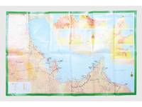
rif. 181557Saudi Arabia: Kruger for I.P.A. International Bookshops Dharan Airport 1977. Road construction faster than map production A folding road map of the Gulf and an interesting snapshot of its natural and human geography in the 1970s with 25 attractive photographs of Dubai. The map extends from Kuwait to Oman's Jabal al-Akhdar showing primary metalled roads roads under construction secondary roads towns wadis oil wells and pipelines oilfields and the morphology of the terrain. It also features 7 inset maps of the city centres of Manama Doha Abu Dhabi Kuwait Dubai Mutrah and Muscat. The small print in the reference section explains that "all roads under construction are being completed as the progress was faster than our production". The photos of Dubai include views of Dubai Creek dhows dromedaries and camels local inhabitants and the main heritage sites. Colour printed map folded 295 x 157 mm; unfolded 585 x 910 mm. Text in Arabic and English. Seven inset maps of Gulf capital cities verso with 25 colour photograph views of Dubai by Said Salah. Original colour self-wrappers printed in yellow black and white on a red and green ground. A few tiny chips or light wear to some folds couple of minor creases to outer corners: a very good exemplar. unknown
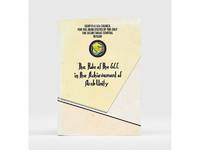
1985rif. 177401Bahrain: Printed by the Arab Printing and Publishing Establishment 1985. Second edition of this booklet produced to showcase the Arab Thought Forum held in Riyadh in April 1985. The first part comprises "Arab Unity: A General Outlook" a speech delivered by Prince Saud al-Faisal Foreign Minister of the Kingdom of Saudi Arabia. It is concerned with the difference between the "failed" concepts of Arab unity and Arab nationalism and their relationship with Islamic doctrines. The second part is devoted to a research paper by the GCC Secretary General concerning the role of the GCC in the achievement of Arab unity. It analyzes regional changes in the decade 1971-1981 and the "Arab degeneration and decline and the downfall of the unity of Arab security" before the establishment of the GCC. Octavo 240 x 165 mm. Text in English and Arabic. Original yellow printed wrappers wire-stitched as issued. Extremities and covers a bit rubbed sunned and foxed first recto and last verso toned: a very good copy. unknown
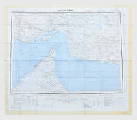
1957rif. 182684London: War Office; Printed for D. Survey WO and AM by Balding and Mansell Ltd 1957. A bright example of this detailed Gulf map Classified "restricted" and issued for military use at the time of the Jebel Akhdar War this double-sided sheet shows much of the modern-day UAE extending northwards from the latitude of Abu Dhabi and the Buraimi Oasis as well as the eastern Arabian Peninsula from the Trucial Coast to Jubail. As with other contemporary GSGS maps the sheet covers six degrees of longitude and highlights towns of significance and other standout features for example oil pipelines and wells water systems and roads and railways. Rayon sheet 630 x 710 mm printed both sides in colour folded as issued. A fine example. unknown
rif. DADAX0230337325New unknown
rif. DADAX1138108669New unknown
2012rif. 1-1618930214Time Home Entertainment Inc 2012. Hardcover. New. expanded edition. 224 pages. 10.00x10.25x1.00 inches. Time Home Entertainment Inc hardcover