560 x 430 mm. Folding poster with several black-and-white photographic illustrations. Aramco poster celebrating technological advances in the Arab world. Featuring pictures taken by Aramco employees, it presents the various modes of transportation in Saudi Arabia, emphasizing the symbiosis of progress and tradition: "Present-day Arabia is a meeting place of ancient and modern ways. Arab Bedouins and camels, reminiscent of Biblical days, are often seen side by side with modern airplanes and oil rigs". The images show pack animals, sail boats, cars, buses, tankers, trains and airplanes.
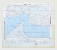
1963réf. 153757London: Geographical Section General Staff 1963. Scarce charts of Bahrain and the Straits of Hormuz A rare and historically interesting pair of adjacent maps of the Arabian Gulf covering six degrees of longitude each the geographical area encompassing the whole of Qatar Bahrain and part of what was to become the United Arab Emirates Al-Hofuf being the major city in the Al-Ahsa Oasis Eastern Province Saudi Arabia; sixth and fifth editions respectively. Maps of the period issued by the GSGS Geographical Section General Staff use a 7-colour tint scale to distinguish altitude and a glossary that highlights towns of significance and other standout features which provided steady references for army personnel to aid navigation in the challenging conditions of the region. The Bander Abbas map was compiled by the US Army Map Service Corps of Engineers from a number of sources including USAF Aeronautical Approach Charts of 1951-55 and the US Geological Survey of the Arabian Peninsula 1958. The Hofuf chart is based inter alia on 512 Field Survey Royal Engineers charts 1942-4. WorldCat lists just three individual copies for Hofuf NG39 SUNY at Buffalo University of Notre Dame and Eastern Illinois University alongside four copies of Bandar Abbas NG40 University of Exeter University of Notre Dame Eastern Illinois University and University of South Florida. It should be noted that major national institutions - BL for example - will have holdings of these maps within the complete GSGS series. Most copies would be discarded on supersession making these an important record of cartographic progress in the region. Two two-colour printed maps 1:1000000 scale 690 x 610 & 750 x 610 mm respectively. Ex- libris stamp of Arizona State Library both stamped "superseded" in blank margin and "withdrawn" on verso some pencilled marginalia; both in excellent condition. unknown
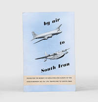
1955réf. 171428Malta: Trade Commissioner to the Malta Government 1955. A rare promotional guide to the air route from London to Basra produced for travellers destined for the Anglo-Iranian Oil Company's refinery at Abadan in Iran. A map shows the route passing through the eastern Mediterranean and Egypt before arriving in Iraq. The text attempts to give the impression of a well-organized journey: "At Basra you will be met by a representative of the Company who will help you with the Customs and other formalities. After a meal at the Airport Hotel you will find that arrangements have been made for your onward journey to your destination". The map to the verso shows critical infrastructure across the Middle East including oil pipelines and railways. Octavo. With 4 photographs and 2 colour maps. Folding colour printed pamphlet 140 x 215 mm when folded 420 x 215 mm when open. Minor scuffing creased at centre a touch foxed at front. A very good copy. unknown
1876réf. 173034London: Printed by Harrison and Sons 1876. We should no longer be looked on as the friendly protectors of the maritime Arabs First edition traced in only five libraries. The opening section centres on the important political implications of receiving fugitives on vessels in the Gulf and reproduces correspondence to and from Edward Charles Ross the Acting Political Resident concerning HMS May Frere whose commanding officer granted safe harbour to a slave from a pearl boat while anchored near Abu Dhabi. London saw curtailing the slave trade in the Indian Ocean and Arabian Sea as a means to consolidate Britain's power in the region and signed anti-slavery treaties with the sultans of Muscat and Zanzibar in 1873. Although guidance from 1871 stated that slaves who were accepted onto naval vessels gained freedom Ross understood the inherent dangers of such an emancipatory approach: "It is however necessary to consider the consequences which would ensue on an excessive exercise in the Persian Gulf of the powers vested in Commanders of vessels-of-war. Nowhere would these be more serious than on the Pearl Banks where the diving is carried on almost entirely by domestic slaves. If the slave should find an opportunity to run off to a British vessel one can easily understand the dismay of the master and the general feeling of consternation and disgust that would be caused by a frequent recurrence of such incidents. We should no longer by looked on as the friendly protectors of the maritime Arabs" p. 2. In Ross's view commanders were best advised not to accept runaways and protect Britain's superior position. We have traced copies at the Senate House Library NYU Abu Dhabi Harvard Florida International University and Leiden. Quarto 315 x 205 mm. Recent blue wrappers. Leaves paginated on verso at top-right. Some rust-marking light creasing and short closed tears internally: about very good. unknown
1957réf. 182684London: War Office; Printed for D. Survey WO and AM by Balding and Mansell Ltd 1957. A bright example of this detailed Gulf map Classified "restricted" and issued for military use at the time of the Jebel Akhdar War this double-sided sheet shows much of the modern-day UAE extending northwards from the latitude of Abu Dhabi and the Buraimi Oasis as well as the eastern Arabian Peninsula from the Trucial Coast to Jubail. As with other contemporary GSGS maps the sheet covers six degrees of longitude and highlights towns of significance and other standout features for example oil pipelines and wells water systems and roads and railways. Rayon sheet 630 x 710 mm printed both sides in colour folded as issued. A fine example. unknown
1978réf. 172055Perhaps Kuwait: United Nations Environment Programme 1978. First and sole edition untraced in Middle Eastern libraries of this plan enshrining environmental protection as a priority for future development along the Arabian coast. The regional conference highlighted the dangers posed by oil spills and committed to pollution-control measures for future projects. Participants included delegates from Bahrain Iran Iraq Kuwait Oman Qatar Saudi Arabia and the UAE. Attendees also agreed on a regional trust fund funded in different proportions by eight governments including the UAE and Saudi Arabia to finance initiatives. In the United Kingdom copies can be found at the universities of Oxford Durham and Southampton. We have also located three each in the US and Canada two in Germany two in Switzerland and one each in Austria and Sweden. Octavo. Original pale blue wrappers wire-stitched as issued front cover lettered in black. Light peripheral toning to covers small rust mark at top corner of front cover back cover slightly creased: a very good copy. unknown
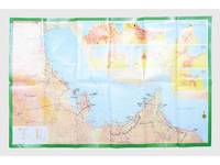
réf. 181557Saudi Arabia: Kruger for I.P.A. International Bookshops Dharan Airport 1977. Road construction faster than map production A folding road map of the Gulf and an interesting snapshot of its natural and human geography in the 1970s with 25 attractive photographs of Dubai. The map extends from Kuwait to Oman's Jabal al-Akhdar showing primary metalled roads roads under construction secondary roads towns wadis oil wells and pipelines oilfields and the morphology of the terrain. It also features 7 inset maps of the city centres of Manama Doha Abu Dhabi Kuwait Dubai Mutrah and Muscat. The small print in the reference section explains that "all roads under construction are being completed as the progress was faster than our production". The photos of Dubai include views of Dubai Creek dhows dromedaries and camels local inhabitants and the main heritage sites. Colour printed map folded 295 x 157 mm; unfolded 585 x 910 mm. Text in Arabic and English. Seven inset maps of Gulf capital cities verso with 25 colour photograph views of Dubai by Said Salah. Original colour self-wrappers printed in yellow black and white on a red and green ground. A few tiny chips or light wear to some folds couple of minor creases to outer corners: a very good exemplar. unknown
1942réf. 191335Washington DC: Army Map Service April 1942. The Gulf when America joined the war An expansive wartime flight chart "the advance edition" classified as "Restricted" for use by the U.S. Army Air Forces. It covers the whole of the Arabian Gulf and a substantial part of the Arabian Peninsula including Saudi Arabia Trucial Oman and Kuwait. After the United States joined the Allies in December 1941 they began operations in the Middle East most notably by providing support in North Africa as part of the Second Battle of El Alamein and Operation Torch. Over the following years the American government began to recognise the importance of Middle Eastern resources extending the Lend-Lease programme to Saudi Arabia Iran and Israel as well as indirectly supporting British colonies in the region. To protect these resources they set up Persian Gulf Command and manned the "Persian Corridor" from Iran through to Azerbaijan. They also participated in the Tehran Conference in late 1943. Further west the Ninth Air Force ran regular sorties out of Egypt and Libya to assist in the European theatre securing air dominance and denying the enemy the opportunity to replenish their supplies. The reverse of the chart features three inset maps of Bahrain Cyprus and Rhodes. They are accompanied by sectional views of their coastlines. The first two countries were host to RAF and Royal Navy bases while Rhodes was occupied by Italy and later Germany after the Battle of Rhodes in 1943. We have traced no copies of this map in institutions and one copy of a 1944 coloured edition in commerce. Single sheet 965 x 1305 mm maps and sectional views printed both sides highlights and compass roses printed in blue key on recto. Rolled tidemarks and creasing in upper margin not past neatlines: a very good copy. unknown
1956réf. 153759London: Geographical Section General Staff 1956 & 1957. Scarce maps of Oman and south-east Arabia dating to the Jebel Akhdar War A pair of decidedly uncommon and impressively sized regional maps both second editions Muscat-Musira following the first of 1945 S. E. Arabia first published in 1956. The Muscat-Masira map drawn up by D Survey of the Ministry of Defence reaches as far north as Khaburah Oman on the coast south beyond Masirah Island and westward reaching beyond Lahus and Hadhi. It is based on several mappings including Bertram Thomas's map of Rub' al Khali the "Empty Quarter" 1931 the sand desert covering most of the southern third of the Arabian Peninsula Samuel Barrett Miles 1910 map of Oman and Captain F. F. Hunter's map of Arabia 1935 revision. The aeronautical chart goes into greater detail reaching beyond Sur in the North South to Masirah Island and Manadhif and West to Uruq ash Shaybah UAE; this was drawn up by No. 1 SPC.RE i.e. Survey Production Centre Royal Engineers and is based largely on the USAF Aeronautical Approach Charts 1956 and World Aeronautical Chart 563 1951. During the mid to late-1950s Britain was involved in a number of disputes in Oman perhaps the most serious involving the Imam Ghalib al-Hinai and his brother Talib bin Ali who led the Imamate's revolt against Sultan Said bin Taimur which resulted in the Jebel Akhdar or Oman War 1954-1959. In this the RAF played a leading role not least because aircraft could at the same time expedite oil exploration operations in the interior of Oman. Pembrokes light transport aircraft and heavier Avro Ansons from 1417 Communication Flight RAF carried out reconnaissance "and other tasks during this operation against the Imamate and were the first aircraft ever to land at Nizwa marked "Nazwa" on the chart on a roughly cleared strip which proved extremely hazardous for the pilots but which was later transformed into a passable airfield" Lee p. 22. The present chart has two pencilled lines radiating from Masira airfield one of which passes through Nizwa near which is marked the "approx. position" of an airstrip. The chart bear the proviso that they should "not be taken as an authority on names" and that "the alignment of all tracks is approximate". Users were also directed to update information and highlight errors which were to be directly sent to the Director of the Military Survey in the War Office. There are noticeable graphical variations between the chart and map as fitting their usage. Before the Second World War pilots flew using landmarks - such as train tracks or roads - as pointers which meant that they relied on perfect weather conditions. However technological advances in aviation alongside the use of radio for more accurate navigation meant that to a degree pilots could work in more challenging conditions. This meant that maps with their focus on terrain and details relevant from the perspective of ground troops would become irrelevant when observed from a plane's altitude. Therefore a number of countries started to produce charts highlighting key information by reducing the contour structure and focusing on key landmarks necessary for aviators. The Muscat-Masira map uses a five-colour tint scale to distinguish altitude includes a glossary and key the latter identifying towns given four categories of importance significant ruins geographical features such as mountains hills marshes saddles and passes rivers water holes and man-made features such as railways roads tracks telegraph lines pipelines and pumping stations mosques and temples; tribal and regional names are also given. However reflecting the simplification required by pilots the S. E. Arabia chart only uses fives tones to highlight land mountains paths and the sea. These maps intended for use in the field would have had a high rate of attrition; WorldCat locates just a handful of copies of the Muscat-Masira map whilst S.E. Arabia 4802 is well represented institutionally but decidedly uncommon on the market. Two colour printed maps the first 1: 1000000 scale 860 x 640 mm the second 1:500000 scale 1100 x 825 mm. Both with creases from old folds and some minor marginal splits and spots the second with pencil lines marking a flight route from Masira Island and a notation in the margin; both remain very good. Sir David Lee The RAF in the Mediterranean and Middle East 1945-71 1978. unknown
1955réf. 188201On board HMS Loch Alvie: South Asia and Arabian Gulf 1955-56. Striking visual record of the Gulf at the dawn of the oil boom An attractive photograph album compiled by a Royal Navy rating during service in the Gulf in 1955-56 notable for its early views of Abu Dhabi and other sites in the present-day UAE on the eve of the oil transformation. Drawn to the stark coastline and improvised shore installations he recorded places that within a decade would be reshaped by petroleum infrastructure and urban expansion. Several images relate to Abu Dhabi. A view of Das Island dated 11 April 1956 shows a bare shoreline with oil drums and rudimentary structures in the first phase of development linked to the Umm Shaif field. At Khawr al Bazm 19 April 1956 he photographed the coast from the ship and the firing of a 21-gun salute for the Queen's birthday juxtaposing imperial ceremony with an undeveloped littoral. Four deckle-edged photographs depict Dalma Island - then a remote outpost - including a grave the remains of a wrecked dhow and the stretch of coast where the vessel was driven ashore in bad weather. Today Dalma is recognised as a major archaeological site within Abu Dhabi emirate. Dubai appears in a 22 April 1956 view of water taxis and the souq along Dubai Creek still a modest mercantile settlement. The following day Lord and Lady Mountbatten paused there during their return from Asia and Australasia an event marked by guards of honour and captured in the album. A coastal view of Dibba on the Musandam Peninsula - now divided between Oman and the UAE - records the rugged shoreline before modern development. Although centred on the Gulf the album also includes related regional material - Bahrain including Juffair naval base Qatar's early oil installations at Umm Said and Halul Island and shipboard scenes - placing the UAE images within the wider strategic network of Britain's post-war naval presence east of Suez. The volume concludes with an official photograph of HMS Loch Alvie and a track chart of her cruise under Captain C. J. Matthews sailing from Chatham in July 1955 and returning in July 1956. Landscape folio 270 × 390 mm. 88 mounted silver gelatine photographs the majority personal rather than purchase and 24 of which relate to the Gulf various formats mostly 105 x 80 mm the great majority captioned in white ink leaves additionally decorated with small sketches and various ephemera. Asian black lacquer album silk ties at the spine typical of those available at the Liberty Stores Aden lettered "Souvenir of Aden" on the front cover with a hand-painted map of the Arabian Peninsula and Red Sea surrounded by images of a mosque camel dhow and local inhabitants HMS Loch Alvie cap tally pasted to spine edges gilt decorative gold and silver leaf spackled endpapers; black card mounting leaves. Corners a little bumped and worn a couple of cracks to the lacquer to the back cover; some tissue guards a little creased contents otherwise clean sound and complete; very good. unknown
4to. 4 issues. 56 pp. each. Original printed wrappers. Stapled. Popular illustrated magazine published by the Arabian Oil Company. A set of 4 issues discussing aspects of Arabian engineering, agriculture, and the advances in science and medicine, as well as cultural and spiritual affairs. - Margins slightly worn.
32 photocopies in polypouch binder (ca. 23 x 34 cm). Highly detailed and extensively hand-annotated map of the eastern end of the Peninsula, photocopied from the one-million scale pilots' ONC maps (Operational Navigation Chart) as a set of 32 sheets and self-assembled by a traveller to the region. Covers Oman, including the eastern portion of the United Arab Emirates and Saudi Arabia. The repeated notations, "maximum elevation believed not to exceed 200 feet" and "limits of reliable relief information" bear witness to the measure in which the inner Peninsula still constituted frontier country in the later 20th century.
Large chromolithographed map (122 x 139 cm). Scale 1:2,000,000. Second edition. A highly detailed map of the complete Peninsula, the first modern map in 1:2,000,000 scale. Based on the groundbreaking series prepared by the U.S. Geological Survey and the Arabian American Oil Company under the joint sponsorship of Saudi Arabia and the U.S. State Department, "a unique experiment in geological cooperation among several governments, petroleum companies, and individuals" (Seager/Johnston). Also includes the territories of today's Kuwait, Qatar, Bahrain, United Arab Emirates, Oman, and Yemen. "The plan for a cooperative mapping project was originally conceived in July 1953 [... By 1955] there was established a cooperative agreement between the Kingdom of Saudi Arabia, the U.S. Department of State, and the Arabian-American Oil Co. to make available the basic areal geology as mapped by Aramco and the U.S. Geological Survey" (ibid.). The plan provided for 21 maps on a 1:500,000 scale in both geologic and geographic versions; "a peninsular geologic map on a scale of 1:2,000,000 was to conclude the project [...] The first geographic quadrangle was published in July 1956 and the last in September 1962. While preparation of the geographic sheets was in progress, a need arose for early publication of a 1:2,000,000-scale peninsular geographic map. Consequently, a preliminary edition was compiled and published in both English and Arabic in 1958" (ibid.). This revised, final version ("I-270 B-2") that first appeared in 1963 incorporated additional photographic, topographic and cultural data. The present map, printed in 1967, is a re-issue of the 1963 edition, merely differing in the date. Includes a key with symbols for water pipelines, desert watering points, oil fields, pumping stations, refineries, and a glossary of Arabic names. - "Although the search for oil, gas and minerals was ultimately to drive geological survey work across the region [...], in its early years it was the need for water that was the catalyst for Saudi Arabia's resource exploration. In 1944 King 'Abd al-'Aziz approached the United States for a technical expert who could assist with the identification and plotting of the kingdom's natural resources, particularly its groundwater reserves. The individual who arrived, Glen F. Brown, was one of the pioneers of a partnership between the United States Geological Survey (USGS) and the government of Saudi Arabia that was to span the next five decades and play an important role in the development of the kingdom [...] By 1954 the Saudi Ministry of Finance, USGS and Aramco were working together to produce the first full series of geographic and geologic maps of the country. The first of their type in the Peninsula, these were published [...] in both Arabic and English versions, and the information they contained formed the basis of subsequent Saudi national development plans. To this day, all modern maps of the kingdom trace their roots back to these first publications" (Parry). - Several small tears and paper loss to right and upper margin; occasional small holes. James V. Parry, "Mapping Arabia", in: Saudi Aramco World 2004/1, p. 20ff. OCLC 6681002. O. A. Seager/W. D. Johnston, Foreword to the Geology of the Arabian Peninsula series (U.S. Geological Survey Professional Paper 560-A-D, 1966).
1380:1216 mm. Lambert conformal conic projection, constant ratio linear horizontal scale 1:2,000,000. Relief shown by hachures and spot heights. Folded. A highly detailed map of the complete Peninsula, the first modern map in 1:2,000,000 scale: the rare preliminary edition, issued five years before the officical release. Based on the groundbreaking series prepared by the U.S. Geological Survey and the Arabian American Oil Company under the joint sponsorship of Saudi Arabia and the U.S. State Department, "a unique experiment in geological cooperation among several governments, petroleum companies, and individuals" (Seager/Johnston). Also includes the territories of today's Kuwait, Qatar, Bahrain, United Arab Emirates, Oman, and Yemen. "The plan for a cooperative mapping project was originally conceived in July 1953 [... By 1955] there was established a cooperative agreement between the Kingdom of Saudi Arabia, the U.S. Department of State, and the Arabian-American Oil Co. to make available the basic areal geology as mapped by Aramco and the U.S. Geological Survey" (ibid.). The plan provided for 21 maps on a 1:500,000 scale in both geologic and geographic versions; "a peninsular geologic map on a scale of 1:2,000,000 was to conclude the project [...] The first geographic quadrangle was published in July 1956 and the last in September 1962. While preparation of the geographic sheets was in progress, a need arose for early publication of a 1:2,000,000-scale peninsular geographic map. Consequently, a preliminary edition was compiled and published in both English and Arabic in 1958" (ibid.). While the revised, final version that appeared in 1963 ("I-270 B-2") would incorporate some additional photographic, topographic and cultural data, the exceedingly uncommon present, preliminary edition is surprisingly complete in virtually all respects - a testament to the precision with which Aramco's cartographers proceeded from the very first. Includes a key with symbols for water pipelines, desert watering points, oil fields, pumping stations, refineries, and a glossary of Arabic names. - "Although the search for oil, gas and minerals was ultimately to drive geological survey work across the region [...], in its early years it was the need for water that was the catalyst for Saudi Arabia's resource exploration. In 1944 King 'Abd al-'Aziz approached the United States for a technical expert who could assist with the identification and plotting of the kingdom's natural resources, particularly its groundwater reserves. The individual who arrived, Glen F. Brown, was one of the pioneers of a partnership between the United States Geological Survey (USGS) and the government of Saudi Arabia that was to span the next five decades and play an important role in the development of the kingdom [...] By 1954 the Saudi Ministry of Finance, USGS and Aramco were working together to produce the first full series of geographic and geologic maps of the country. The first of their type in the Peninsula, these were published [...] in both Arabic and English versions, and the information they contained formed the basis of subsequent Saudi national development plans. To this day, all modern maps of the kingdom trace their roots back to these first publications" (Parry). - In excellent condition. James V. Parry, "Mapping Arabia", in: Saudi Aramco World 2004/1, p. 20ff. OCLC 30099393. O. A. Seager/W. D. Johnston, Foreword to the Geology of the Arabian Peninsula series (U.S. Geological Survey Professional Paper 560-A-D, 1966).
1380 × 1216 mm. Lambert conformal conic projection, constant ratio linear horizontal scale 1:2,000,000. Relief shown by hachures and spot heights. Framed and glazed. A highly detailed map of the complete Peninsula, the first modern map in 1:2,000,000 scale: the rare preliminary edition, issued five years before the officical release. Based on the groundbreaking series prepared by the U.S. Geological Survey and the Arabian American Oil Company under the joint sponsorship of Saudi Arabia and the U.S. State Department, "a unique experiment in geological cooperation among several governments, petroleum companies, and individuals" (Seager/Johnston). Also includes the territories of today's Kuwait, Qatar, Bahrain, United Arab Emirates, Oman, and Yemen. "The plan for a cooperative mapping project was originally conceived in July 1953 [... By 1955] there was established a cooperative agreement between the Kingdom of Saudi Arabia, the U.S. Department of State, and the Arabian-American Oil Co. to make available the basic areal geology as mapped by Aramco and the U.S. Geological Survey" (ibid.). The plan provided for 21 maps on a 1:500,000 scale in both geologic and geographic versions; "a peninsular geologic map on a scale of 1:2,000,000 was to conclude the project [...] The first geographic quadrangle was published in July 1956 and the last in September 1962. While preparation of the geographic sheets was in progress, a need arose for early publication of a 1:2,000,000-scale peninsular geographic map. Consequently, a preliminary edition was compiled and published in both English and Arabic in 1958" (ibid.). While the revised, final version that appeared in 1963 ("I-270 B-2") would incorporate some additional photographic, topographic and cultural data, the exceedingly uncommon present, preliminary edition is surprisingly complete in virtually all respects - a testament to the precision with which Aramco's cartographers proceeded from the very first. Includes a key with symbols for water pipelines, desert watering points, oil fields, pumping stations, refineries, and a glossary of Arabic names. - "Although the search for oil, gas and minerals was ultimately to drive geological survey work across the region [...], in its early years it was the need for water that was the catalyst for Saudi Arabia's resource exploration. In 1944 King 'Abd al-'Aziz approached the United States for a technical expert who could assist with the identification and plotting of the kingdom's natural resources, particularly its groundwater reserves. The individual who arrived, Glen F. Brown, was one of the pioneers of a partnership between the United States Geological Survey (USGS) and the government of Saudi Arabia that was to span the next five decades and play an important role in the development of the kingdom [...] By 1954 the Saudi Ministry of Finance, USGS and Aramco were working together to produce the first full series of geographic and geologic maps of the country. The first of their type in the Peninsula, these were published [...] in both Arabic and English versions, and the information they contained formed the basis of subsequent Saudi national development plans. To this day, all modern maps of the kingdom trace their roots back to these first publications" (Parry). - Some insignificant browning; a few slight edge defects professionally repaired. Altogether in fine condition. James V. Parry, "Mapping Arabia", in: Saudi Aramco World 2004/1, p. 20ff. OCLC 30099393. O. A. Seager/W. D. Johnston, Foreword to the Geology of the Arabian Peninsula series (U.S. Geological Survey Professional Paper 560-A-D, 1966).
575 x 425 mm. Colour lithograph, signed "Ibrahim K.". Mounted on styrofoam board. Bilingual safety poster in Arabic and English. - Traces of folds.
580 x 420 mm. Colour lithograph, signed "Ibrahim K.". Mounted on styrofoam board. Bilingual safety poster in Arabic and English. - Traces of folds.
575 x 420 mm. Colour lithograph, signed "Ibrahim K.". Mounted on styrofoam board. Bilingual safety poster in Arabic and English. - Traces of folds.
560 x 430 mm. Colour lithograph, signed "Ibrahim K.". Mounted on styrofoam board. Bilingual safety poster in Arabic and English. - Traces of folds.
570 x 430 mm. Colour lithograph, signed "Ibrahim K.". Mounted on styrofoam board. Bilingual safety poster in Arabic and English. - Traces of folds, some brownstaining to lower right corner.
580 x 420 mm. Colour lithograph, signed "Ibrahim K." Mounted on styrofoam board. Bilingual safety poster in Arabic and English. - Traces of folds, some brownstaining to lower right corner.
555 x 430 mm. Colour lithograph, signed "Arab Jawa". Mounted on styrofoam board. Bilingual safety poster in Arabic and English. - Traces of folds.
570 x 425 mm. Colour lithograph, signed "Ibrahim K.". Mounted on styrofoam board. Bilingual safety poster in Arabic and English. - Traces of folds.
560 x 430 mm. Colour lithograph. Mounted on styrofoam board. Bilingual safety poster in Arabic and English. - Traces of folds.