4 589 résultats
400 x 460 mm. Plaster relief plan of the city in original hand colour. Scale: 1:5,000 (millimetre to metre) for distances and 1:2,500 for height. Contained in the original wooden and cardboard box, imitating a book. Half cloth over marbled boards with spine-labels. All edges covered in marbled paper coating. With an index mounted to the inside of the cover. Exceptional three-dimensional model of Jerusalem: the fifth edition of this rare relief plan showing the principal landmarks of the city, including the Church of the Holy Sepulchre, Al-Aqsa Mosque, Via Dolorosa, and the Mount of Olives, as well as other places of worship, cemeteries, hospitals, hammams, schools, grottos, and the Pasha's palais. Heightened in blue, green, orange, yellow and brown. With a total of 215 labeled places of interest that are further detailed in the mounted index. - The plan was prepared by the French mathematician and surveyor Charles Muret, who made one of the first representations of a projected canal across the Isthmus of Panama around 1881, as part of the ultimately unsuccessful French venture to build the Panama canal. Muret's plaster cast of the topography of Panama was shown at the 1885 World Exhibition in Antwerp and was awarded a gold medal. In addition to the relief plan of Jerusalem, Muret created similar plans of Paris, Athens and the English Channel. - Small pieces of plaster chipped in a few places. Upper cover somewhat soiled, hinges cracked. Paper coating and cloth starting to peel off in places; fragments of spine-labels lacking. An uncommon specimen of French mapmaking, offering a glimpse of the Holy City and its topology towards the end of the 19th century. OCLC 659770835.
réf. 2354Durley Chine Tunbridge Wells 29 Oct. 1922. British Women's Golf Champion c.1922 one page 8vo partly laid down good condition saying "Many thanks for your letter and congratulations. I much regret the unavoidable delay in replying and have great pleasure in giving you herewith my signature." With a newspaper photograph clipping from newspaper of her admiring her trophy. Durley Chine, Tunbridge Wells, 29 Oct. 1922. unknown
8vo. 233, (1) pp. Giltstamped green half calf. Top edge gilt. Only edition. First-hand account of military and intelligence operations in the Gulf area prior to and during World War I, including chapters on "The Arab Revolt in Kermak", "The Rebellion in Oman", "The Persian Gulf in 1913-14", etc. Lt.-Colonel C. C. R. Murphy, 30th Punjabis, from the Suffolk Regiment, wrote several works of military history. - Slight browning; minor chipping to top edge near beginning of volume. OCLC 13460560. Not in Macro, Bibliography of the Arabian Peninsula.
1991213 pages including index and references. "The lovely Gulf Islands of the BC coast have captivated visitors and settlers for almost 150 years. Their tranquil present belies a turbulent past - the pioneers faced cattle rustlers, Indian battles, political upheavals and opium smugglers, but they were still attracted by the islands' independent lifestyle. Everybody worked hard, but they enjoyed themselves too, with tennis parties, picnics and dances that went on till dawn, so the guests could row home safely in daylight. Each island has a different story: Salt Spring exported apples before the Okanagan, Texada boasted an elegant opera house, Lasqueti sheltered notorious robbers, Mayne was known as "Little Hell" for its boisterous pubs. This colourful past is brought together in this volume." - from back cover. Gift greetings inside front cover else clean and unmarked with moderate wear. Sound copy. Book
4to. 3 in 4 vols. With 2 folding maps and one folding panorama. Numerous illustrations and plans. Original wrappers. First edition of this standard work on the region: the first scientific account of the Nabataean antiquities, including the ruins of Petra. The Bohemian scholar Alois Musil (1868-1944) was fluent in 35 Arabic dialects. In 1898 he had rediscovered the lost desert castle of Qusayr Amra (built ca. 715 A.D.) in the Jordanian desert north of Amman. During WWI he was sent to the Middle East to thwart British operations against the Ottoman Empire, thus becoming the opponent of T. E. Lawrence. In 1827 he helped establish the Oriental Institute of the Academy of Sciences in Prague. - With contemp. ownership "Dr. Zweig" on wrapper covers (in Hebrew and German). Some pages uncut; professional repairs to edges. Rare with all 4 volumes; no complete copy recorded at auction during the past decades. Macro, Bibliography of the Arabian Peninsula, 1667. Howgego III, M103 (p. 664). Fück 262. NYPL Arabia coll. 171. OCLC 3114451.
Illustrated with 40 photographs and a map at rear. Original publisher's black cloth boards with gilt titles to spine and cover. First edition of this popular account of Musil's experiences in Arabia Deserta. An excellent copy. Macro 1669.
1860Large 8vo. 3 vols. (instead of 5). I: (4), 328 pp. II: (4), 245, (1) pp., last blank f. IV.1: (8), 218 pp. 58 pp. 78 pp. Contemporary half calf. Islamic history of the world from creation to the Ottoman Empire. - Wants vols. III and IV.2. Babinger, p. 124.
8vo (18,4 x 12,6 cm). 14 ff., riq'a script, 17 lines on a page, black ink, text markers (Qala-aqulu) in red ink. Dark brown, half-leather binding. "Gloss on a Philosophical Work" by Mustafa Ibn Yusuf al-Bursawi, a Turkish theologian. He also wrote an important refutation on Ibn Rushd (Averroes) and his "Tahafut al-Tahafut". Greek philosophy had entered the Islamic society through the adoption of the neo-platonic worldview by the great philosophers of Muslim Spain. - Minor worming (not affecting text), some glosses near beginning; ff. 5-10 loose.
Large folio. Half morocco, retaining the original cloth covers and gilt cover label. 11 (instead of 21) plates. Author's Edition. Landmark collection of Muybridge's revolutionary "instantaneous photography", a self-developed technique that allowed for high-precision series of high shutter speed stop-motion photographs. He began his work with photographing horses, but in time it would also include athletes, birds, lions, and even camels. Muybridge first photographed a horse with all 4 hooves off the ground in 1872, after Leland Stanford (later the Governor of California) hired Muybridge to determine whether a horse leaves the ground completely when running, a hotly debated issue at the time. (Stanford believed they did, and Muybridge won Stanford a $25,000 bet.) By 1885, Muybridge had accumulated over 20,000 photographic negatives, or 781 sequential series of photo-plates, shot from multiple cameras at carefully planned locations and angles, each of which showed a human and/or animal engaged in a continuous motion. This required Muybridge to develop cameras for faster shutter closure. In cases where a human or animal moved any great distance, photographing the movement required a team of photographers, rather than a single photographer. Muybridge and H. Allen, a physiology professor at the University of Pennsylvania, published 37 eleven-volume sets which contained a collotype of every one of the 781 photographic series. This "Author's Edition" consists of a selection of the most important collotypes contained in the full work; the present set includes all the plates to show animals: No. 565. Horse trotting. - 616. Horse and rider, trotting more rapidly. - 626. A third horse and rider, running, including several frames with all 4 hooves off the ground. - 647. A horse jumping a hurdle at high speed, with a bareback jockey. - 659. Mule jumping and kicking with his hind limbs. - 710. Race hound at high speed, including frames with all 4 feet off the ground. - 721. Lion circling along the wall of a small enclosure. - 739. Camel walking. - 755. Bird flying, including swoops down. - 3. Runner. - 152. Runner jumping a hurdle. - The combined illustrated area of any given plate varies, but is typically about 21 x 30 cms. Muybridge had focused his early photographic work on San Francisco and Yosemite, but had later been sent by the Federal Government to photograph Alaska for the High Sierra Survey. (The latter project was in 1868, shortly after the territory was purchased. He was later sent on a second trip to Alaska to photograph the Tlingit tribe and the Modoc War.) During his time as a photographer, Muybridge owned a racetrack. Late in life, he invented the zoopraxiscope, a primitive forerunner of the motion picture camera. Analyses made possible by the technique later had a wide range of implications for sports, podiatry, physical therapy, vertebrate paleontology, and other fields. - Pastedowns and spine renewed, otherwise an excellent, clean copy in the original boards. Grolier, Truthful Lens, 123. Parr/Badger, The Photobook I, 52.
8vo. (10), 56, (4), 370, (28) pp. Near contemporary vellum with giltstamped spine label. All edges sprinkled in red. First edition. The editor, Joseph Labrosse, "was born in Toulouse in 1636 and entered a Carmelite order, taking the name of Fr. Angelus of St Joseph. In 1662 he went to Rome and studied Arabic for two years before travelling to Isfahan to study Persian. While in Iran, he used medicine as a means of propagating Christianity and in the process read many Arabic and Persian books on medicine and 'visited the houses of the learned people of Isfahan and paid hundreds of visits to the shops of the druggists, the pharmacists, and the chemists.' After returning to France in 1678 he published his 'Pharmacopoea persica', which consisted of a Latin translation of a Persian book on compound remedies written in the previous century by Muzaffar ibn Muhammad al-Husayni (d. 1556), with additional comments by Labrosse" (in: I. Loudon [ed.], Western Medicine [1997], p. 52f.). Hyde (Biographia Britannica, cited by Langlès, Biographie universelle) asserts that the credit for this work really belongs to Père Matthieu. - Insignificant chipping to spine label. Some minor browning and brownstaining. 18th century annotations on first endpaper and engraved bookplate to pastedown. From the library of Swedish antiquarian bookdealer Björn Löwendahl (1941-2013). Wilson 7. OCLC 13058281.
réf. DADAX1888531150New unknown
réf. DADAX1945959320New unknown
réf. DADAX0978845005New unknown
4to. (2), 12 pp. Contemporary bronze-varnished boards. Rare dissertation on early Hebrew and Arabic poetry, with a few specimens. A second part was published separately. - Boards rubbed. Printed dedication to Eric Waller. From the library of the Swedish bishop and writer Eric Waller (1732-1811) with his bookplate on front pastedown. OCLC 839100044.
1986réf. V10458Hamburg 1986 (= Erste Ausgabe). Gr.-8°, illustrierter Originalkarton, 106 S., zahlrreiche Abbildungen und Bildtafeln
4to. 4 parts in 1 volume. (8), 47, (1) pp. (38) pp. 63, (1) pp. 18 pp. With 2 title pages, the first and dedication on its verso printed in red and black, 1 botanical woodcut in text, woodcut headpiece, tailpiece and decorated initials, woodcut Chinese characters, decorations built up from cast fleurons. With diamond-head music notes, long passages in Syriac and Arabic type. - (Bound with) II: Müller, Andreas. Monumenti Sinici [...]. Berlin, Christoph Runge, 1672. Including: [drop-title:] De monumento Sinico commentarius novensilis. [drop-title:] Caput Primum. Historia lapidis. [Berlin, Georg Schultz?, 1674?]. Marbled boards (ca. 1800?). A series of works apparently printed and published together (even though the second title-page gives a different publisher and date) on various aspects of China and its culture, by the gifted orientalist Andreas Müller (1630-94). The title-page of part 1 lists seven numbered subjects for its brief observations: history, missionaries in China from the time of the Old Testament to the time of publication, Chinese emperors and other rulers, ginseng and its medicinal uses, astronomy and the calendar, geography and the relation between the names of the planets and the days of the week. Part 2 is devoted primarily to the transliteration in italic type of an extensive Chinese inscription, using special diacritical marks to indicate the tones and representing them also with Western musical notation above the text. It was a 781 "Nestorian" (East Christian) inscription that had been discovered in the 1620s and first published by Athanasius Kircher in 1667. Müller took issue with Kircher's publications on the inscription. It is followed by several shorter texts, including two pages with parallel columns giving an Aramaic text (the language of the Nestorians) in Syriac script with a Latin translation, and a phonetic rendering of the Chinese Lord's Prayer. Parts 3 and 4 contain additional commentaries on the same Nestorian inscription. - Although the title-page to part 2 is dated "1672" and names the "officina Rungiana" as publisher, all four parts appear to be printed on the same paper stock and they share at least some typographic materials. At least the supplements (which have no date or imprint) seem likely to have been printed by Schultz with part 1, and part 2 may have been as well. - The extensive use of Syriac and Arabic type gives the publication special typographic interest, and it also provides a fine example of Reinier Voskens's two largest italic types (the largest in the 6-page dedication), only about a decade after he cut them. Copies with all four parts complete are extremely rare, VD17 recording at most one. - Somewhat browned, but otherwise in good condition, with only some tiny marginal worm holes (affecting 1 letter in the imprint of the second title-page). Parts 2 and 4 each lacks a final blank leaf. A remarkable example of early oriental studies. BLC German (17th cent.) M-1471. Cordier (Sinica) 773f. (parts 2-4 only). Löwendahl 155, 161-163. Walravens, China illustrata 88 (part 1 only).
(2), 11, (1) SS., l. w. Bl. Marmorbroschur der Zeit. 8vo. Aufsätze: "Das Auslaut- und Betonungsgesetz des Neupersischen"; "Über das Lautgesetz: altbaktr. sh = alteran. rt."; "dahân". "Aus dem Decemberhefte des Jahrganges 1870 der Sitzungsberichte der phil.-histor. Cl. der kais. Akademie der Wissenschaften [LXVI. Bd., S. 361] besonders abgedruckt." Im Rand etwas angestaubt. Mit Bibliotheksstempel des Indogermanischen Instituts der Karl-Marx-Universität Leipzig am Titelblatt sowie Ausscheidestempel.
1994réf. 63594Hamburg : Christians 1994. 128 S. : m. Fotos, Beil.: 1 Faltbl. ; 28 cm + Beil. (1 Bl.) Top Zustand, kart., Softcover/Paperback, Exemplar in gutem Erhaltungszustand
Engraved map, outline coloured. 580 x 260 mm. An antique map showing the East African coastline, extending from the mouth of the Red Sea to the Island of Zanzibar. The work was originally included in Karl Müller's "Geographi Graeci minores", along with many other maps of the region. - The map is highly detailed, showing many settlements, mountains, wadis, and more. The map is composed of four insets, with the largest focusing on the Somali coast. Most interestingly, Müller models one inset after a Greco-Roman periplus describing the western Indian Ocean. On this inset, Müller notes the travel times between adjacent ports, ostensibly following the notes in the periplus. - Fold toning.
Engraved map, outline coloured. 730 x 260 mm. An antique map of the upper portion of the Red Sea, referred to on the map as the Sea of Arabia, stretching from the western Gulf of Aden to central Eritrea. This region, one of the most important shipping lanes in the world, also includes parts of the modern-day nations of Yemen, Djibouti, and Somalia. The work was originally included in Karl Müller's "Geographi Graeci minores", along with many other maps of the region. - The map is highly detailed, showing many settlements, mountains, wadis, and more. Most interestingly, Müller provides Ptolemaic coordinates for some of these features, and the map credits Agatharchides, Arthemidorus, Pliny, and Ptolemy as its sources. Place names given range from Arabic to Greek. Seven inset maps are provided, including one showing the full Red Sea. The map also includes a view of the "Pic de Bab-El-Mandeb" (the "gate of tears"), a mountain which lies above the straits at the entrance to the Red Sea.
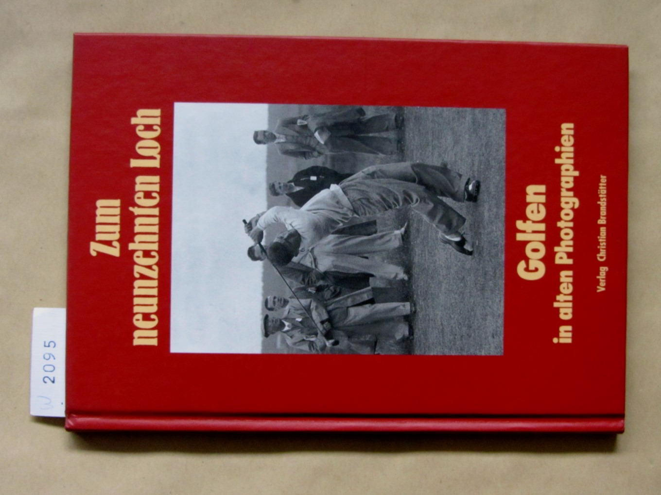
1995réf. 2095Wien: Brandstätter 1995. 1. Auflage. Mit 60 Abbildungen in duotone, 63 S., 8°, photoill. OPb.
Folio. (24), 1162, (2) pp. With woodcut printer’s device on the final leaf by Urs Graf, 14 double-page maps as well as 37 double-page views and approximately 900 woodcuts in the text. Modern vellum. A very early edition of Münster’s monumental work. The Cosmographia by Sebastian Münster (1488-1552), a German cartographer and cosmographer, was one of the most successful and popular books of the 16th century. It passed through 24 editions in 100 years, and was most important in reviving geography in 16th-century Europe, being the most valued of all cosmographies. - In very good condition, with some very slight overall discoloration; map of the Americas shows unobtrusive rust mark. VD 16, M 6717. Burmeister 89. Hantzsch 77.32. BM-STC German 633. Adams M 1910. Sabin 51381. Borba de Moraes II, 90. BNHCat M 834. Brunet III, 1945. Graesse IV, 622.
réf. LDM0020678We ship worldwide. 100% guarentee. BRAND NEW unknown
4to. 56 pp. Slightly later papered spine. Very rare sole edition of this detailed study of the Al-Fatihah, the first Surah of the Holy Qu'ran. By the mid-18th century the text of the Qu'ran had become less of a heretical menace to European scholars and more of a document of serious study: the present work focuses on philological subtleties within the various manuscripts of the Qu'ran known to Europeans including Erpenius, Hinckelmann, Wasmuth, and Schiefferdecker. A printed dissertation defended by one of Nagel's students, Jakob Holste, the text presents a word-for-word comparison of two manuscripts of the Al-Fatihah: one in the possession of Nagel himself, and the other of Christoph Fürer von Haimendorf (1541-1610), who had brought a copy back from his visit to the Middle East in 1565. To these are further compared printed editions of Marracio, Hinckelmann, Erpenius, and others. Because no Arab typeface was available in Nuremburg at the time, the author is forced here to write the text of the Al-Fatihah in Hebrew characters (!). The last section of the work gives no less than 17 translations into Latin of the Al-Fatihah drawn from Arabic, Persian, and Turkish. Nagel and his student Holste finally propose a 'perfect' conglomerate translation of the Surah based on their findings. Much space is devoted to the question of whether Al-Fatihah was revealed in Medina or Mecca, and Nagel's discussion of this point even includes topographical details collected from previous authors (cf. pp. 13-15, 31-36). - OCLC shows just a handful of copies in institutions worldwide, including one in America at the University of Chicago. The present copy is deaccessioned from the library of the Ludwig-Maximilian University in Munich with small release stamps on verso of title-page. Printed glosses trimmed closely, with occasional loss of a few letters; otherwise a good copy. Schnurrer 382. Chauvin I, LXI. Not in Enay. Cf also Encyclopedia of the Qu'ran IV, 250.
Oblong folio (430 x 280 mm). Illustrated t. p. and 32 plates, lithographed throughout. With a supersized letterpress table of contents. Stored loosely in original printed half cloth portfolio. First edition, dedicated to Baron Ludwig von der Tann. The fine outline lithographs show the Bavarian military's riding exercises and were probably intended for the instruction of the Bavarian cavalry's recruits. Ludwig von Nagel (1836-99) served as a lieutenant in the second Royal Bavarian Cuirassier Regiment. - Slight browning; occasional duststaining to edges. A fine set. Anderhub collection 211. OCLC 907714135. Not in Huth.